Gariwerd (Grampians) Peaks Trail
Gariwerd (Grampians) Peaks Trail
Gariwerd (Grampians) Peaks Trail
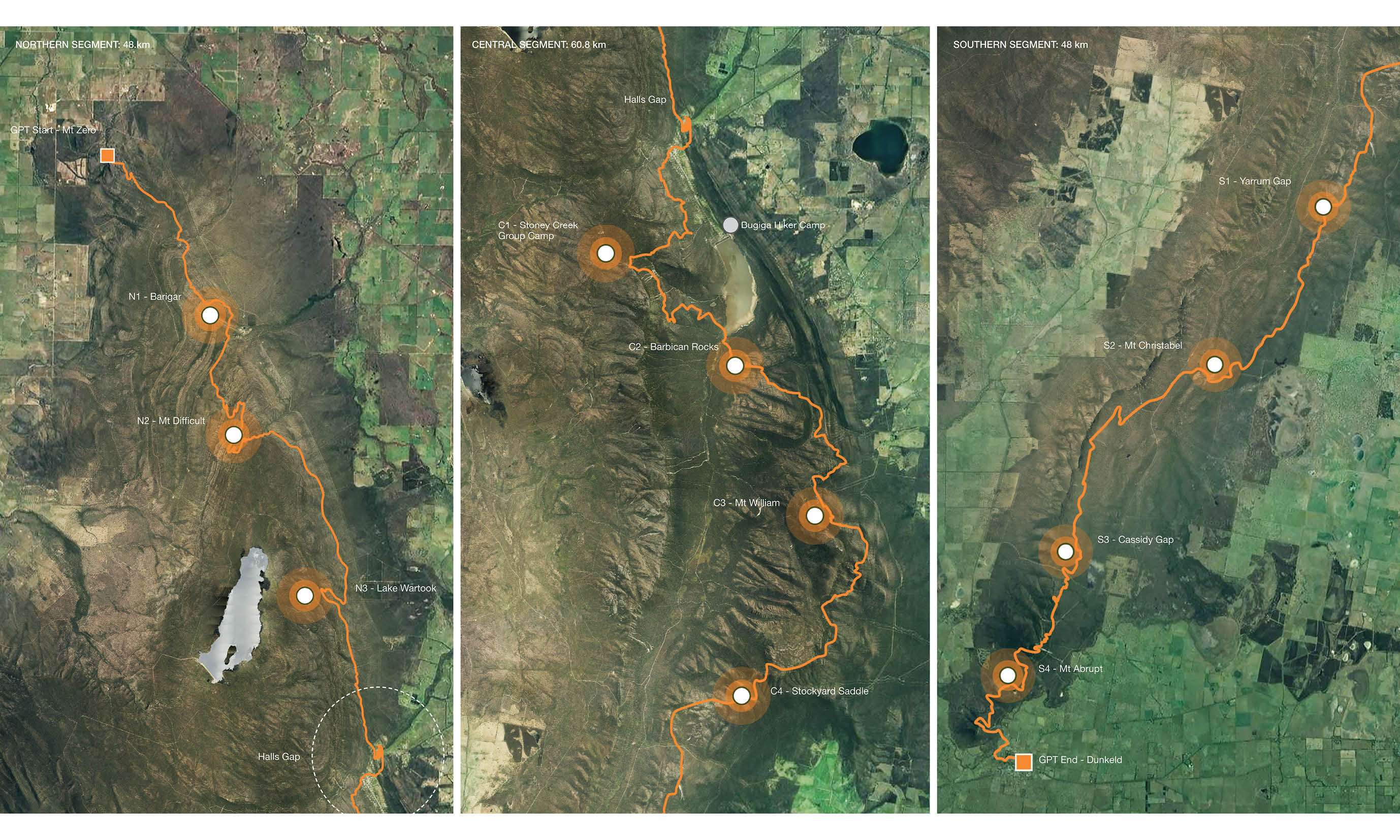
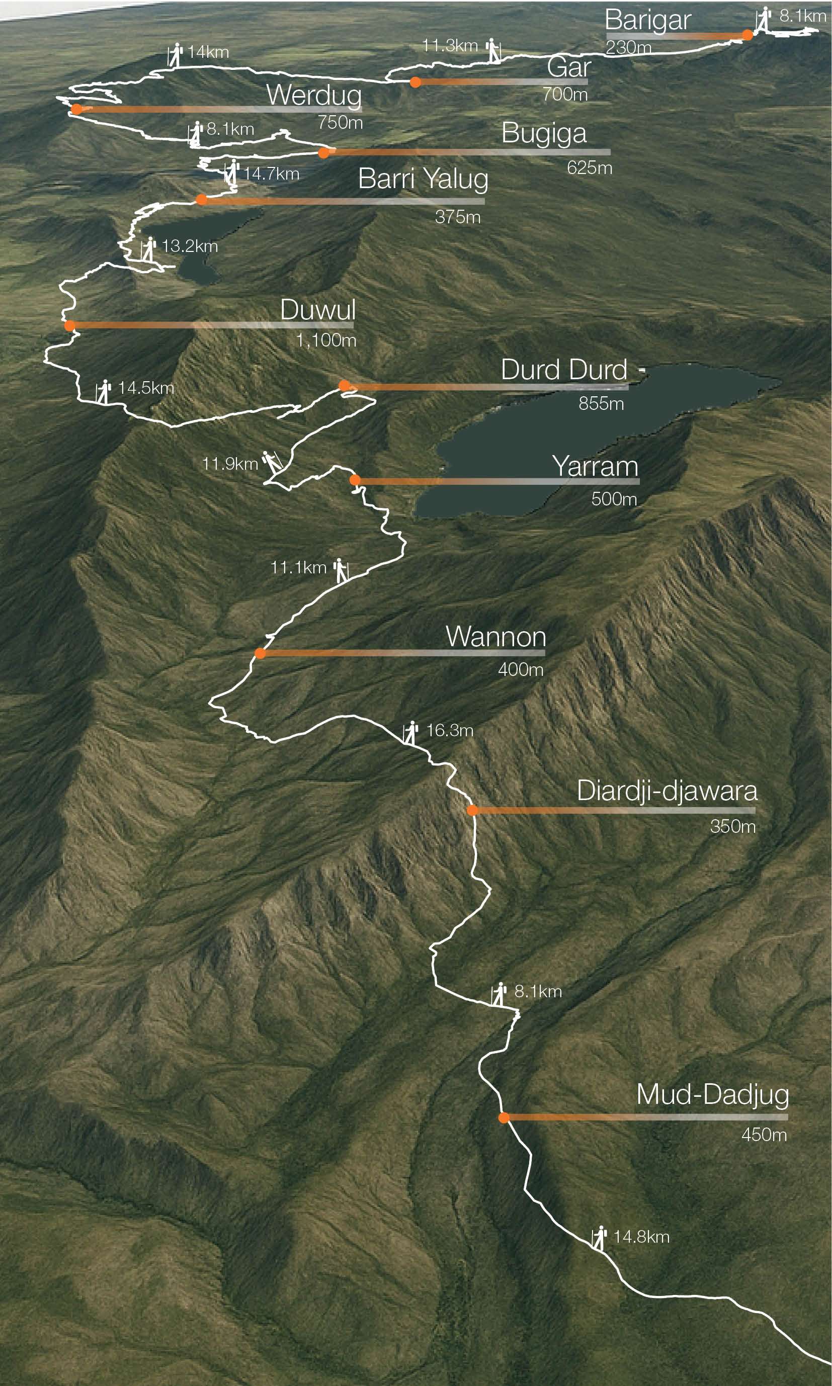
Objective: With a pinnacle at 1,167 metres, the Grampians Peaks Trail is a 164 km hiking route traversing the Grampians (Gariwerd) National Park in Victoria, Australia.
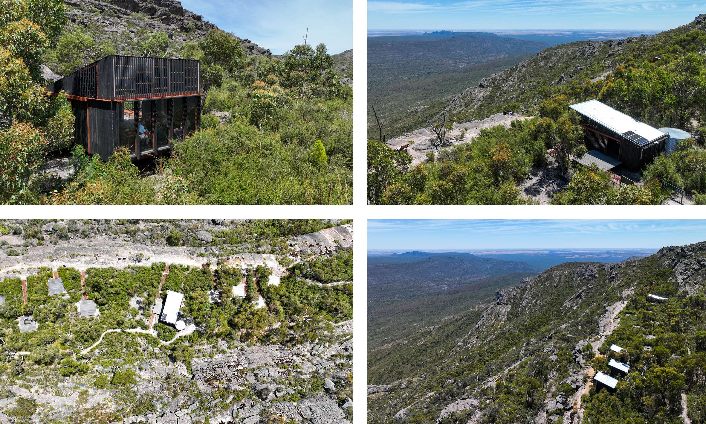
The primary objective was to sustainably upgrade the aging hiking infrastructure and visitor experience. Parks Victoria commissioned McGregor Coxall over a ten-year period as lead consultant to masterplan and design an upgrade to the trail and its eleven unique campgrounds.
Project Description: 500 million years ago there was Gondwanaland: a massive supercontinent stitched together deep in the Earth's past. Drifting south the Australian continent was born, a land of mystery and memory — part of that land become known as Gariwerd, the Grampian Ranges. It is here that the Grampians Peaks Trail traverses ancient Gariwerd, where 20,000 years of Jardwadjali and Djab Wurrung custodianship intertwines with geological forces that created its distinctive formations.
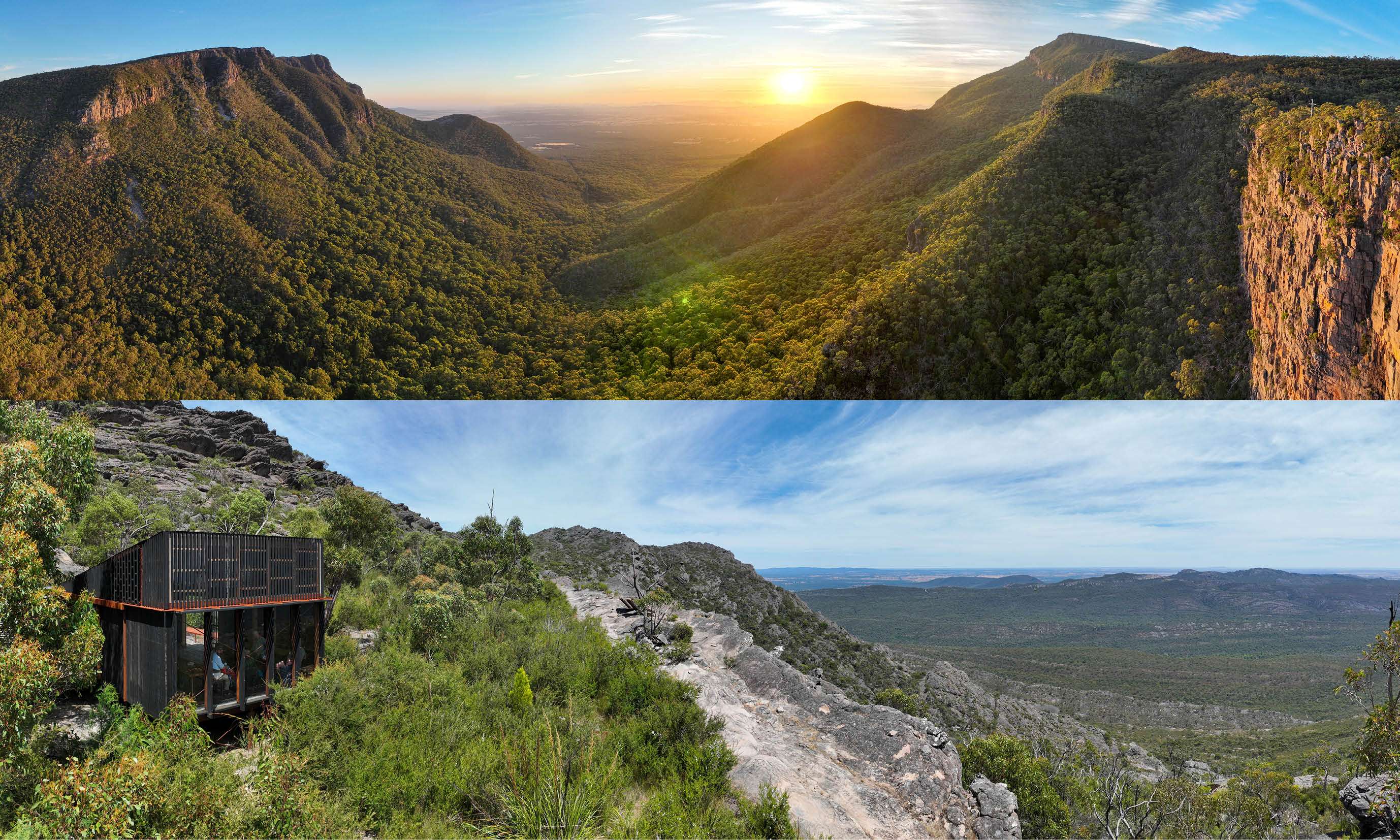
The trail traverses a wide range of terrains including rugged rocky mountains, valleys and ridge-lines alongside biodiverse sclerophyll flora and abundant fauna. It is split into 3 sections, the North(4 days, 3 nights), Central (5 days, 4 nights) and South (4 days, 3 nights).
Connection to Country guided our approach, working with Barengi Gadjin Land Council, Eastern Maar and Gunditj Mirring Traditional Owners. This revealed Gariwerd not as wilderness, but as cultural landscape shaped by millennia of custodianship, with seasonal gathering areas, ceremonial sites, and ancient pathways.
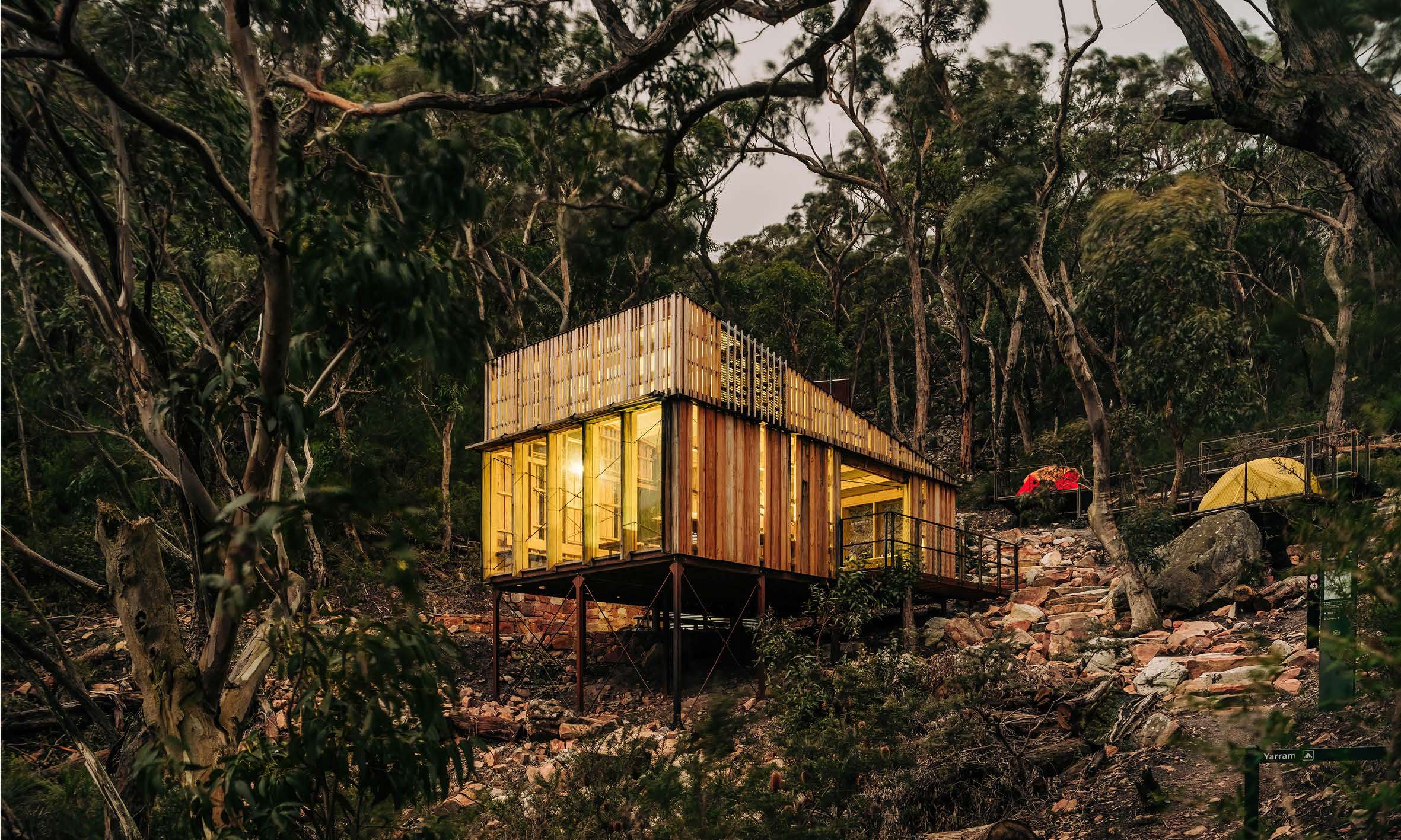
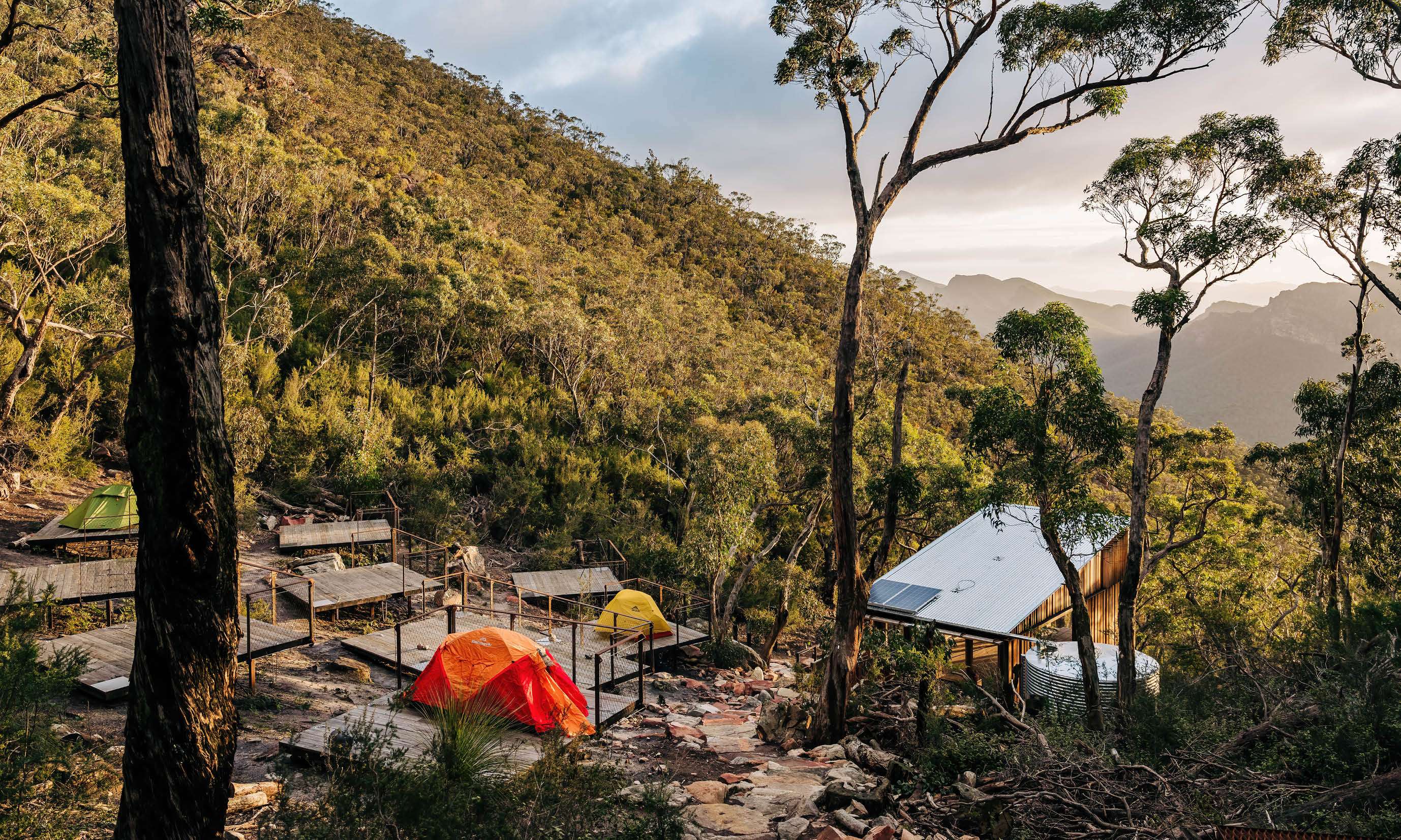
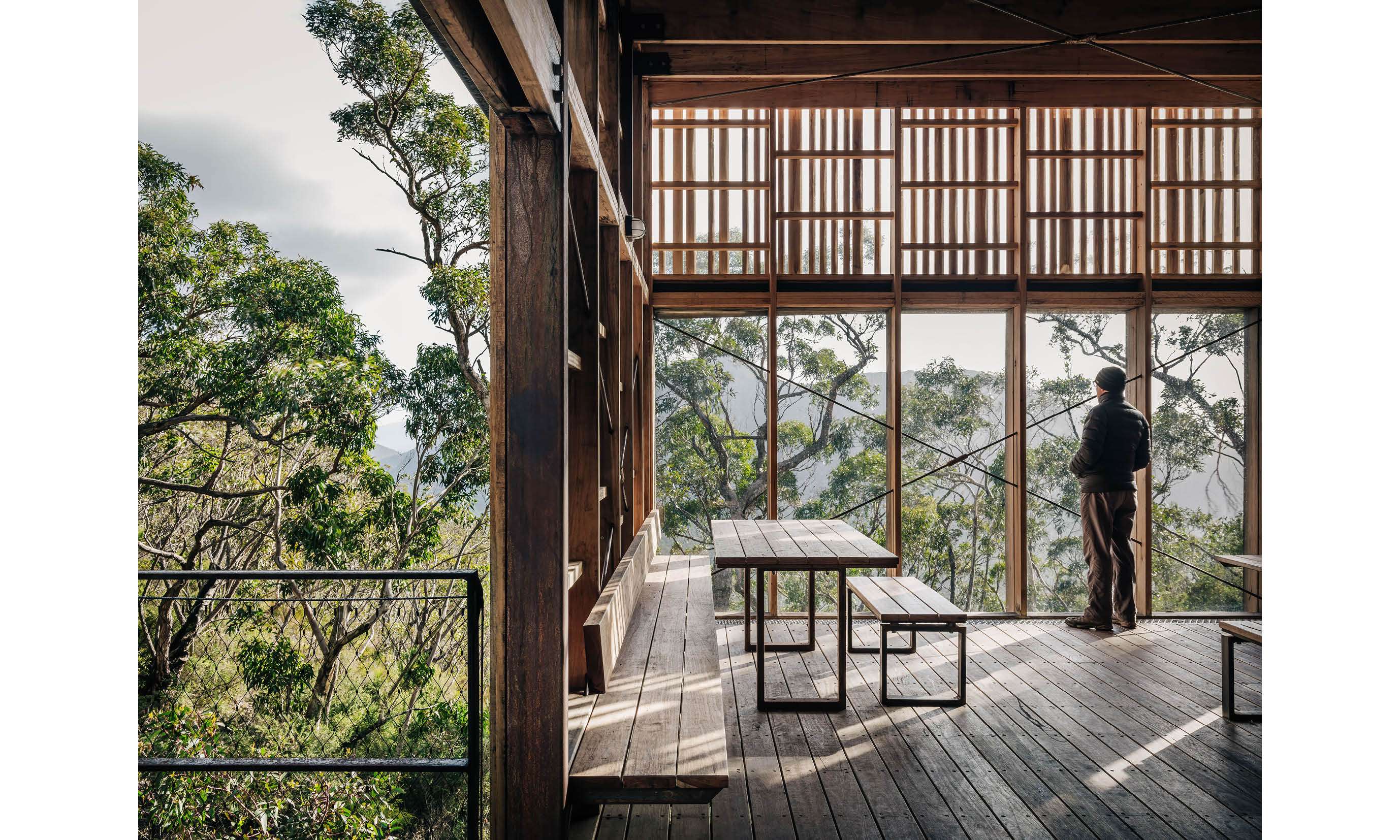
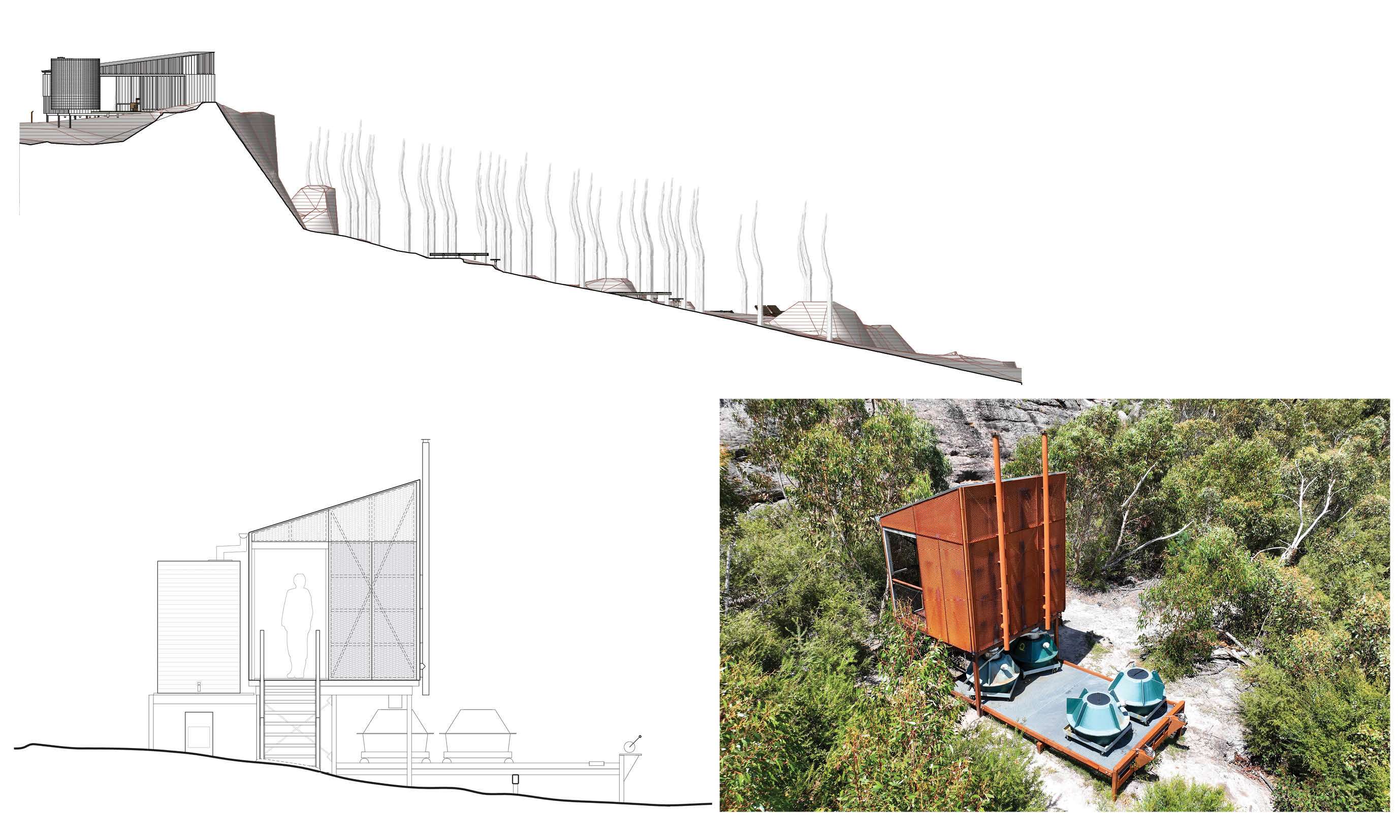
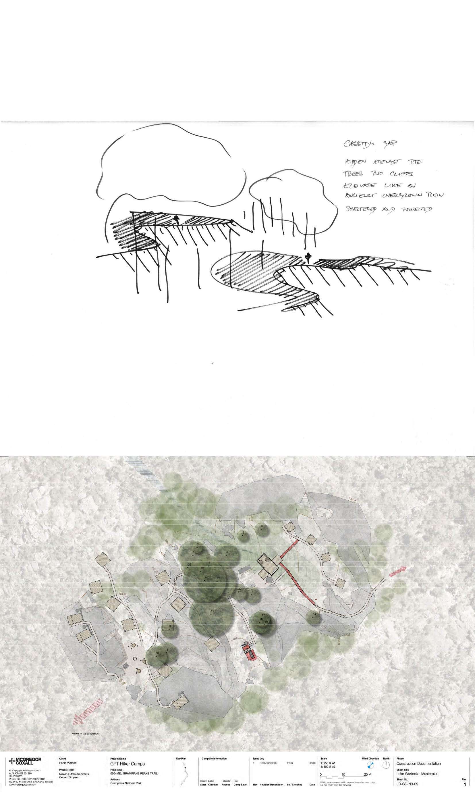
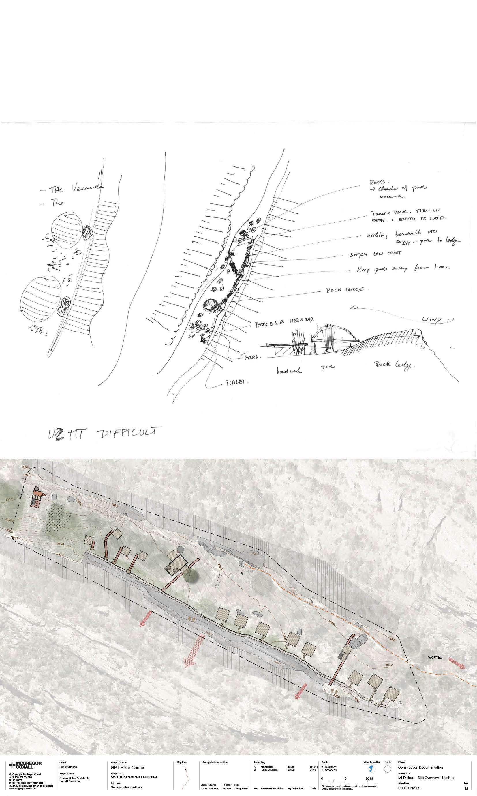
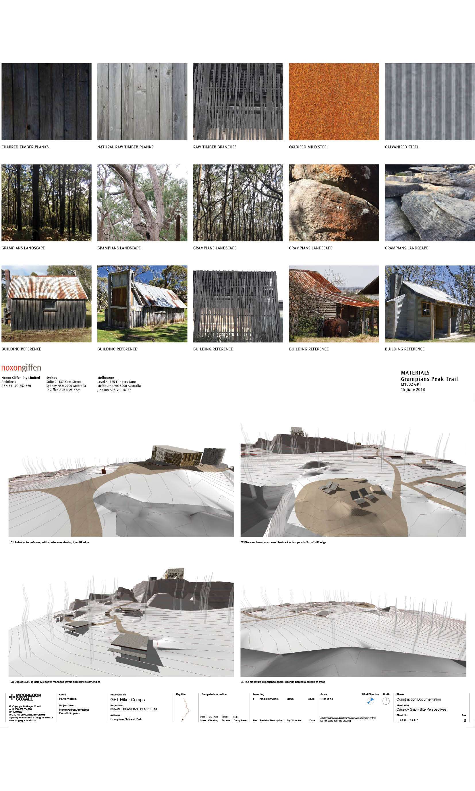
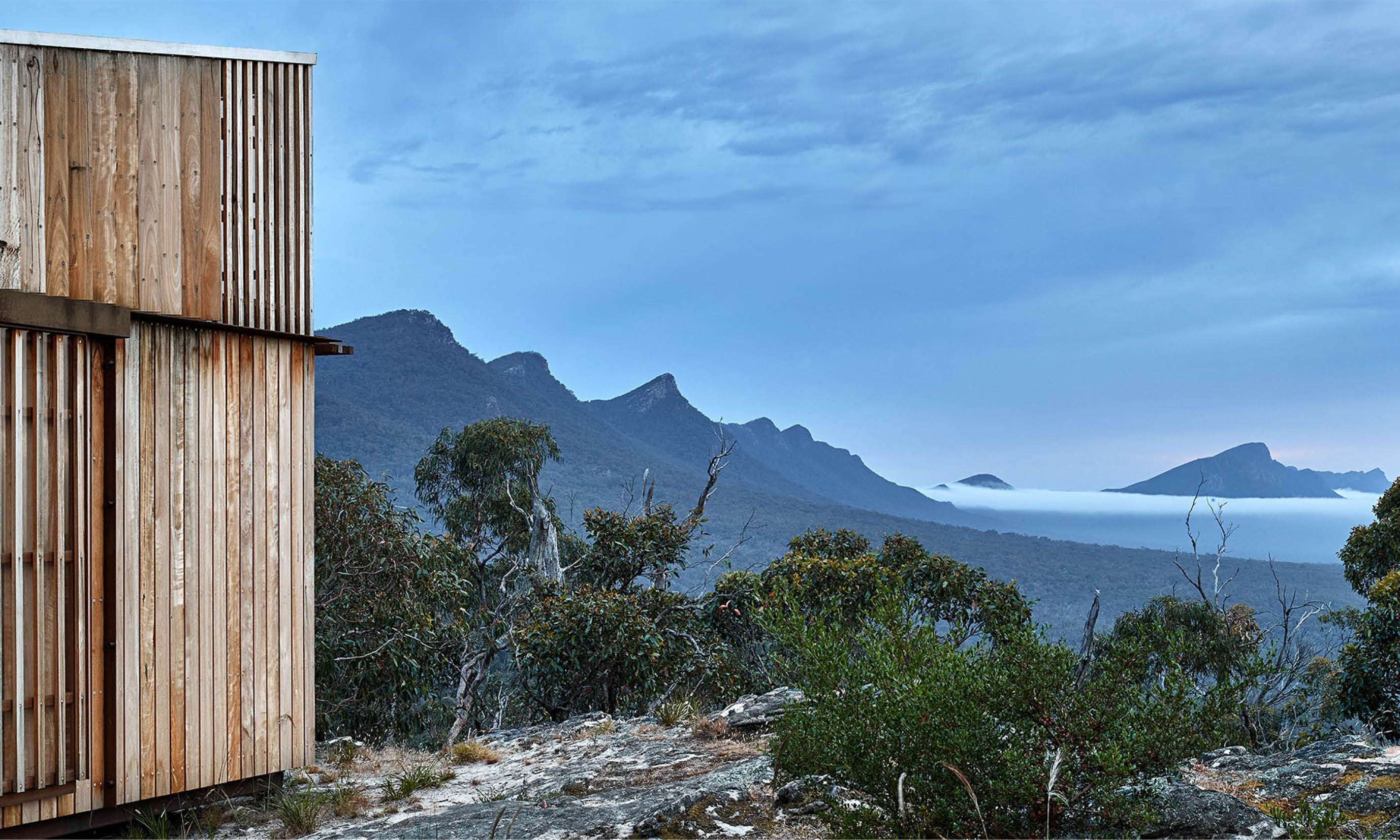
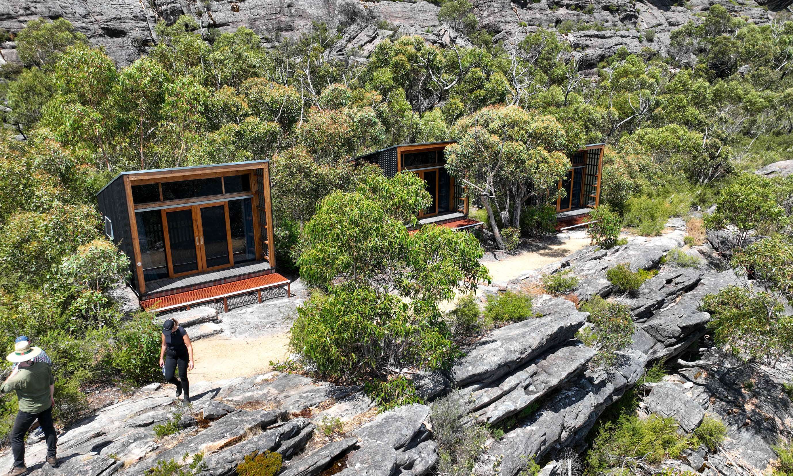
Individual design narratives were developed for each campsite based on culture and ecology. Facilities include communal shelters, gathering areas, timber tentpads, water systems with phyto-remediation, and overnight cabins positioned for shelter and safety. Construction methodologies minimised site impact, with prefabricated components helicoptered to remote locations. The camp shelters designed by Noxon Griffin float above sensitive ground, water systems reflect traditional management, and pathways follow songlines established through thousands of years of cultural practice.
Evaluation: The trail fosters an understanding of landscape through education rather than recreation alone. Visitors leave with a deeper appreciation of Indigenous knowledge systems and ecology.