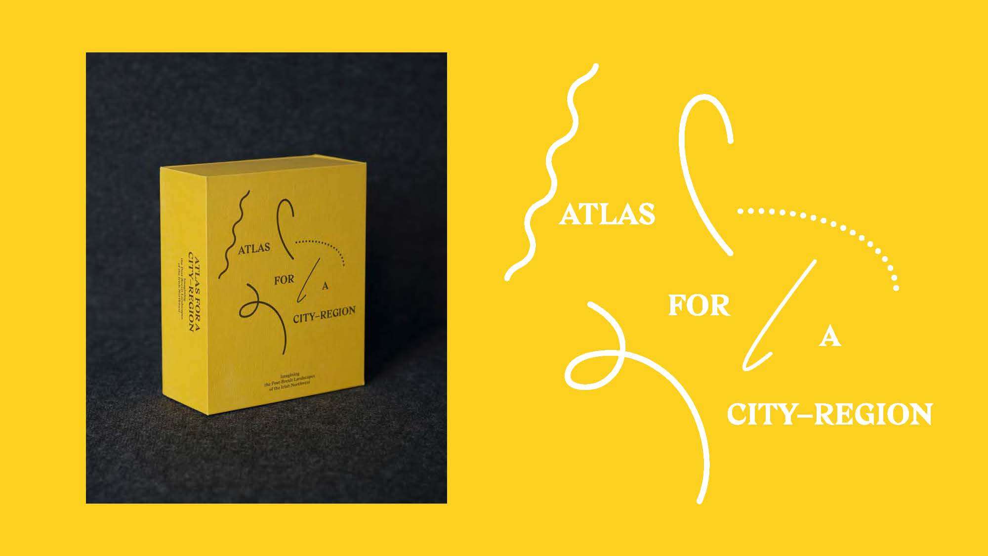
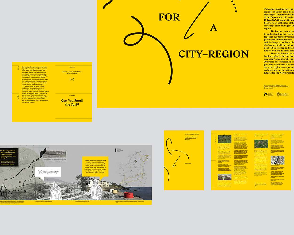
ATLAS FOR A CITY–REGION - Imagining the Post-Brexit Landscapes of the Irish Northwest
ATLAS FOR A CITY–REGION - Imagining the Post-Brexit Landscapes of the Irish Northwest
ATLAS FOR A CITY–REGION - Imagining the Post-Brexit Landscapes of the Irish Northwest
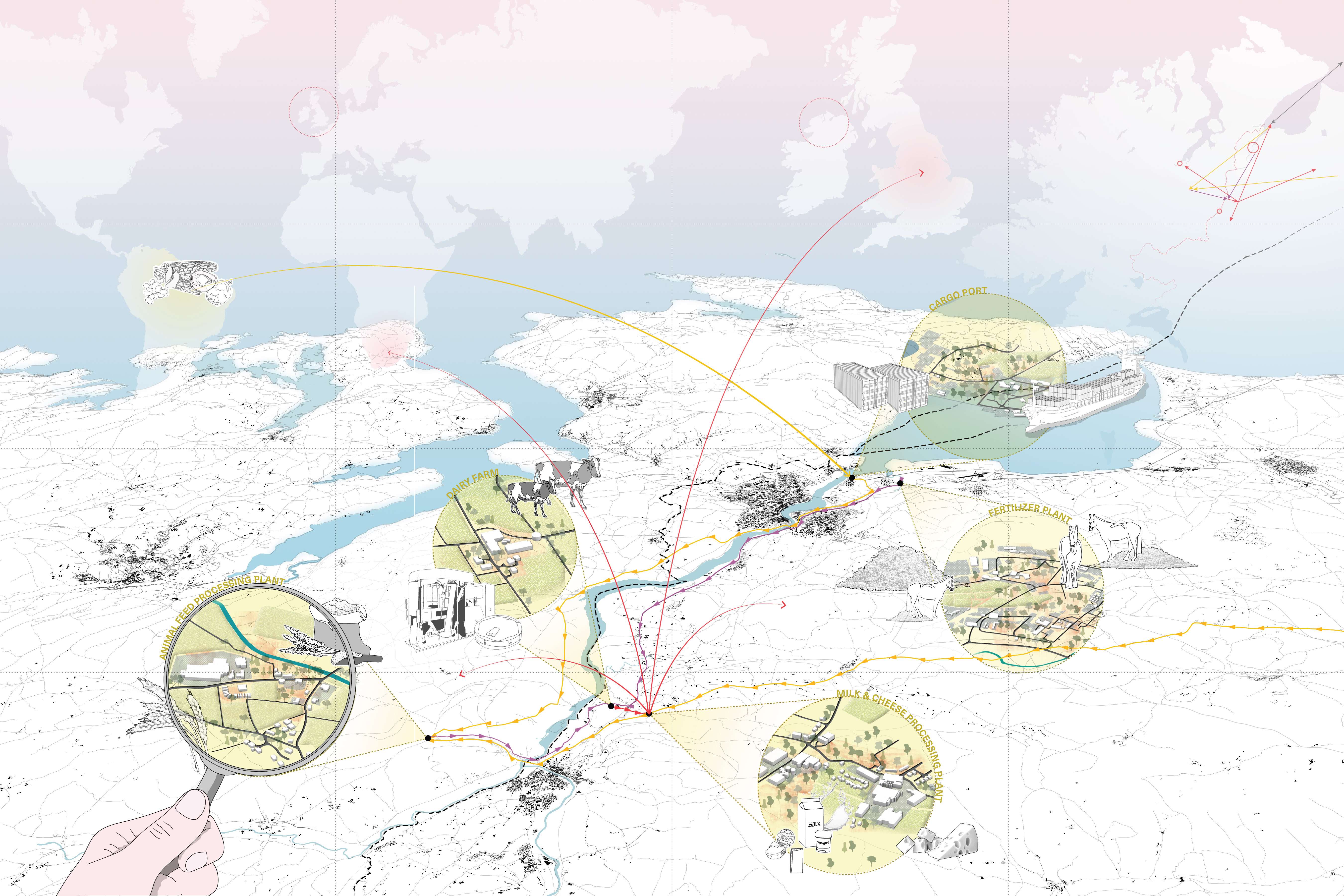
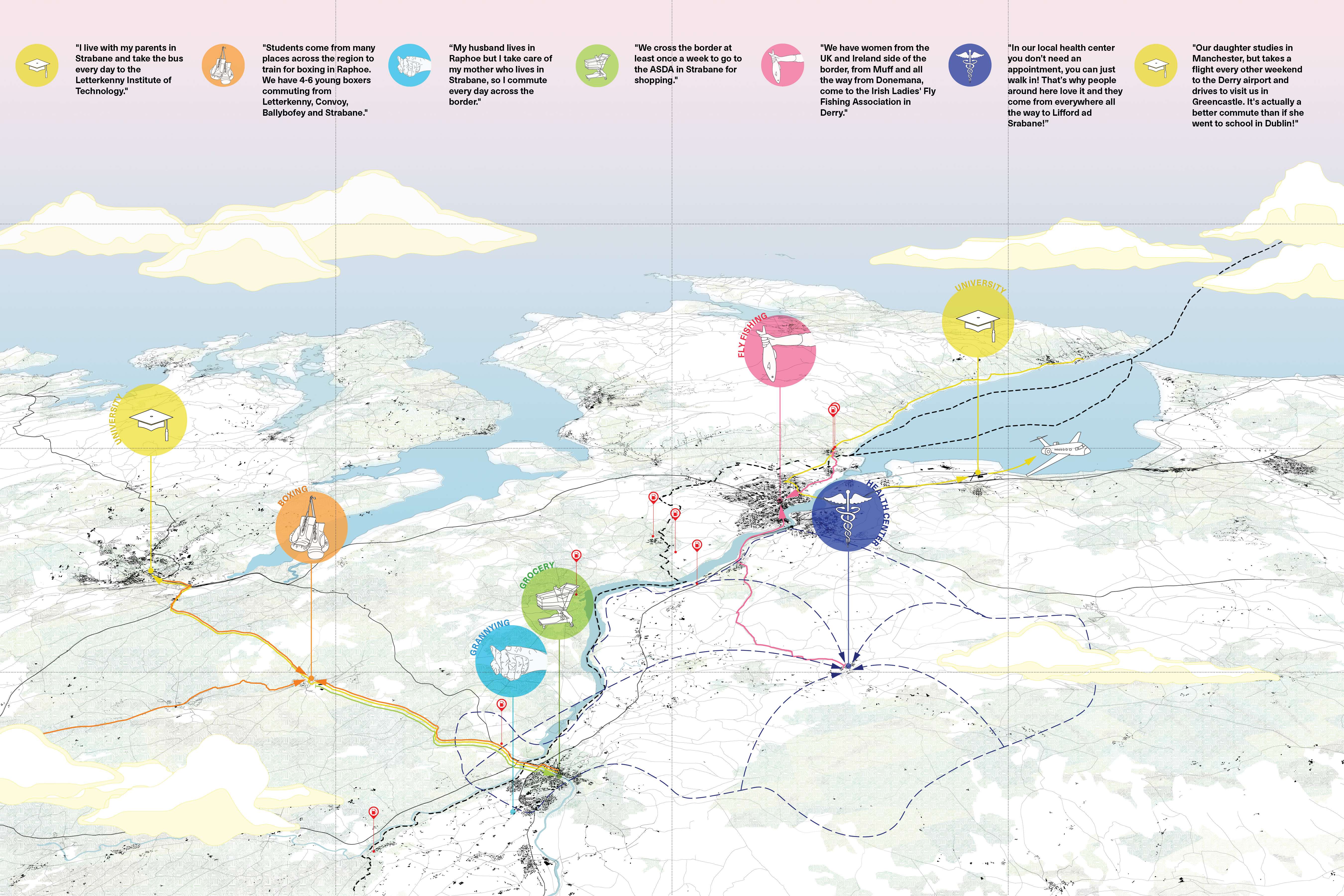
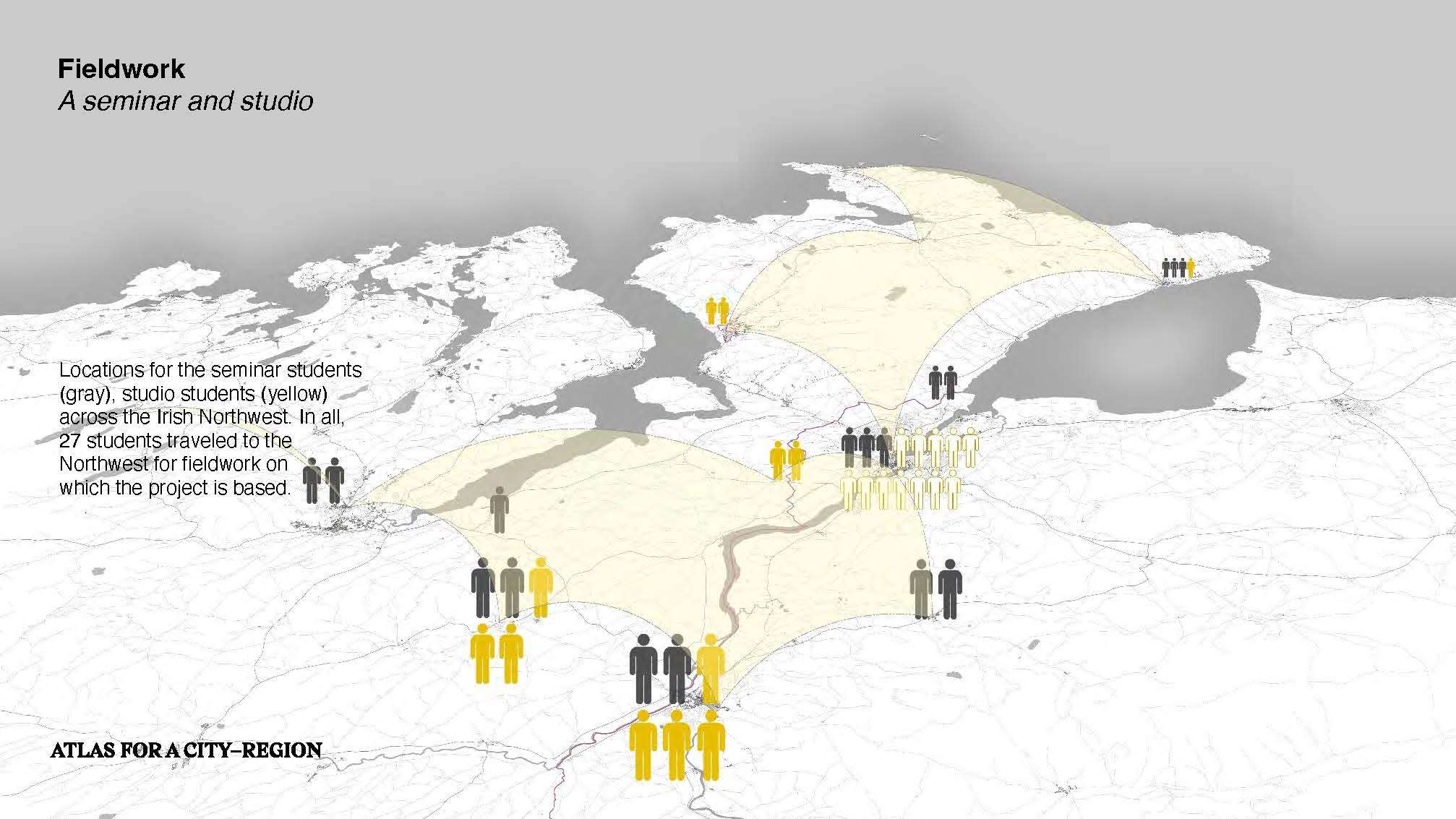
Centered on the northwest of Ireland, this eighteen-month-long research project investigated how a cross-border city-region could be shaped in light of the economic, political, and social realities of Brexit. Integrated within the teaching of the department of landscape architecture at the Harvard Graduate School of Design, and engaging faculty from across the university, the project asked how landscape could be an agent in the shaping of the cross-border city-region. Located between the counties of Derry, Donegal, and Tyrone, the cross-border city-region has a population of approximately 350,000 and growing. Through a research seminar and an option studio, the multi-scalar project addressed the design of smaller urban spaces right up to the design of the region itself. The project demonstrated how the post-conflict Northern Irish landscapes can adapt to post-Brexit conditions, and how landscape architecture could be instrumental in shaping not just the physical landscape but the new political landscape too.
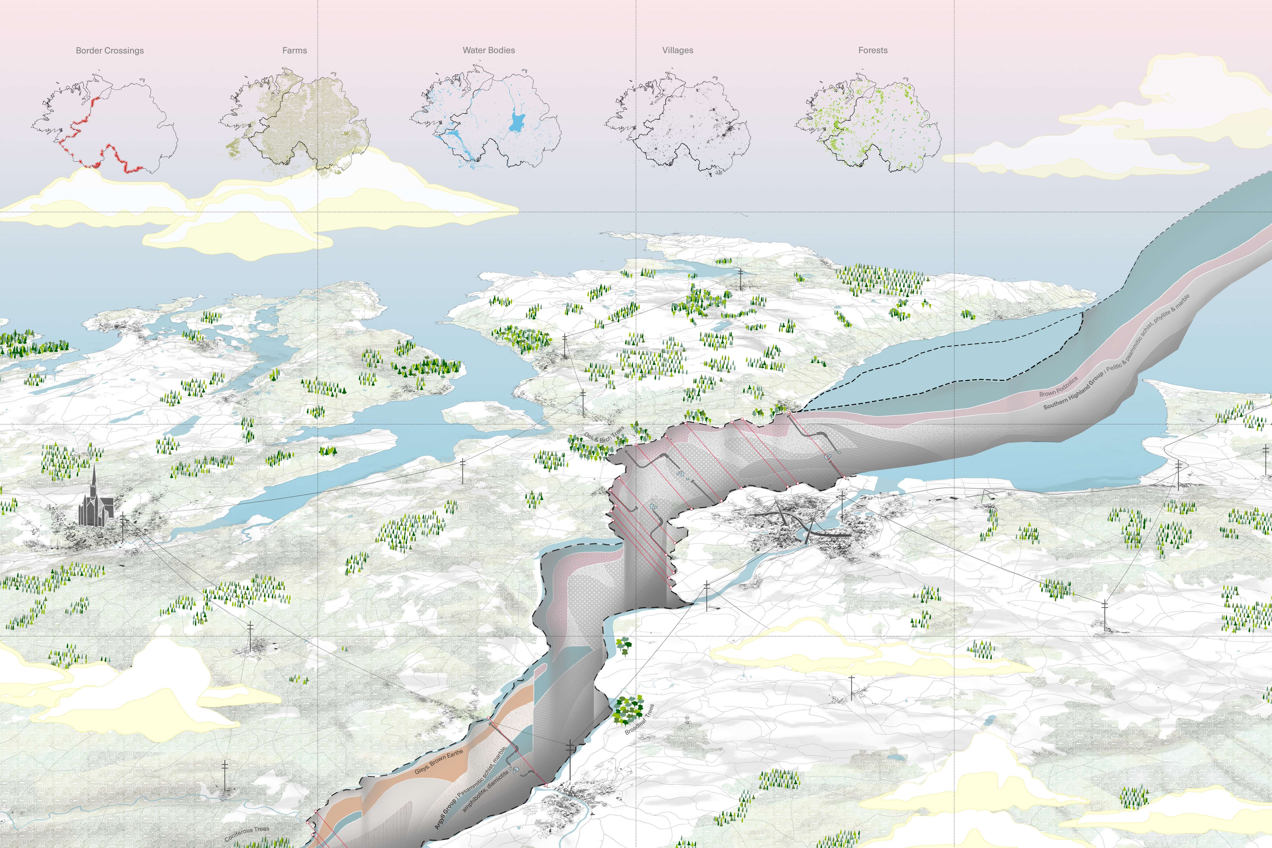
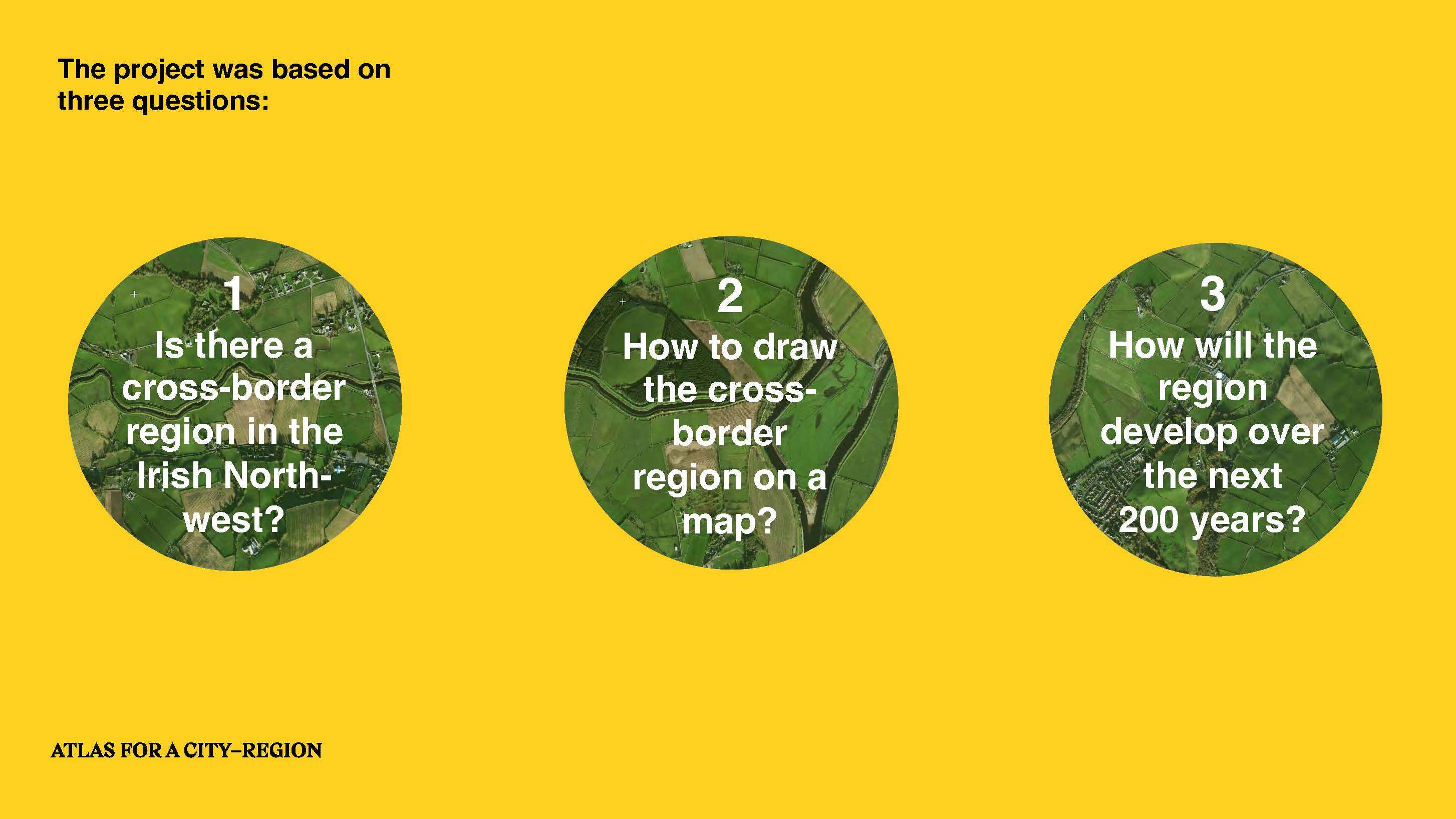
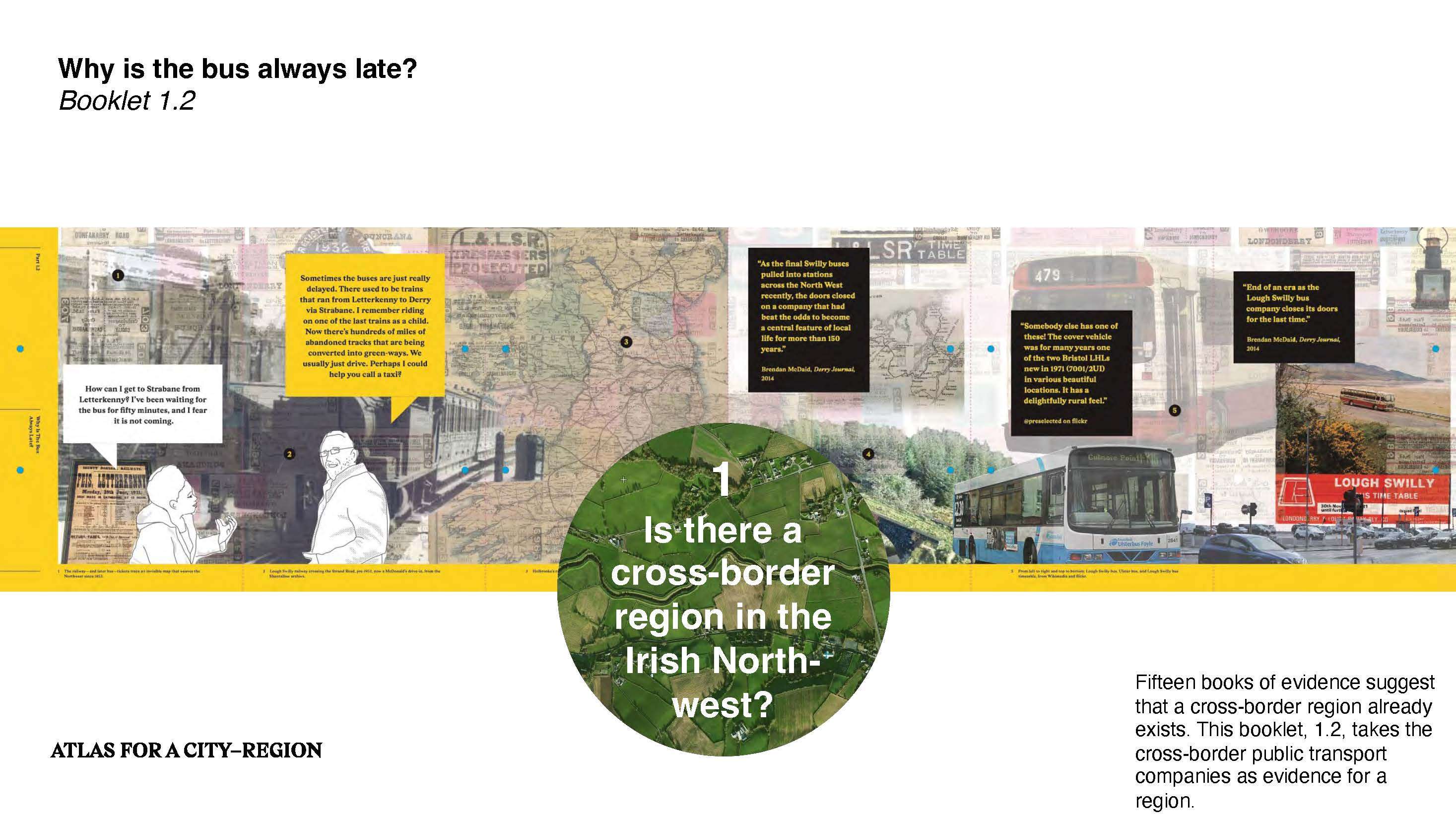
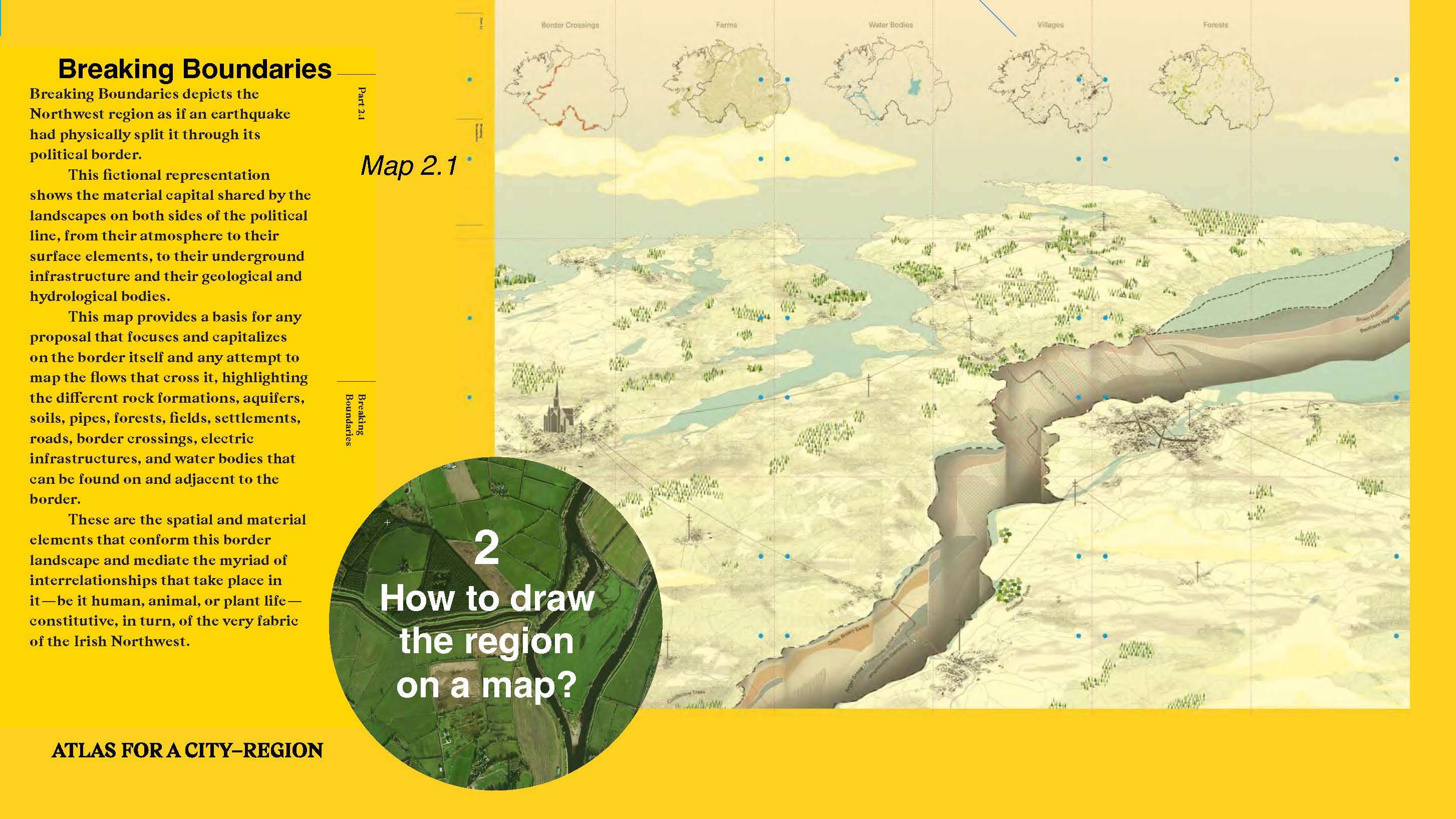
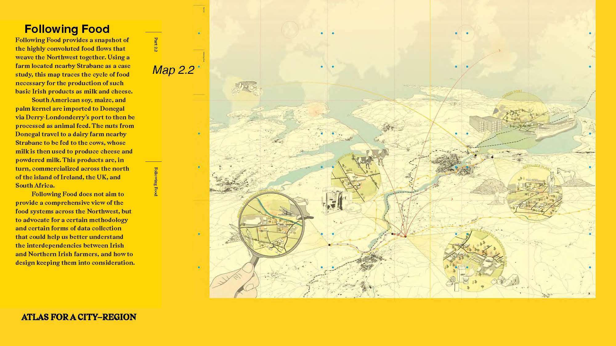
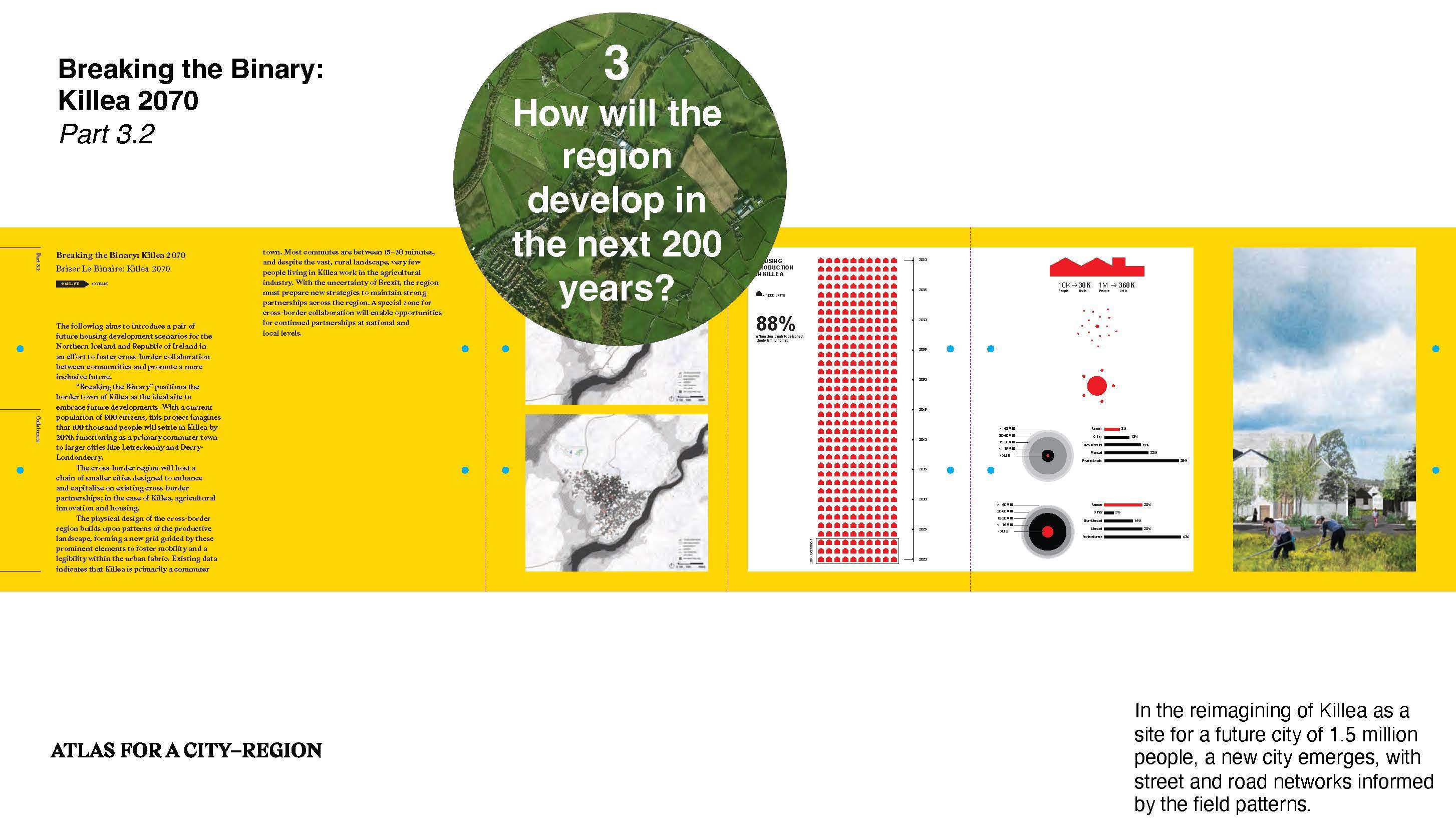
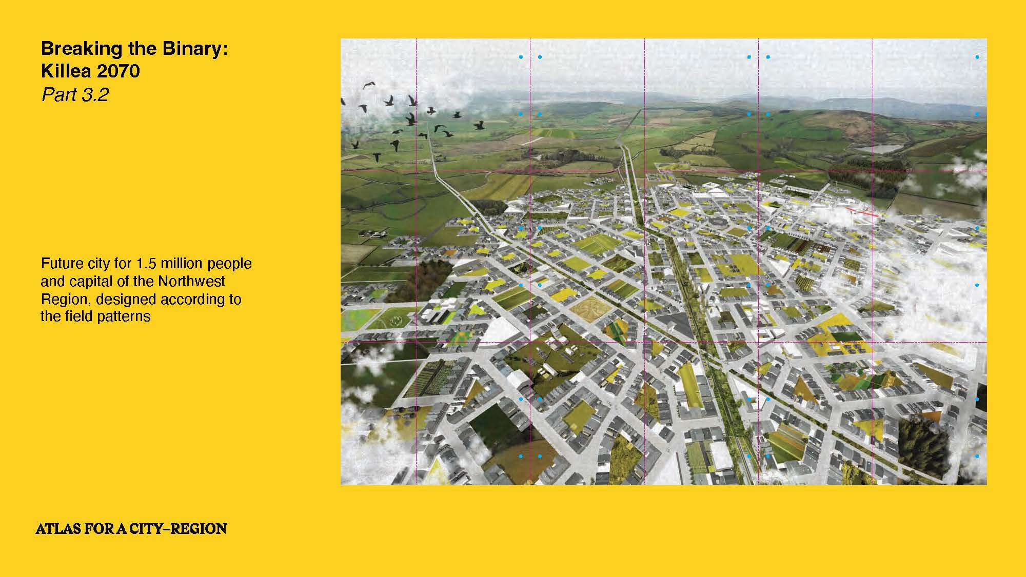
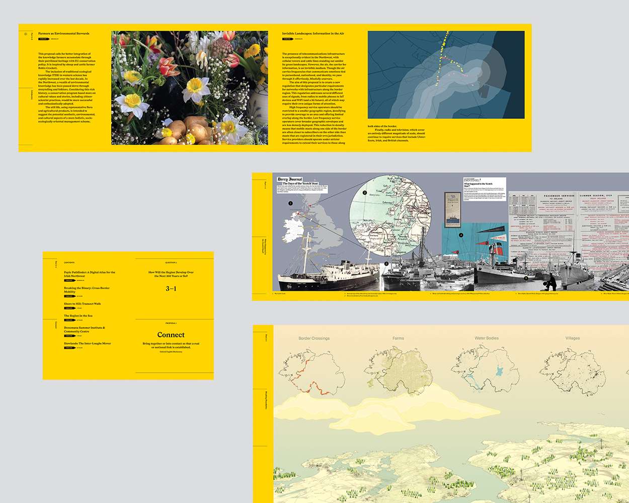
The Atlas is based on three questions: Is there a cross-border region in the Northwest? If so, how to draw that region on a map? And how will the region develop over the next 200 years or so? Designed as a portable exhibition, the Atlas presents evidence of a cross-border region, suggests how to draw the region on maps, and demonstrates how landscape architecture can be instrumental in imagining alternative futures for the Northwest Region.
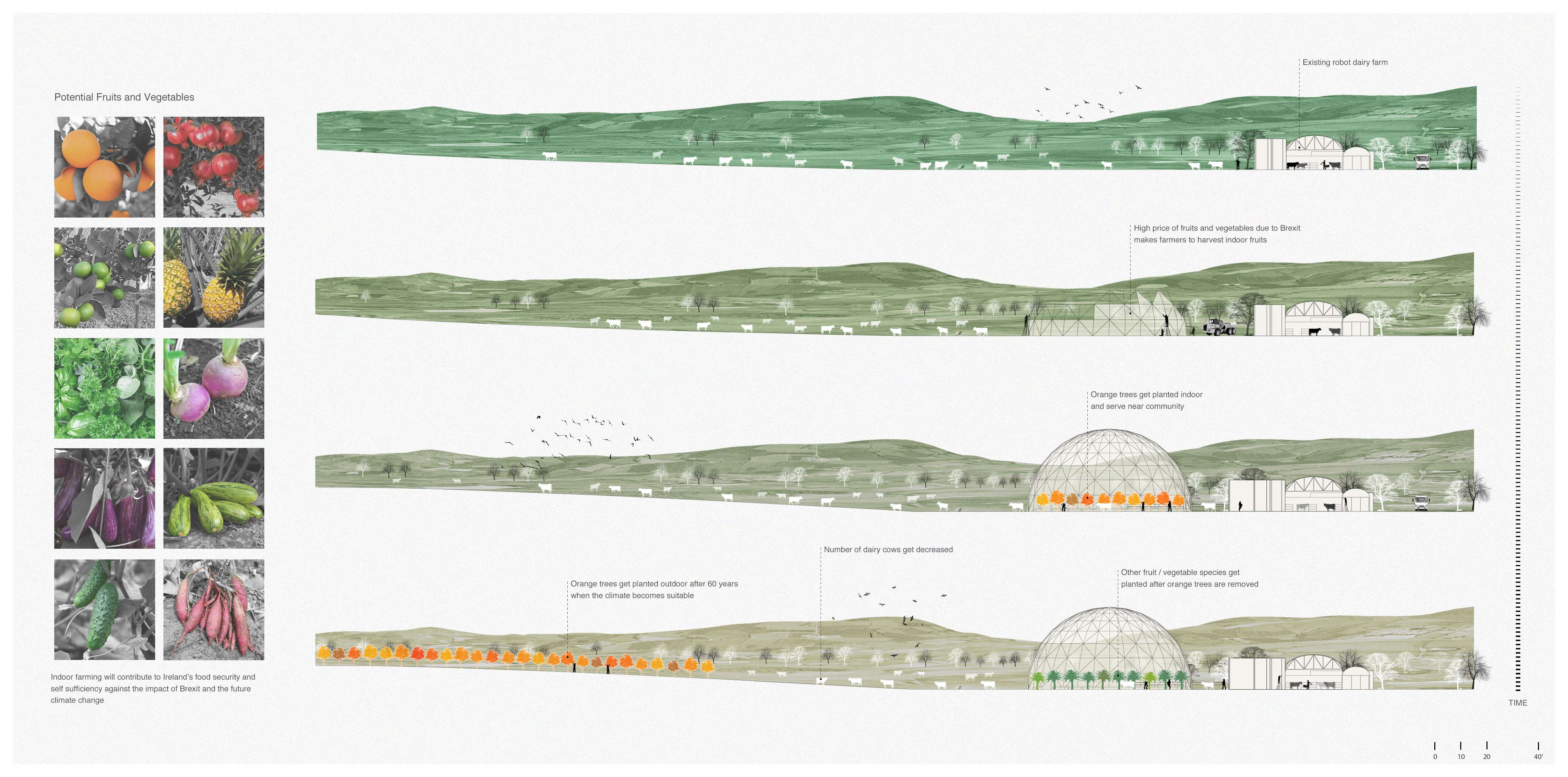
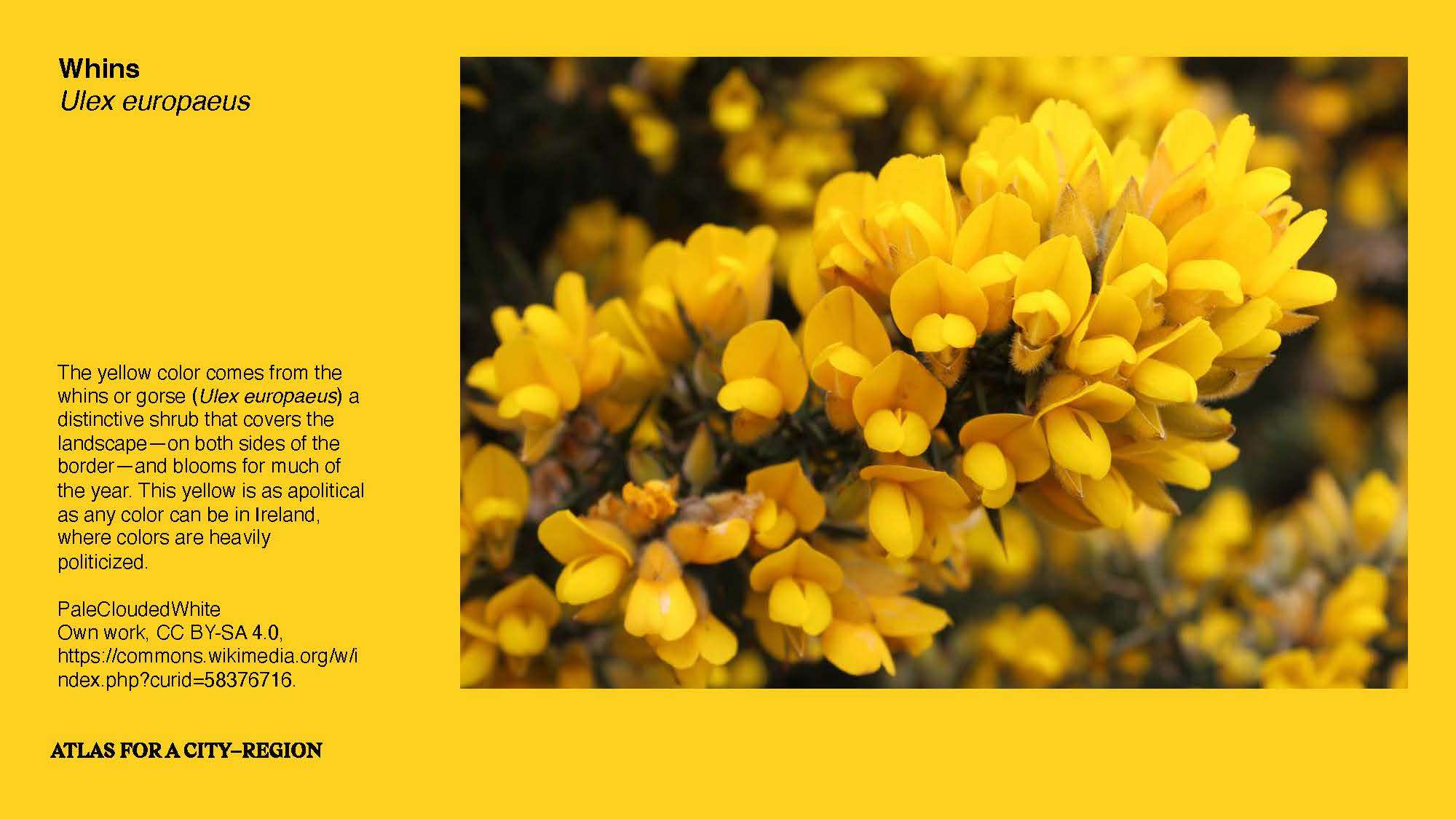
"A border is not a line; it is a landscape" (Doherty and Fité Matamoros, 2020). The future lies in understanding the relationships that weave the landscape together, supported by its network of towns and villages and patchwork of field patterns. The repercussions of Brexit and the long-term effects of climate change and population displacement will have drastic impacts on this landscape that need to be designed and planned for. If we don’t imagine the future, we have no hand in shaping it.
For more information, see https://atlasforacityregion.com
The Atlas for a City-Region articulates a cross-border region between Northern Ireland and the Republic of Ireland. The project imagined how the economic, political, and social realities of Brexit could begin to reshape the Irish Northwest’s landscapes. Integrated within the teaching and research of the Department of Landscape Architecture at Harvard University’s Graduate School of Design and based on fieldwork on both sides of the border, the project asked how landscape could be an agent in the shaping of a cross-border region.
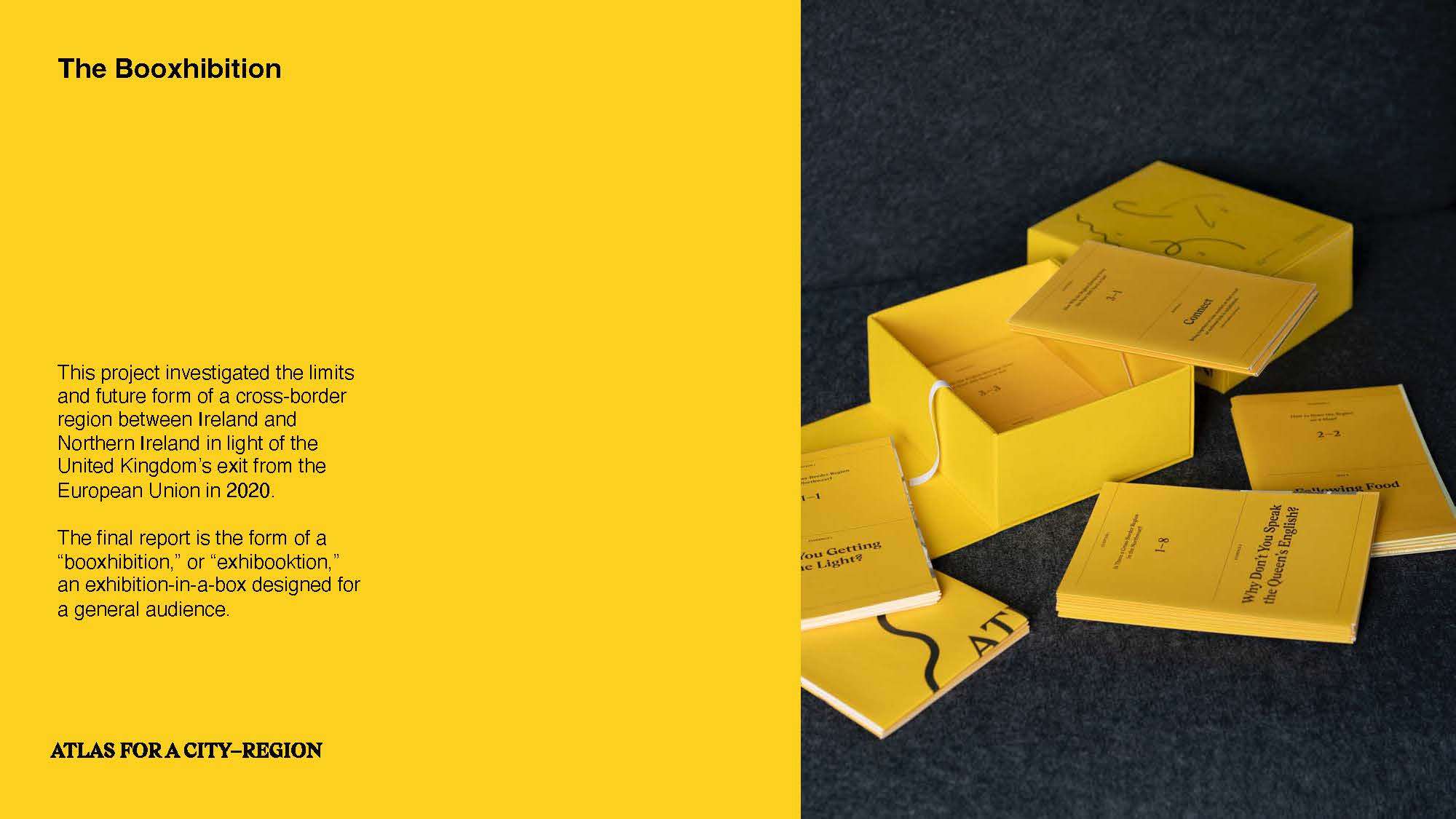
At the project’s outset, the local governments that commissioned and sponsored the project asked us to refrain from producing a report that would sit on a shelf. We asked how landscape architects could engage better with our audiences by developing a format to reach those who make significant decisions over our landscapes, whether a farmer or a policymaker.
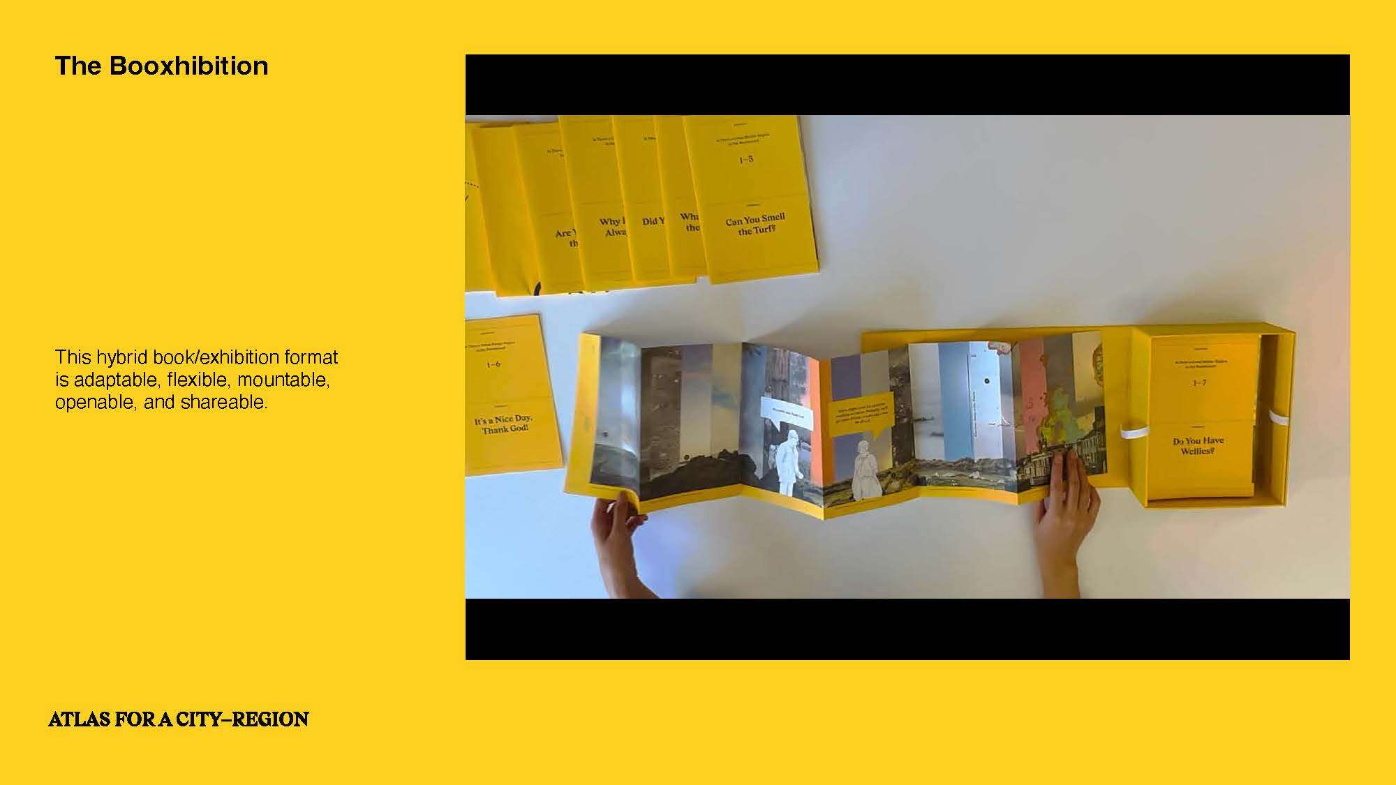
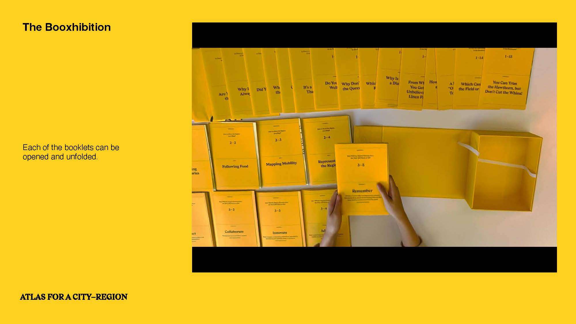
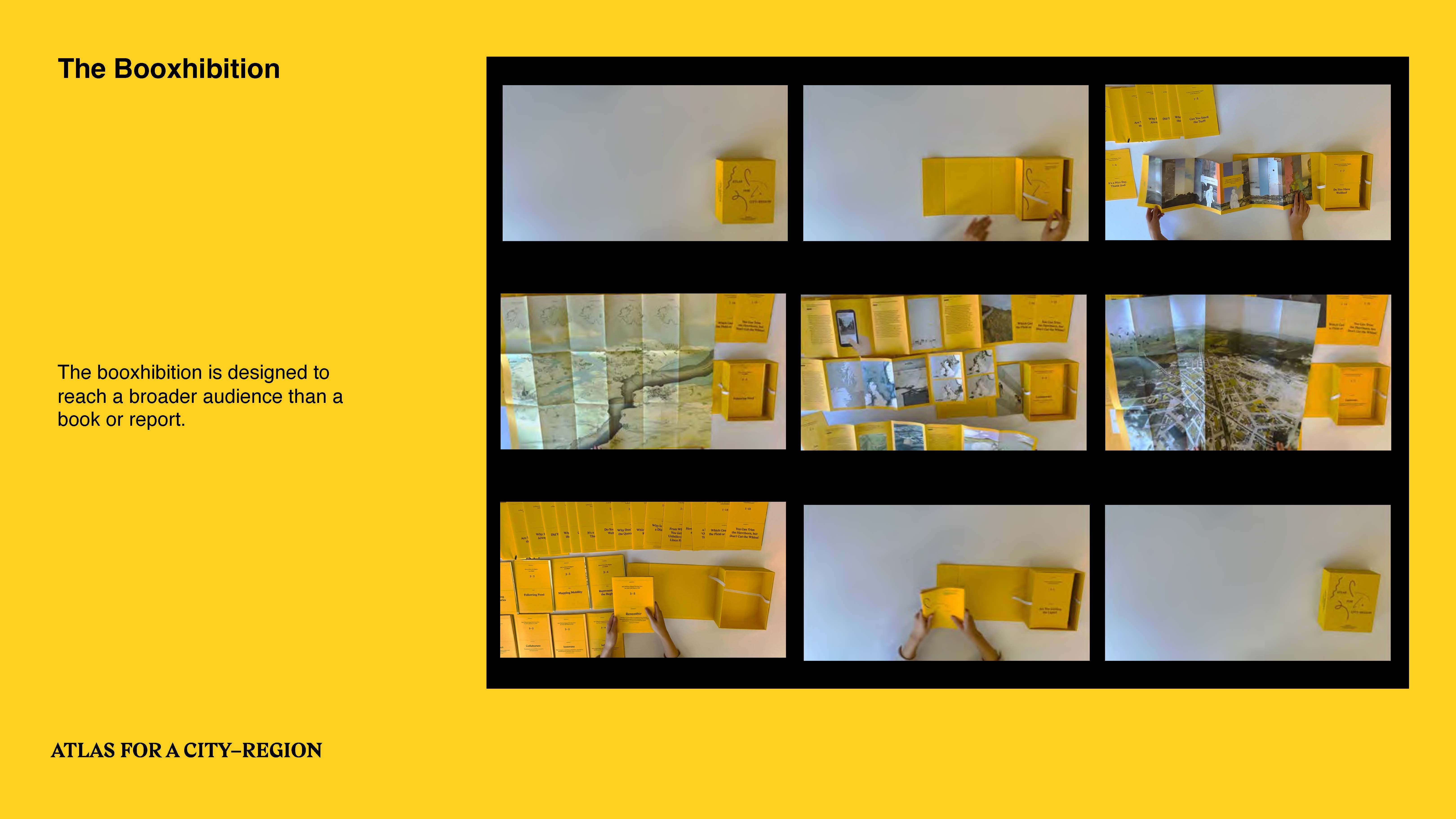
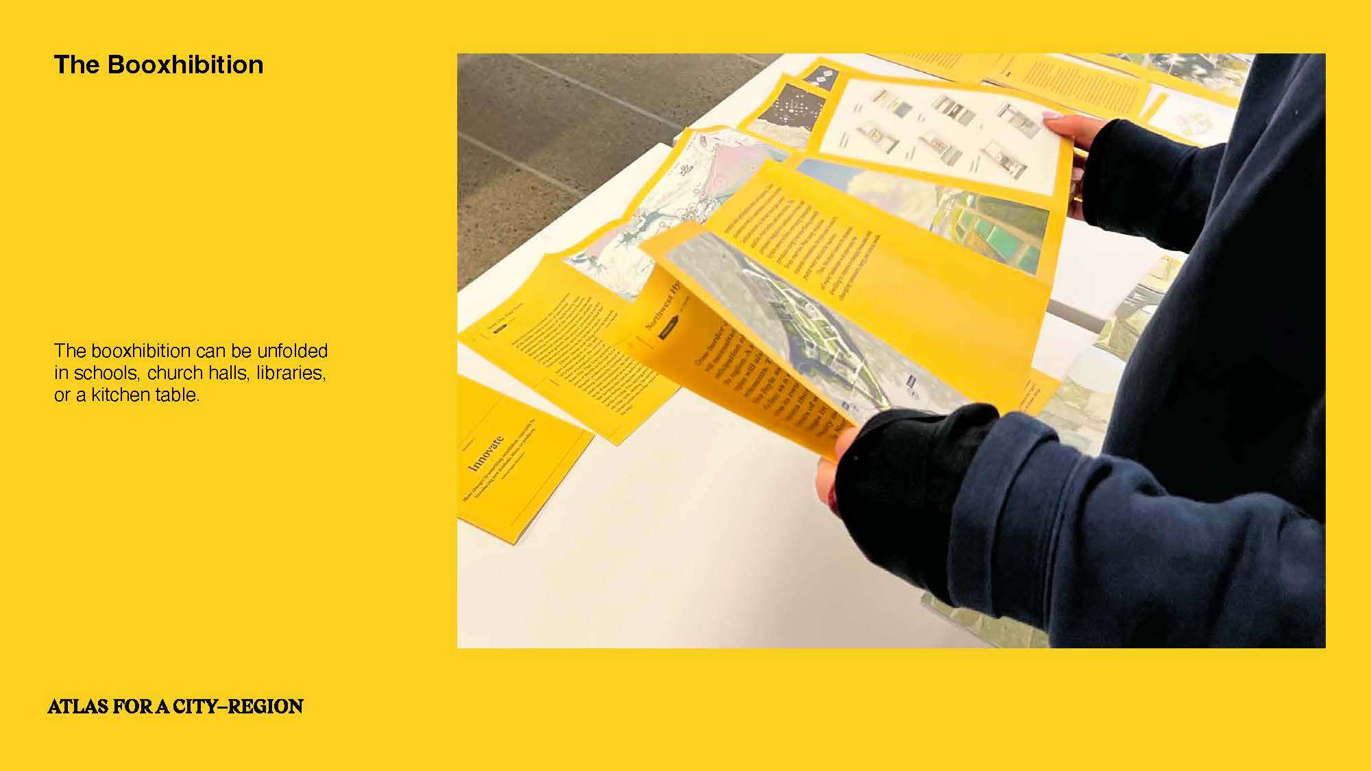
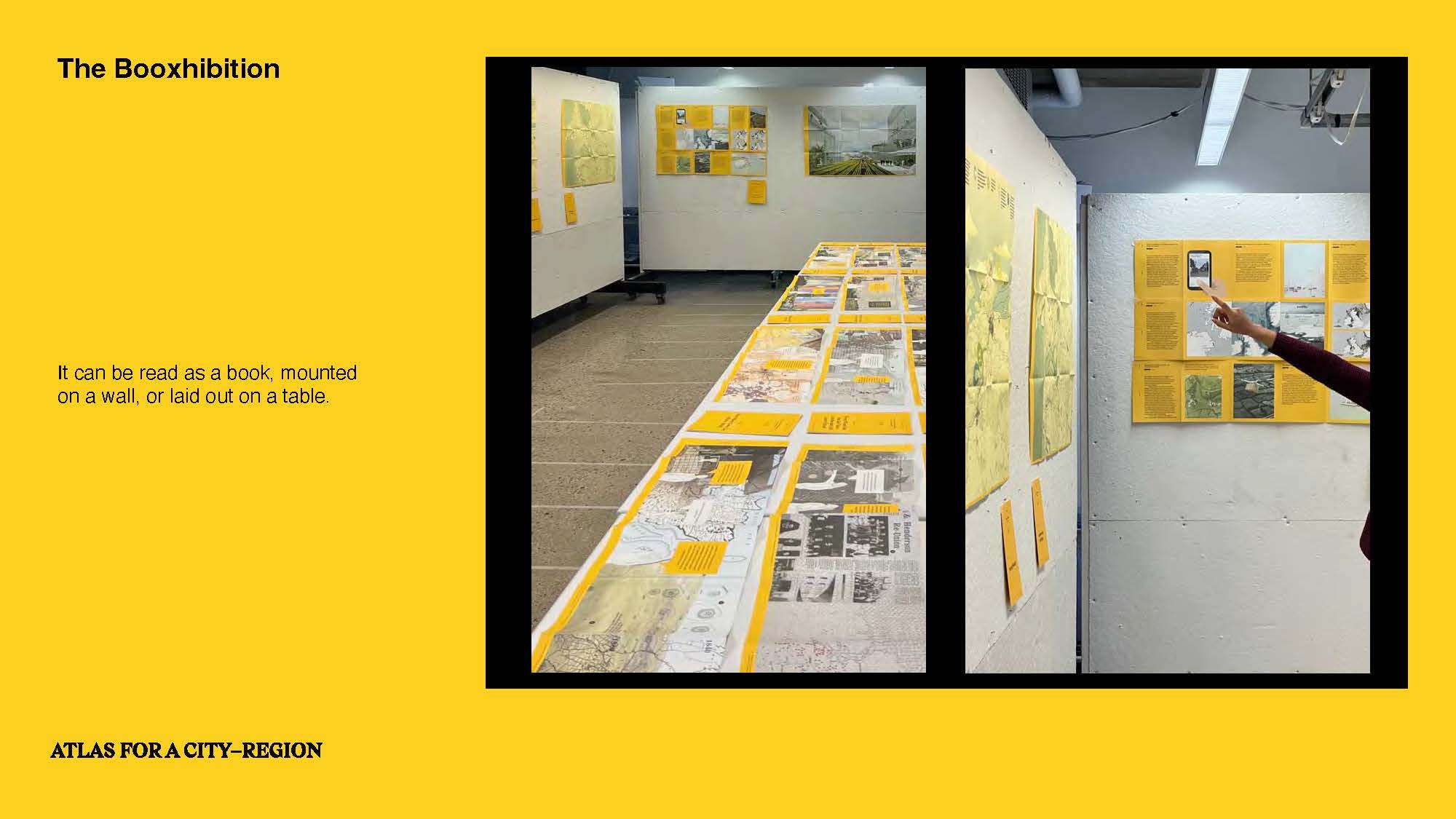
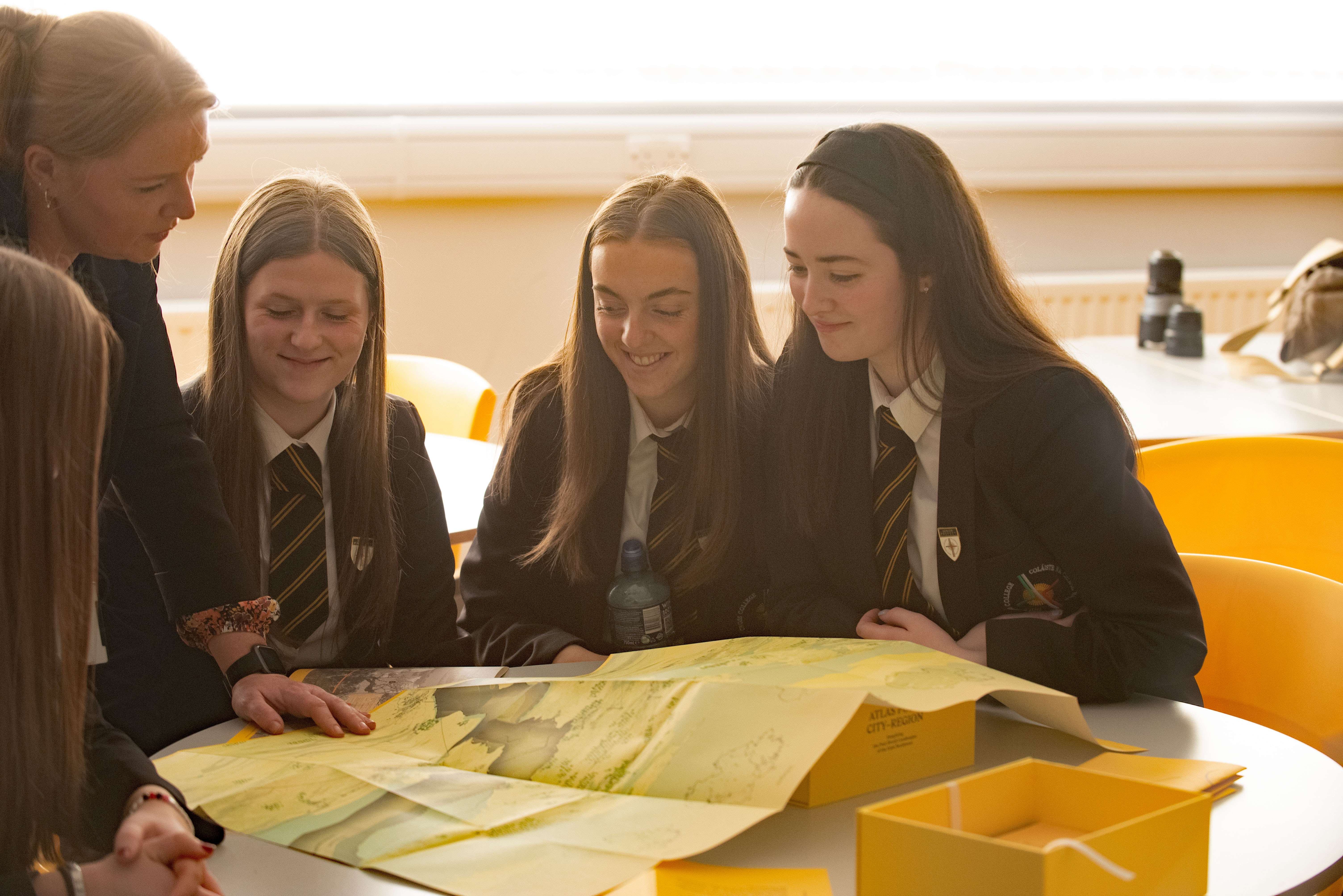
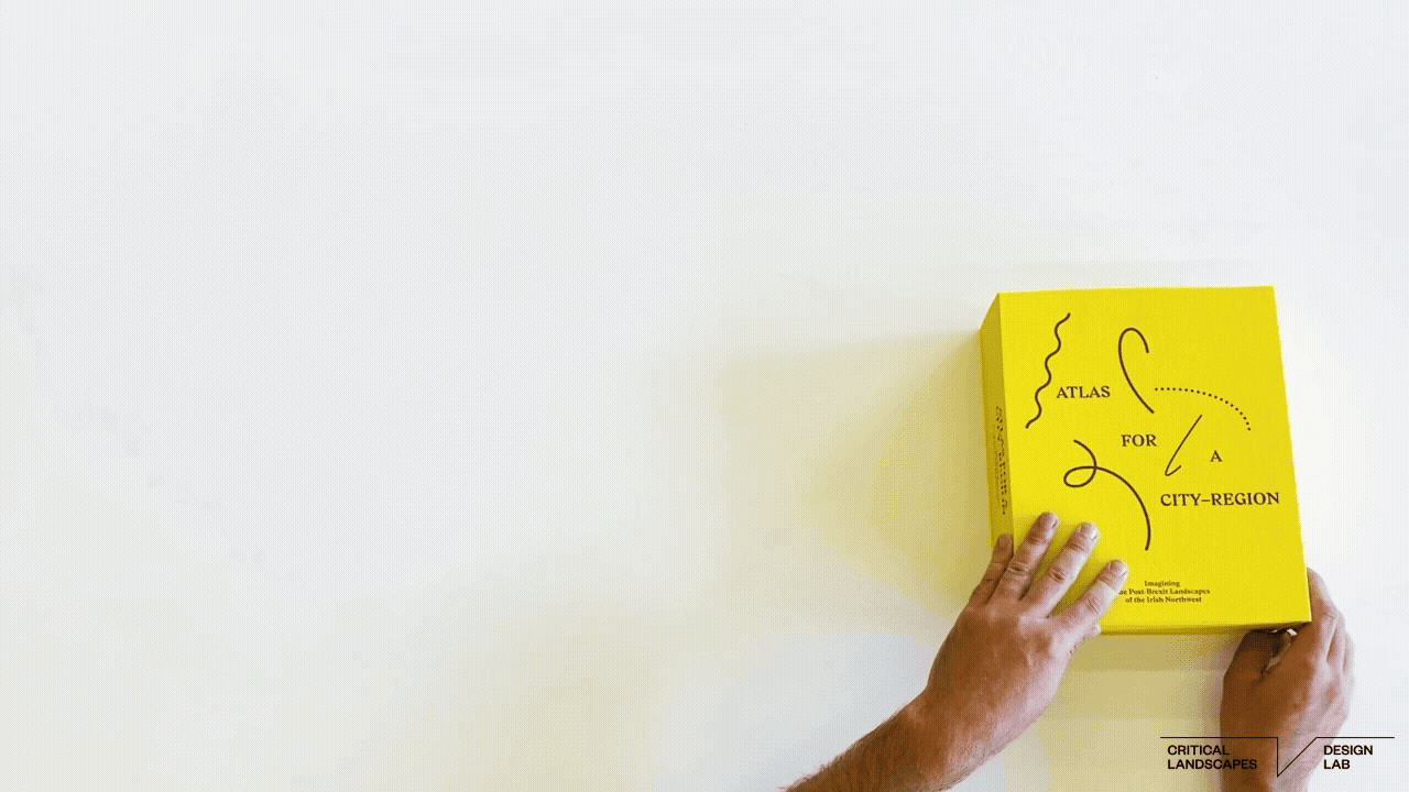
We conceived a “booxhibition”, a hybrid book/ exhibition, that we could distribute in the dispersed communities of the Northwest Region, and that can be opened on a kitchen table, church hall, art gallery, or in the office of a government minister. The booxhibition’s format ensures that this work can reach a wide audience and get a core message across more efficiently than traditional reports and exhibitions.
We originally planned to print 20 booxhibitions, but the sponsors asked us to print 500 copies after seeing our design, which we developed with Why Not Smile LLC in New York. The booxhibitions were distributed among communities, schools, and libraries in the Irish Northwest, on both sides of the border. The discussion that the booxhibition inspires at its unfolding anticipates the region’s unfolding over time.
In an impact statement, the Derry City and Strabane District Council wrote that “The Atlas has become a critical tool for both Councils in forward mapping the potential for the cross-border landscape over the next 200+ years. Whilst some elements of the Atlas are futuristic and visionary, they are inspirational in terms of helping to inform policymakers across local and central government in relation to matters such as planning for population growth, establishing new settlements, climate change and flood mitigation, sustainable food production, transport and connectivity, and landscape management.” They shared that the Atlas is playing a key educational role in schools around the region. It has already informed policy development and is guiding regional strategy while informing the long-term planning work of the Northwest Partnership, a strategic cross-border group.