
Owens Lake Environmental Land Art
Owens Lake Environmental Land Art
Owens Lake Environmental Land Art
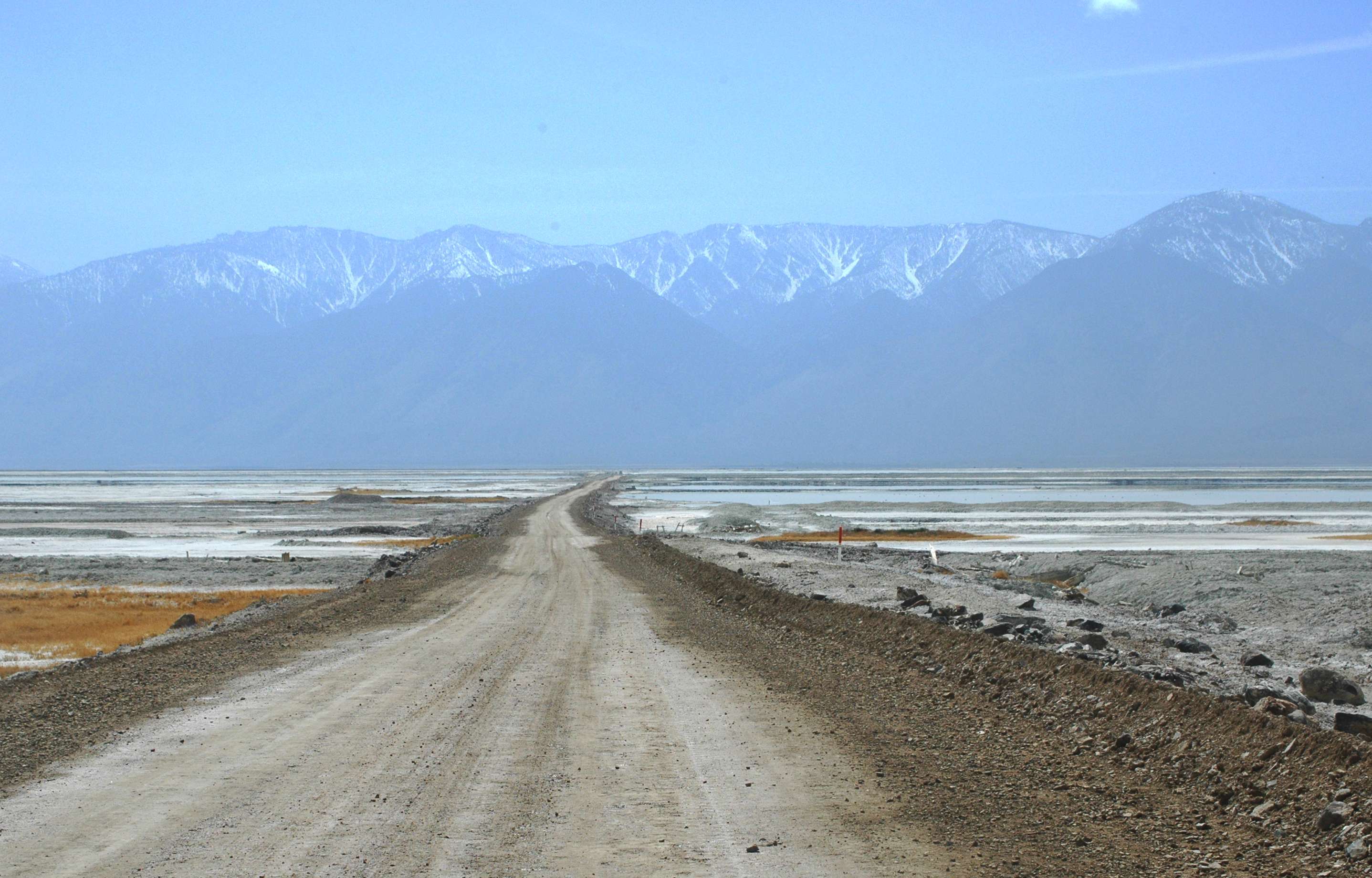
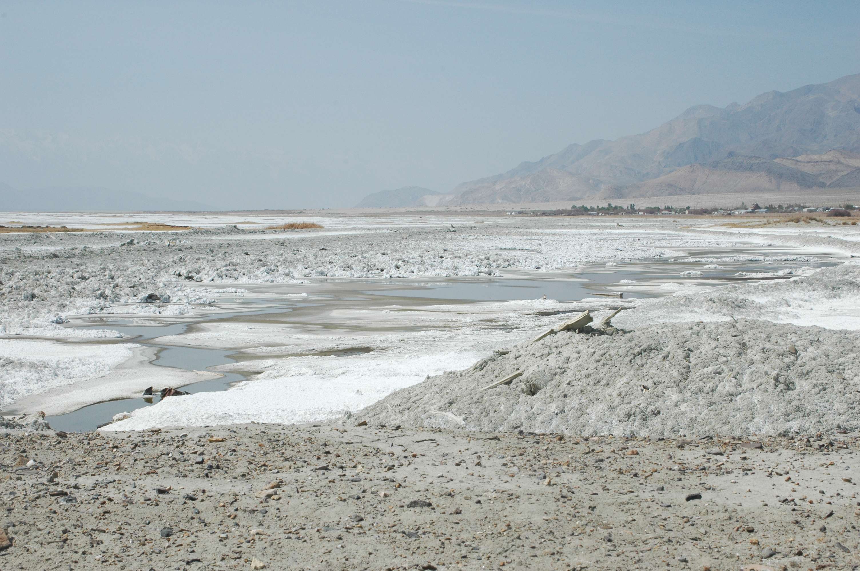
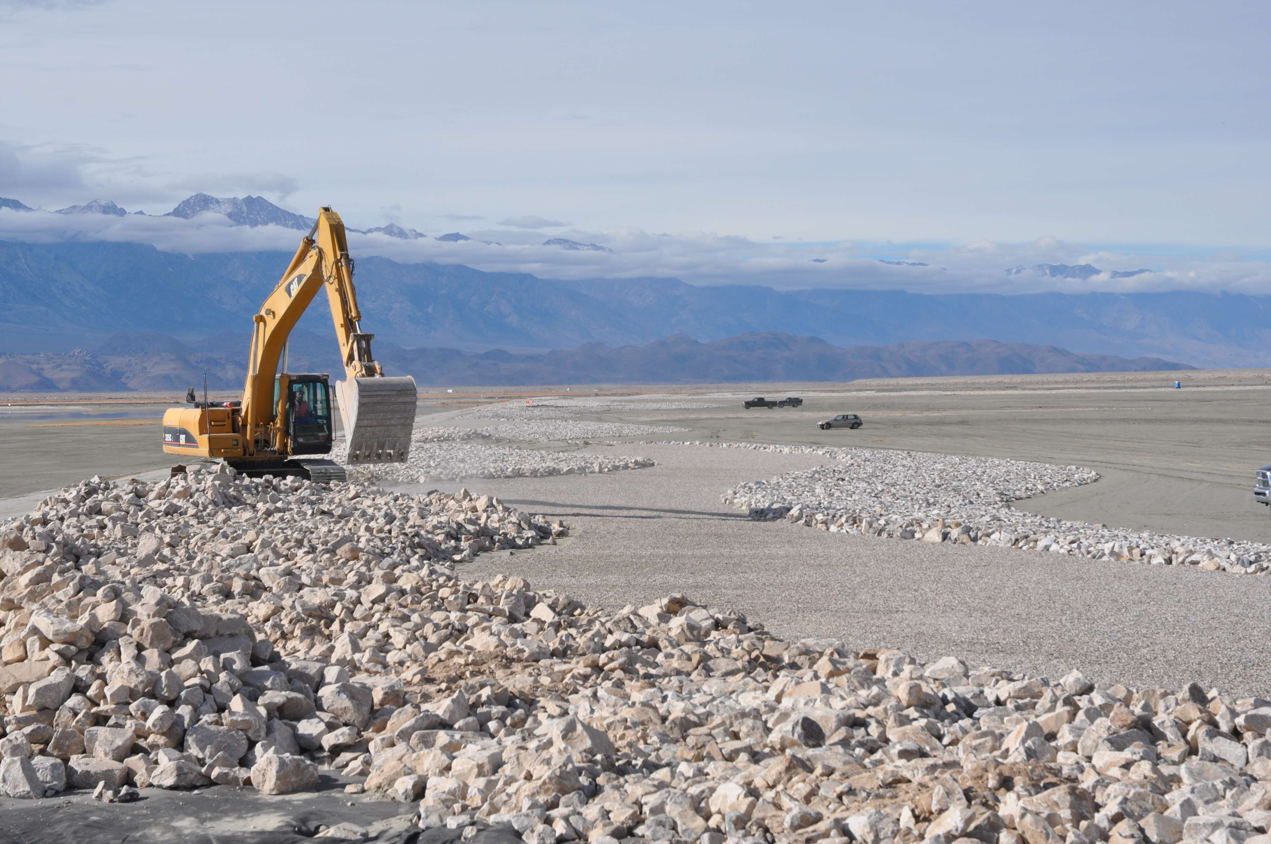
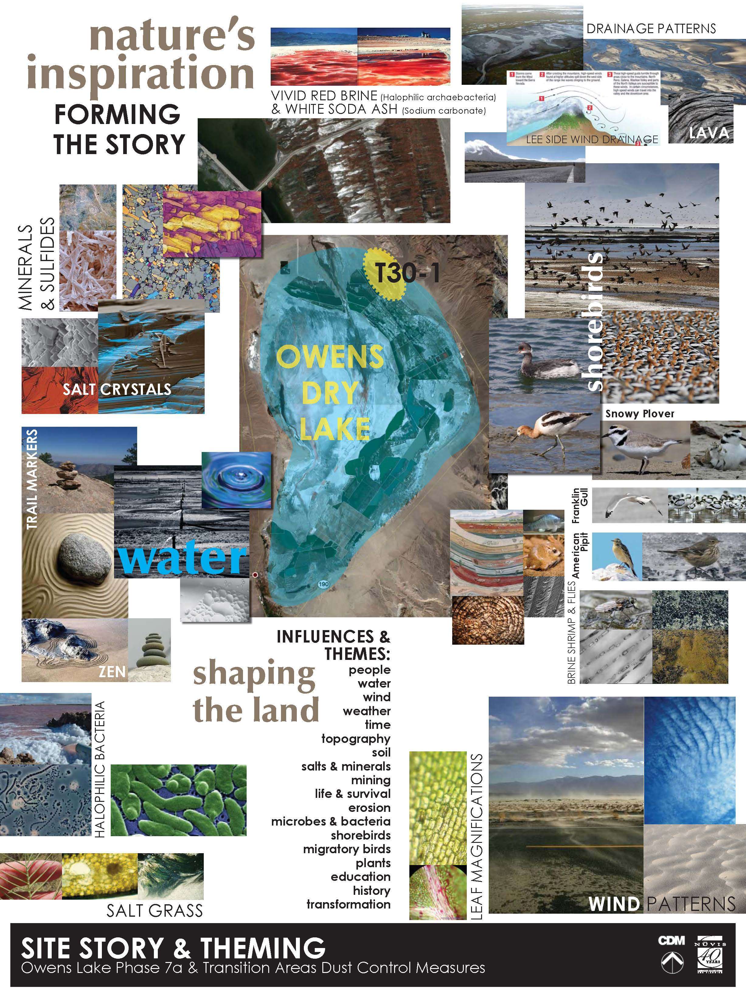
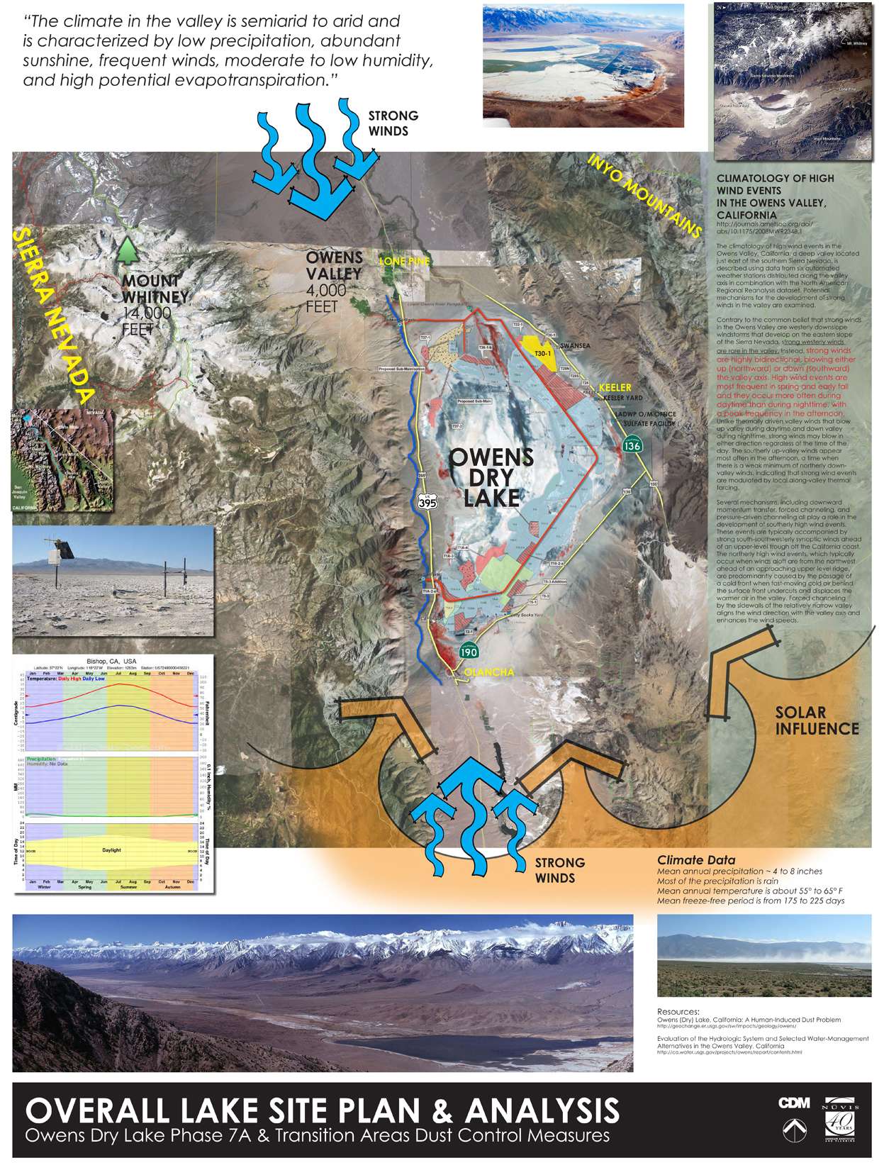
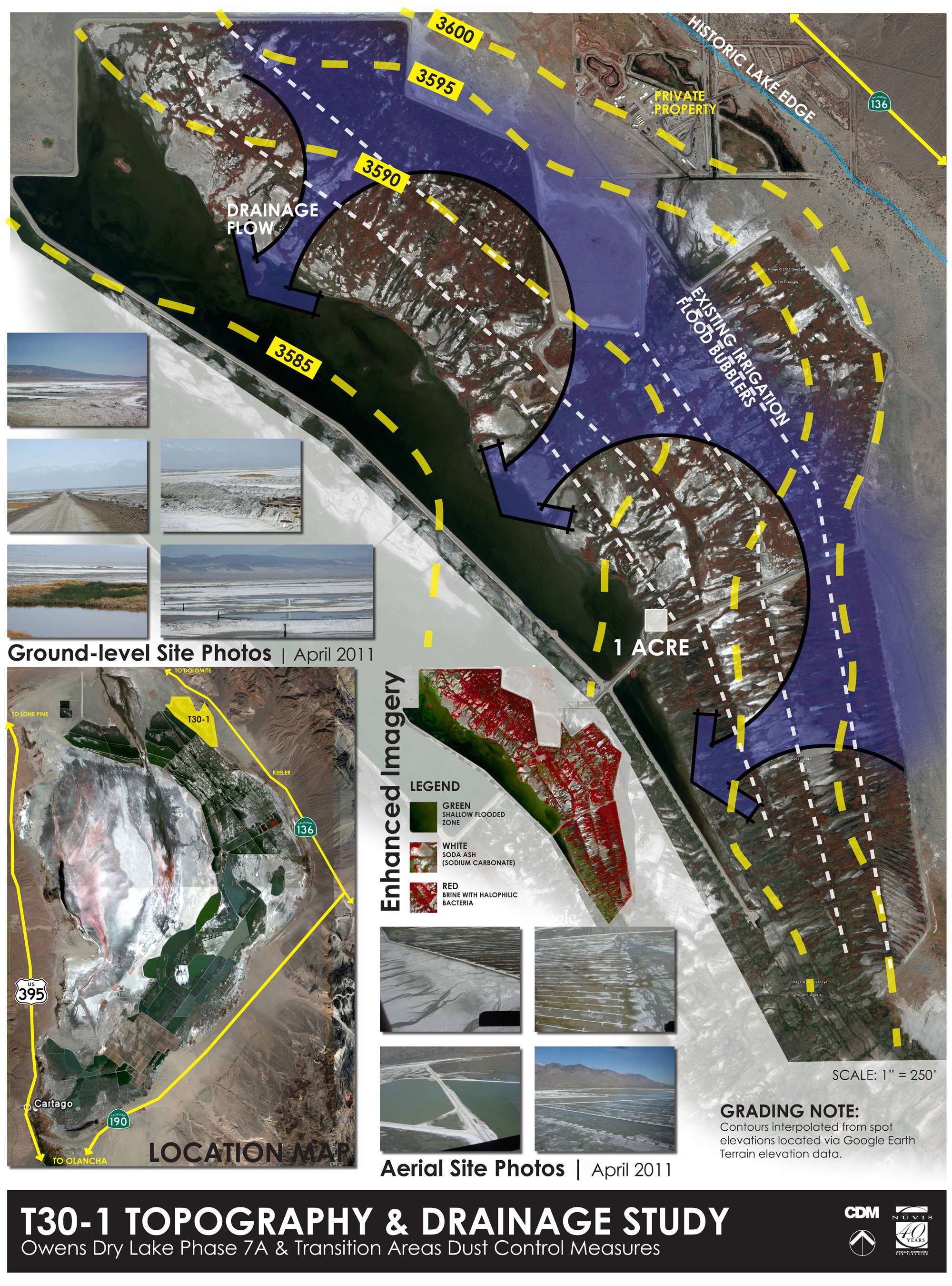
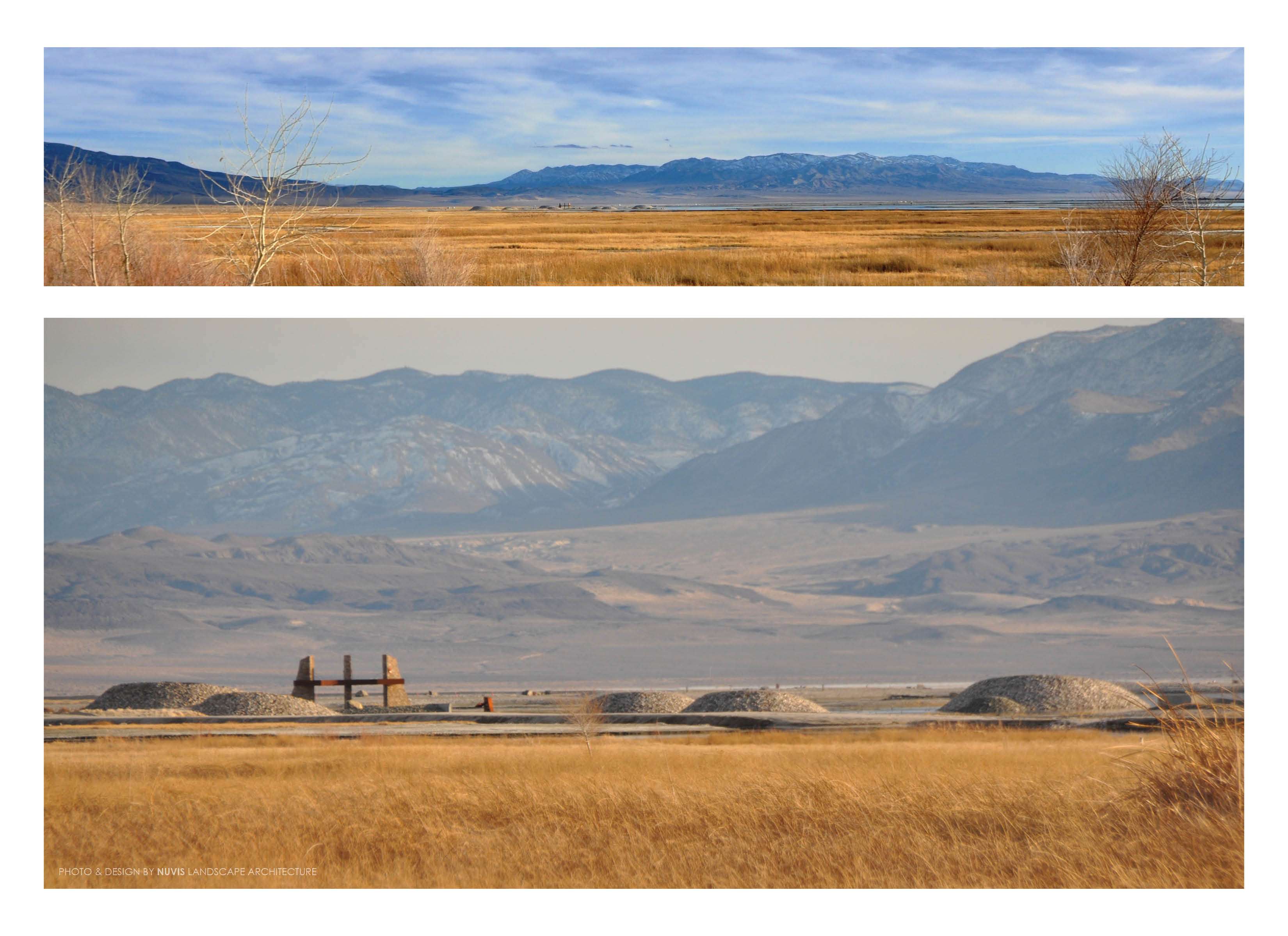
Owens Dry Lake is located in the Owens Valley on the eastern side of the Sierra Nevada Range in Inyo County, California. Unlike most dry lakes in North America’s Basin and Range Province which have been dry for thousands of years, Owens held significant water until 1913. To supply Southern California’s rapid population growth, the Owens River was diverted into the Los Angeles Aqueduct, causing Owens Lake to desiccate by 1926. The lake became the largest single source of dust pollution in the United States. Legislation passed in 1983 initiated a comprehensive dust mitigation effort. Since then, significant reductions in dust production have been realized through the implementation of mitigation measures (shallow flood, gravel cover, and managed vegetation) over engineered parcels on the dry lake playa.
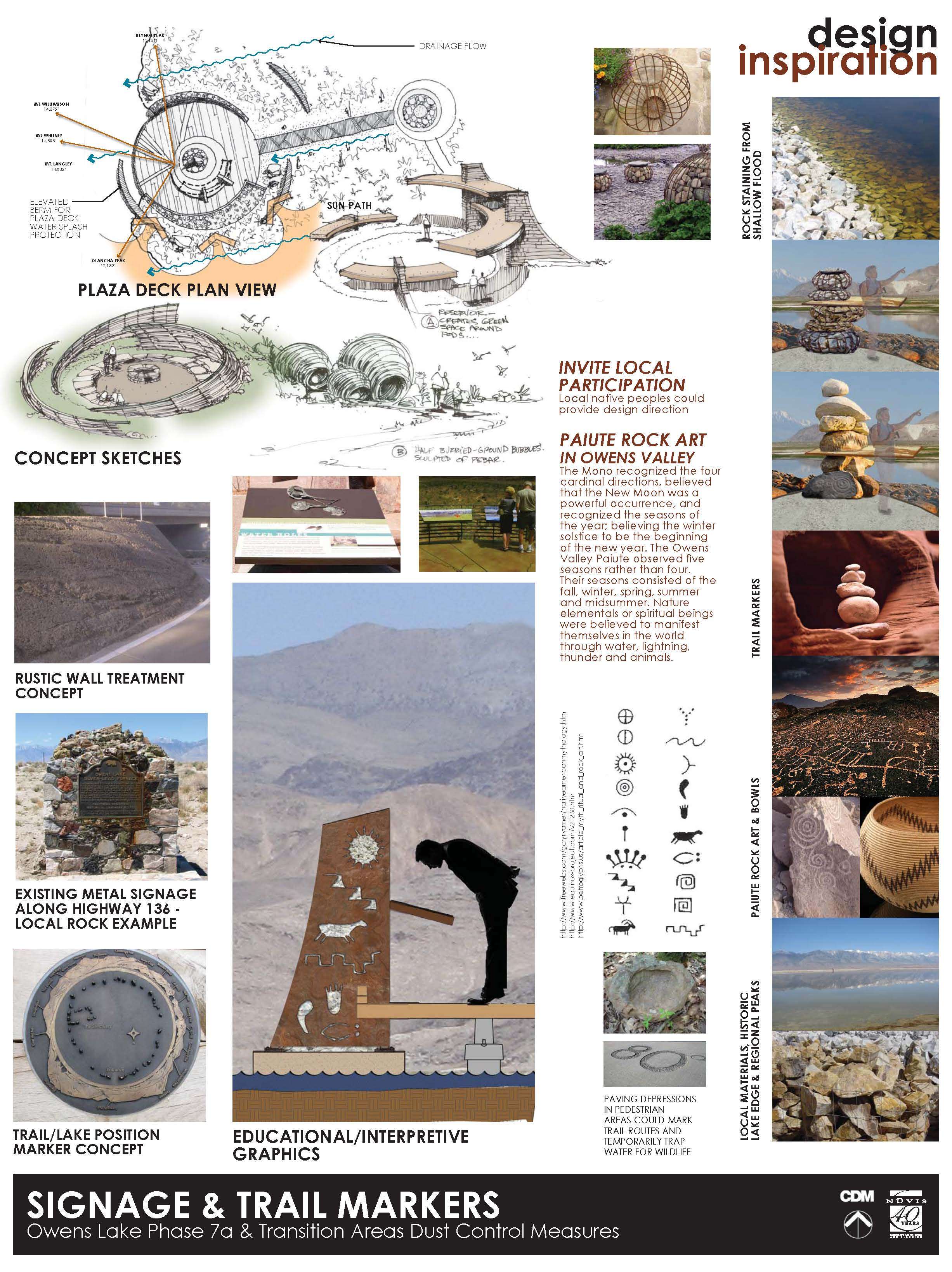
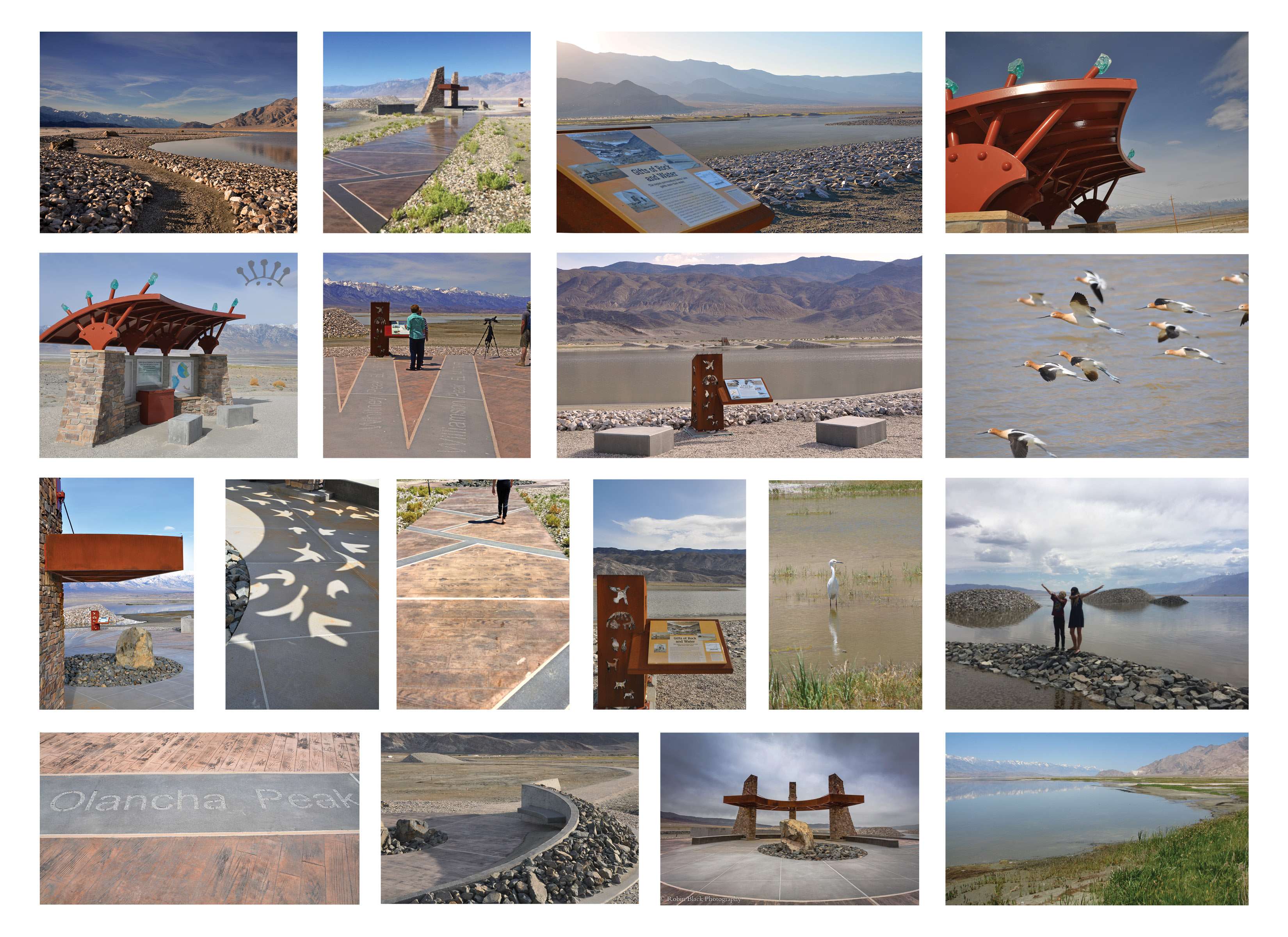
The landscape architect led team workshops, created over 75 presentation exhibits, designed themed site elements which celebrate local wildlife, native culture, and historical industry, established graphic and CADD sheet standards for all consultants, and provided on-site construction observation. Collaborating with the civil engineer (prime - infrastructure), environmental consultant (soils and wildlife), and signage consultant (way finding and interpretive), the landscape architect (grading, construction, irrigation, and planting) developed buildable construction documents for a site that improves the quality of life by:
- reducing dust emissions
- celebrating local native cultures
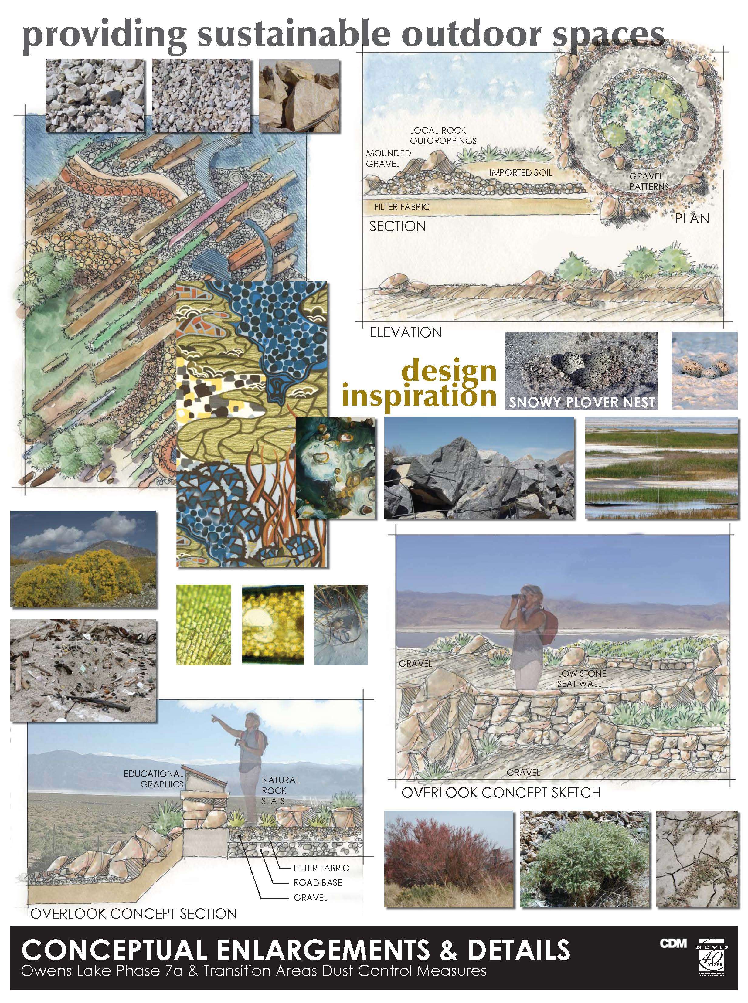
- promoting interpretive education
- creating and protecting habitat
- offering safe public access
- providing functional aesthetic site elements
- increasing awareness and public interest in the story of Owens Lake and its continued protection
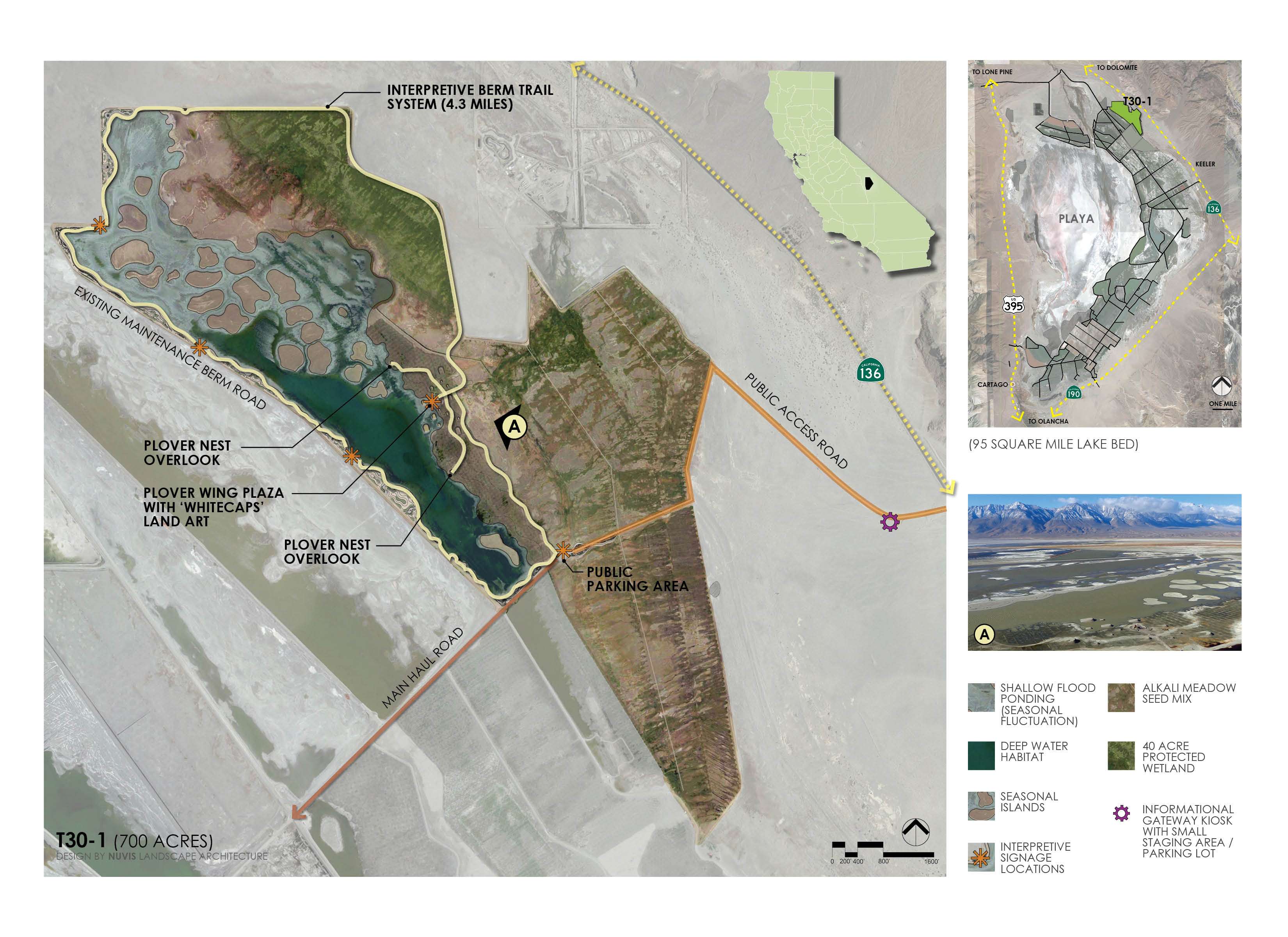
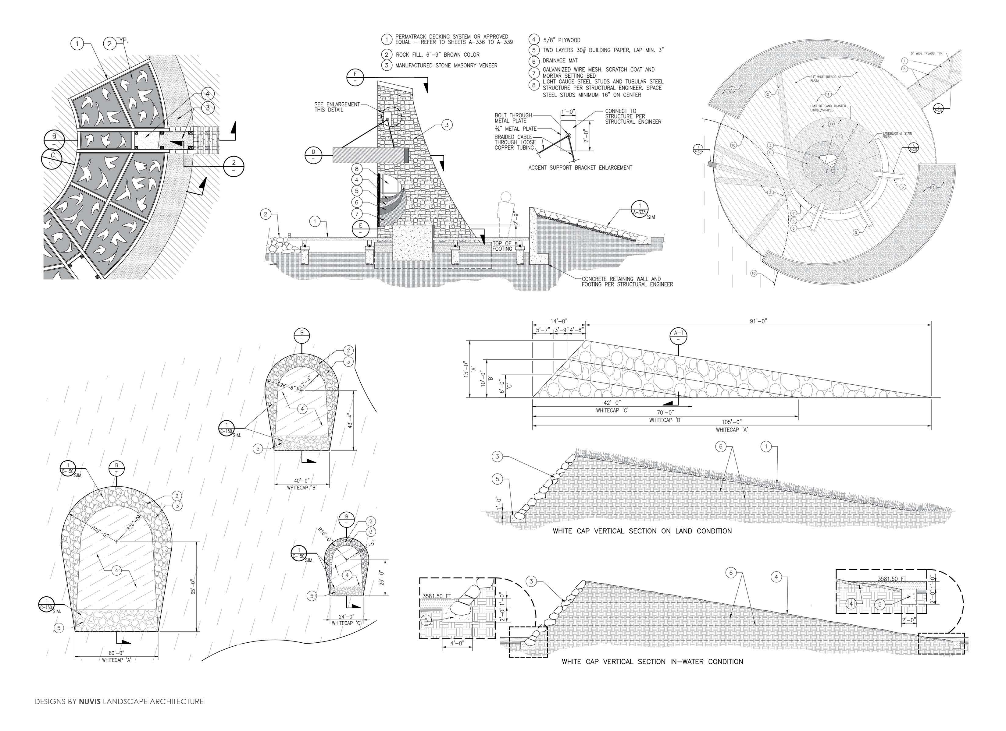
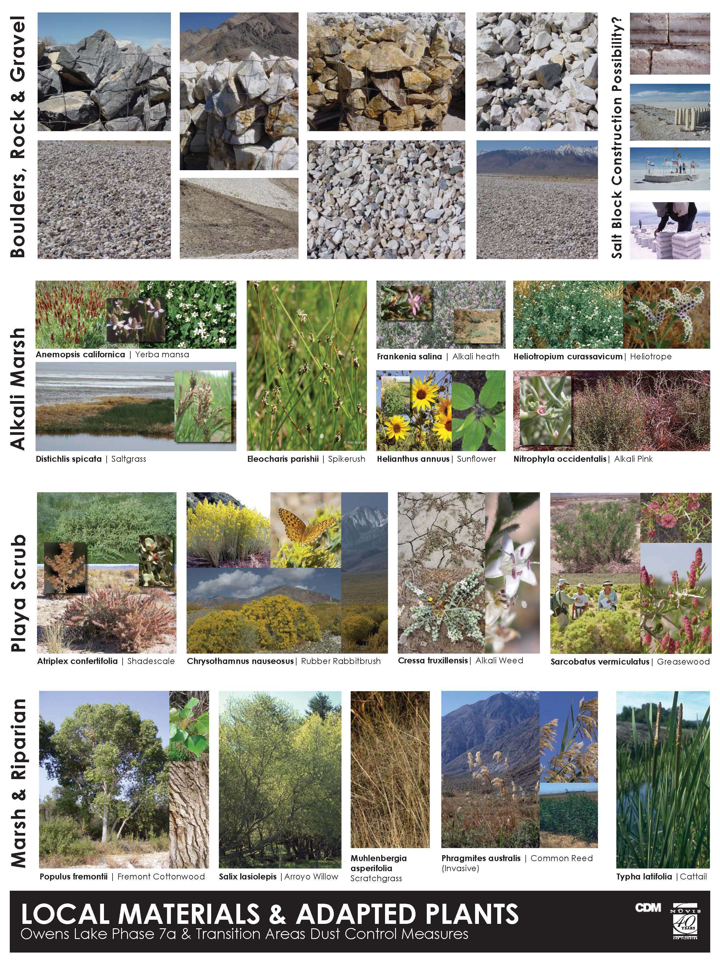
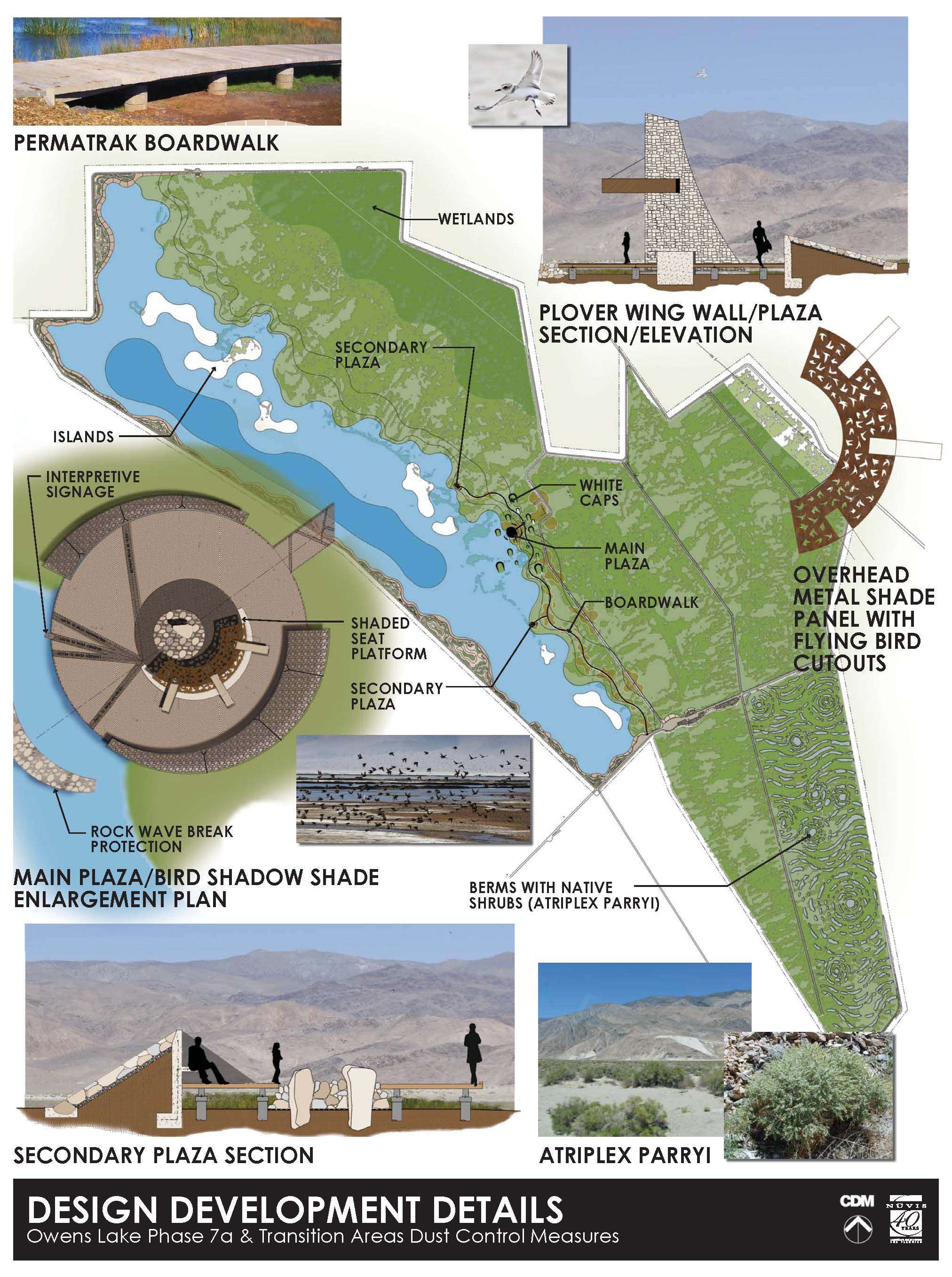
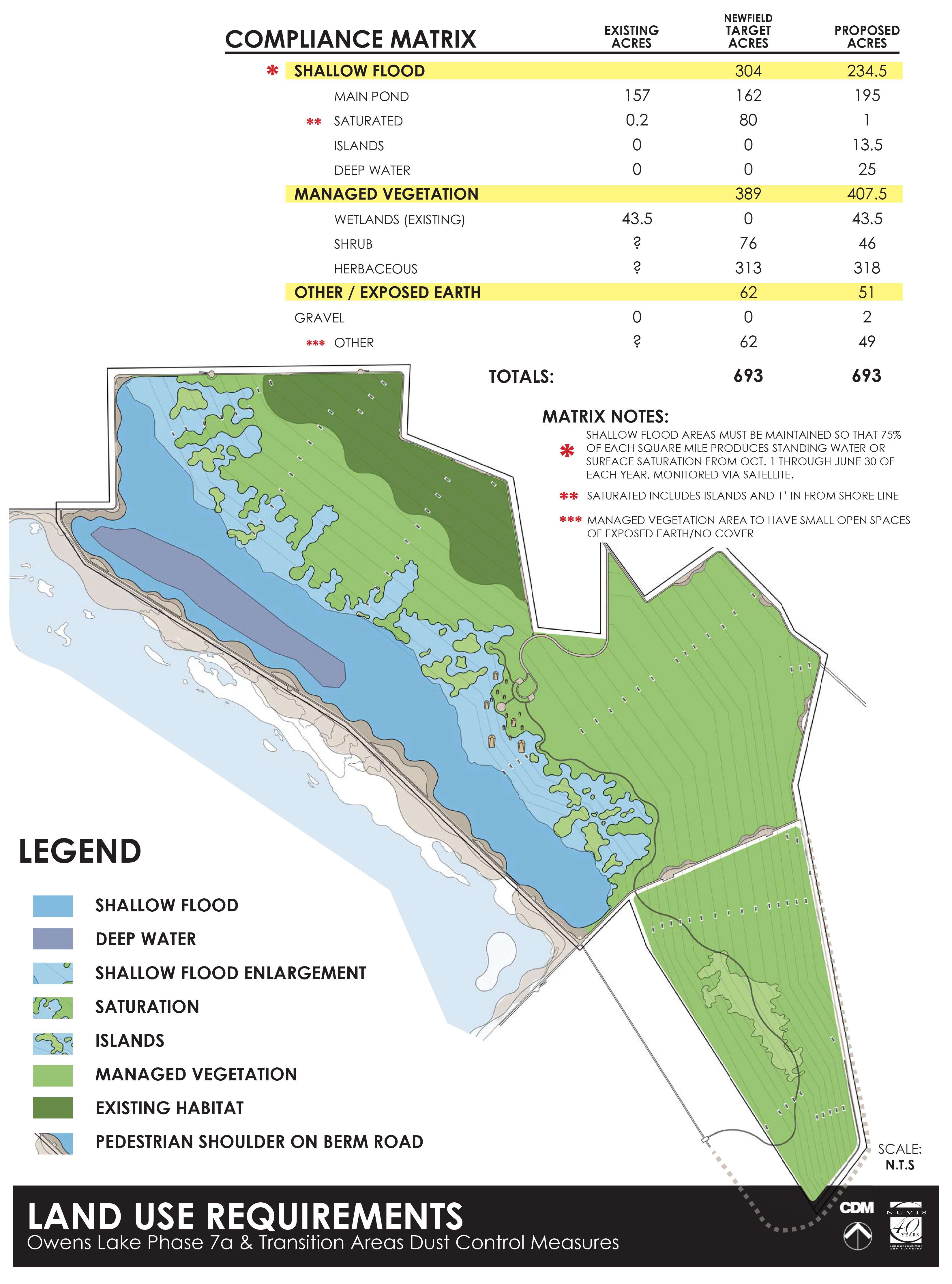
In order to meet the criteria of the dust mitigation agreement, the design had to adhere to specific compliance targets for each of the mitigation measures. 235-acres of shallow flood were required to be maintained so that 75% of each square mile produces standing water or surface saturation from October 1 through June 30 of each year as monitored via satellite. 407.5-acres of managed vegetation were to be planted as a mosaic of Dry Alkaline Meadow, Mixed Alkaline Meadow, Shrub/Dry Meadow native species. The remaining 51-acres (excluding the berm roads) were required to be made up of gravel or rock cover and small open spaces of exposed earth (no cover) scattered through the managed vegetation for habitat purposes. The resulting solution is a dynamic tapestry of native and local materials woven into forms which serve specific functions.
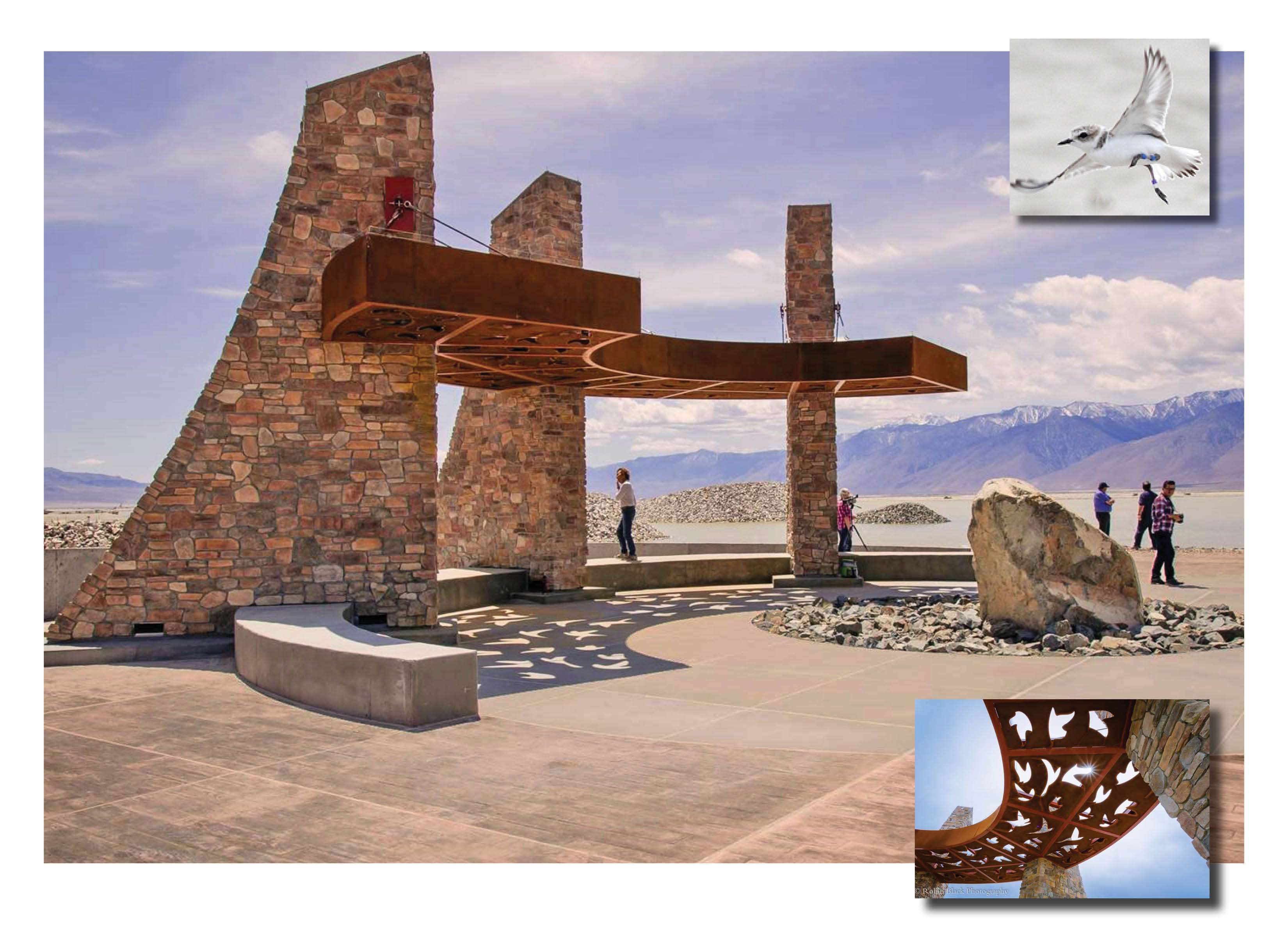
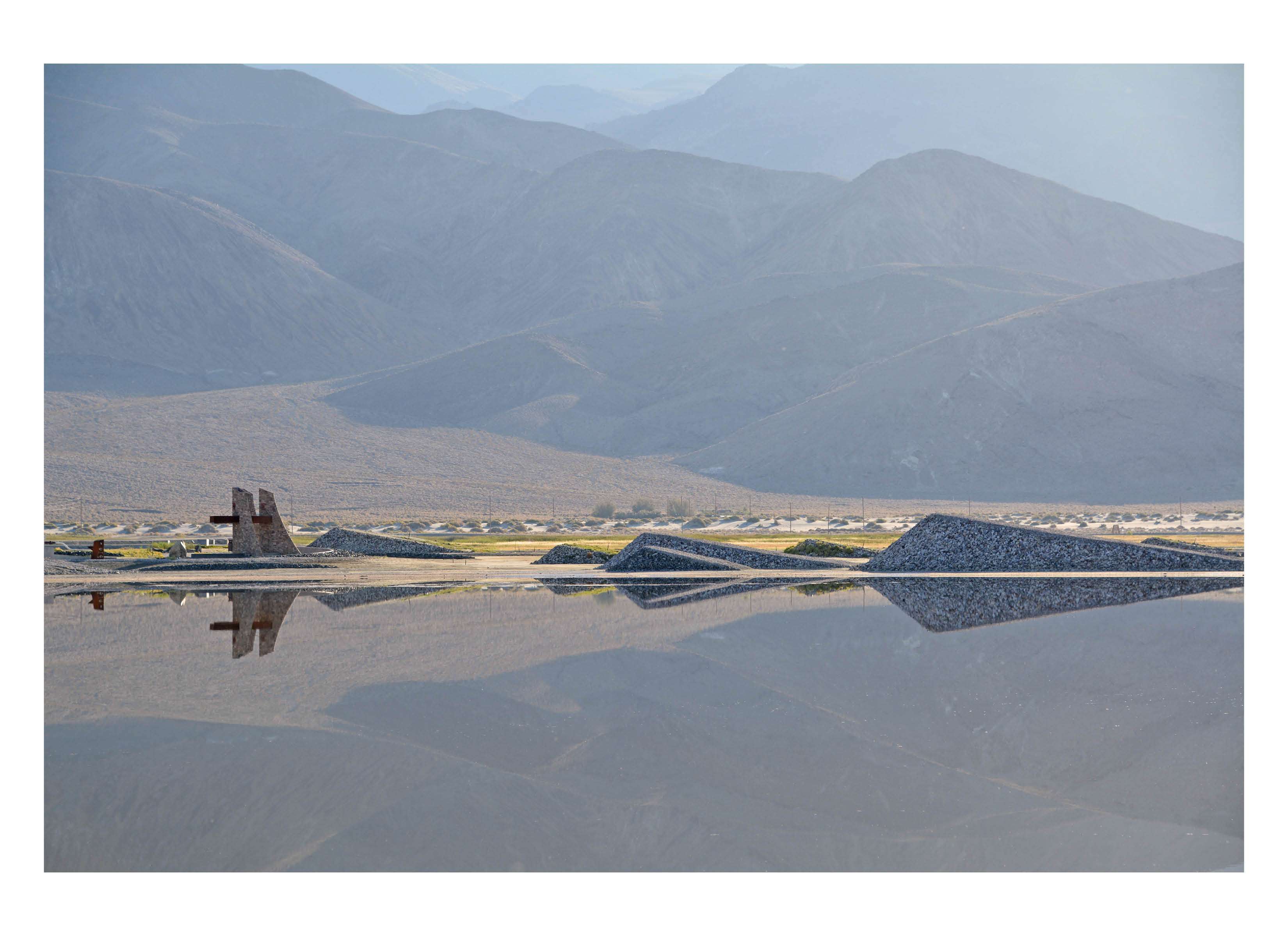
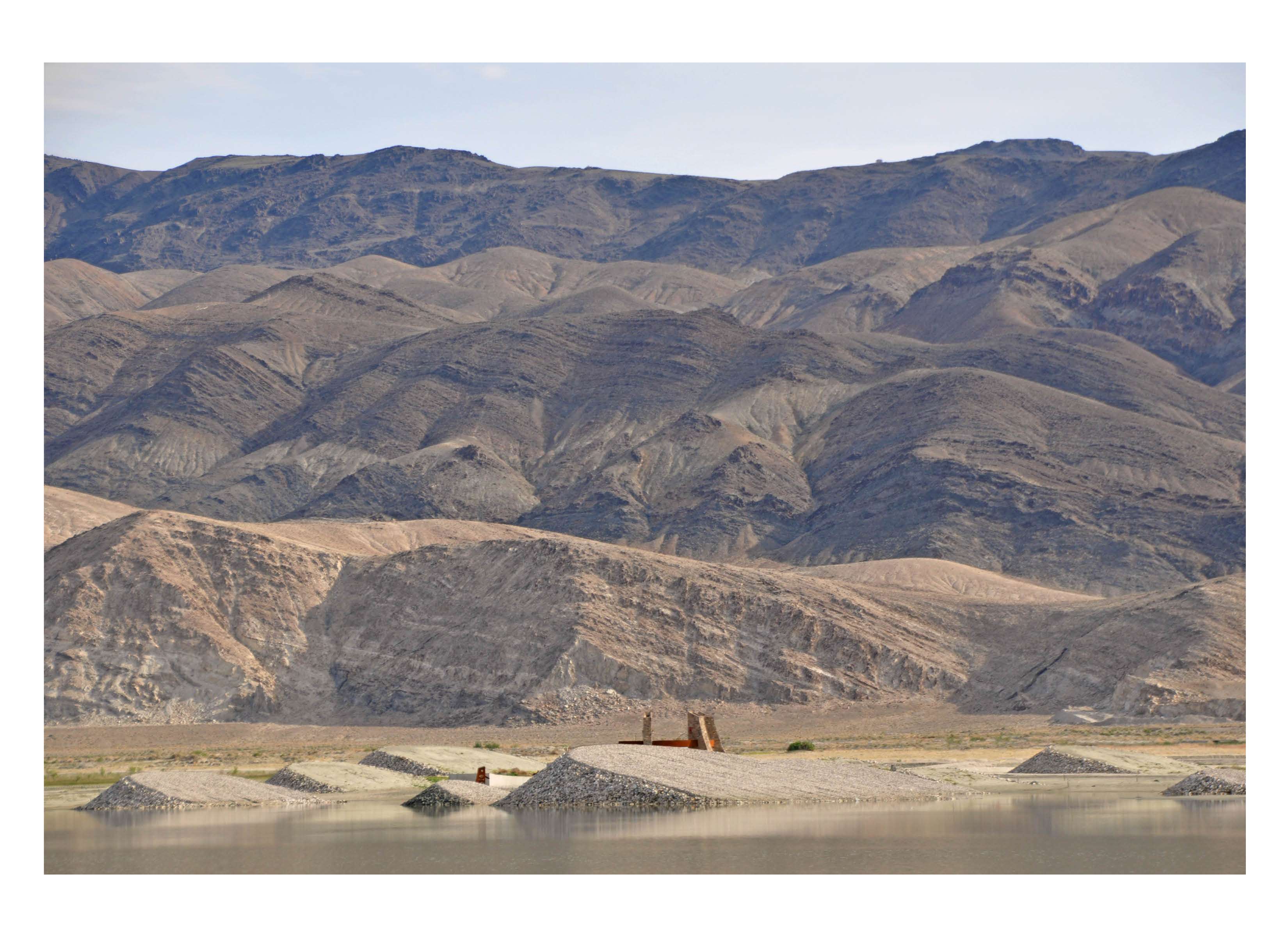
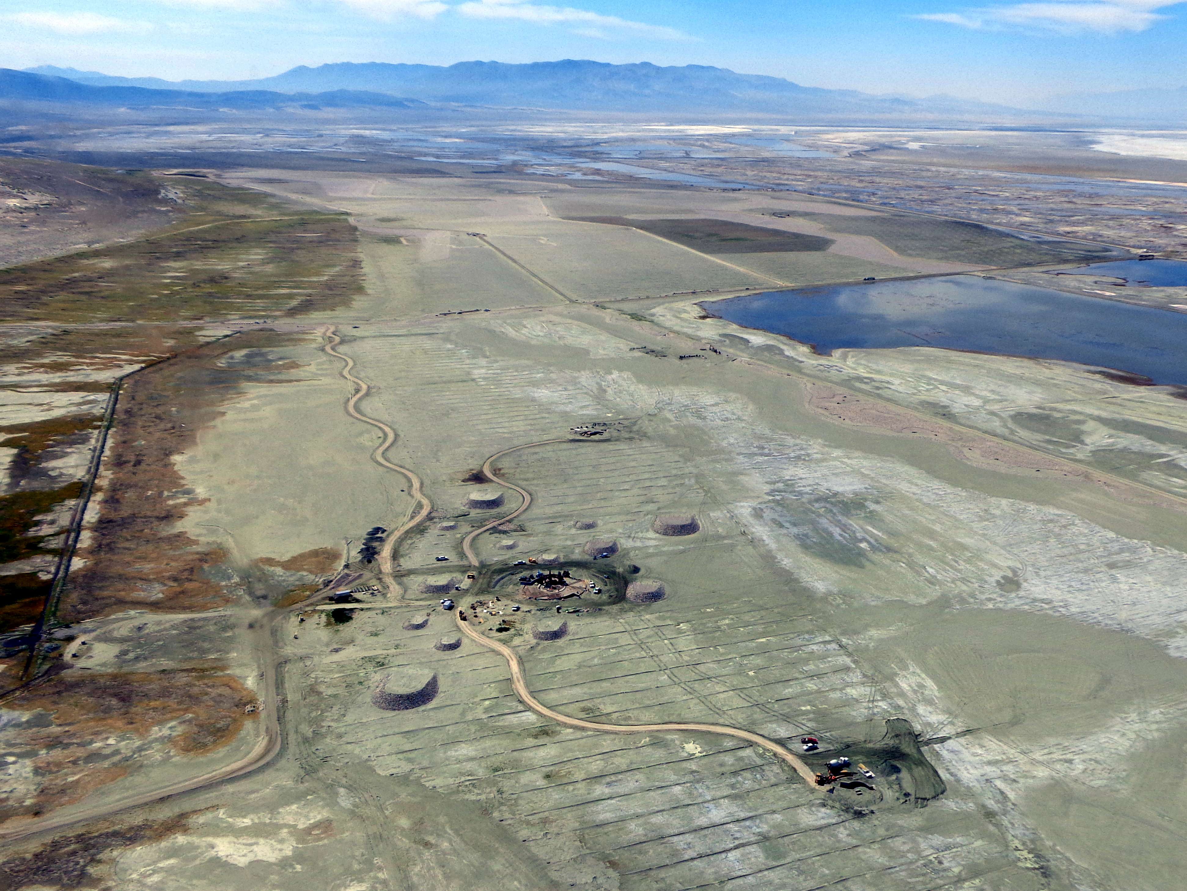
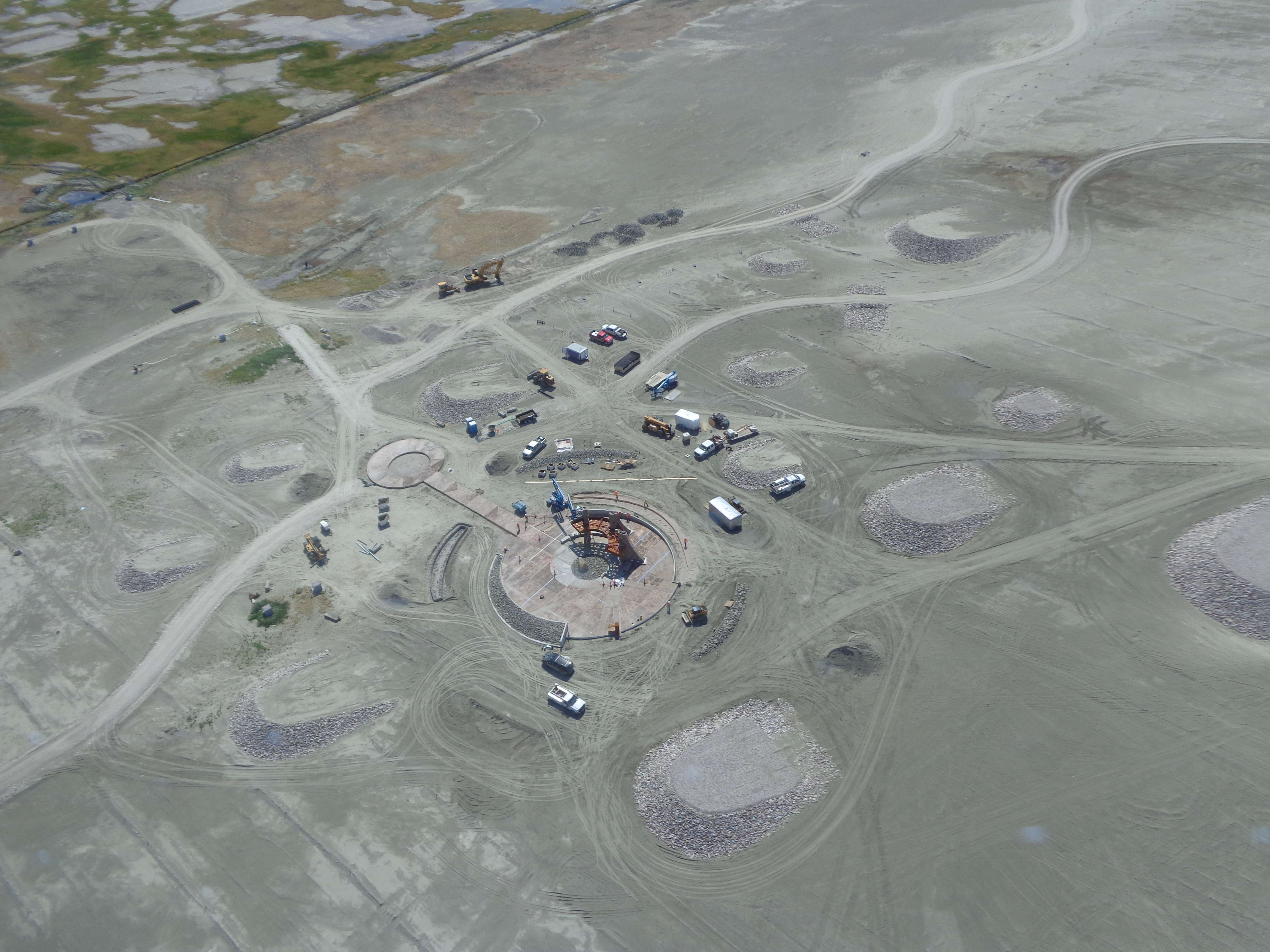
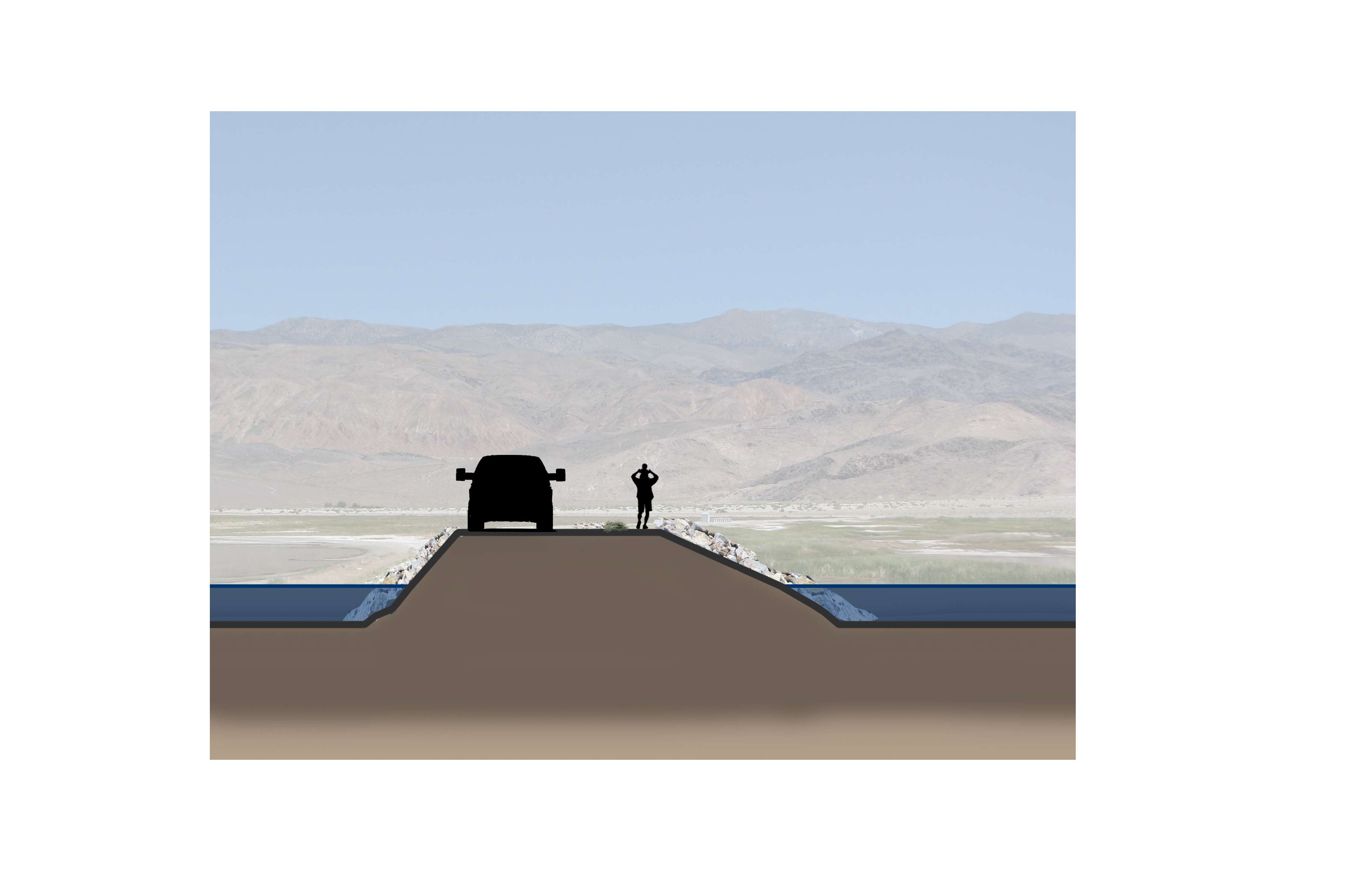
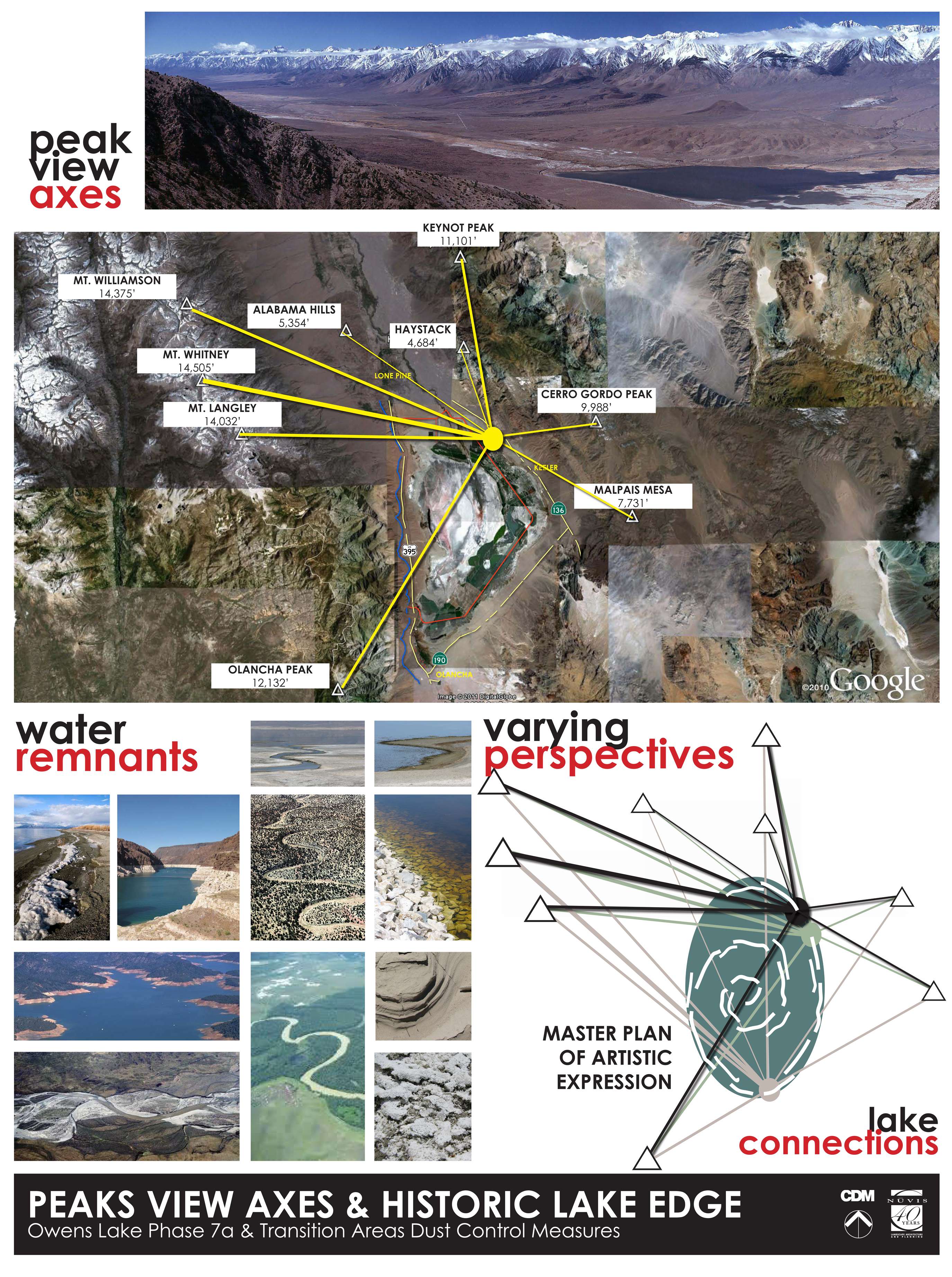
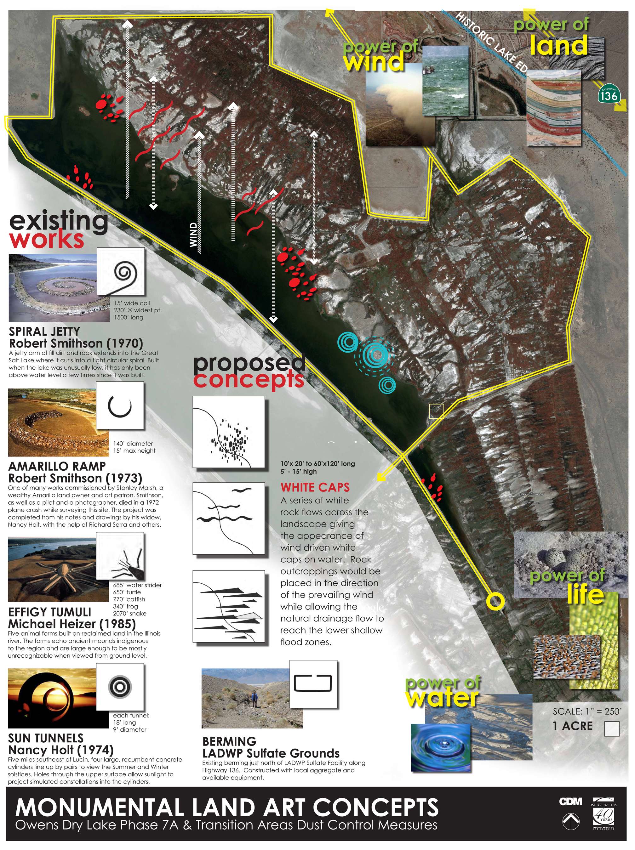
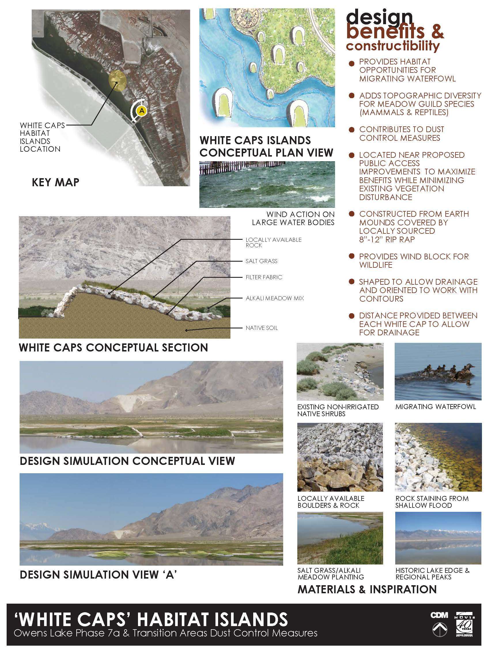
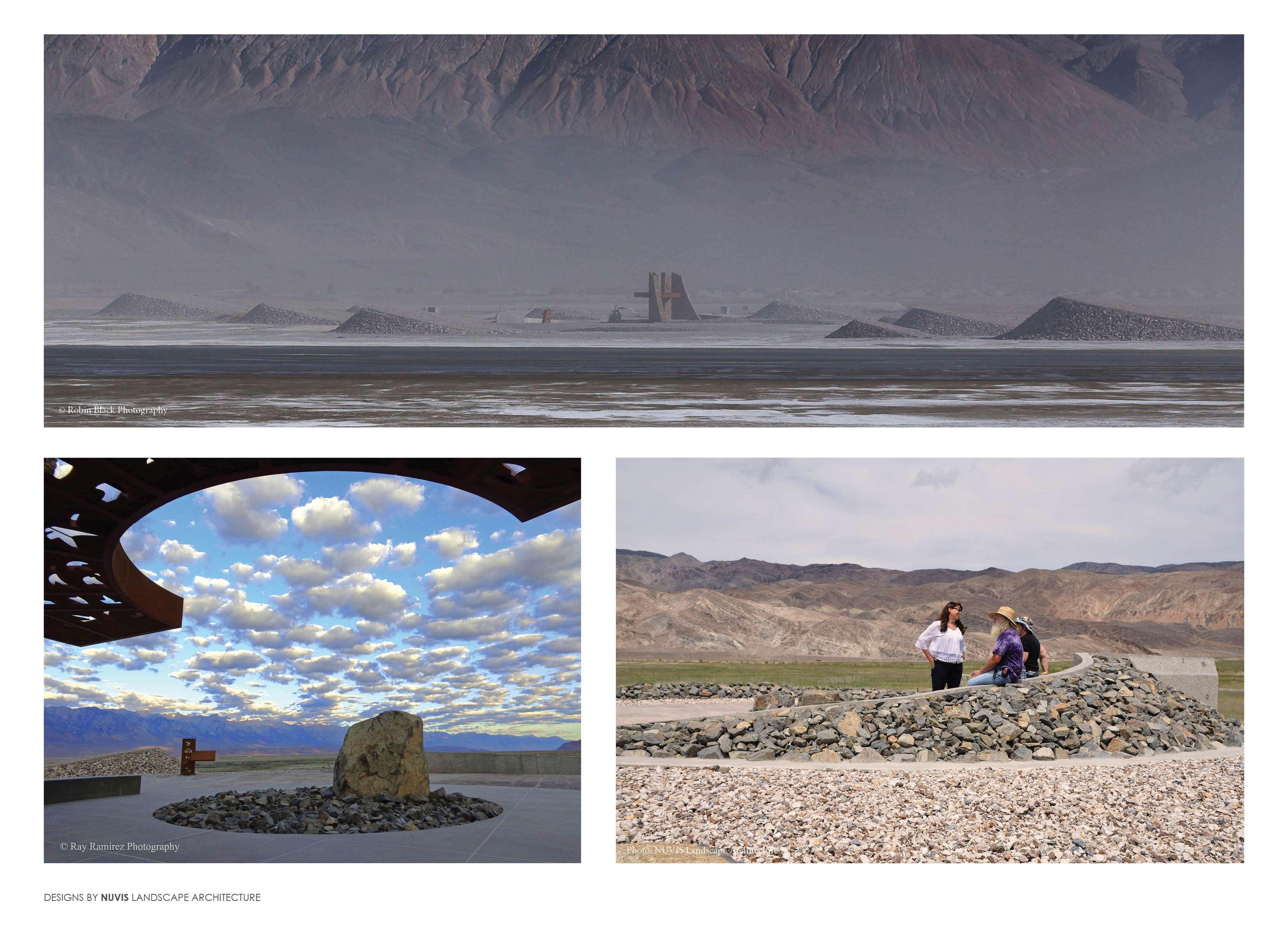
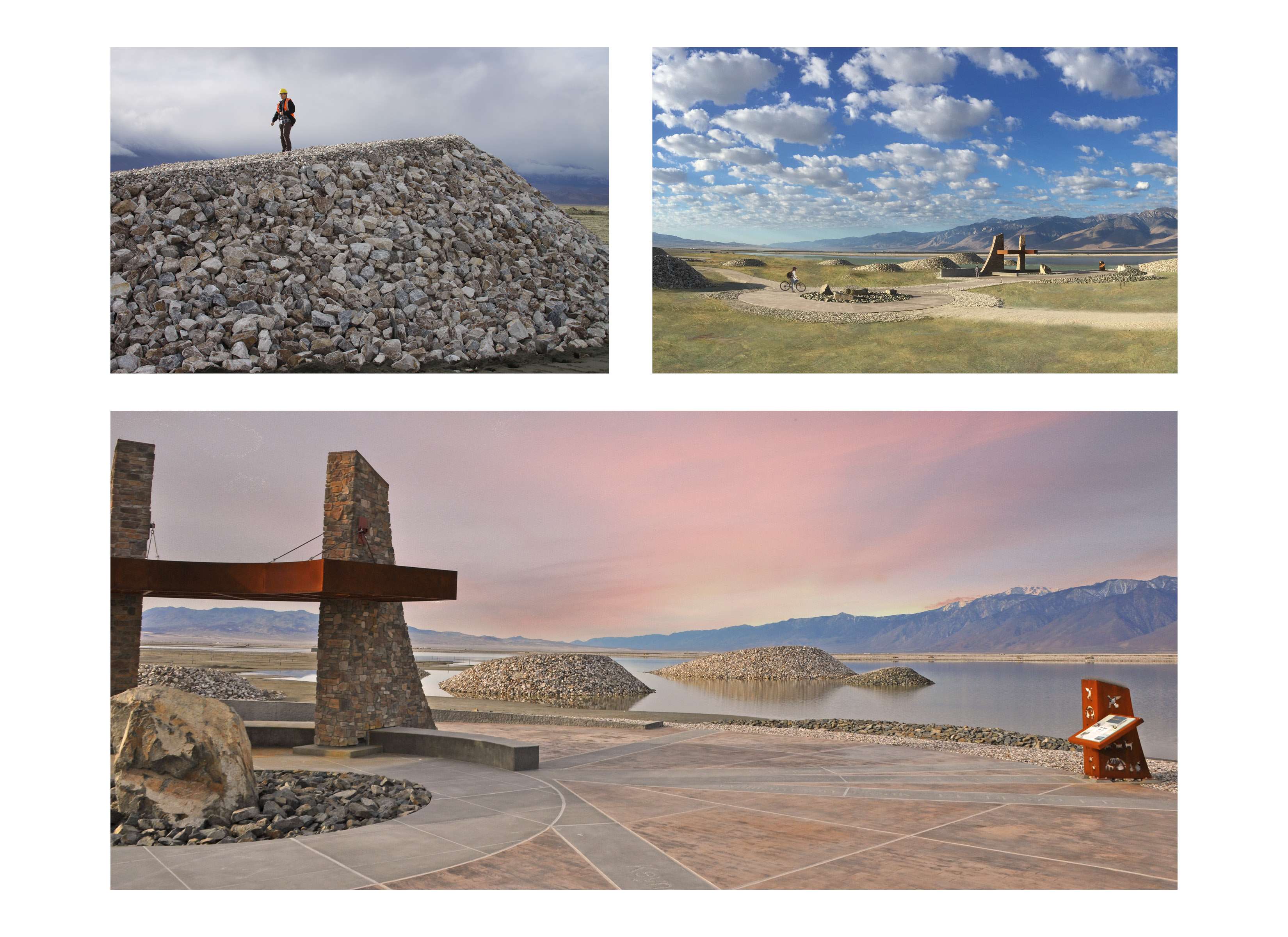
Imagine the lake before the river was diverted; a large body of water in a vast valley with 80 mile per hour winds blowing across its surface. Old photographs show the lake having the appearance of a small sea filled with whitecaps during its windy season. Our team, in collaboration with LADWP’s biologists, designed a monument to the lake’s past which solves the challenge of providing habitat for shorebirds, small mammals, and invertebrates. The ‘Whitecaps’ are large land forms in four size variations which provide niches and topographic variation for both plant and animal diversity. The shape and direction of the sculptures emulate the direction of white caps blowing over the once 110-square-mile lake. As the landscape architect/artist we embraced the unique beauty of this majestic place and understood the importance of designing a solution that is in harmony with the surrounding view shed while providing an important habitat benefit.
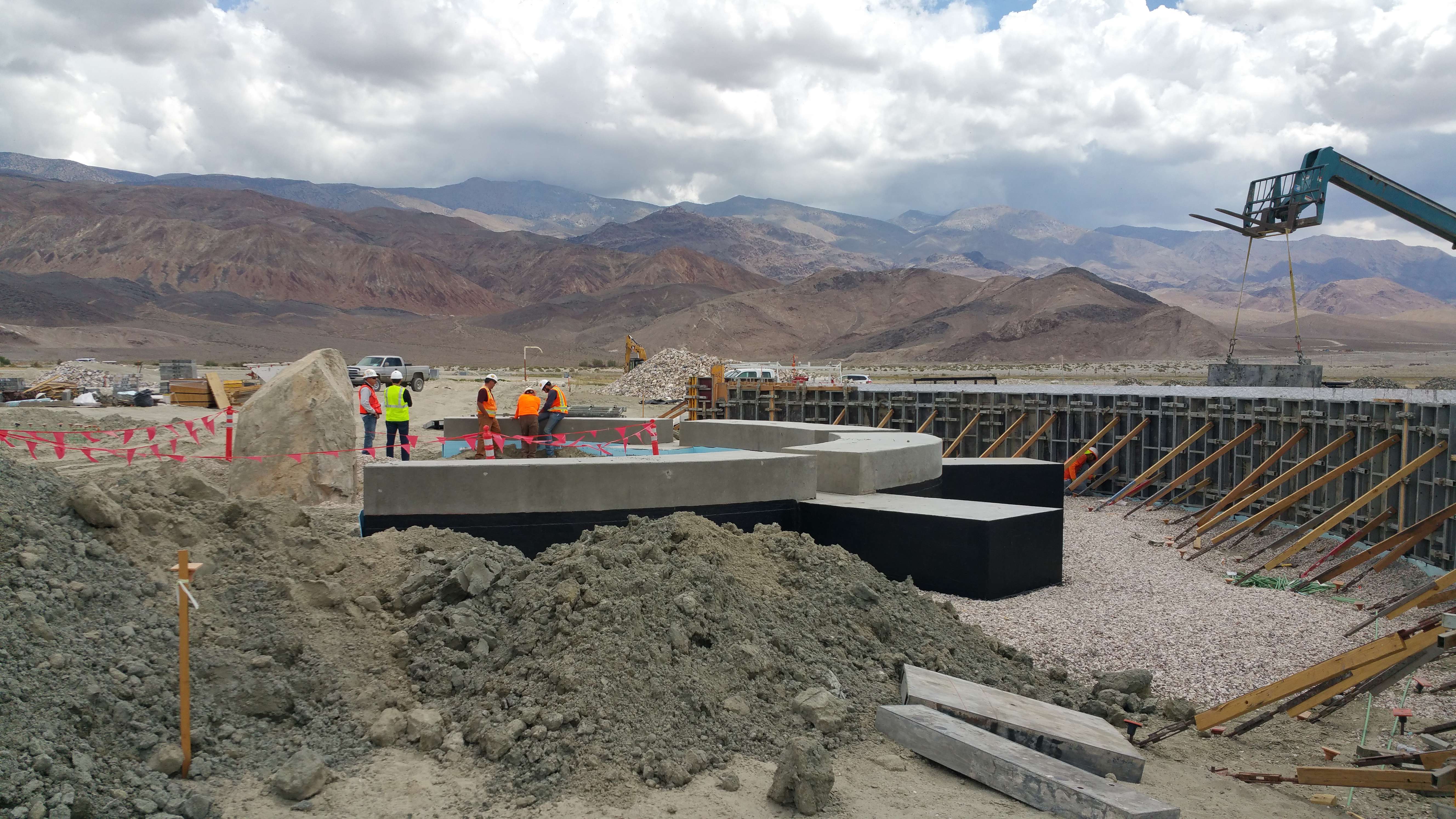
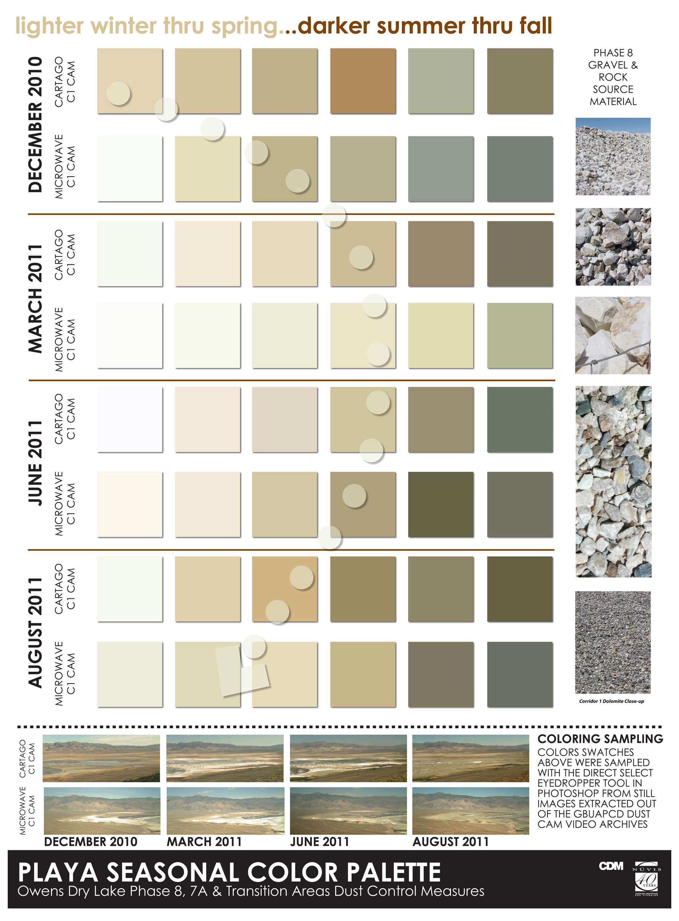
Collaborating with LADWP’s operation and maintenance staff, site amenities were designed to stand the test of time and hold up against the unforgiving environment of the playa which experiences seasonal temperature fluctuations from below 0° F to over 110° F and is home to corrosive alkaline soils and extreme atmospheric conditions. Ted Schade, former air pollution control officer for the Owens Valley and avid critic of the LADWP, recently stated in the Los Angeles Times that the Owens Lake Land Art project, “is California’s version of Stonehenge”.
The Owens Lake Land Art project has made a positive impact both locally and nationally toward increasing public understanding of the unique Owens Lake environment as well as the role landscape architects can play in large environmental projects. Having only been open to the public since April of 2016, the project has been featured in several articles, blogs, and new stories including: Smithsonian.com (recognition as one of six Monumental New Outdoor Art Installations), Vogue, KCET Art Bound, KABC, Los Angeles Times, Inyo Register’s Celebration of Art and Science, Sierra Wave Media, and the California State Lands Commission. Owens Lake Land Art provides the region with a new interpretive habitat destination which is improving local business, creating recreation opportunities, and increasing public dialog on water conservation.
Owens Dry Lake is located in the Owens Valley on the eastern side of the Sierra Nevada Range in Inyo County, California. Unlike most dry lakes in North America’s Basin and Range Province which have been dry for thousands of years, Owens held significant water until 1913. To supply Southern California’s rapid population growth, the Owens River was diverted into the Los Angeles Aqueduct, causing Owens Lake to desiccate by 1926. The lake became the largest single source of dust pollution in the United States. Legislation passed in 1983 initiated a comprehensive dust mitigation effort. Since then, significant reductions in dust production have been realized through the implementation of mitigation measures (shallow flood, gravel cover, and managed vegetation) over engineered parcels on the dry lake playa.
The implementation of dust mitigation measures on Owens Lake have created incredibly productive habitat for birds and other wildlife. Over 100 different species of birds have been observed at Owens Lake to date. On the project site during spring and fall, tens of thousands of shorebirds, waterfowl, and other migratory bird species stop to rest and feed on alkali flies, brine shrimp, and other invertebrates in shallow flooded areas and natural springs. Breeding shorebirds like the endangered Snowy Plover nest along the barren shore-line. Mammal’s found on site include Mule deer, Tule Elk, Jackrabbit and Brown Bats just to name a few. Although the presence of this variety of wildlife presented unique challenges for design and construction, the resulting project has protected, improved, and expanded habitat while providing interpretive access to the public.