Landscape's infrastructure in Súria
Final Project
Universitat Rovira i Virgili. Escola Tècnica Superior d'Arquitectura de Reus.
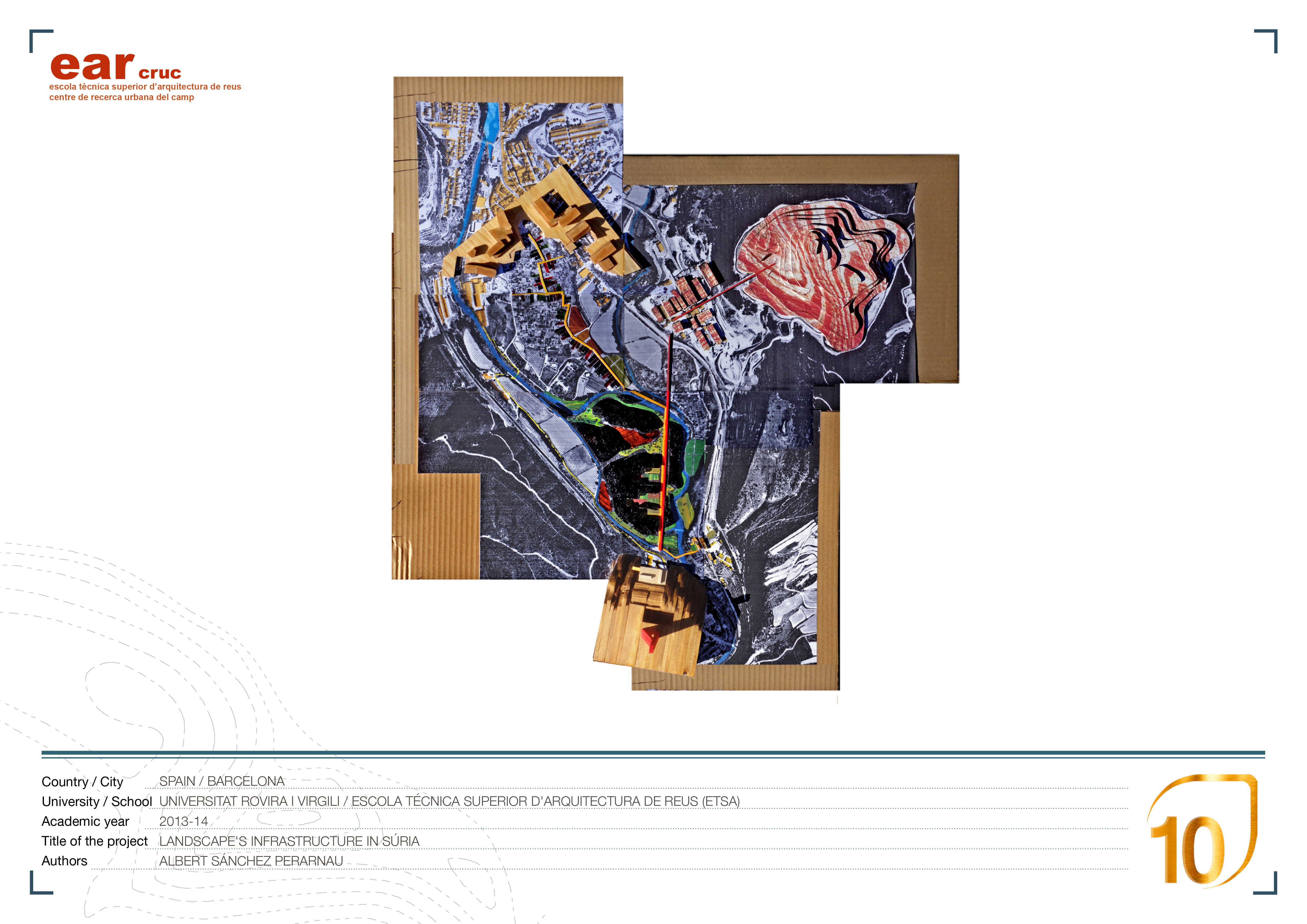
Welcome to Súria! The area of the project is placed in the Cardaner river valley situated in the town of Súria. There are some elements with a strong presence: the river and his parallel path, the vegetable gardens and the riverbank forest, the urban center and the Fustaret suburb, the mine factory and the salt mountain, the obsolete mine facilities and the industrial conveyor belt that cuts the riverbank forest. The vegetable gardens and the riverbank forest have a strong landscape value due to their capacity to host a extend variety of plants and animals. One of the aims of the proposal it is to recognize these values. We introduce them inside the mobility infrastructure of the valley, they will be the new landscape connection with
the urban center and the Fustaret’s suburb. We propose a new path’s network that create a multiplicity of initenaries. To attract the people to walk around the area we propose to place a anchor, the geological and mine’s museum (MMiG).
The landscape’s permeability is created through the redefinition of the urban boundaries and trancing a new walking path that cross the vegetable garden and the riverbank forest and arrive to the museum and the Fustaret’s suburb. The landscape’s livability is achieved by creating living spaces inside the forest. The new clearing permit the visual relations and assign uses like bath area, fishing area, entrances, picnic and relax areas. In order to manage all these strategies we have divided the proposal in three blocks: urban, landscape and construction.