
Calle Plaza
Carrer Plaça
Square Street
SHORT DESCRIPTION - ENGLISH
Turó de la Rovira is included in the last foothills of the Coastal Range before the change of slope that forms Barcelona’s plain. This geological formation includes a series of hills that emerge from the urban fabric with heights between 180 and 260 meters above the sea level and constitute one of the most extraordinary and wide balconies over the city.
The hilltop where the project is located has undergone several stages of urbanization starting at the beginning of the twentieth century with the construction of several summer homes for wealthy families from Barcelona. During the civil war and due to its strategic location an anti-aircraft battery and some related military installations were built. After the war the city had to cope with a strong wave of immigration that favored the emergence of a settlement based on self construction that later became a populated shantytown. It was not until 2010 that the crown is regained for collective use with an intervention that rings back to the light the dense history of the site including all its layers.
In past recent years Barcelona's planning directors worked with a clear aim to reintegrate Turó de la Rovira’s area into the urban grid imagining new pedestrian routes that would connect it with some of the most signified landmarks of the city as Park Guell, Sant Pau Hospital and Sagrada Familia. This operation required an intervention to improve the access that leads to the veranda of the old batteries through the small inhabited village of Marià Lavèrnia.
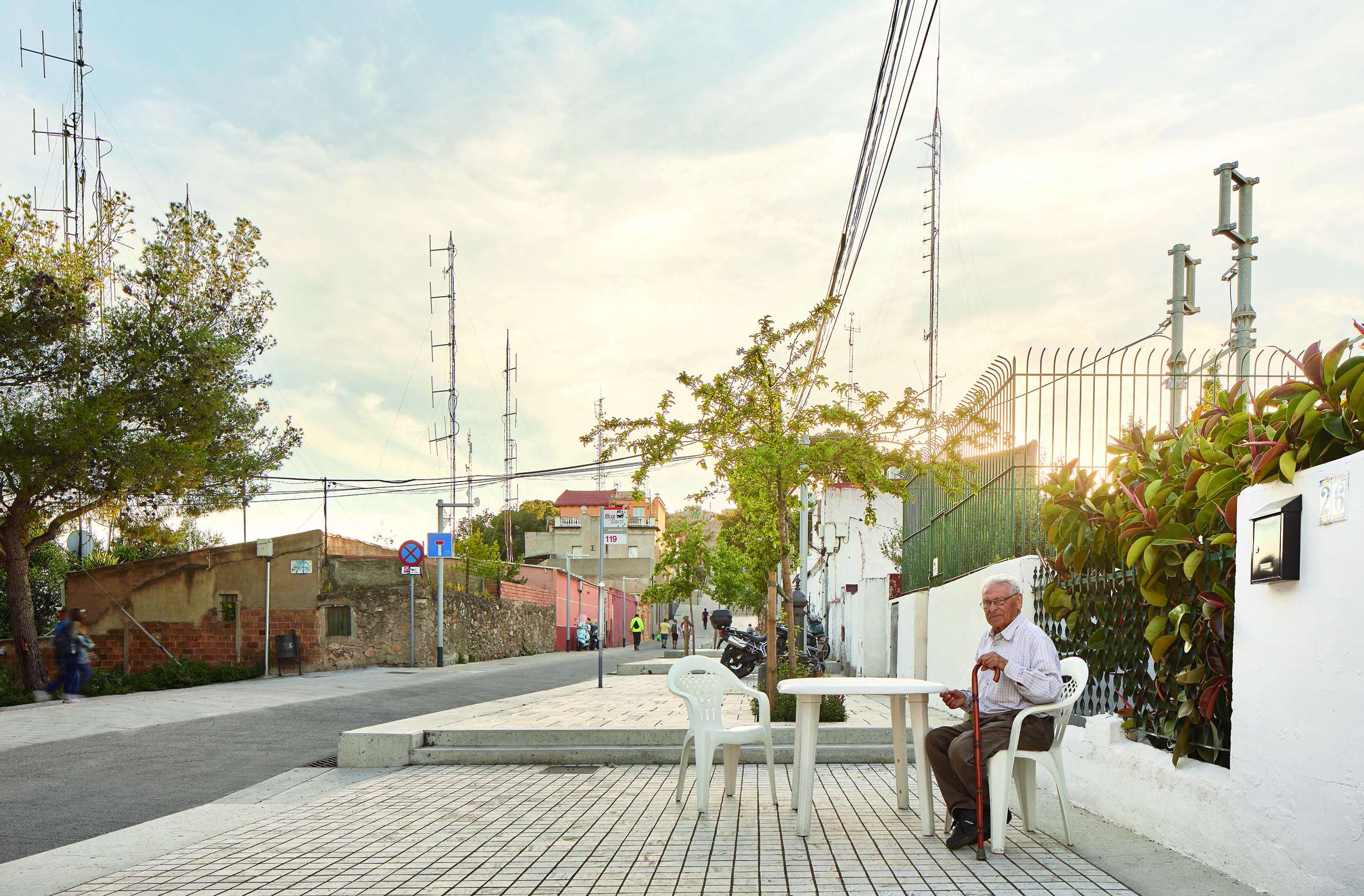
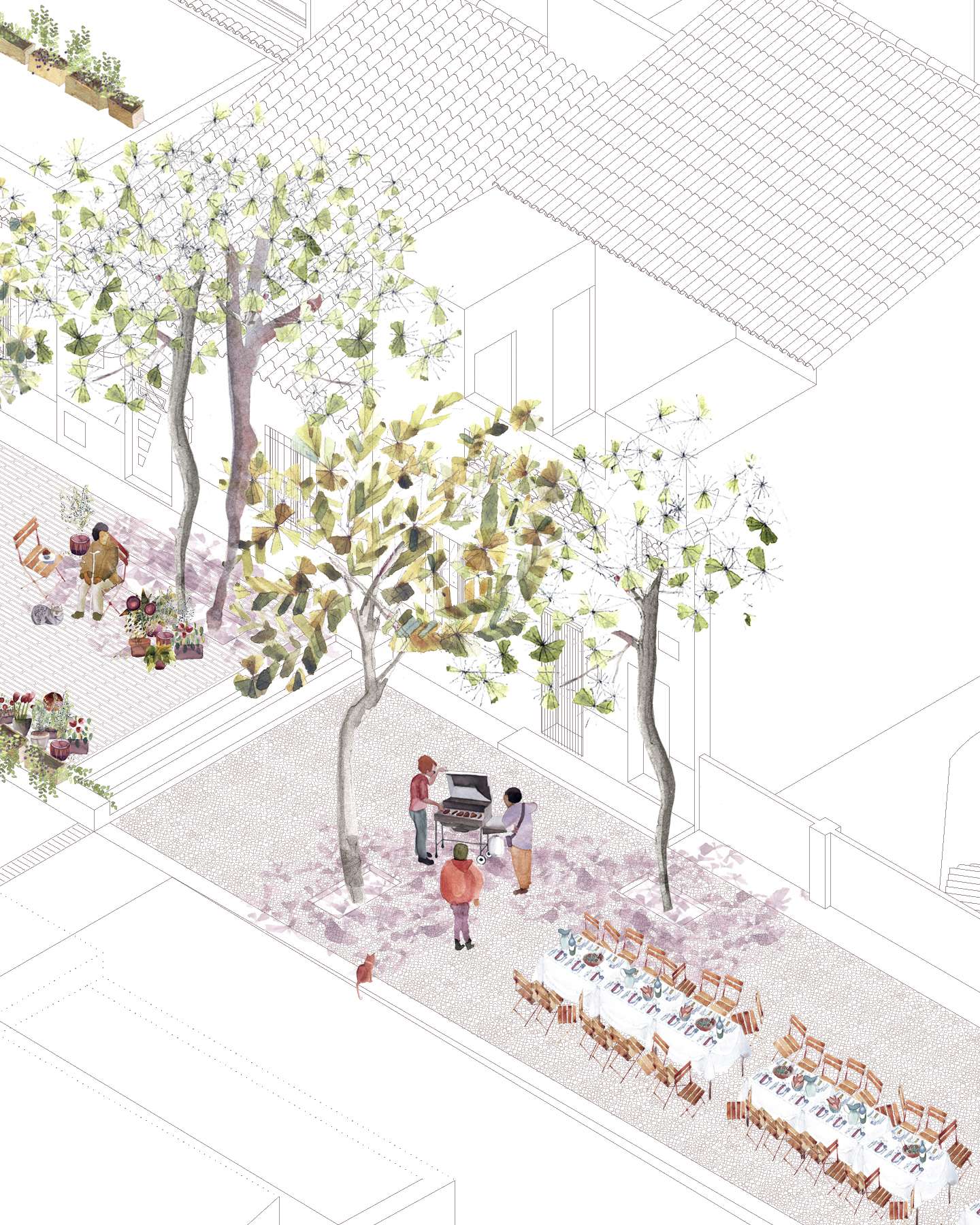
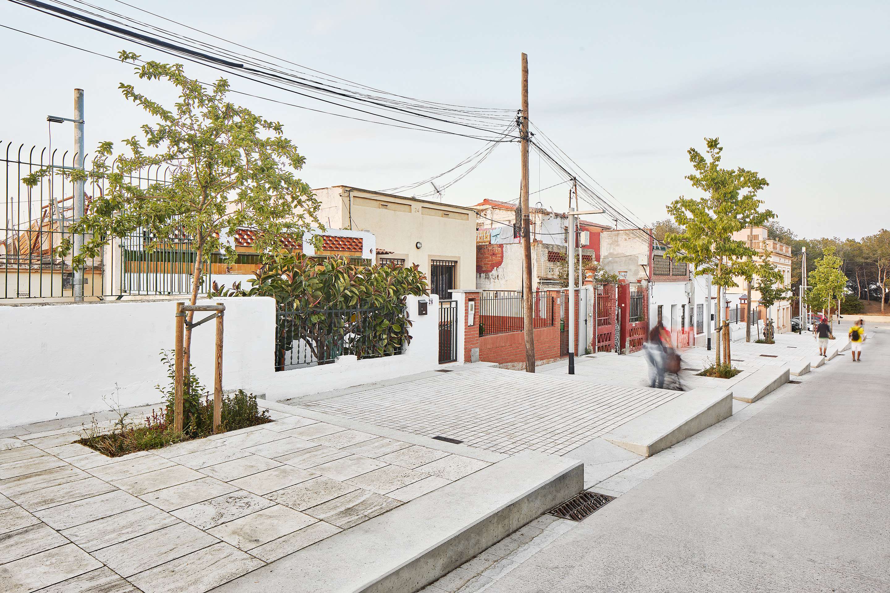
The project aims to mainly operate by modifying the topography. It simultaneously provides the necessary condition of a road access through a ramp and the will to have new small resting areas able to generate new outdoor activities: successive horizontal planes that will allow an open appropriation of the public space. These terraced squares along the existing street seek to preserve and emphasize the domestic character that is and has been an intrinsic part of the history of the place.
The planted vegetation should play an essential role in the forthcoming years in order to provide the necessary hygrothermal and luminic comfort for the flourishing open air life.
SHORT DESCRIPTION - SPANISH
El Turó de la Rovira es uno de los últimos contrafuertes de la Cordillera Litoral antes del cambio de pendiente que conforma la planicie de Barcelona. Forma parte litológicamente del macizo de Collserola.
Esta formación geológica comprende un conjunto de colinas de alturas comprendidas entre los 180 y los 260 metros sobre el nivel del mar que emergen del tejido urbano y constituyen uno de sus más amplios y extraordinarios miradores.
La cima donde se ubica el proyecto ha vivido varias etapas de urbanización que comienzan a principios del s. XX con la construcción de diversas casas de veraneo de familias acomodadas de Barcelona. Durante la guerra civil, y debido a su situación estratégica sobre la ciudad, se construyen allí las baterías antiaéreas junto con las instalaciones militares correspondientes. Acabada la guerra, la ciudad hace frente a una fuerte ola de inmigración que favorece la aparición de un asentamiento basado en la autoconstrucción y el barraquismo. No es hasta 2010 que se recupera el espacio para uso colectivo mediante una intervención que hace visible la densa historia del lugar, incluyendo todos sus estratos.
En años recientes la ciudad de Barcelona estuvo trabajando con la idea de reformar la ligazón entre el ámbito del Turó de la Rovira y la trama urbana, imaginando nuevos itinerarios peatonales que lo unieran a algunos de los hitos urbanos más significativos de la urbe como el Parc Güell, el Hospital de Sant Pau o la Sagrada Familia. Esta operación requería de una intervención para mejorar los accesos que conducen al mirador de las antiguas baterías, atravesando el pequeño núcleo habitado de Marià Lavèrnia.
El proyecto se propone operar básicamente mediante la modificación de la topografía. Se contempla a la vez la necesaria condición de acceso rodado, y por lo tanto de tránsito a través de una rampa, y la voluntad de disponer de pequeñas zonas de descanso generadoras de nuevas actividades al aire libre, planos horizontales sucesivos que permiten la apropiación abierta del espacio público por parte de las personas. Estas plazoletas de descanso se escalonan a lo largo de la calle existente, buscando preservar y enfatizar el carácter doméstico que es y ha sido parte intrínseca de la historia del lugar.
La vegetación plantada tendrá un papel esencial en los próximos años para dotar al espacio del confort térmico y lumínico necesarios y permitir el florecimiento de la vida al aire libre.
EXTENDED DESCRIPTION - ENGLISH
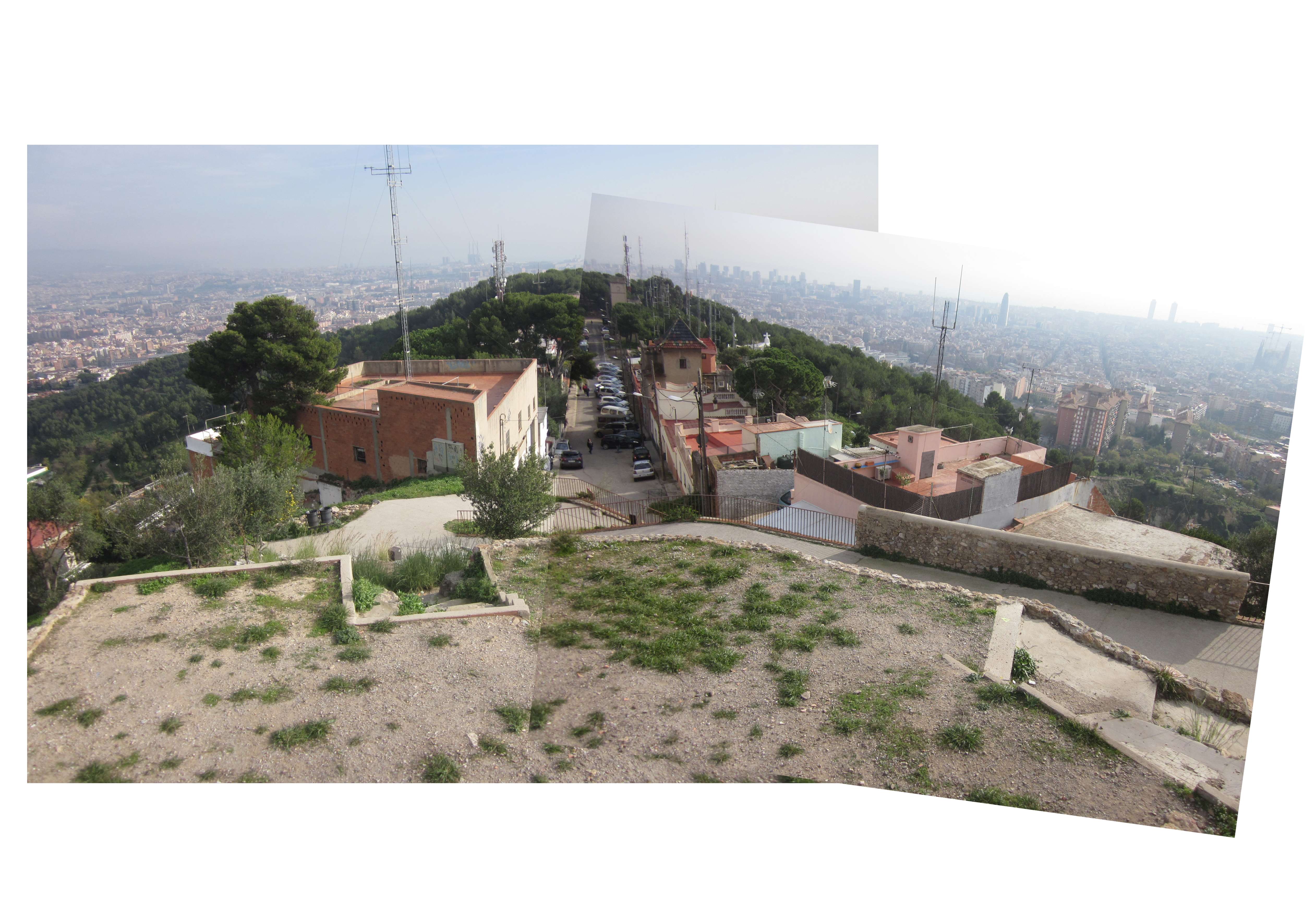
Previous state
Turó de la Rovira is included in the last foothills of the Coastal Range before the change of slope that forms Barcelona’s plain. This geological formation includes a series of hills that emerge from the urban fabric with heights between 180 and 260 meters above the sea level and constitute one of the most extraordinary and wide balconies over the city. Probably this geographic situation favored the installation on its summits of Iberian settlers already in the 6th. Century B.C.
The hilltop where the project is located has undergone several recent stages of urbanization starting at the beginning of the twentieth century with the construction of a few summer homes for wealthy families from Barcelona. During the civil war and due to its strategic location, an anti-aircraft battery and some related military installations were built. After the war the city had to cope with a strong wave of immigration that favored the emergence of a settlement based on self construction that later became a populated shantytown. It was not until 2010 that the crown is regained for collective use with an intervention that rings back to the light the dense history of the site including all its layers: the restoration project of Turó de la Rovira summits, designed by the team Jansana - De la Villa- De Paauw, winner of the European Prize for Urban Public Space in 2012.
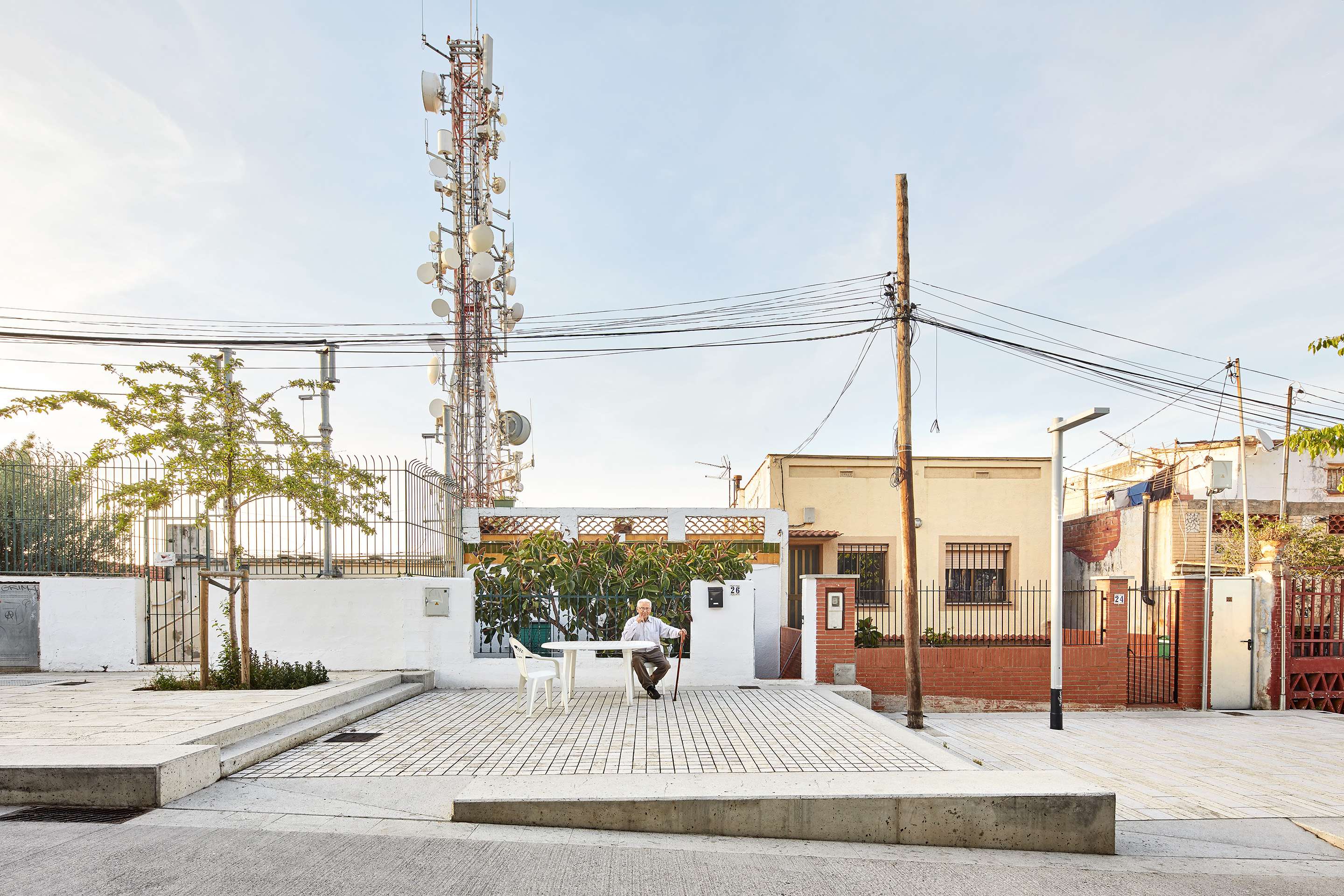
That intervention encompassed strictly the highest levels of the hill. The two streets of the small inhabited center of Marià Lavèrnia, located just below the crest, stayed submerged in the lethargy to which the city condemned them since the beginning of the last century. Oblivion has meant that among the houses of different age and quality that surrounded the two mudholes that lead to the top, the city never provided any urban service: no pavements, no sidewalks, no rainwater evacuation systems, no sewers, neither public lighting nor trees ... Rough existing solutions have been made by the residents themselves without reaching the desirable health and efficiency standards. What should be streets, over the years have become two parking areas for cars and motorcycles. None of the qualities of a collective space designed for the enjoyment of its inhabitants was found.
Object of the intervention
In past recent years Barcelona's planning directors worked with a clear aim to reintegrate Turó de la Rovira’s area into the urban grid, imagining new pedestrian routes that would connect it with some of the most signified landmarks of the city as Park Guell, Sant Pau Hospital and Sagrada Familia. This operation required an intervention to improve the access that leads to the veranda of the old batteries through the small inhabited village of Marià Lavèrnia, located in a large wooded area.
It is the City Council through its office of Urban Habitat that promotes the project with a clear public vocation based on the idea that any city fragment can be redeemed despite the difficulties of its history. Under the name of “microbarcelonas” the Consistory grouped several urban rehabilitation operations in spaces that for various reasons had become neglected inside the urban fabric.
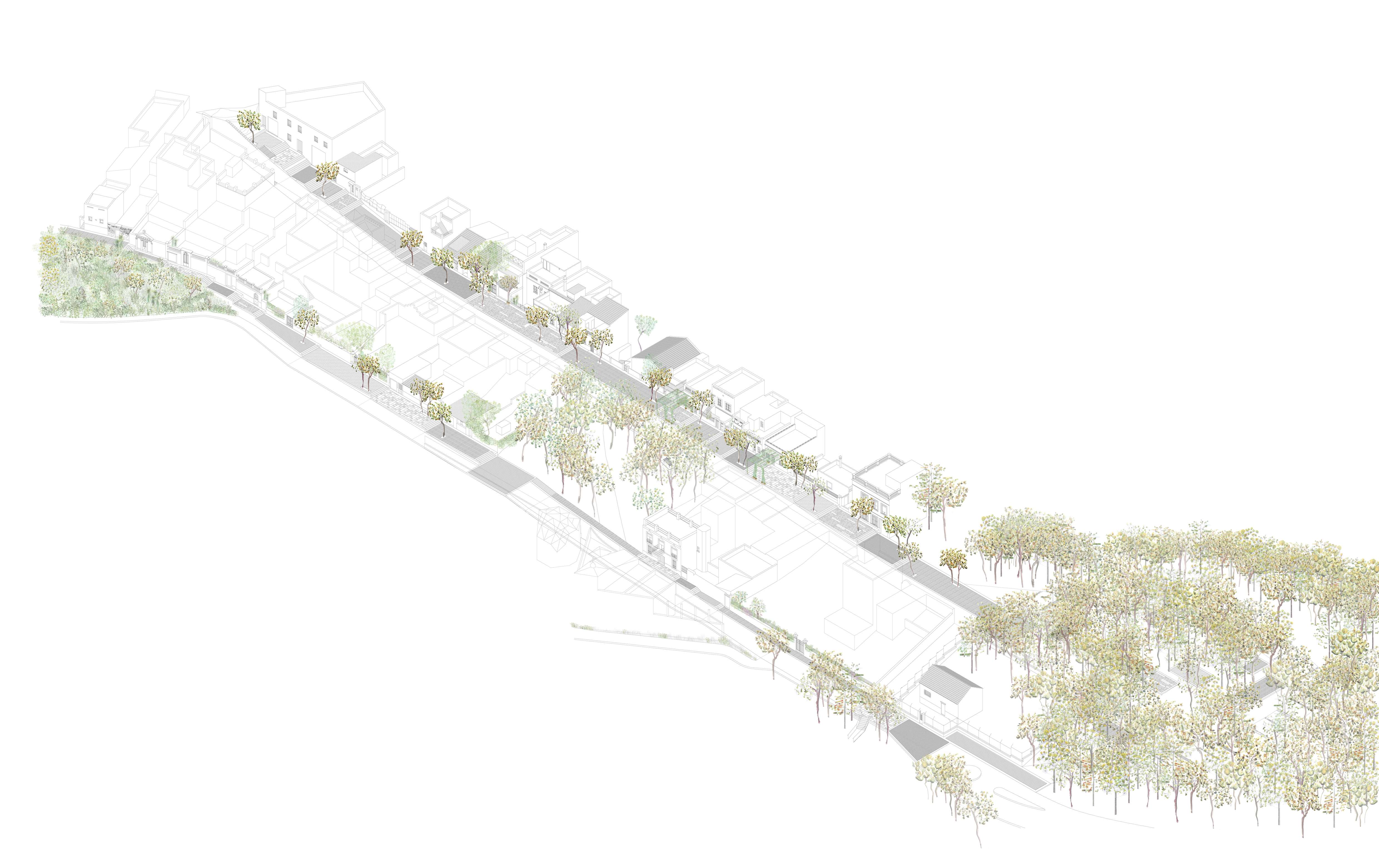
The main challenge was to transform this absolutely peripheral place, in spite of its privileged geographical situation, into two streets of the city, trying to maintain, at the same time, its fragile peri-urban, almost semi-rural character, and its essentially domestic nature.
A system of inverted priority is proposed, fruit of the conviction that in a place like that people must count more than vehicles, and that neighbors have the right, after decades, to a qualified public space. Thanks to the configuration of a roadway, public transport can finally reach all inhabited levels, favoring the access of older neighbors or those with mobility problems to each of the houses.
The proposed geometry seeks an harmonious coexistence between visitors and inhabitants, offering to each and every one a kind way of accessing the top, and the possibility of enjoying each stretch of the ascent.
Description of the intervention
The project aims to give the place a unitary character and to respect at the same time the uniqueness of each fragment, considered as a value to preserve as living testimony of its history and the diverse cultures that have shaped it.
We do mainly operate by modifying the topography. At a conceptual level it is a proposal based on land movement.
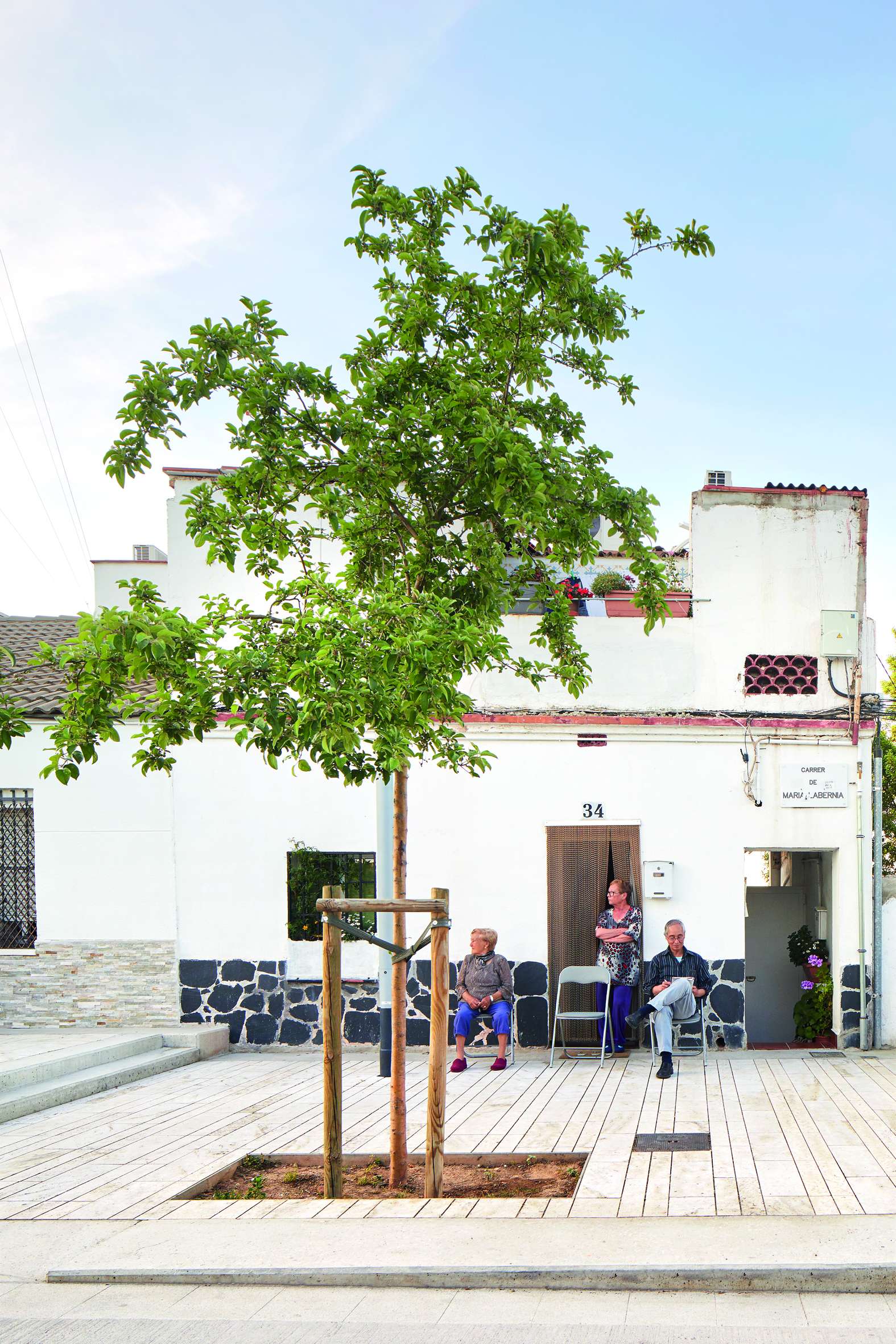
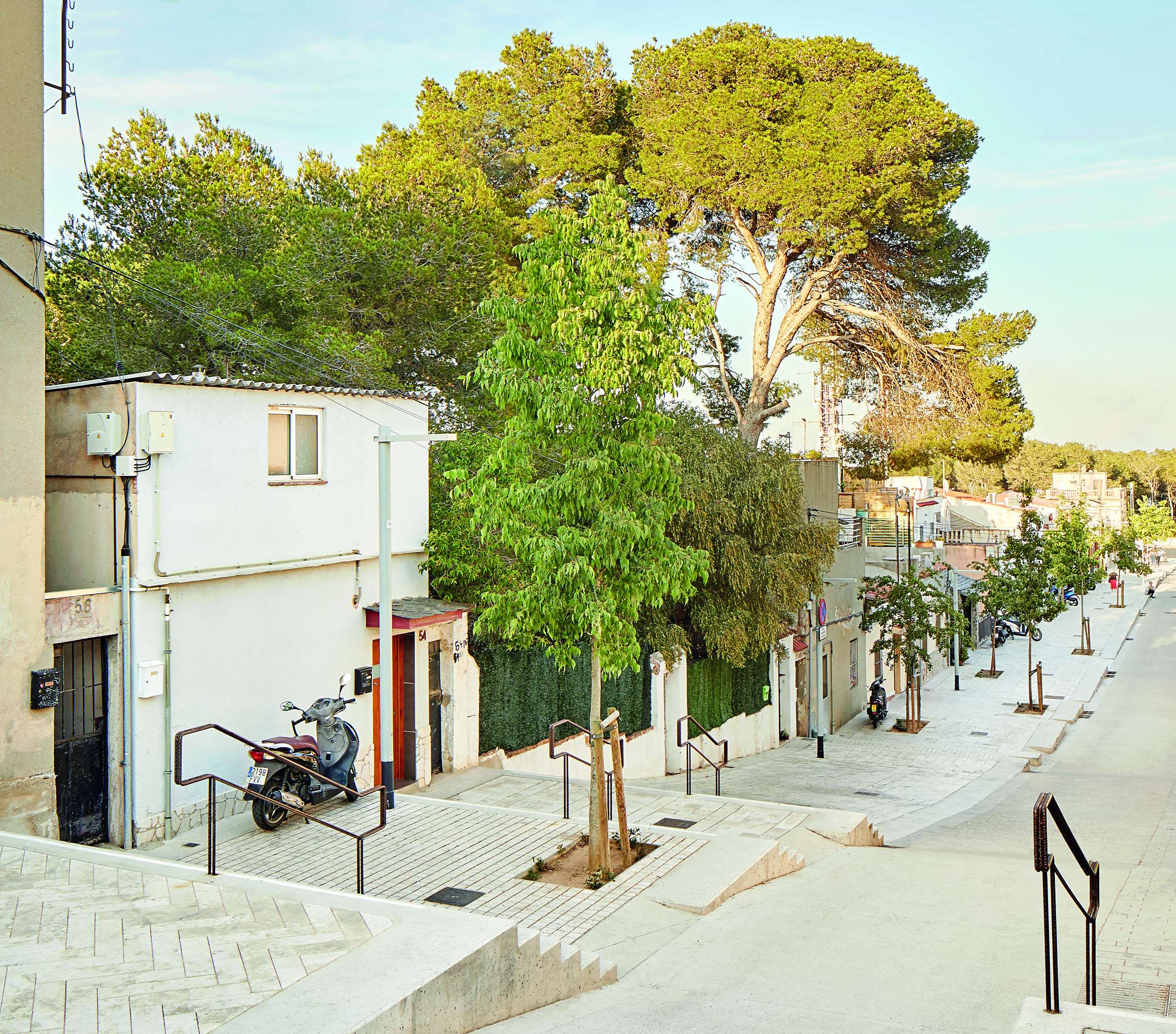
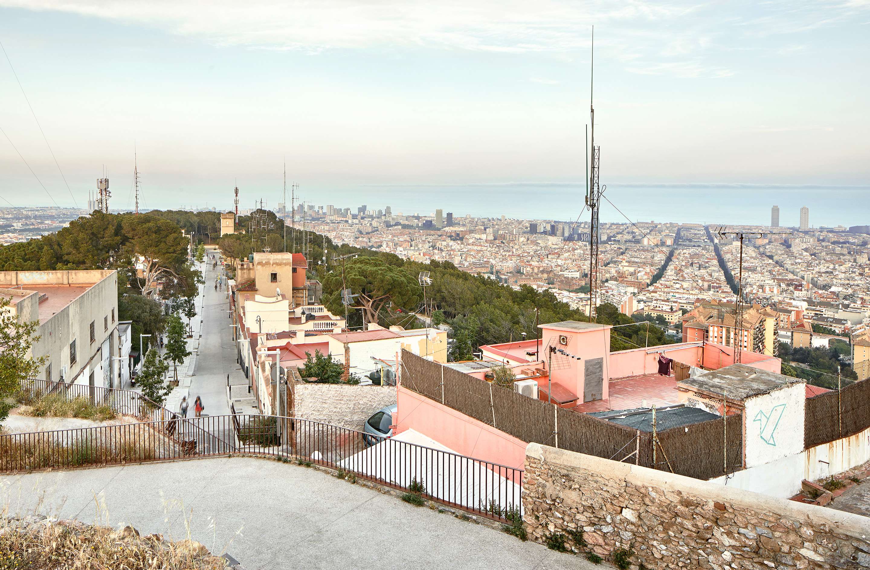
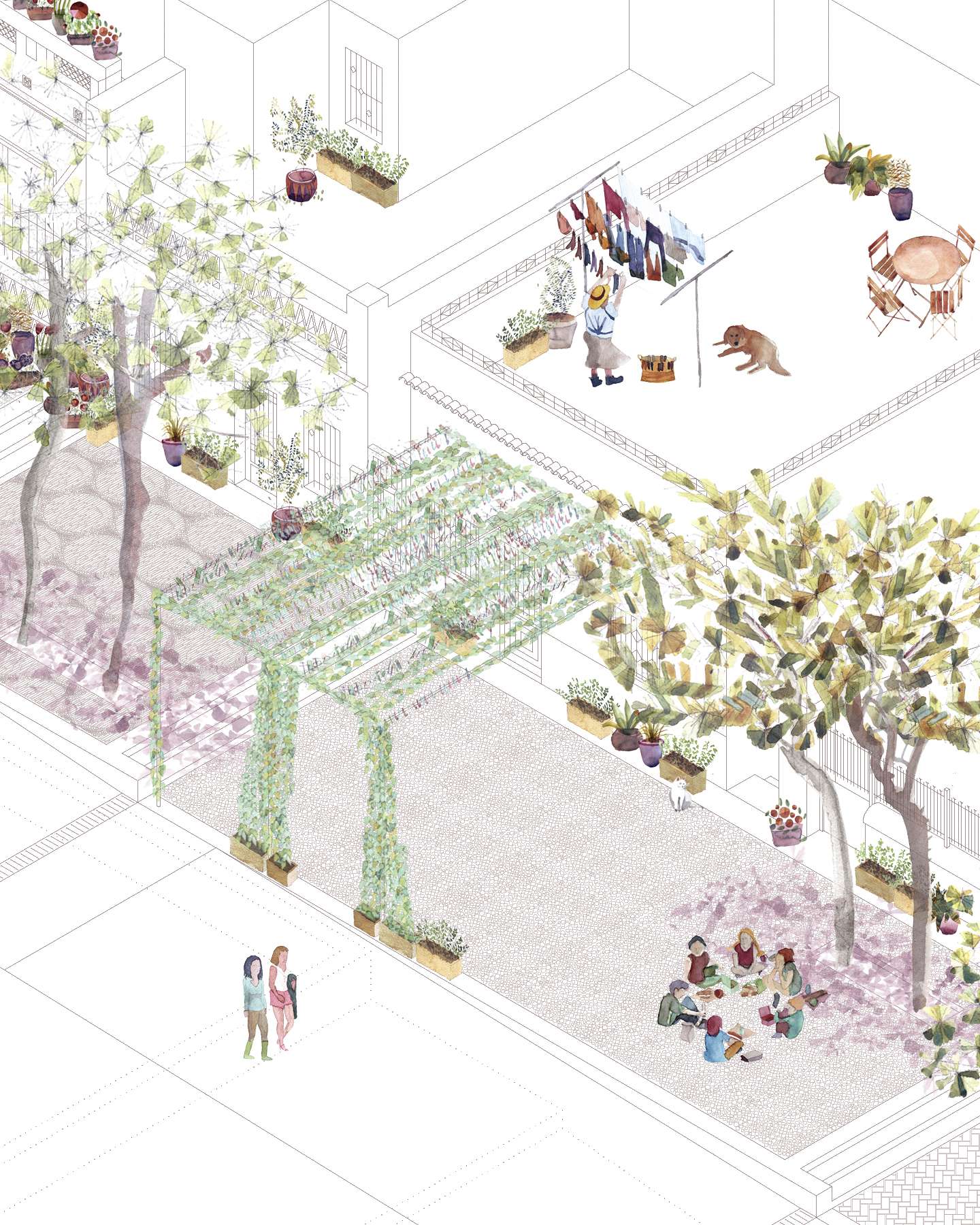
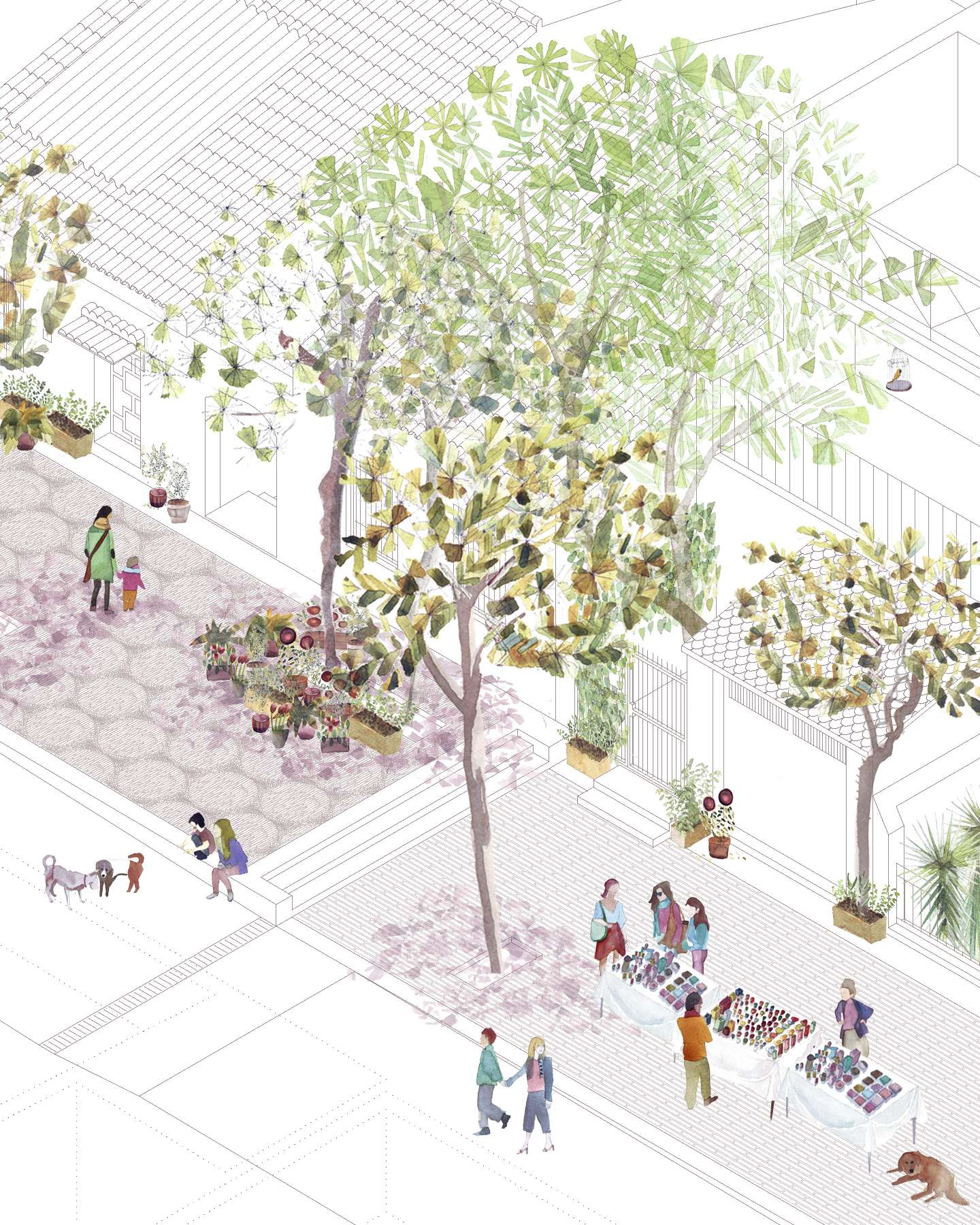
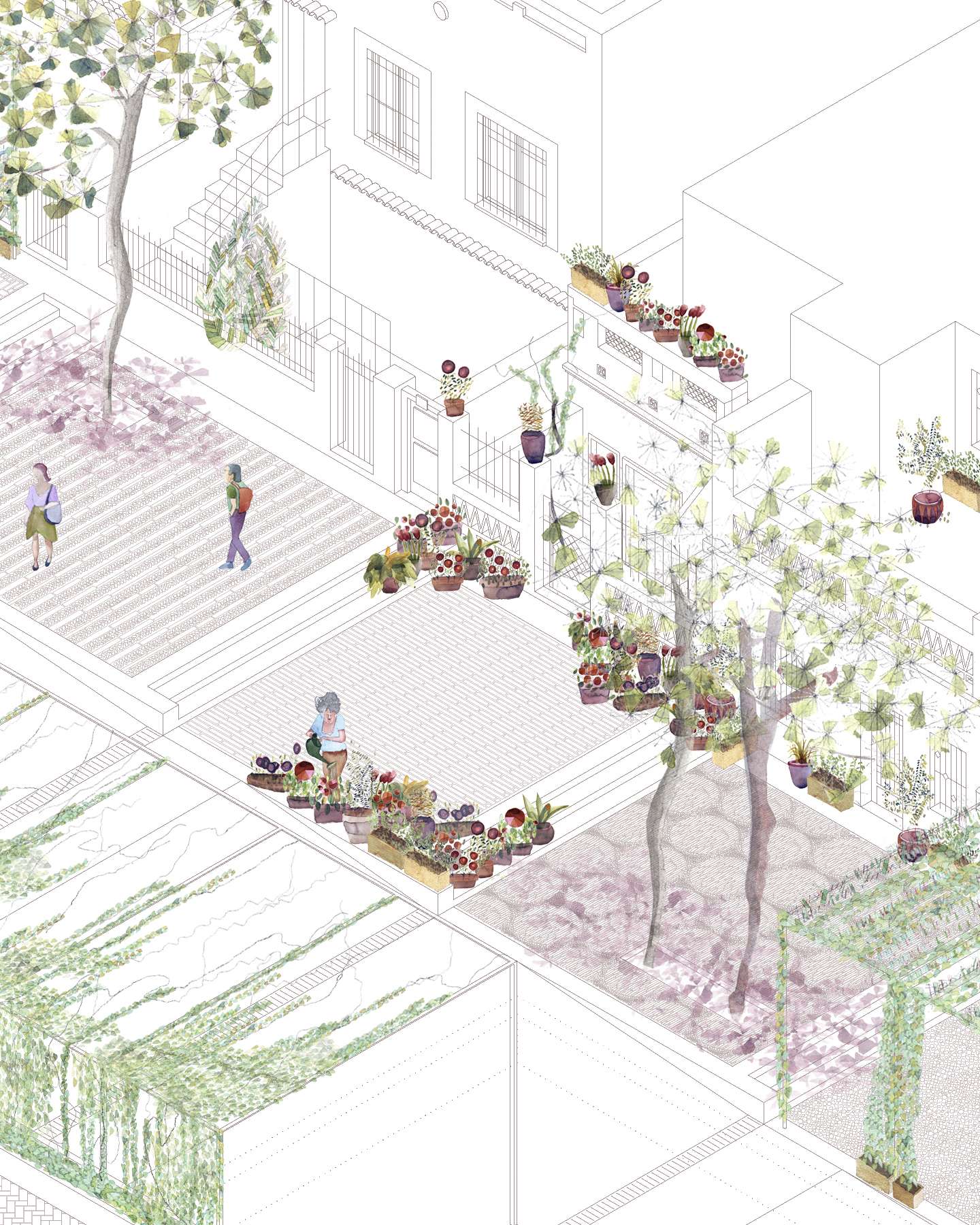
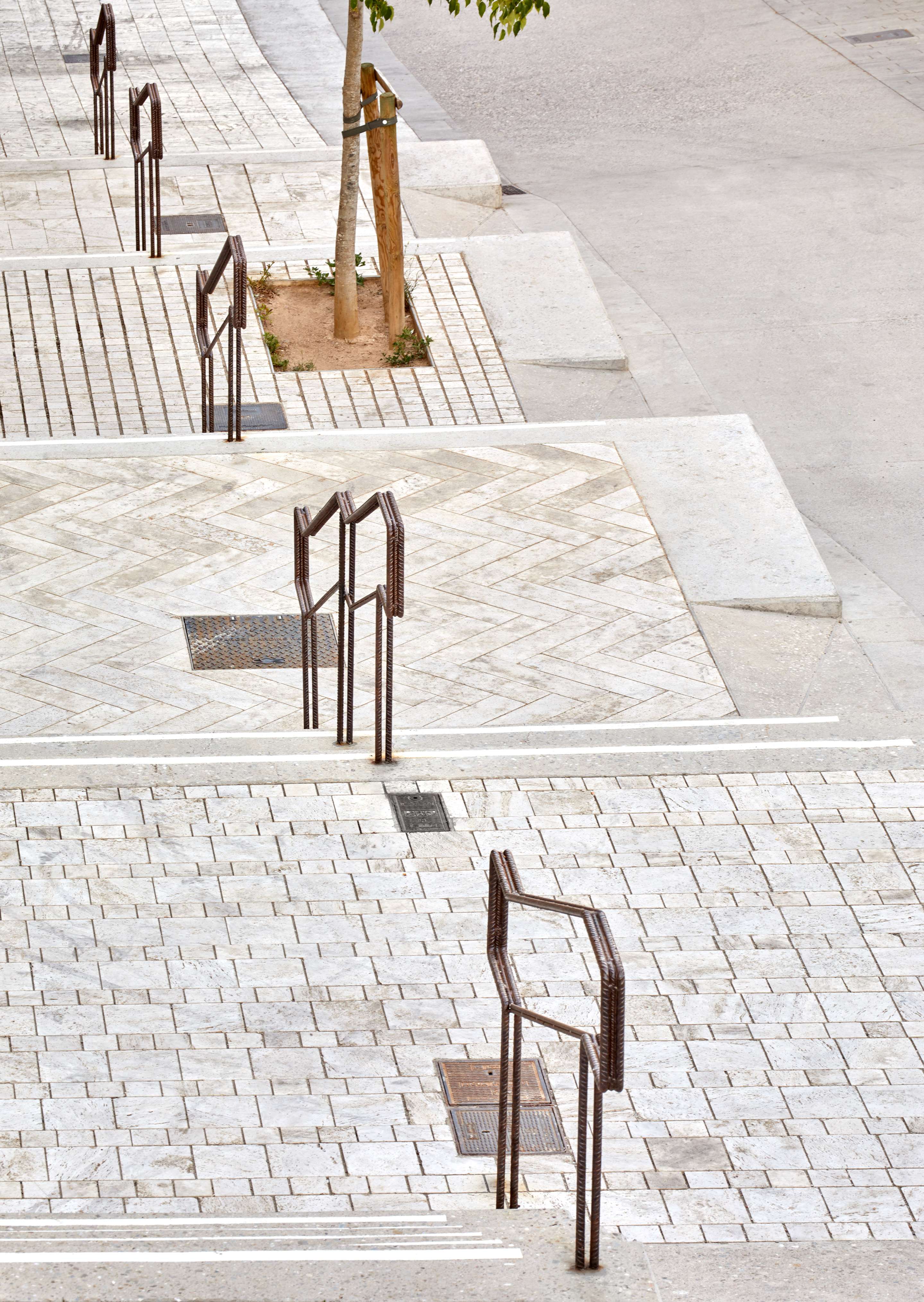
It simultaneously provides the necessary condition of a road access through a ramp and the will to have new small resting areas able to generate new outdoor activities: successive horizontal planes that will allow an open appropriation of the collective space. These small squares are terraced along the existing slope and take the dimension of the plots that make up the street. Each one of them can be understood as a public space of domestic dimension or as an exterior room of the houses for the use of its inhabitants.
The project manages to solve a double geometric challenge: to give access to each existing door on both sides of the street and to gently domesticate the natural slope of the land, avoiding at all times the appearance of railings that would divide the perception of the of the overall width.
The roads are paved with scraped concrete to favor the adherence of the vehicles. The squares are paved with travertine pieces for their bright chromatism and the irregularity that comes from their geological history. Each of them has a diverse pattern, as carpets, with the wish of preserving and emphasizing the inhabited character that has been intrinsic to the place since ancient times.
The planted vegetation should play an essential role in the forthcoming years in order to provide the necessary comfort for the flourishing open air life. The new trees should also help establish continuities between the surrounding green spaces, the slope and the top of the veranda.
Evaluation
We believe that the project has radically improved the situation of the place, dignifying very significantly the life of its inhabitants after many years of neglect. The neighbors finally enjoy all the services that distinguish an urban fabric, including considerations of maximum accessibility despite the complex topography of the place.
For the first time in their long history, they have horizontal spaces that allow them to widen the limits of their small homes and unfold an outdoor life.
Present difficulties lie in the fact that the restoration of the summit and conformation of the old batteries public balcony have caused a drastic increase in visitors, mostly during sunset and nighttime, which has represented a remarkable change in the essentially quiet and lonely atmosphere of the place. It is also true that this greater influx of passers-by could also be understood as an opportunity for the emergence of a small commercial, productive or service fabric in the area.
Faced with the risk of touristification, we believe that the project's geometric commitment, based on the additive and small-scale components of the site, is helping to preserve its domestic character and favors the appropriation of the street by the neighbors themselves. Similarly, the limited and diverse dimension of the platforms could boost, in the medium term, the appearance of small economic activities with spaces for collective use under the shade of trees.
Anyway, the main conflict in the neighborhood lies in the fact that, due to the urban qualification of the hill, the idea of demolishing the existing buildings and displacing their tenants to another zone to free the top as a green area reappears from time to time. That would lead to the disappearance of the testimonial existence of this inhabited nucleus. Against this great concern, the project tries to provide the irrefutable proof that the neighborhood can also be, despite its imbricate history, a splendid place of life for its inhabitants.
-