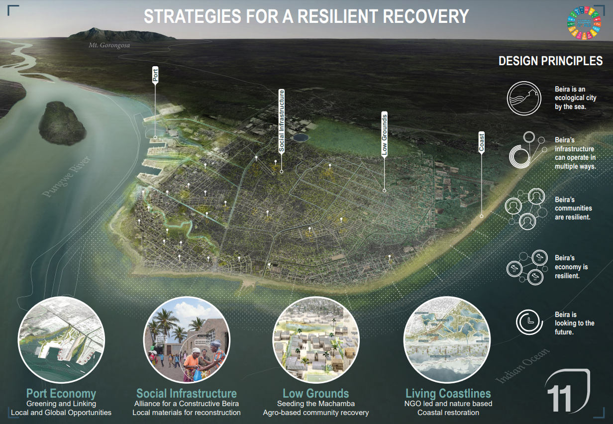
STRATEGIES FOR RESILIENT RECOVERY IN BEIRA
Urban Design Studio III - Global Cities and Climate Change - Water Urbanism: The Great Rift Valley, 2020
Columbia University, Graduate School of Architecture, Planning and Preservation
Beira statement, is located short in description the delta of the of the Pungwe project River, in English, where it meets the Indian Ocean, with fertile lowlands of central Mozambique. Although Mozambique ranks among the lowest nations on the UN’s Human Development index, it is rich in natural capital. The WWF for Nature has developed a Natural Capital Program to help protect coral reefs, seagrass beds, mangrove forests, and other ecologies along Mozambique’s coastline.
Founded in 1887 as a port city, a few meters above sea level, it is currently the second largest seaport in Mozambique, after Maputo. The city has experienced rapid population growth escalating from 42,265 inhabitants in 1950 to 530,604 in 2019, with an expected increase of an additional 250,000 residents by 2030. (UN - World Population Prospects). Beira has experienced degradation of its natural capital, transforming the sand dune and its estuary, where the city was originally settled into a low-density, extended urban sprawl.
Cyclone Idai ravaged Beira in March 2019. It is the worst storm on record in Mozambique, with heavy rains and strong winds that led to flash flooding, hundreds of deaths, and massive destruction of property and crops. In Beira alone, 90 percent of the buildings were damaged.
In its aftermath, a major humanitarian crisis unfolded with hundreds of thousands of people displaced as central Mozambique was transformed into a vast inland lake. A year later, recovery is ongoing and food insecurity remains widespread. The studio projects investigate and propose strategies for a resilient recovery.