Forma Terrae. Topographic itineraries of mining heritage
Mining Landscapes
University of Cagliari. Faculty of Engineering and Architecture
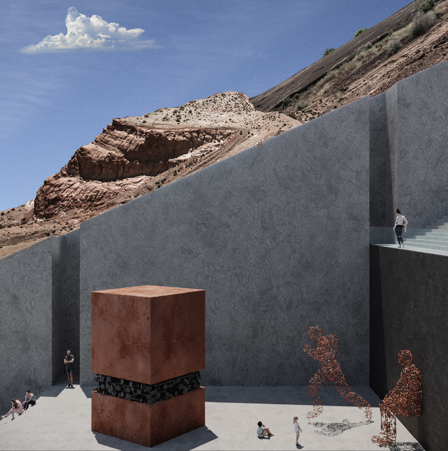
The project site, which is the area of Monteponi’s village, represents one of the greatest legacy of the most prosperous age of mining activity in Sulcis, between 1850 and 1980. The mining activity provoked a jarring contrast between the environmental context and the industrial artifact which characterize it. The aim of the project is to give value and convey the magnitude of these topographic modifications that became symbol of the territorial identity through an itinerary which is both cultural and sensorial. The topographic modifications previously mentioned can be categorized in two typologies: the material subtraction, that is the excavation within which the surface mining was practiced, and the material addition, that is production scraps’ deposit. These categories combine the multiplicity of Sulcis territory’s mining sites; this allows to design a circuital system which gathers together all of these sites and which preserves their specificity and memory. In Monteponi’s village are present both the subtraction, which is Cungia’s cave, which is the greatest open-air cave in Sardinia, and the addition, “I Fanghi Rossi”, a product scraps’ stratification 3 millions cubic meter wide. The design approach was to work with negatives: in the addition we design a subtraction, and vice versa. Both interventions are associated with the topic of the wall as a living place as a place of paths characterized by cultural events and by the emotional charge of architecture which allows the visitor to measure himself with the monumentality of these artifacts.