
ENVOLVIENDO LA MARISMA: ITINERARIO PAISAJÍSTICO EN TORNO AL ESTUARIO NORTE DEL ODIEL
EMBORANT LA MARISMA: ITINERARI PAISATGÍSTIC ENTORN DE L'ESTUARI NORD DE L'ODIEL
WRAPPING THE MARSH. Landscape itinerary around the North Estuary of the Odiel river
The action stems from the consideration that the citizens of the 21st century no longer live in confined places, with hardly any relationship with neighbours in other nearby municipalities. The concept of Territory, as a space where life takes place, calls for the establishment of links between the different parts that make up our closest physical reality.
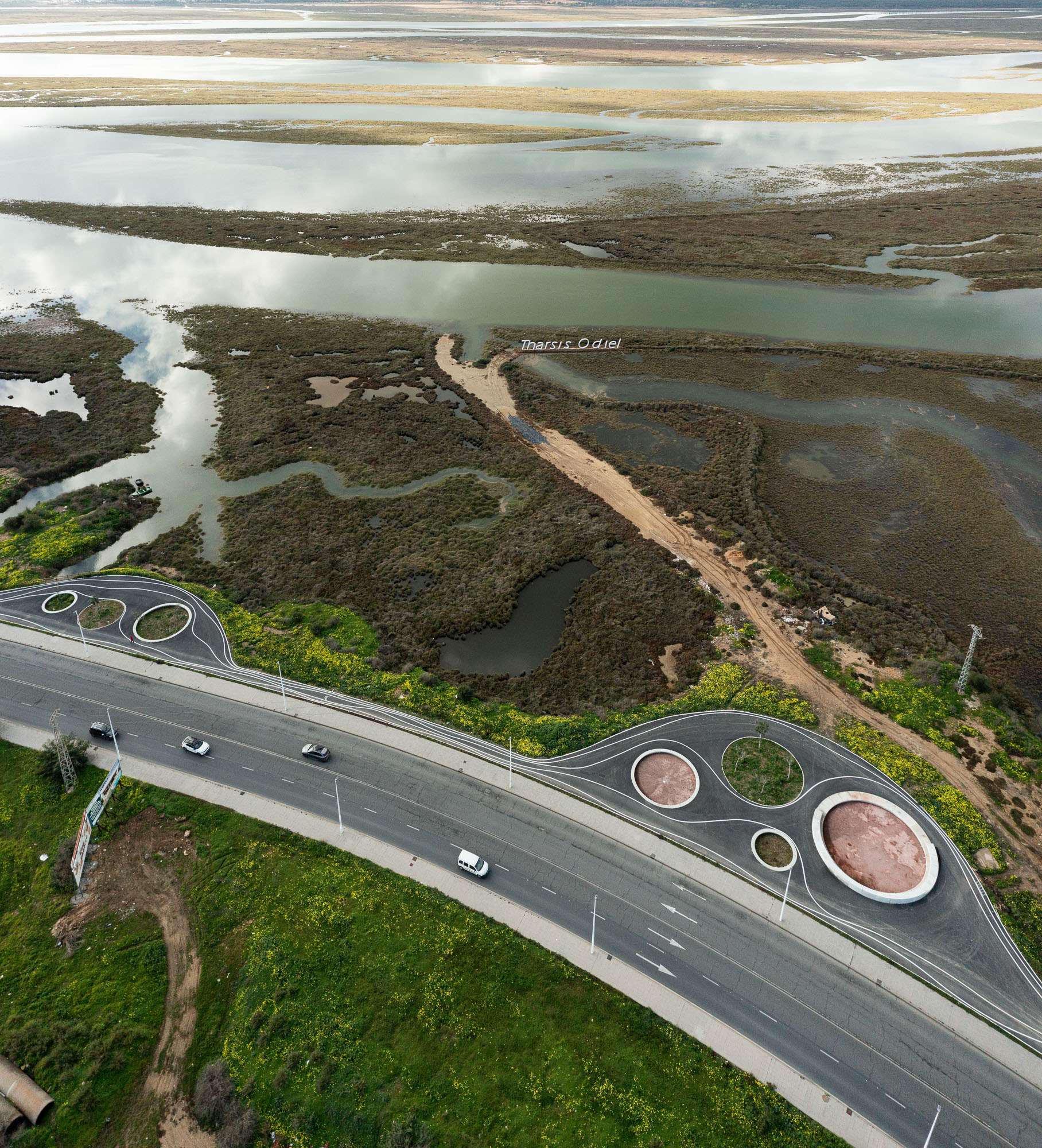
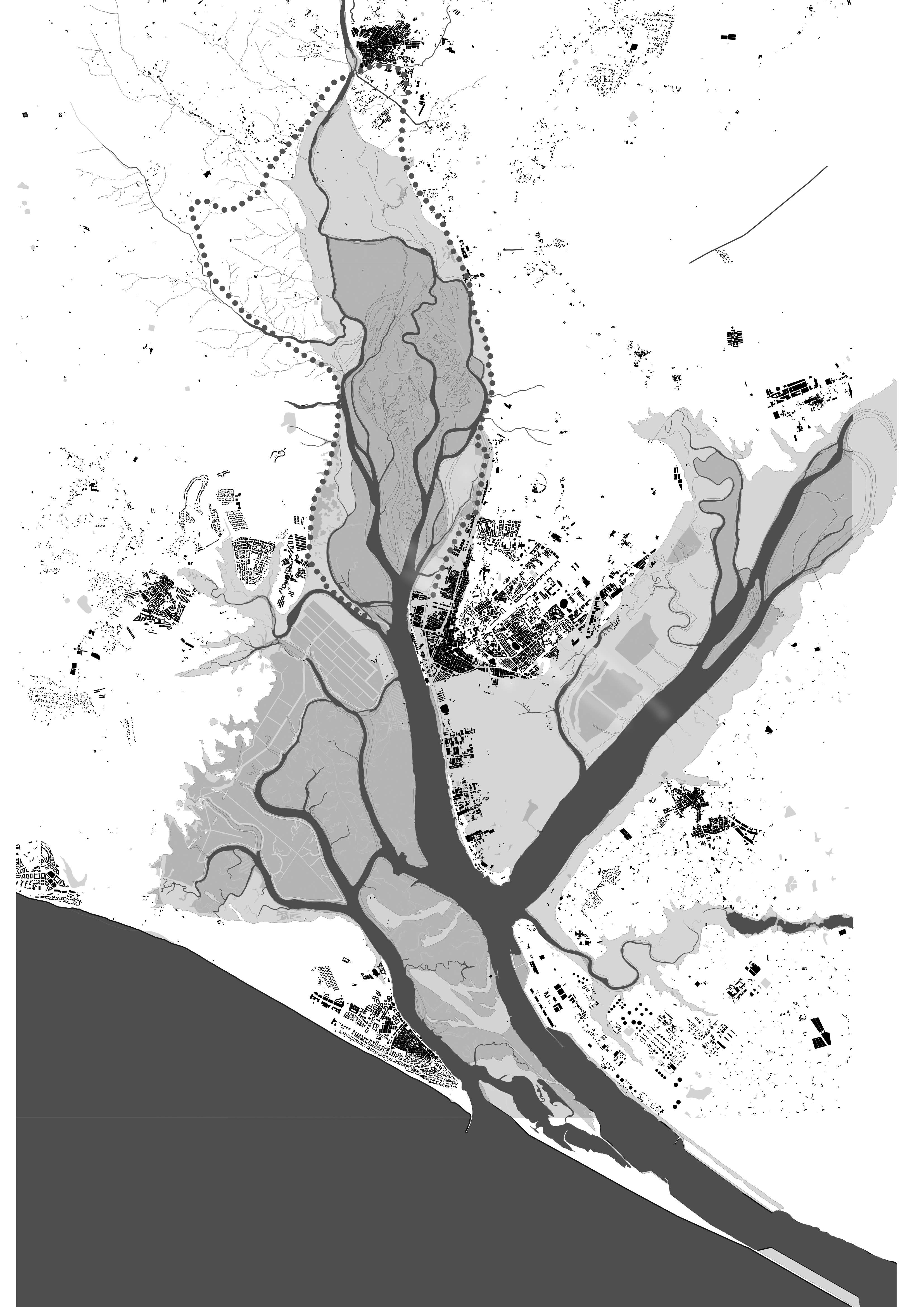
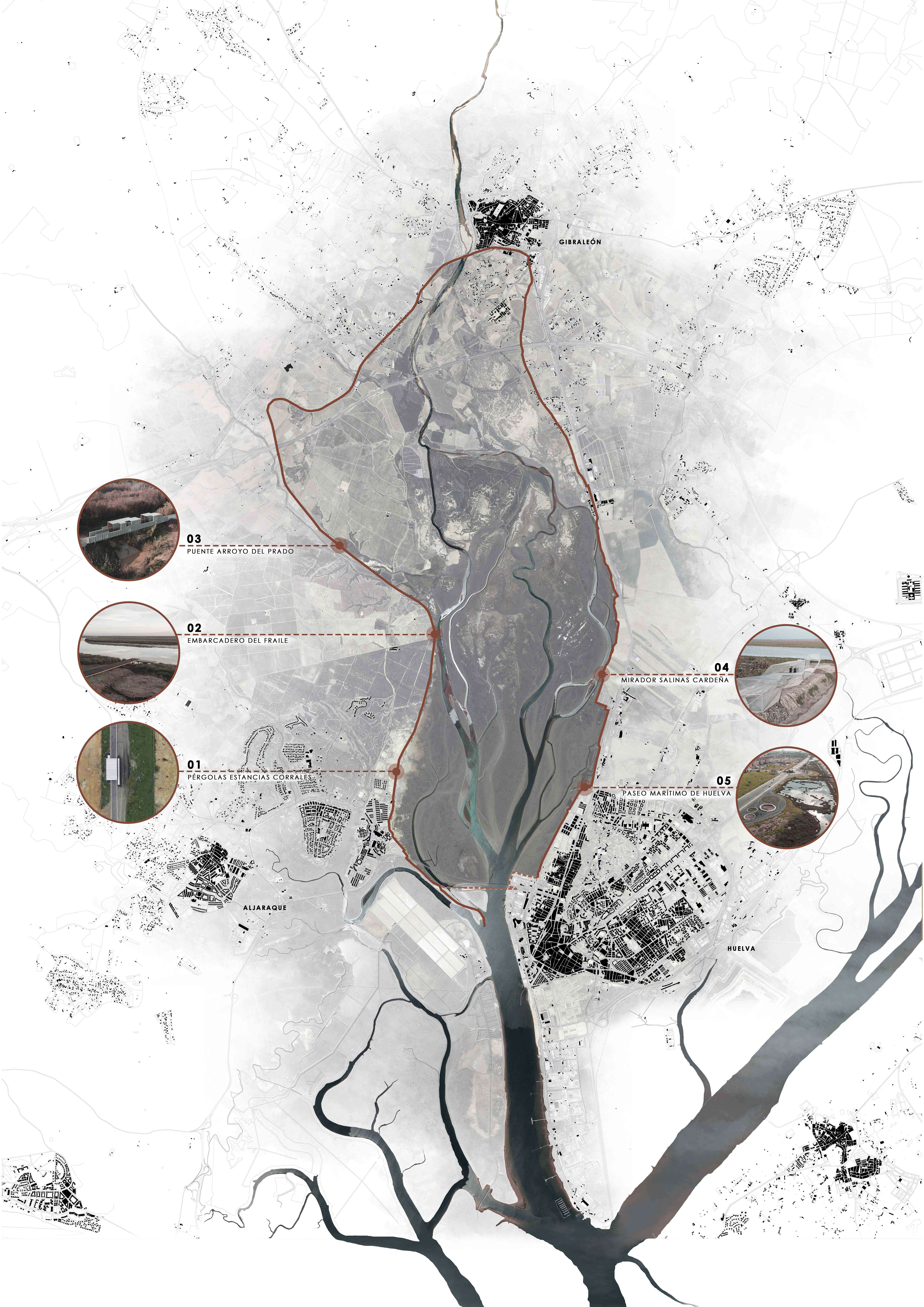
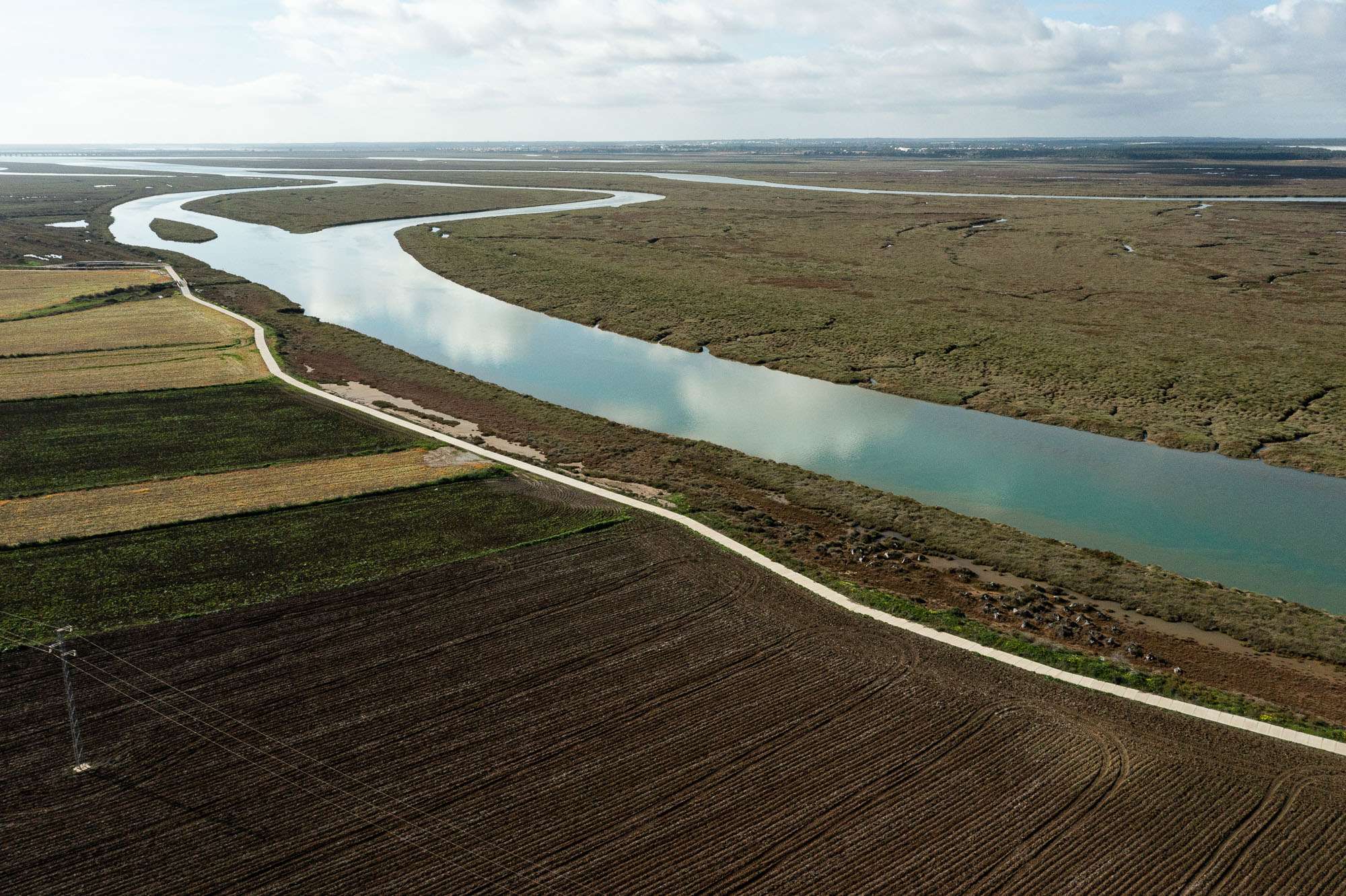
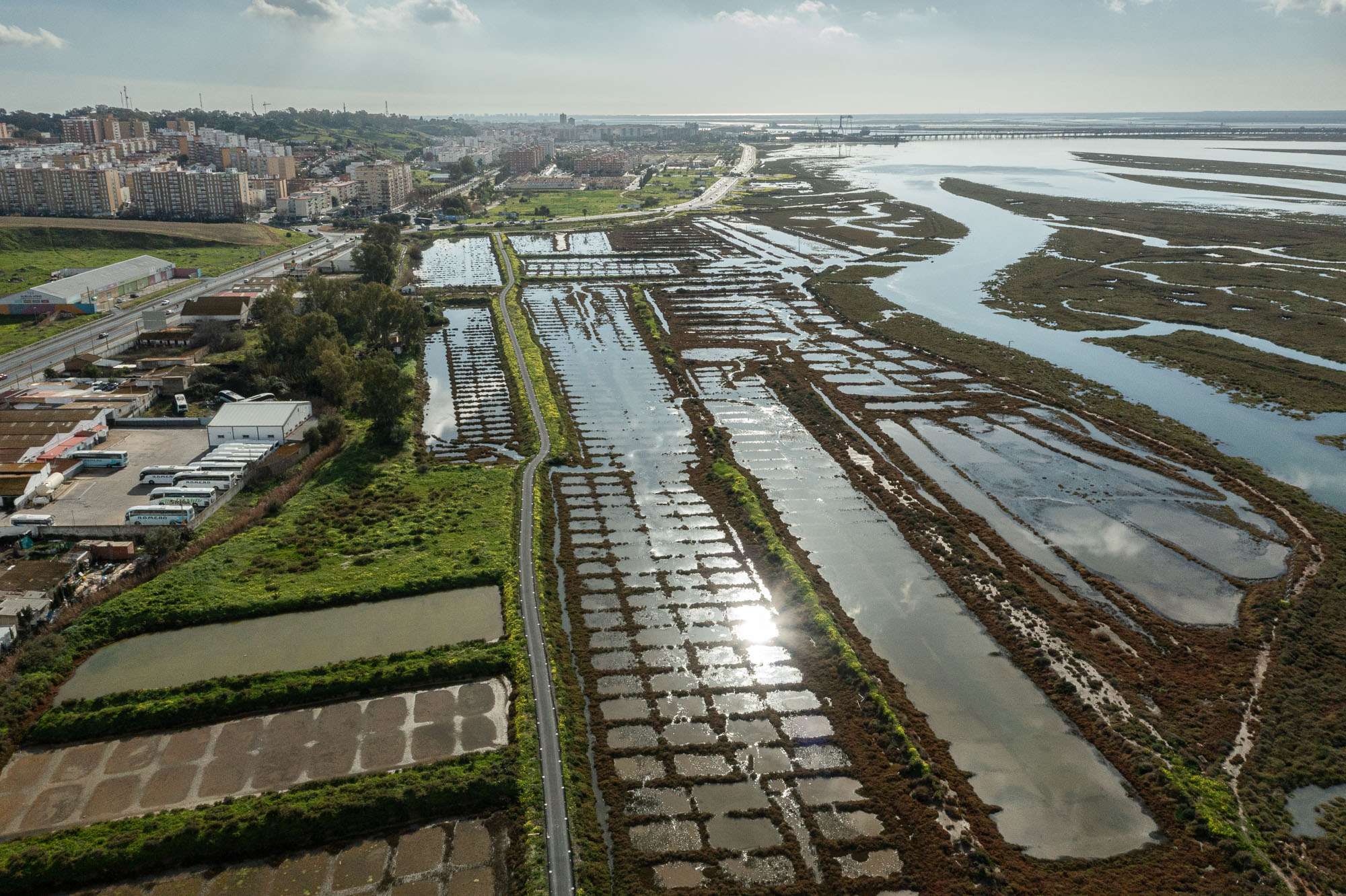
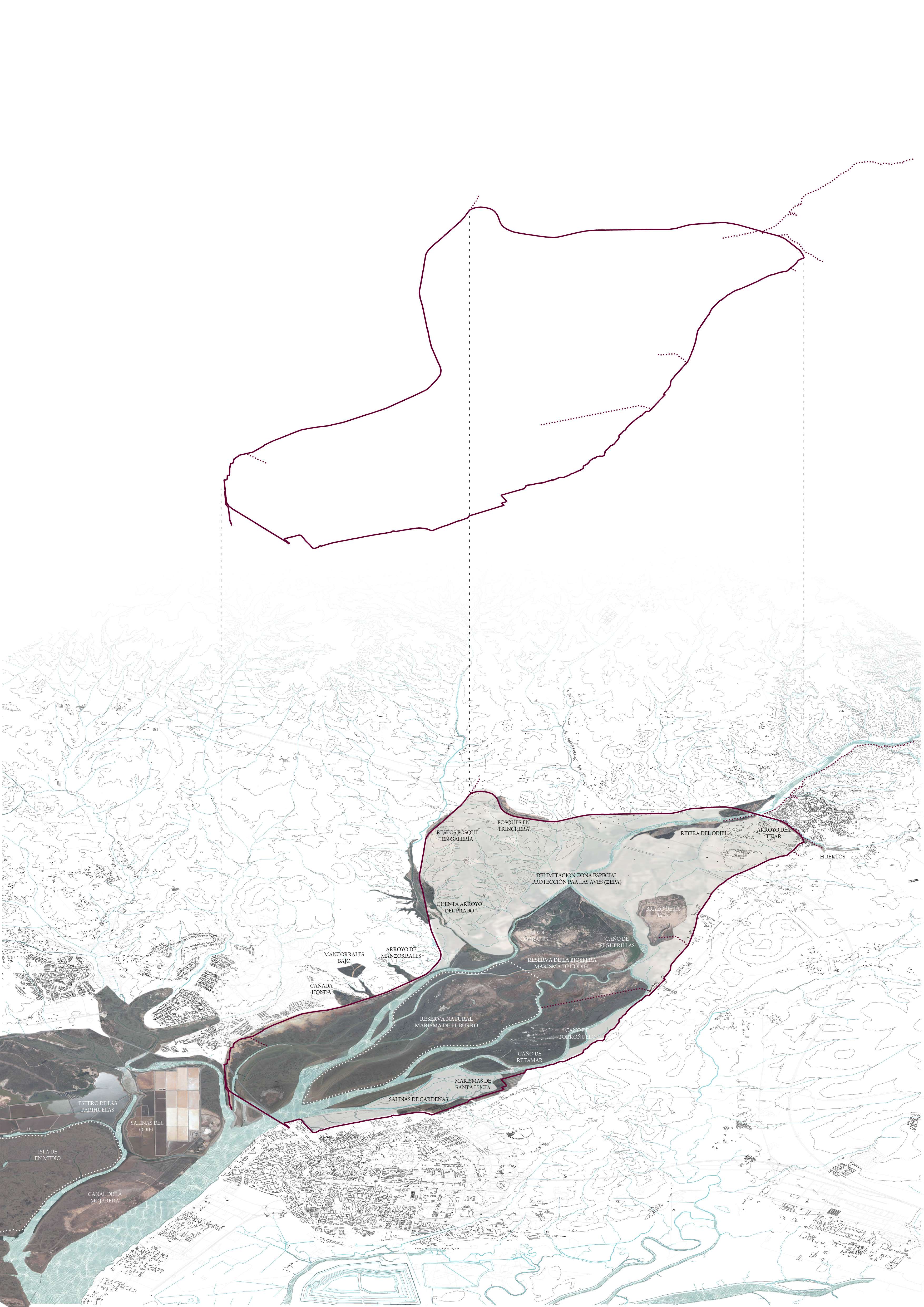
We are faced with a large green infrastructure of a supra-municipal nature, 30 km long, which connects the towns of Huelva, Aljaraque and Gibraleón (180,000 inhabitants in total) and brings them closer to the great wealth of the vast protected natural area of Marismas del Odiel that surrounds them. The main objectives are non-motorised accessibility between the three towns by means of a sustainable multimodal road that runs along the edge of the northern Odiel estuary; and the requalification and regeneration of degraded urban-rural edges, both of which are fully framed within the 2030 Agenda.
The intervention is voluntarily contaminated by other disciplines beyond the purely architectural, already present in the work territory. And so, in addition to architecture, it is also engineering, hydraulics, infrastructure, landscape, heritage, ethnography, botany (25,000 new specimens planted), biology, sport and even public health. All this contributes to combating climate change, protecting abandoned terrestrial ecosystems and their associated underwater life (salt marshes and salt flats) and, in short, to creating more sustainable societies.
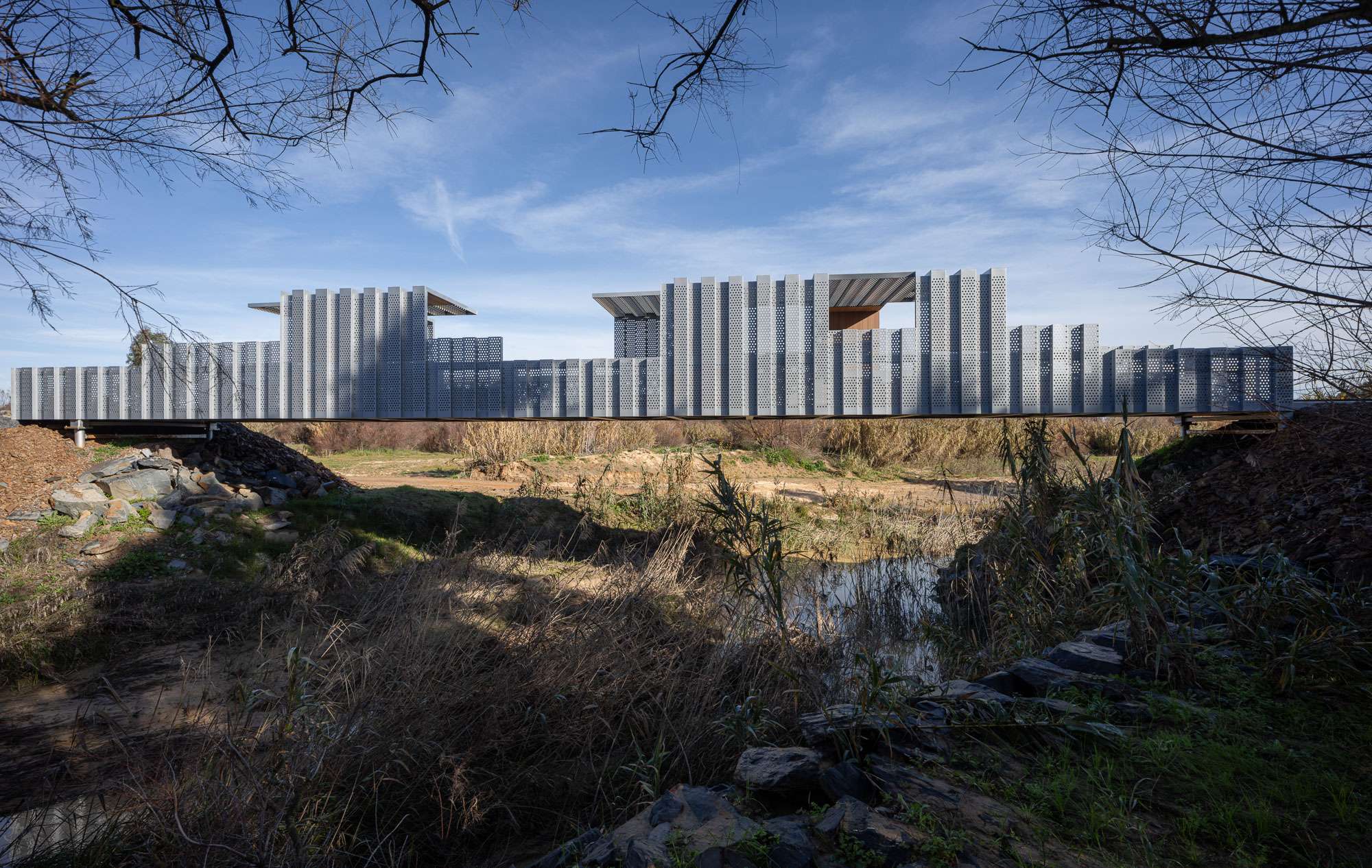
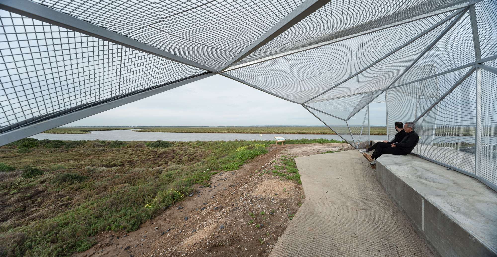
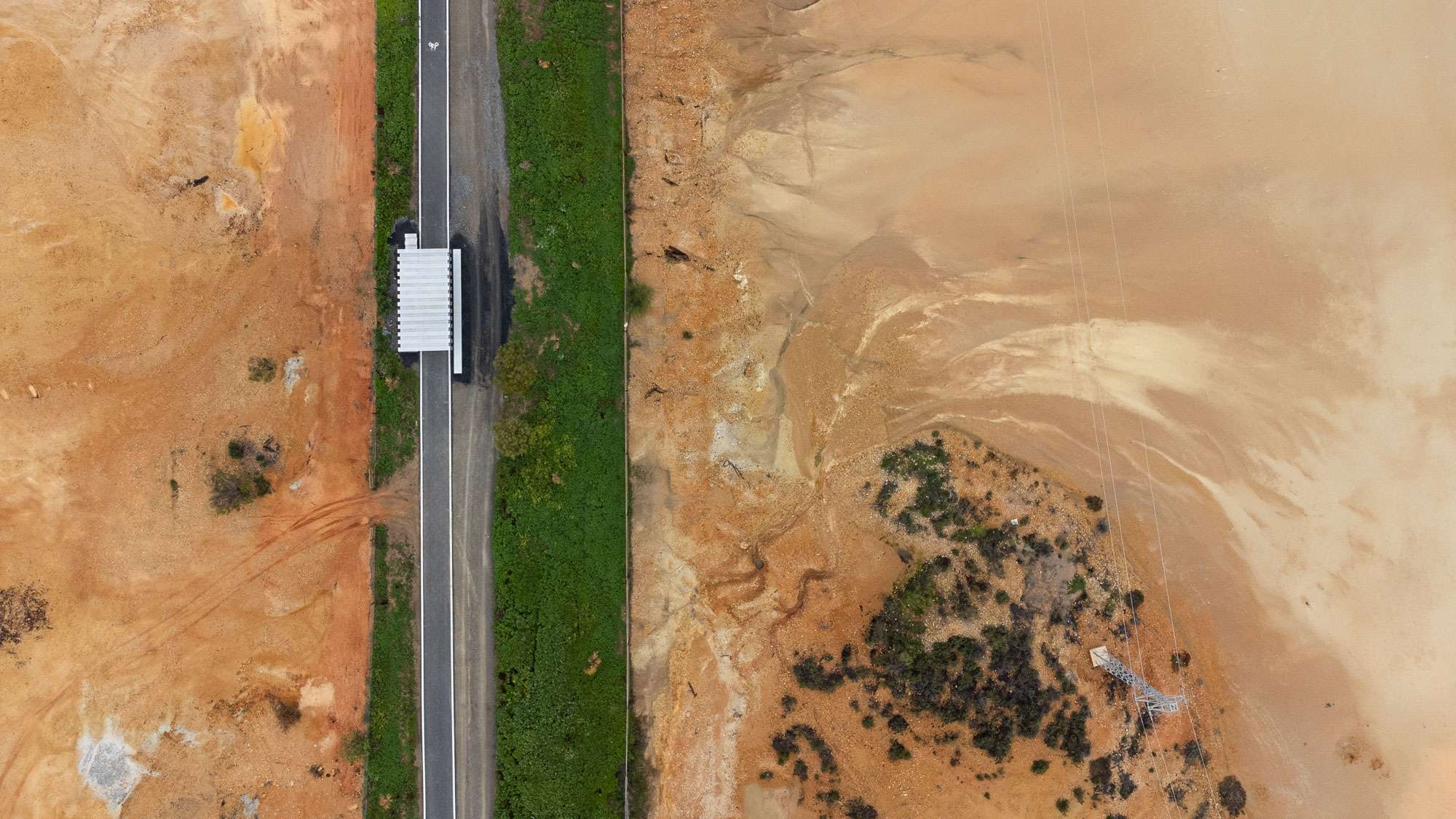
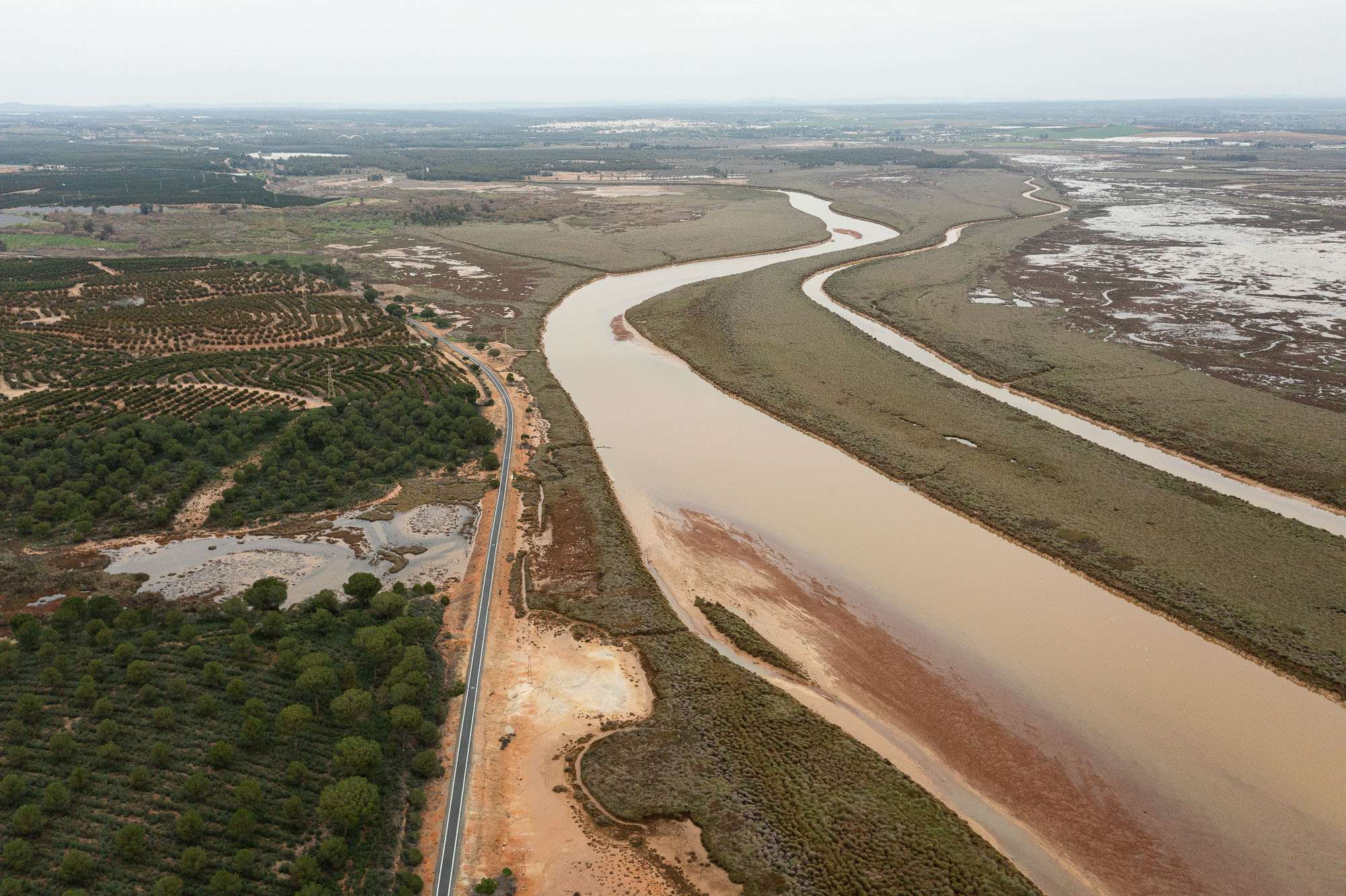
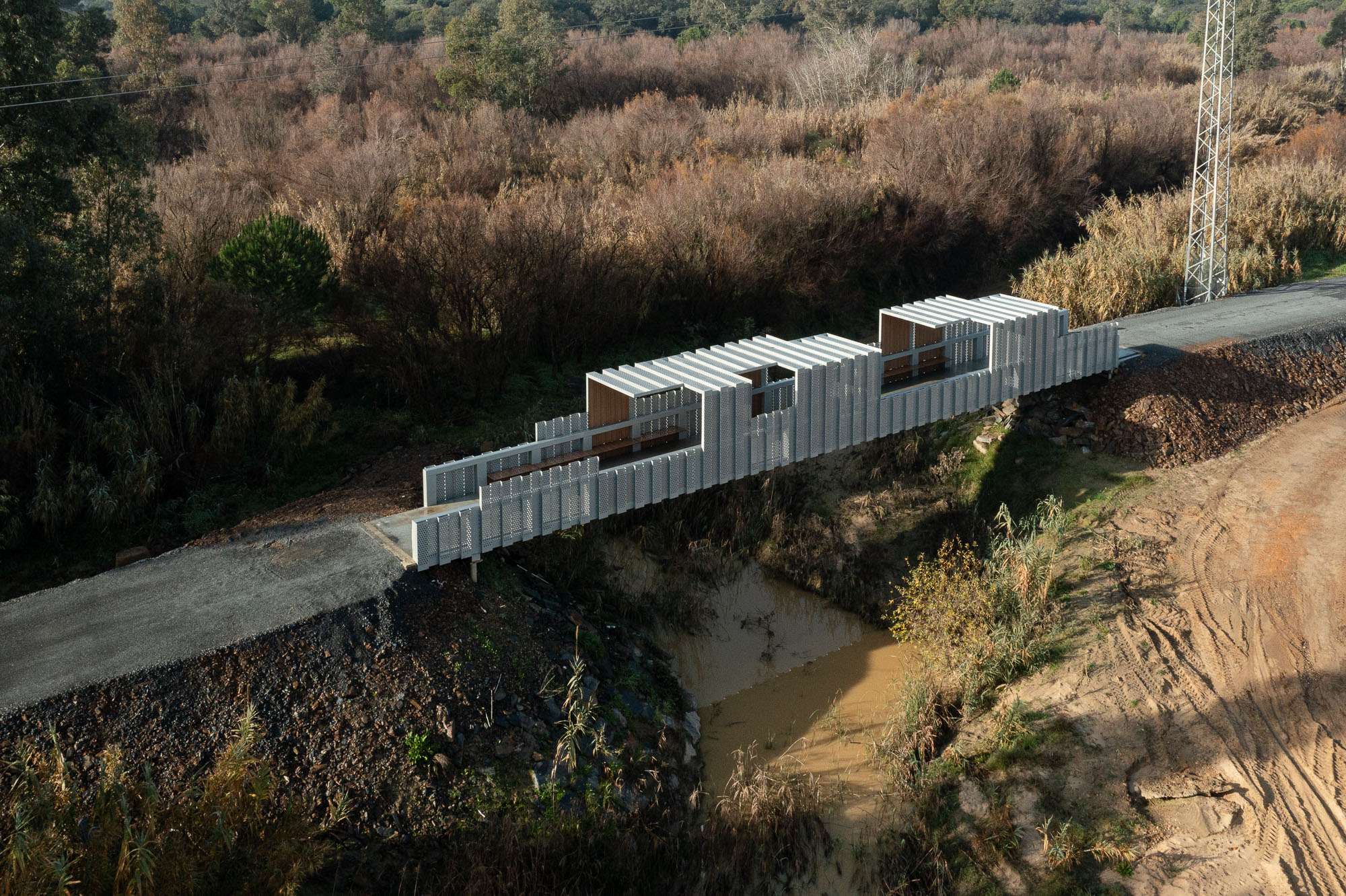
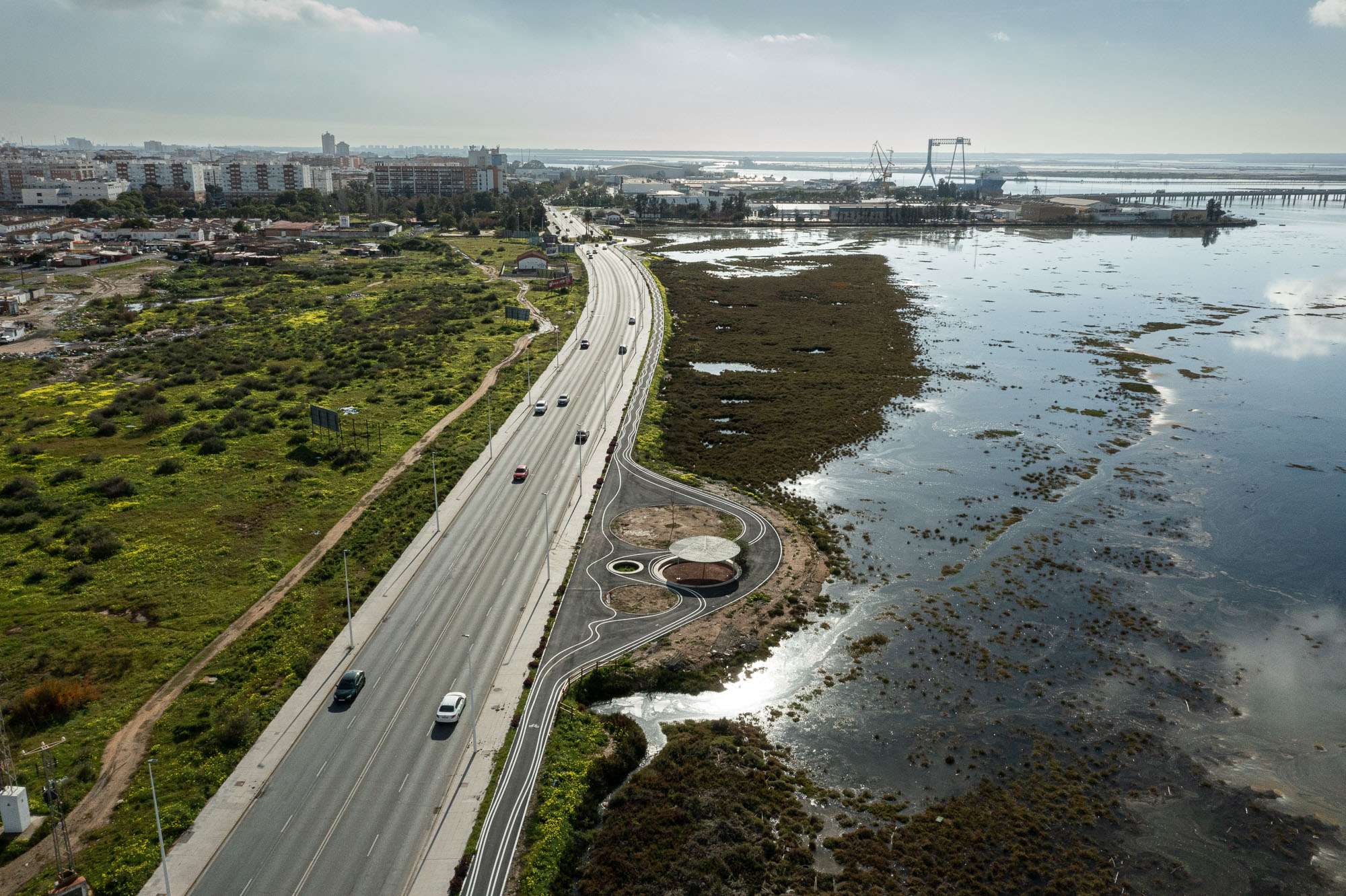
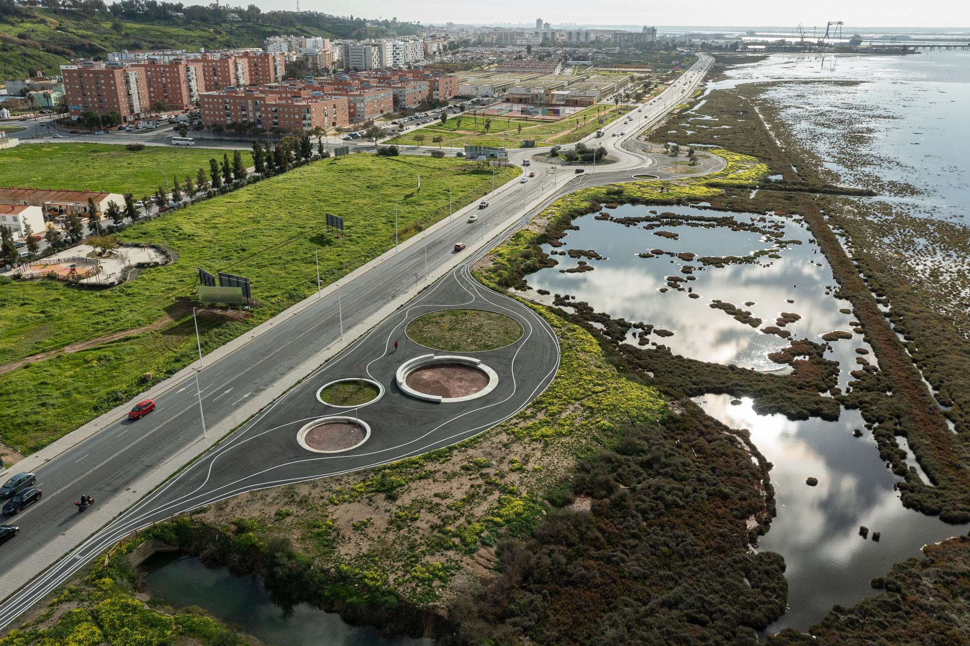
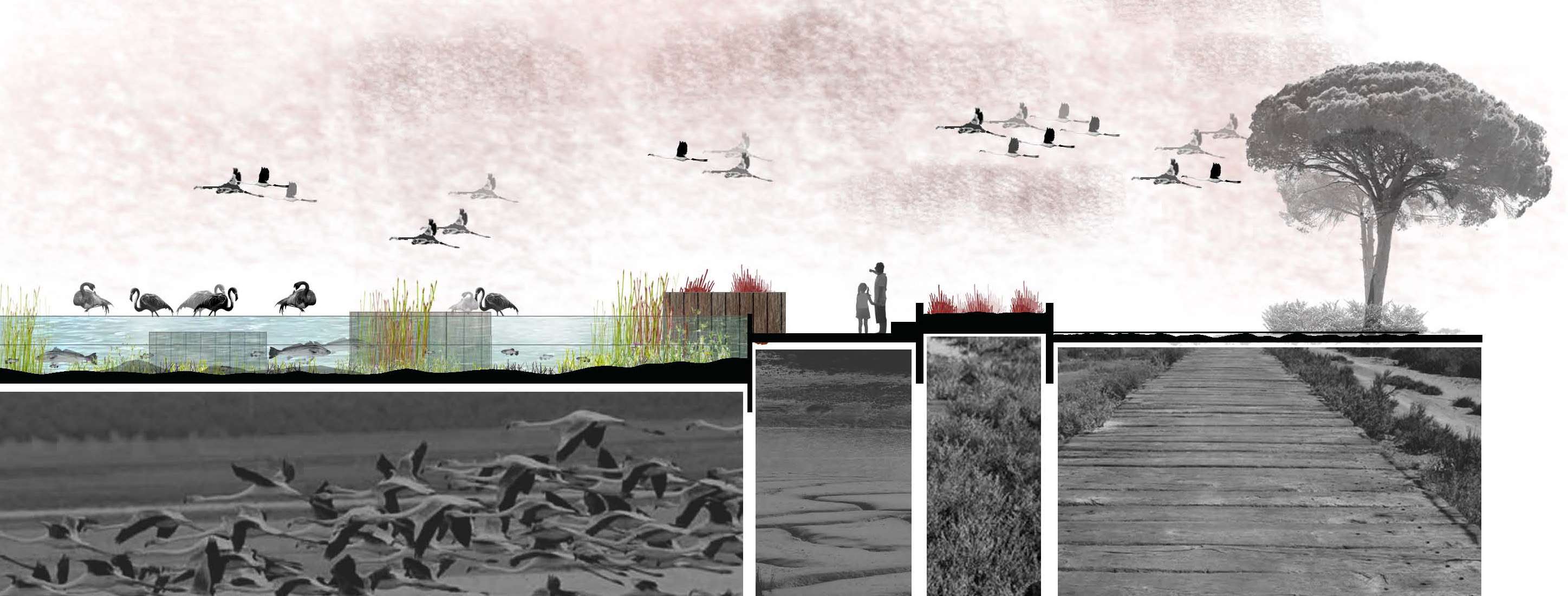
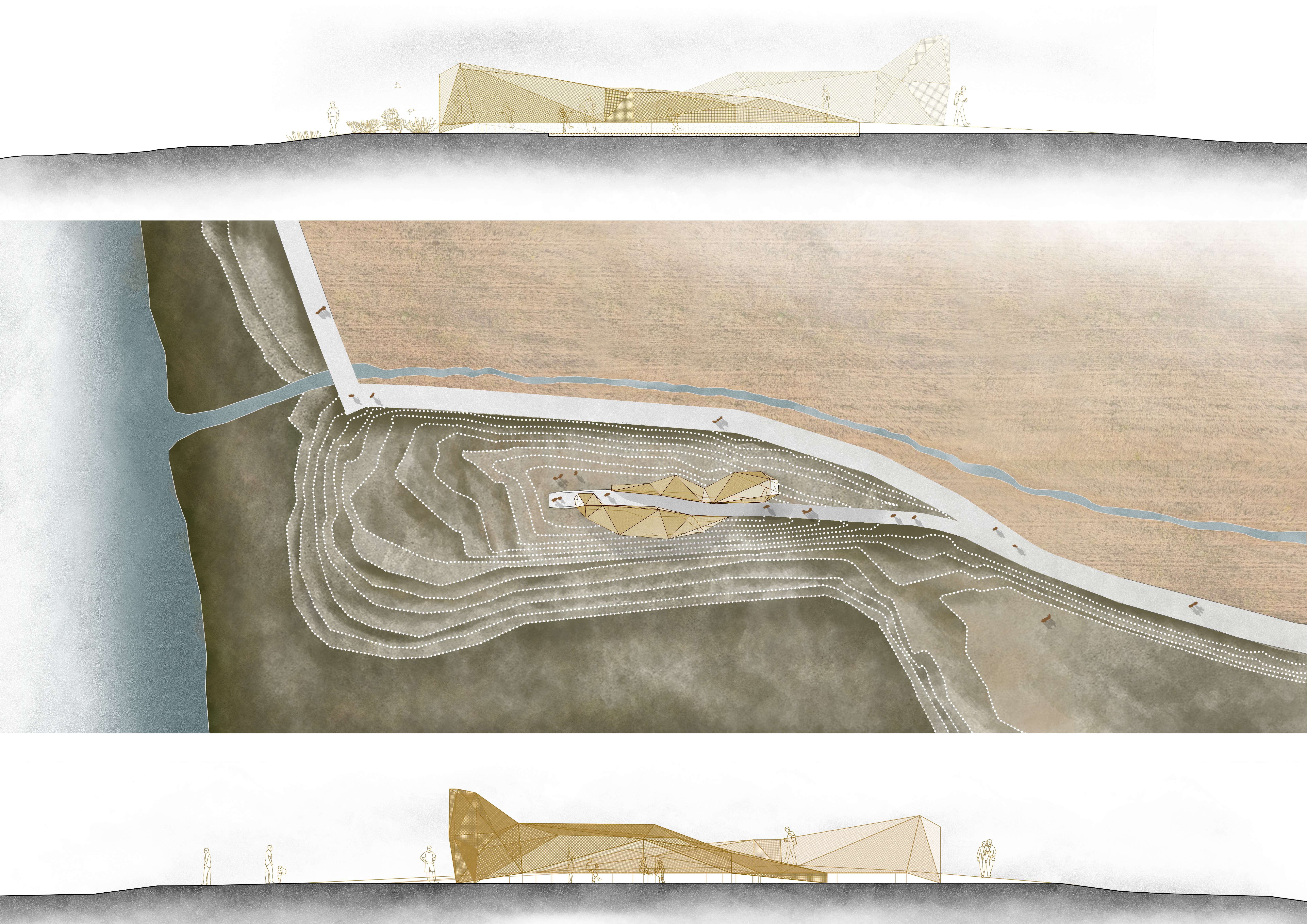
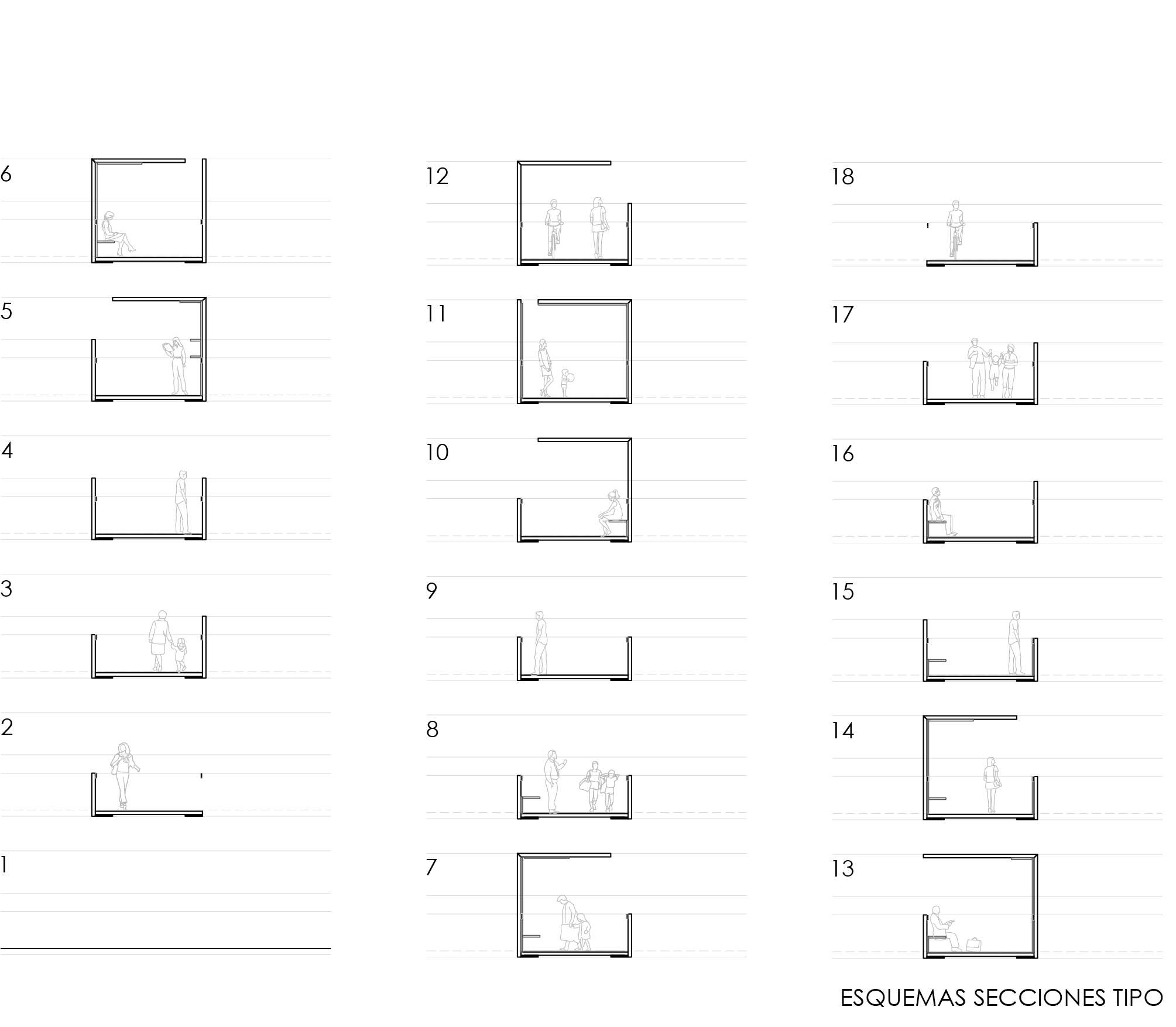
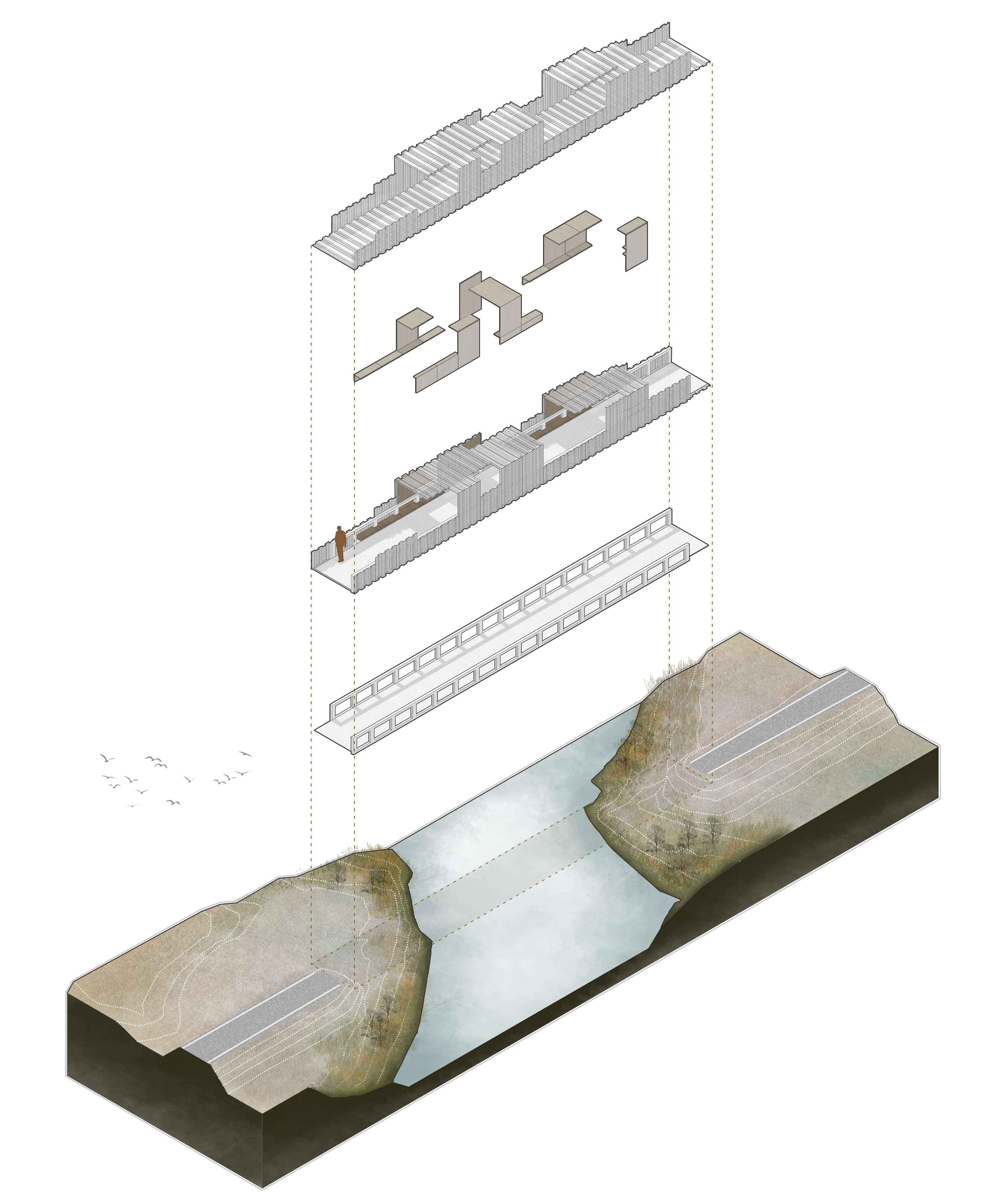
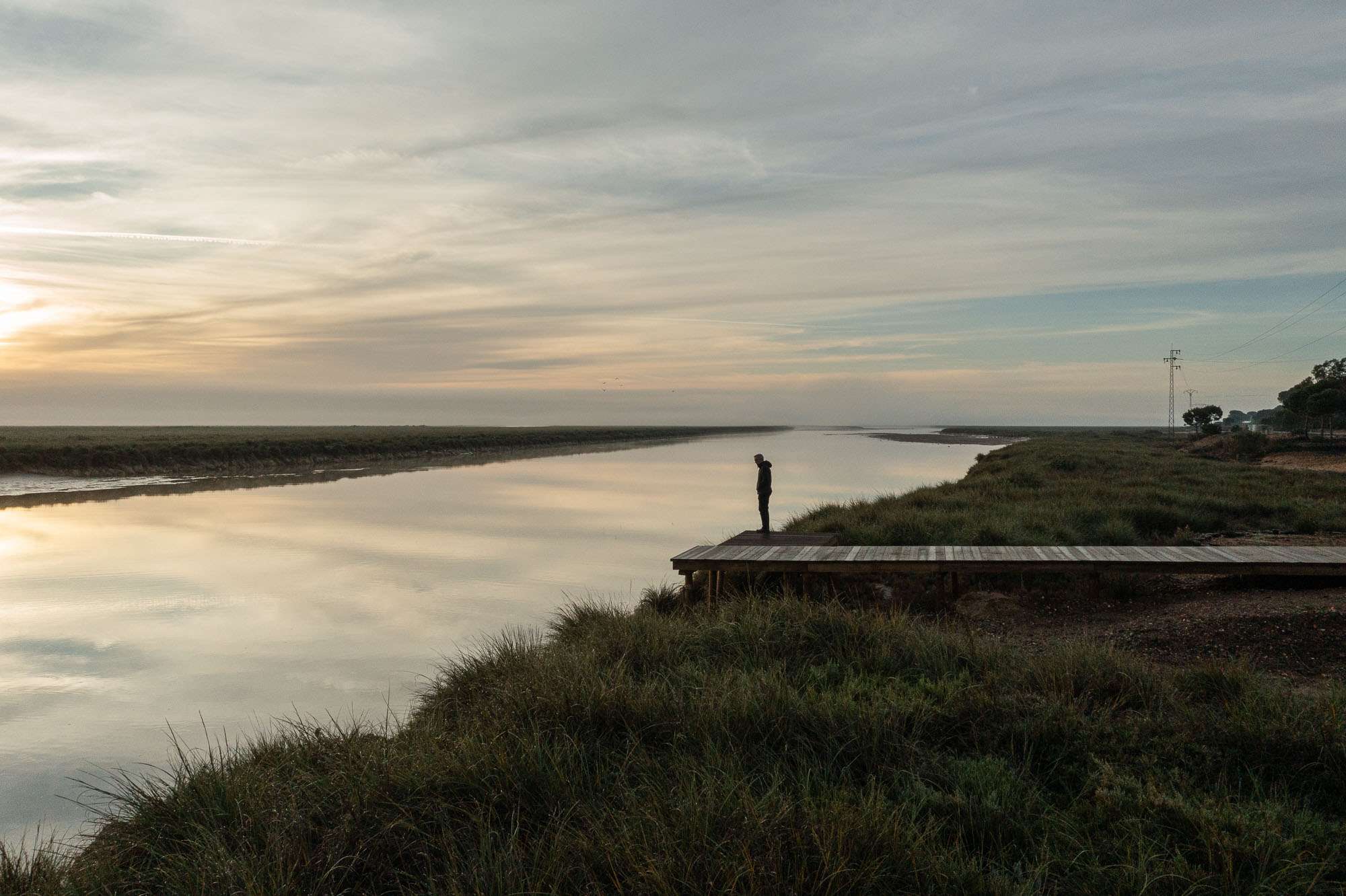
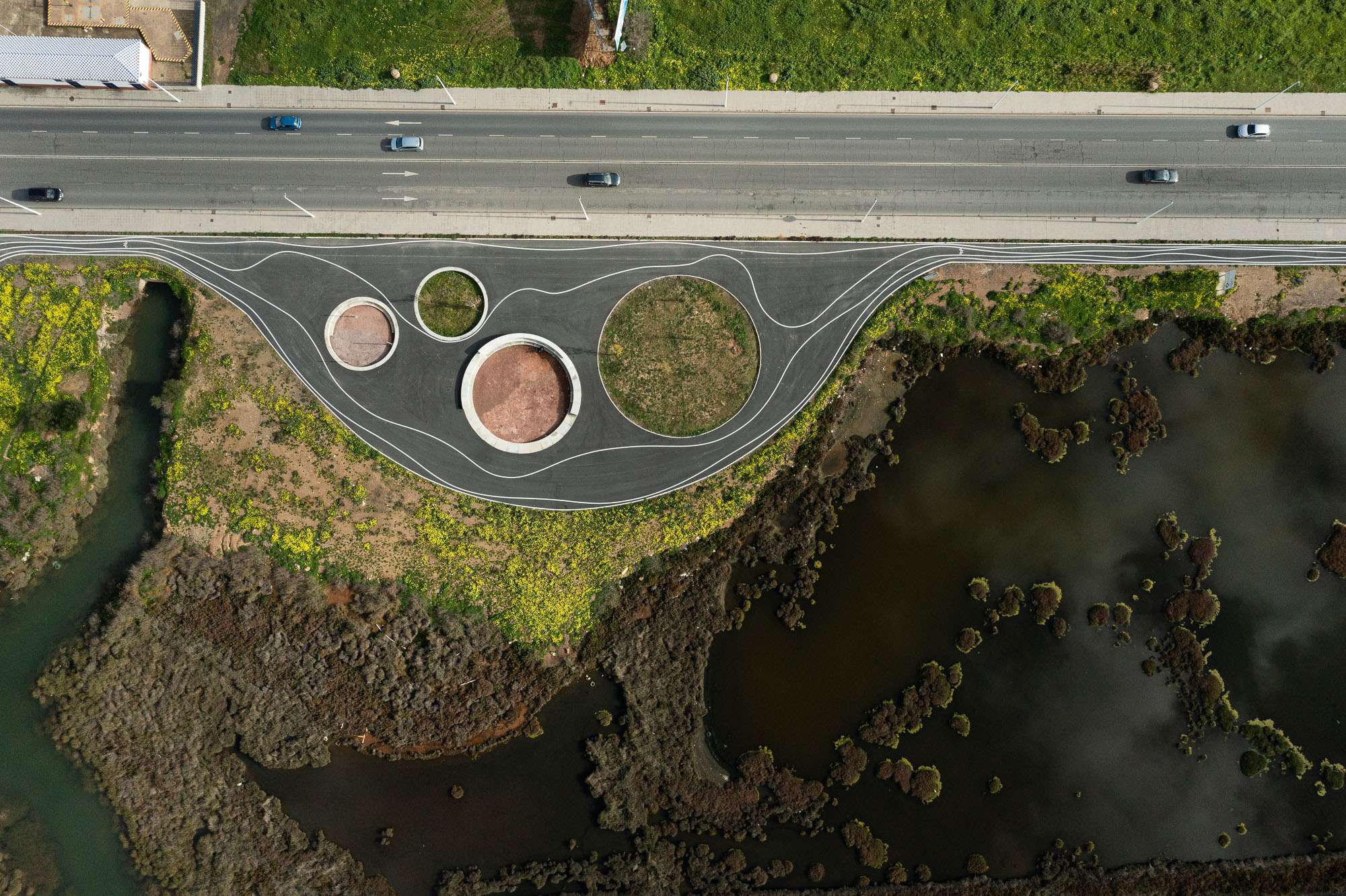
The route runs along disused railway tracks that have been reused, livestock trails, the edges of marshes, abandoned salt marshes - now regenerated - and the occasional urban stretch. The itinerary is punctuated by a series of elements (pergolas, bridges, jetties, rest areas, viewpoints or rooms) that, in the manner of architectural-sculptural proposals of territorial acupuncture and strategically situated, contribute to mark out the route, mark the rhythms and make the territory legible.
The project oscillates between the large scale of the territory where it acts (XXL) and the small scale of the architectural pieces built (XXS), with hardly any of the usual scale or average dimensions in architecture. The meagre budget for an intervention of this calibre has forced us to sharpen our ingenuity and concentrate our efforts on very specific points along the vast route.
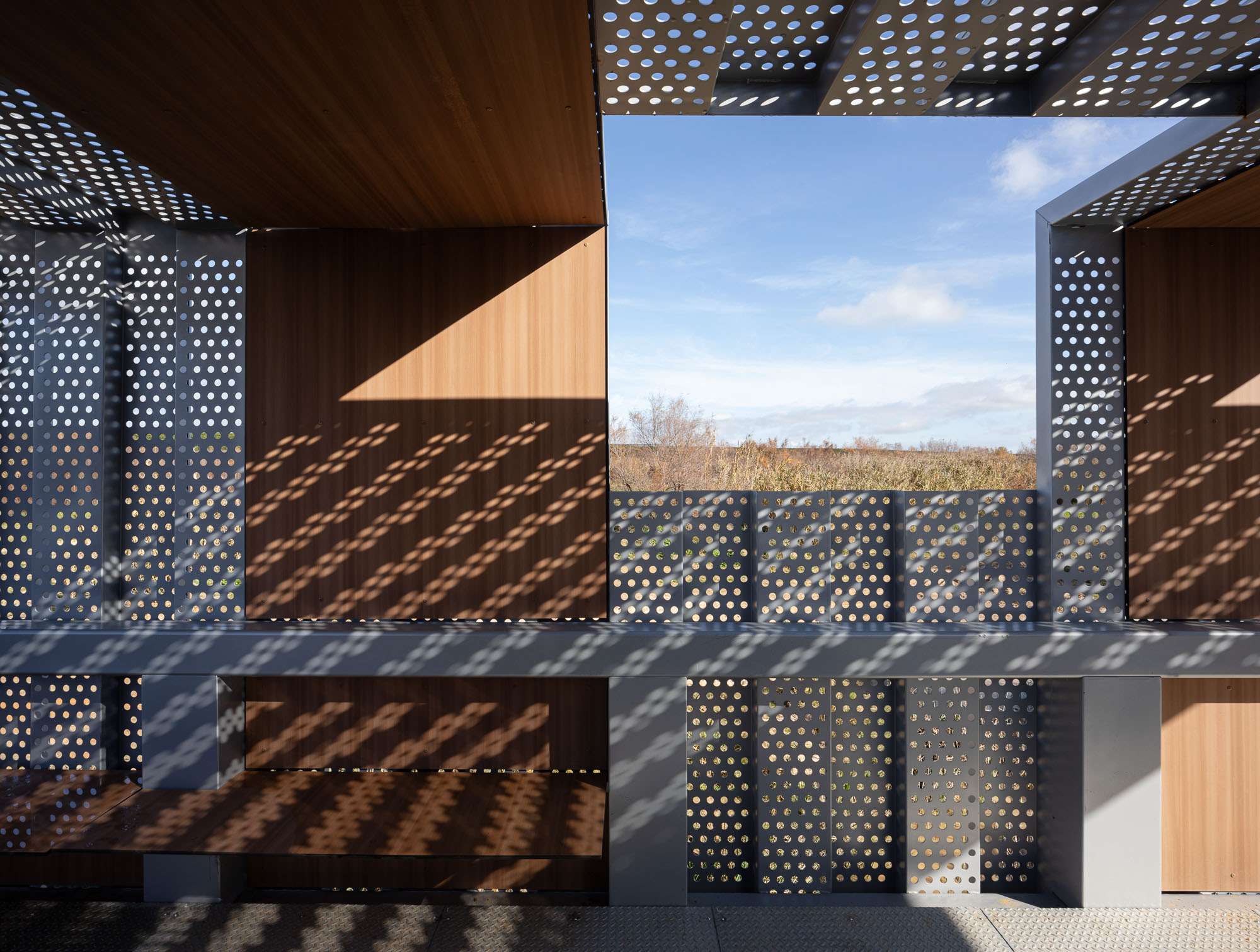
To define its morphology and choose the materials, the strategy is to remember the rich natural and cultural heritage of the territory and maintain its essence. All this is expressed in the use of curved, natural, sinuous and organic shapes, the same shapes that the intertidal nature shows us. In terms of materials, we have resorted to those used historically in this territory: breakwaters, mud walls, sluice gates, sheet piling, eucalyptus poles, untreated wood and reinterpreted water crossings. The traces of the mining-railway past are reflected in the use of steel and perforated sheet metal used to build bridges, pergolas and belvederes.
In short, starting from an infrastructure and communications project, we propose to give added value to the intervention, turning it into an equipped park. In short, it is a question of taking advantage of a 30 km. loop operation to reflect on the future and the development of the territory it envelops.
VIDEO LINK https://www.youtube.com/watch?v=zchbHN4wXQM
The main objectives are non-motorised accessibility between the three towns by means of a sustainable multimodal road that runs along the edge of the northern Odiel estuary; and the requalification and regeneration of degraded urban-rural edges, both of which are fully framed within the 2030 Agenda.
The SDGs addressed by this project are:
Goal 3: Healthy Living and Well-being: The action allows outdoor exercise in nature and NON-MOTORISED communication (on foot, by bicycle or on horseback) between 3 towns with a total of 180,000 inhabitants.
Objective 12: Respectful production and consumption: The project focuses the population towards a more sustainable model with the regeneration of old abandoned salt mines, with a vision of circular and local economy.
Objective 13: Climate change: The promotion of non-motorised mobility throughout the area contributes to the reduction of CO2 emissions into the atmosphere. Likewise, thanks to the planting of 25,000 new plant species, it contributes to mitigating climate change.