Valencia, Horta Sud
Valencia, Horta Sud
Valencia, Horta Sud
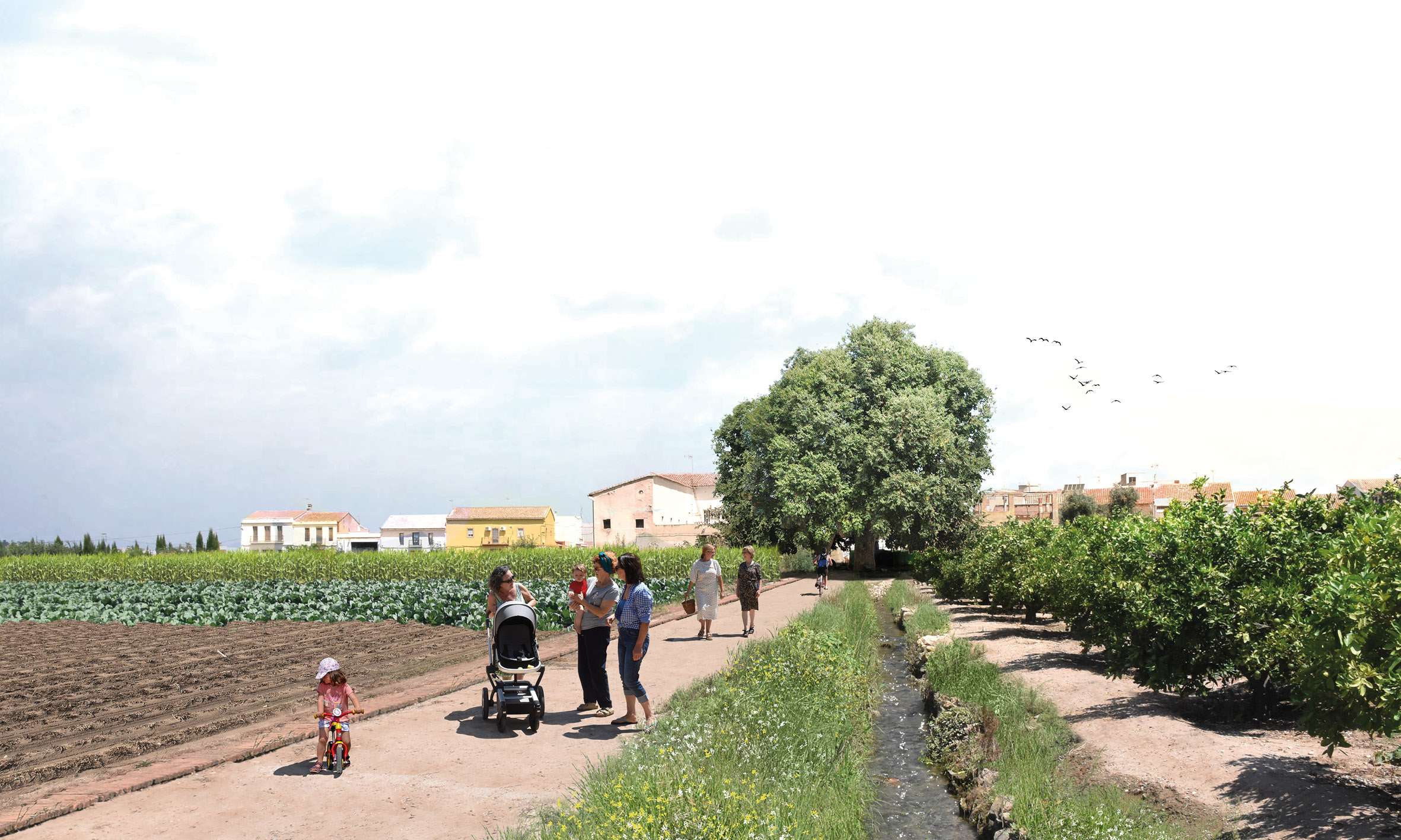
The city of Valencia, located on the alluvial plain of the River Turia (western Mediterranean) is inseparable from its territory which, for thousands of years, has been inhabited by people and shaped by agriculture, giving the city its own identity.
The Blue-Green Infrastructure proposed for the Horta Sur of the city of Valencia, tries to articulate the territory from multiple aspects, putting in relation environmental, landscape, mobility, heritage aspects, etc... trying to mediate in the metropolitan conflicts suffered by the southern districts.
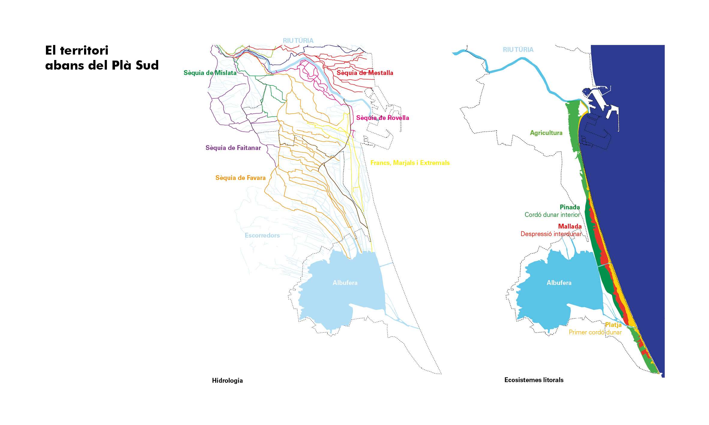
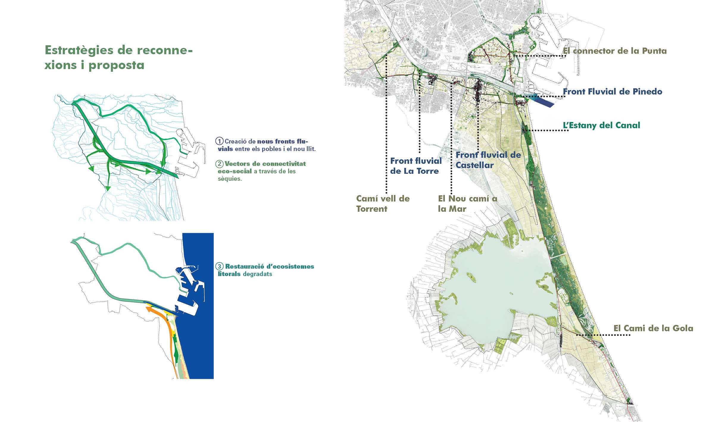
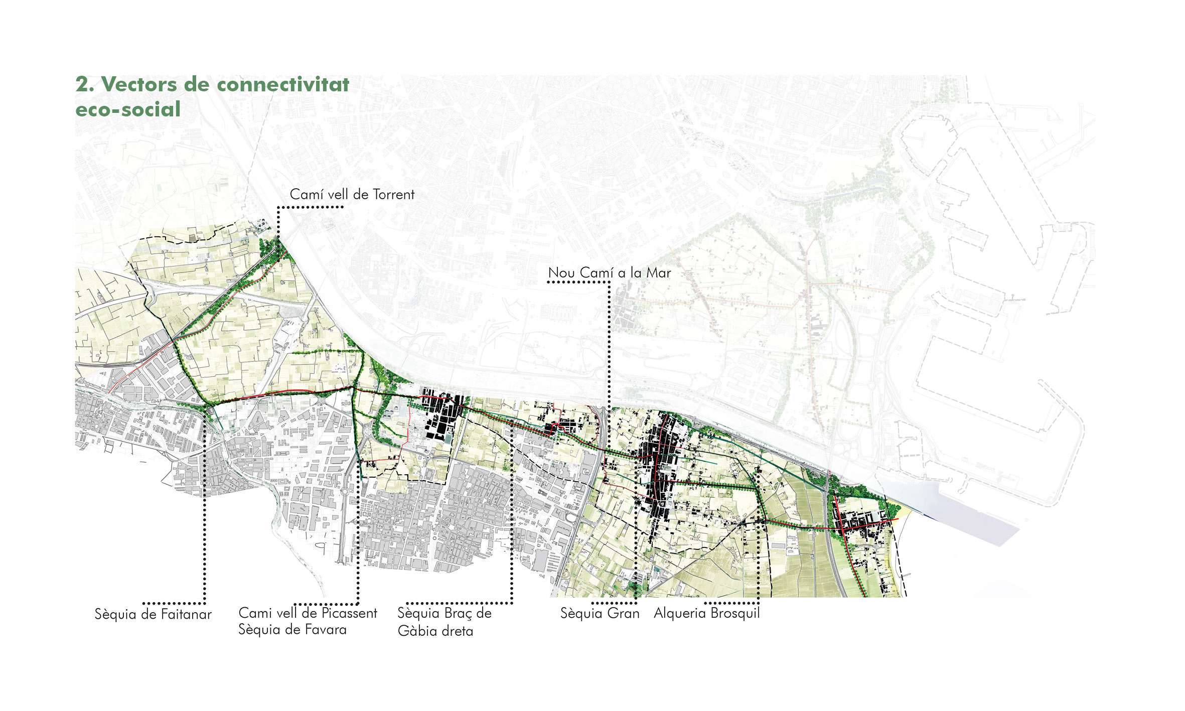
It starts from a recognition of the key and structural elements that make up l'Horta Sur such as:
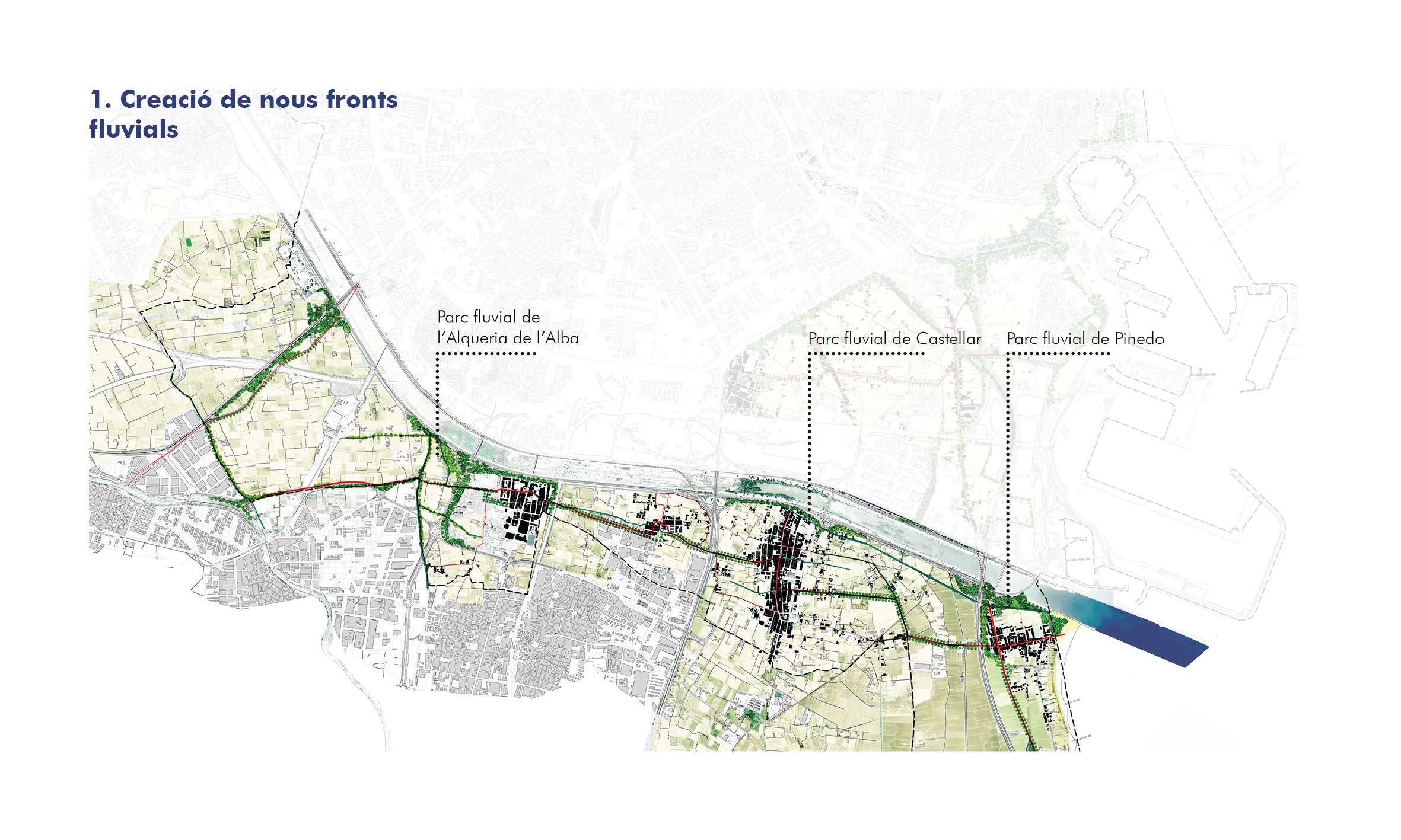
- The network of irrigation ditches and historical paths and the heritage and identity value they represent.
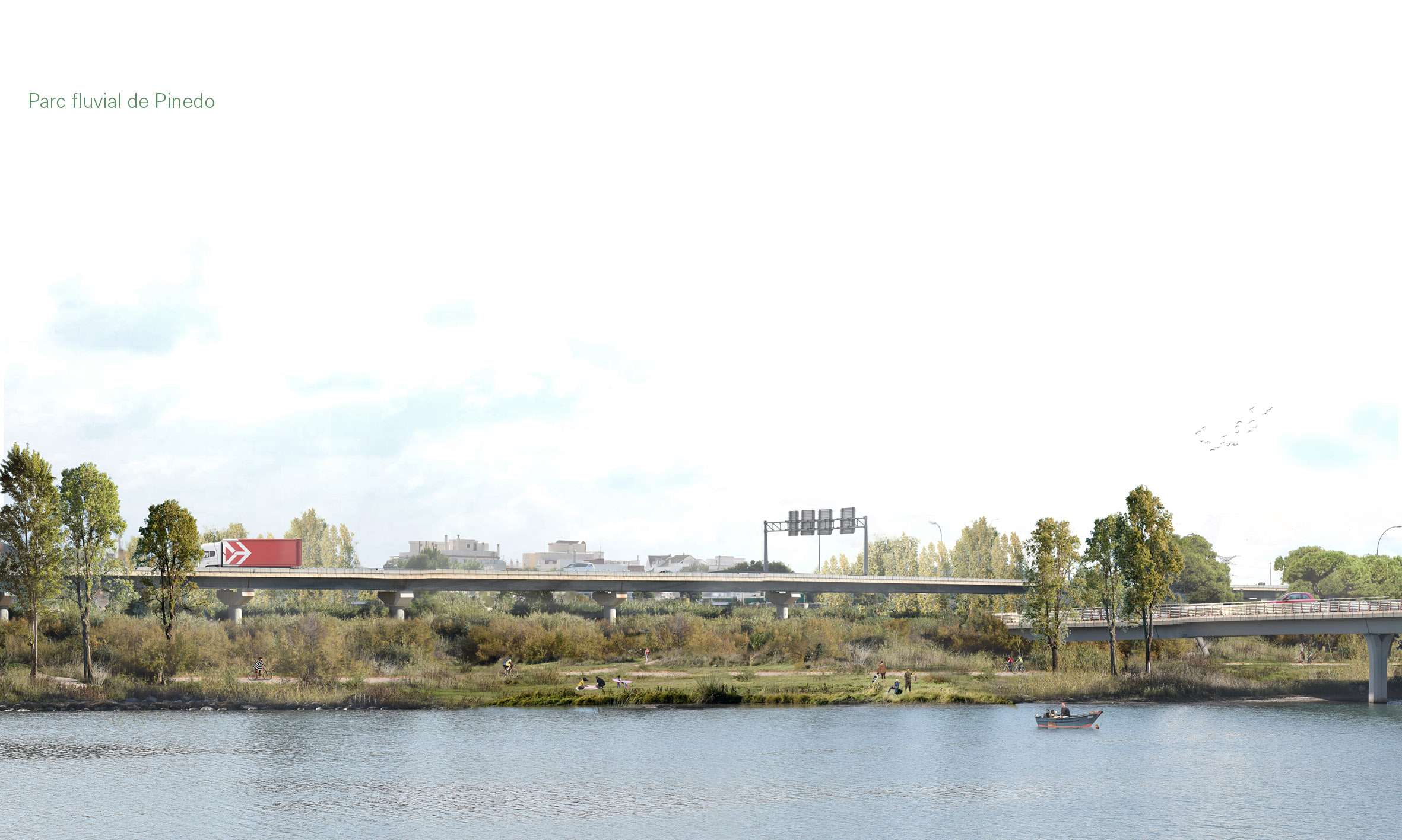
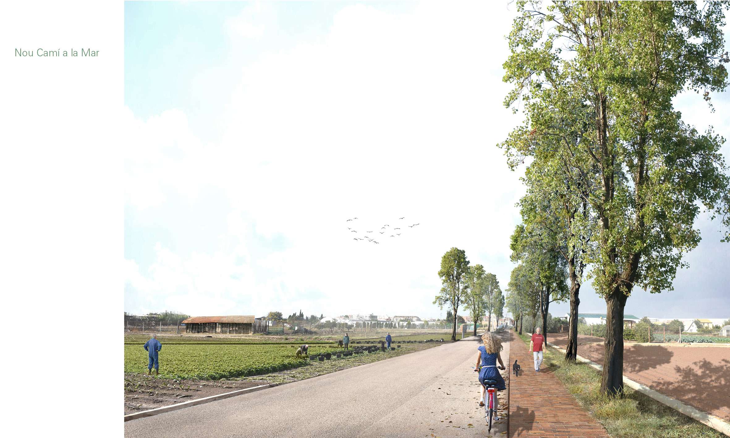
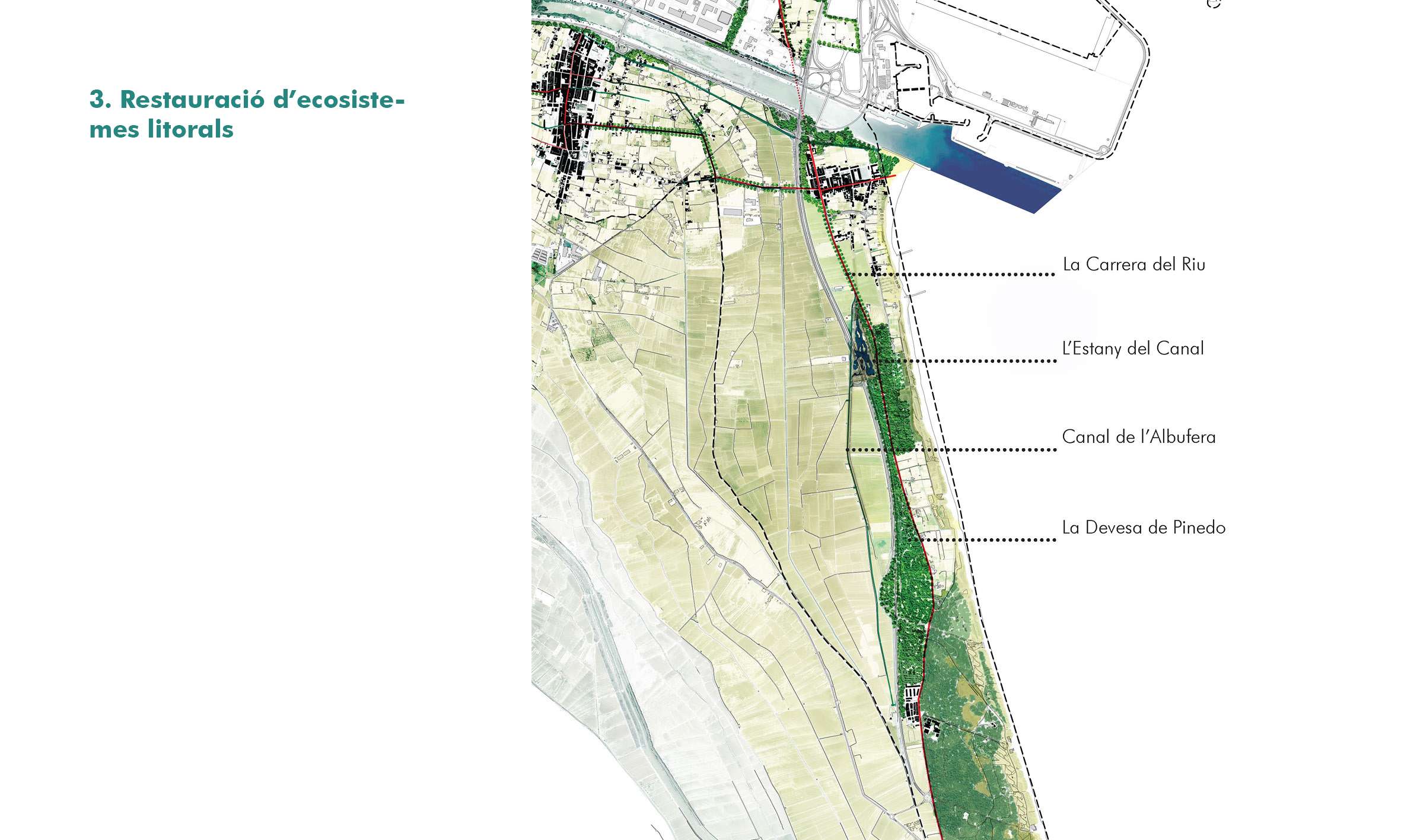
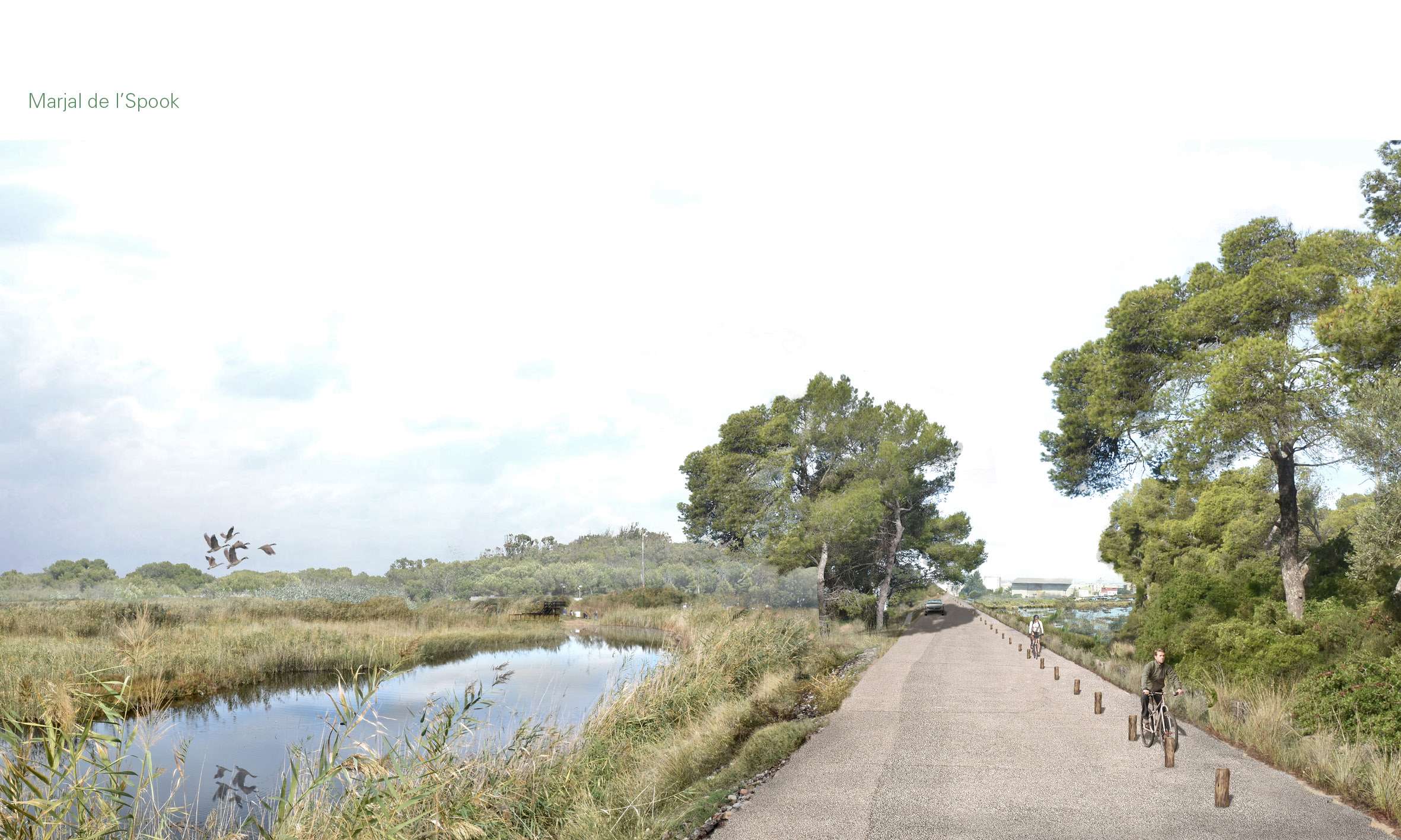
- The landscape, cultural and environmental resources of great value found in the study area, such as the beaches, the agricultural landscape of orchards and rice fields, the Devesa and Albufera landscapes, etc...
- The areas of high environmental value present, which represent one of the great green heritages of the city of Valencia, of international relevance.
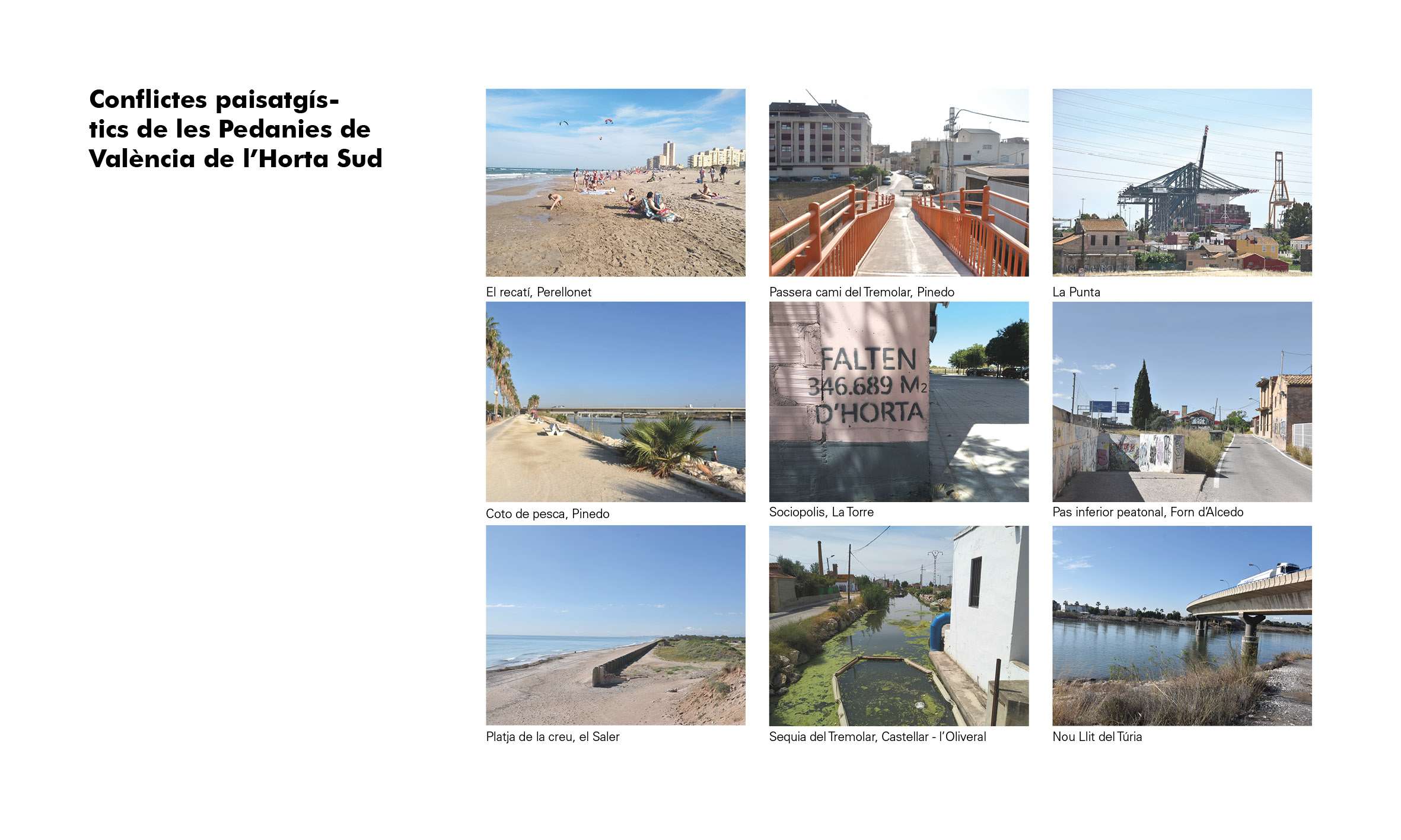
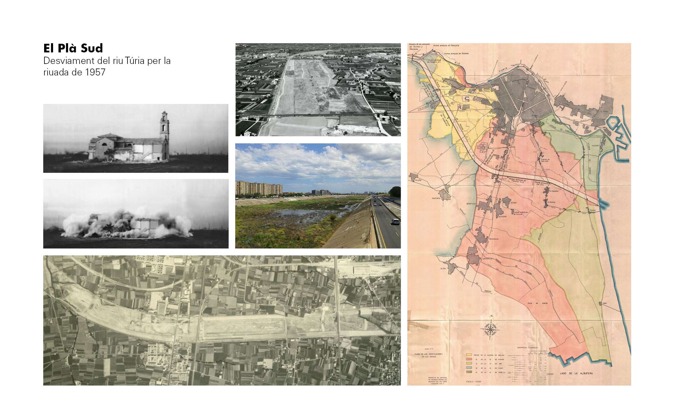
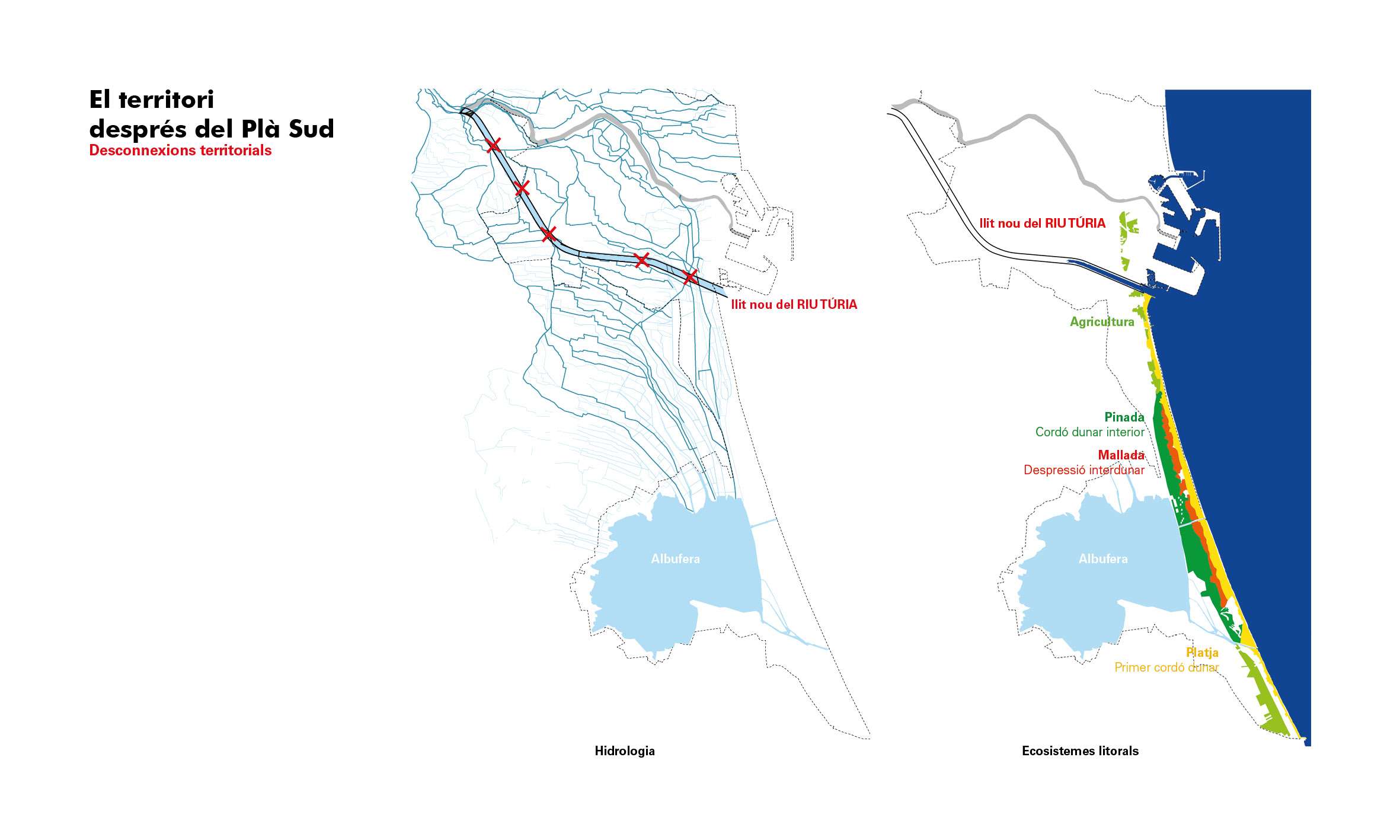
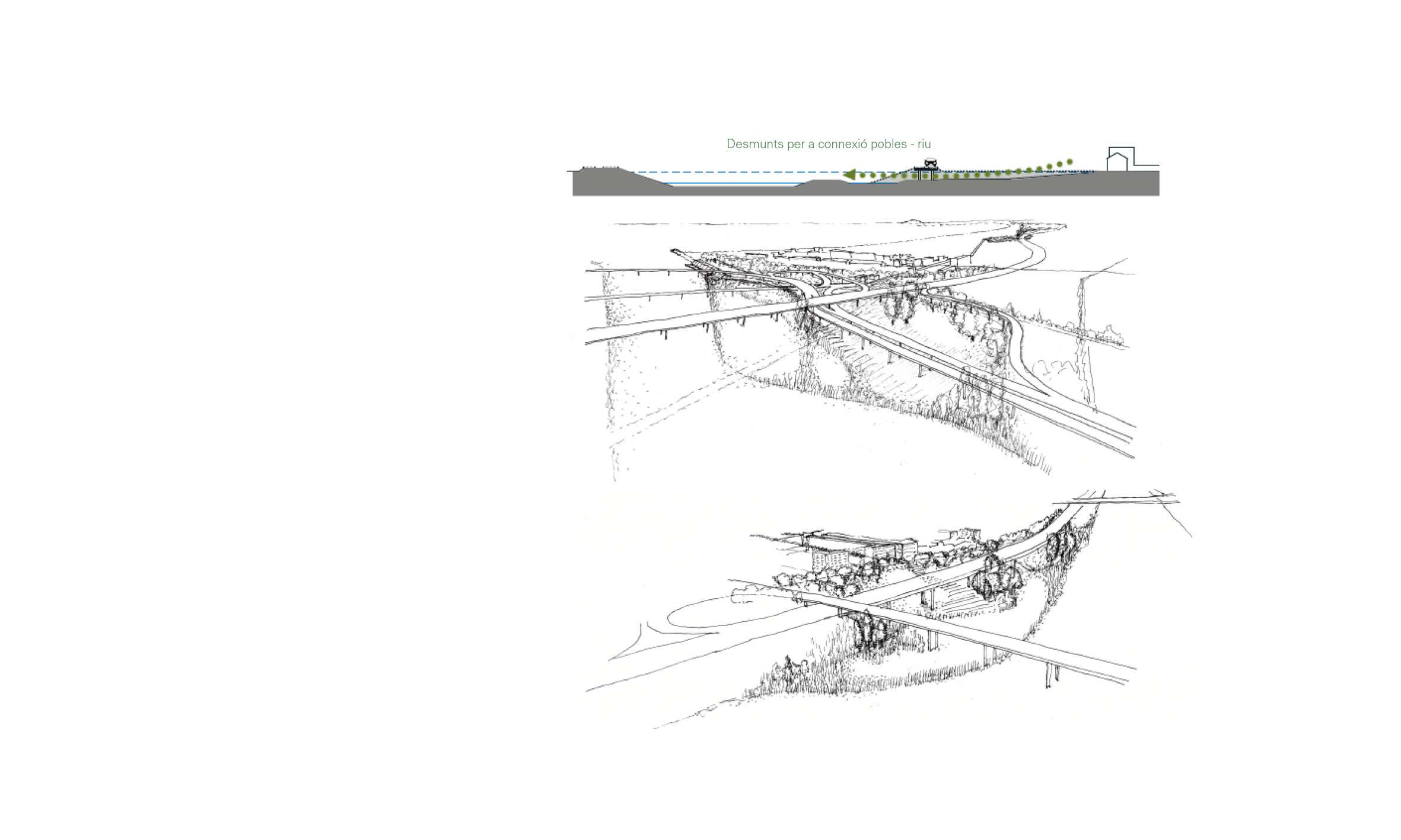
- The conflicts with the infrastructures derived from a very dynamic metropolis with a great capacity to transform the territory to satisfy its needs and interests.
With the recognition of their elements and values, the green-blue infrastructure of l'Horta Sur reformulates them within the metropolitan context to establish new links between them. And it does so by taking advantage of territorial synergies between the new interests and projects, and the needs of the towns that make up l'Horta Sur of the city of Valencia, such as the relationship between the towns in the south and the new green infrastructure of the New Riverbed or the metropolitan Green Ring, among others.
As a result, the green-blue infrastructure l'Horta Sur de València, re-connects the fragments of a territory highly fragmented during the last decades, rescuing it from oblivion and giving it a new impulse to face the new local and global challenges of today.