

Madrid Rio
Madrid Rio
Madrid Rio
In 2003 Madrid City Council decided to bury the 10km western stretch of the city’s first Ring Road, known as the M30. This West section travels along both banks of the Manzanares River.
The Madrid Rio project was part of the main engineering traffic renewal operation of the entire M30, which also involved a large set of construction works in different locations of the city.
The construction of the M30 was not the result of a single design, it had taken place carelessly during the last 40 years and its development had always been dependent on traffic demands.
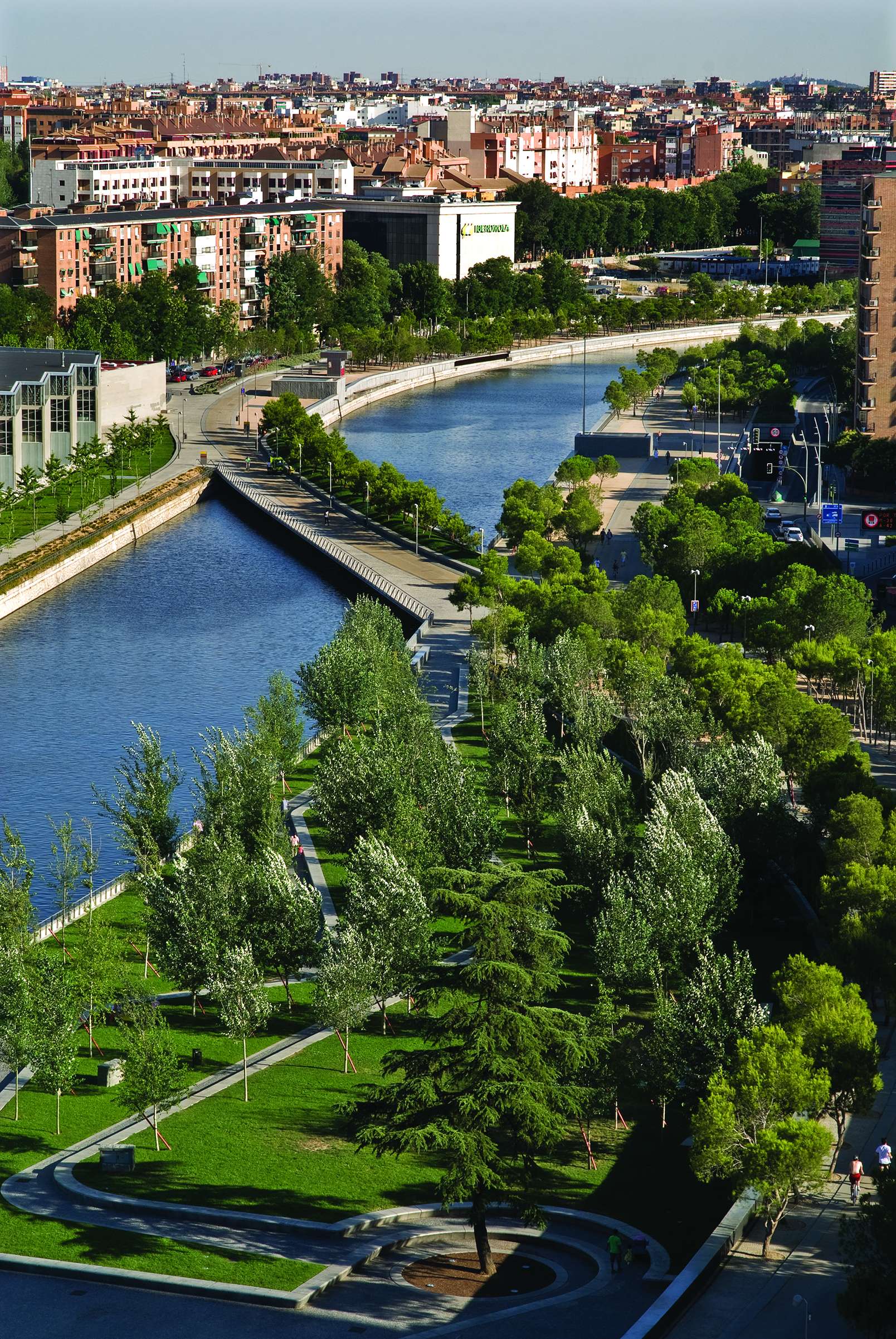
Amongst the consequences and side effects, it erased the city’s connection to its river, rendering it inaccessible and invisible.
As a result of these major infrastructural works, valued at almost €4 billion, an enormous public open space appeared vacant at the heart of the city of Madrid, at a very central location, less than half-a-mile away from the Royal Palace and its gardens.
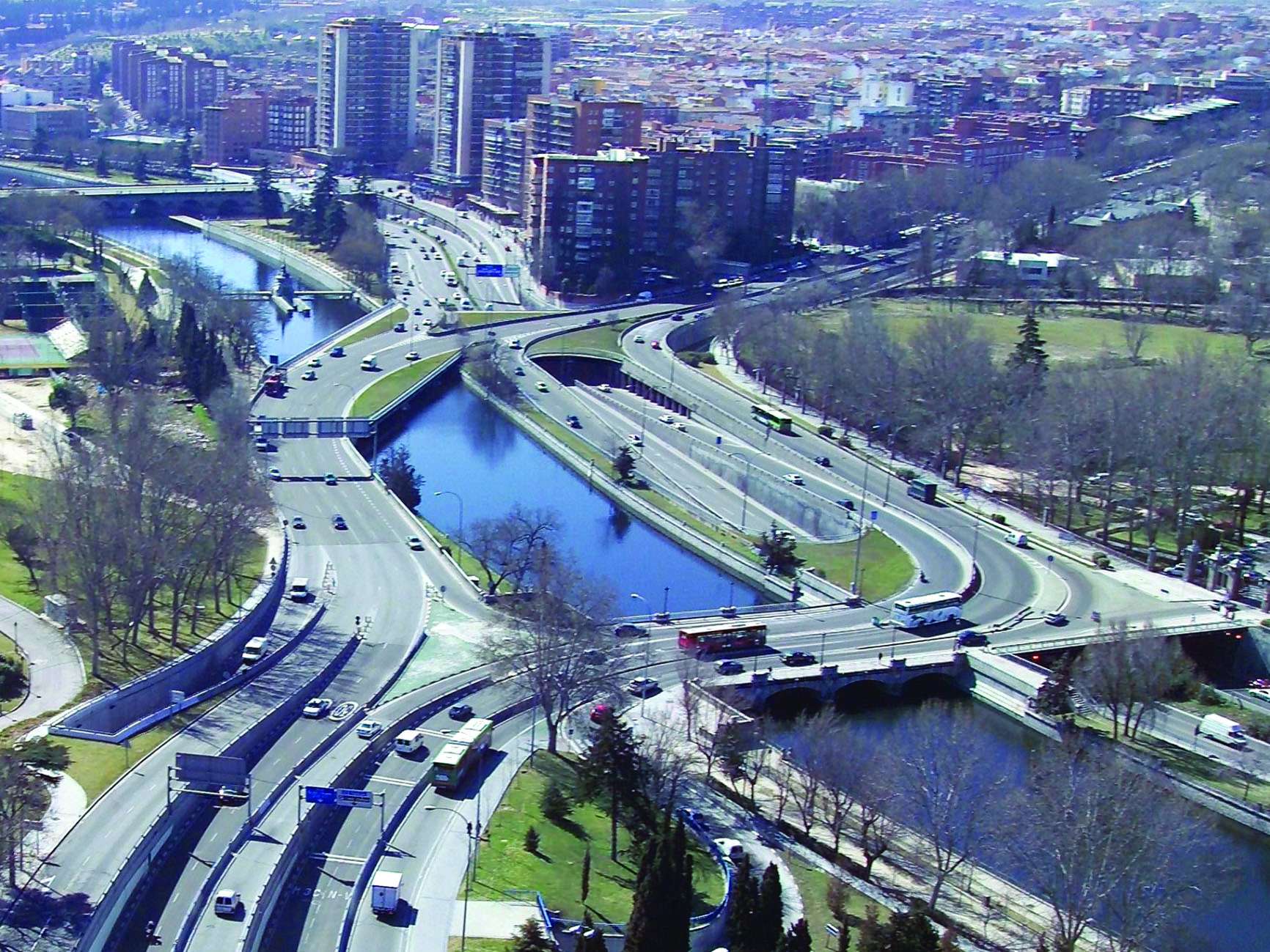
The construction of these tunnels, with a total length of over 40km, and through which more than 200,000 vehicles pass by every day, involved the replacement of all of the city’s major supply lines, previously placed at random along both sides of the river.
This included burying the electrical power lines that transport 40% of the city’s energy; renovating the rainwater collection and filtering system, and the main sewage system; restoring the flood protection scheme; the drinking water pipe-lines, gas, data and telephone lines. Additionally, it was also carried-out in the same place occupied by the motorway, where traffic could not be cut off .
Certainly, these works also affected the existing historical, archaeological and botanic heritage and they were highly criticized by many citizens, who considered the intervention to be a waste of public money and yet another scheme supporting the use of private cars.
Thus, it was an extremely complex construction work that modified all the infrastructural layers of the city, found in a very dense location where everything was compressed together.
The completion of the works, over the short period of 3 years, was a great relief for the city, especially for those neighbours who lived closer to the M30 and who faced the works with immense resignation.
In 2005, half way through the construction process, the City Council held an open international competition to solve the enormous public open space that the tunnelling of the motorway and its nodes had left vacant.
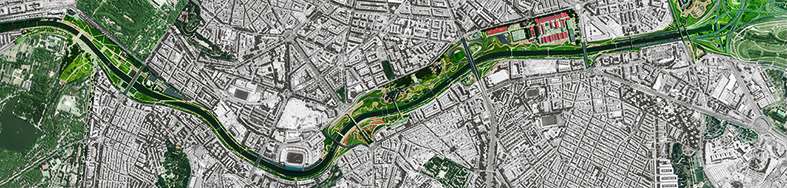
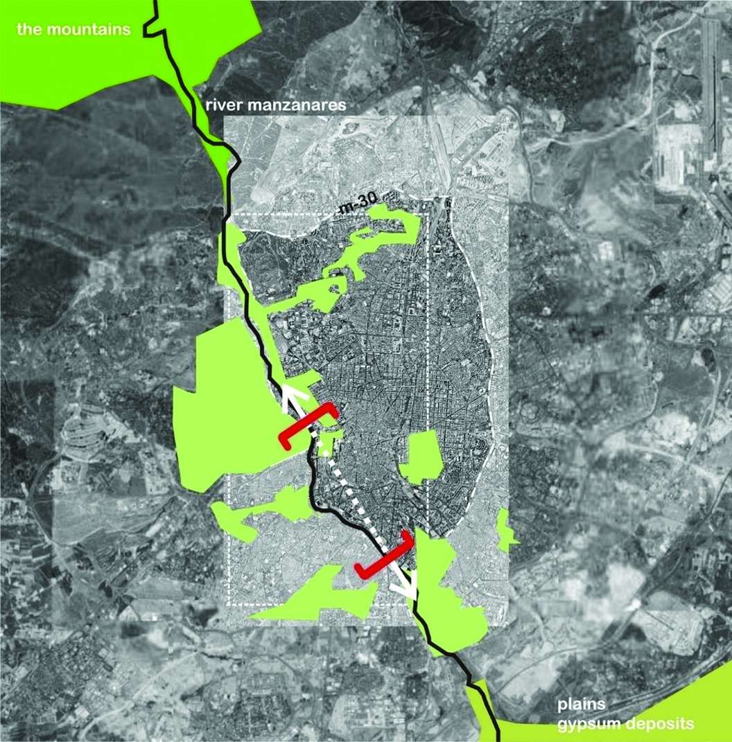
Our team regarded the project as a great geographical intervention, much bigger in scale than just the area
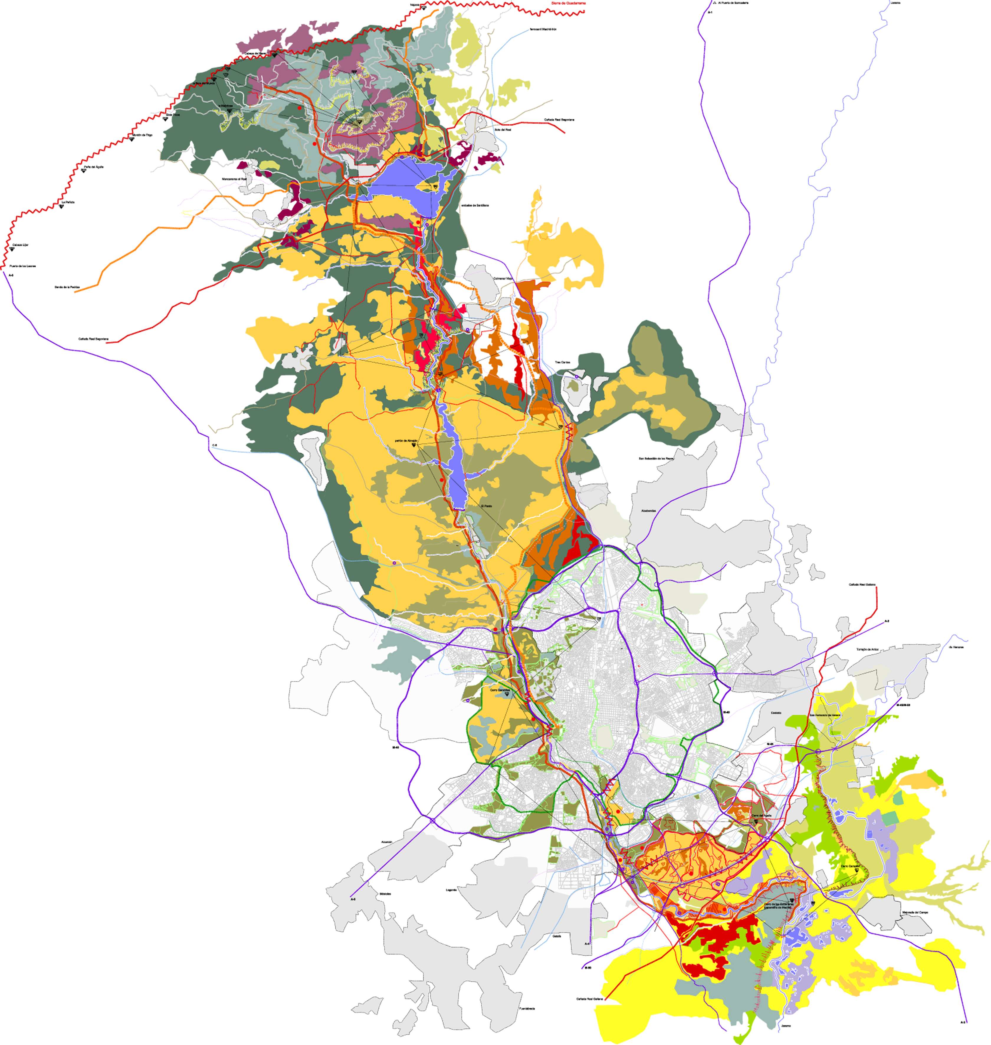
left vacant by the burying of the motorway. It was essential to envision, understand, draw, and walk the river as a whole, from its source at the Sierras in the North of Madrid, to the plateaus and meadows in the South and somehow incorporate this experience and geographical reality into the project.
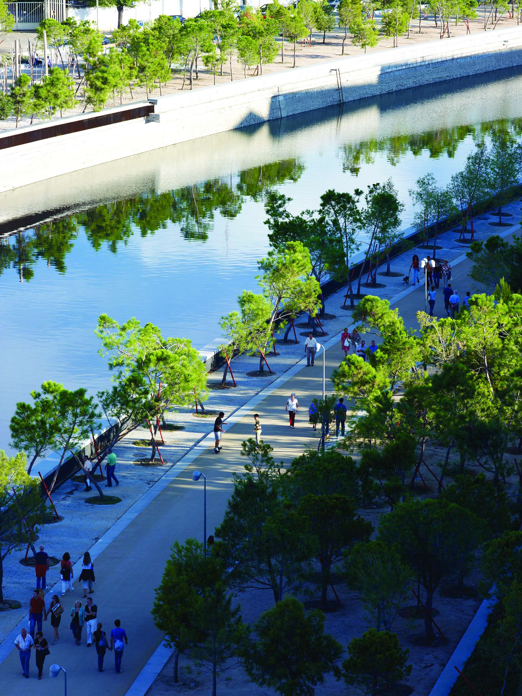
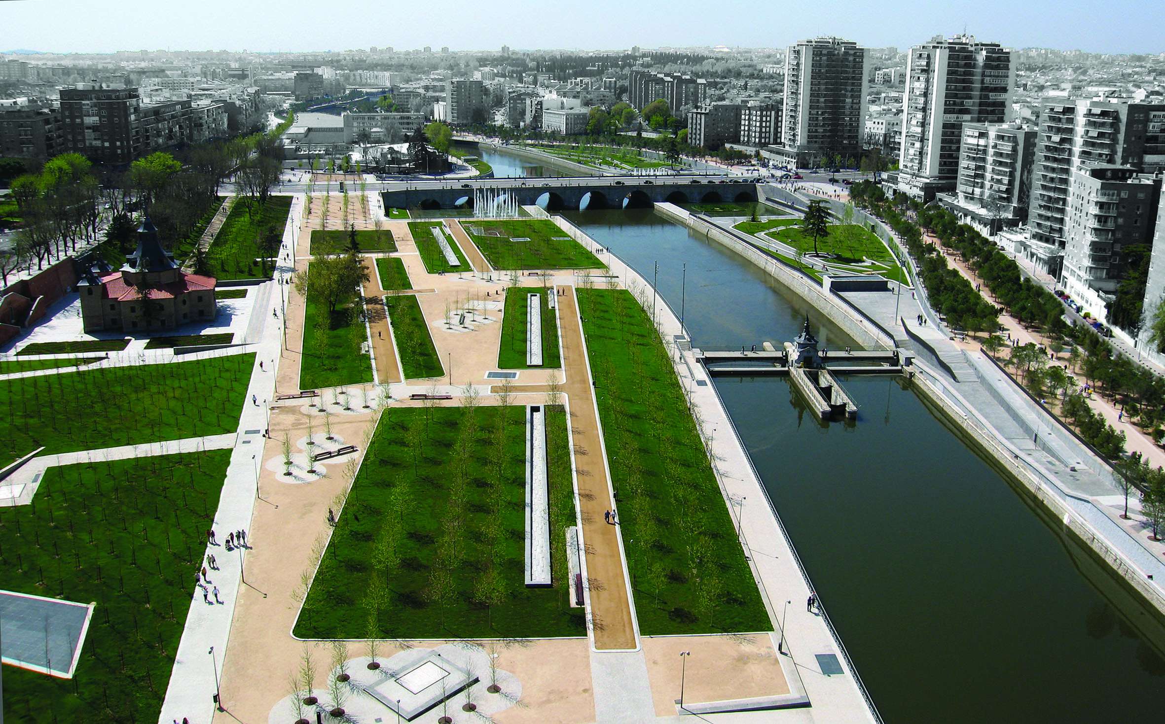
The design of this big park with a surface of over 150 ha consists of the reorganization and the urban design of the public space left available after the burial of the motorway and it includes:
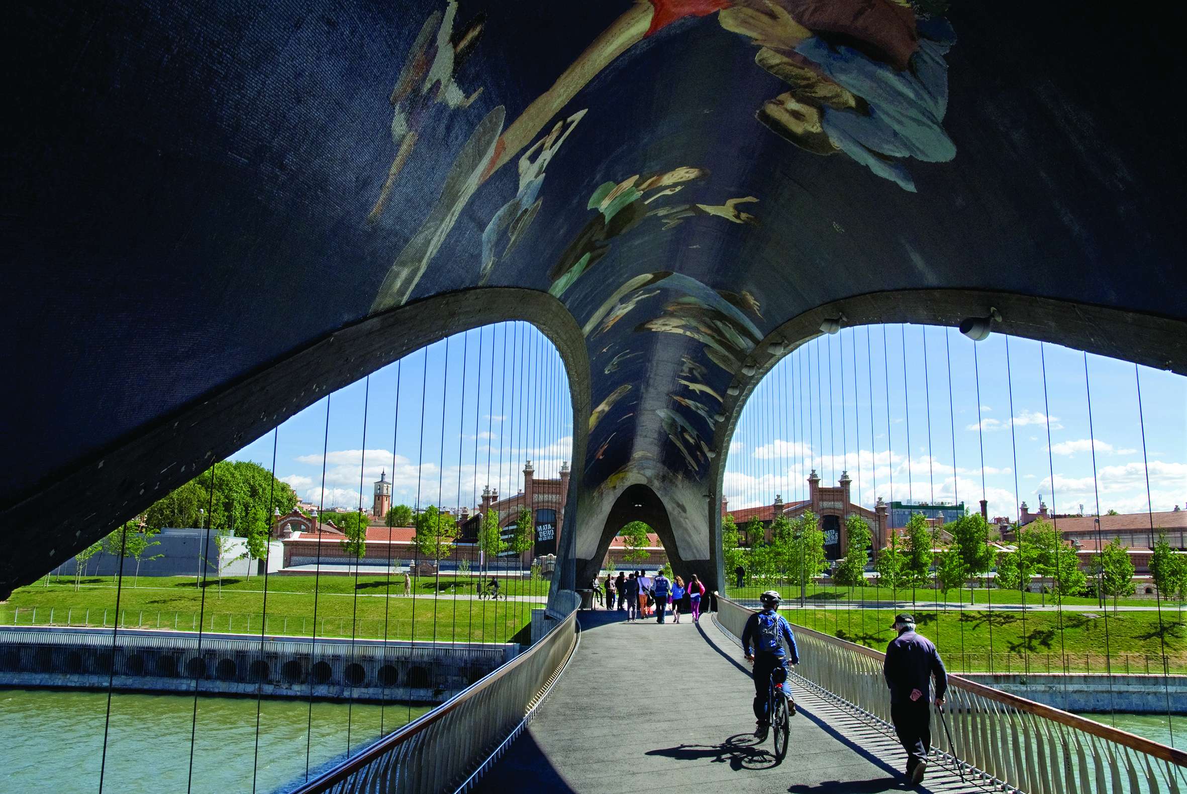
- 12 new pedestrian-bridges
- 6 hectares of public and sports facilities, social, communal and artistic amenities
- An urban beach
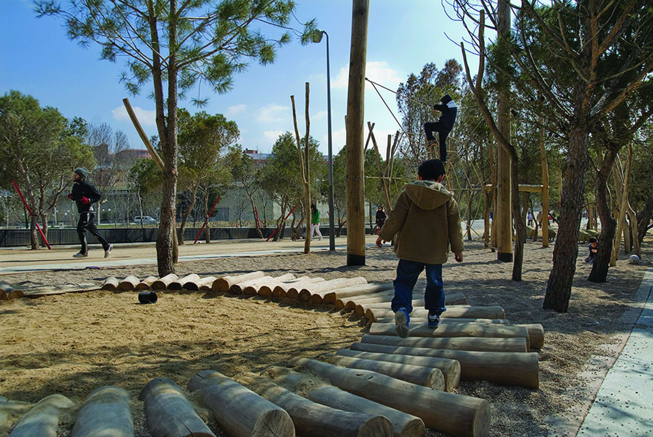
- Children’s areas
- The restoration of the river’s hydraulic architectural heritage.
This is only what is visible but it is has no full meaning on its own because removing the M30 off the city’s surface, obviously had a greater impact on it .
Many things could happen once the M30 was erased and for that reason, the project also includes a Masterplan that extends over an additional 1,700 acres.
This Masterplan, as well as arranging public and private traffic, identifies new locations for the city’s public facilities. It enhances and suggests the design of all the public spaces found on this area, all following a 5, 10 and 15 years’ time-span.
Mainly, the Madrid Río project deals altogether with two urban targets that can be easily identified:
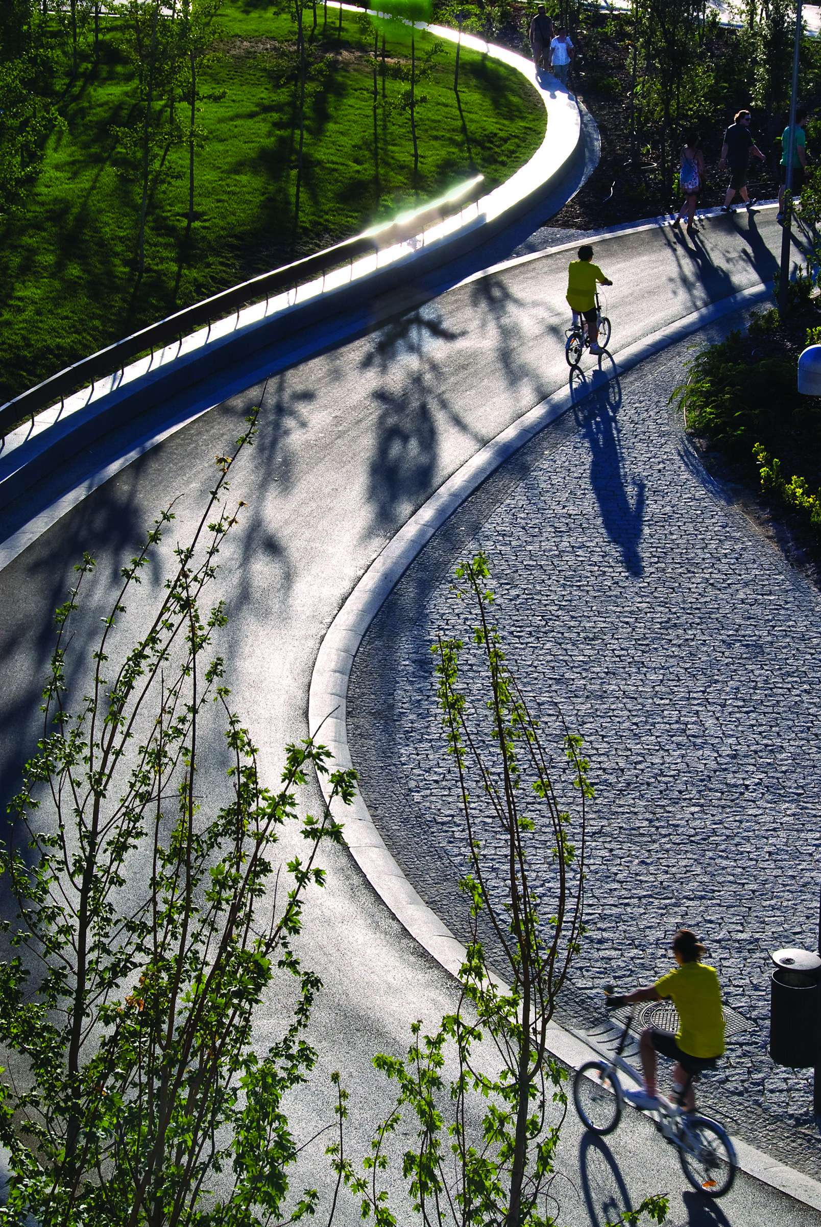
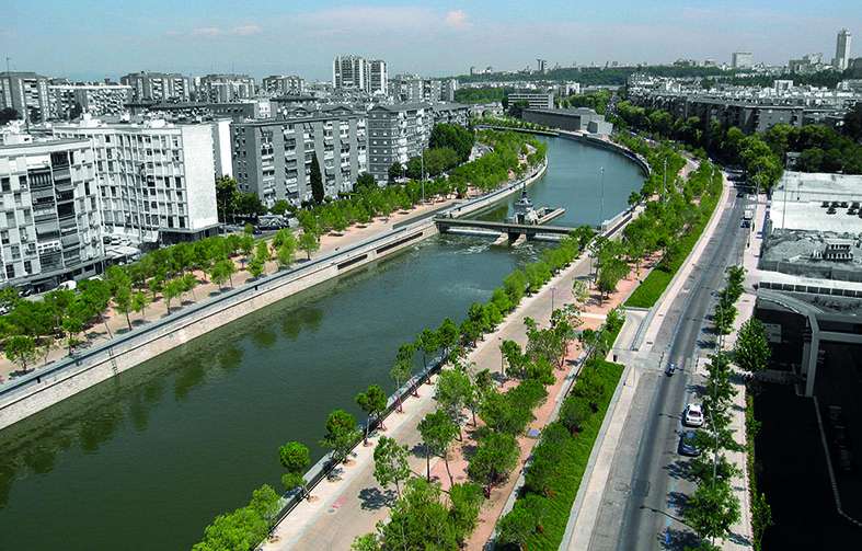
1. The project heals the wounds caused over 40 years by the motorway situated within the urban and social fabric. It also heals the wounds produced by the tunnelling works themselves, as they were also quite significant and aggressive. This was achieved with the design and construction over 48 km of sidewalks; the reorganization of the traffic and the public transport lines and system; the construction of 12 new footbridges over the river and the redesign of 6 existing ones, making them more pedestrian friendly.
2. The design and construction of a completely open public space essentially covered with trees that can be used by all, skaters, cyclists, strollers, climbers, runners, locals and city visitors. Longitudinally, it links the amazing exterior landscapes of the city of Madrid, mostly wild still, with its strongly urban and extreme dense interior. Something difficult to achieve in compact and old cities like Madrid. Transversally, it connects the historical city centre with the modern periphery. Thus, the project establishes a physical and conceptual continuity, which did not previously exist, between the city centre and the valuable countryside that surrounds it. And as a result, the river Manzanares has become the node that connects the city with its geography.
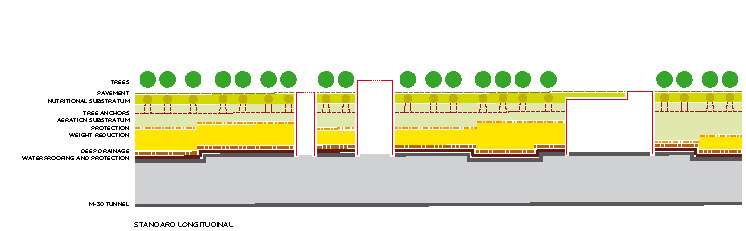
This all was fulfilled in a very uncomfortable, even inconvenient place. A significant part of Madrid Rio’s surface (60%), hence more than 80 hectares, are mainly the top of the underground lanes, but they also cover the technical rooms of the urban infrastructure systems. Thus, the way established to solve the technical
difficulties and details was essential for the project to succeed.
The project vertically links what is infrastructural to what is superstructural; the diverse and apparently chaotic engineering geometries to those geometrics belonging to the city; the abrupt topography of the buried constructions to the plane of the City and the fictional essence of a slightly undulating natural space.
The topography and therefore, the depth of the underground structures, changes substantially. It is linked to its bearing capacity, which determines, to a great extent, the also variable topography of the public space. It also links the tunnels’ emergency evacuation routes and their emergency exits to the outline of the strolling pathways on the surface, the smoke extraction and impulsion systems and machinery and their chimneys to the materials of the city of Madrid; minerals to vegetation; cars to pedestrians.
Madrid Rio as a whole is one of the biggest “urban mat-building” in the world. Vegetation was the main material used on top of it to create a dense and ecological environment, a living landscape on an inert underground substrate. It is perhaps one of the projects that best integrates large infrastructures and the built urban fabric with the natural environment that surround them.
The aim of the project was to make place where the landscape, the city, the architecture and the urban infrastructures combine to create a more diverse environment and a greener and more inhabitable city.