
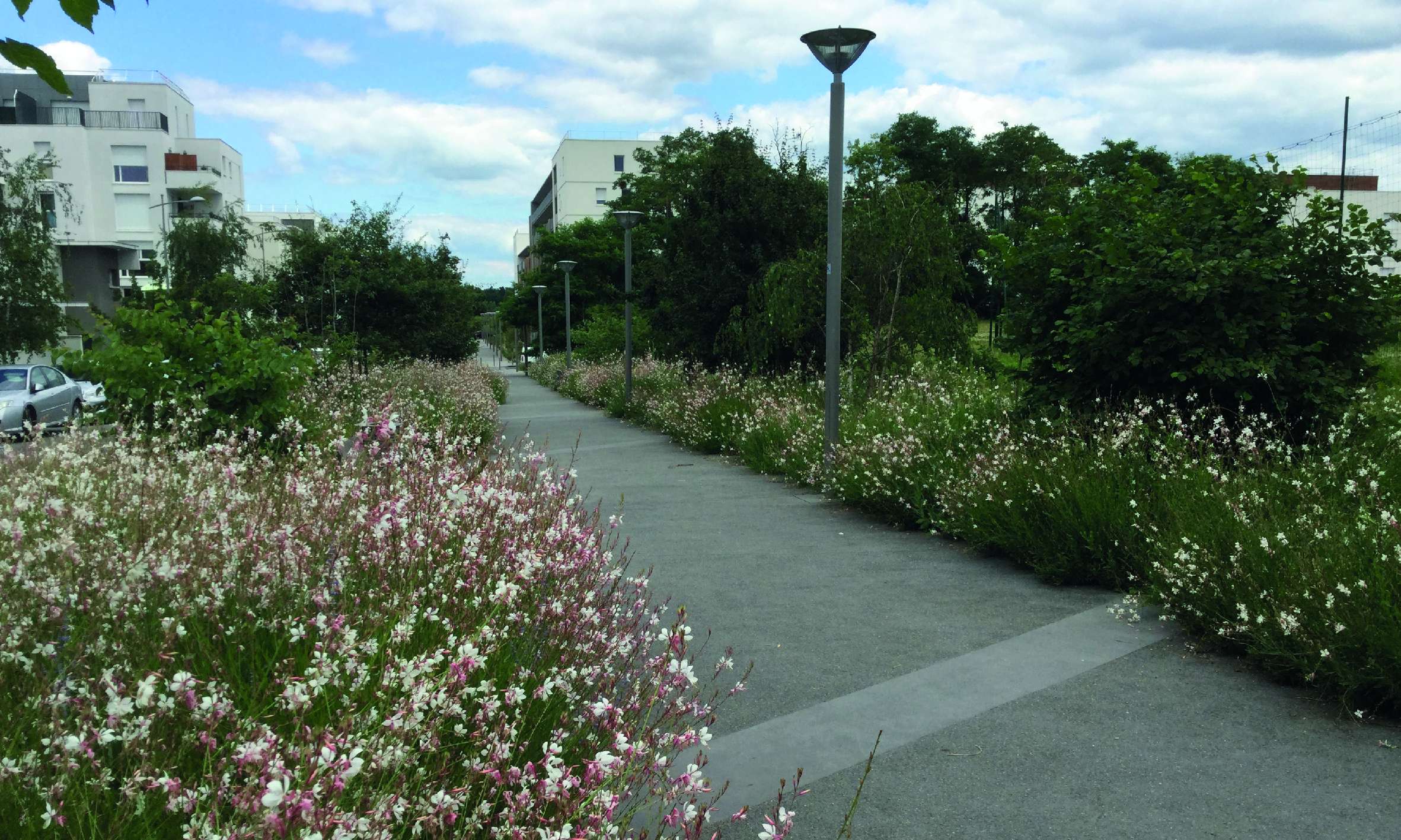
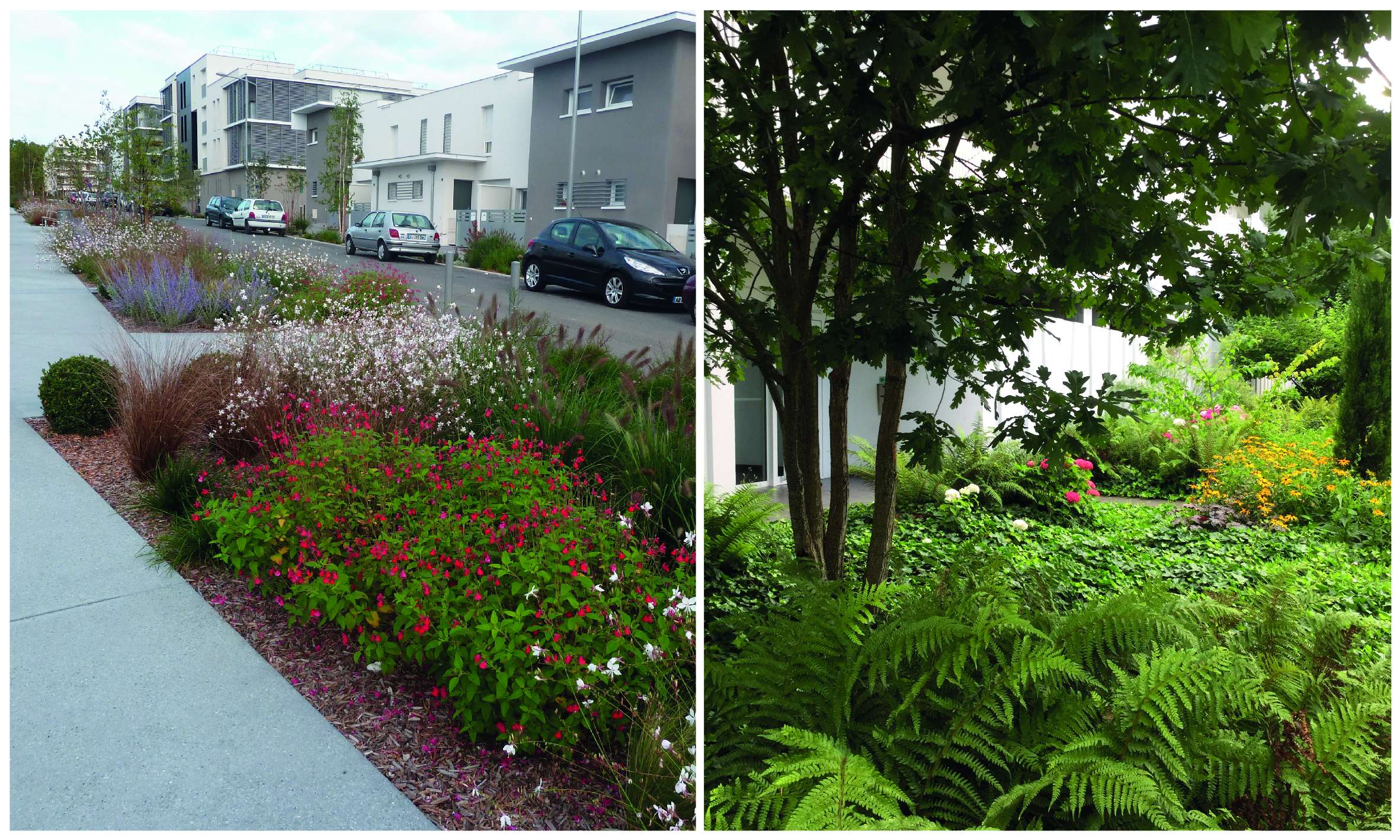
The path of links, Génicart & La Ramade neighborhoods, Lormont (France)
La ruta d'enllaços, barris Génicart & La Ramade, Lormont (França)
La ruta de enlaces, barrios Génicart & La Ramade, Lormont (Francia)
> Background
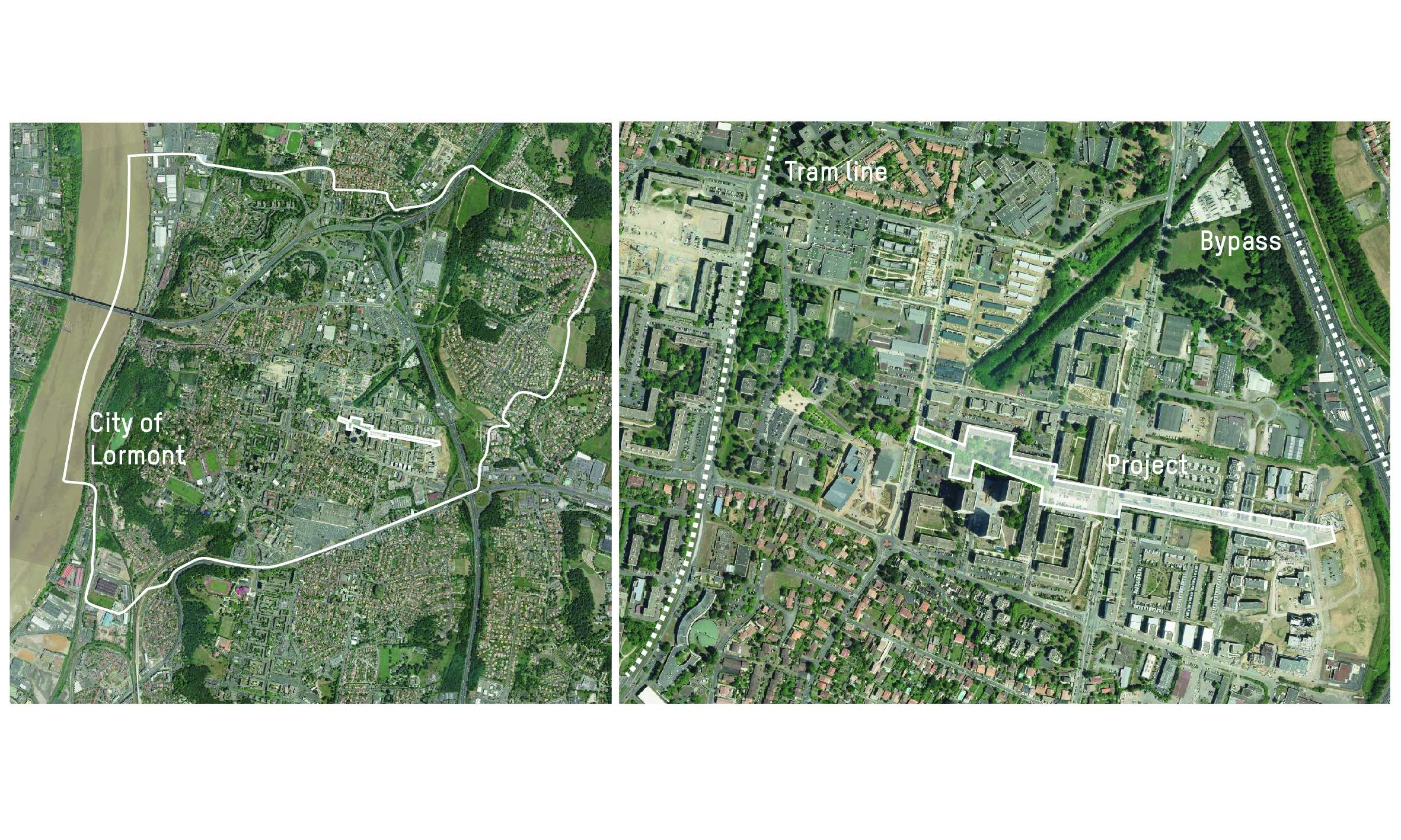
The project site is a social housing neighborhood composed on the west side by the ‘cité Génicart’, built in the 1970s and currently in urban renewal, and on the east side by the new district of “La Ramade”, under construction.
A striking feature of the site was its fragmentation into north-south strips. As Genicart's urban renewal project was at an intermediate stage of progress, former permeable areas had been closed, and some passages were in fact leading to dead ends. In addition, the district of La Ramade was built sector by sector, breaking the continuity of public spaces.
The site includes many open spaces, inheritances of the ‘plan de grand ensemble’, whose main function was most often to balance the built masses. Over time, these spaces became uncertain empty spaces without clear assignment, with few urban uses, cut by fences or overgrown by car parks. ‘Green spaces’ were neither parks, nor really gardens, nor even public spaces. The inhabitants maintained only a distant relationship with them, without any appropriation.
The fragmentation of the site and the lack of clear assignment of open spaces altered the readability of the spaces. In a site where it was difficult to find one's bearing and where spaces were austere, people tended to isolate themselves and to withdraw to their homes, especially the elderly people, women and children. The tram arrived in Lormont in 2008, but the nearest station was not located in direct interaction with the neighborhood.
> Goal
If we must consider the expectations of the inhabitants for very secure spaces, we cannot bring ourselves to build a city where only barriers and gates would stand. On the contrary, the landscape must play a mediating role between a growing need for residential interiority and open public spaces with urban life.
The challenge of the project was to reconquer the public space, to reintroduce unity in a very fragmented area and to bring nature closer to the inhabitants. Introducing nature to the city can arouse everyone's attention and emotion. It is a message to one’s senses, body and an intimate and personal relationship with the place. But our relationship to nature also gives us precise indications for our relationship with the other: it allows us to understand the matter of the interaction between phenomena, cause-and-effect relations and interdependence to, in a certain way, prepare us to welcome social diversity.
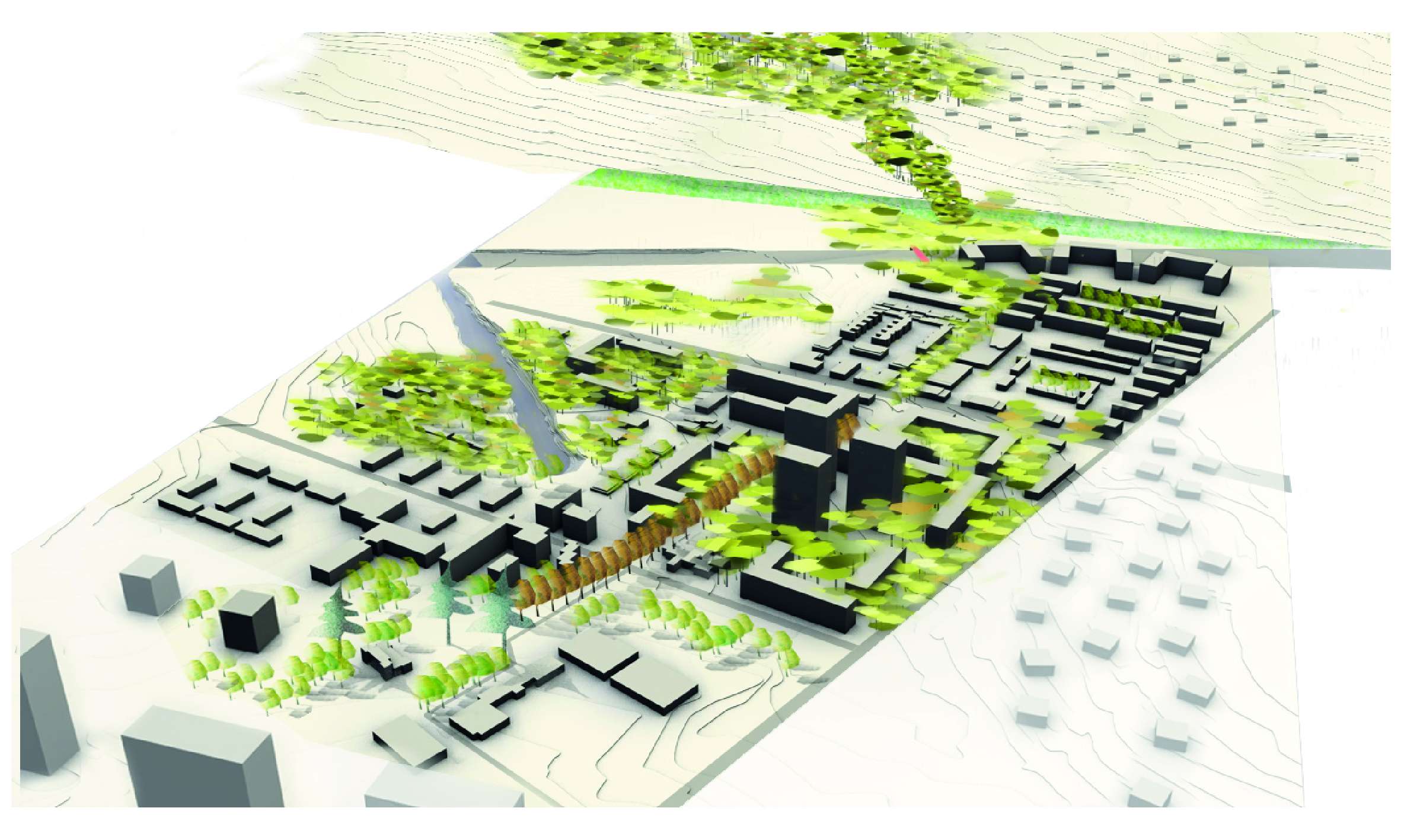
The goal of the project was to create a large green framework, the backbone of the neighborhood, to reweave footpaths between the tramway to the west and the bypass bridge to the east, through the ‘cité Génicart’ and the new district of ‘Ramade’. The idea was less to make ‘coup d’éclat’ effect on some spots and neglecting other spots considered ‘less important’ than to maintain a good quality of the facilities throughout the facades of the ancient and new buildings. We wanted the ‘empty spaces’ not to be based only on an urban structure anymore, but also on urban uses. Our goal was to respond to residents' requests, to anticipate new urban uses and even to encourage others.
> Description
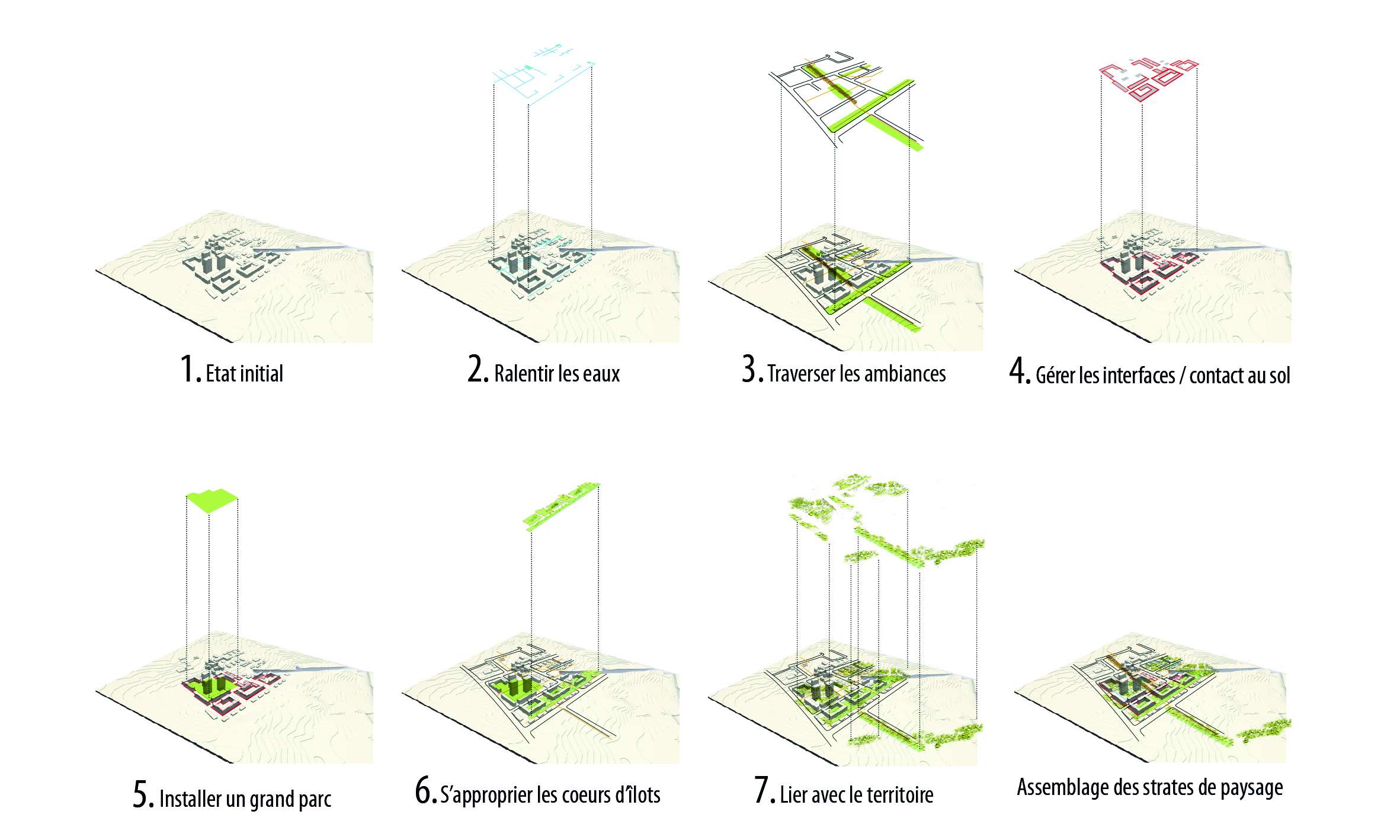
The project was built with 6 approaches: slowing down the waters, crossing atmospheres, managing interfaces and ground contact, installing a ‘Grand Parc’, inhabiting the hearts of the blocks, building a link with the territory.
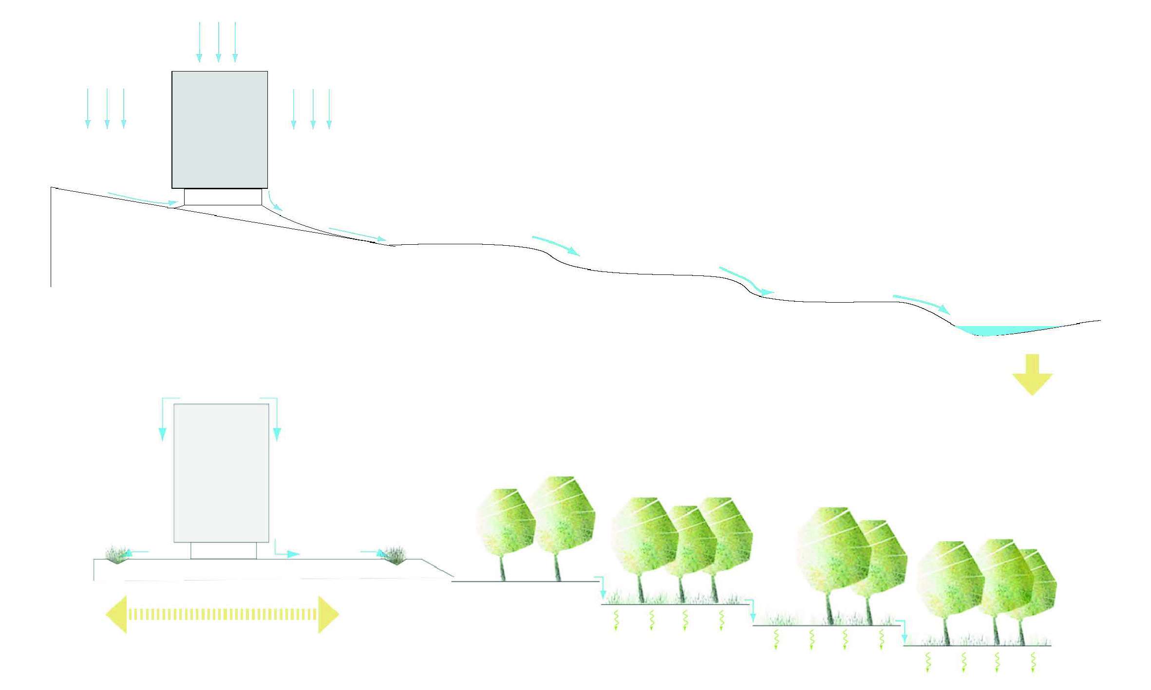
1/ Slowing down the waters. The consequences of low water management were obvious on the site: distorted sidewalk, public spaces dug by the strong runoff... Working on the clipping of water to slow its movement, as shown in the diagrams, has created a certain a logic in the landscape, but has also been a project tool to create and nurture various atmospheres. It was necessary to understand and integrate the water flow continuums, to improve the natural infiltration as much as possible and to build innovative systems for rainwater harvesting. The goal was to reach near-autonomy of the site in terms of water supply for the landscape.
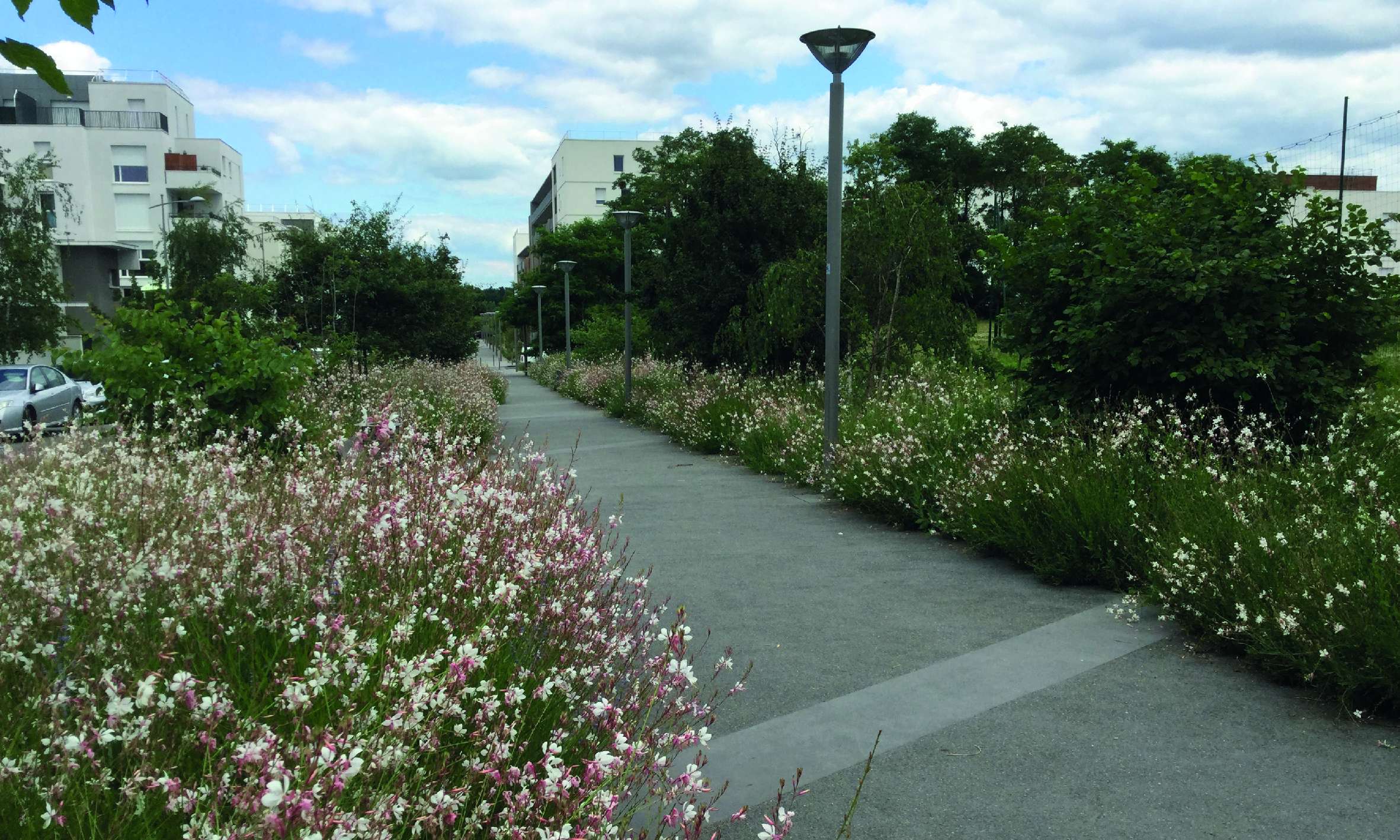
2/ Crossing atmospheres. Between the buildings, between the facilities, between one’s apartment and the school of the children, can be inserted places for meeting and dreaming: terraces, open balconies, gardens, paths that cross landscapes, along woods of oaks and hazel... With this project, we have ‘drawn’ a landscape that contains ‘mini-worlds’ just in front the buildings. Rather than focusing on the symbolism or codification of materials, we have focused on a dominance, to set up a meaningful space. We have recommended uniformity of tones for soil materials to accentuate the strength of the variety of shapes and colors of the plants. The plant palette is directly inspired by the vegetation of the slopes of the ‘Hauts de Garonne’ and create microclimates that can host biodiversity.
3/ Managing interfaces and ground contact. Initially, the public space was only composed by the buildings’ surroundings and the parking lots. The project organized the installation of a layer in front of the buildings. This layer allowed to slow down the waterflow, to host programs (bike shed, urban furniture, gardens...) and to distance and protect the housing cell from the street. Throughout the project site, the levelling work have allowed to unblock a large base for buildings to find a more obvious, generous and comfortable ground contact.
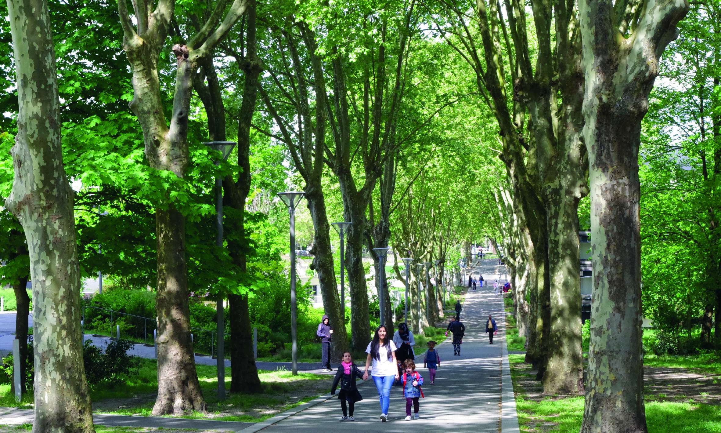
4/ Installing a ‘Grand Parc’. The parks and castles that punctuate the city built its image. Each major equipment is in a park or garden: the town hall, the house of civic life, the ‘Bois Fleuri’ hall, the Leisure Center, the multimedia Library... The project makes part of this logic. It guides the pedestrian path to create a vast park alley, bringing nature at the edge of the buildings and highlighting the historic avenue of plane trees Henri Dunant Street.
5/ Inhabiting the hearts of the blocks. If there must be fences in this neighborhood, it is to protect the gardens and to highlight squares. If there must be hedges, it is to make part of the modern geometric compositions. If there must be ‘green spaces’, it is to create billions of shades of white green to yellow green in the landscape...
6/ Building a link with the territory. The traces left by the landscape make it possible to go over the historical context of the "grands ensembles" and insert the project within the plateau landscape. Lormont has a very rich wooded heritage showing a diversity of environments, reliefs and histories. This parks system can still be read and understood as a continuity that neither the infrastructure nor the modern fabric could completely eliminate.
> Evaluation of the finished work
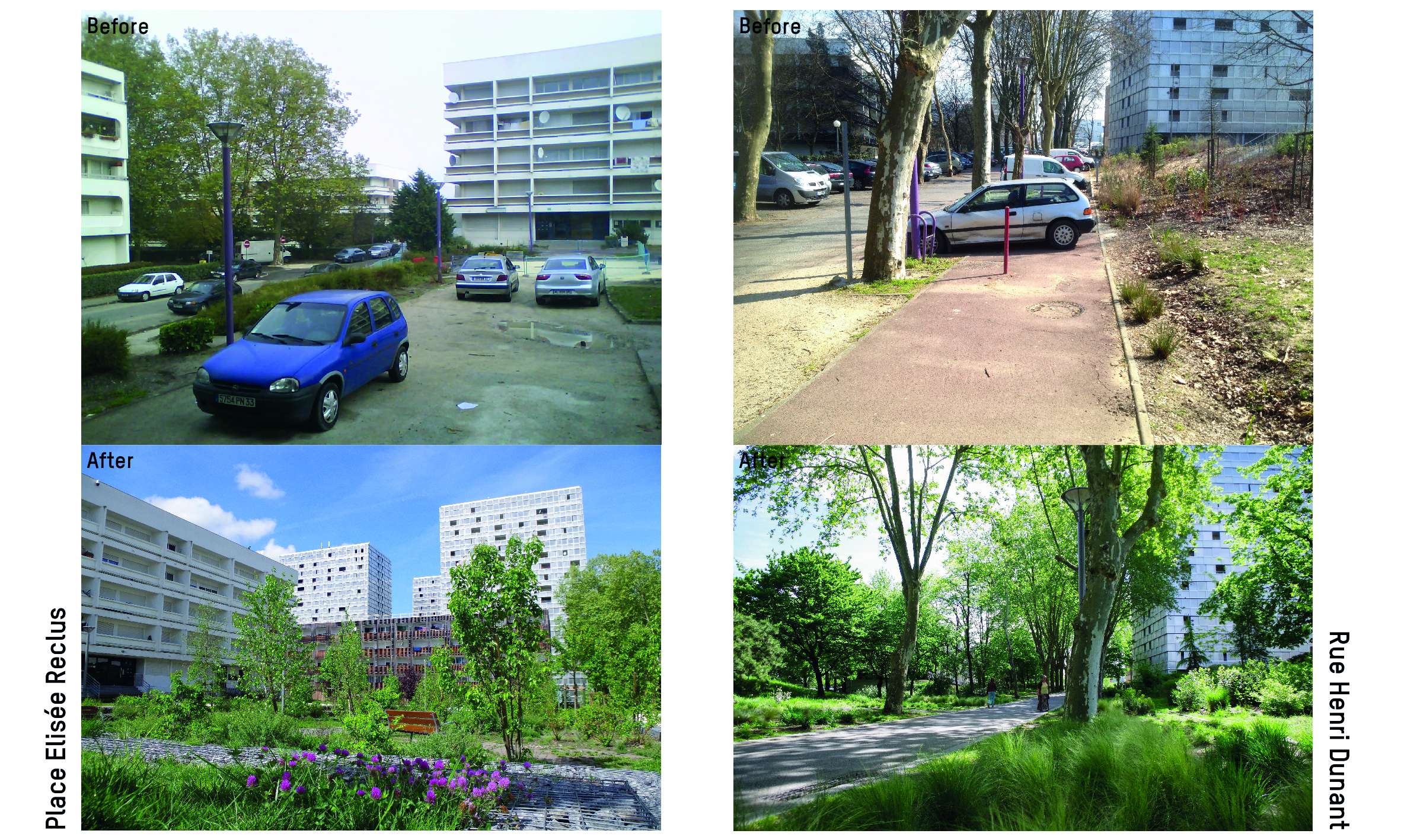
The project has made it possible to go from a completely fragmented site to a site structured by a great path that is now essential for the inhabitants: it's the way to go take the tram, the way to school, the path leading to the parks... This axis really made it possible to open and oxygenate the neighborhood.
Before the intervention, the neighborhood was extremely mineral, the only natural elements being the soil and the few large trees. The project brought nature closer to the inhabitants and brought a fresher and cheerful atmosphere. This allowed a real social regeneration. Women, children and the elderly people, who were not used to go out a lot, now animate the streets and squares.
Regarding the public space, it was almost non-existent before the project, only composed by the direct surroundings of the buildings and the parking lots. The project has made it possible to prioritize spaces: surroundings of buildings, residential alleys, paths, gardens and squares. Parking lots has been redistributed. The public space now creates a great porosity throughout the neighborhood.
Although the project is recent, the change of uses in the site is already obvious. With time, the affection of the inhabitants for their district will be able to grow more.
