ADECUACIÓN PAISAJISTICA EN LA CORNISA Y LADERAS DEL CONQUERO
ADEQUACIÓ PAISATGÍSTICA A LA CORNISA I LLADERES DEL CONQUERO
LANDSCAPE ADAPTATION ON THE CORNICE AND SLOPES OF EL CONQUERO
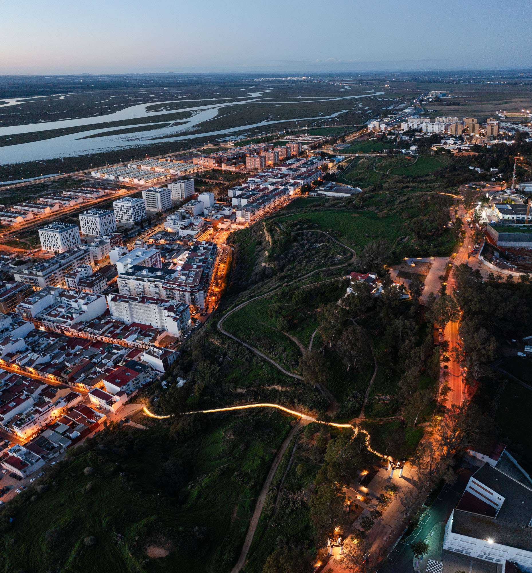
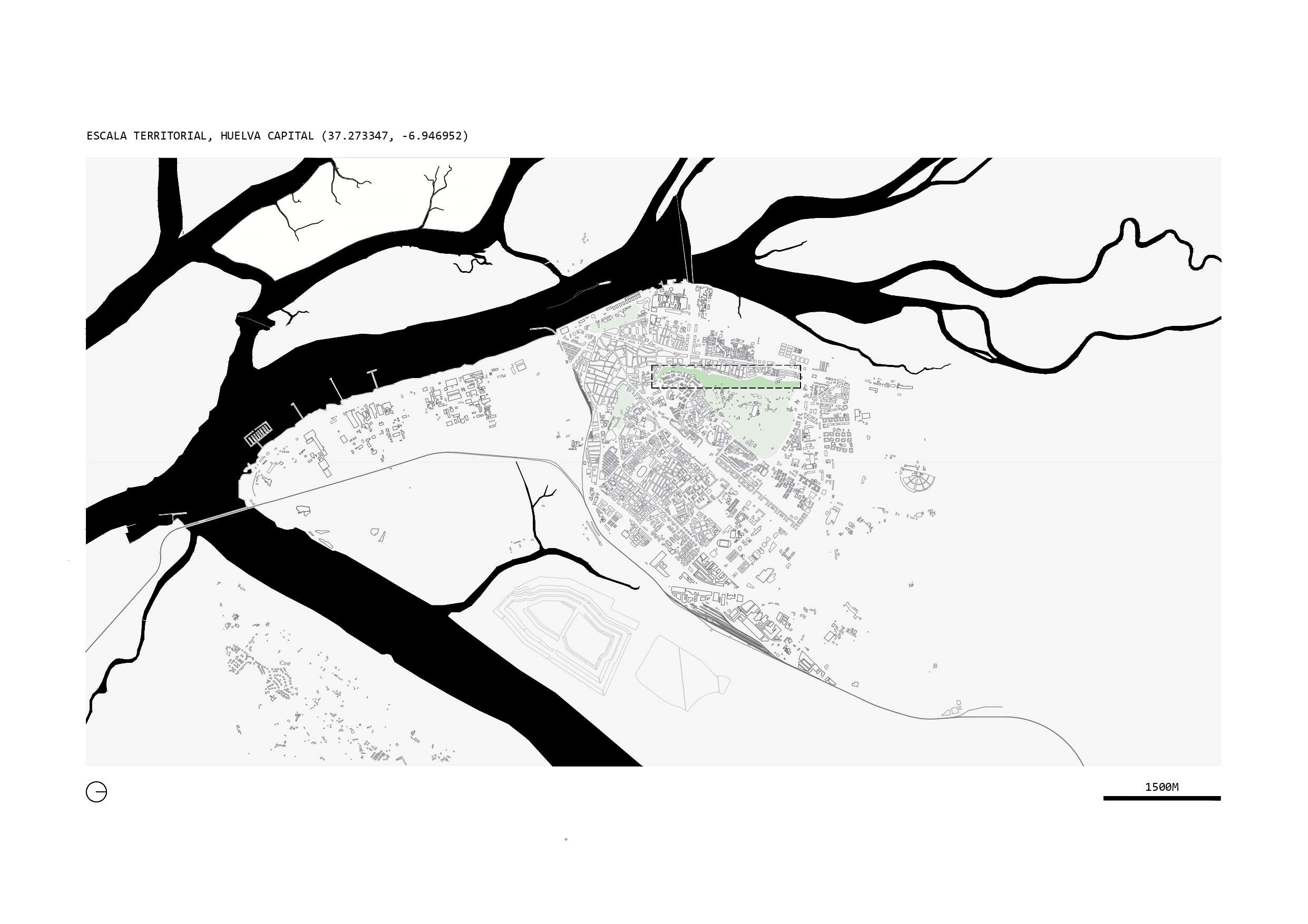
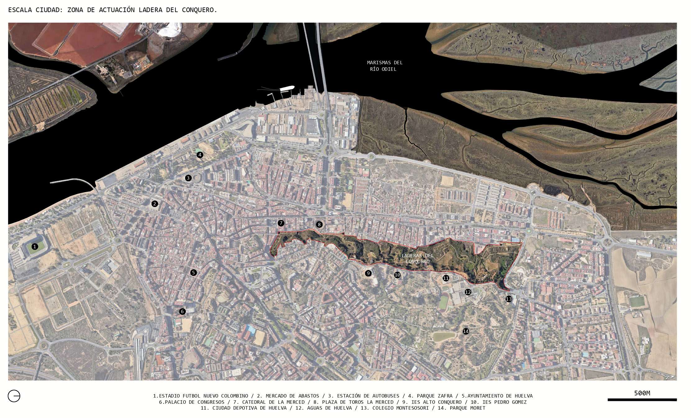
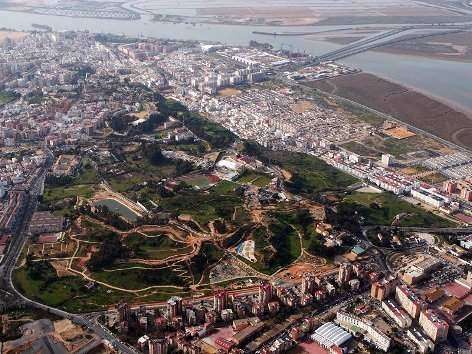
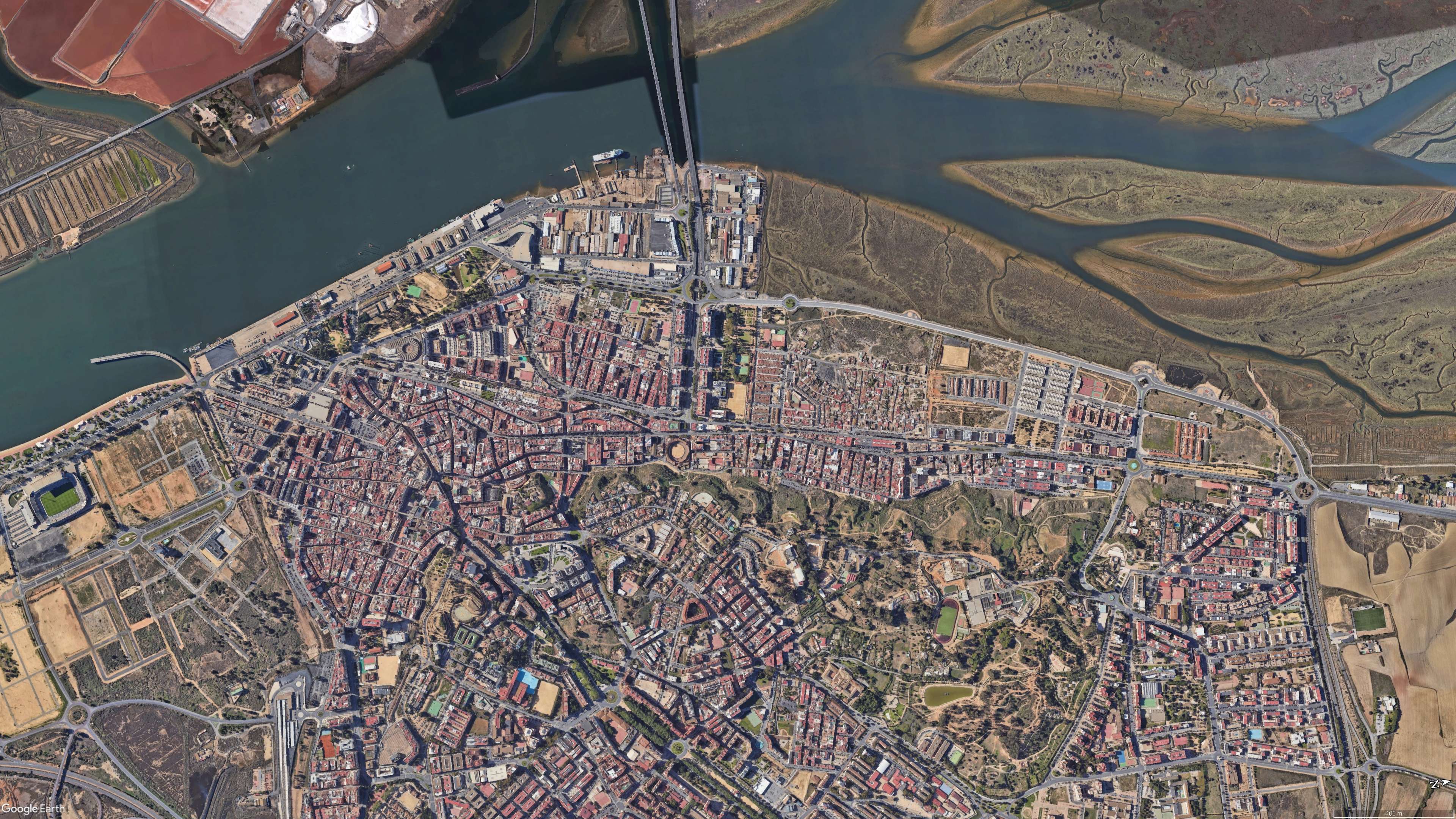
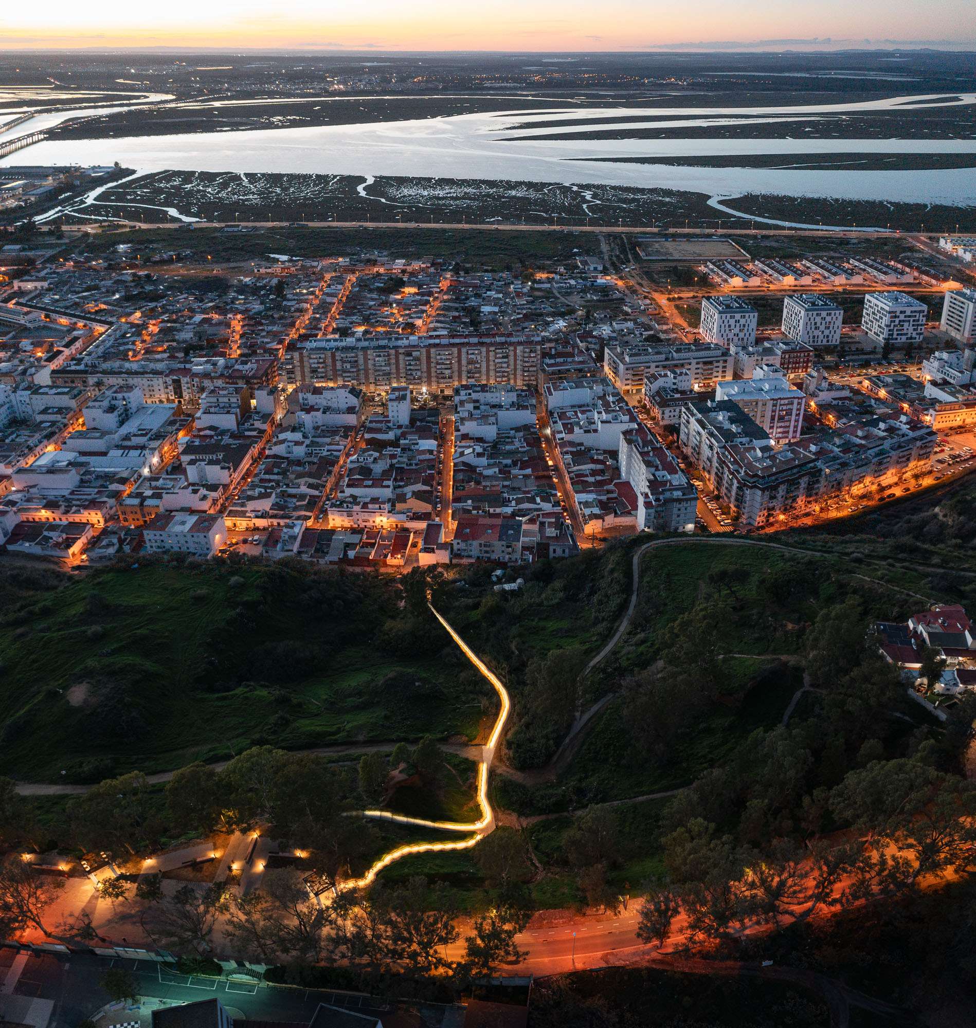
The city of Huelva stretches along the estuary formed by the rivers Tinto and Odiel, embracing and colonising the so-called cabezos, a system of characteristic earth formations that reach a height of 68 m. at El Conquero, the highest point of the town, and which conserve valuable vestiges of primitive settlements, such as the Roman underground aqueduct that runs along the slopes of El Conquero.
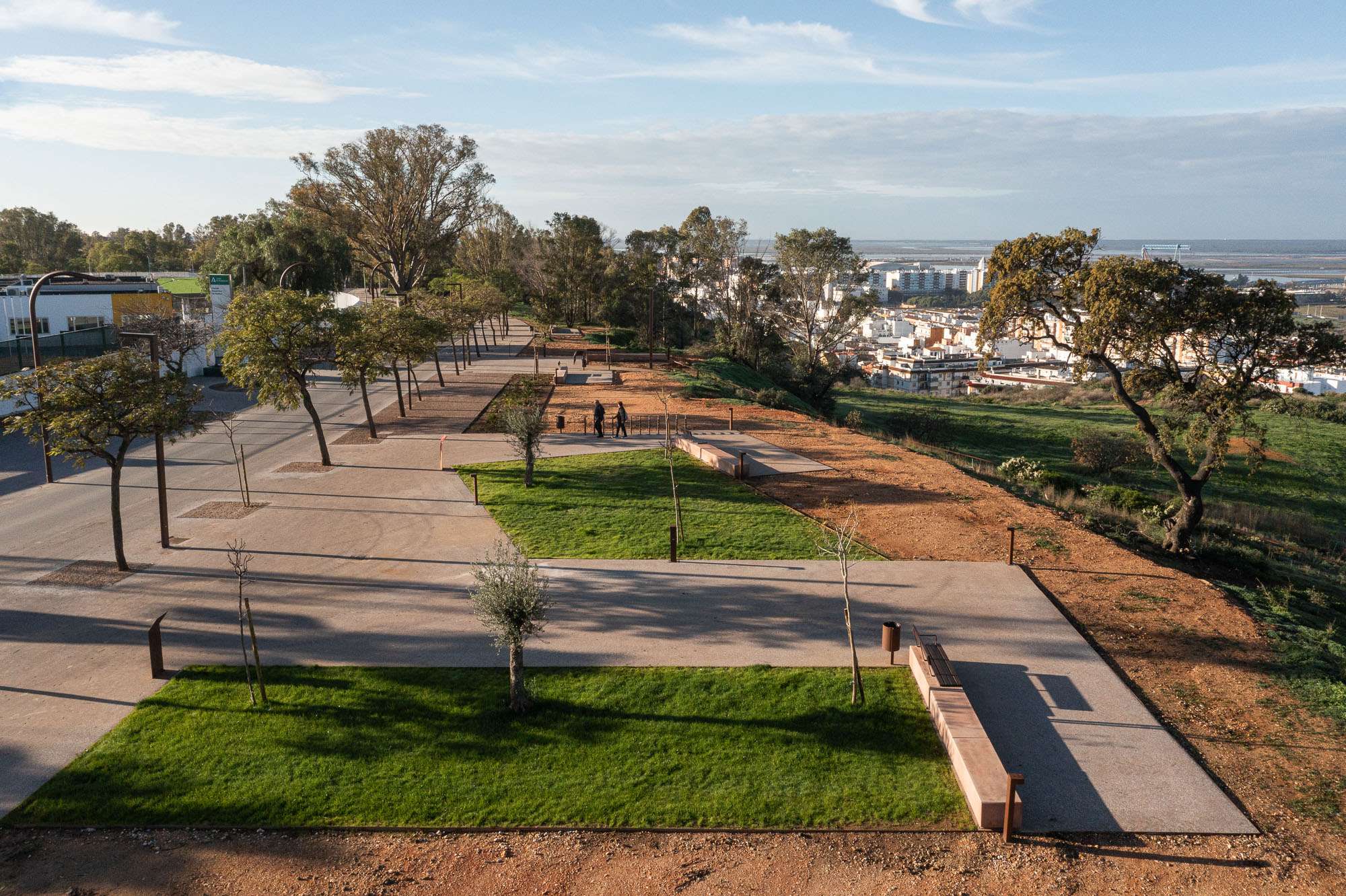
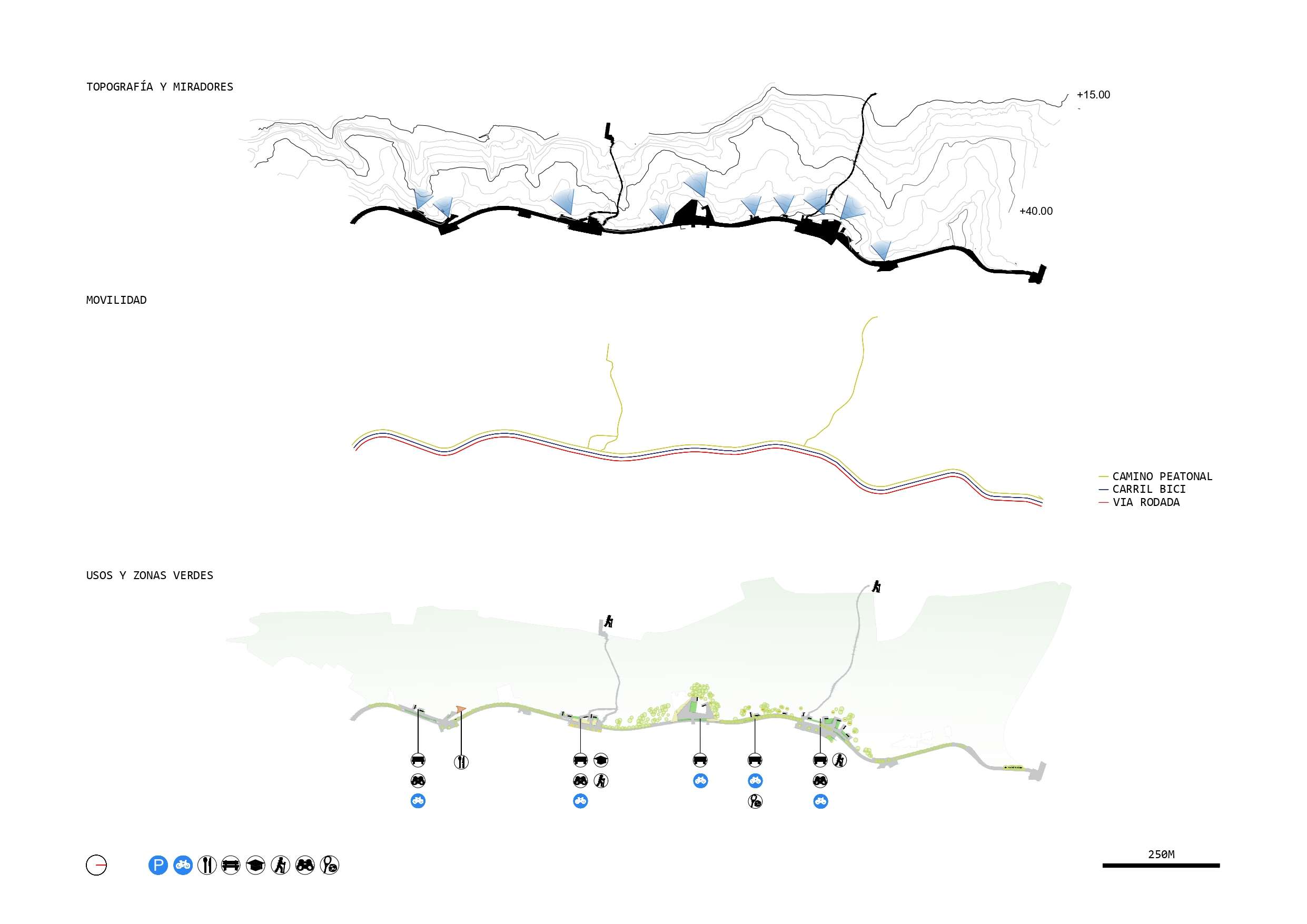
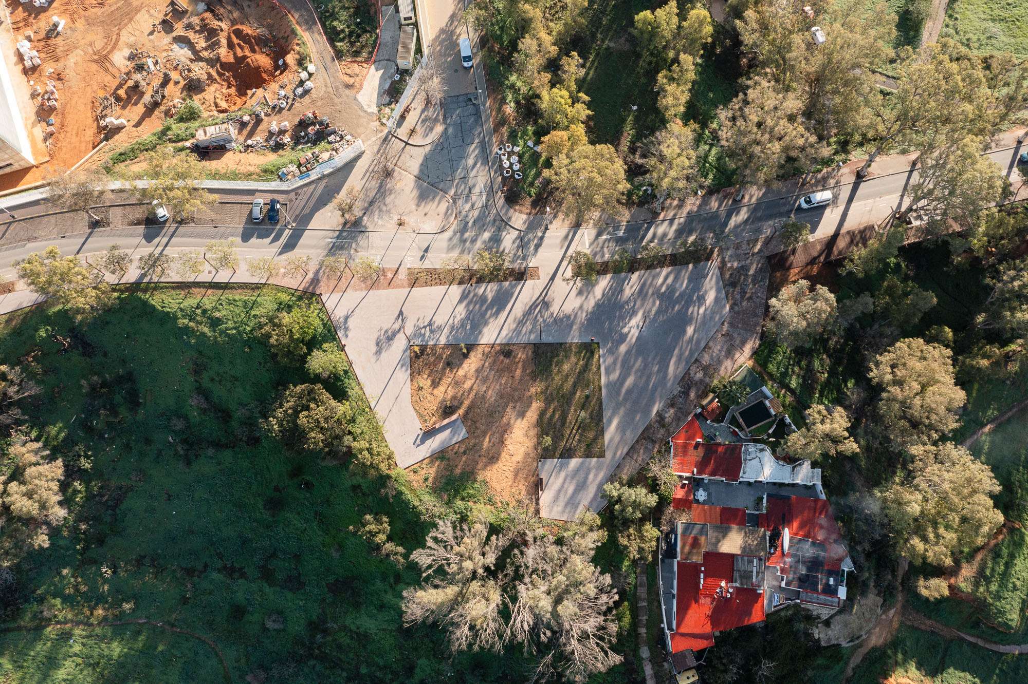
The action - the first phase of a more ambitious plan - aims to enhance the value of an existing corniche promenade, forgotten for decades, now in disarray and colonised by private vehicles. To this end, the first operation consists of converting Avenida Manuel Siurot into a Parkway that allows the whole of Laderas del Conquero, Parque Moret and Santuario de la Cinta to be understood as a single landscape unit, eliminating one of the lanes and giving the space obtained to pedestrians and cyclists.
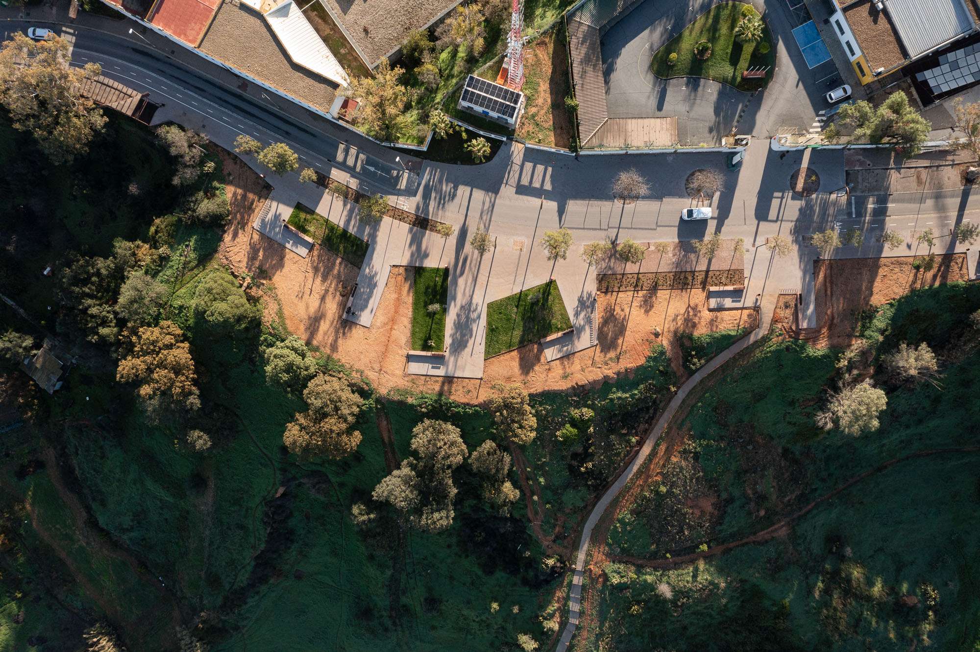
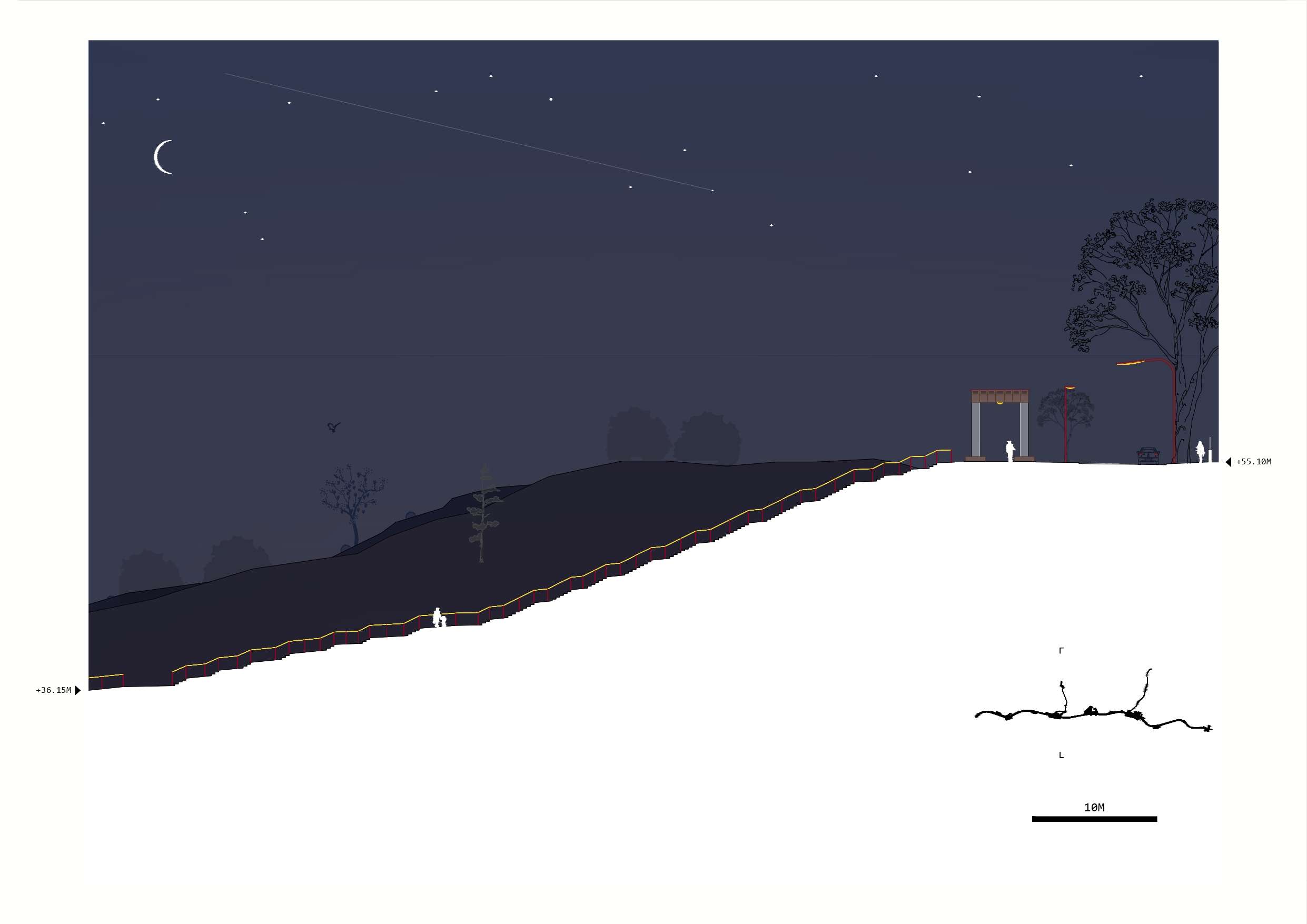
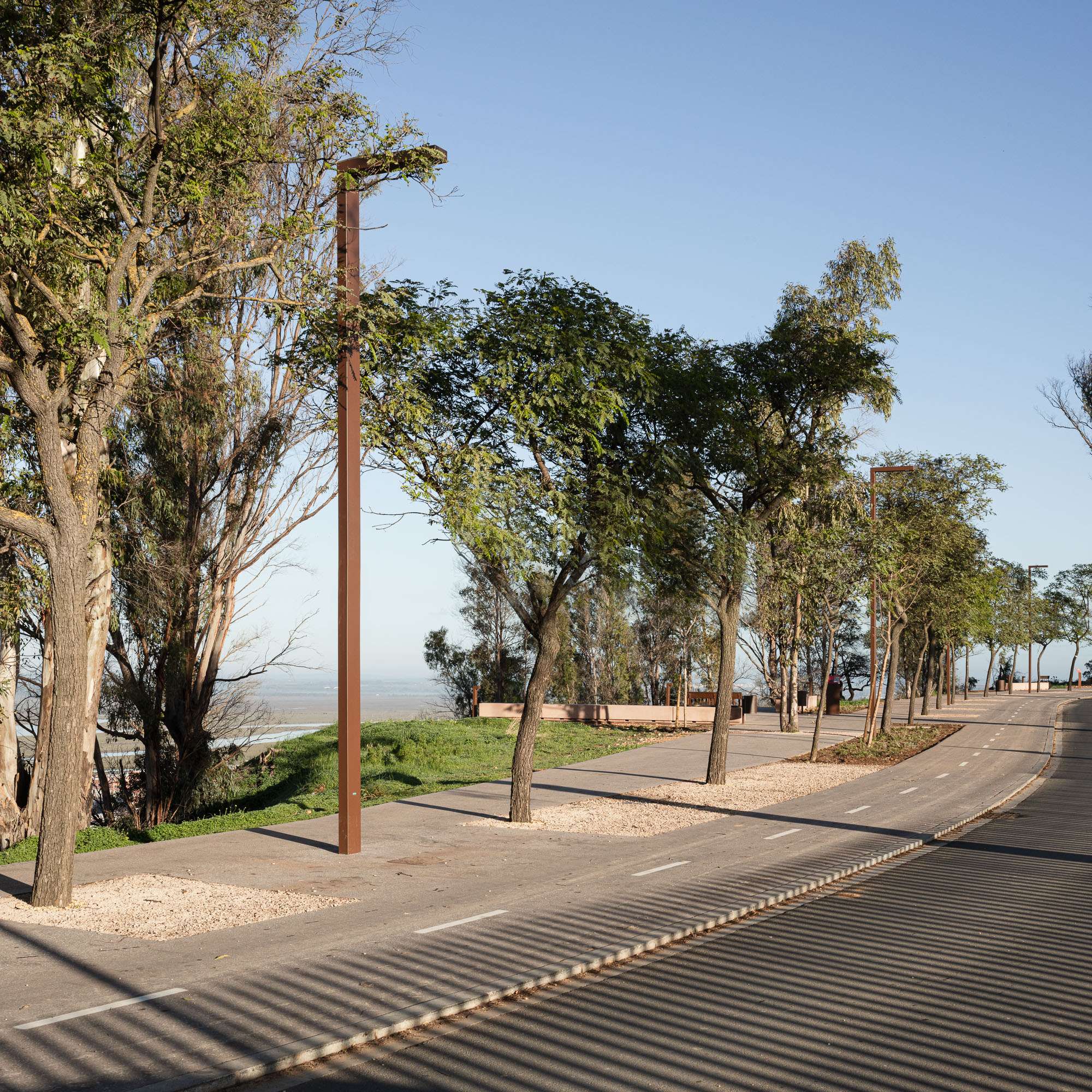
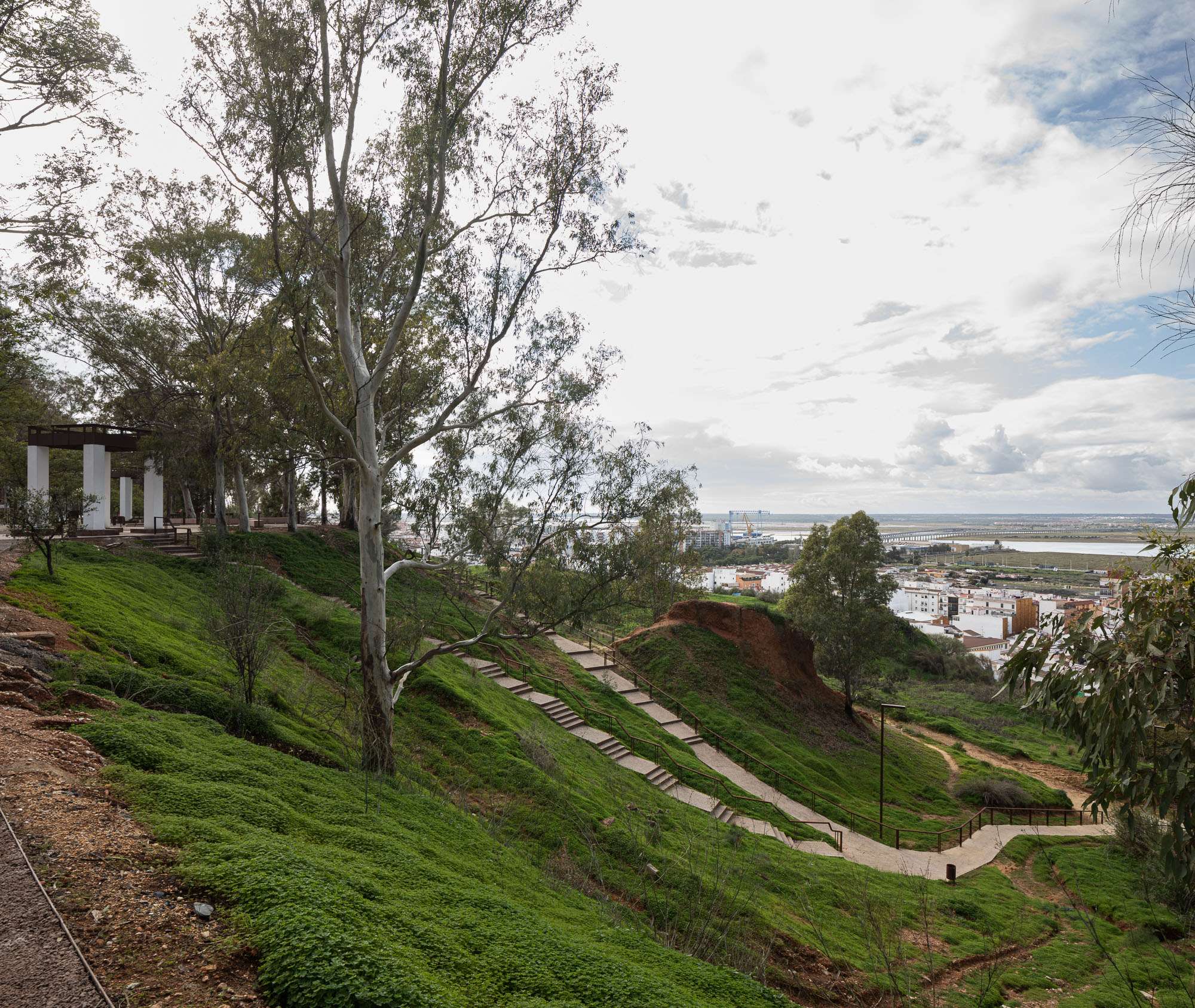
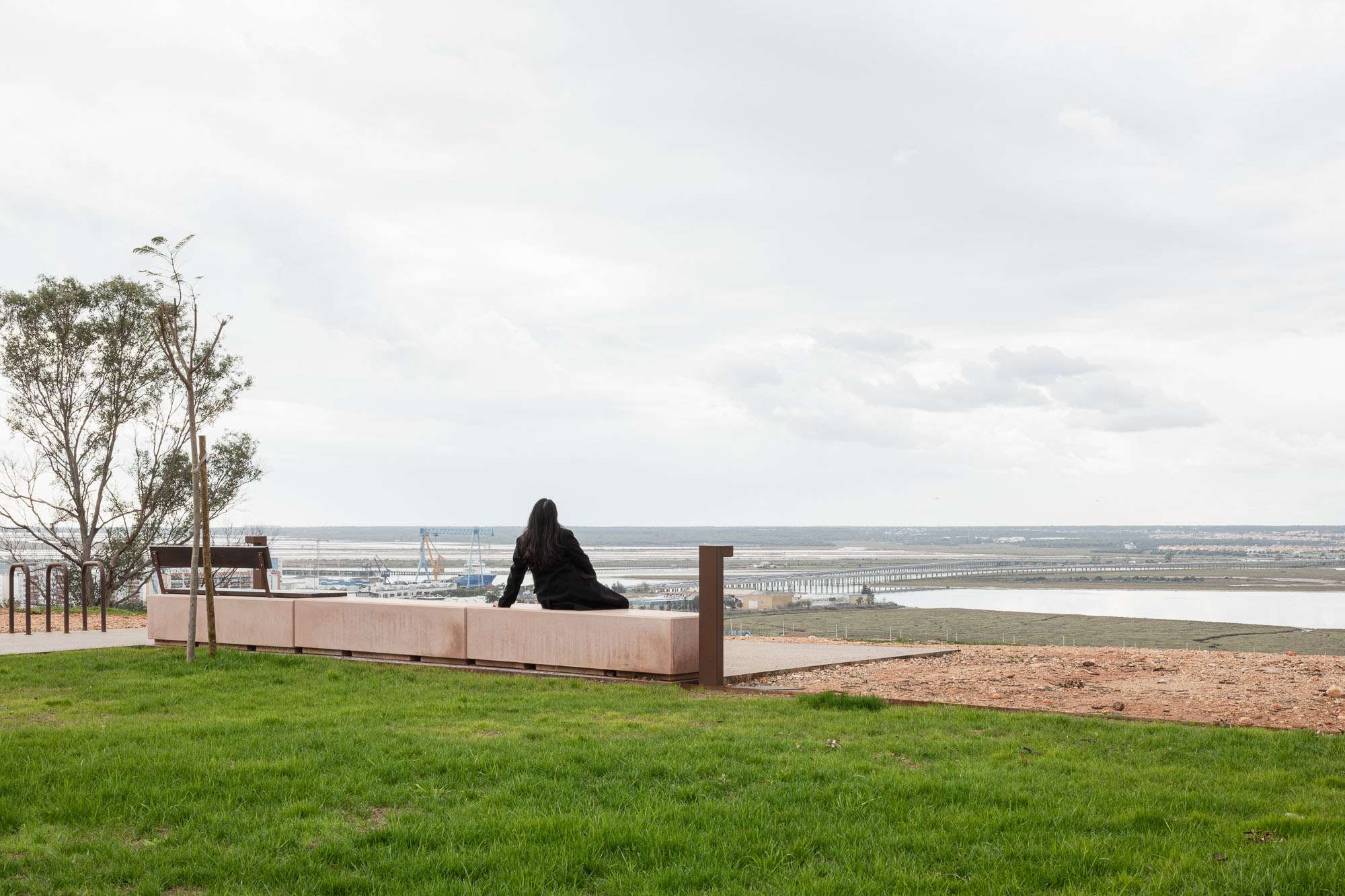
Over a length of more than one kilometre, the work is mainly on the west side of the avenue, free of buildings and endowed with exceptional views, where paths, viewpoints, rest areas, flowerbeds and gardens are planned. A series of unique platforms, strategically located along the route, connect with the east side, where sports, educational and welfare facilities are mainly concentrated.
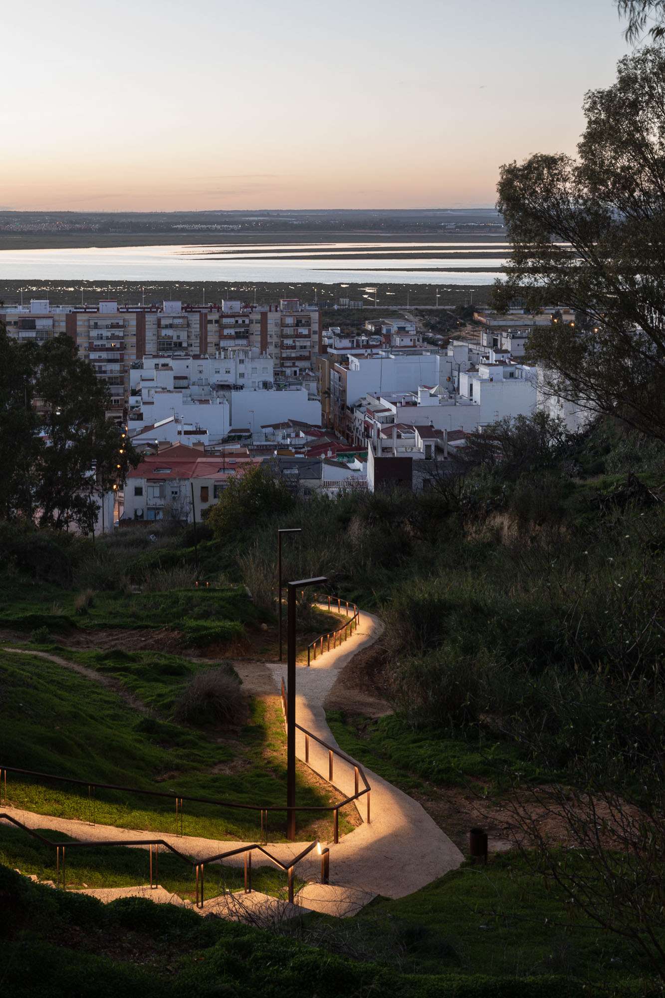
The improvement of the hillside is completed with the improvement of two of the transversal paths that connect the lower and upper areas of the city, which are paved and provided with street furniture and lighting, thus contributing to urban cohesion. And, through advanced archaeological research techniques, it has been possible to discover the route of an important section of the aqueduct.
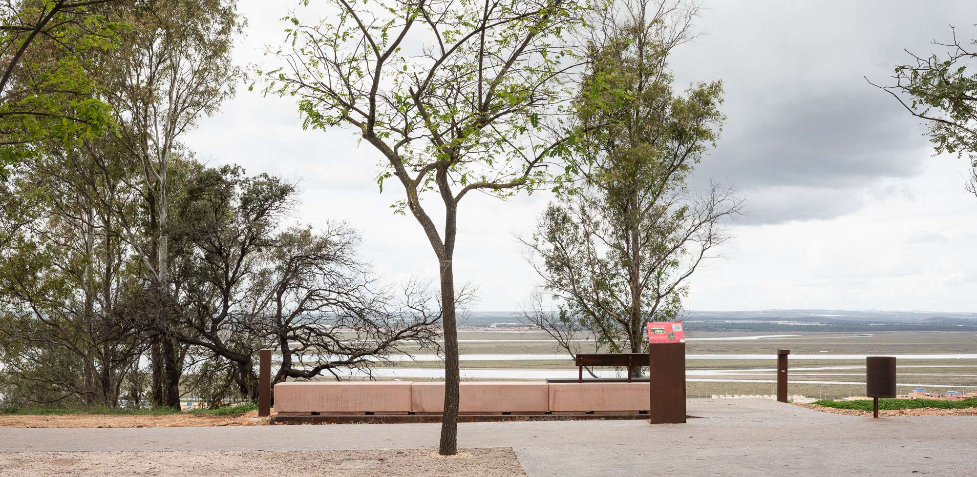
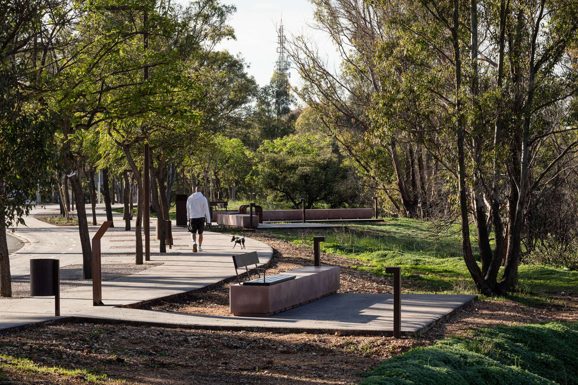
As for the materials and colours used in the paving and furniture, the main objective has been to match the ochre and reddish tones of the Cabezos. Thus, lampposts, bollards, benches, litter bins and bicycle racks acquire a reddish tone, in the same line as the aggregates used in the bituminous mixtures of the most usual pavements, which are completed with deactivated or draining concretes.
The tone of the intervention aims to provide citizens with a place for walking and archaeological information, sport or contemplation of the marvellous landscape of the Odiel Marshes - Biosphere Reserve - which extends to the west. And to achieve this, it does not seek to impose itself on the park, but only to organise, improve, extend and green the new spaces provided for pedestrians and sportspeople, at the expense of motorised traffic and uncontrolled occupation.
This is not a purely urban park, but rather a peri-urban ledge, a piece of domesticated nature. Rather than softening, the intervention aims to bring this part of nature closer to the citizen, to enable its use and enjoyment, something transcendental in a society and a climate such as the one we live in, where leisure, sport and contact with nature are now an indissoluble part of daily life.
The SDGs addressed by this project are:
Goal 3: Healthy Living and Well-being: The action allows outdoor exercise in nature in the middle of a city of 150,000 inhabitants, as well as walking and cycling along 1700m.
Goal 13: Climate change: The elimination of a traffic lane in the area helps enormously to reduce CO2 emissions into the atmosphere, in addition to the reduction of the speed in the only lane that is still operational to 30 km/h. The planting of new plant species also helps to mitigate climate change. Finally, the replacement of all lighting in the area with state-of-the-art LED luminaires helps to reduce emissions into the atmosphere. With these 3 actions, it is calculated that 640 Tons of CO2 / year are eliminated (14.64 (Lighting) + 623.33 (Traffic) + 1.50 (vegetation).