

Area development Ooijen-Wanssum
Flood protection, nature, quality of life and economy all in one plan
Desarrollo del área Ooijen-Wanssum
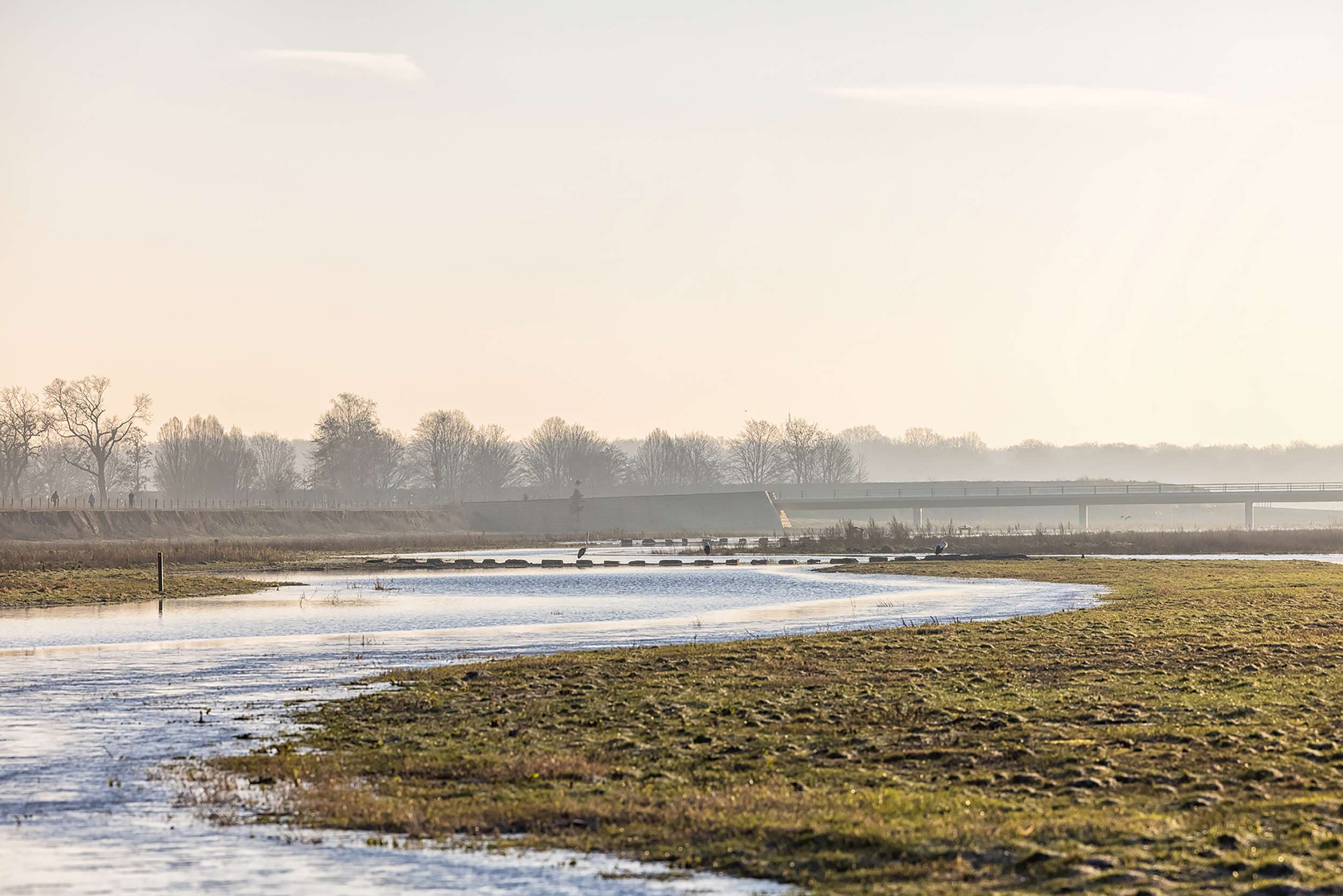
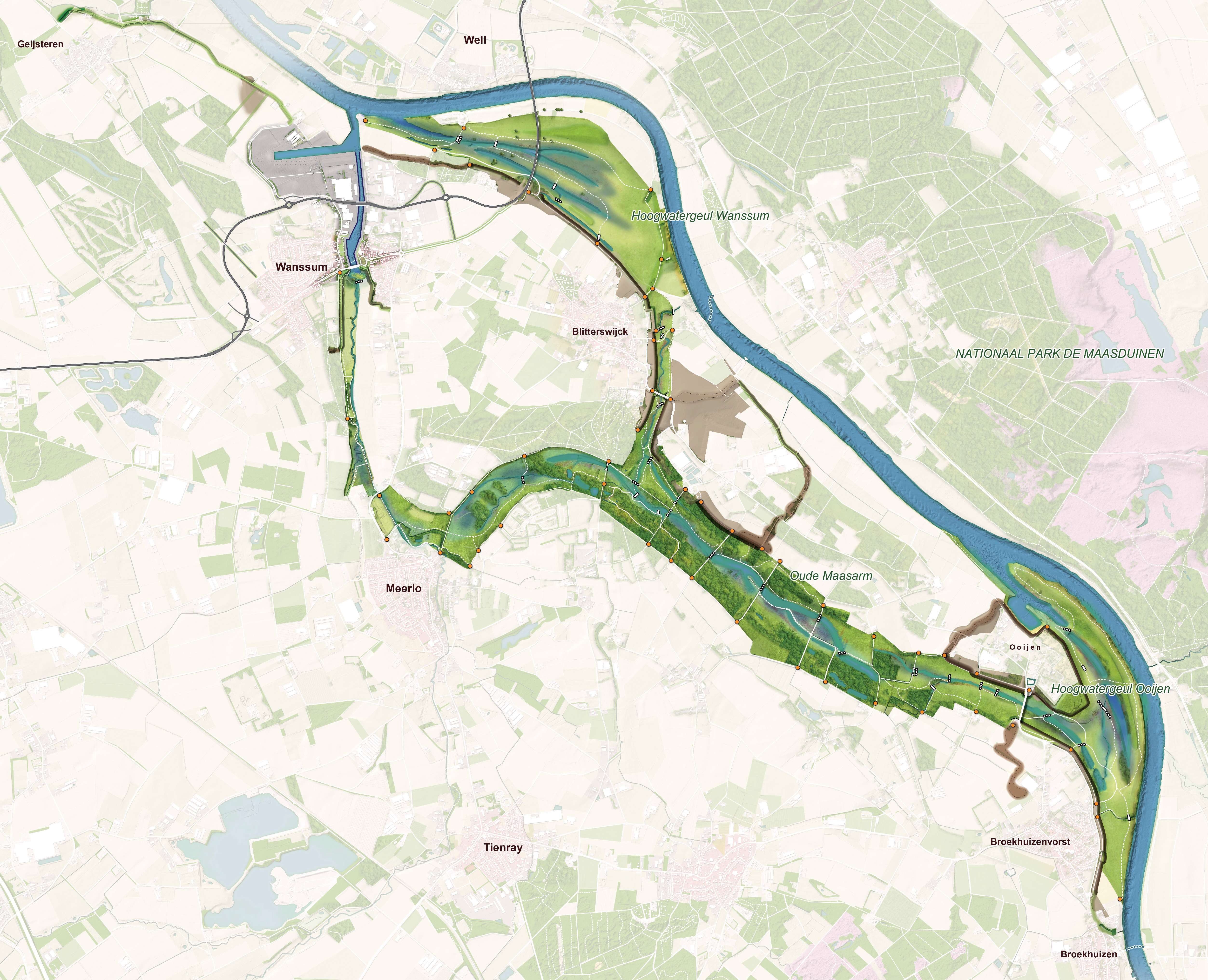
In 1993 and 1995 the area was startled by two major floods of the Meuse. Temporary measures were taken, but in the long term these are not sufficient. With this project, the area is better protected against high water by a combination of dike construction (20km) and river widening (lowering of the floodplain and reactivating an old river arm, the ‘Oude Maasarm’. More than 300 hectares of freely accessible nature is realized and the quality of life in the town of Wanssum is increased by the construction of a new ring road and redesign of the center.
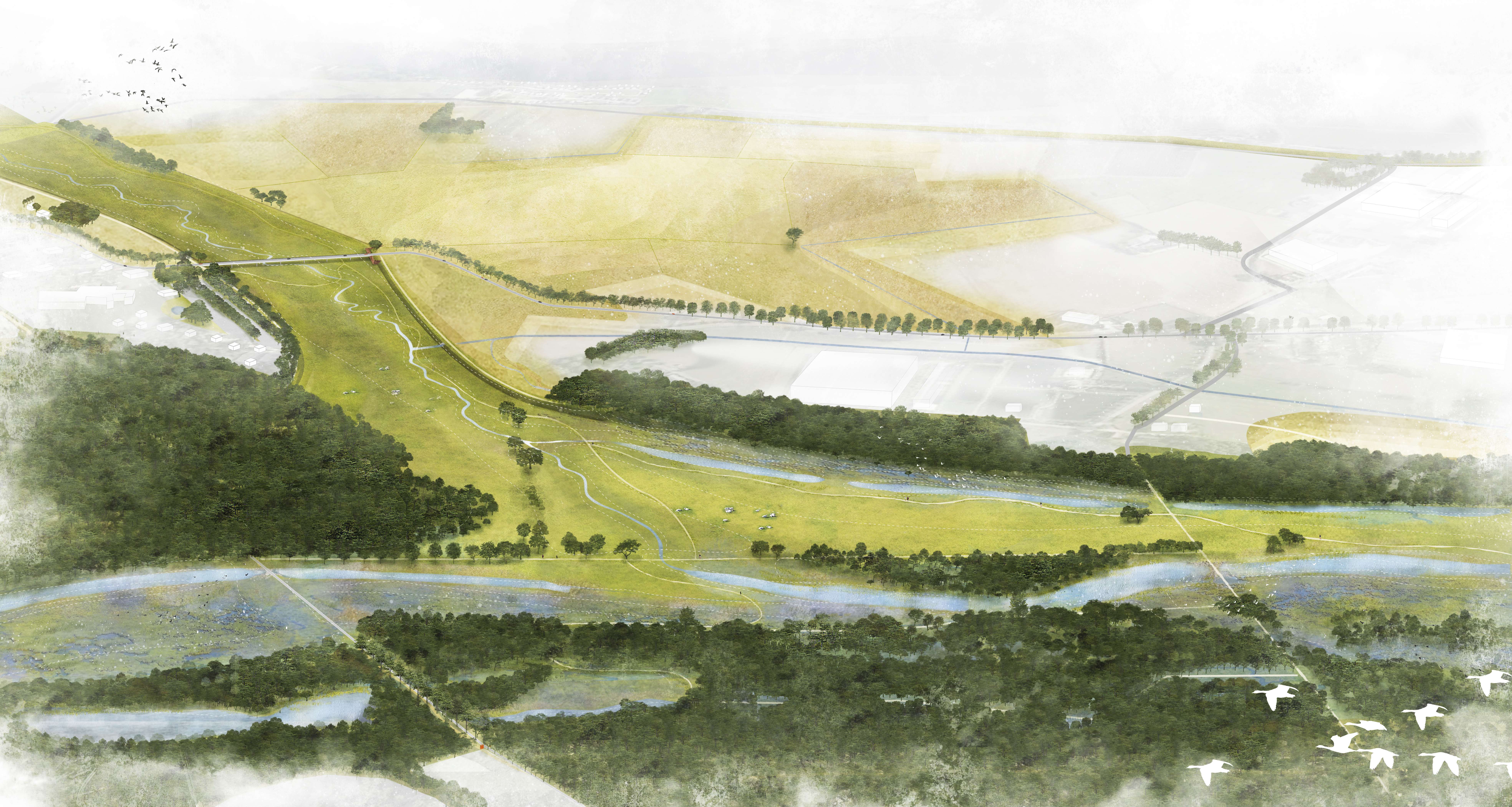
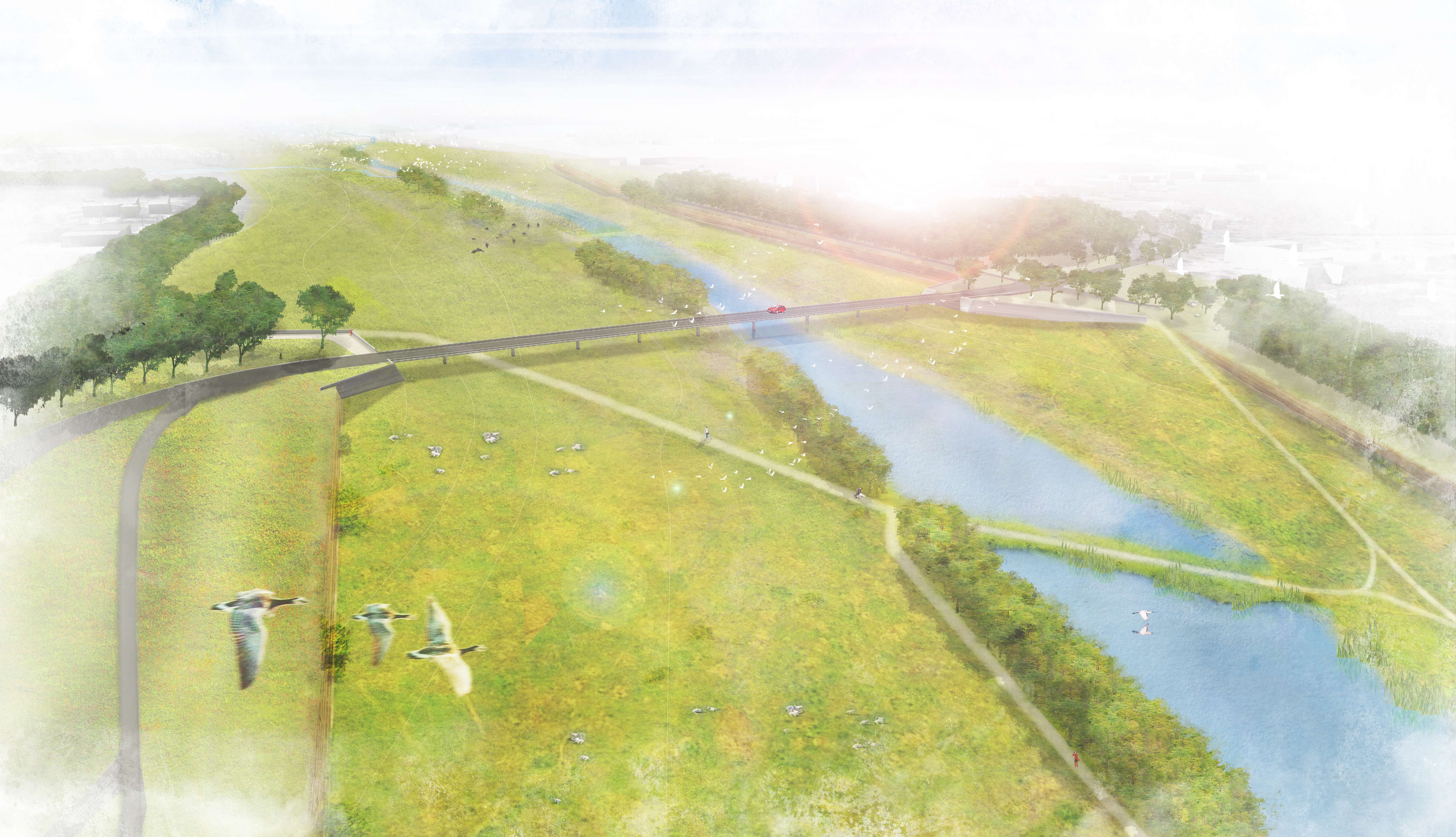
What is special about the project is the integrality of the plan, the close cooperation between all parties involved and the high degree of attention to spatial quality and innovations. Most striking and priceworthy part is a new and unique approach to the dike reinforcement task. With the dike design a solution has been devised for water safety without affecting the traditional terraced landscape of the Meuse, that until the construction of the emergency dikes in 1996 never included dikes. The new dikes have a smaller net space requirement, more usage possibilities including arable farming and reforestation and a smaller management burden for the Water Board. To this result two new dike types were developed:
The steep-edge dike has an a-symmetrical profile and is implemented at the transition from the upper middle terrace to the lower terrace, on the border of the new nature reserve. In the steep edge with a 2:1 slope, natural erosion processes are allowed resulting in high ecological value. At the inside of the dike a slight slope is constructed on which the current land use can be continued.
The high ground dike is an invisible dike, completely merging into the landscape. Due to it’s robust and future-proof profile, the high ground dike does not have to be maintained as a flood defense by the water board and there are no obstacles to its use.
The dikes are made with local soil that is released during the lowering of the floodplains. This makes it possible to achieve a virtually closed ground balance. Deep sand extraction with its negative environmental impact is avoided as well as large (CO2) emissions and costs of the removal of millions of m3 of soil from the floodplains and the supply of dike clay. In order to realize this innovation, we worked very closely with the water board and tested the dikes in a hydrodynamic laboratory in Hamburg.
Program: new dikes, nature development, water management, water safety, ring road, bridges, gully construction, park entrances.