


Bungarribee Park
Bungarribee Park
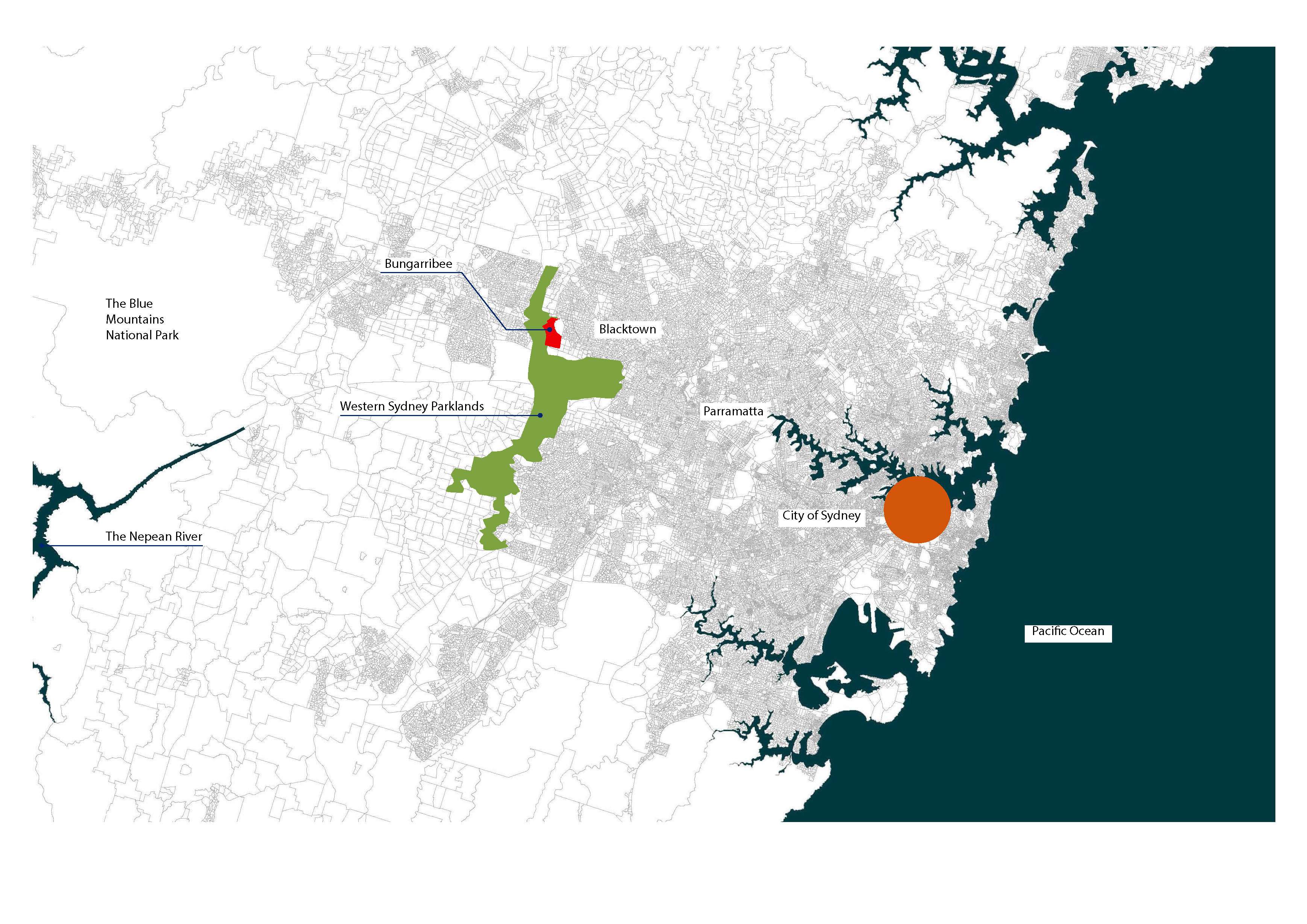
The new 240-hectare Bungarribee Park in Western Sydney is located 40km west of the City of Sydney in a changing landscape. Once the country of the Dharug people, who lived there for millennia before their forced removal by invading British settlers, it is today a landscape of freeways, factories, large warehousing and new residential suburbs interspersed with remnant bushland and fragmented pastoral lands.
In this utilitarian and urbanised periphery, Bungarribee Park claims a space for care and appreciation of this landscape threatened by urban expansion. The Park protects its environment, systems and habitats, engages with its built context and provides various recreational opportunities and amenity for its visitors whilst distilling an identity for this hitherto neglected western portion of Greater Sydney.
The move westward from the City of Sydney and its harbour has been slow and somewhat sporadic. Initially led by the pastoralist in search of fertile grazing lands, it was followed by industry and affordable housing. Westward, inland and away from the iconography that defines Sydney (the beach, the harbour, the Opera House), laid an altogether different landscape of rolling clay plains, grassland and open woodland with a network of meandering creeks and rivers - a freshwater landscape.
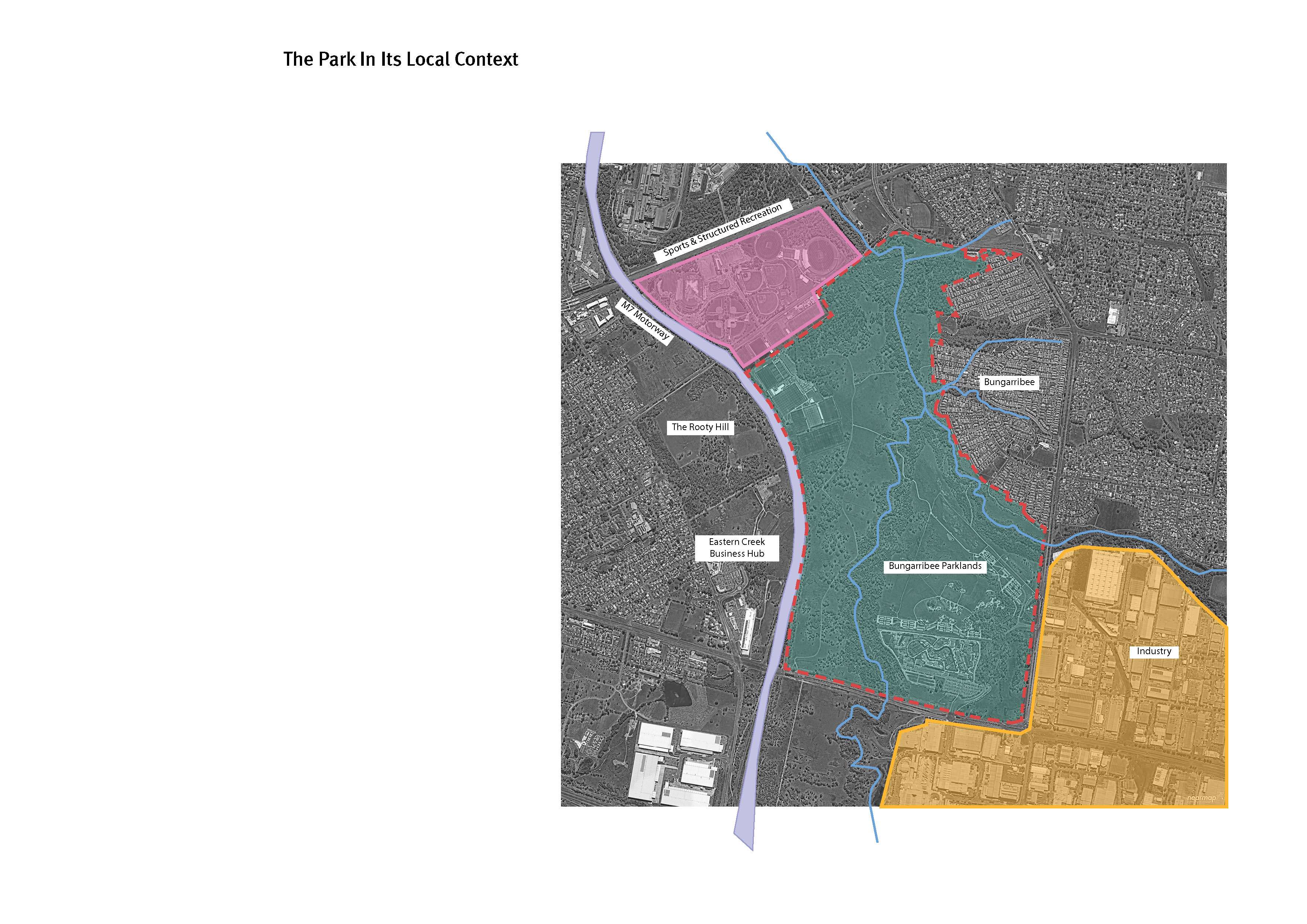
Population growth of the late 20th and early 21st century accelerated a demographic shift towards the west, however Greater Sydney’s perception of itself remained tied to the east. With the dynamic shift westward, the multicultural influx and formation of communities in the Western Sydney landscape a transition began to occur and a self-awareness about an identity independent of the harbour started to emerge. The move toward a strong Western Sydney identity is gaining speed and is abetted by a number of substantial developments, among them the creation of a 5,000-hectare Western Sydney Parklands that inserts a 27-kilometre-long band of parkland through the western portion of Greater Sydney. Bungarribee Park sits within the greater Parklands and is the first major park to be designed.
Since 2013, JMD design have been working with the Western Sydney Parklands Trust (WSPT) on the Bungarribee Park Master Plan and subsequent design phases. Bungarribee Parkland is a key attraction within the greater Western Sydney Parklands, which averages approximately 5 million visits per year.
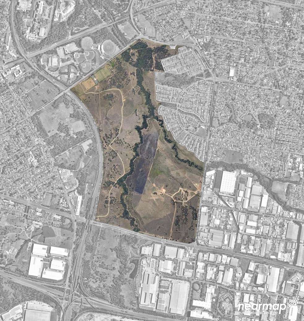
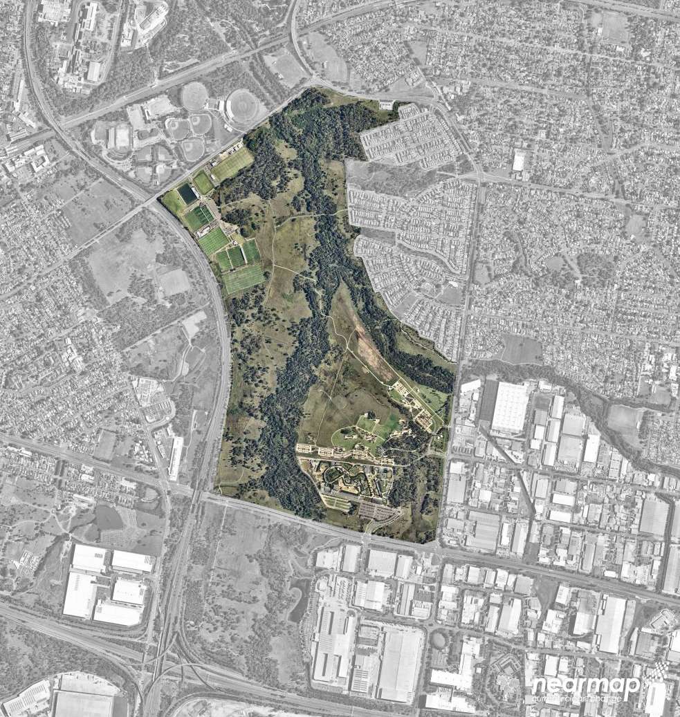
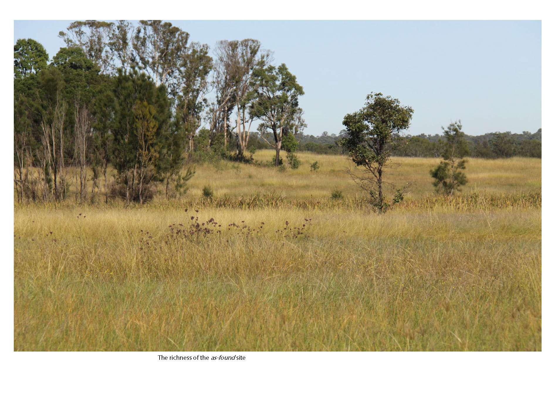
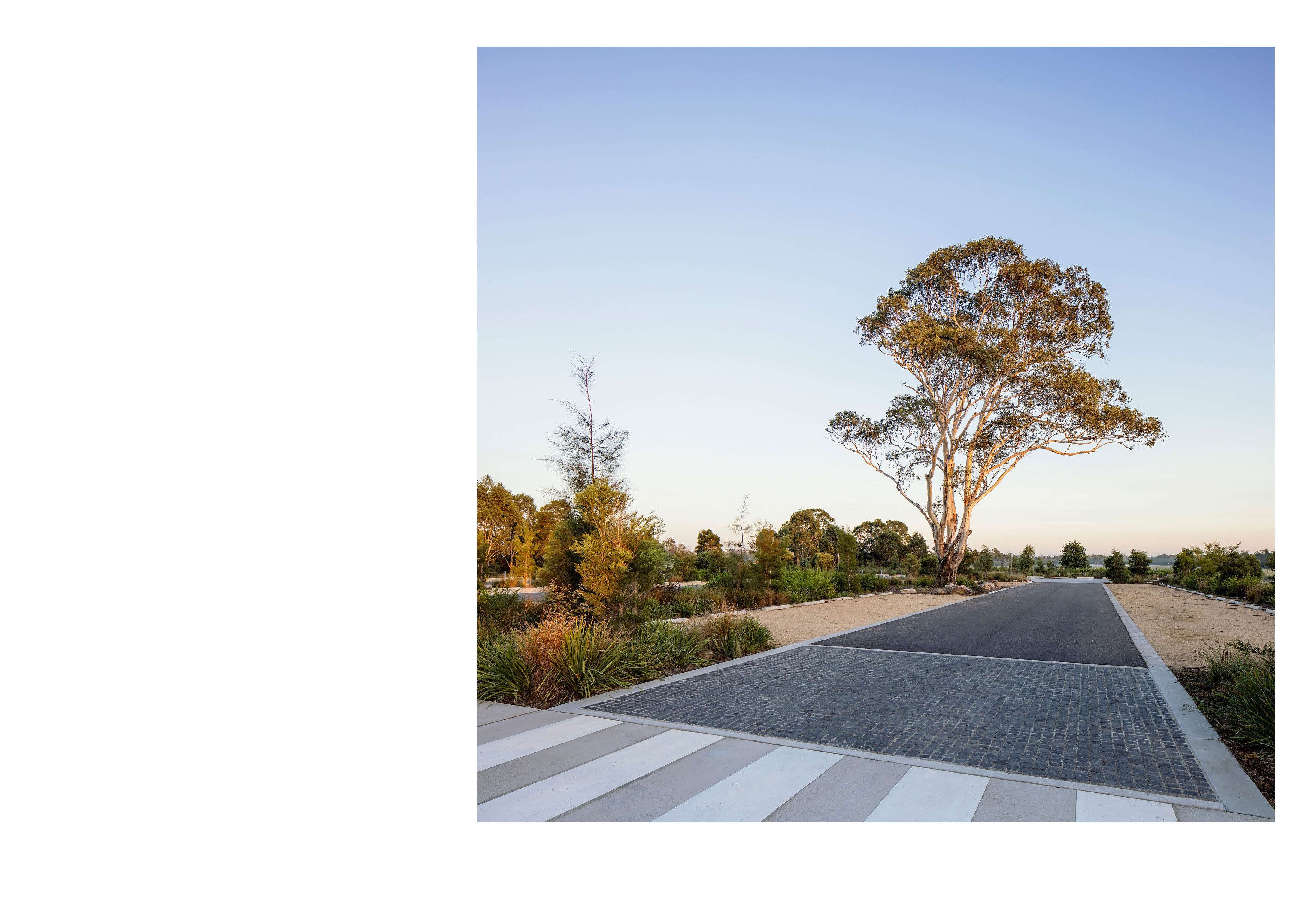
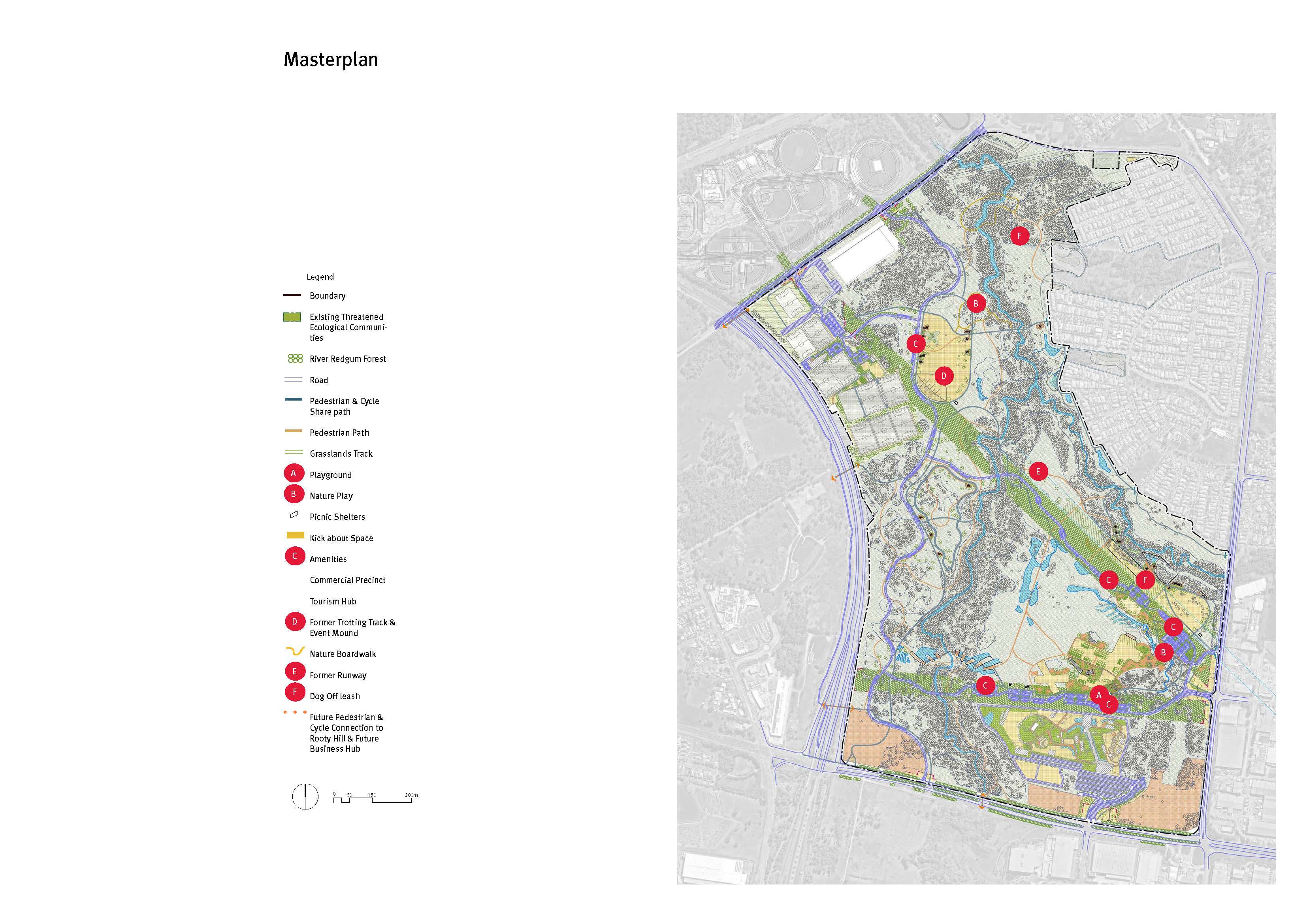
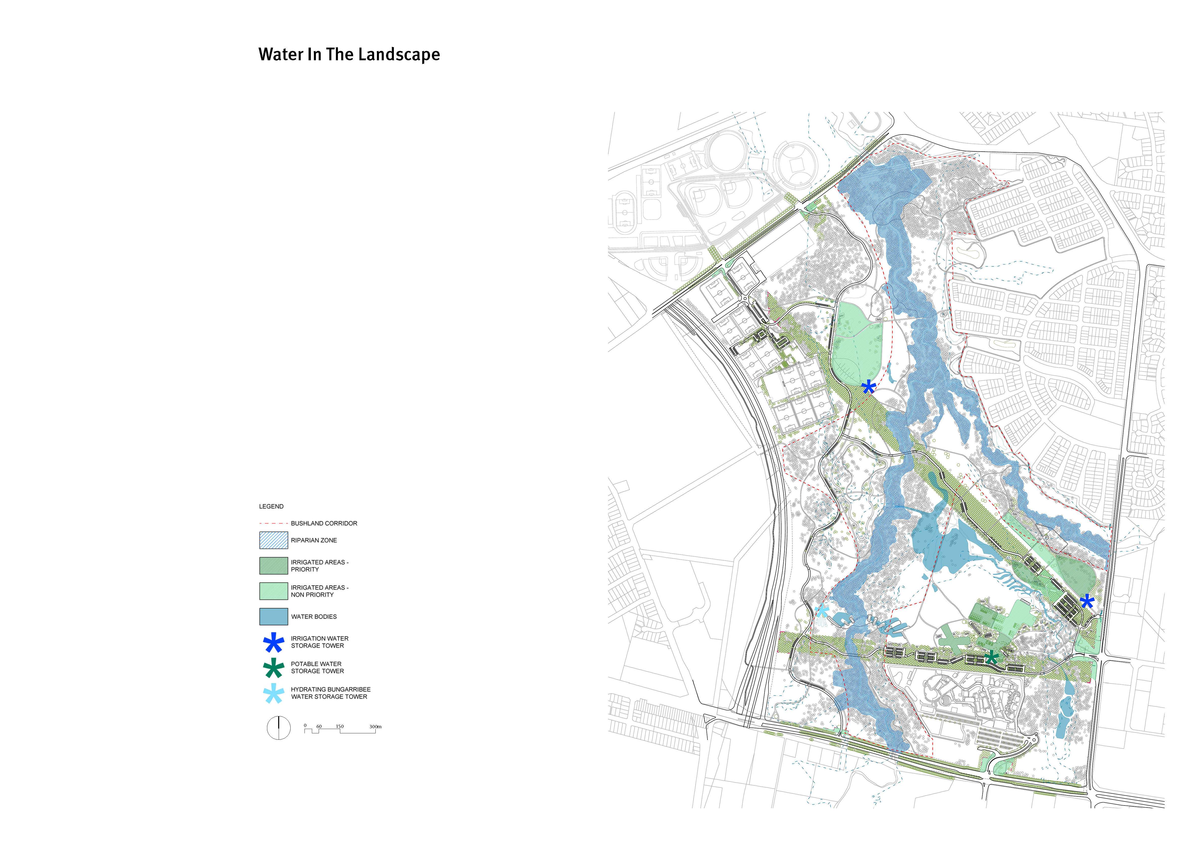
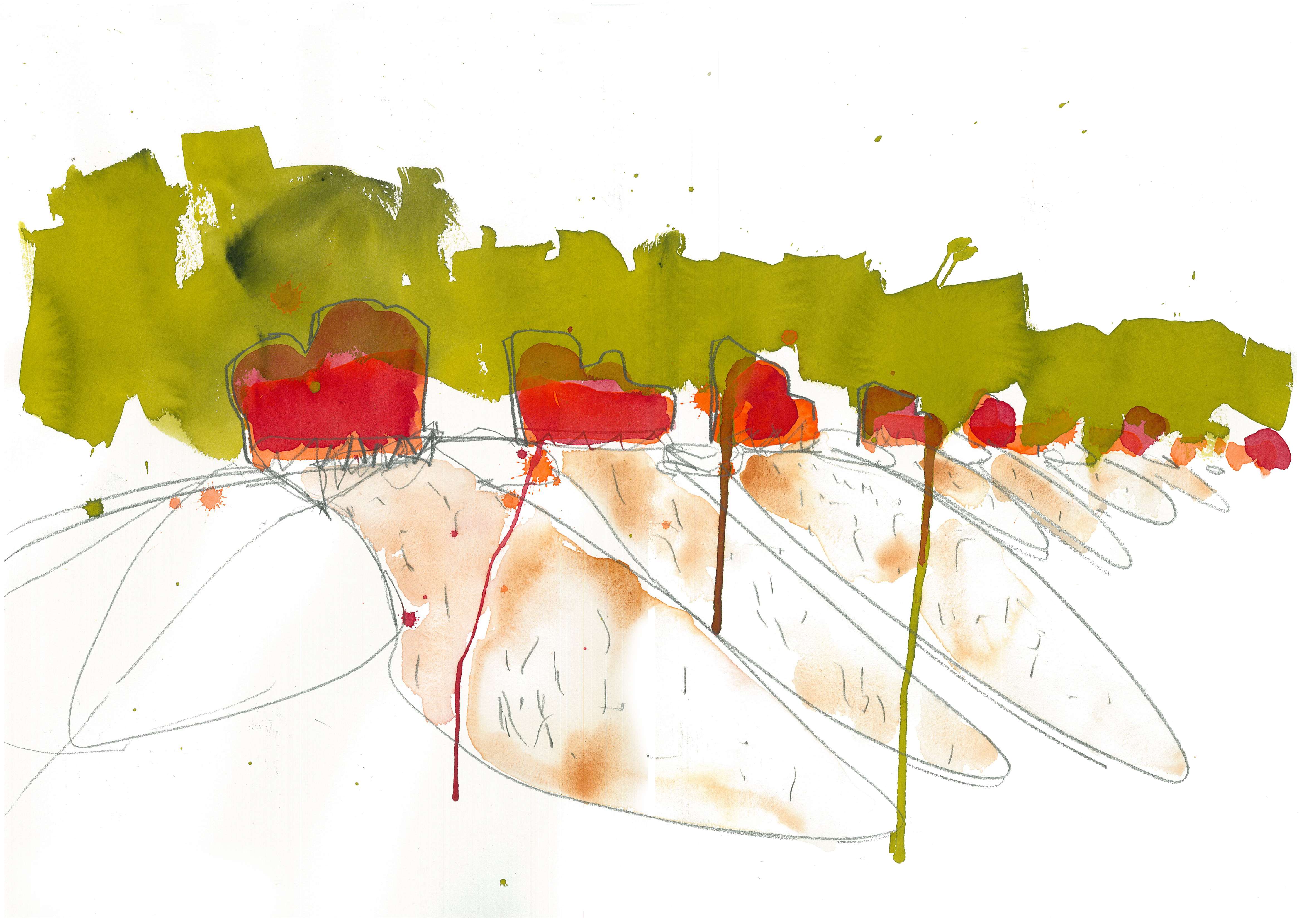
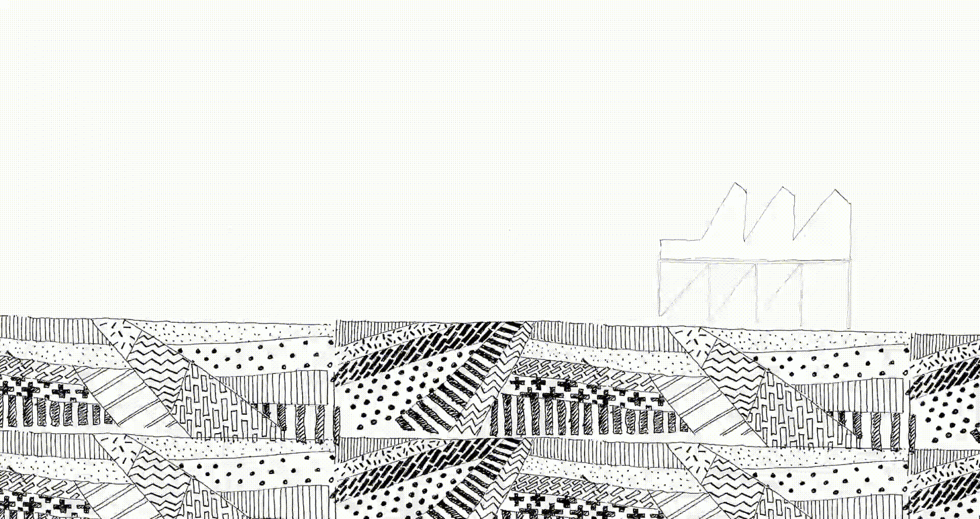
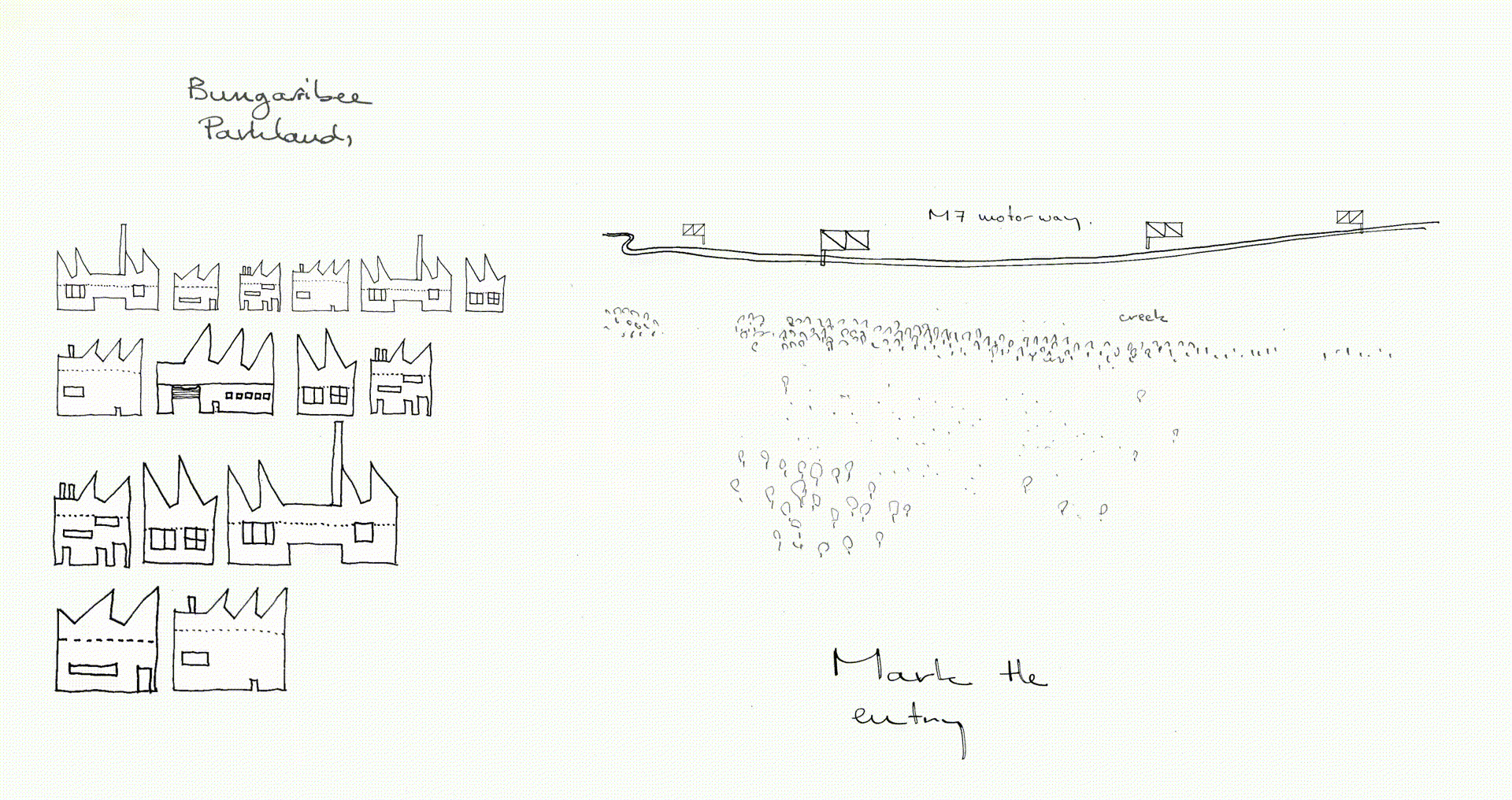
The site straddles Eastern Creek and is bounded by the M7 Motorway, Blacktown International Sports Park, Eastern Road, Bunya residential Estate, Doonside Road and the Sydney Zoo to the south. Bungarribee has a unique landscape setting, made up of a number of different physical, environmental and cultural layers. The natural qualities of the site, the regional views to the Blue Mountains, the adjoining infrastructure, the industrial scale of neighbouring buildings and the quirky on-site features such as the WW2 airstrip, model aircraft airstrip, model rocket launch site and contour ploughing combine to give the clues on which to build a regional park.
JMD design’s approach was to respond to the inherent site qualities and to engage with the scale and language of both the infrastructure and the topographic/ecological inflections found on site. With the ultimate aim being to create a coherent and legible parkland that promotes a variety of uses and caters to a wide range of anticipated visitors from the local and wider communities, all the while fostering identity and care for place. The Park gains its strength and relevance through the development of a design methodology that closely engages with the scale, materiality and voice of the “as found site”. One that distils the park’s identity from its context whilst addressing function, sustainability, use and stakeholder demands.
The design is a realisation of a number of key elements that address ecology, use and identity.
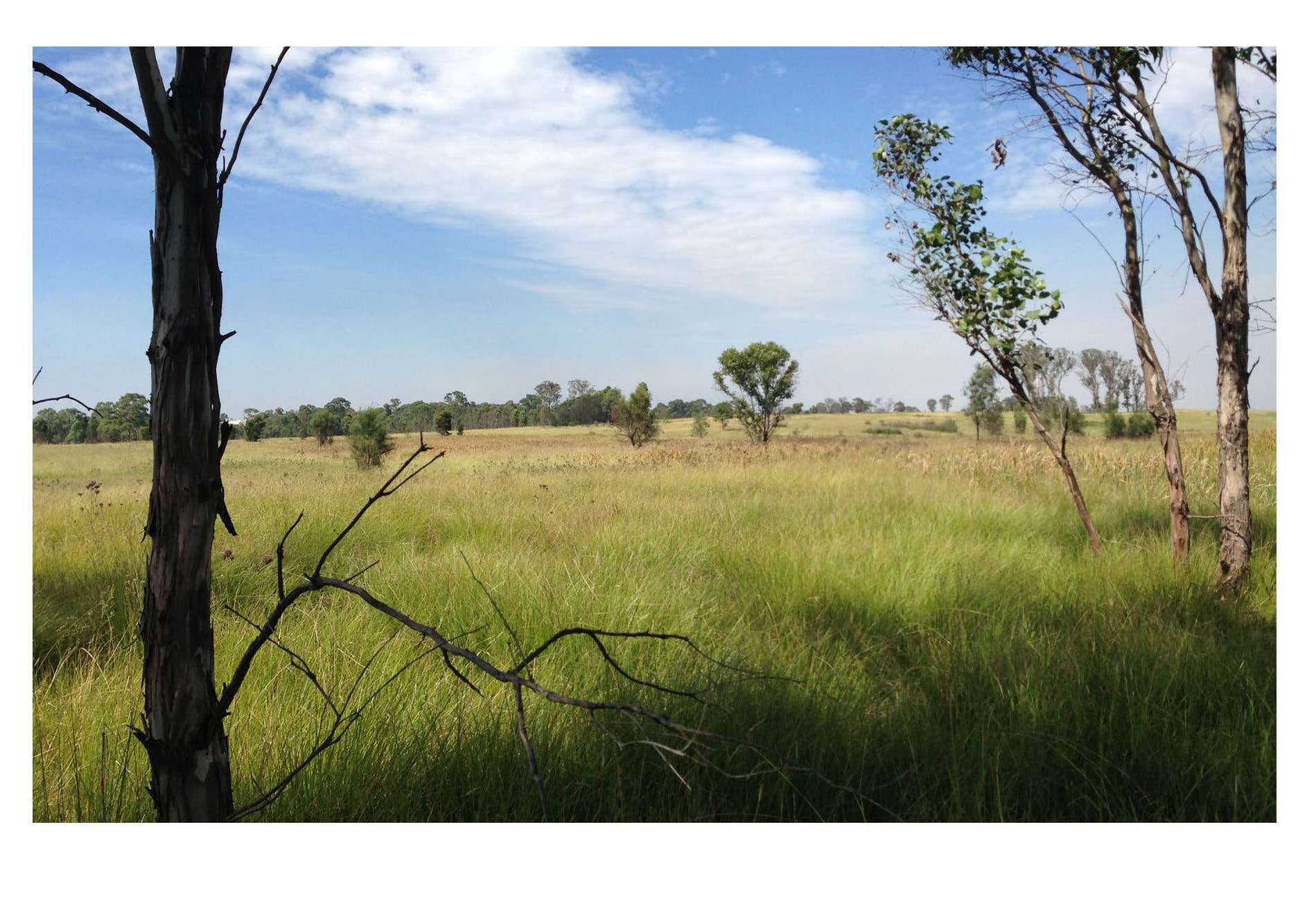
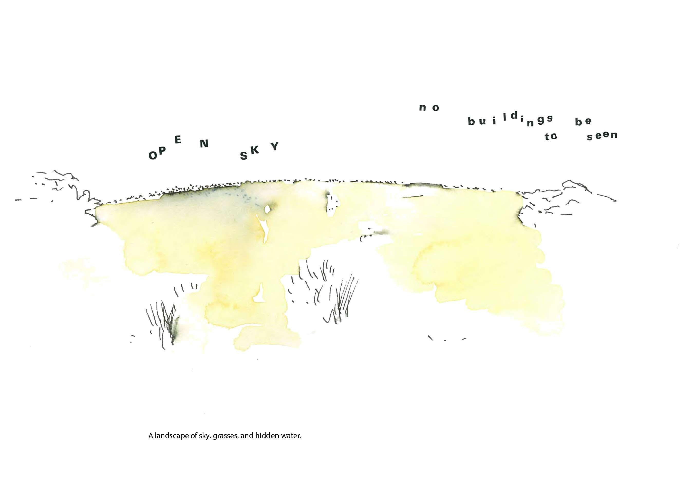
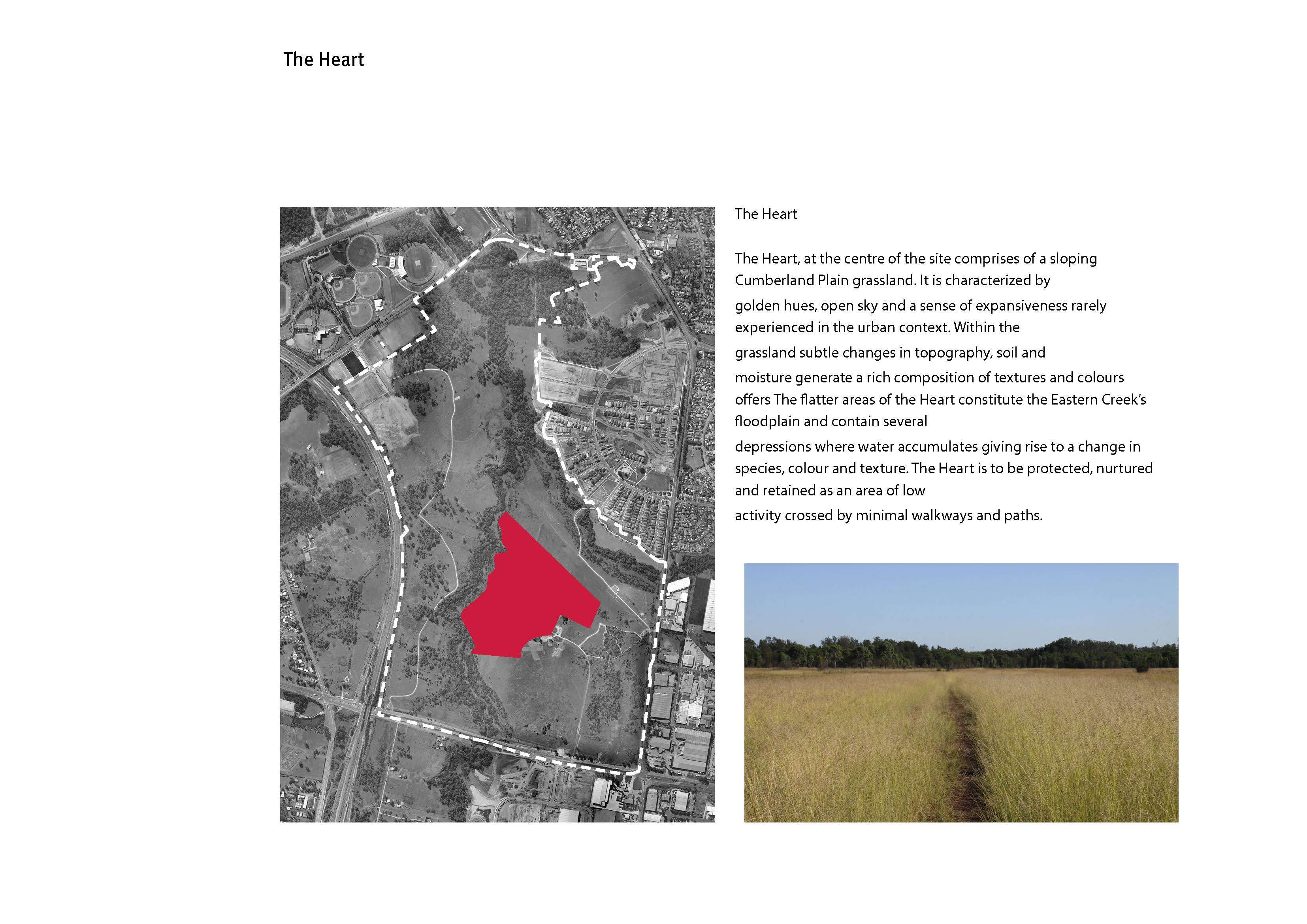
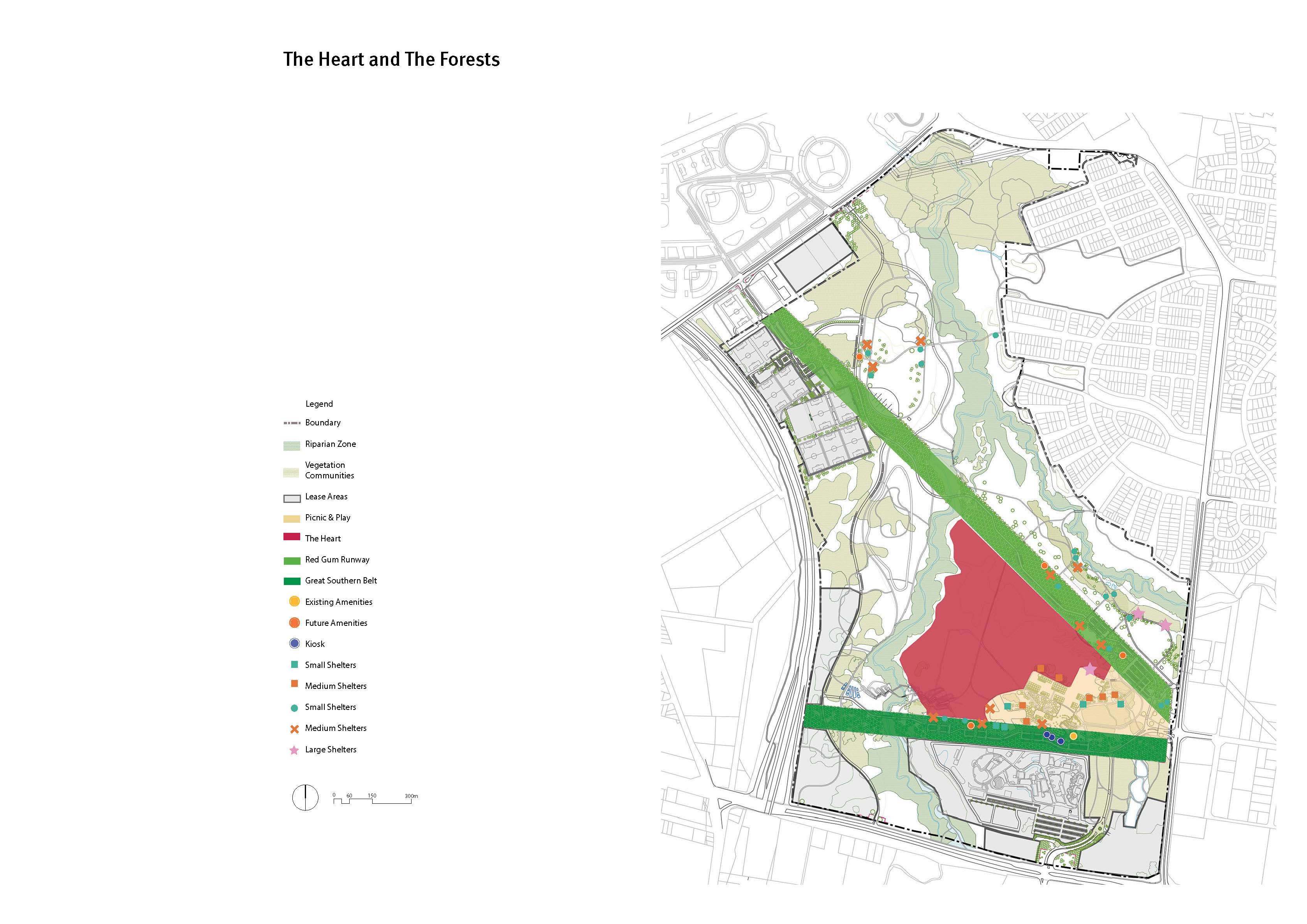
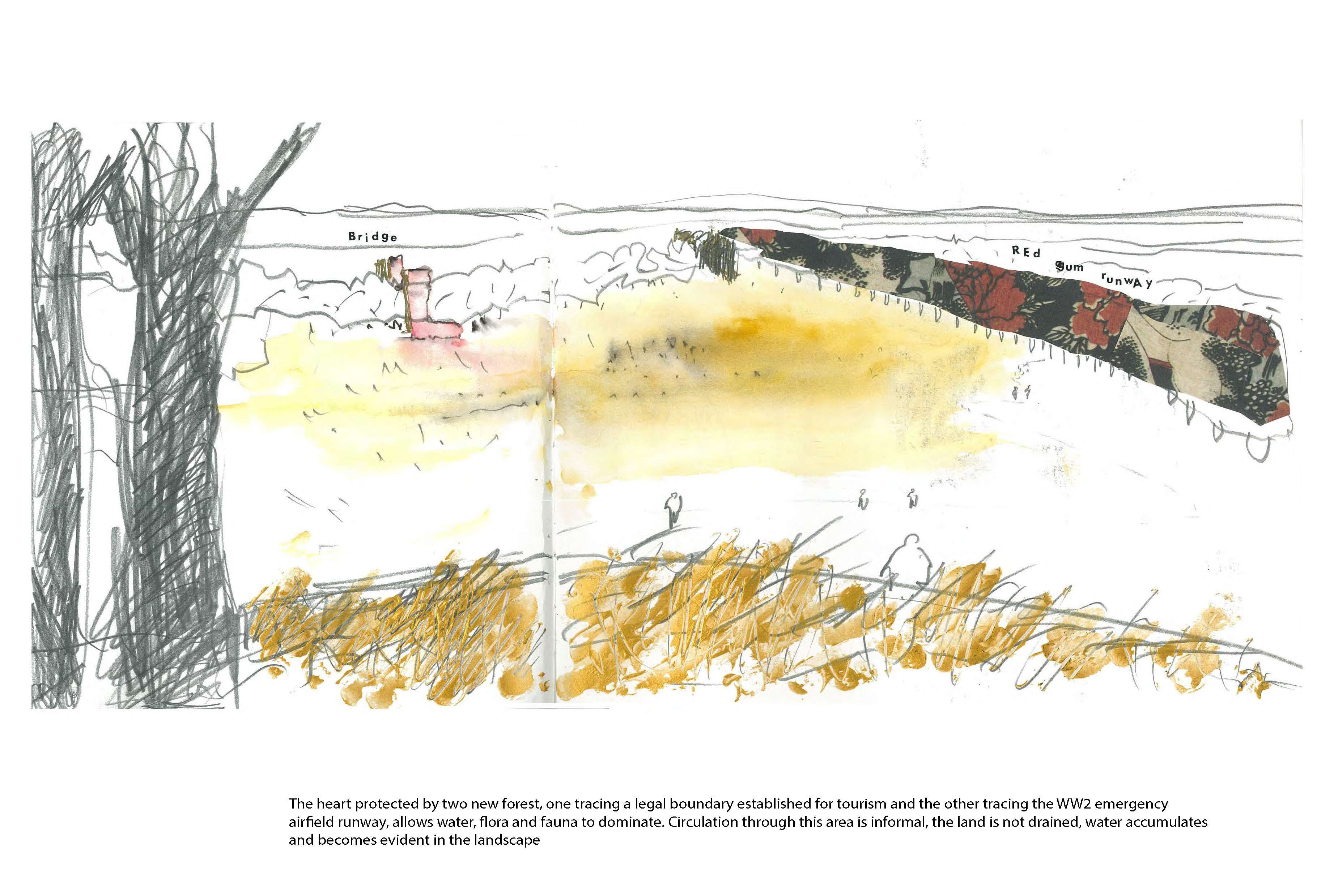
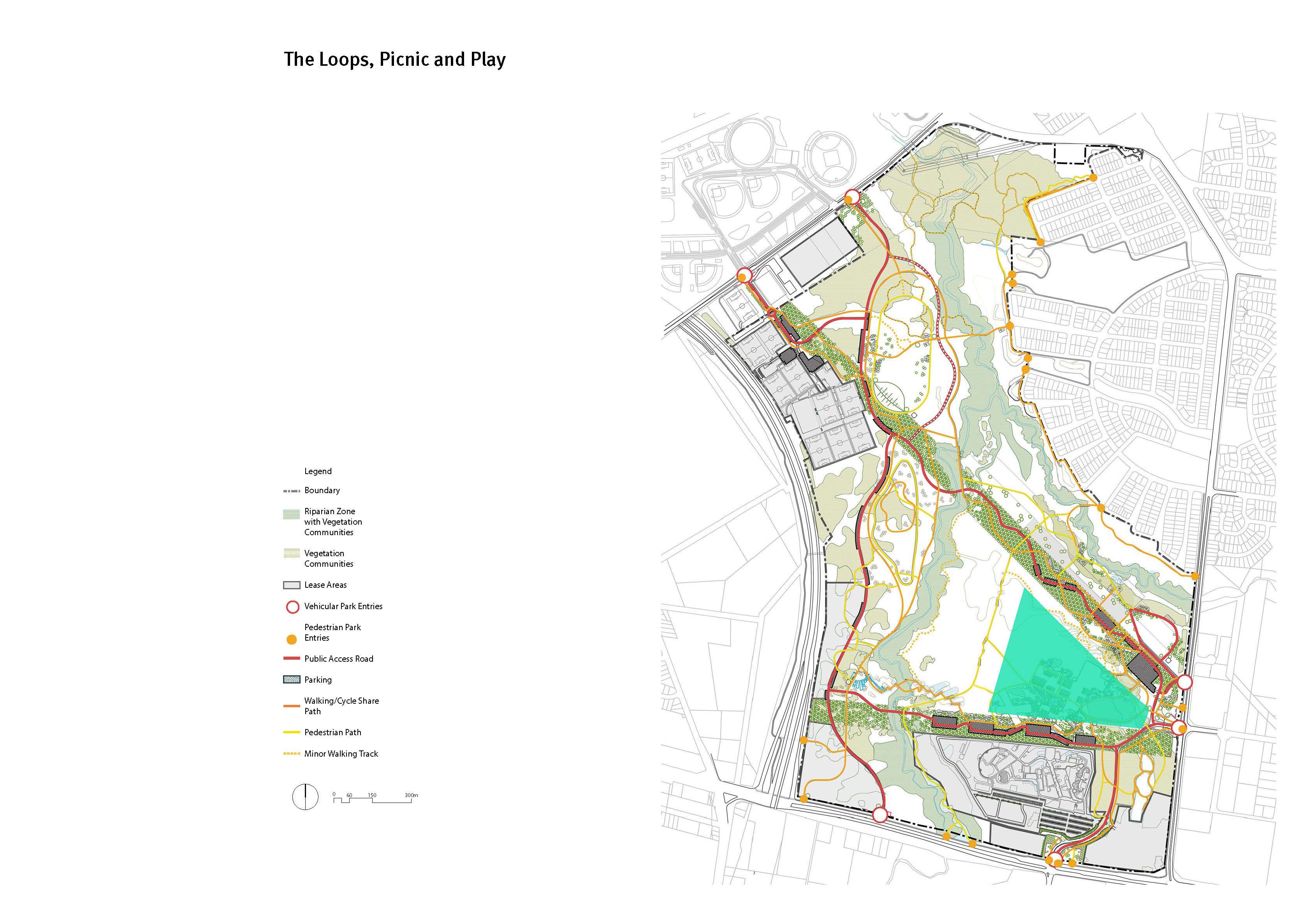
- ‘The Heart’ - protects, celebrates and foregrounds an expanse of open grassland and wetland nestled at the confluence of Eastern Creek and Bungarribee Creek. The Heart is a low activity area, crossed by minimal footpaths and walkways at the edges The Heart is a tranquil place where flora and fauna dominate, self-organise and are given the conditions to thrive.
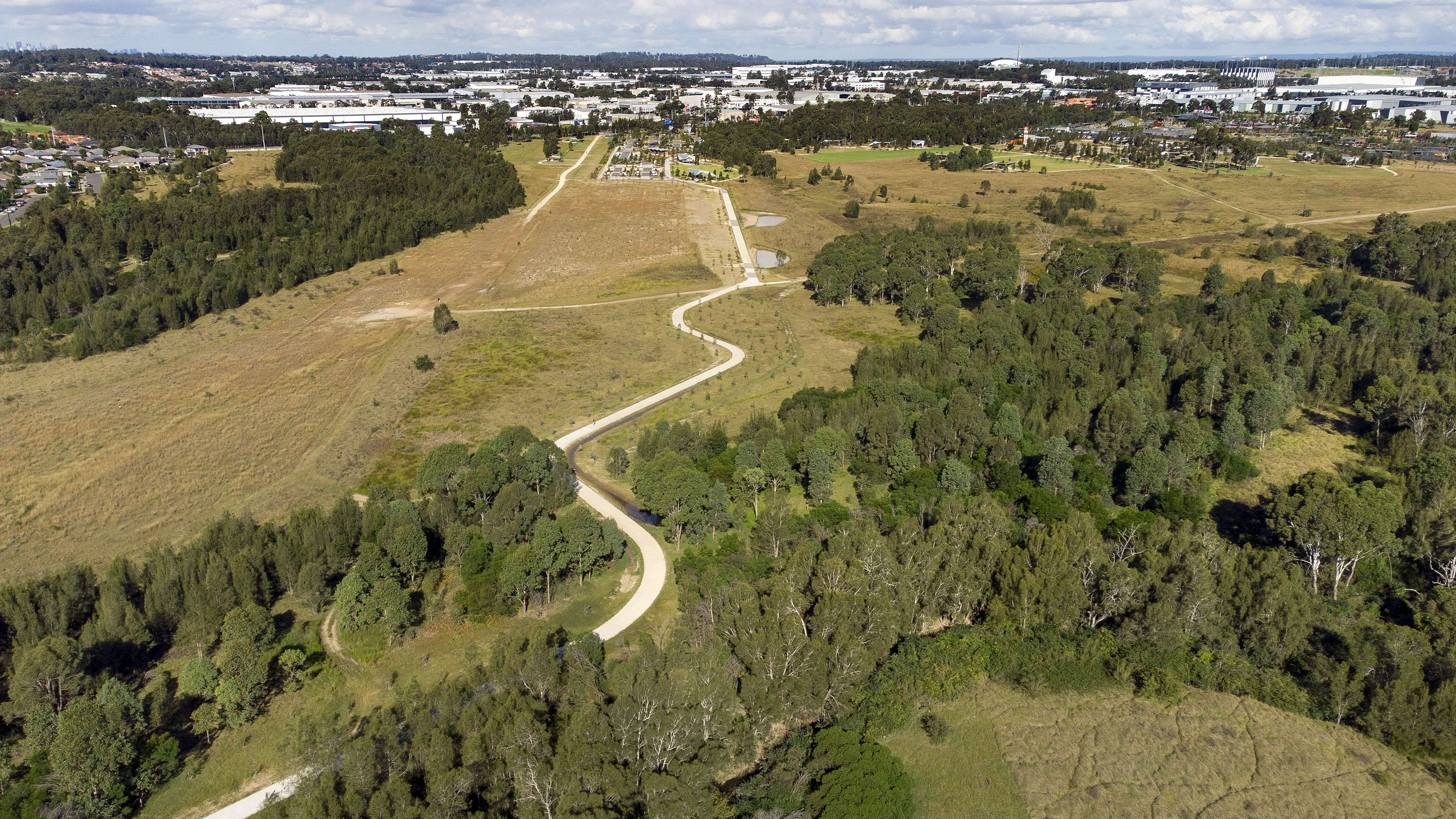
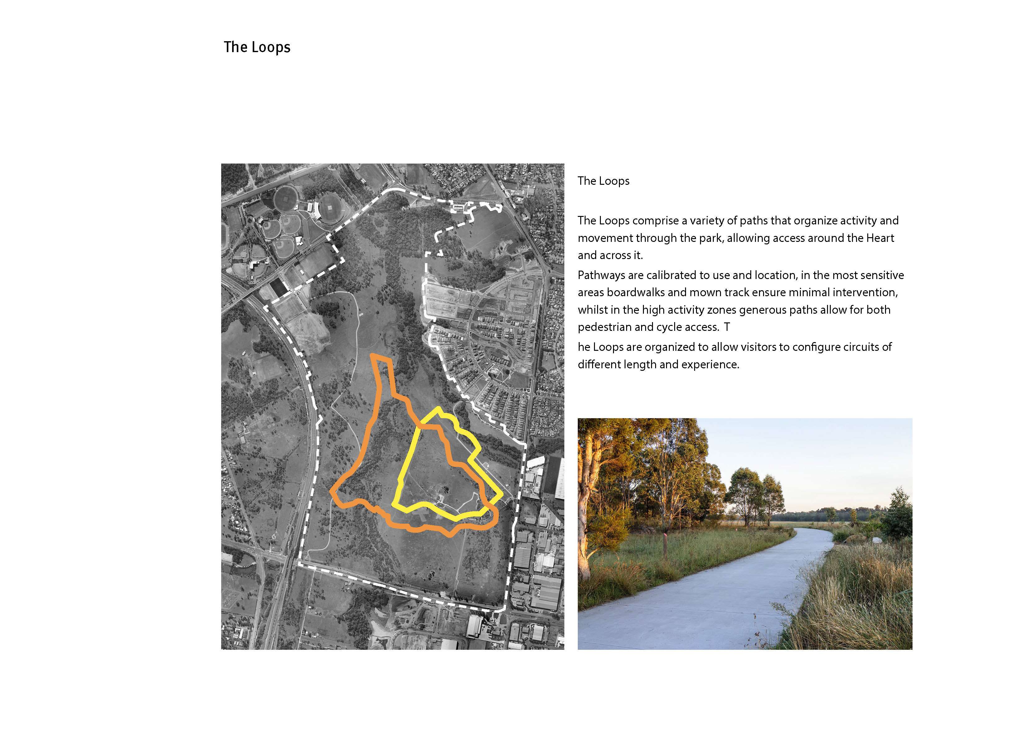
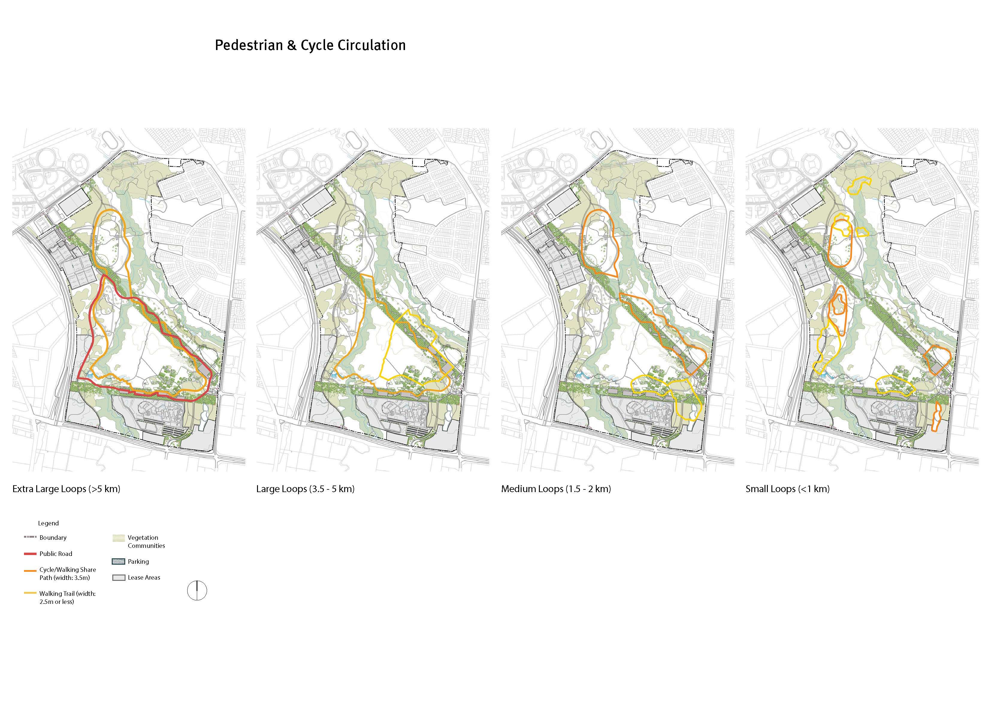
- ‘The Loop’ - demarcates zones of use and their intensity. It forms the major connections through the park incorporating pedestrian, cycle and vehicle links. The Loop carries Park infrastructure and organises areas of greater impact. It provides a continuous link between activity nodes
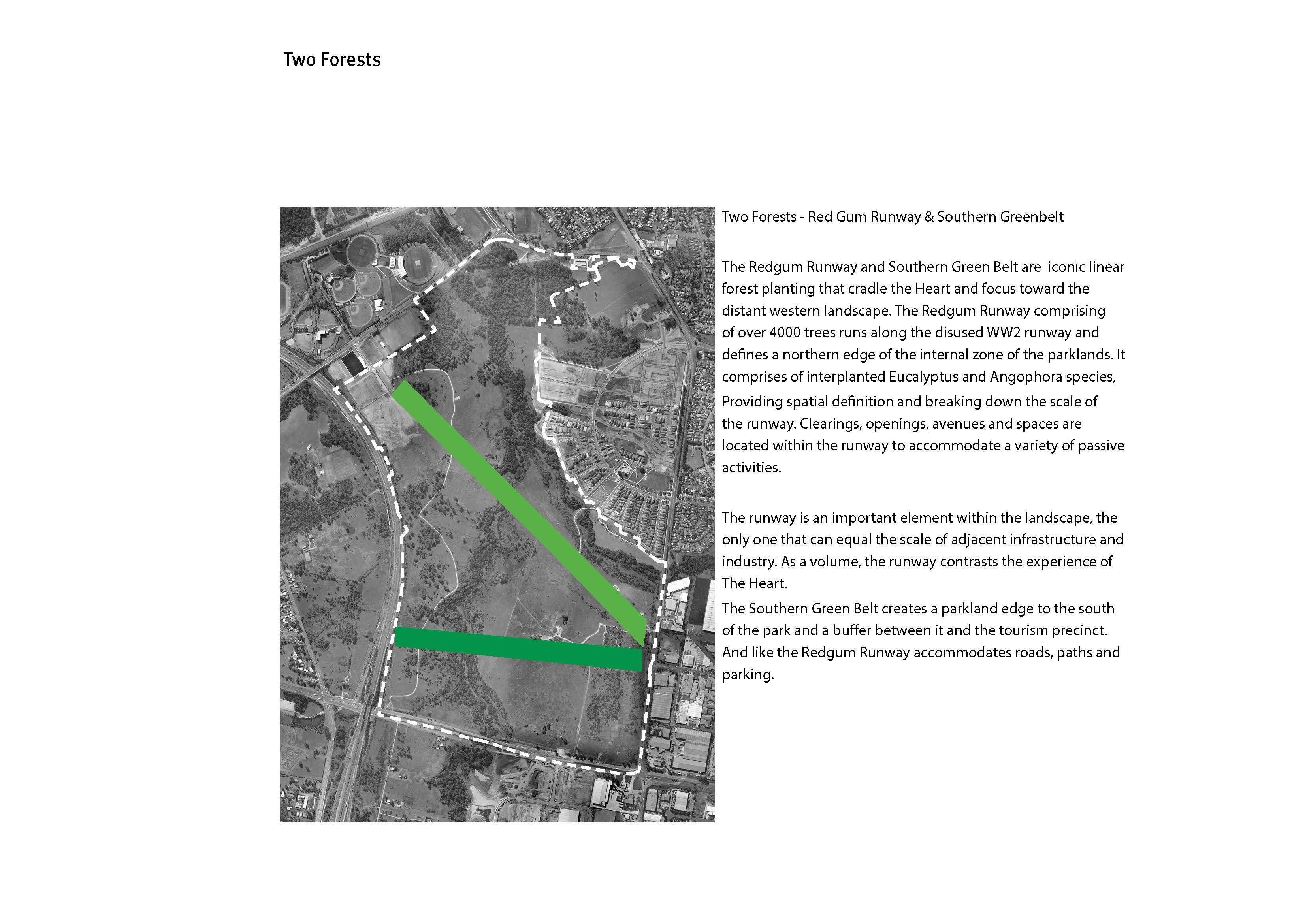
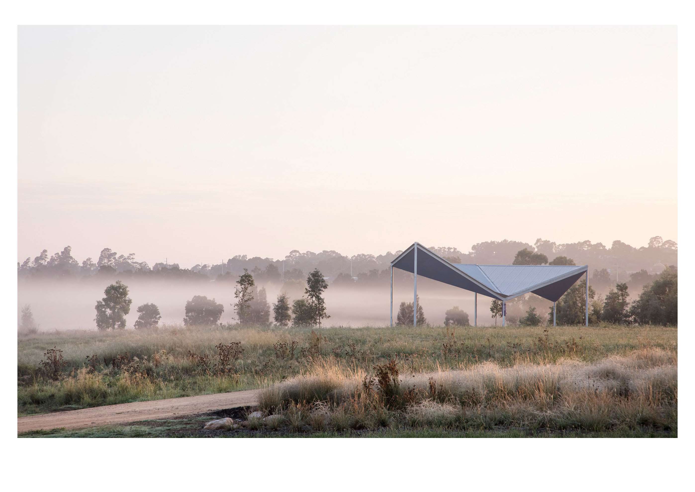
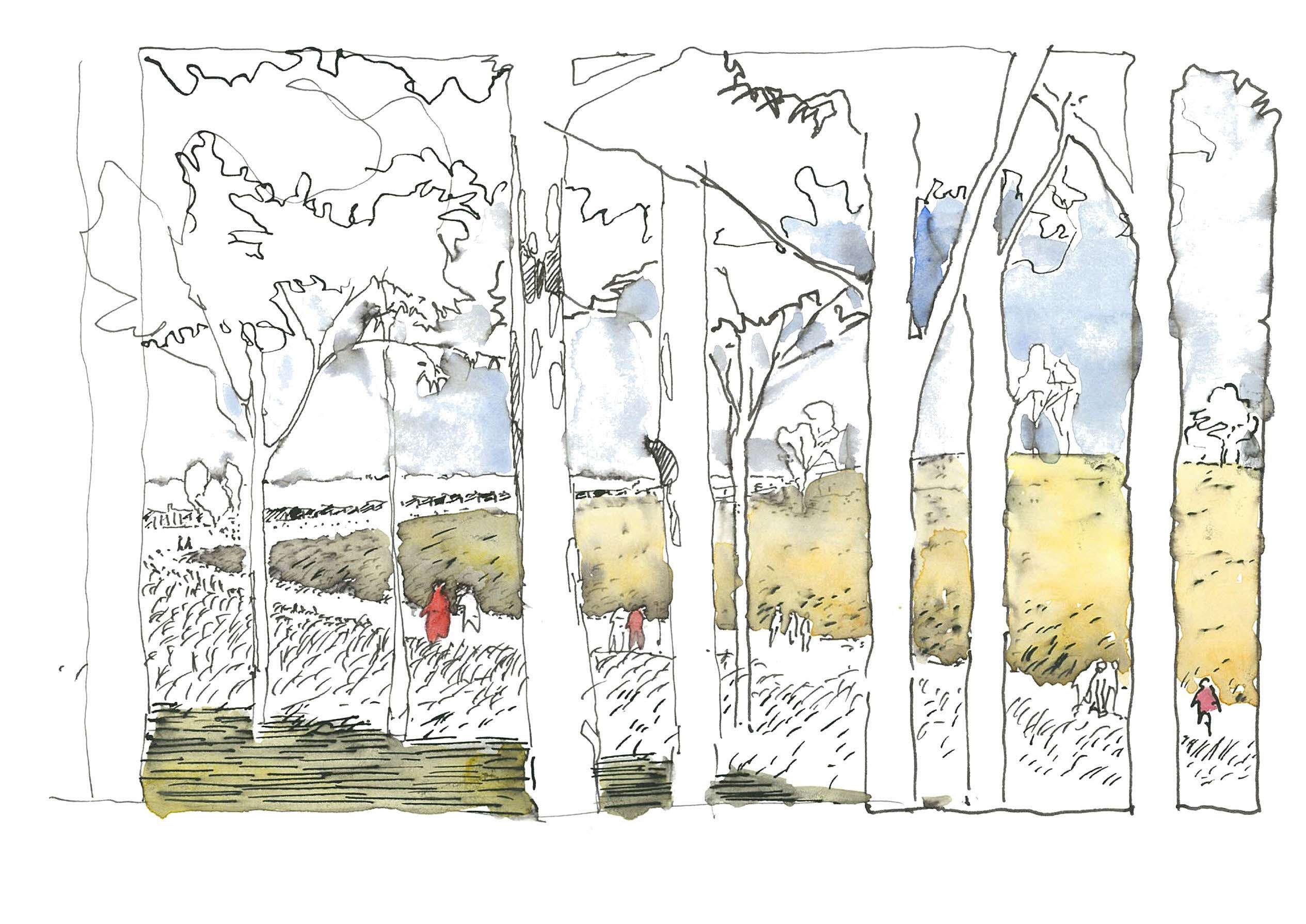
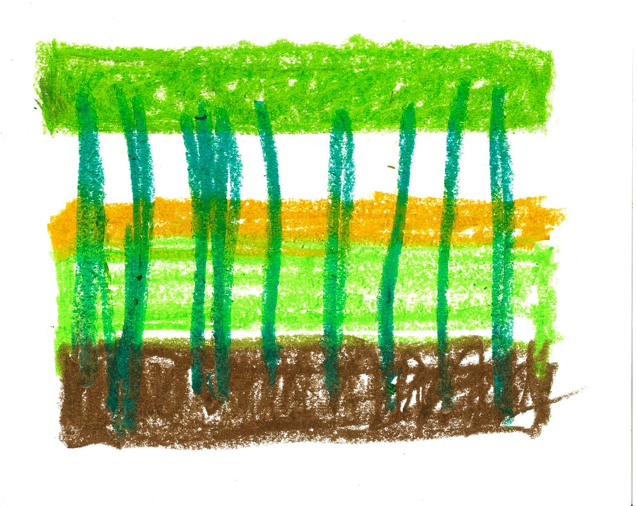
- ‘The Redgum Runway Forest and the Great Southern Green Belt scale the landscape, create an iconic identity and traces heritage. On the alignment of a former WW2 overshoot runway is a block of 1200 mixed eucalypts planted on a diagonal grid to provide a vegetative buffer to the heart whilst supporting the armature for the Loop and its new share paths and future stages of carparking/shelters. The forest inverts the impressive void required for aircraft landing into an arboreal volume of species lost to the site. Clearings, openings, avenues and spaces located within the runway will accommodate a variety of activities. The Runway Forest equals the scale of adjacent infrastructure and industry and declares the importance of public open space in a landscape of oversized industry.
- The western corridor along the M7 motorway, a space of marshes and standing water is impacted by freeway noise. This area provides access through the park and is designated as location for organised high use activity- football clubs and fields, BMX and mountain bike track and a large event space on the former trotting track
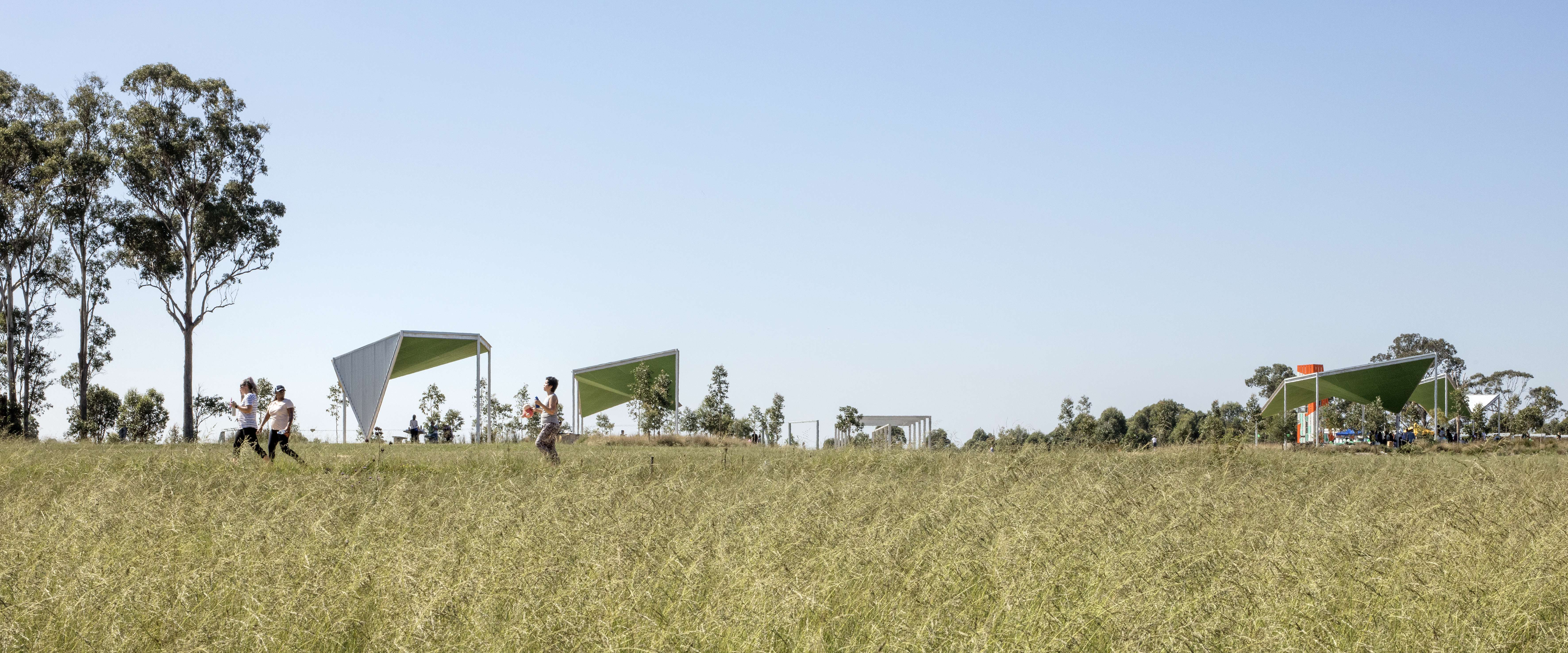
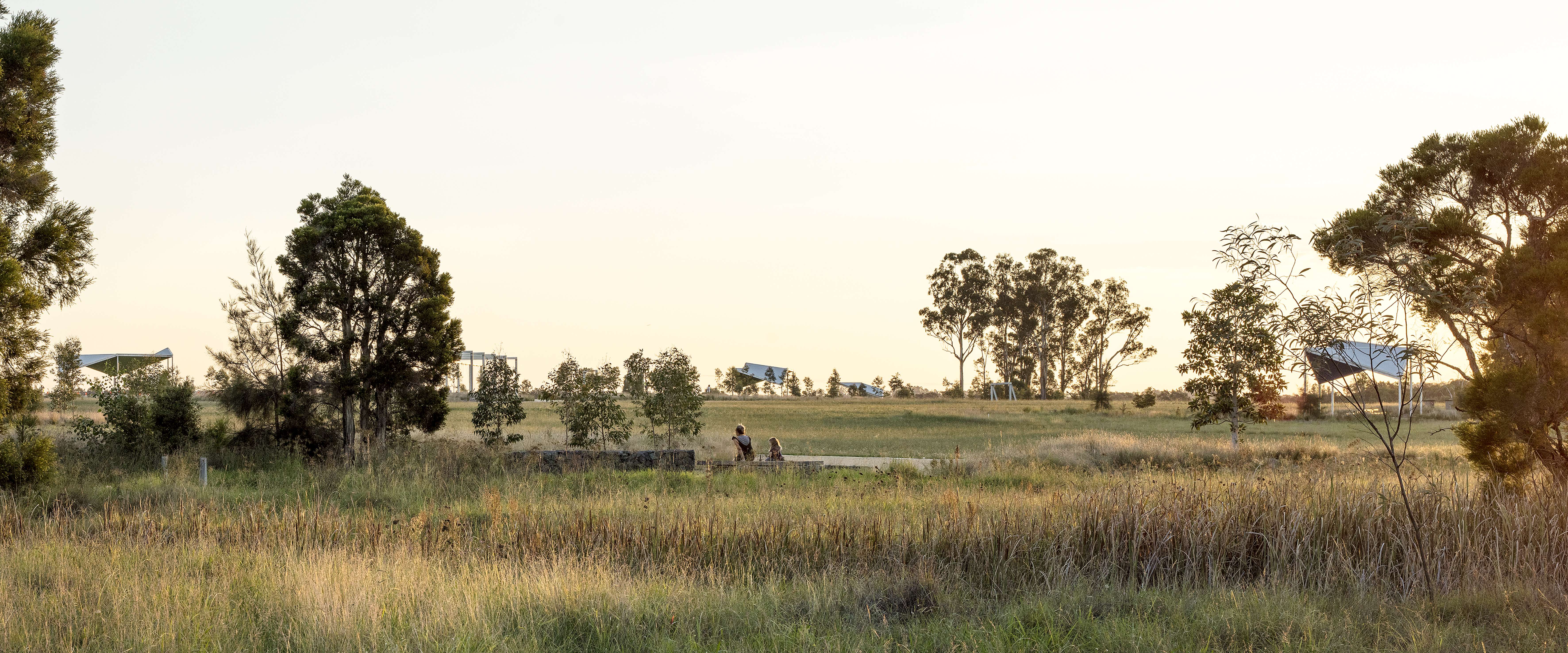
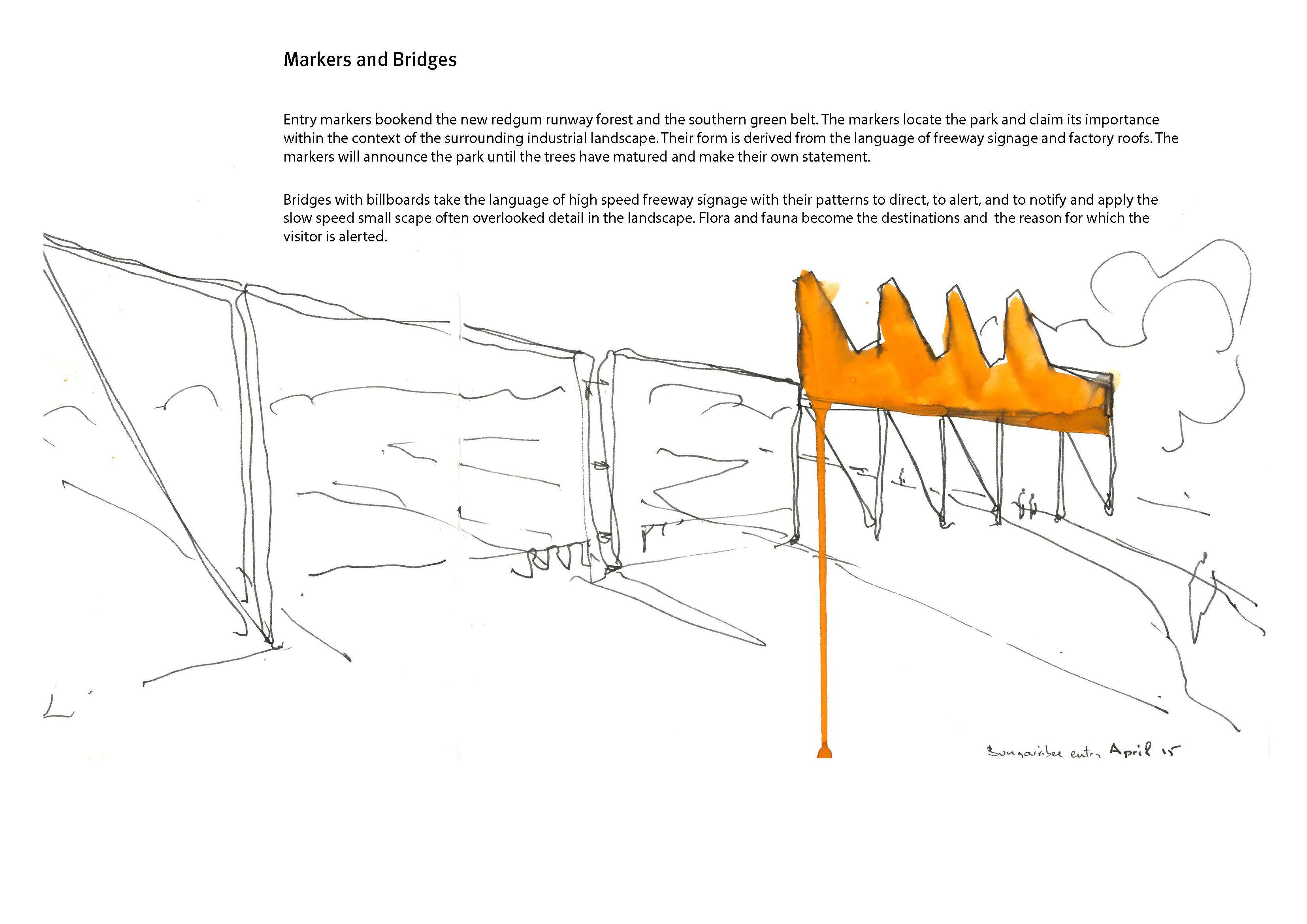
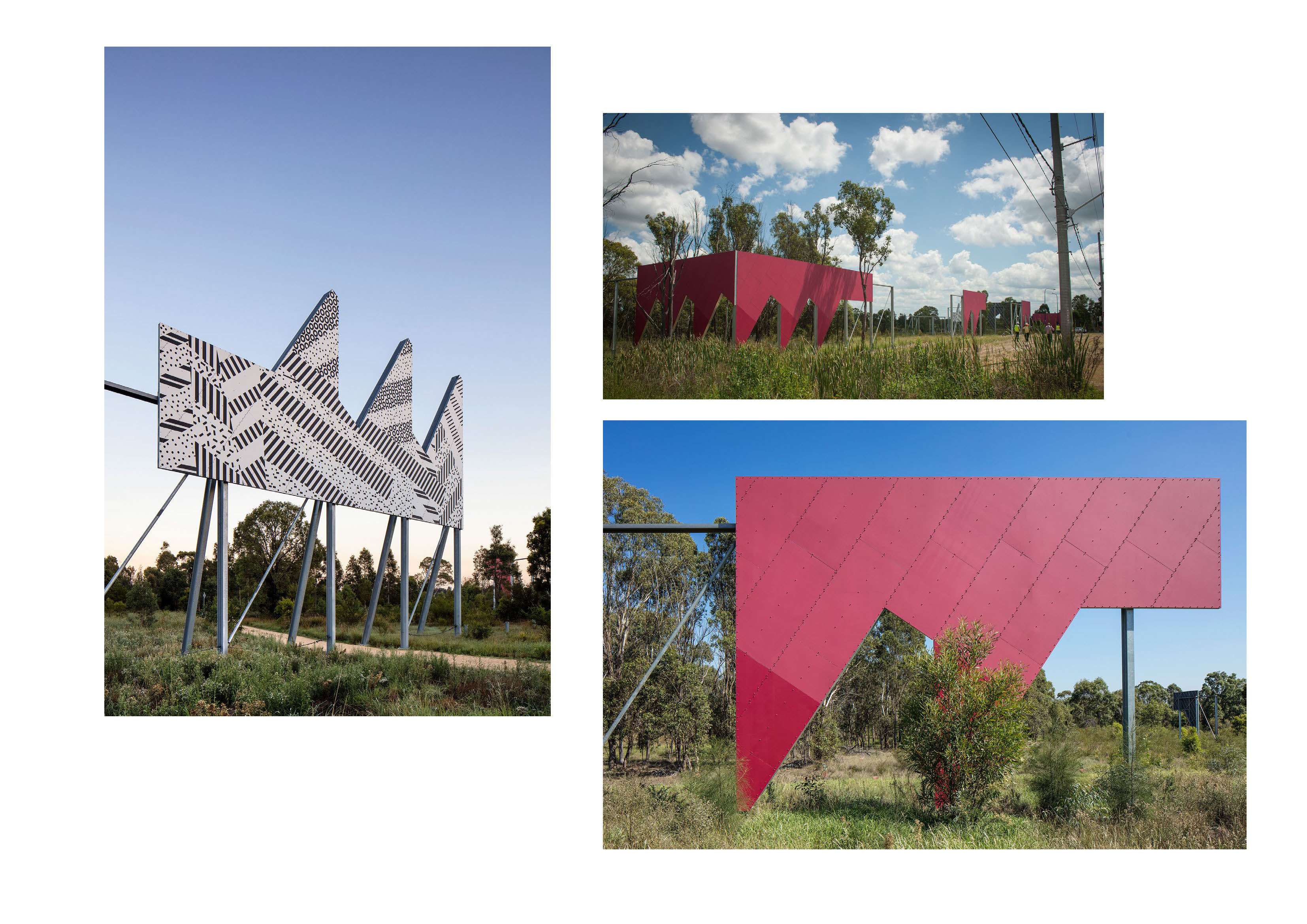
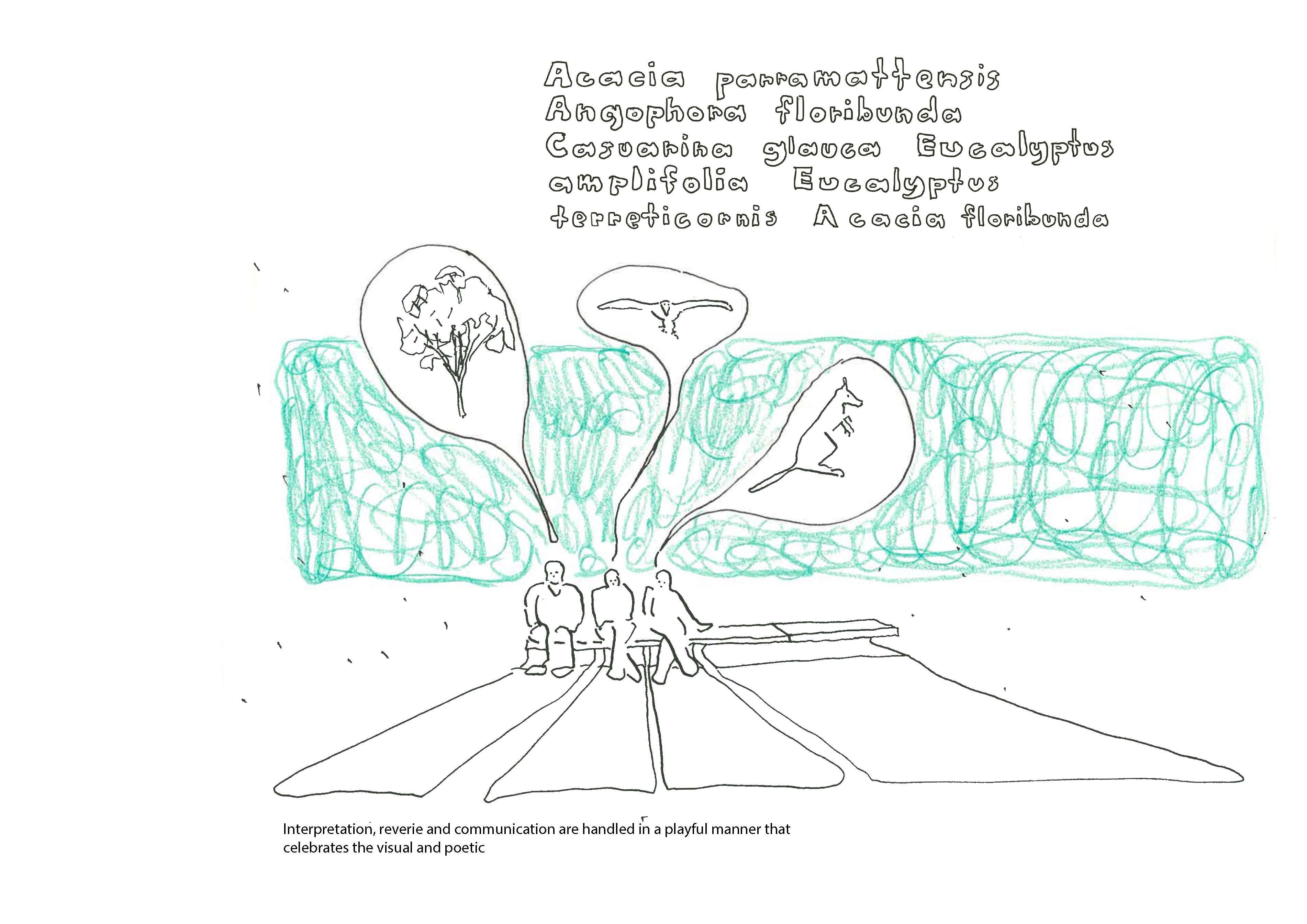
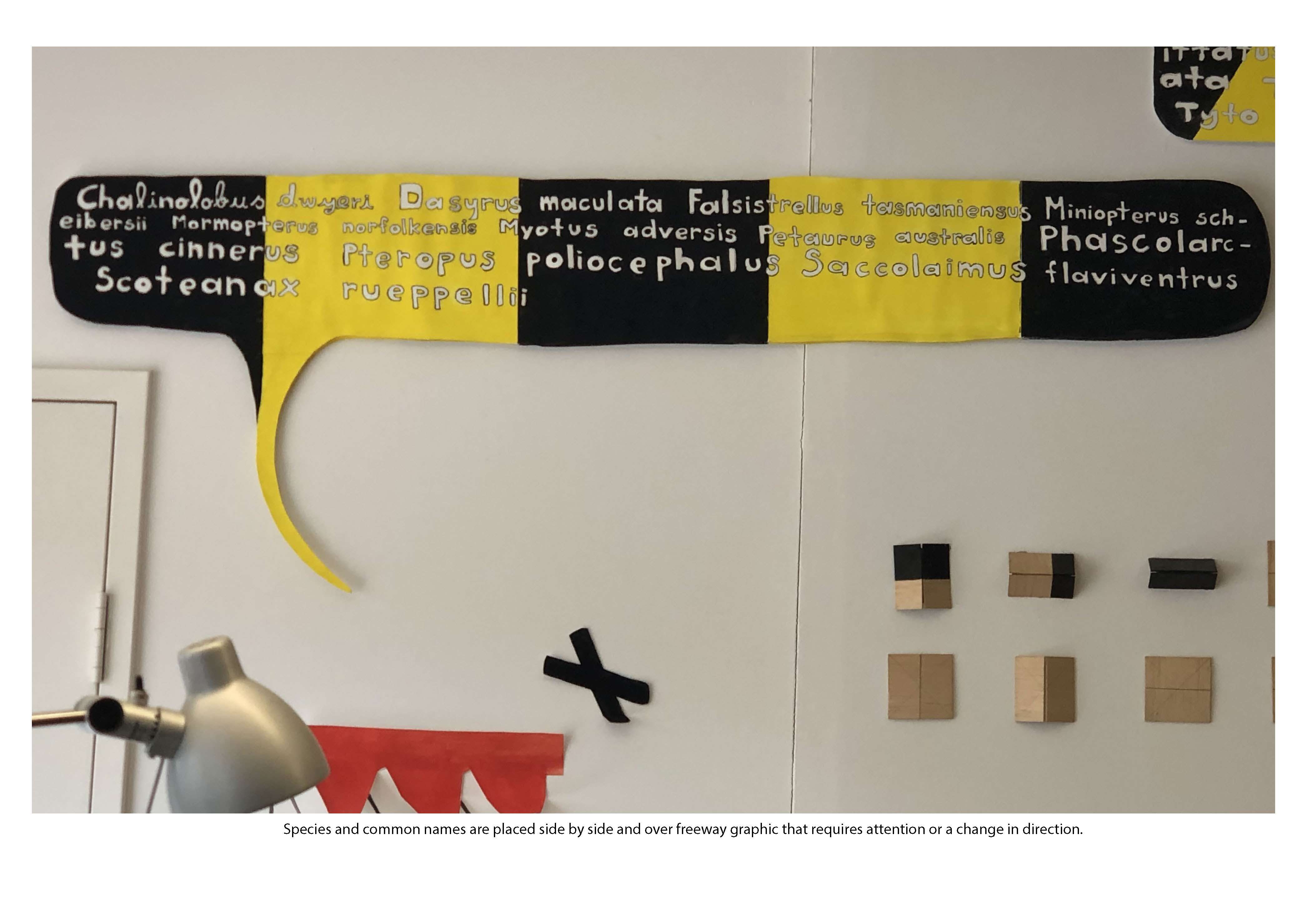
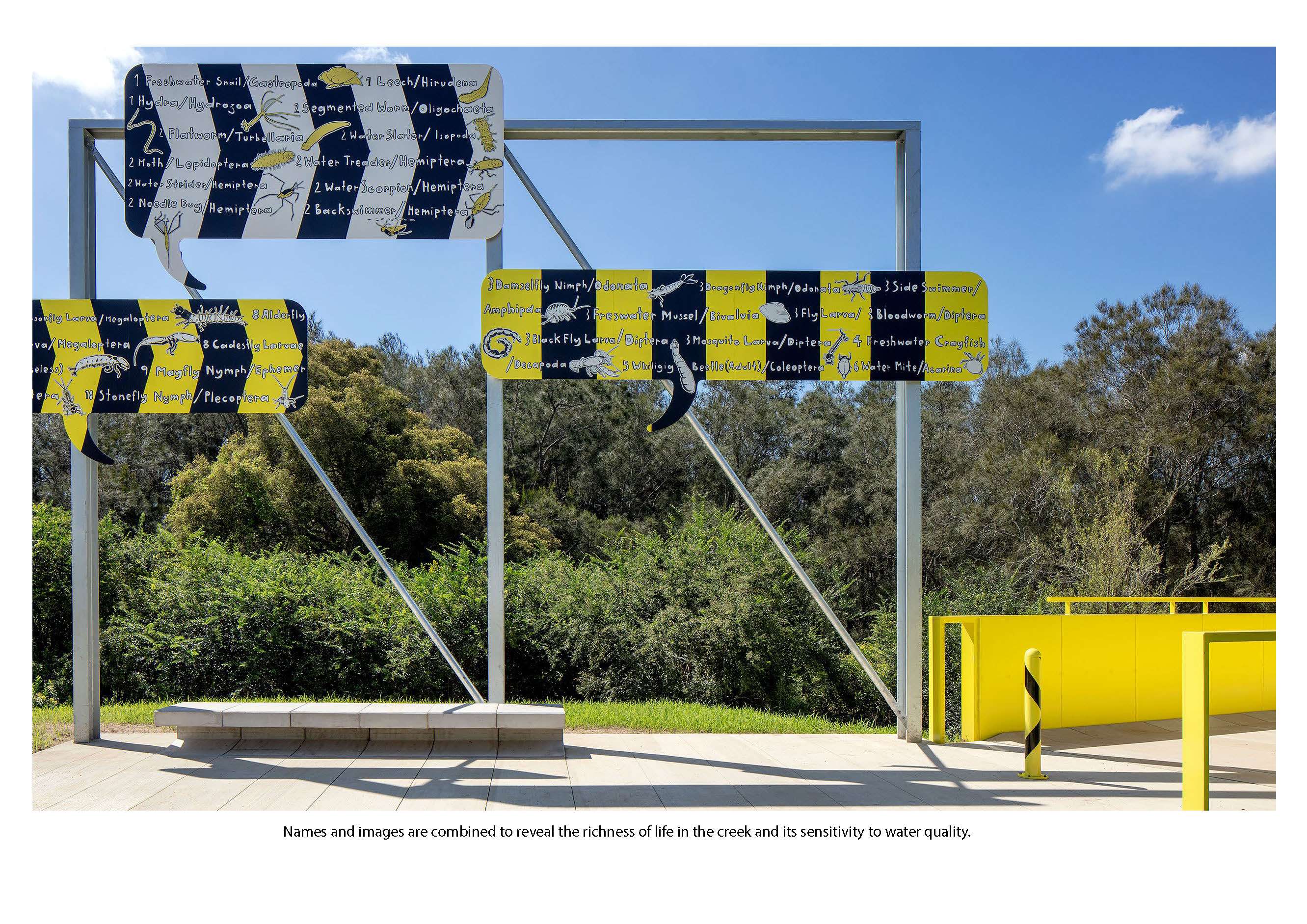
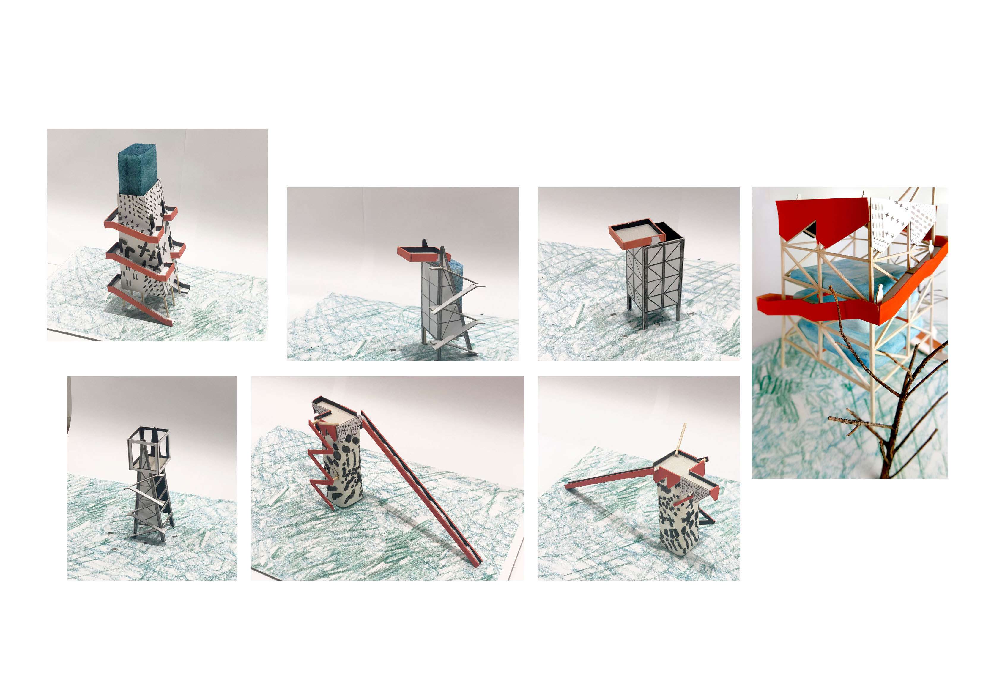
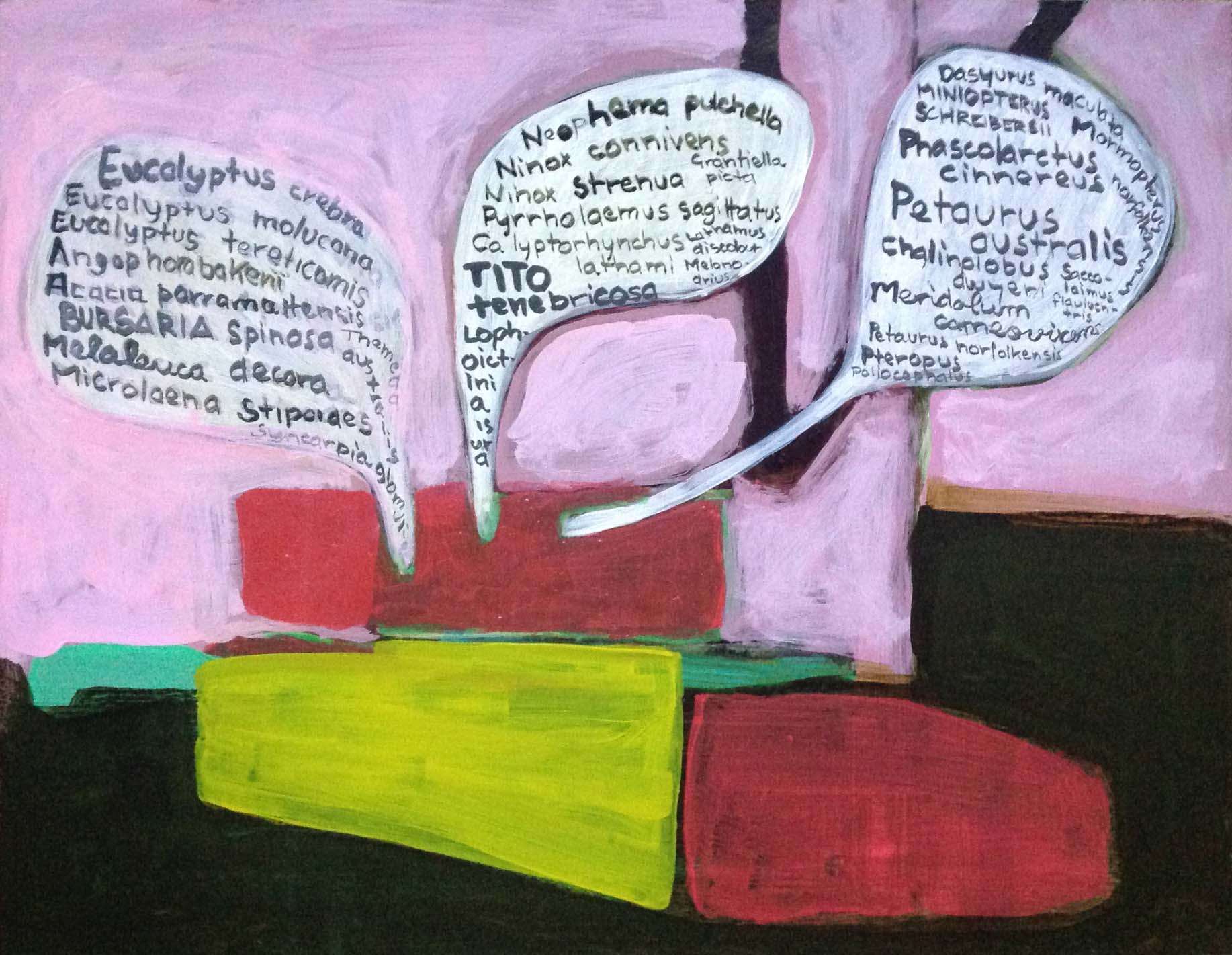
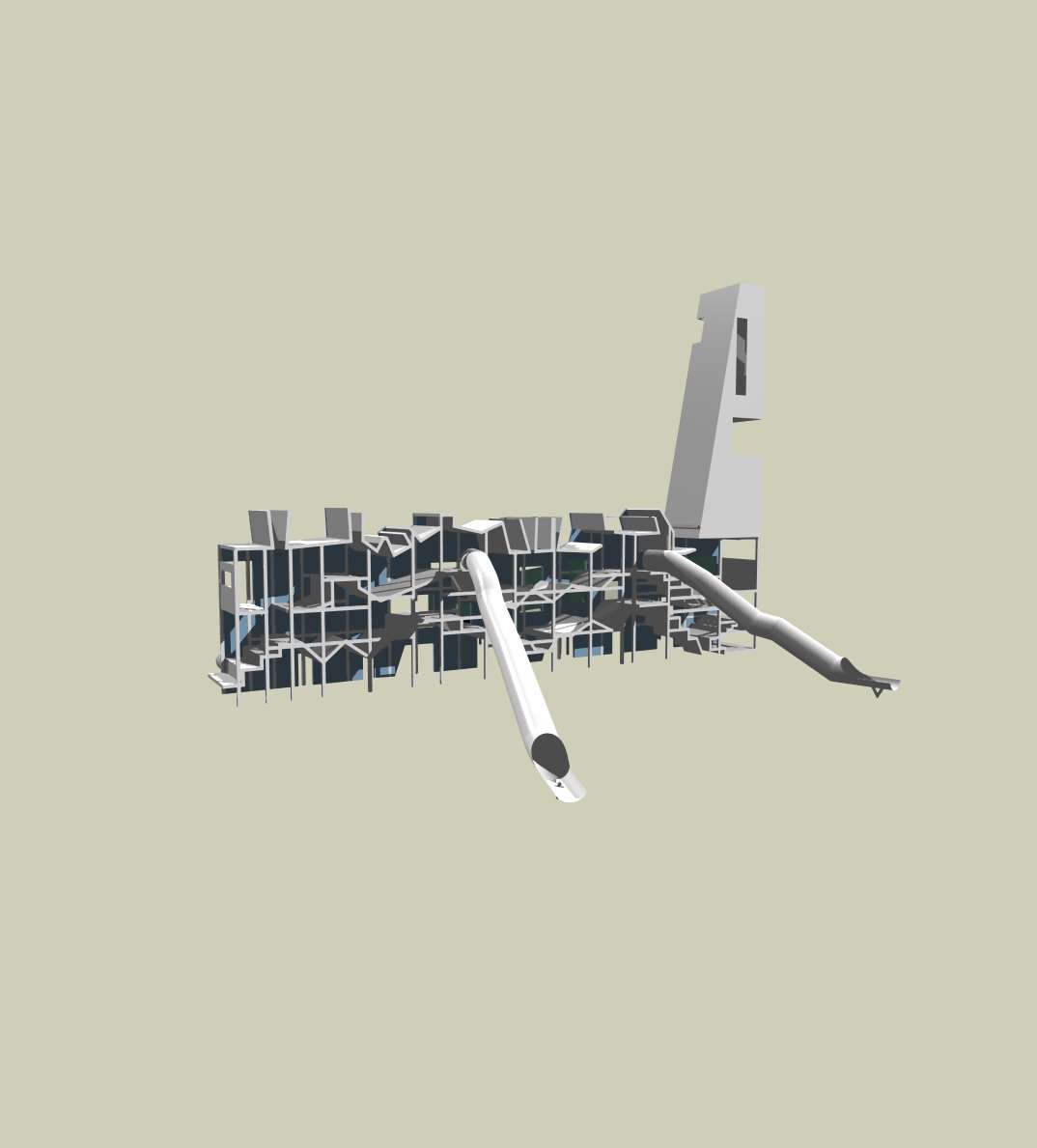
- A language of bold structure in contrast to the subtle grasslands and native vegetation, one able to instil identity and project care for the existing landscape whilst not been dominated by the industrial context. These structures take the form, materiality, scale and language of freeway signage and warehouse typology to signpost the landscape. Billboards and directional signage do not direct the visitor to somewhere or some product further down the road, instead they highlight the Bungarribee landscape its detail, the species that make up its fragile ecology and the evolving park.
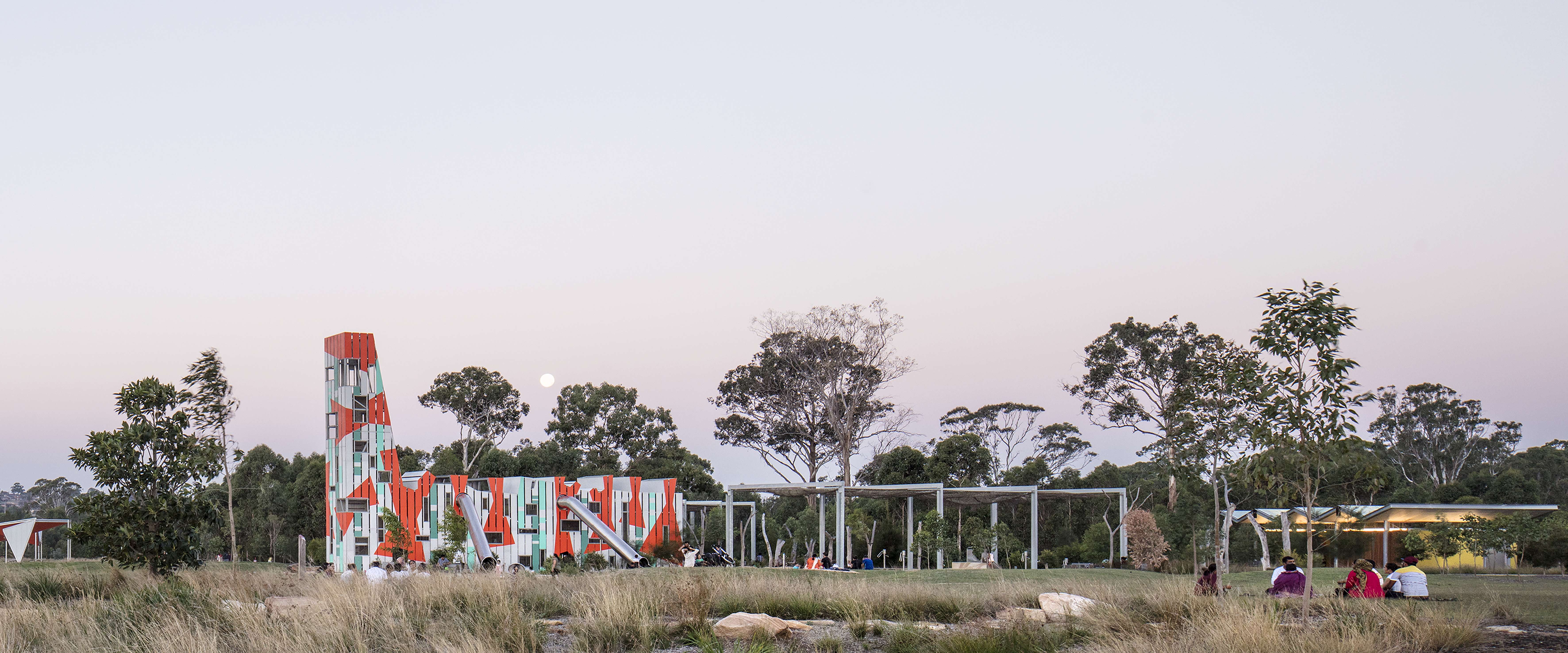
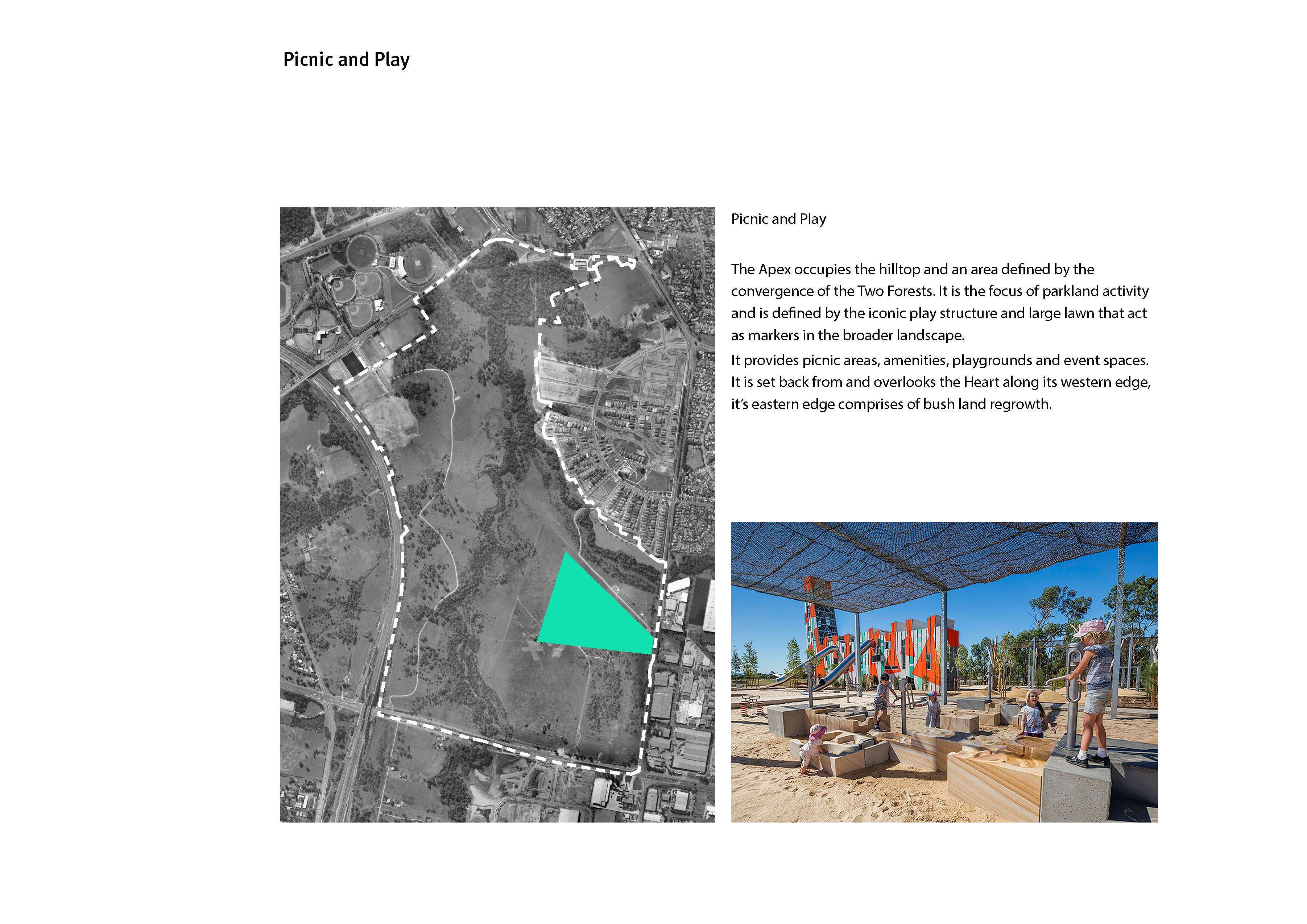
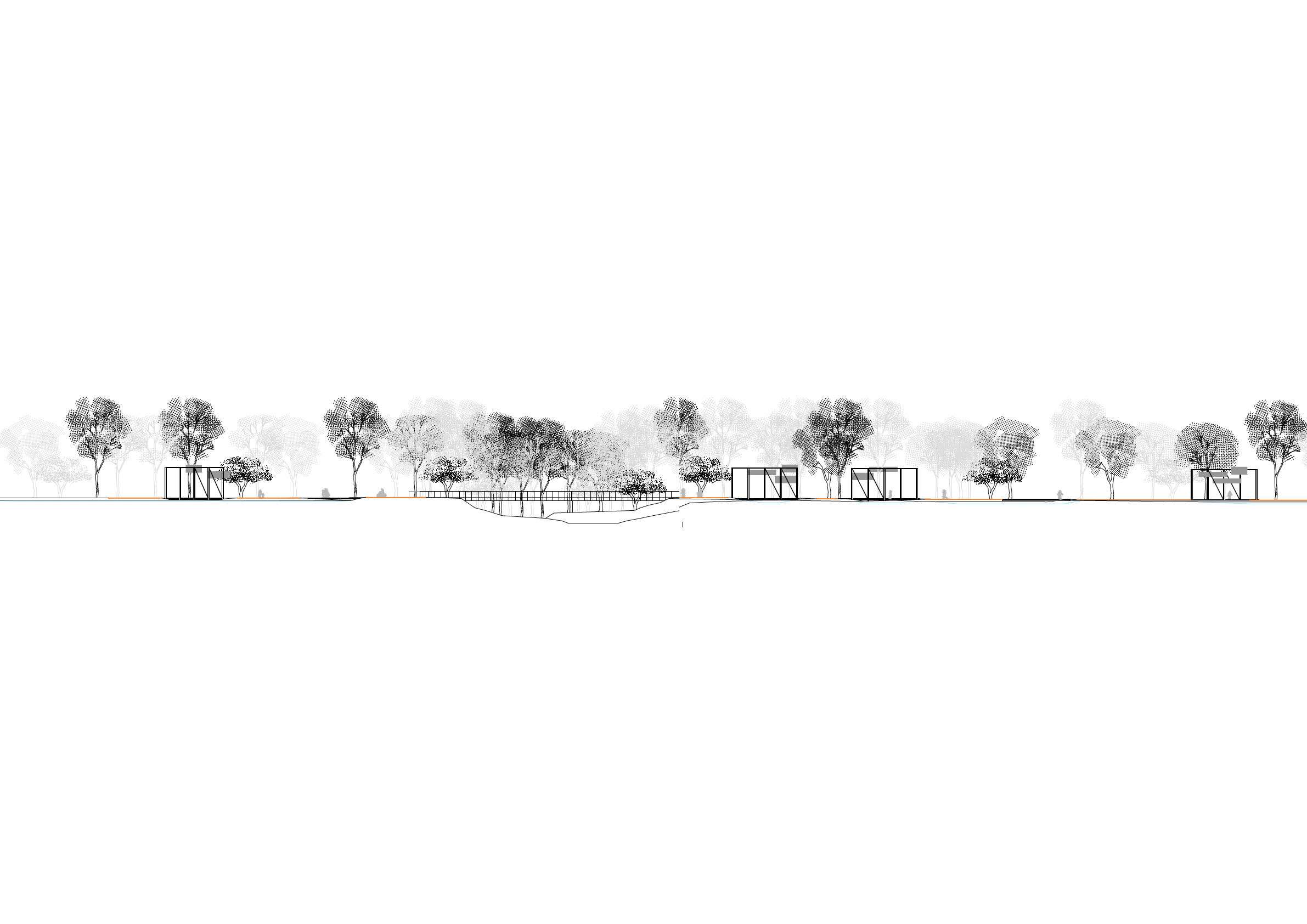
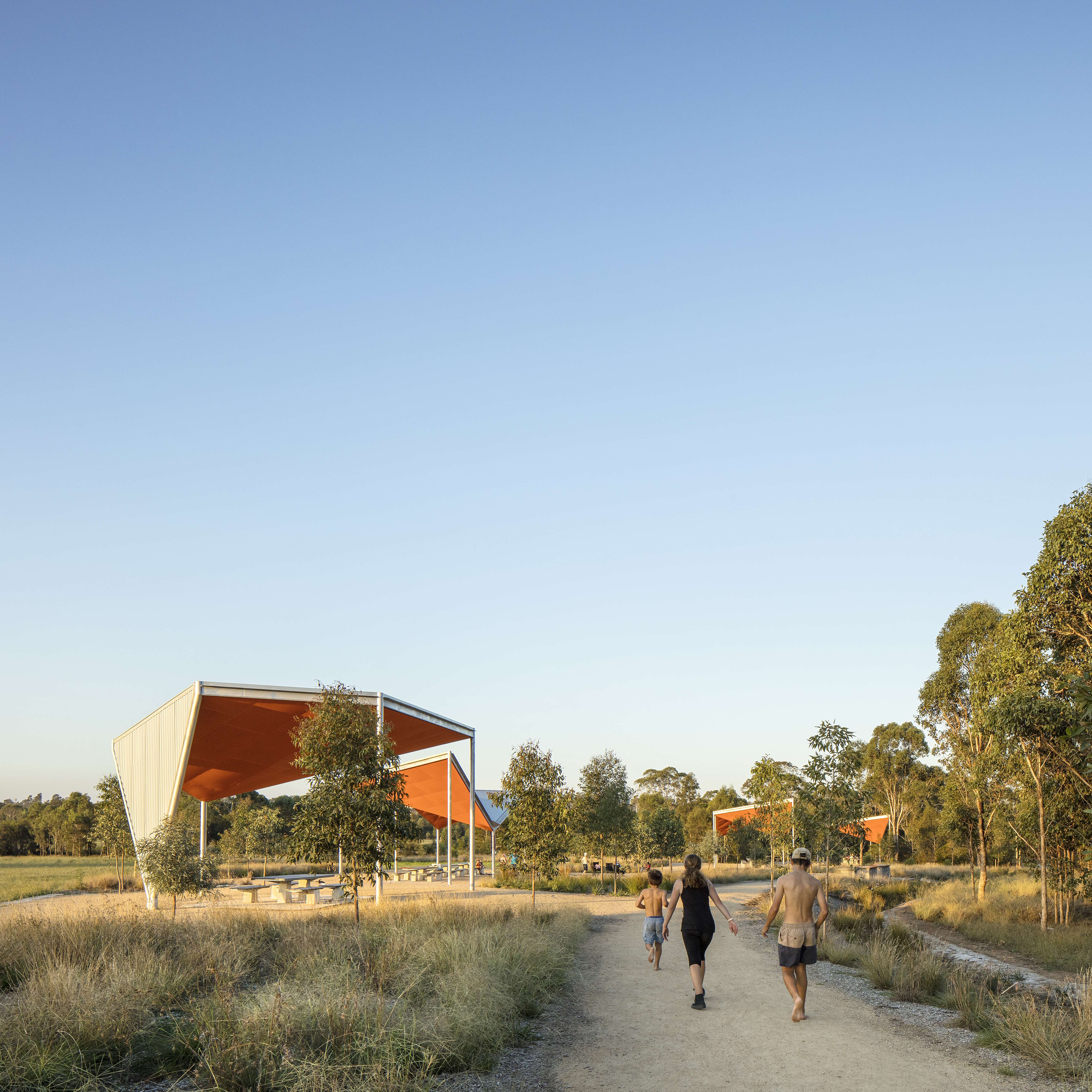
From these components, contrasting characters were established. The Apex with its overview of the “Heart”, remnant plantings and model aircraft runway is organised by the large cross lawn and playground on the ridge. The two sub-precincts offer very different experiences that cater to a range of users. The playground, picnic grounds, shelters, event space, access paths are more densely clustered in the east where the two forests meet in a remnant woodland.
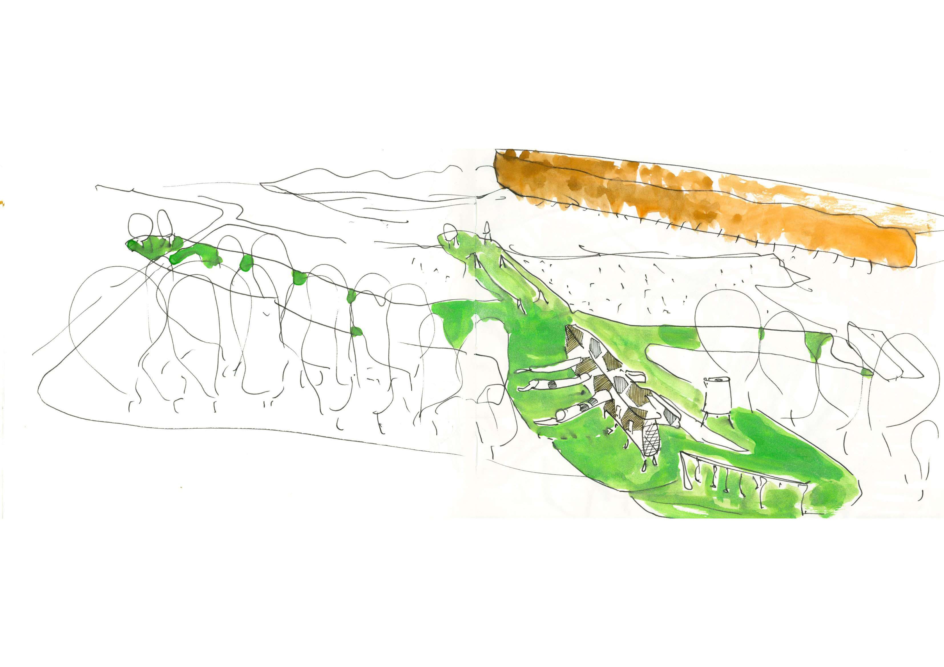
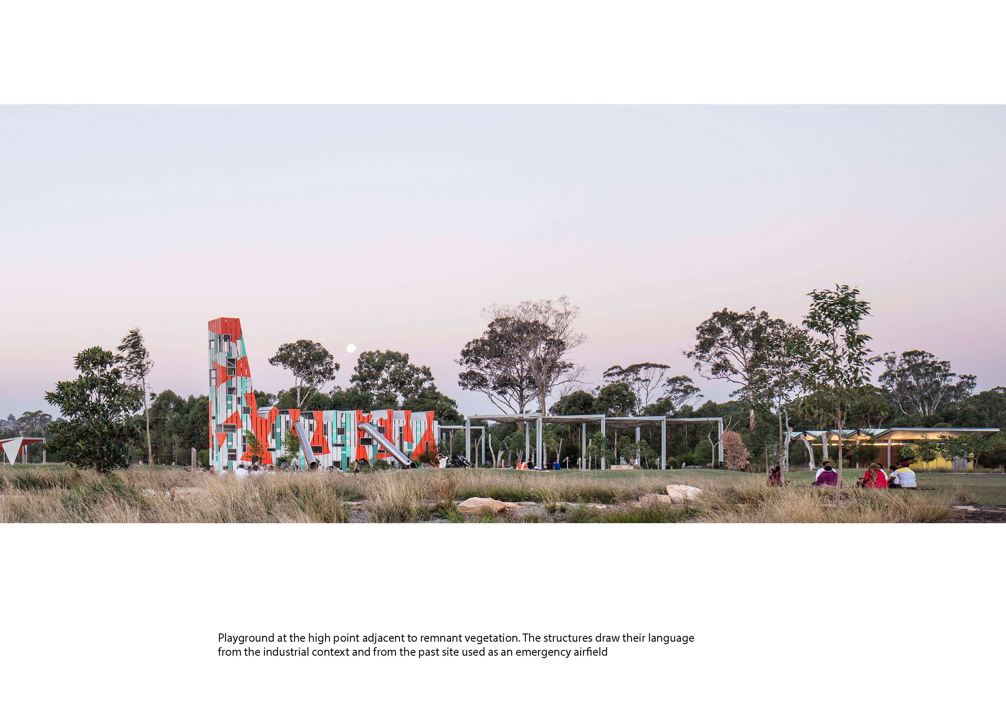
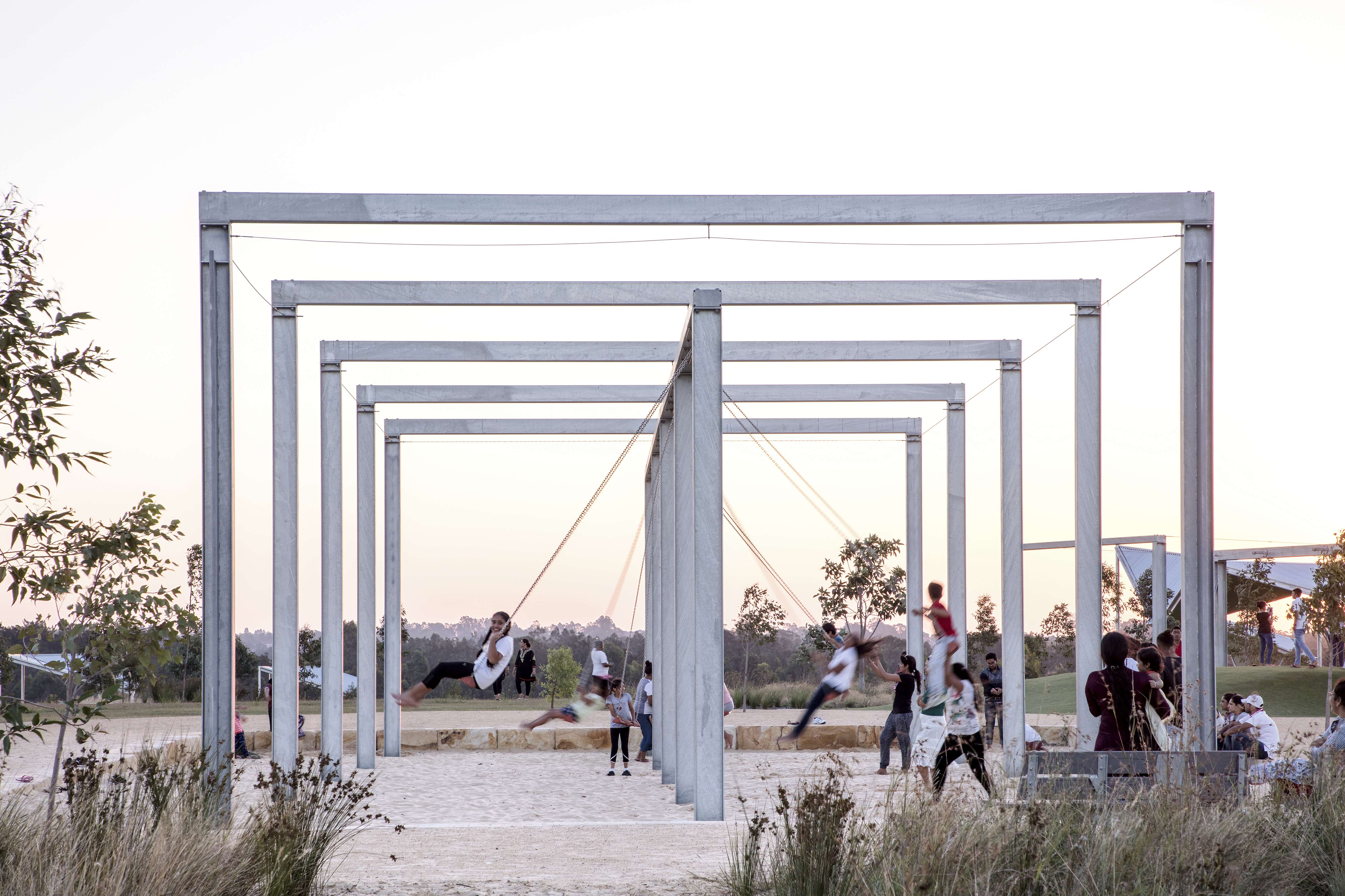
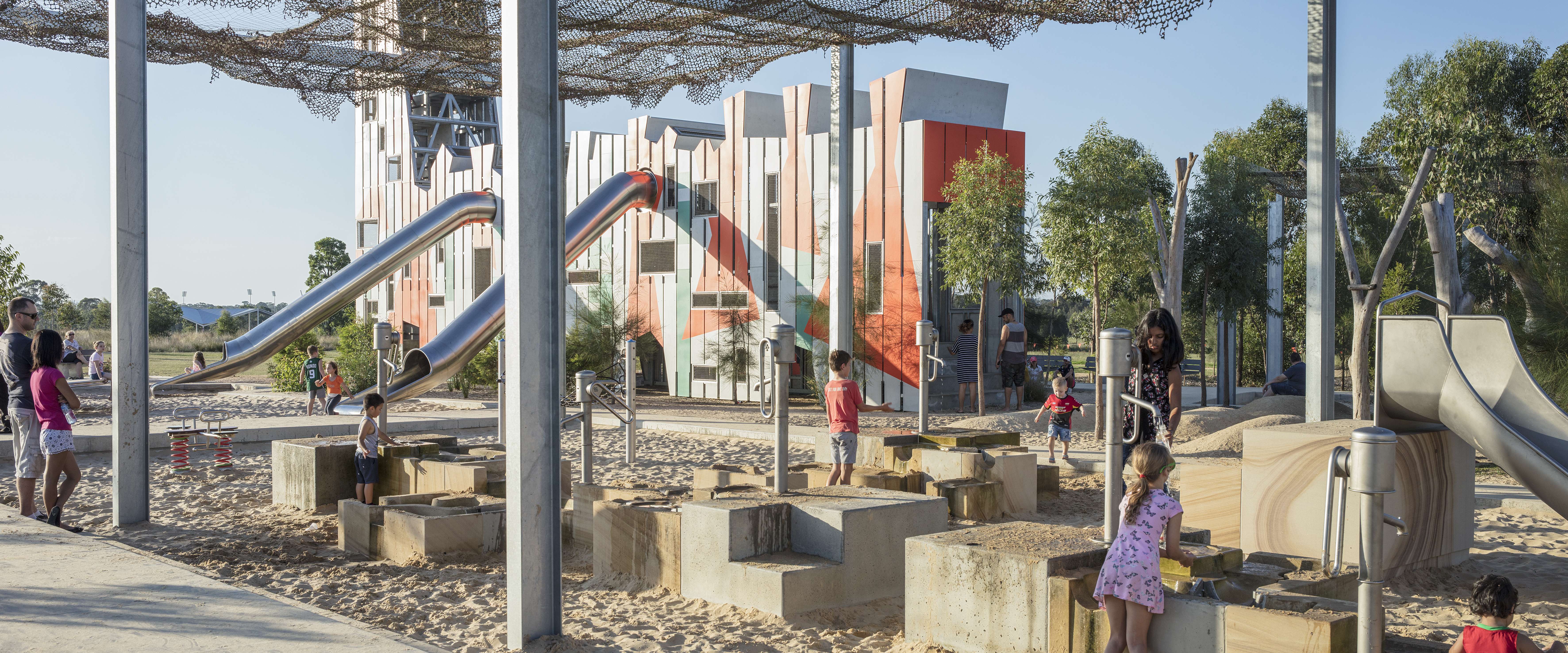
The playground is a place of bigness, of sky and of metaphorical flight echoing the site’s previous uses. The treehouse is part ant farm, part airplane, part tower with a summit that overlooks the regional landscape. Internally multiple journeys take children through, down/up, in and out of the structure. Nestled around the treehouse are radial mounds, logs, boulders and two sand pits, one with water play on large robotically carved sandstone blocks, the other with toddler swings. The playground radiates outward from the treehouse into the landscape with the flying fox and big swings launching their riders toward the edge of the ridge and the western horizon.
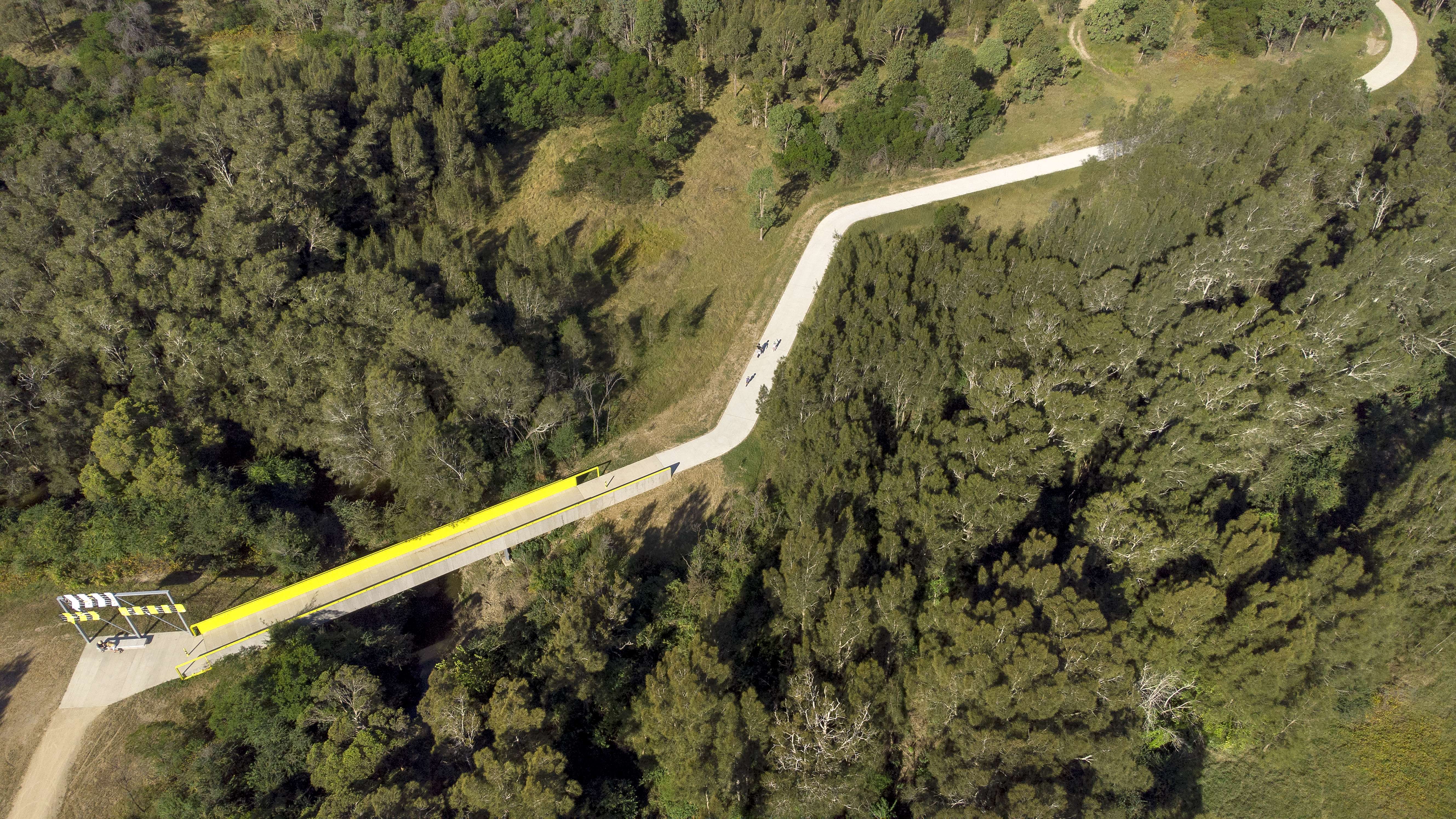
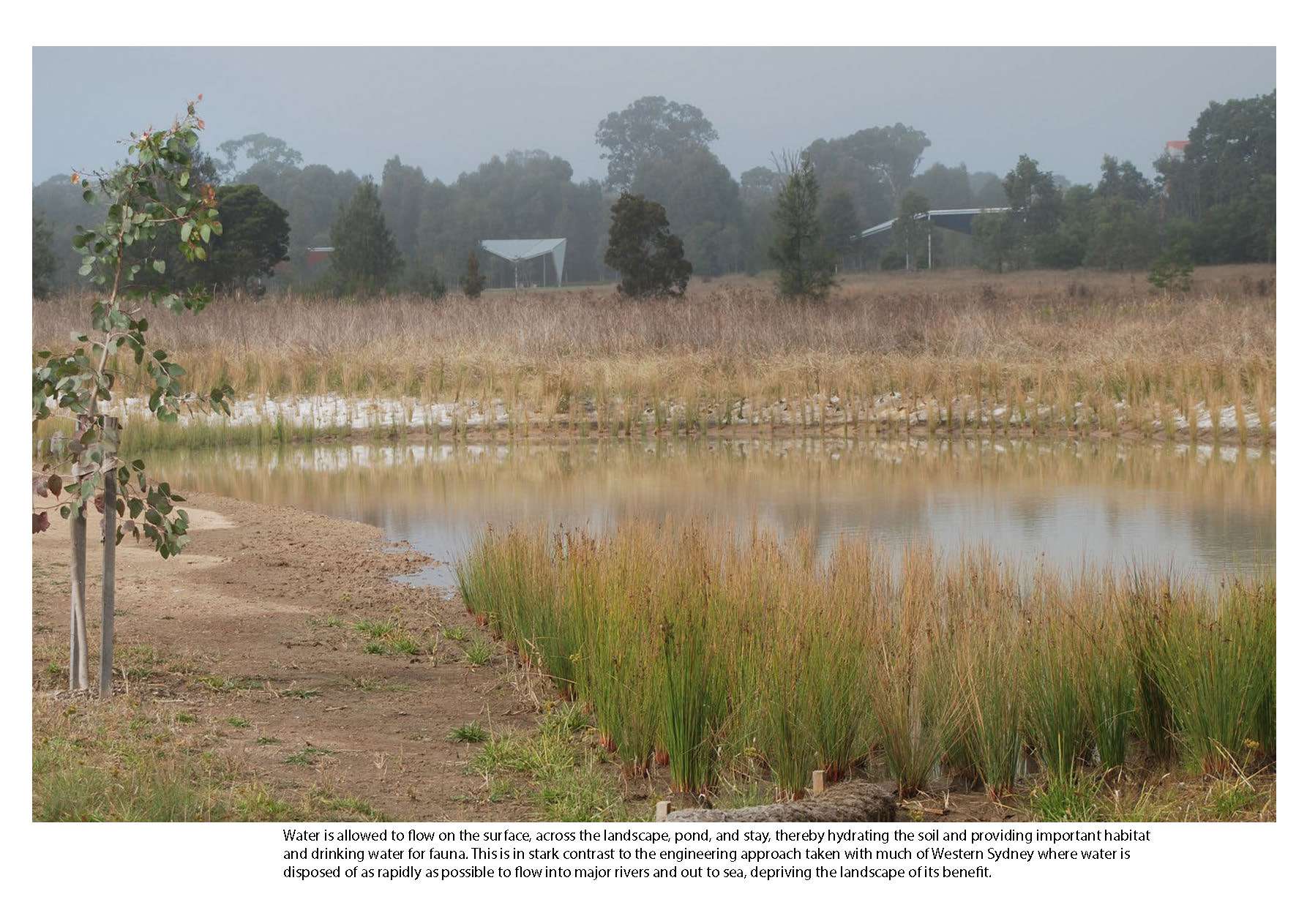
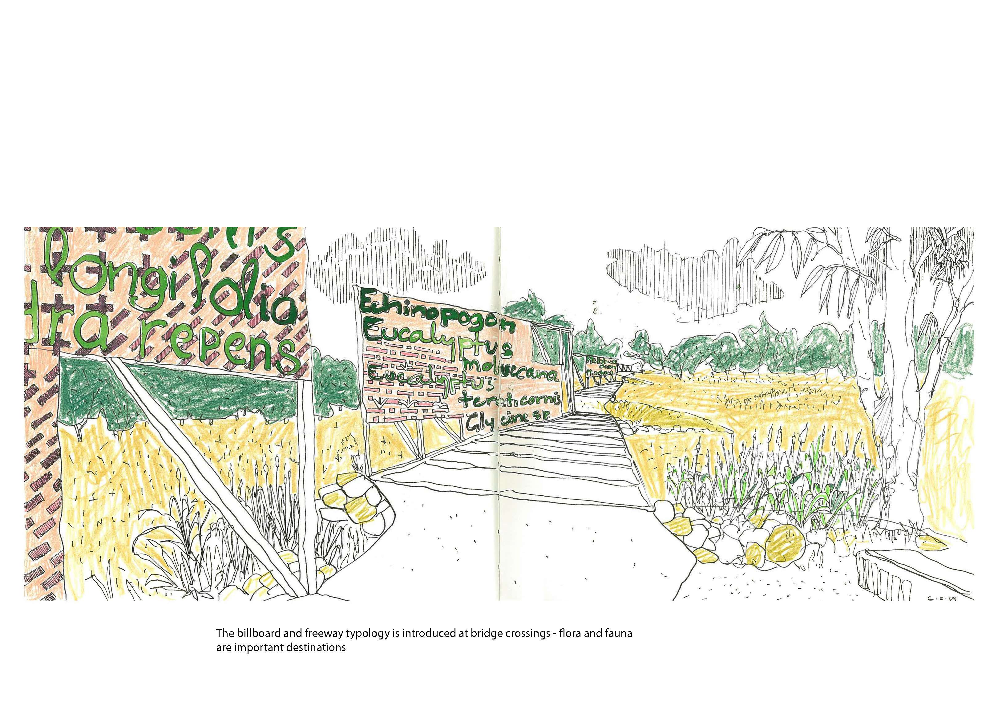
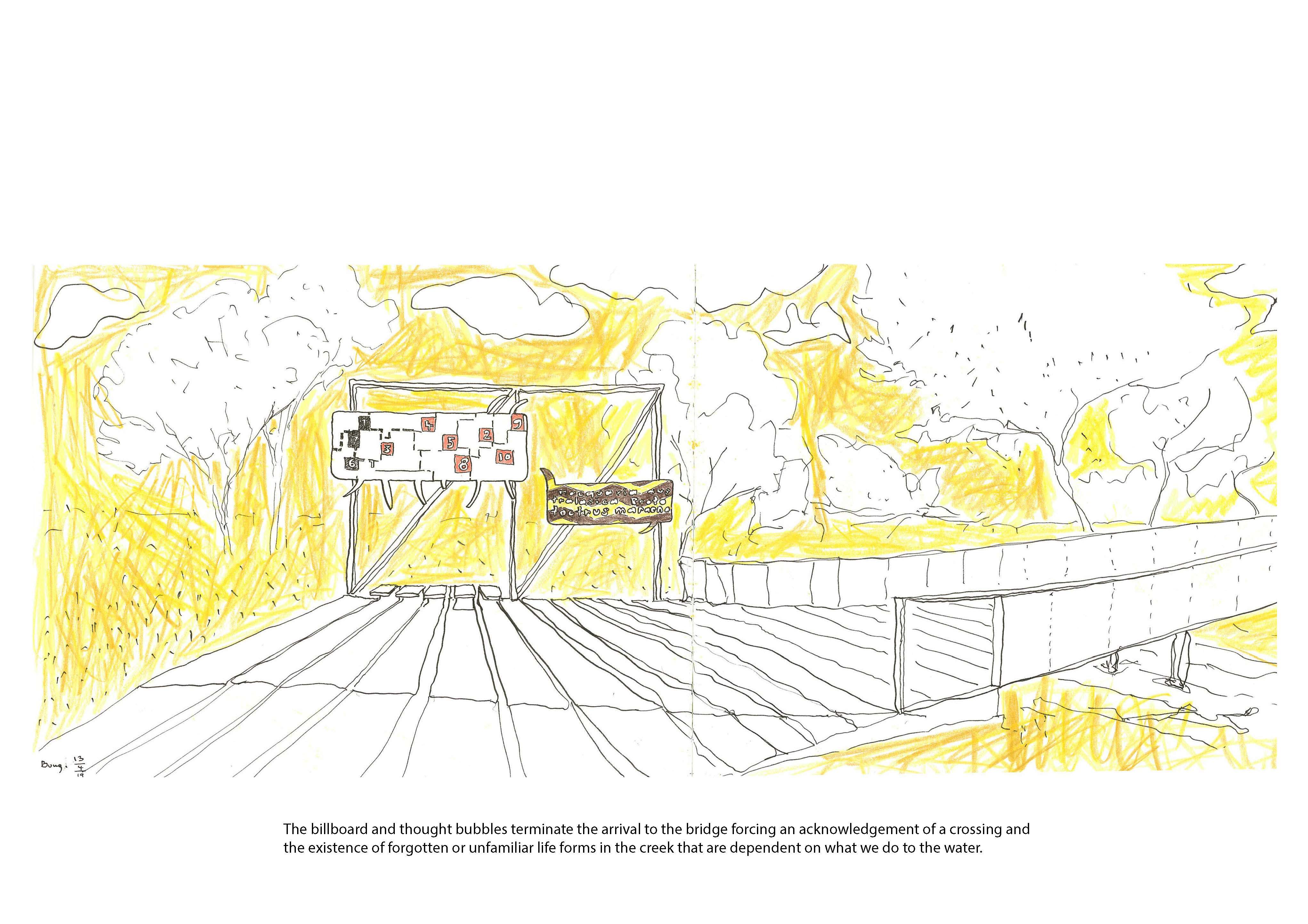
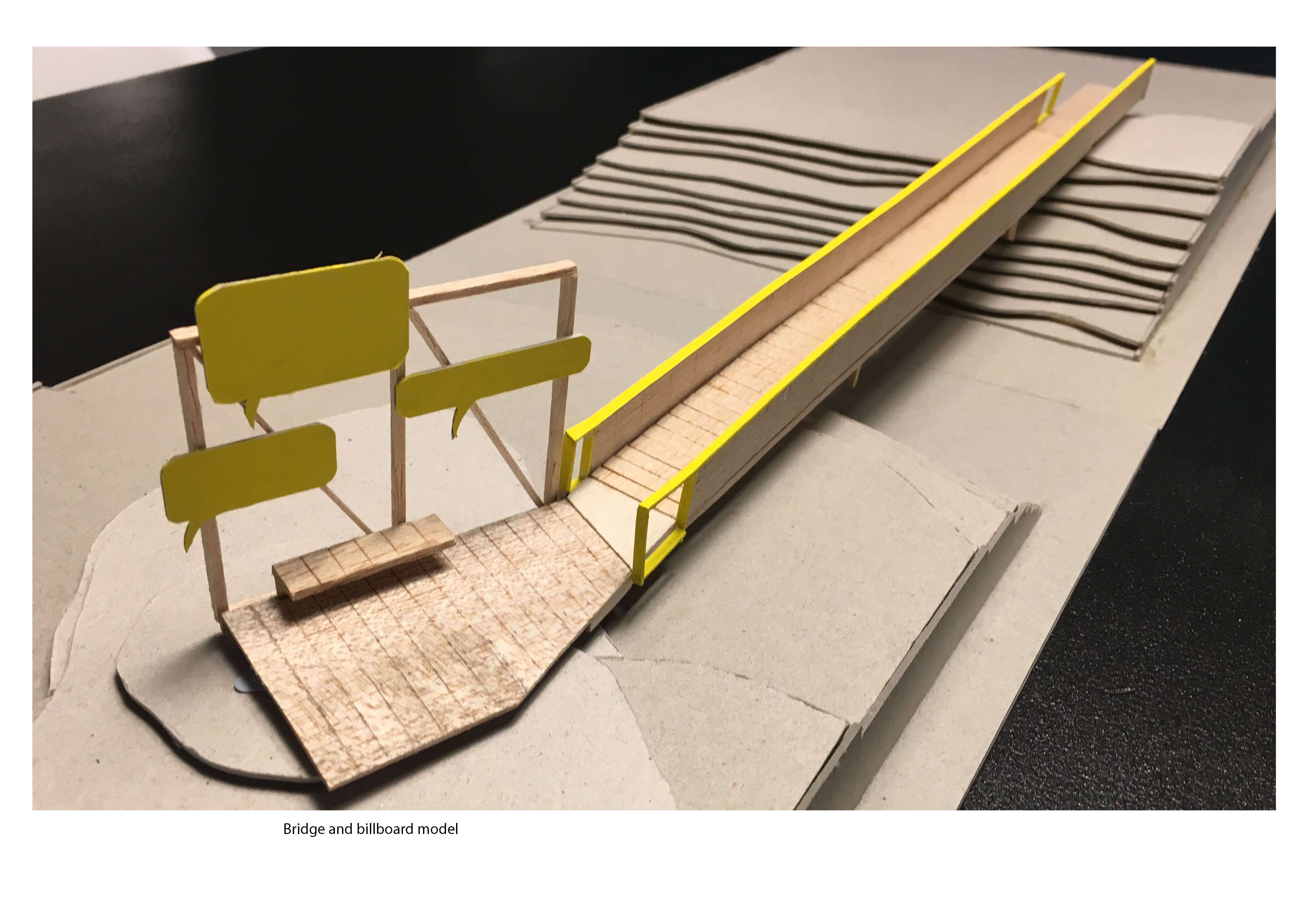
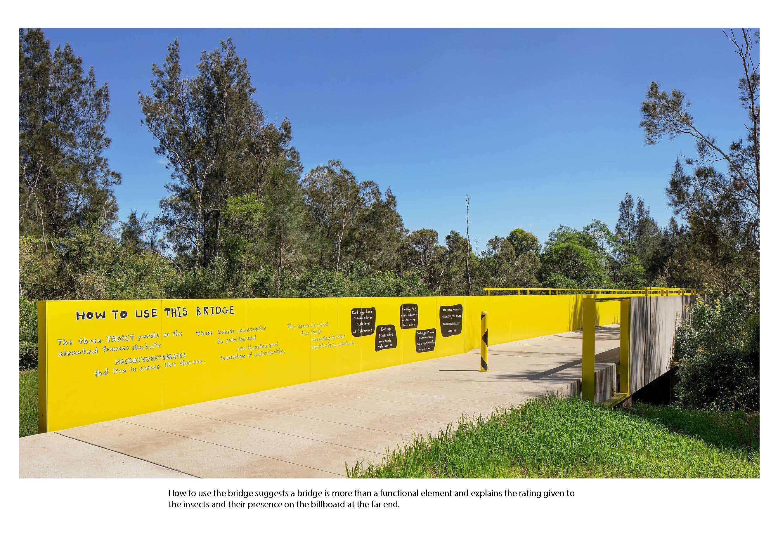
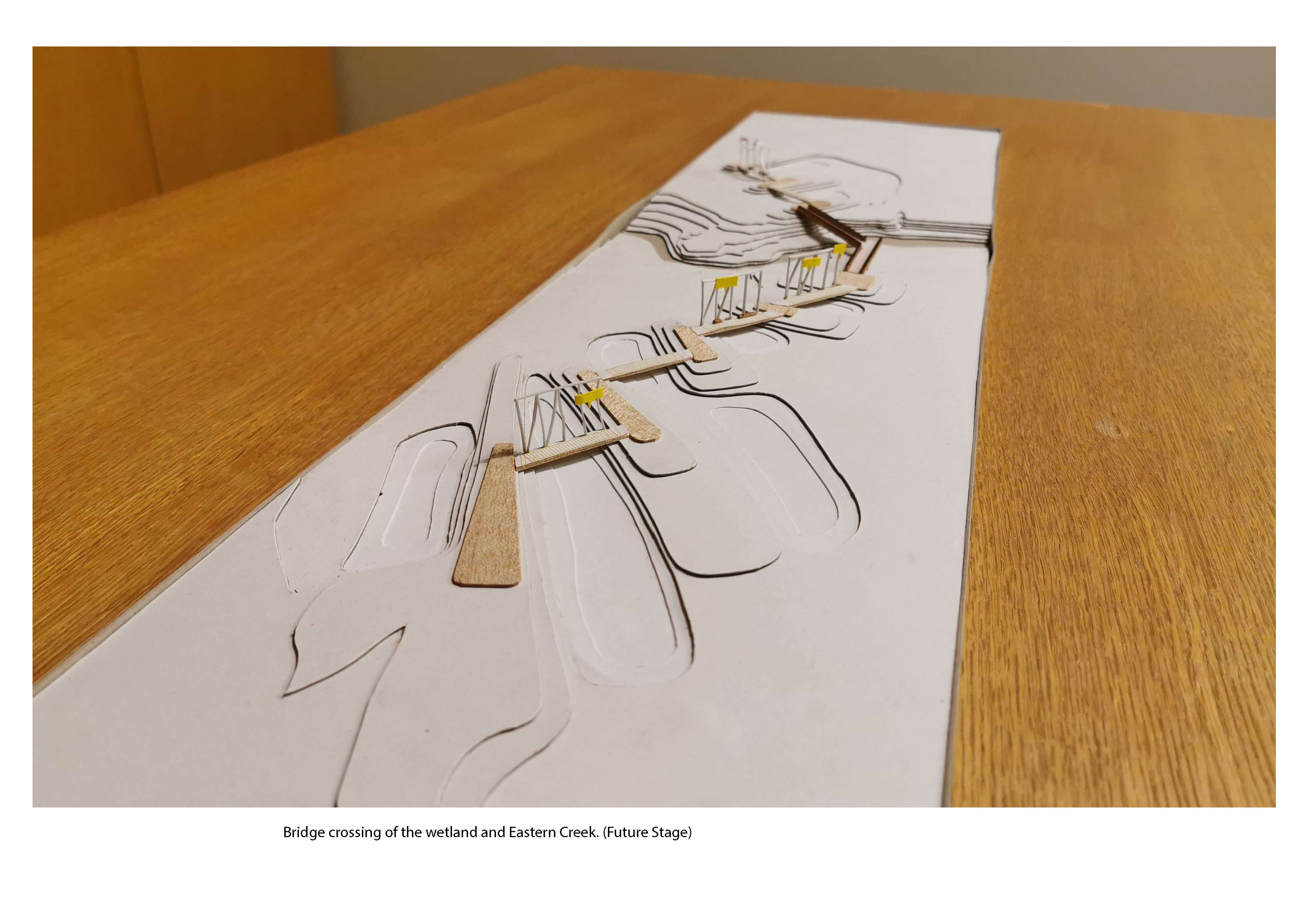
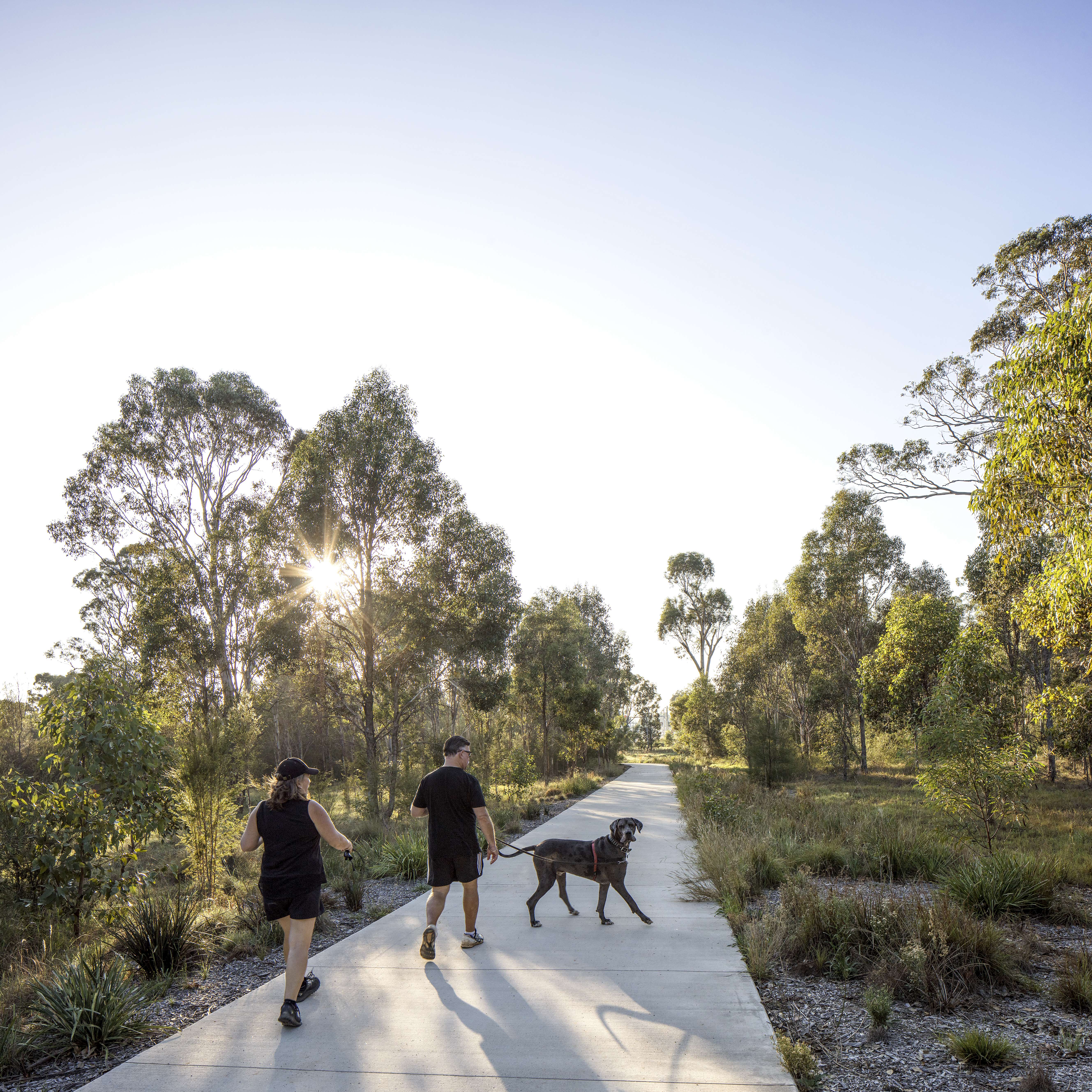
Nestled in the low-lying floodplain of Eastern Creek sits the Northern Bridge. The Bridge provides pedestrian access to the previously inaccessible western portion of the park, new shared paths and clear and generous links to the Redgum Runway, subtly directing surface water flow to slow it and hold it to create an ephemeral landscape that encourages infiltration, allows the diverse water-based ecosystems and the surrounding forests to thrive and creates a space that accommodates both human and non-human use.
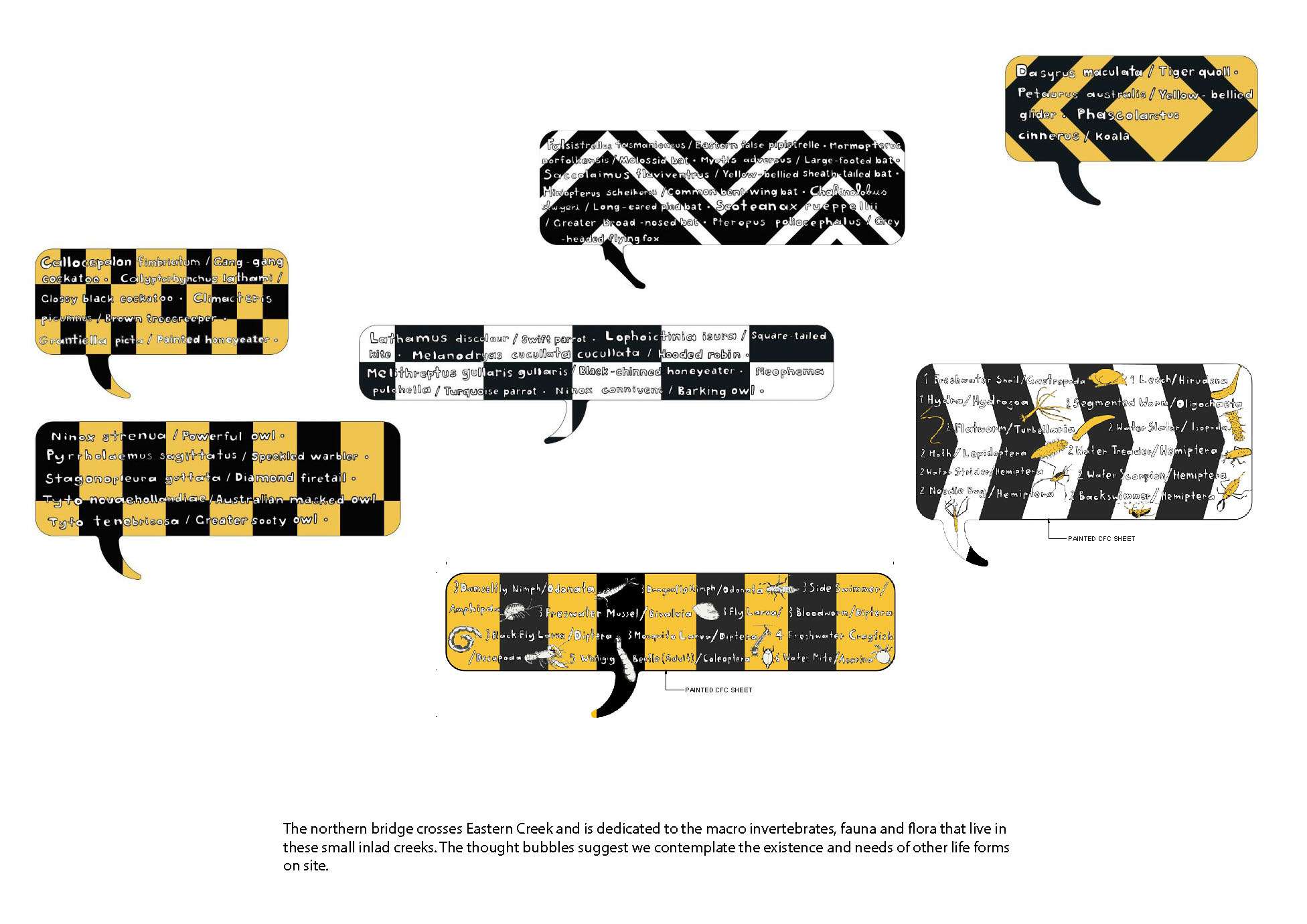
The Northern Bridge sits firmly within the family of parkland structures evident in the playground, entries and picnic shelters. The bridge is both billboard and infrastructure, interpretation and transportation, idea and technology. The graphic billboard structures on the bridge depict macro-invertebrates that may be in the creek depending on water quality. The bridge is a continuation of the industrial style seen in the entry signage and play spaces; It’s industrial steel profile, size and bold traffic style directional graphics introduce an interplay of scales and announce the importance of the unseen flora and fauna in the precinct. Whilst these macroinvertebrates are rarely visible to the user their depiction invites consideration and acknowledgement of their value within the ecosystem.
Car parking, access roads and amenities buildings are located within the forests designed to buffer the sensitive parts of the site from the busy infrastructure. Water is held treated, in car parks with generous plantings and infiltration.
The design of each sub-precinct within Bungarribee celebrates the unique Western Sydney landscape. Bungarribee asserts itself in a manner that engages with the scale and language of the industrial context, with the factory sheds, the freeways, the billboards to create a space that is aesthetically cohesive and, in scale and character with its surrounds. We saw in Bungarribee a great opportunity to look carefully and retain what is on site. With specific attention to site character, indigenous and non-indigenous heritage, ecology and hydrology to introduce a subtle yet powerful appreciation of the site’s uniqueness that is fostered and communicated to a wide audience. We have in this project refined our approach to site, green infrastructure and soft engineering.
Bungarribee has been able to assert itself in an urban sense by elevating the value of the as found landscape and working toward a shift in values that seeks to no longer see these landscapes as left over but rather as rich places in their own right. Bungarribee Park is making a positive contribution to the ongoing transition taking place in Western Sydney by actively pursuing a reformulation of what this landscape means.
Project reviewed in: https://landscapeaustralia.com/articles/a-grassland-splendour-bungarribee-superpark/
Subconsultants:
Stanic Harding Architects
Coffey
Northrop Consulting Engineers
Lighting, Art & Science
Simplex Electrical Engineers
Playrope
Turner & Townsend Thinc
Daracon Group
CD Construction Group
Fleetwood Urban
H4DA
J. Wyndham Prince
Cunneen Signs
Geotechnique
Sydney Water
Hollis Partners
Vince Morgan Surveyors
Photography: Simon Wood Photography
Watercolours / Sketches: Anton James (JMD design)