Corktown Common: Building Community Resiliency with a Neighborhood Park
Corktown Common: Building Community Resiliency with a Neighborhood Park
Corktown Common: Flood Protection and a Neighborhood Park
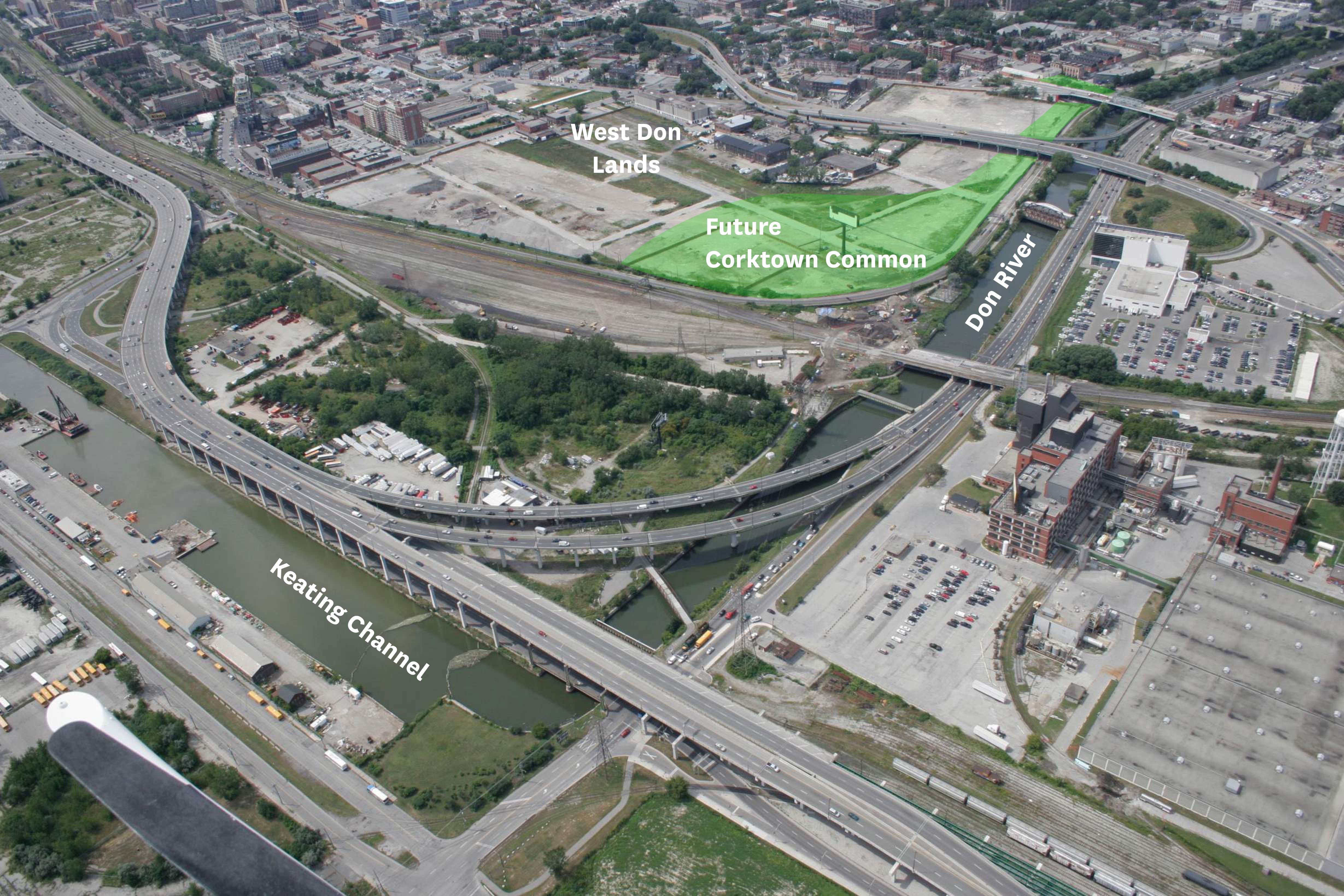
Project location: West Don Lands, Toronto, Ontario
Client: WaterfrontTORONTO, a government agency charged with revitalizing 2,000 acres of Toronto’s waterfront, in partnership with the Toronto Region Conservancy Authority and Infrastructure Ontario, the latter two charged (among other things) to protect the city from the flood waters of the Don River.
Owner: City of Toronto Parks, Forestry and Recreation Division
Project Mission: Protection, Enjoyment, and Regeneration
Major world cities such as Toronto are in transition and many are recycling their industrial pasts. Corktown Common demonstrates that this type of renewal can be profoundly transformative: serving public safety, ecological health, and quality of life within the same project.
Below Corktown Common’s surface of popular recreational activities and richly planted site ecology, replete with Ontario’s native flora, is a 4-meter high clay substructure that reshapes the Don River’s floodplain. A massive flood control embankment masquerading as landscape, the park shields Toronto’s post-industrial West Don Lands from potential inundation by shunting floodwaters south toward the lake. It is, in fact, the park itself that allows the new neighborhood to come safely into being.
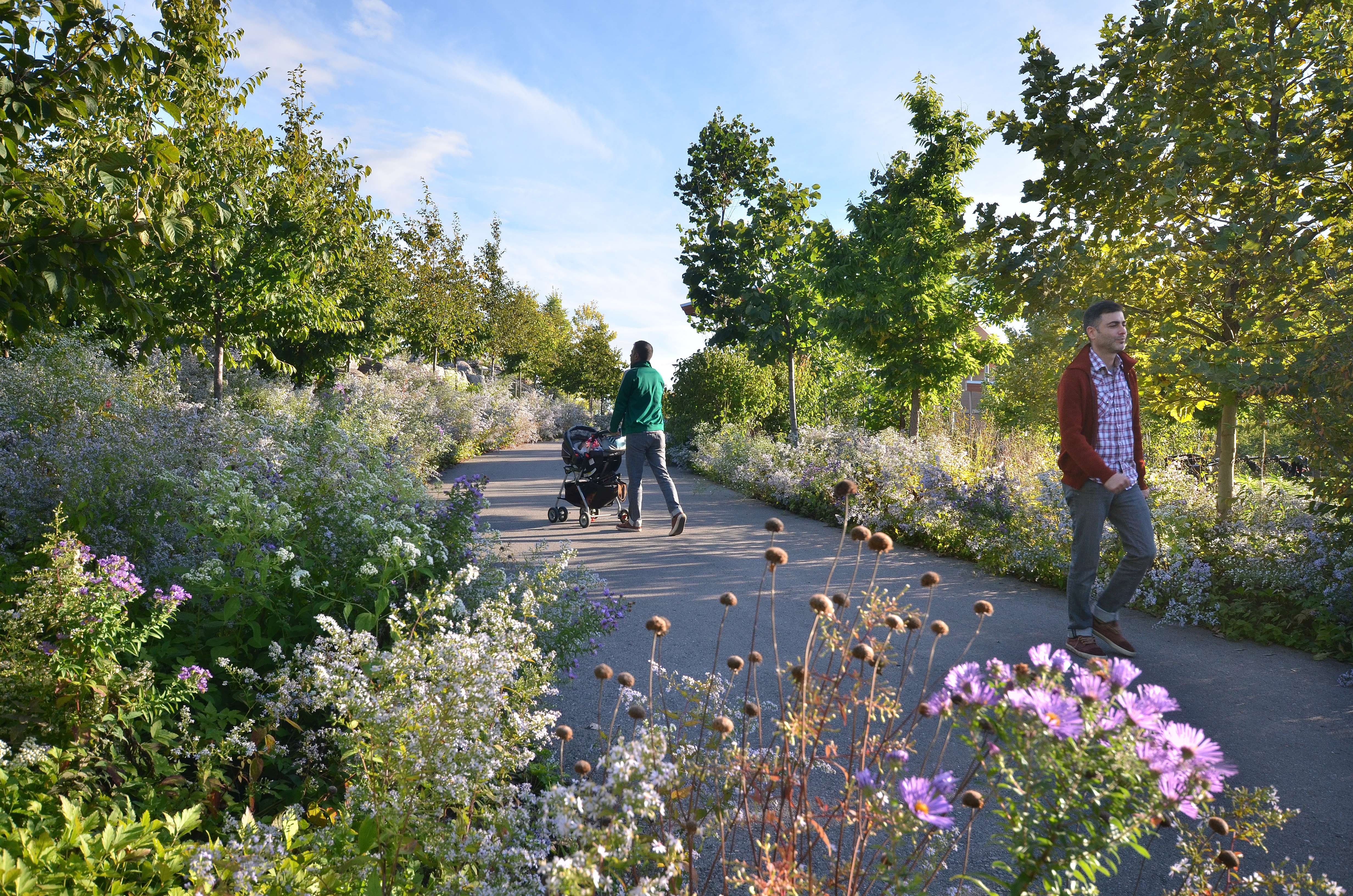
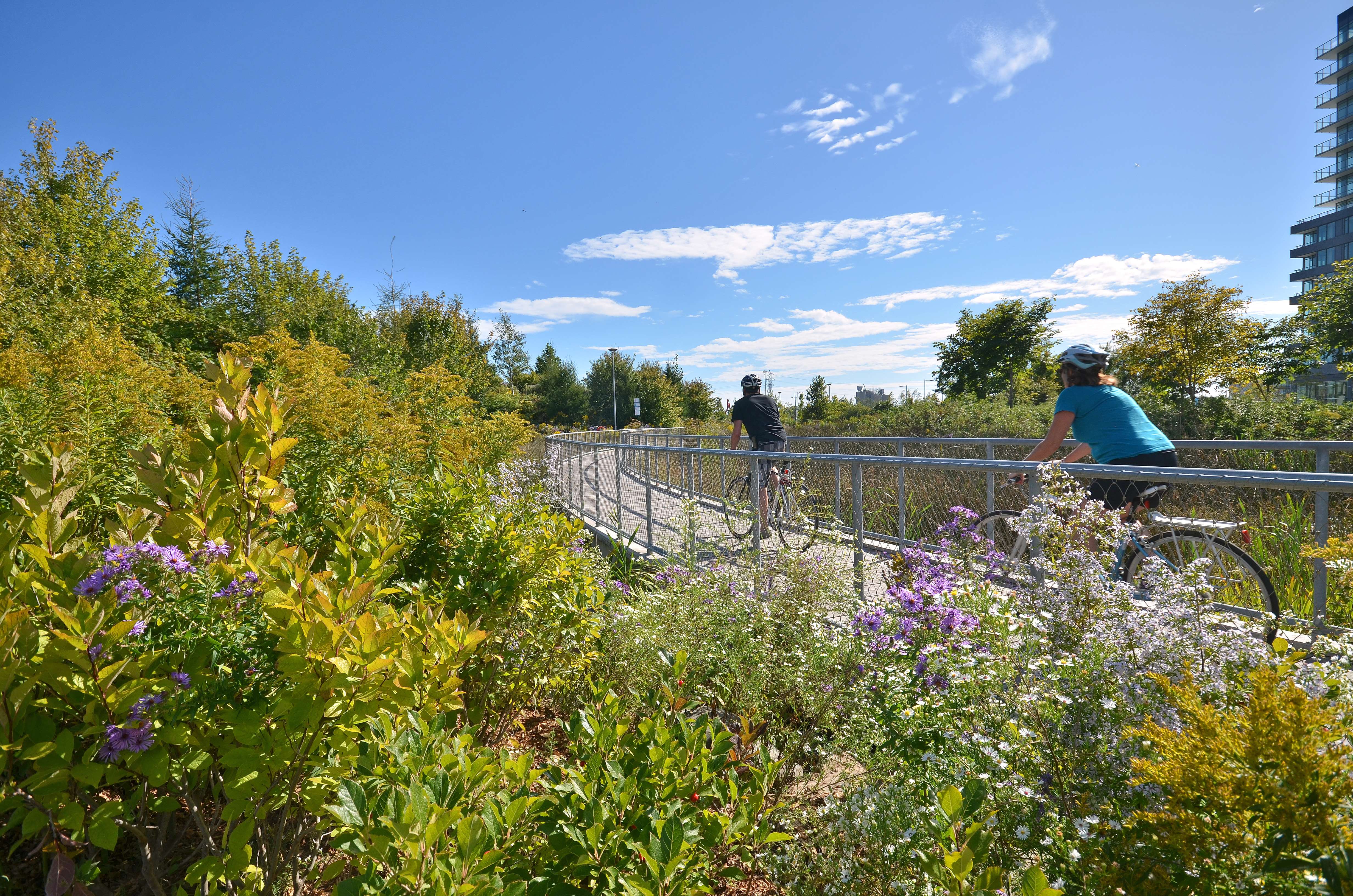
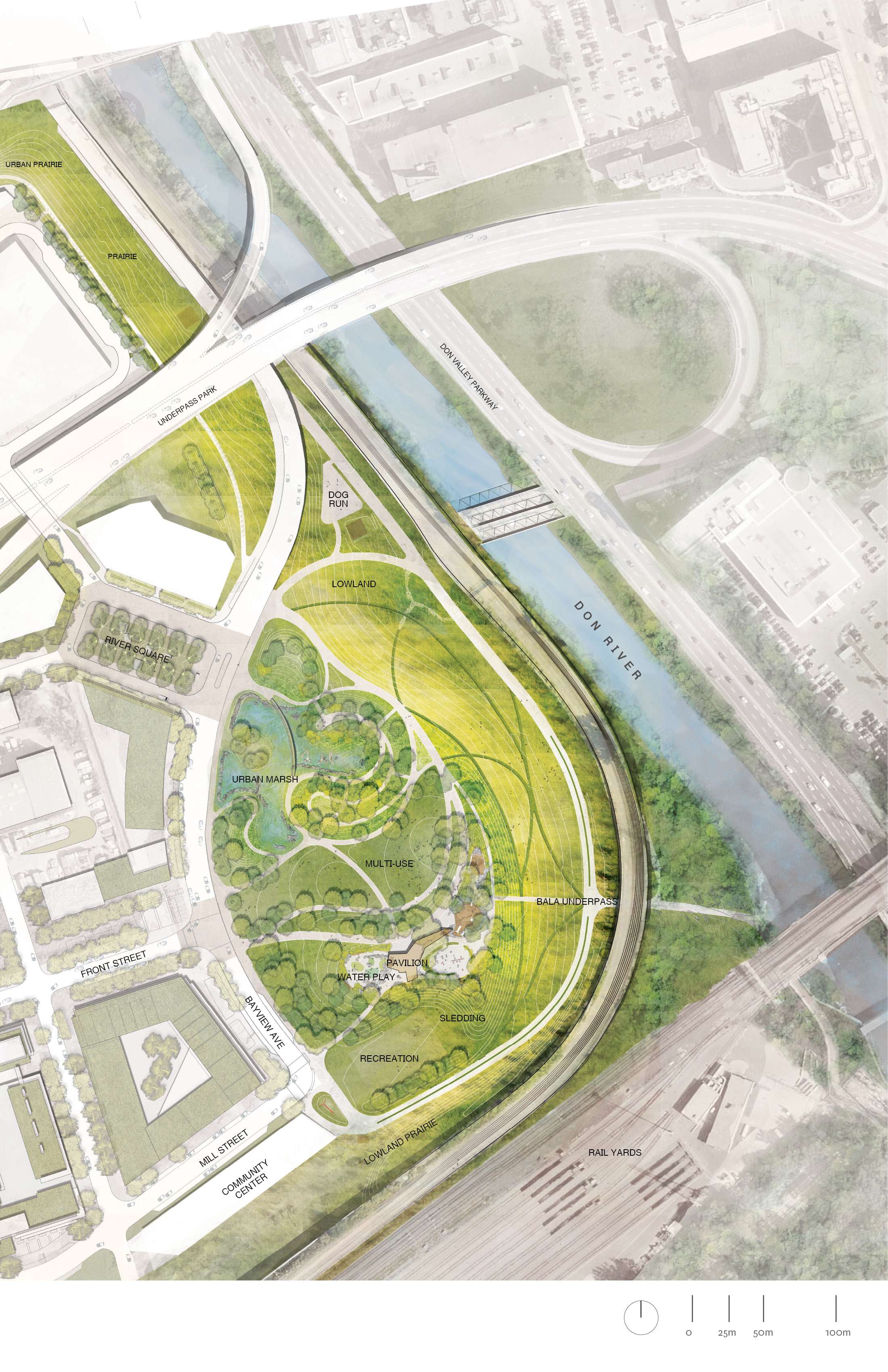
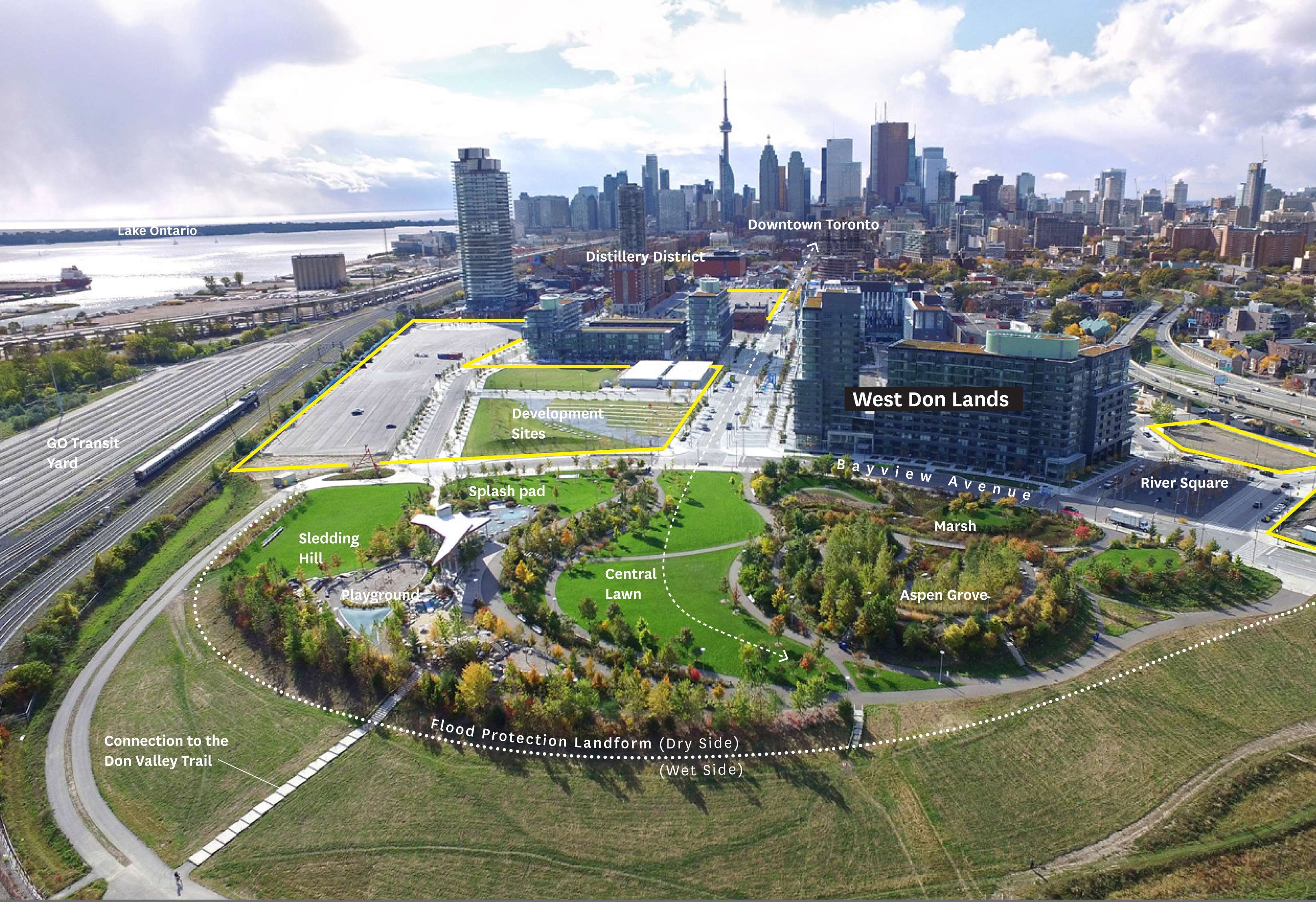
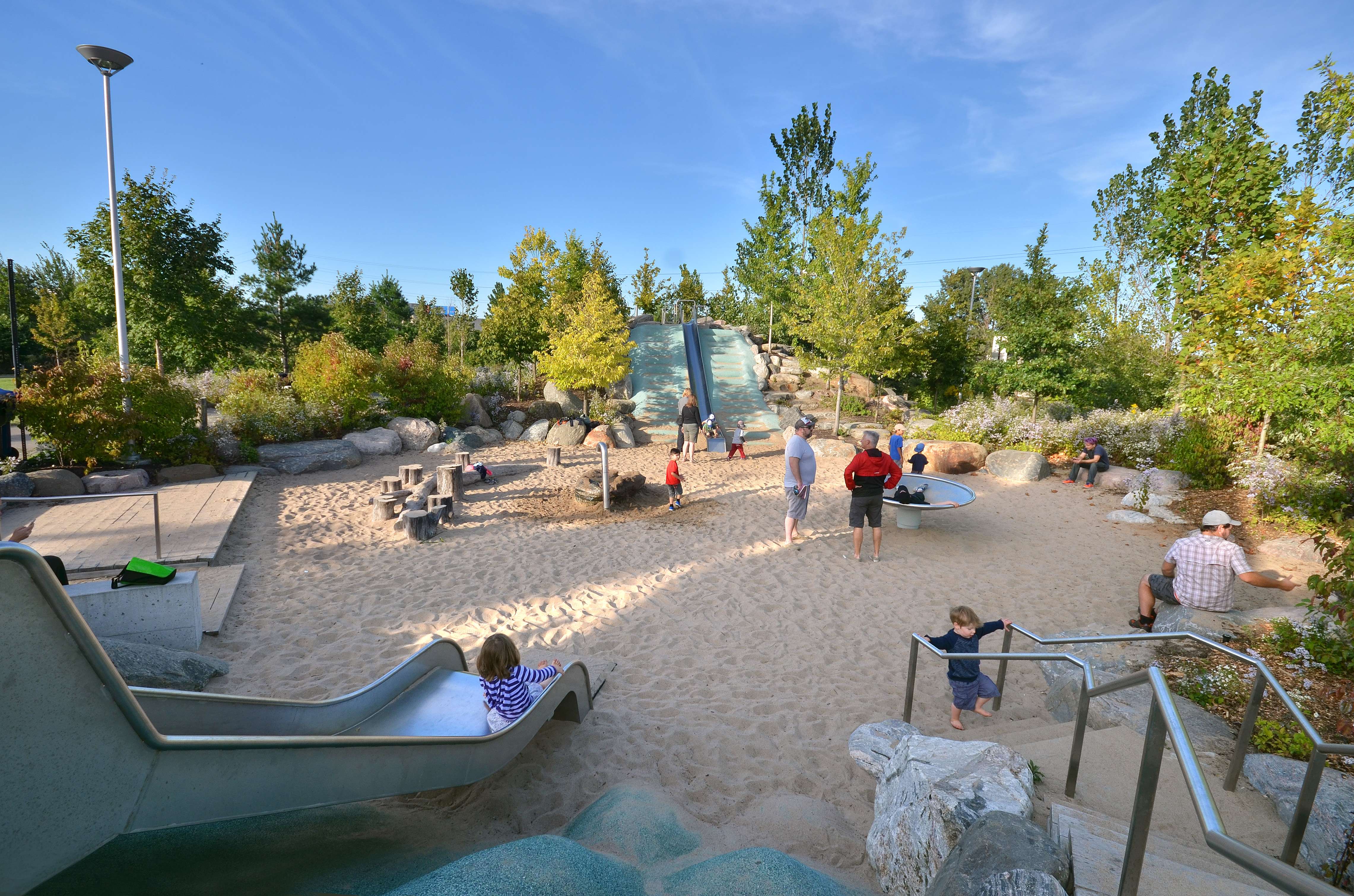
The unique morphology of the flood landform splits the park in two highly distinctive halves. The 9-acre riverside prairie is designed to help move floodwater, which restricts the use of woody plants across its surface, so the sloped plane is planted with a grassland seed mix, which attracts birds and insects. The low impact trails along the slope are designed to sustain this high levels of flood disturbance. The 9-acre cityside is designed to remain out of reach of flooding with higher lands where robust recreational activities, including a community pavilion, waterplay, urban marsh and multi-purpose lawns could be safely introduced. As a reconstructed brownfield site and the first completed piece of the West Don Land urban plan, Corktown Common is a pioneer, helping to define the character of a new urban neighborhood.
This city park was conceived of and constructed using an unusual organizational model—commissioned and paid for by WaterfrontTORONTO, but maintained and ultimately owned by the city. This joint partnership was of great value to the design team, enabling experimentation with different ideas about combining flood resistant infrastructure with an ecologically and culturally rich public space. The collaboration also helped insure a thoughtful program of community engagement and outreach throughout the project as well as compatibility with a strong precinct plan to guide development.
Corktown Common demonstrates the value of leading with parks and open spaces, but even more importantly it reflects the powerful potential of integrated design. With urban impacts that extend far beyond the site boundaries, this new flood protection, recreational facilities, and constructed site ecology have transformed a discarded outer edge of the city into an exciting new urban center.
Project Description
Size: 18 acres (7.3 hectares); 9 acres facing the city and 9 acres facing the river
Design Goals:
Inhabiting infrastructure: making a Neighborhood park from the backbone of a flood control infrastructure
Encouraging urban development: program a park to be the centerpiece for the future West Don Lands Neighborhood
Enabling regenerative ecology: creating the structure for a biodiverse ecosystem that will thrive and self-sustain
A Brownfield with a High Risk of Flooding
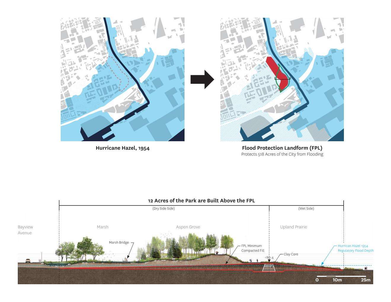
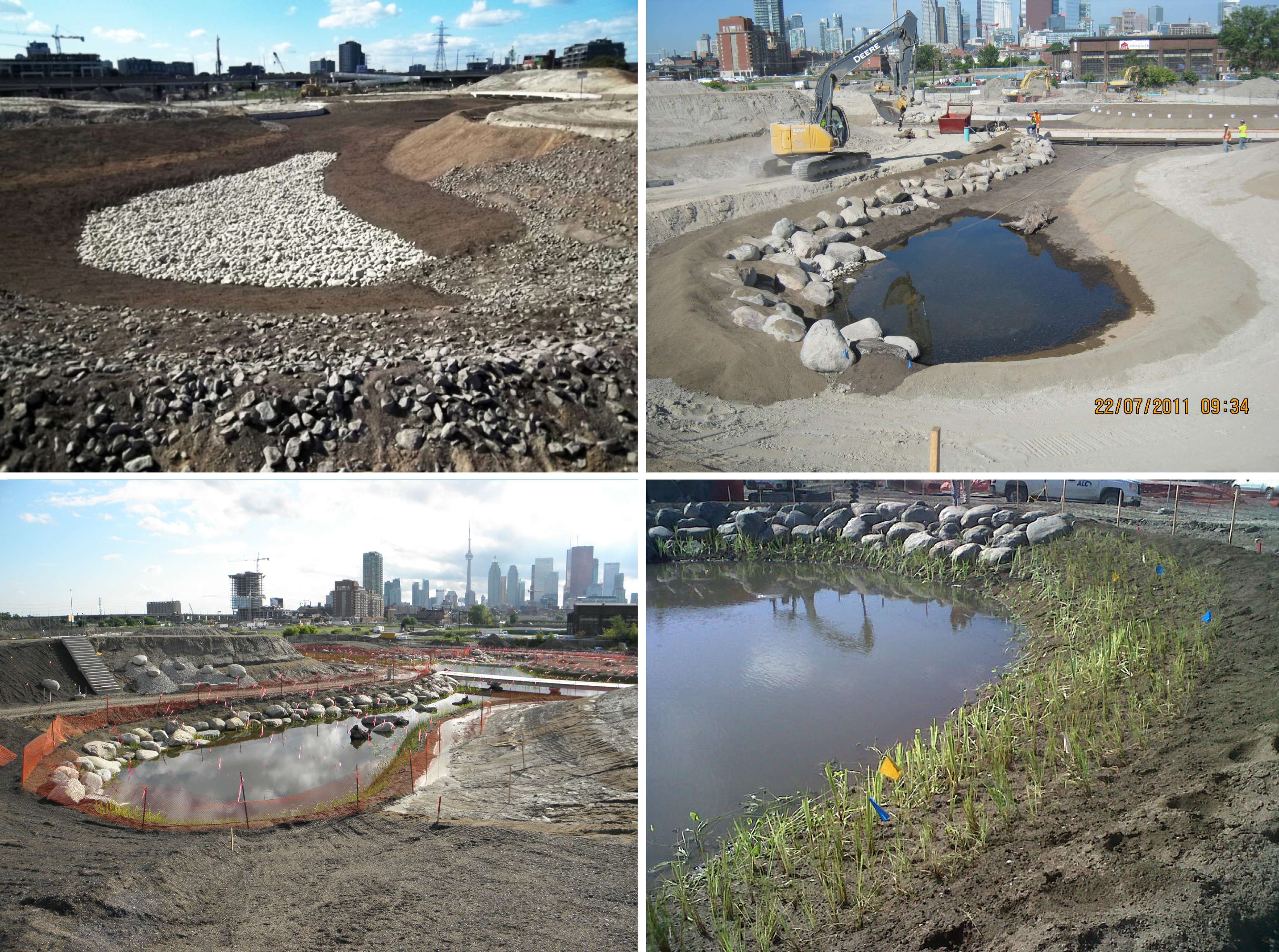
The park’s site is a relic of Toronto’s industrial past. Once a ecologically rich wetland that helped absorb high waters, industrial development transformed the physical underpinnings of the site – filling, paving, straightening, armored edges -- and also left a legacy of pollution. Once Toronto’s industrial production had moved elsewhere by the late 20th century, what the future site of Corktown Common was a brownfield in desperate need of remediation. The site was hazardously exposed to Don River flooding, with the potential to inundate up to 519 acres (210 hectares) of Toronto.
Building Safe Ground
Initially conceived of as an urgently-needed public works project to mitigate flooding, Corktown Common exponentially expands its value by also providing an immersive recreational landscape. Forming the icing on the cake of a constructed 4 x 750-meter earthen flood protection landform, the park has made this vital infrastructure a gathering place for an emerging Neighborhood. The necessity of the raised landform actually offered new landscape opportunities – for instance, the team opted to build additional height, above what was mandated, to enable dramatic views of downtown and the iconic CN tower. The landform also shields the new residential community from a cluttered rail and highway corridor adjacent to the Don River. Framed from the higher vantage point of the mound, this same view is transformed into a more abstract image of industrial sublime. Sloping away from the high point, the shallow gradient of the landform’s western slopes offer a dynamic sheltering topography affording an immersive experience and a diversity of habitat microclimates.
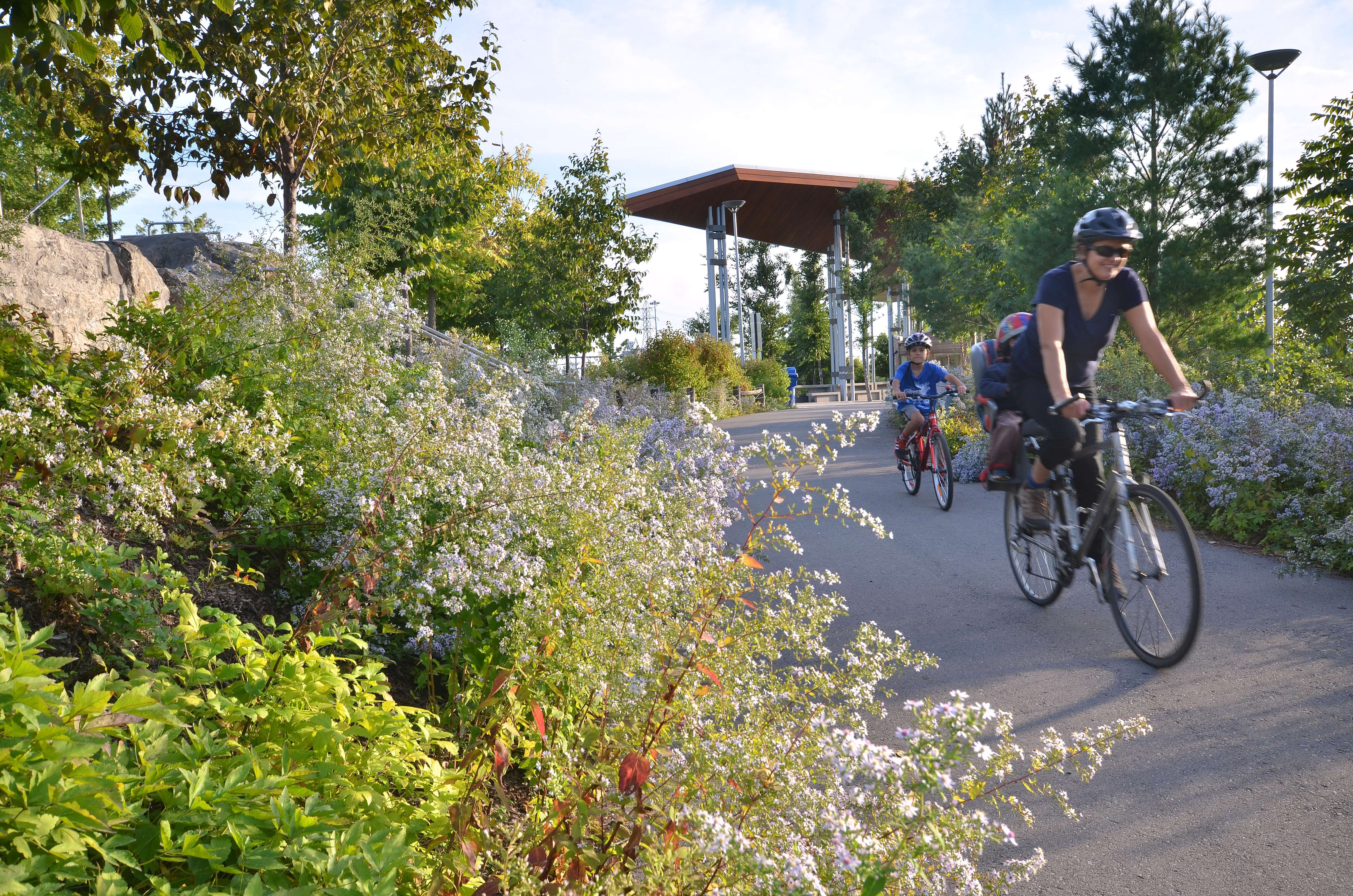
The elongated barrier separates two ecologically and programmatically discrete sections of the park: the floodable and the protected. To the east, the landform is provides a simple grassy slope for gazing out on the river and city, as well as providing trails down and a commuter bike path linking to the popular Don River Valley trail system. The western 9-acres are more complex spatially, programmatically, and ecologically: there are opportunities for children and adults of all ages to enjoy the outdoors, nature, organized activities, and a sense of escape from the city. Densely planted perennials attract an array of butterflies and other pollinators in the spring and summer.
A Regenerative Ecology – Transformation of the physical context
Creating the conditions for a regenerative ecology was integral to the planting soil and planting palette design. The flood protection landform - a compacted clay mass devoid of horticultural value – meant the park’s ecology required restarting from scratch. 50,000 cubic meters of planting soil was installed to support the ecological goals for the project: provide habitat and sustenance for migratory birds and for pollinators, provide a water body to increase the viability of wildlife in the city, showcase the characteristics of Ontario native plants, and encourage self-seeding native perennials to migrate within and beyond the park boundaries. Toronto Park’s horticultural staff are on board with a hybridized management approach that balances maintenance of the park as a natural, forested area with fidelity to a designed landscape with specific spatial and programmatic intentions. With the 100% organically maintained landscape and the native palette, the park is a flagship for new approaches to park design and maintenance within the city of Toronto.
Water Conservation
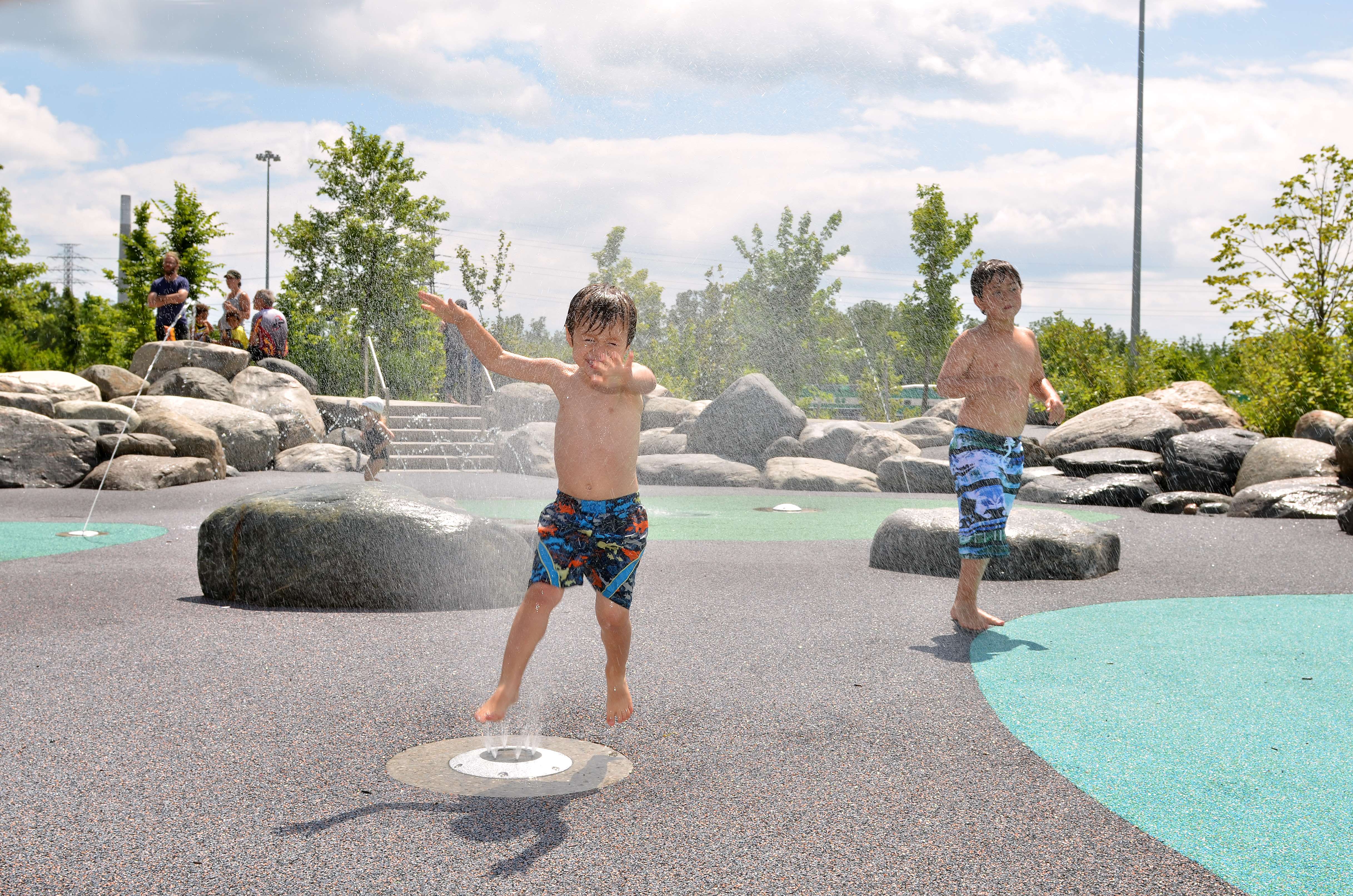
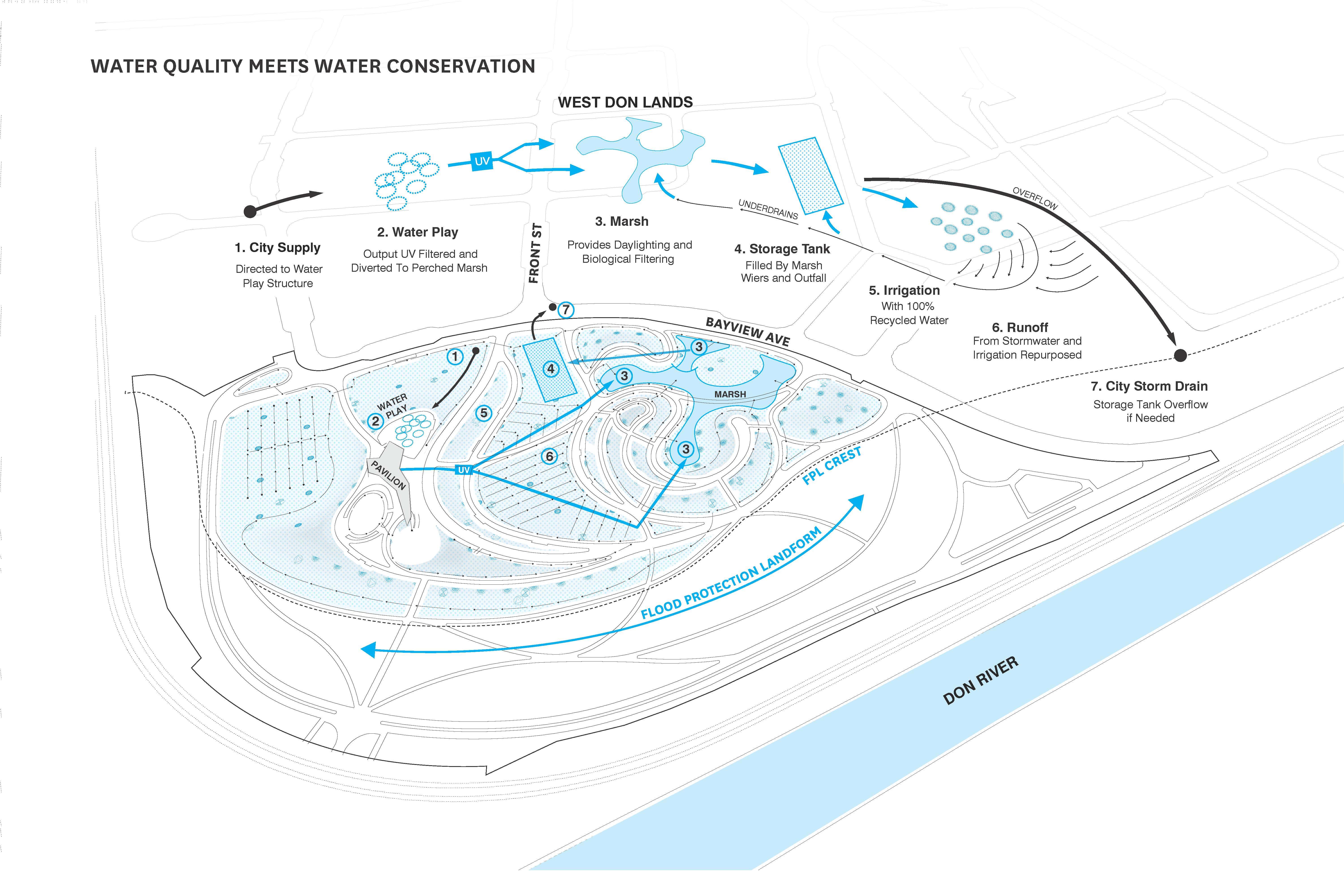
Water drawn from city systems for use in the water play “splashpad” becomes part of a robust water recycling system that sustains the hydrological needs of the marsh and provides all water needed for irrigation. When the weather is hot, the splashpad sends out jets of water, to the delight of children and adults. In accordance with Toronto’s codes, this water cannot be used a second time, so after it drains from the splashpad, it is UV filtered and combines with a park wide underdrainage system before discharging at several locations into the marsh. If the marsh exceeds its design elevation, water flows to an underground cistern sized to store 1 week’s worth of water at peak demand. The water-cycle needs of the park makes this recycling system exceedingly effective: the hottest days of summer, when the splashpad provides 570,000 liters of water per week, is also when the irrigation demand is highest and the benefits of circulating cool water through the marsh are most needed. Not a drop of water is wasted - all of the water consumed in play is redirected to transforming the artifice of landscape construction into a living natural system.
Project Assessment
Corktown Common has introduced new social and ecological vitality to the former brownfields: 3.6 hectares of dynamic open space, 3.6 hectares of prairie and nature trails, 120 species of plants, a 95% native plant palette, and more than 700 trees planted. The park is not just a recreational destination, but also an urban system that people want to learn more about, as reflected in the number of requests for tours from governmental groups, universities, and industry associations.
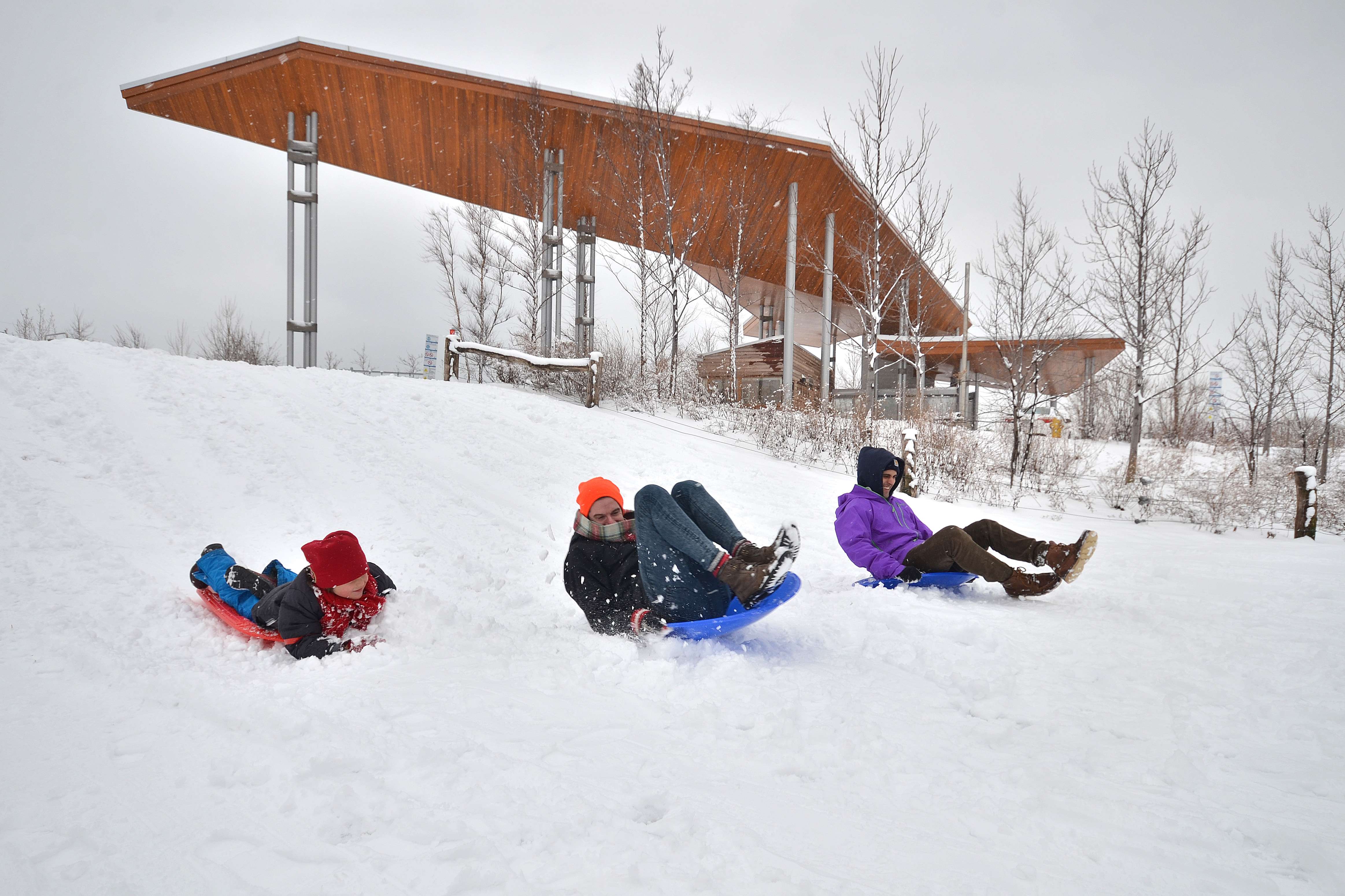
The engineered topography that provides flood protection also creates various microclimatic plant zones to attract people and fauna throughout the year. Without the risk of inundation, these zones are growing and thriving, together developing a biodiverse ecosystem. Visitors weave in and out of meadows and marshes along curvilinear paths that cut through densely vegetated groves. Migratory birds travelling on the Atlantic Flyway are attracted by the open green eastern slope, which creates a safe place to touch down in a dense city of more than 2 million people. Cross-country skiers enjoy the park in winter, sometimes stopping in at the warming pavilion to get out of the cold.
Corktown Common has helped catalyze economic growth and has spurred development even more quickly than expected. Starting with the construction of athlete housing for the 2015 PanAm and ParaPanAm games, nearly 3000 residential units have opened adjacent to the park with another 3000 under construction. Corktown Common has contributed to the identity of the neighborhood, first as its role as part of the athlete’s village for the games, but even more so in the health and fitness related businesses -- yoga, training, biking, and more -- that have sprung up throughout the new neighborhood. So far, $1 billion in investment has stimulated as much as $6.5 billion in construction investment in three neighboring communities. When fully developed the West Don Lands alone is expected to yield $2.3 billion in construction related development.
Through a combination of engineering, regeneration, and landscape program, Corktown Common’s constructed nature lays the groundwork for more growth in the future, both the expansion of the city and the organic growth of a more richly complex environment for urban ecology.