
Design of Dongqian Lake shoreline Ecological Belt (east bank of North Lake)
Landscape architecture
Design of Dongqian Lake shoreline Ecological Belt (east bank of North Lake)
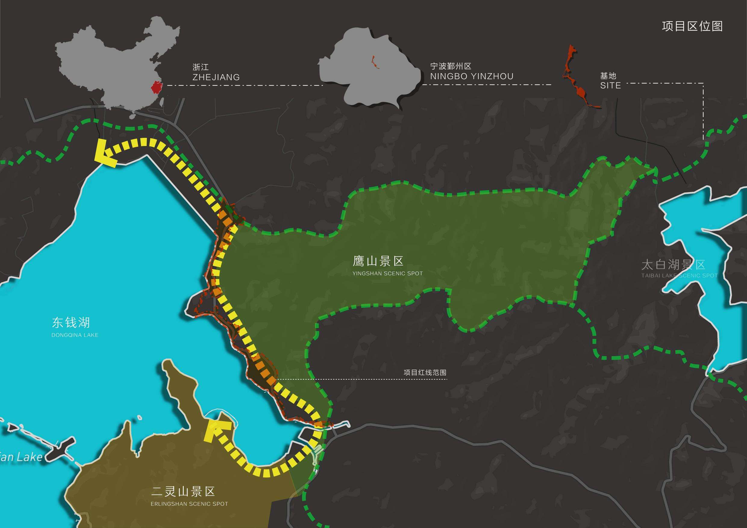
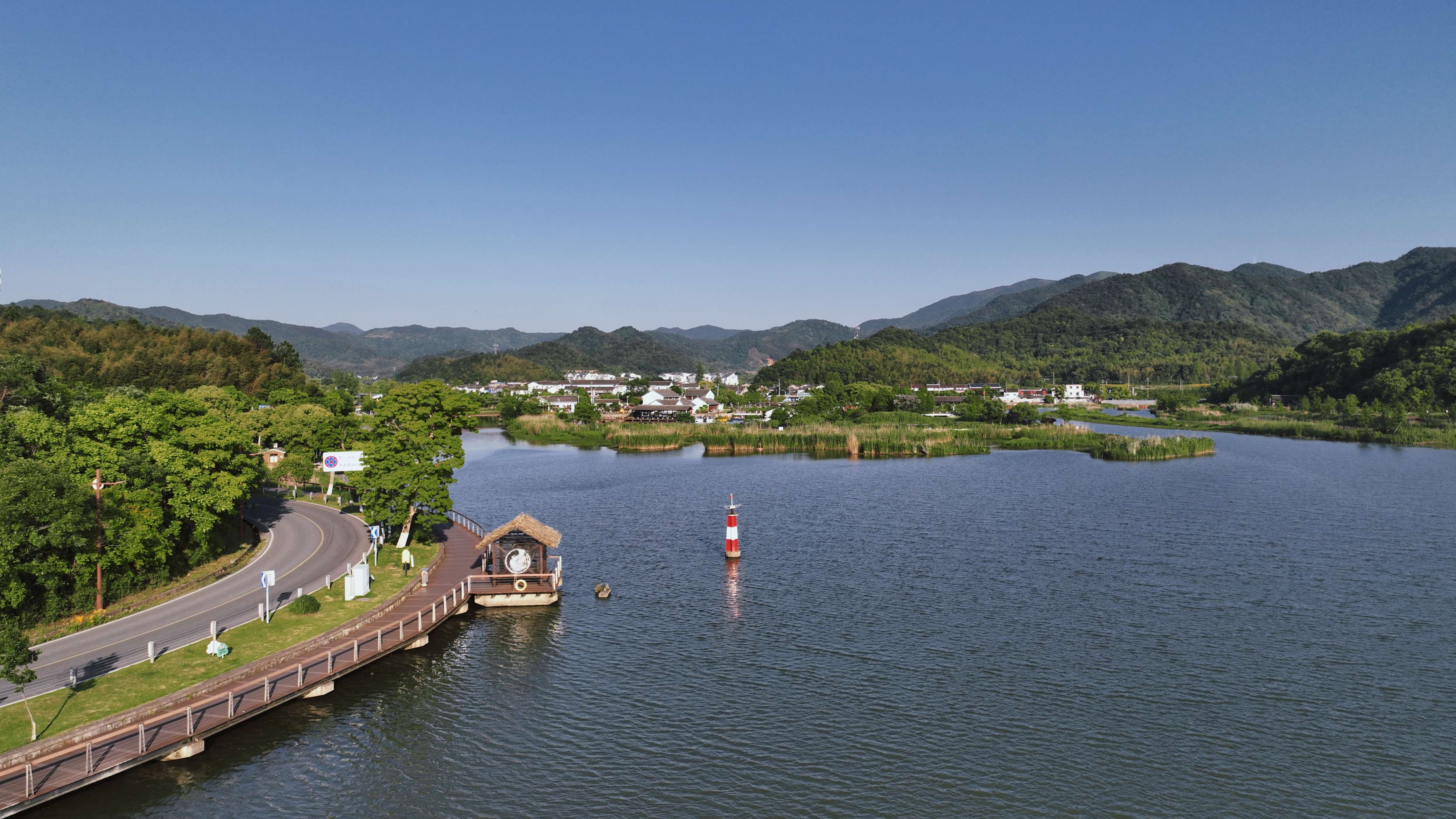
Located on the east bank of the North Lake of Dongqian Lake in Ningbo City, the project is 3.5 kilometers long and covers an area of about 20 hectares. It is a United Nations Green Development Fund project.
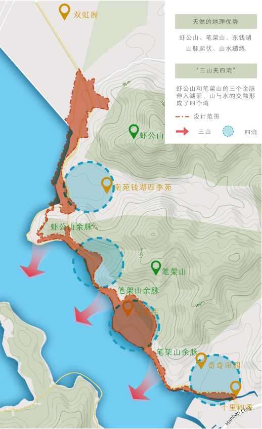
The design relies on the landscape and cultural resources of Dongqian Lake, with three lines in series, forming a spatial pattern of three mountains and four bays. With the concept of sustainable development, the east bank of the North Lake will be built into a waterfront ecological zone with both leisure tourism and countryside sports functions.
Half smoke water half Tingzhou, located in the East China Sea shore of Ningbo, Tianyi water, Haidingboning. Behind its developed water system and vigorous regional culture, there are thousands of years of humanistic nourishment, but also because of the water bond, from the water poetry and painting. We seek poetic solutions to the ever-changing water civilization and respond to the challenges of environmental creation with a design that responds to nature.
Among the many lakes in Ningbo, Dongqian Lake has become the most special one. In the design of Dongqian Lake shoreline Ecological Belt (east of North Lake), we try to take "ecology, wild interest, nature" as the theme, and create a comprehensive landscape with "distinctive features, excellent ecology, landscape integration, and perfect facilities".
As a natural ecological zone of mountains and lakes, the landscape design of the east bank of the North Lake of Dongqian Lake practices the observation of future environmental changes, and also adheres to the basic design concept of green and sustainable, committed to the proper preservation and reasonable transformation of the local environment, making the landscape design a tool to improve and slow down the ecological changes at the site.
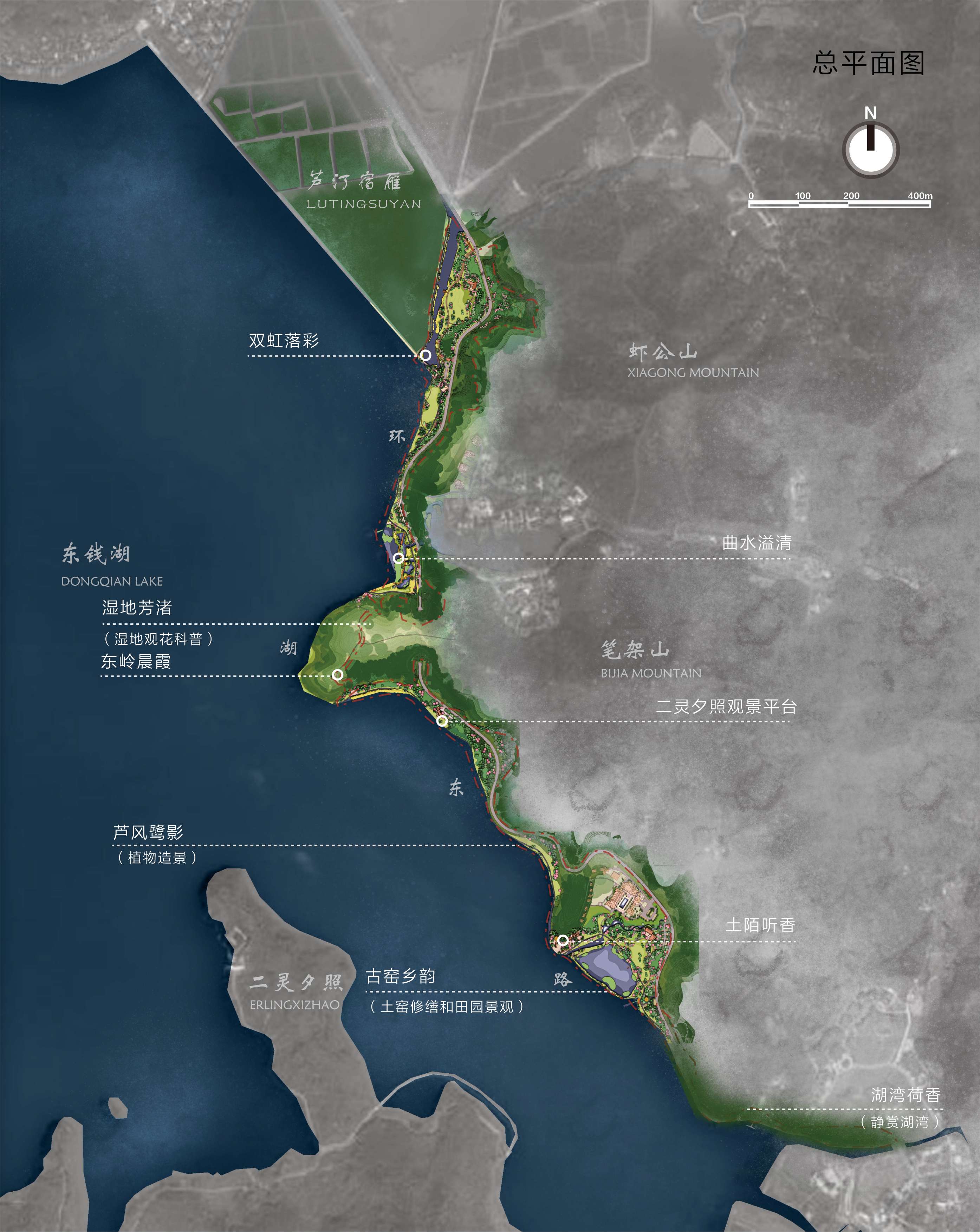
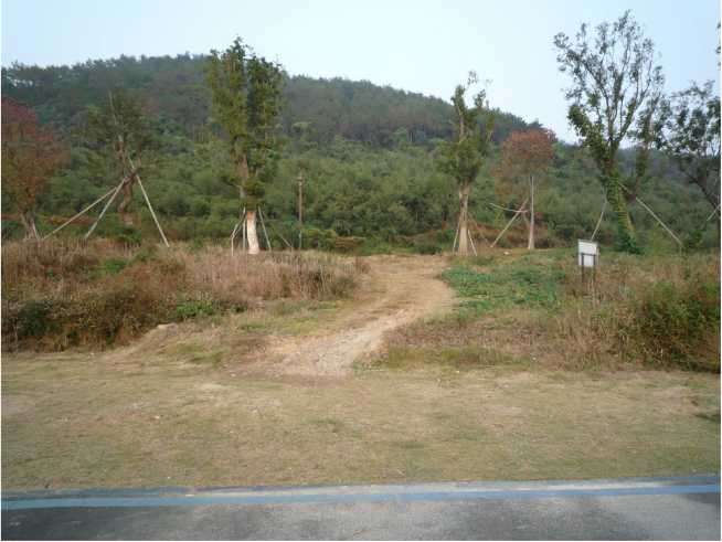
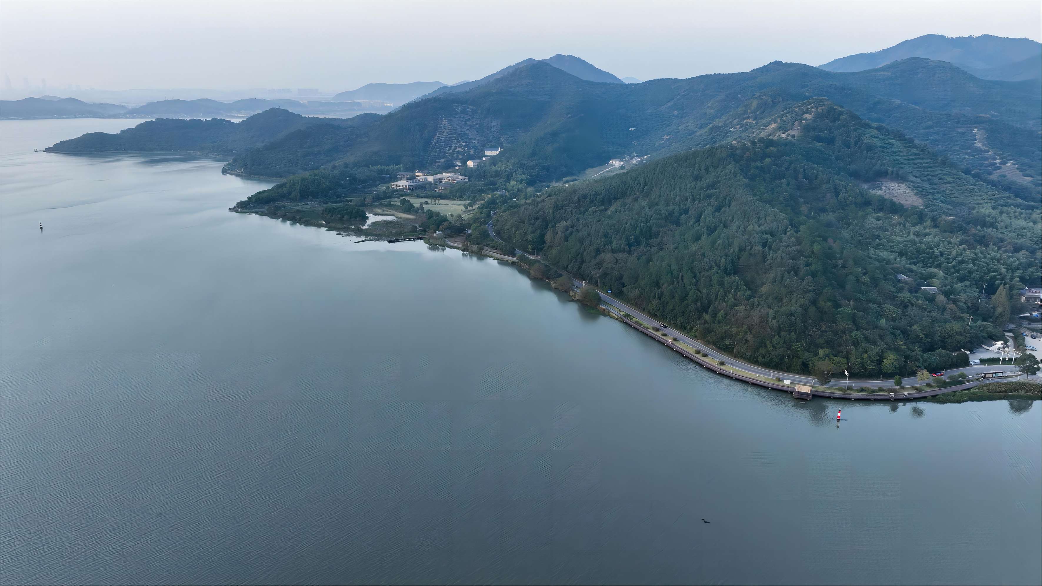
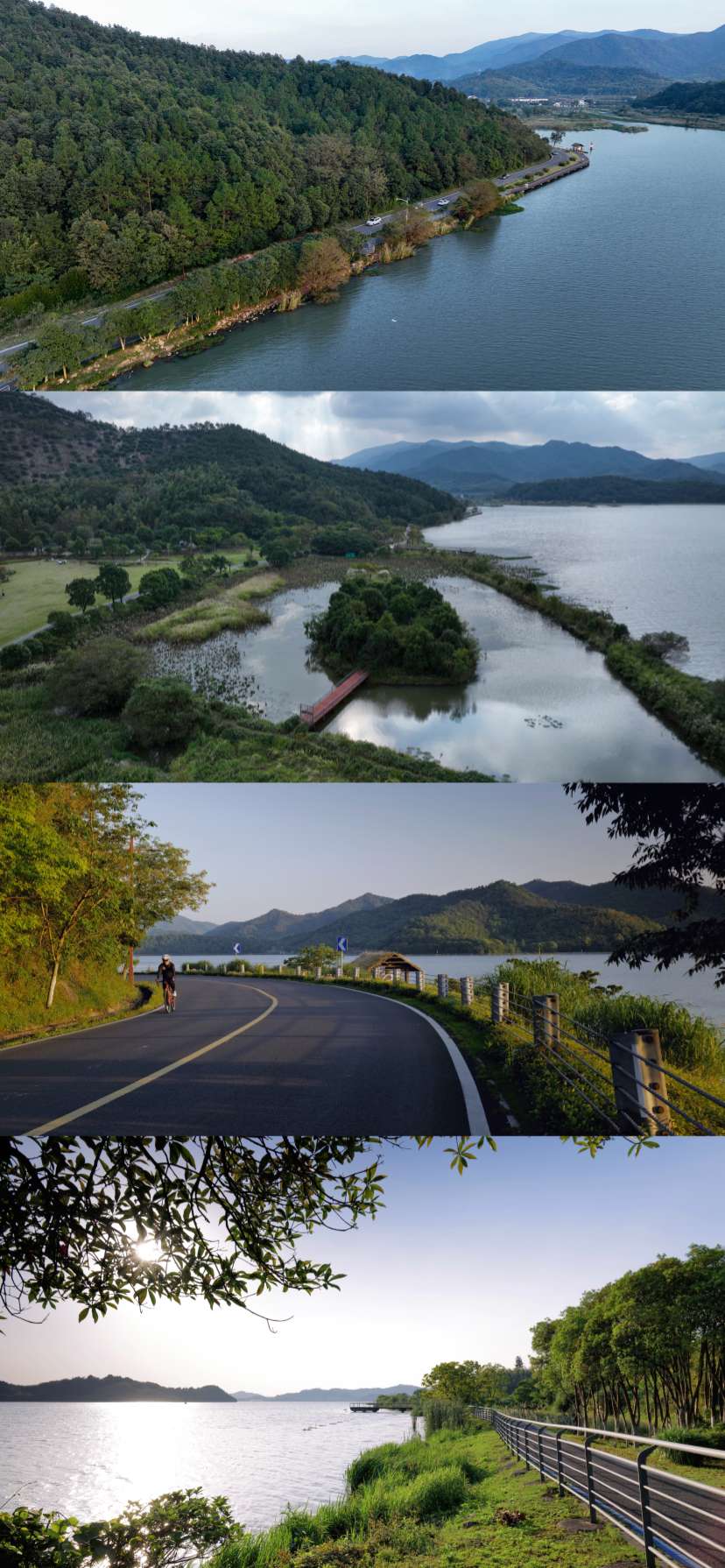
The actual landscape area of this design is an irregular narrow corridor terrain, from Shuanghong Pavilion in the north to Shilisixiang in the south, about 3,530 meters long, covering an area of about 20.467 hectares. Along the way, it covers part of the three residual veins of Shrimp Mountain and Bijia Mountain, and reaches deep into Dongqian Lake to form four bays, showing a terrain pattern of "three mountains sandwicked by four bays" as a whole.
How to make reasonable use of the natural geographical advantages in the complex terrain and improve the construction of ecological belt along the shoreline of Dongqian Lake by relying on the traditional and emerging cultural scenic spots and characteristic plants of "Ten scenic spots of Qian Lake" have become the main problems to be solved in Dongqian Lake.
Based on the local consideration of the landform, soil, vegetation, history, culture and development projects of the lakeside zone along Huanhudong Road, as well as the natural geographical location of Dongqian Lake, we propose that "relying on the beautiful landscape and high-quality ecological environment of Dongqian Lake, create colorful characteristic plant seasons and complete tourism service facilities to protect the ecological environment of Dongqian Lake. The concept of "showing the long history and culture of Dongqian Lake" is designed to build the east bank of the North Lake into a lakeside ecological scenic zone with functions of leisure tourism and countryside sports.
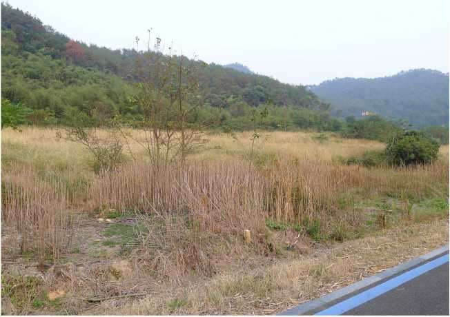
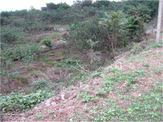
According to urban planner Le Corbusier, the best design is when we are deep in it and don't know where nature ends. This "traceless" consciousness of taking from nature and hiding in nature coincides with the eastern artistic conception of doing nothing. Therefore, the existing site does not carry out large-scale demolition and transplantation, but basically retains the natural vegetation along the lake shoreline. The area designed by the transformation is also smaller than the reserved utilization area, which follows the protection and utilization of the local natural ecology.
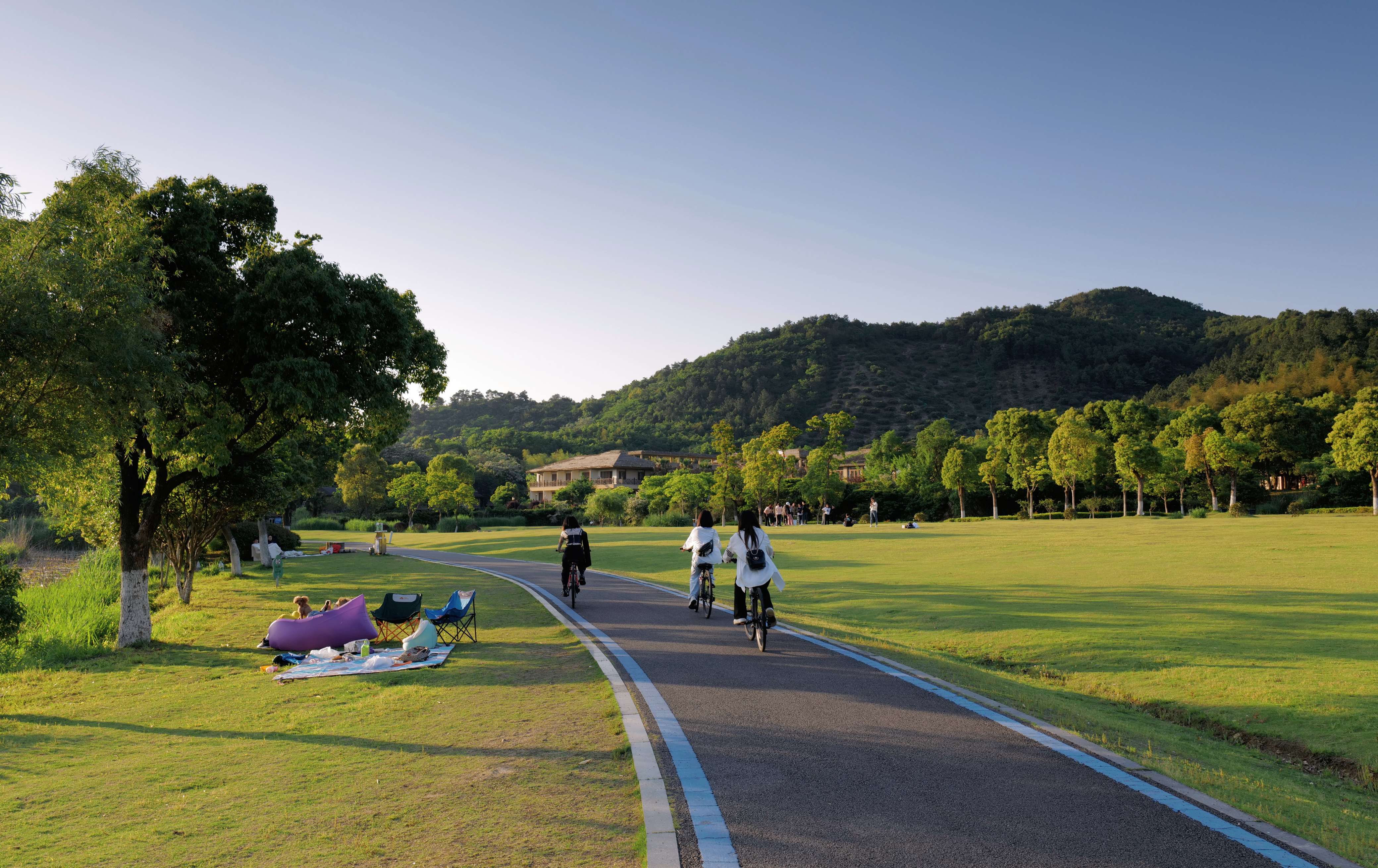
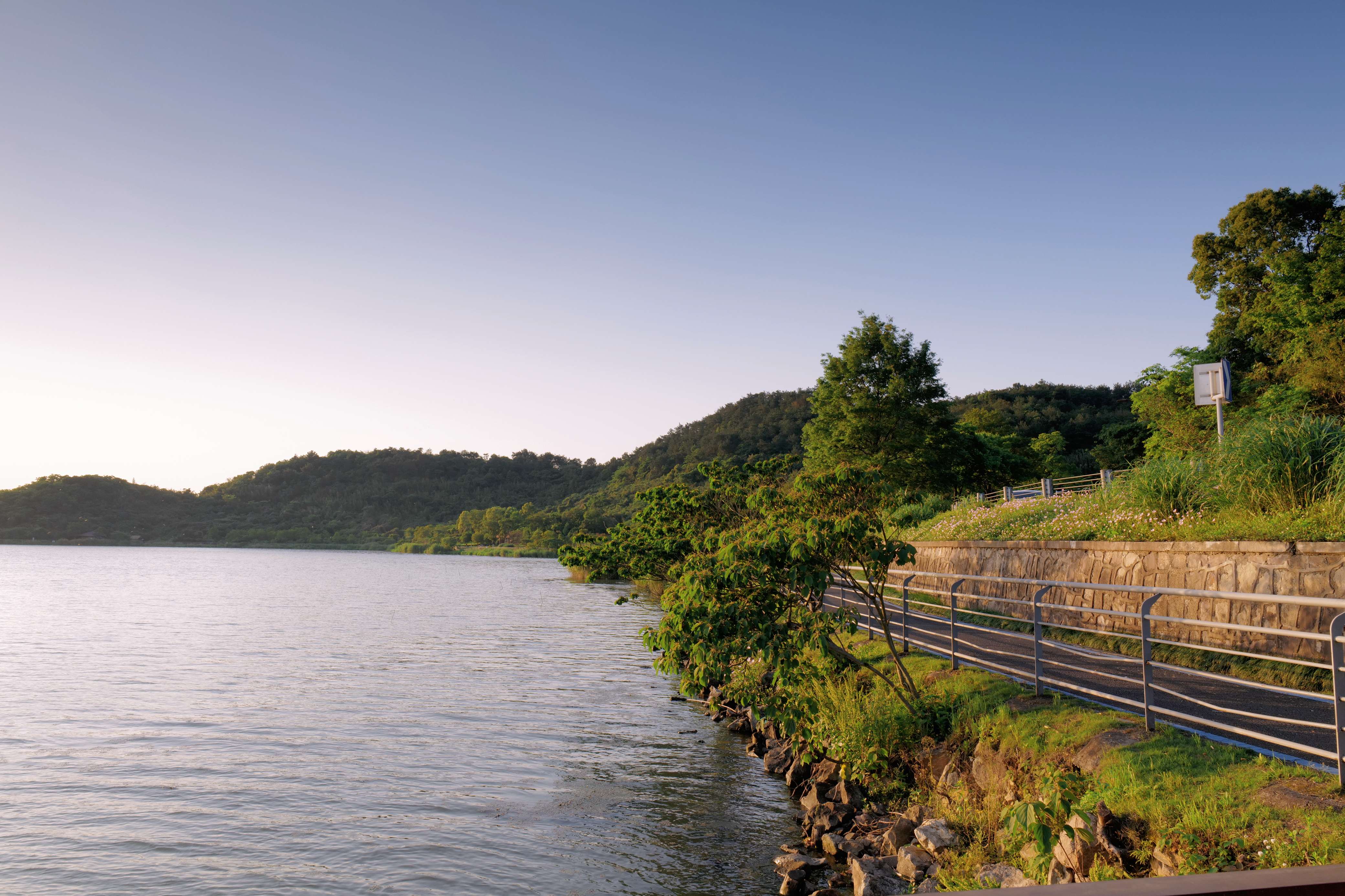
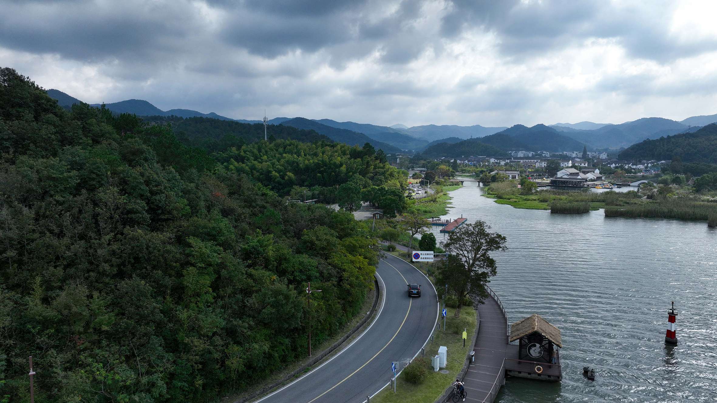
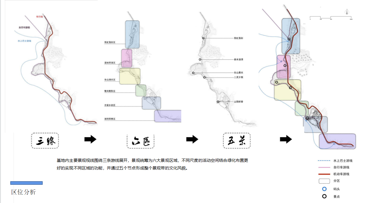
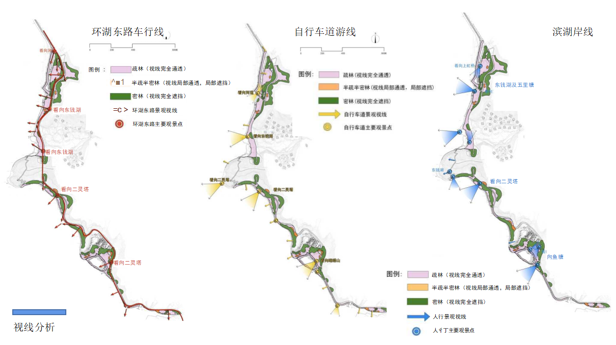
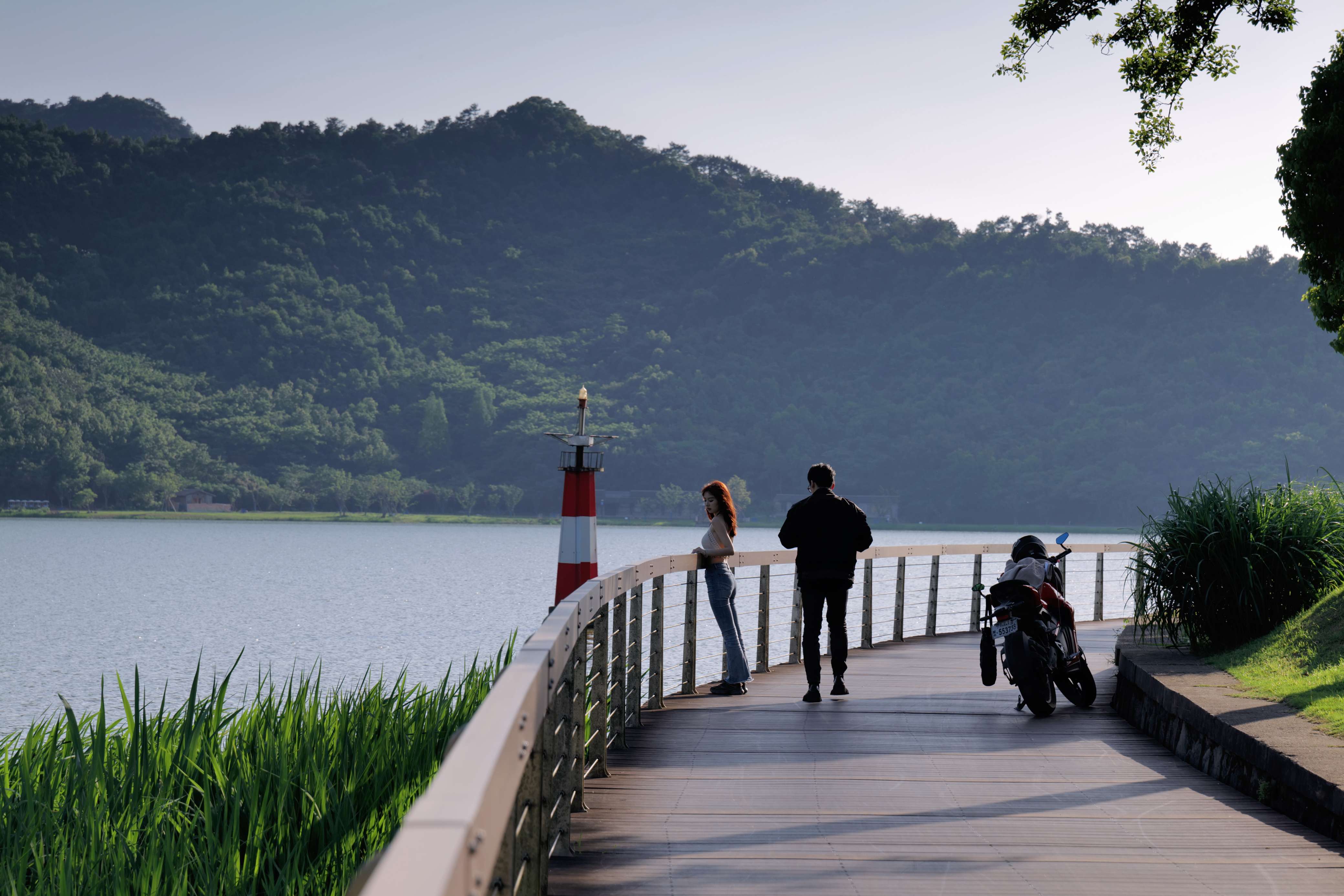
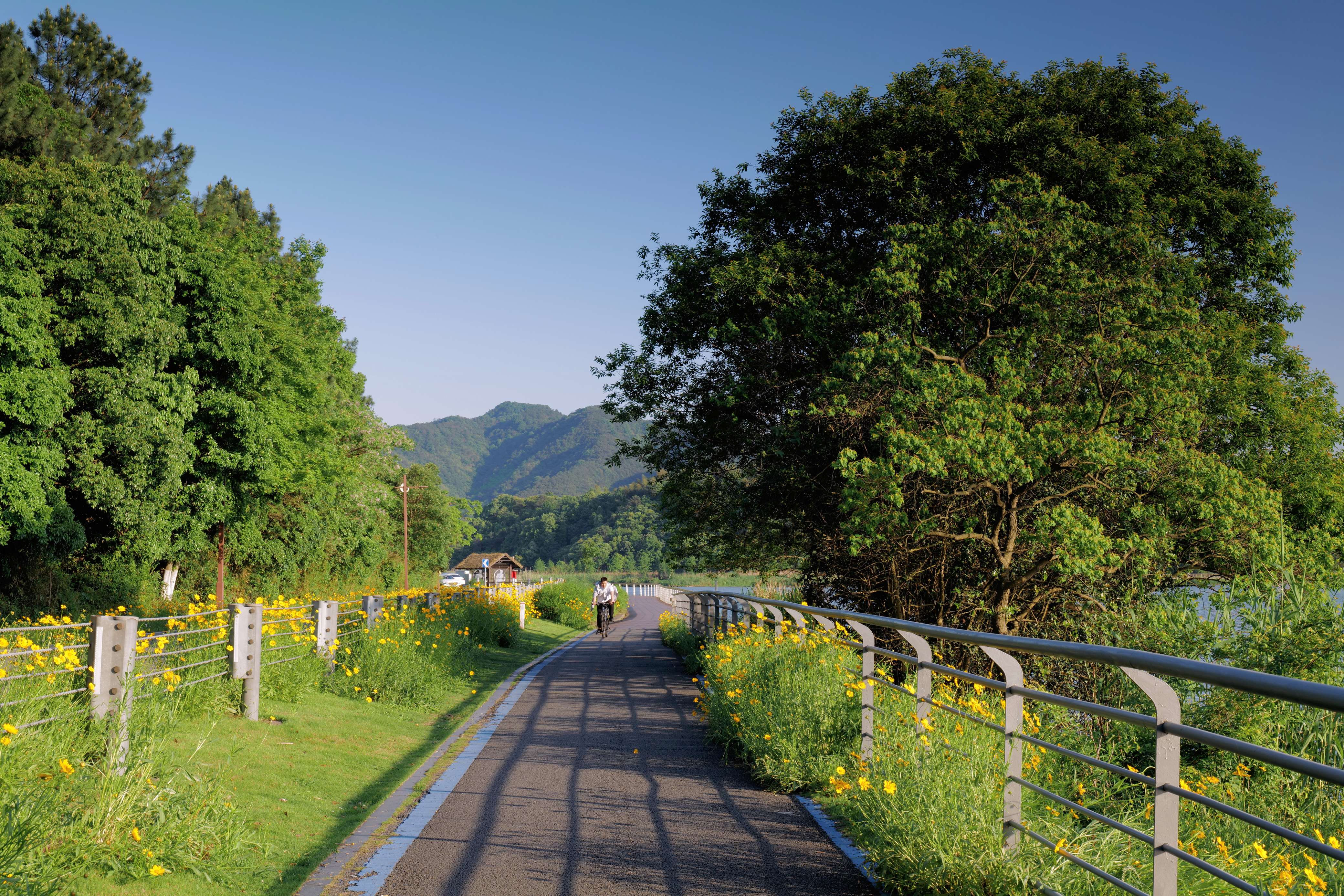
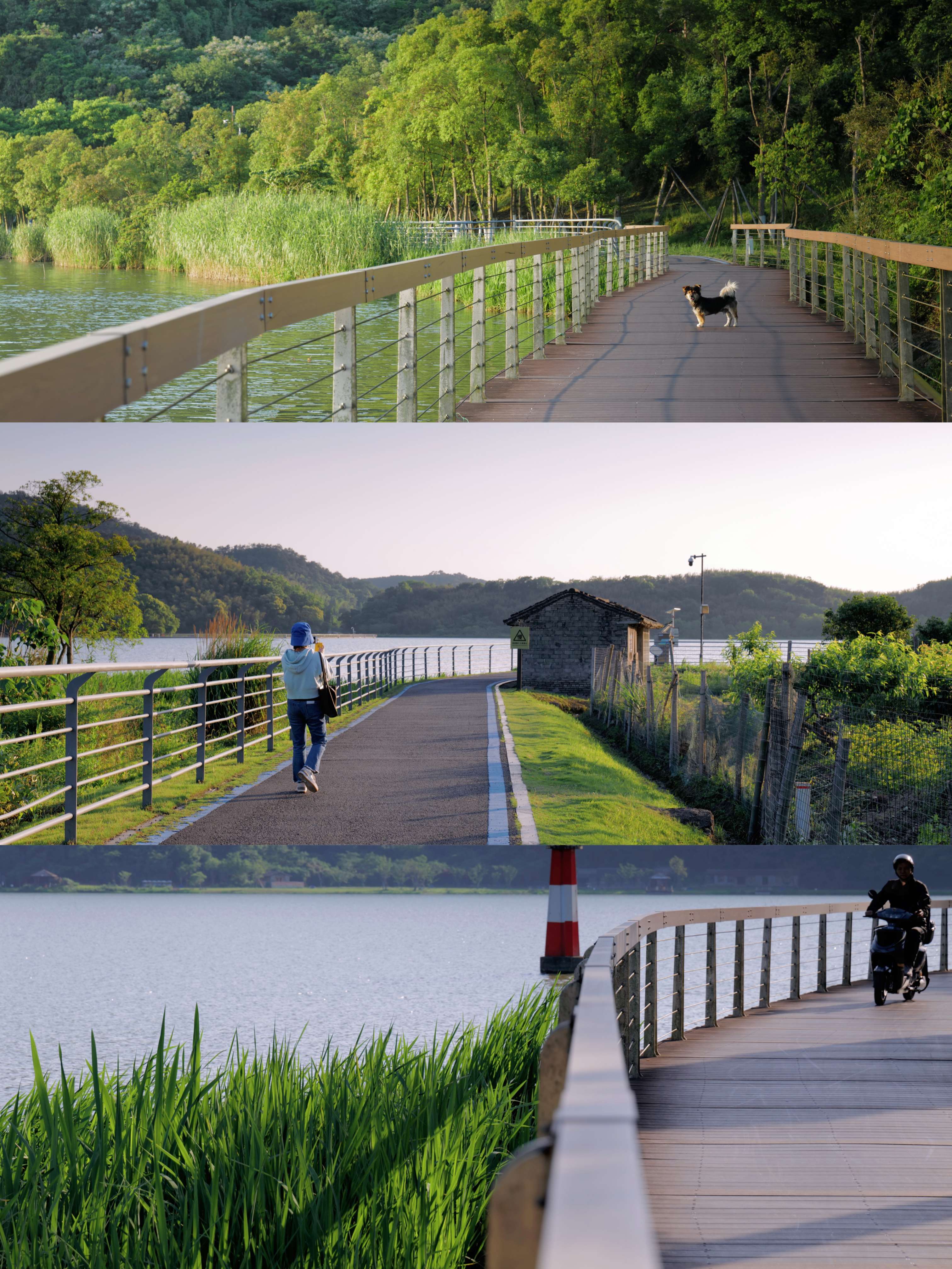
On both sides of the shoreline, three moving lines of motor vehicle tour line, bicycle tour line and water bus tour line are placed to emphasize the separation of people and vehicles, eliminate safety risks, open the closed line of sight, form a certain play time sequence, reasonably connect the stop nodes and viewing spots within the design range, and guide visitors to visit in sequence.
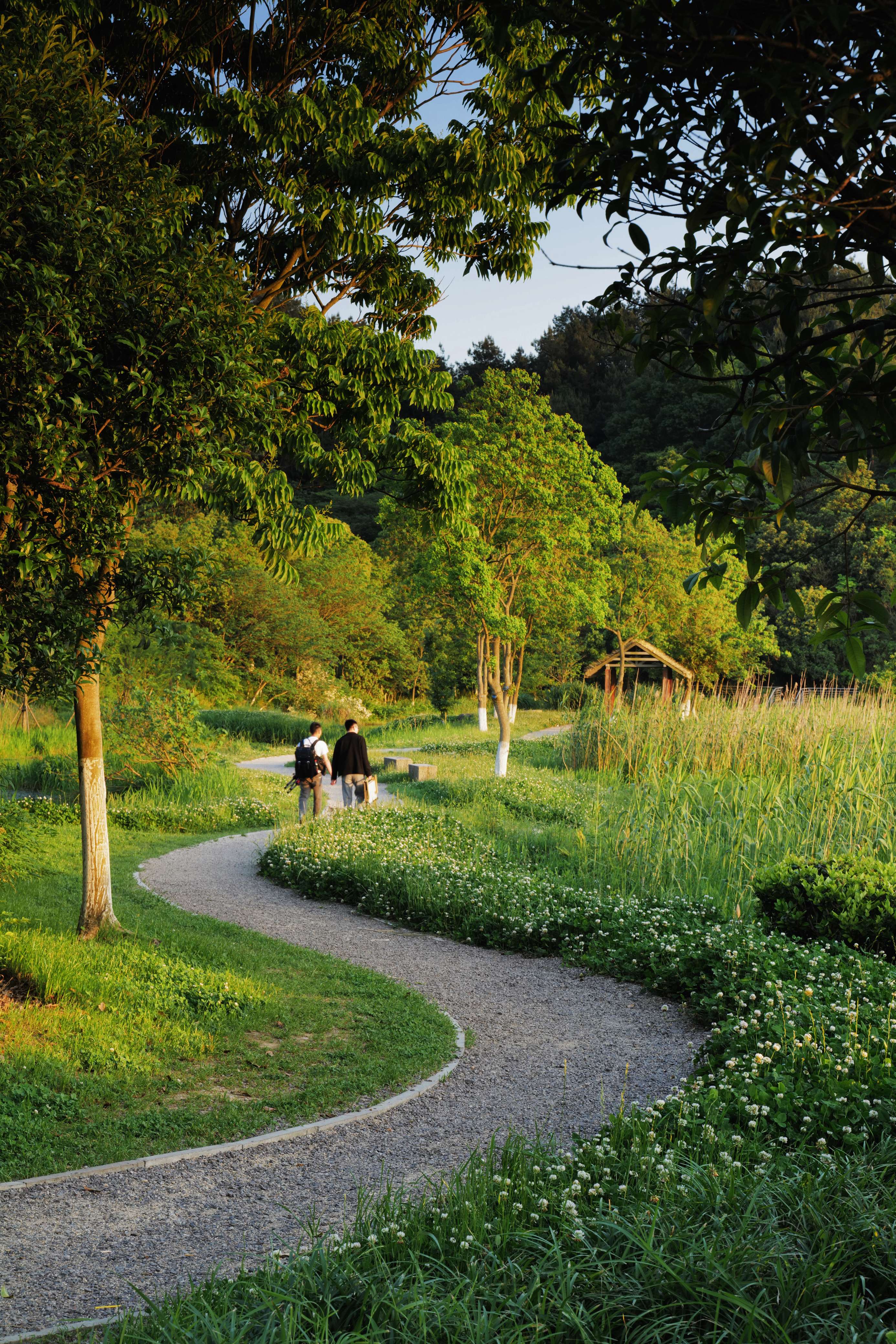
Due to the action of lakeshore current and tide, the silting land gradually formed outside the sandbank. Under the influence of slow terrain rise and fall, the site developed out of order and lacked clear streamline and effective organization. With the clever introduction of the three moving lines, not only the wetland ecological governance was carried out along the route, improving the efficiency of the journey, but also the cadence of the 3,000-meter-long journey was generated, with different steps and sceneries, and the distinctive landscapes were harvested in the properly dense jungle according to different sight directions.
The interest of this tour line reaches its peak between twists and turns. The natural ecology full of wild interest comes to the face. It also closely follows the changes and development of the site, forming a certain place interaction, leaving room for future environment construction.
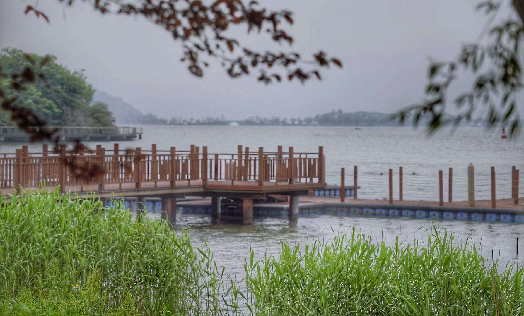
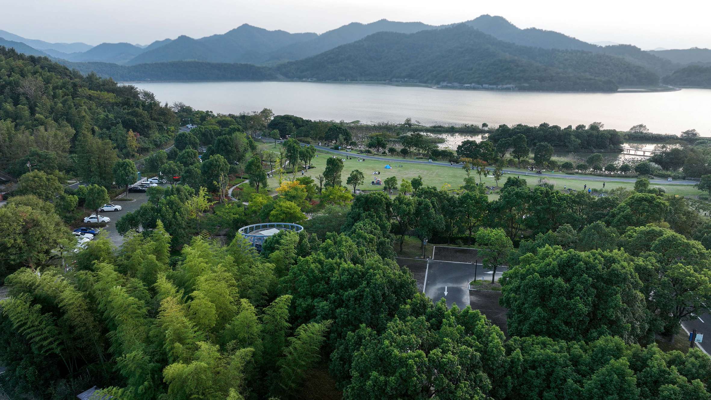
Spread out around the three tour lines, the landscape is integrated into six landscape areas. Activity Spaces of different scales combined with green layout can better realize the functions of different areas, and form the cultural features of the whole landscape belt through five nodes. For example, in the village charm area of the ancient kiln, the earth kiln was repaired to form an ancient style combined with the countryside, the plant landscape was constructed in the Lufeng and Luying area, and the wetland flower observation and popular science was carried out in the wetland Fangzhu District. The rich node Settings give the east coast of the North Lake a unique romantic atmosphere of the site.
Whether it is flower appreciation, boating, winter fishing, or walking in the forest path, the properly dispersed landscape area and the coordination of scenic spot activities all make the project have organic links in the details, and finally make the whole east bank of the North Lake itself, and the local microclimate also witness the flow of landscape pattern of the whole Dongqian Lake.
In the design concept of Dongqian Lake shoreline ecological belt (east of North Lake), the concept of "ecology, wild interest, nature" is not only deeply rooted in the green positioning, but also covers all possibilities of lakeshore landscape. This is actually a profound insight into the relationship between man and nature, but also the respect for nature, and harmonious coexistence with nature.