Praça Universitária
Plaza Universitaria
University Square
At some point of the city’s growth, people demands for public areas that can be used for leisure, practicing sports, places that gather kids to play, pet places or simply a contemplation area to be around the trees, see the leaves falling and watch the birds singing. To ensure that, it is important the analysis of the nature of the space, to get a complete understanding of the cycle that the site has currently, respecting the natural points of this process that will keep this place alive for a long time.
During the analysis of the site, it was identified two very distinct zones. The first one is built upon a large and in the highest plateau, with some surrounding vegetations and a very flat topography. This part of the site had a potential of integration with the neighborhood, since the street is located at the highest point of the topography, offering a complete view of the area. In the second zone, there is a very accentuated topography and a denser vegetation of the woods around the old house. That is the place where we can find a lot of older trees planted when the old house was a private residential home.
Our approach of interpretation of the landscape is to respect the majority of the existing vegetations and the topography, therefor, the project could embrace the natural and existing aspects of its site.
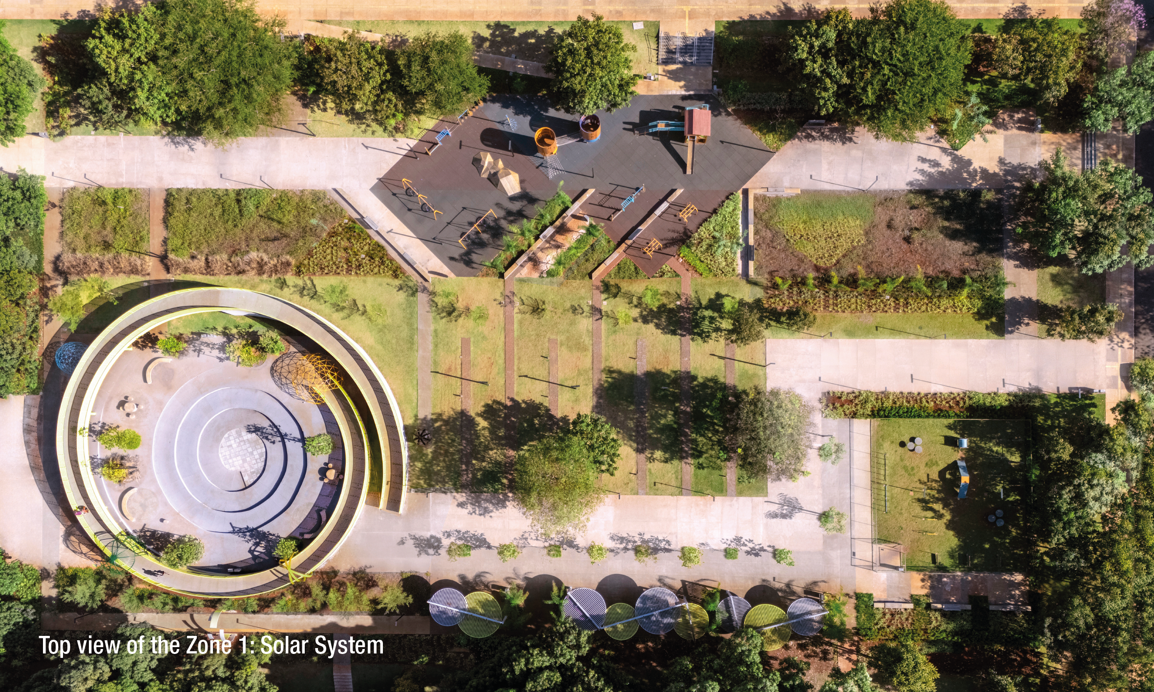
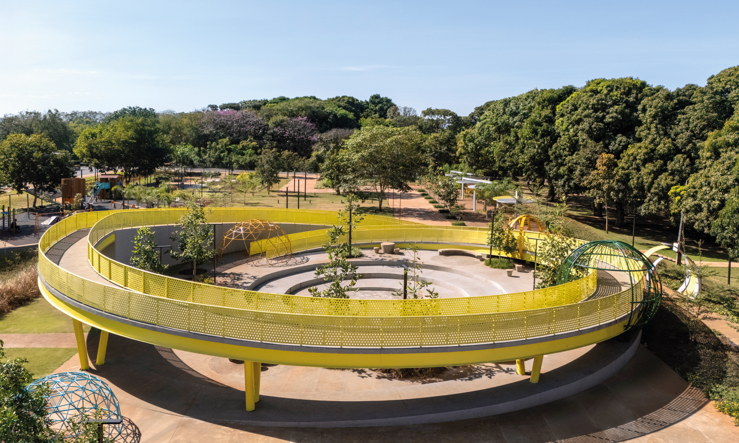
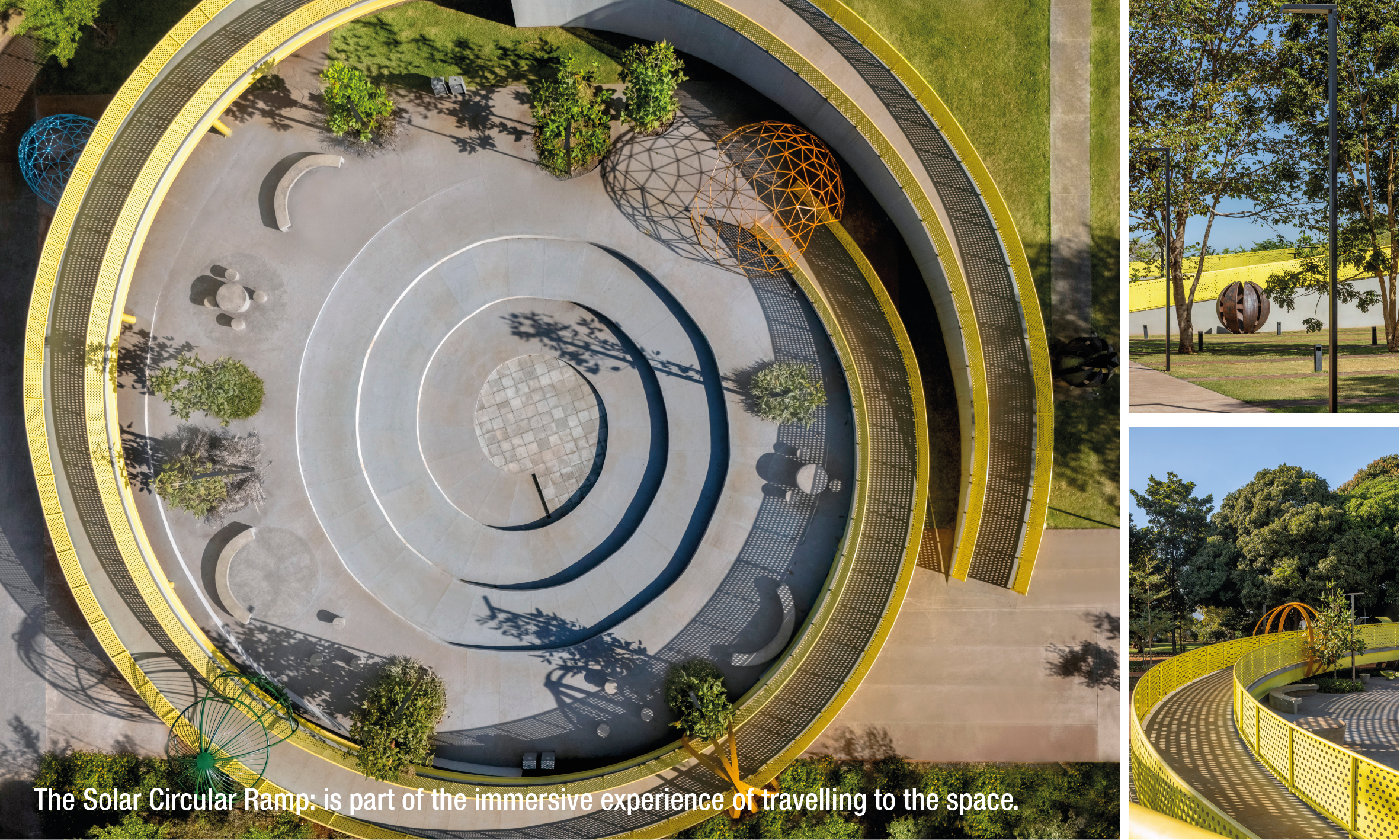
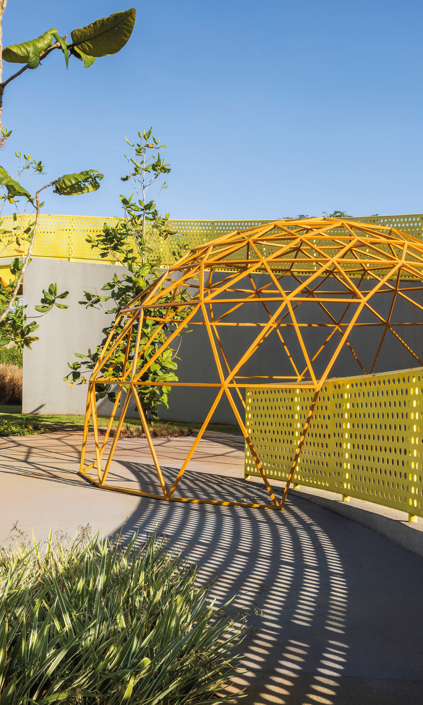
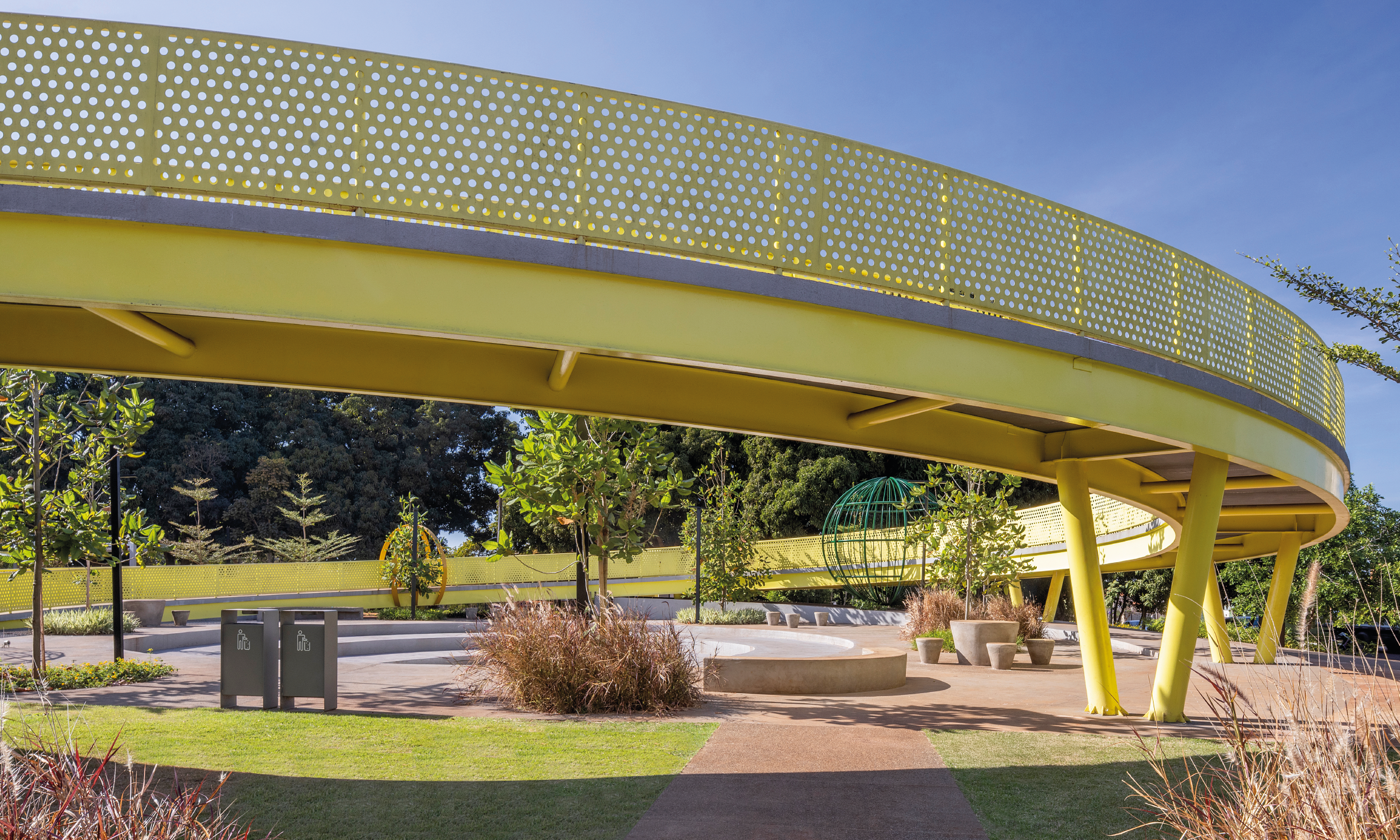
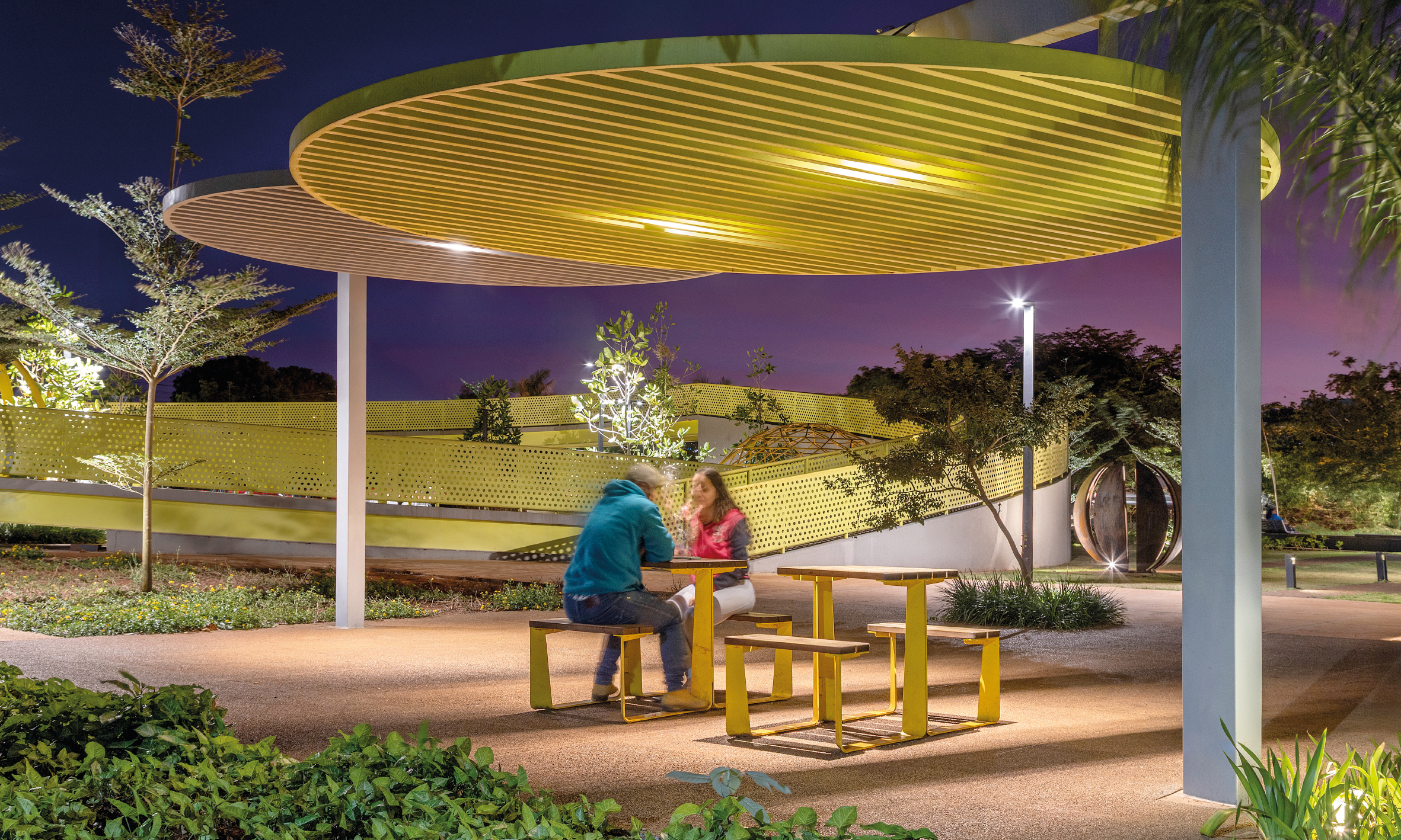
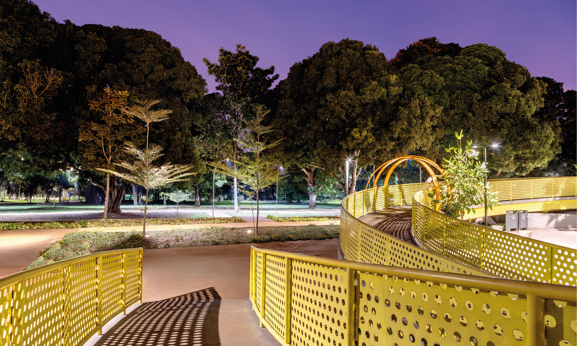
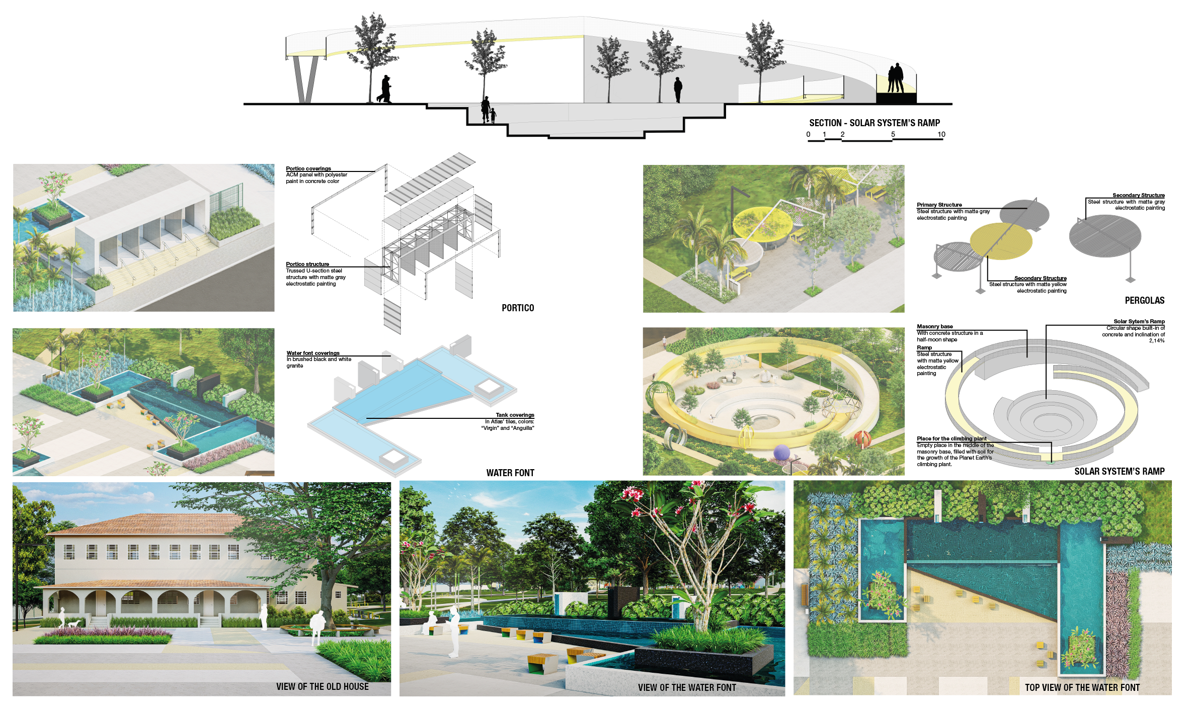
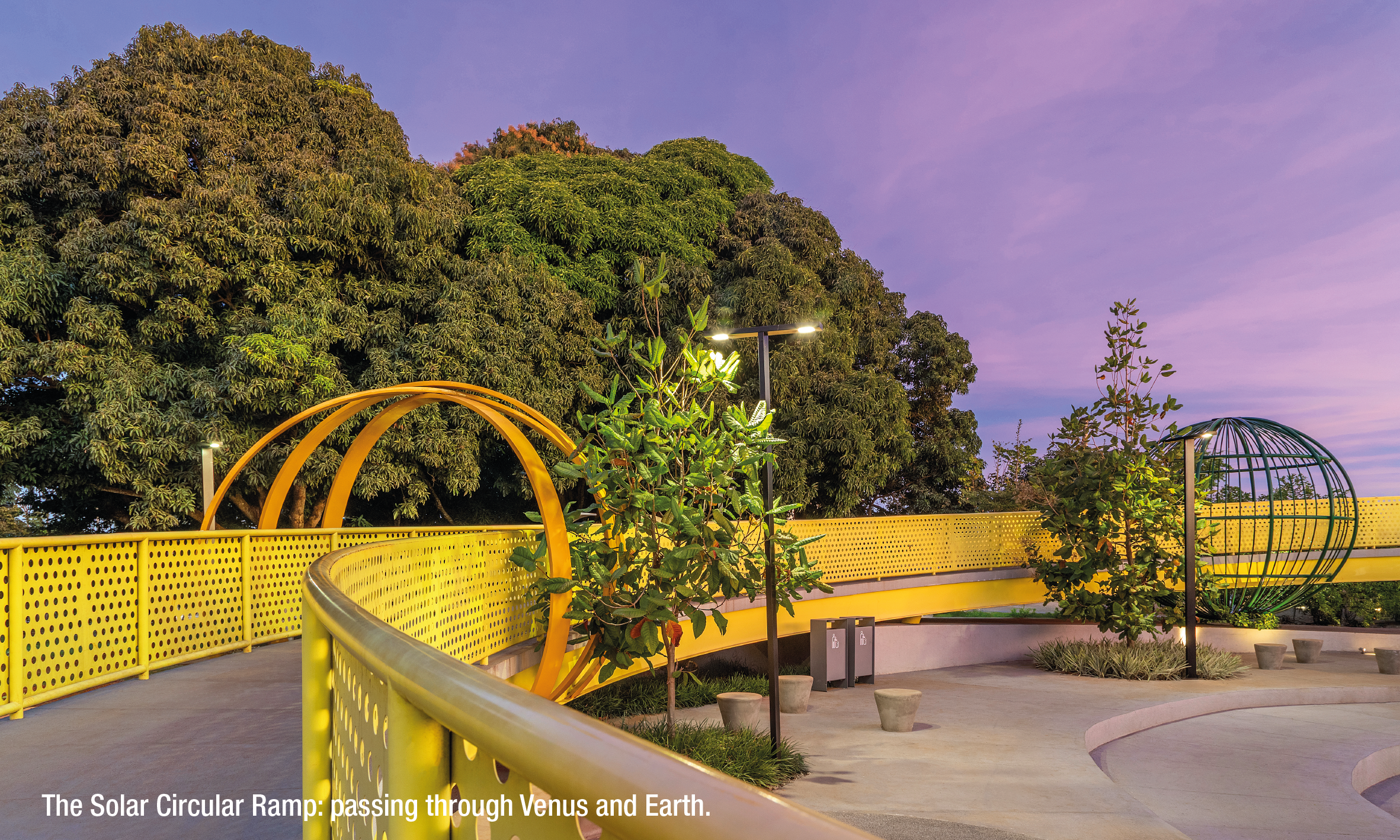
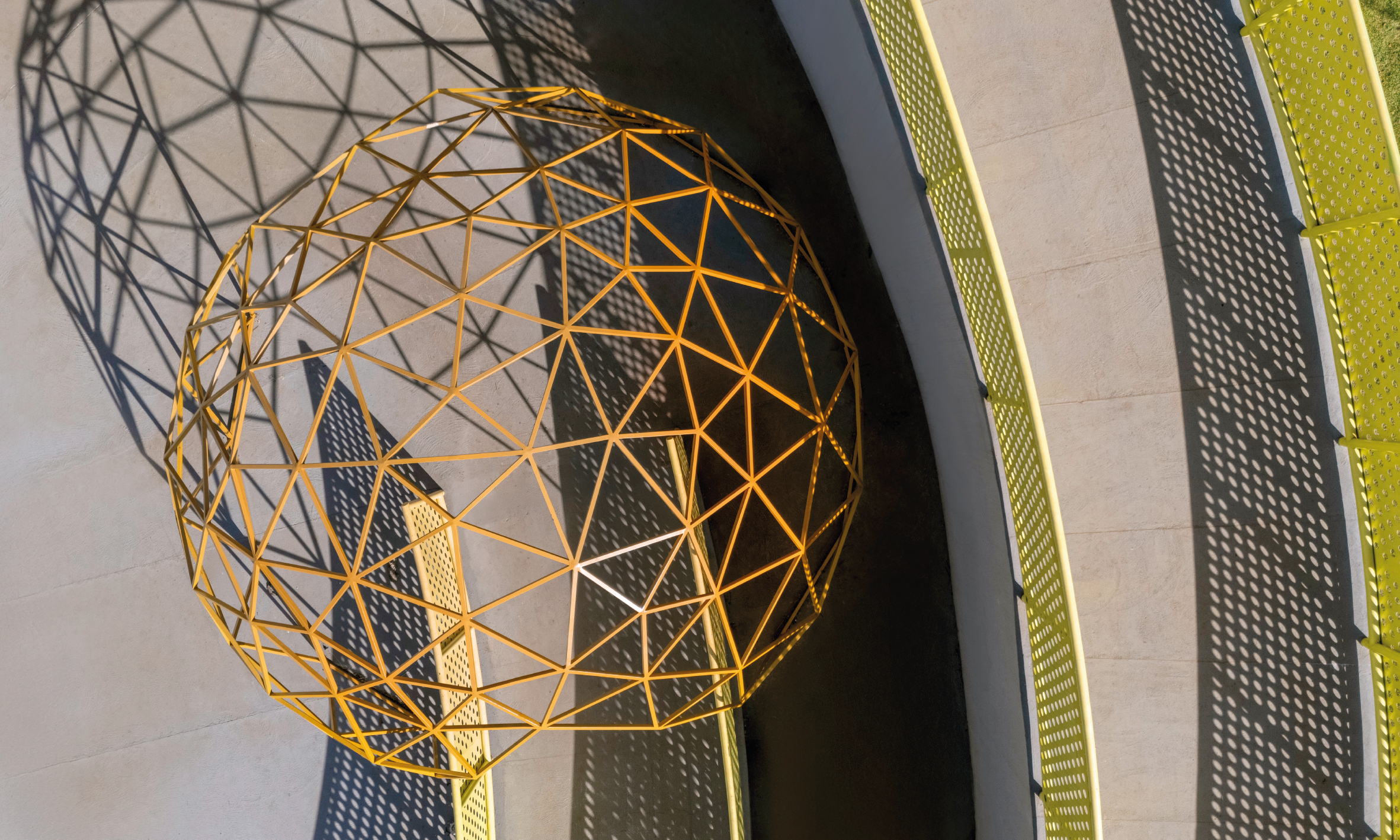
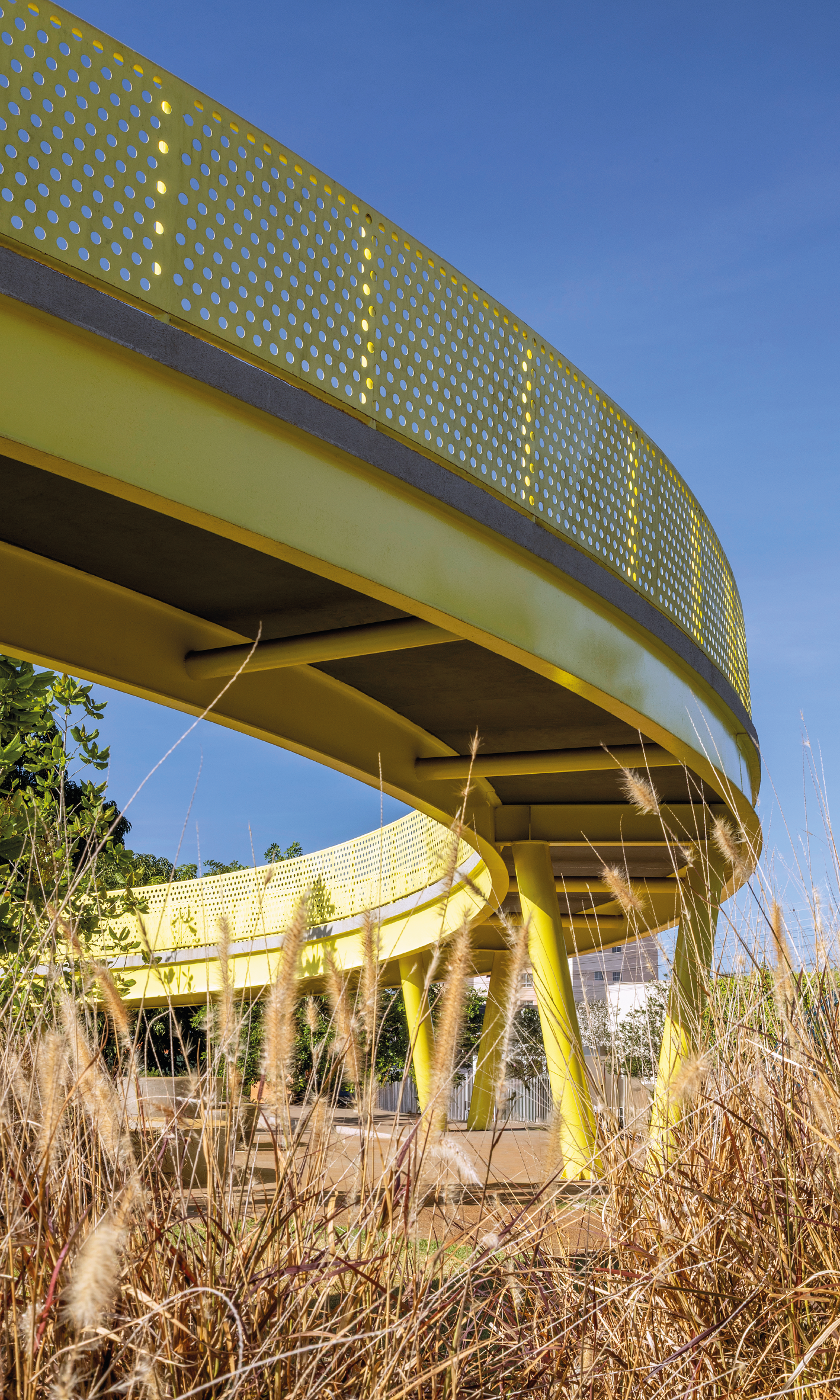
On the social approach, the Plaza was located in a university’s zone of the city, in which the terrain was provided by the Federal University of Jataí in a partnership with the Jataí’s Public Administration. The briefing was to validate the connection between the City Hall and the University with the creation of places that could bring curiosity and science’s knowledge for the citizens who are visiting the plaza. But then, in our analysis, we found out that there was an old planning of building a Planetarium in the site, so we realized that this was an opportunity of creating a place with built volumes dedicated to exploit and discover the space. Since teletransportation is impossible, we could, at least, try to create new point of views to see the surroundings and immerge people in a place where they couldn’t imagine they would be one day. This is why, the starting point of the project was to create a circular ramp, in the color of the sun, big, bright and yellow, that is a trip to the space, where the visitor can run or walk on this, passing through all Solar System’s planets. Each planet was represented in a different material, color, dimension that links to its real features. And the Earth, which is the only planet that is in constant evolution, has its dynamism represented by the growth of a climbing plant on its green steel structure.
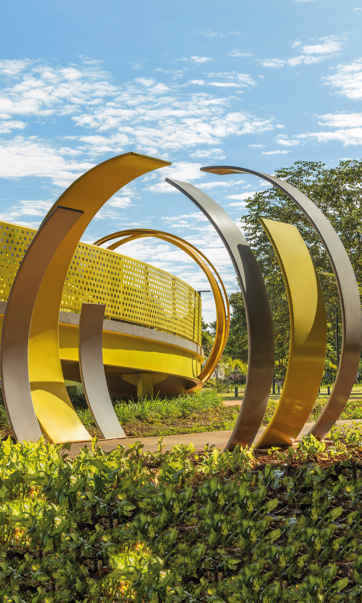
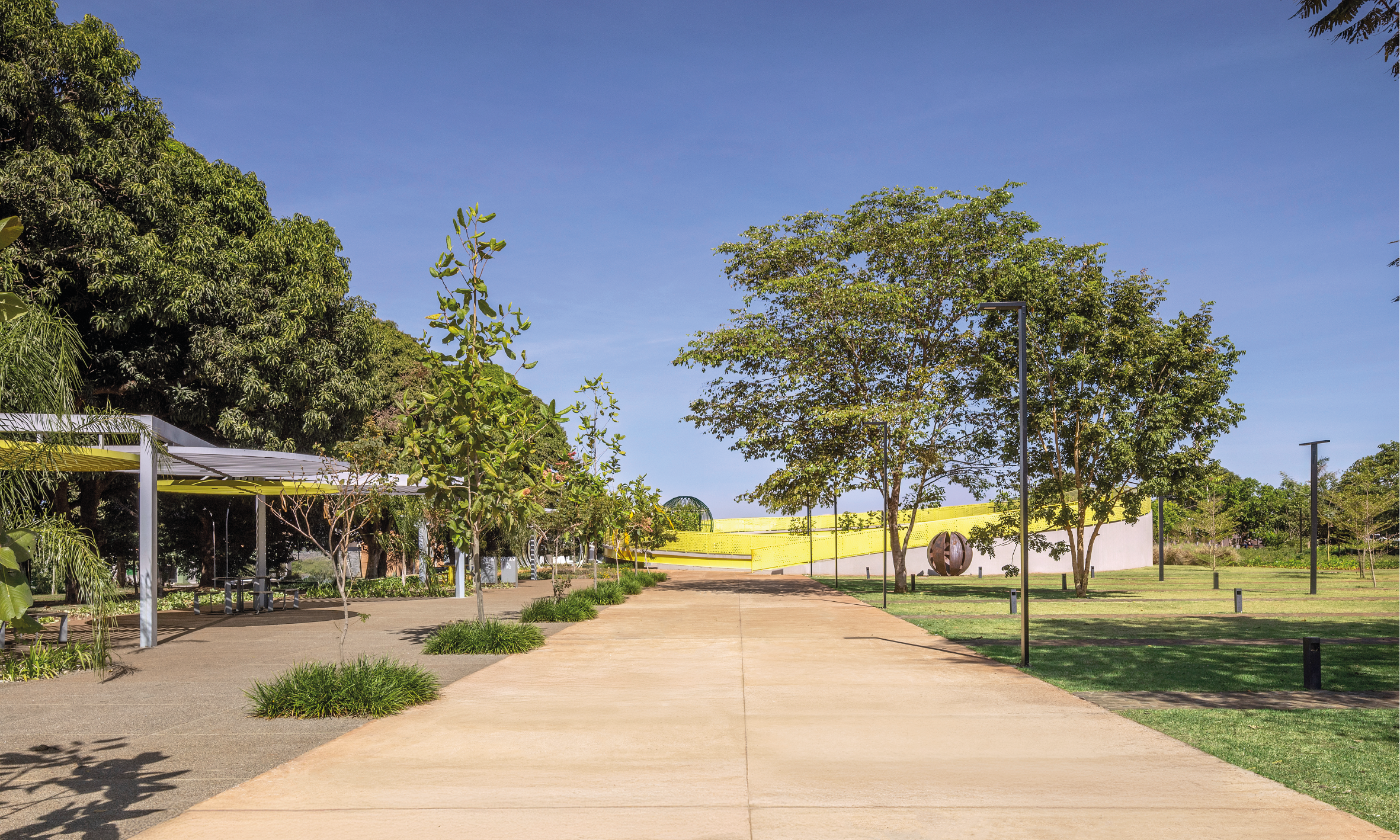
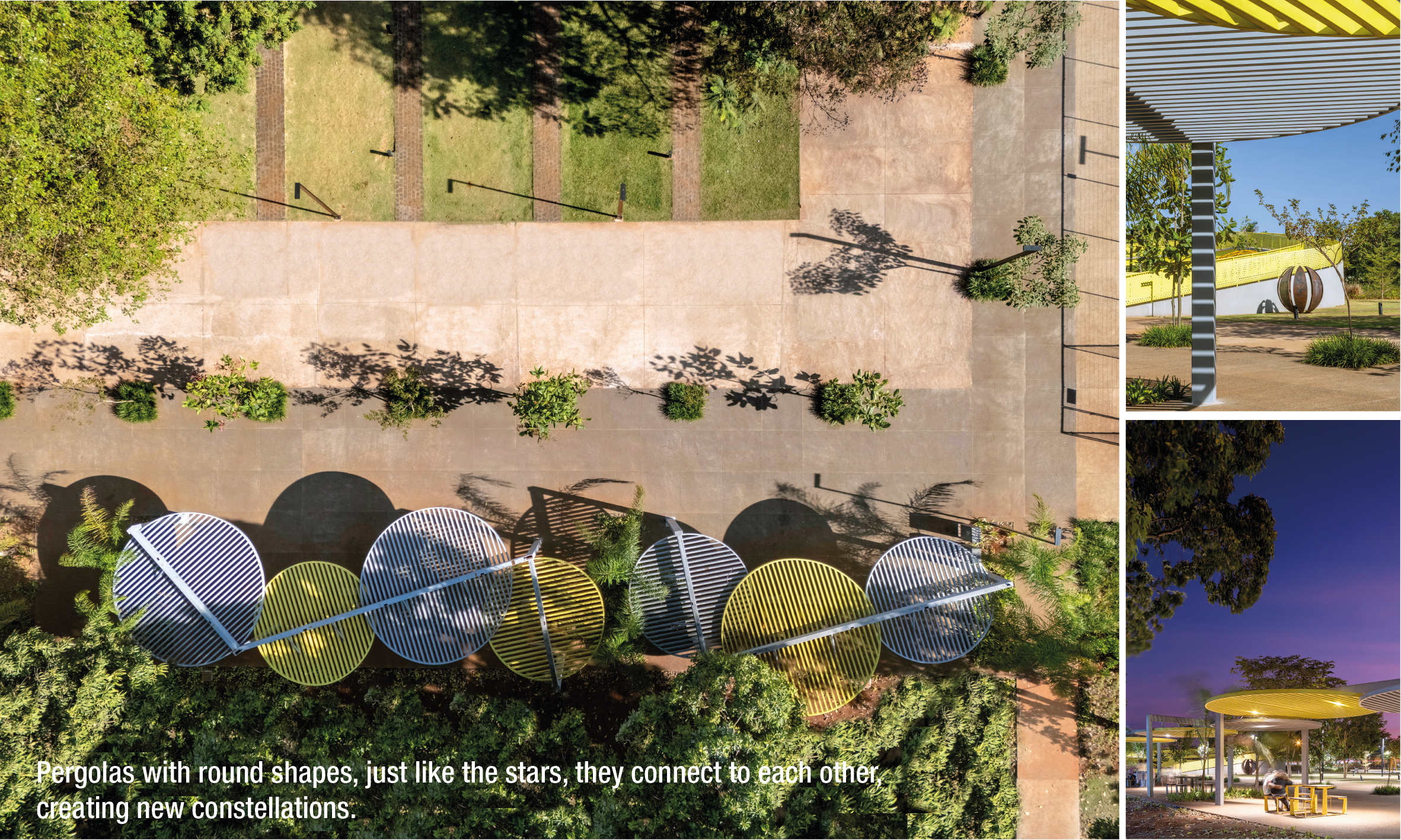
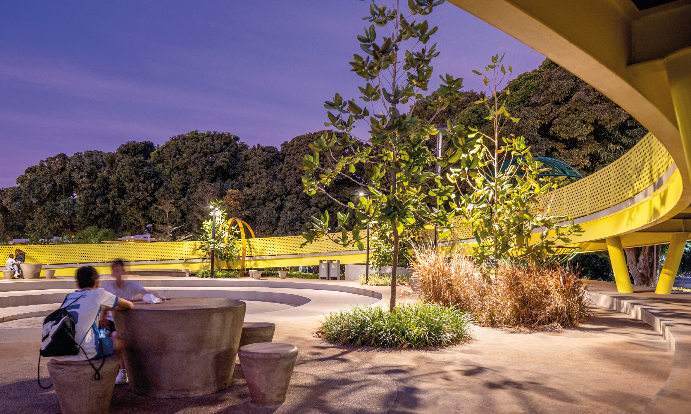
From the solar circular ramp, the pathways were distributed along the project, creating seating and recreation areas, contemplating all kinds of public, as we organized the Solar System. To connect people to the stars, the pergolas have a round shape and, just like the stars, they connect to each other, creating new constellations.
The definition of the pathways was guided by their use and how to create different ways of seeing and interact with the landscape. Even in the woods area, the aim goal was to create new lounge zones, to encourage the use and belonging of the visitor to the site. Also, it was planned a large open grass area, to give space to open activities that might come up in this public space.
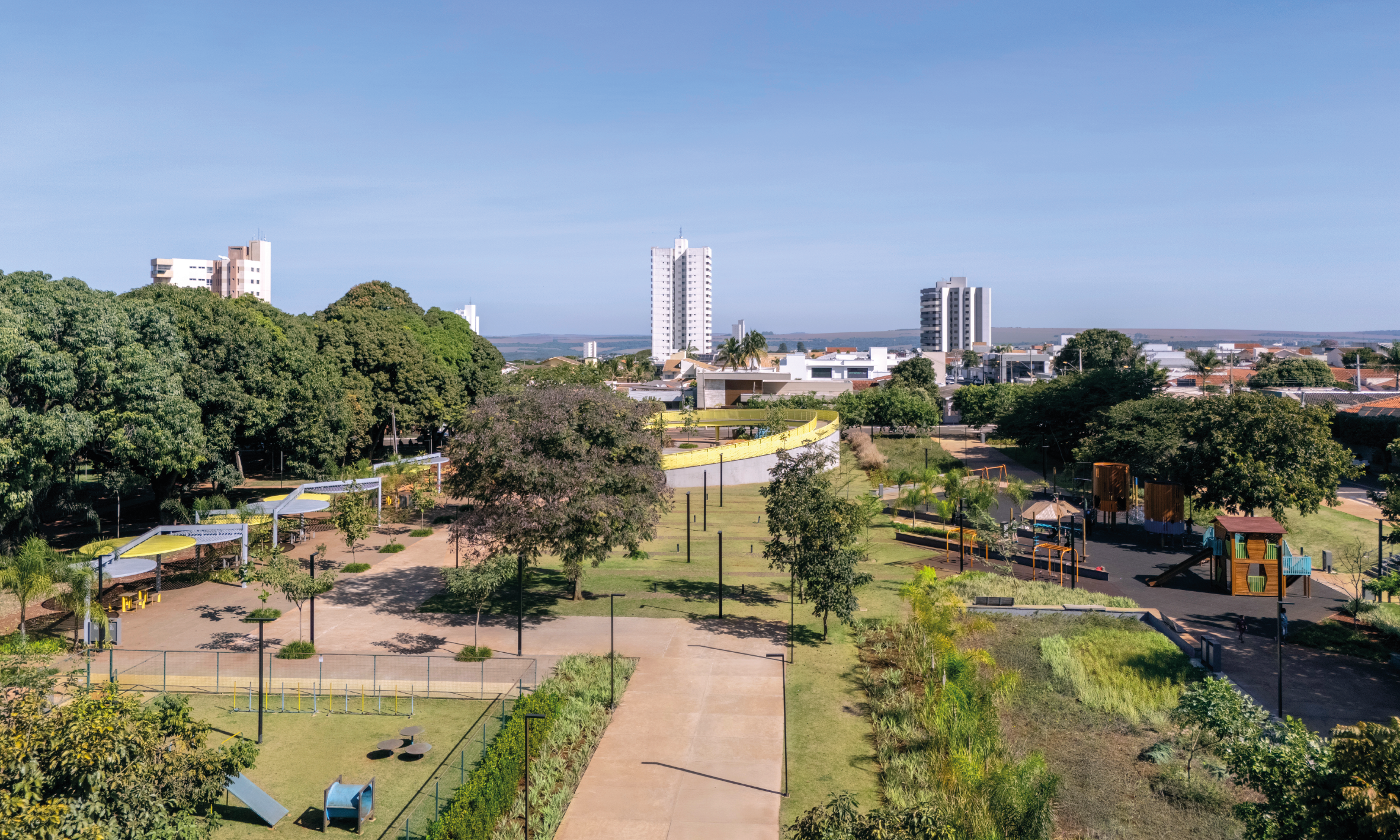
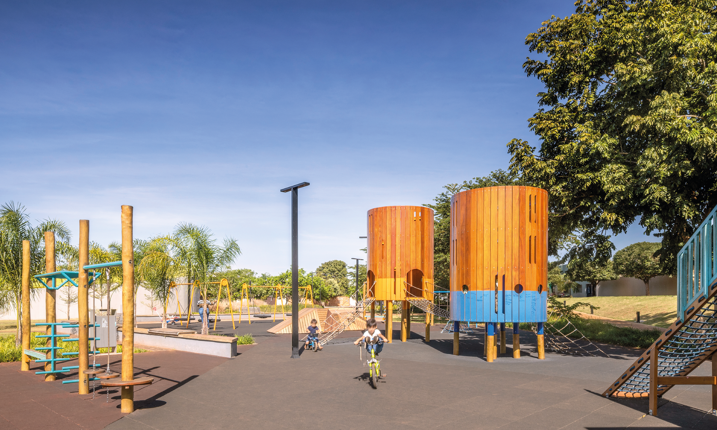
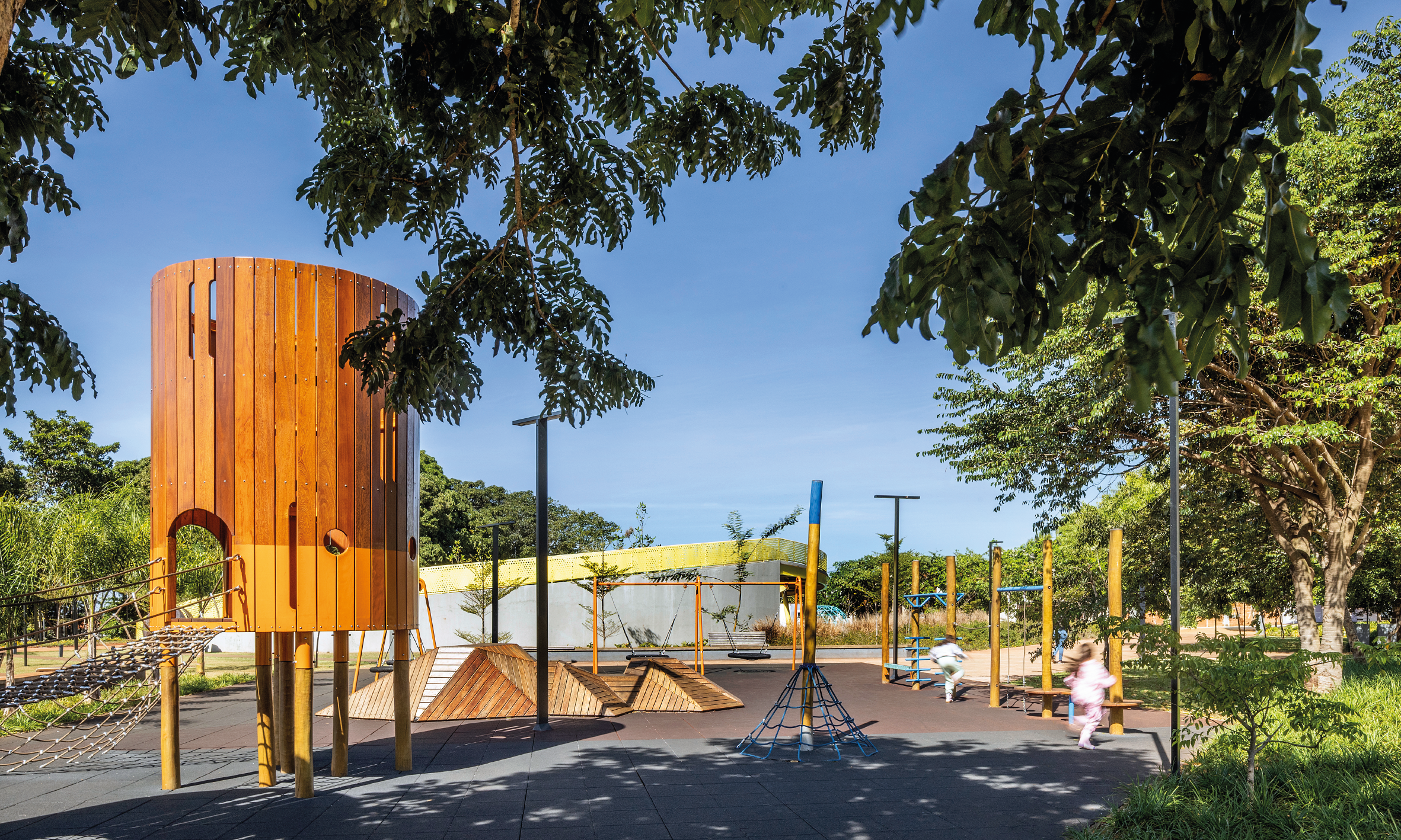
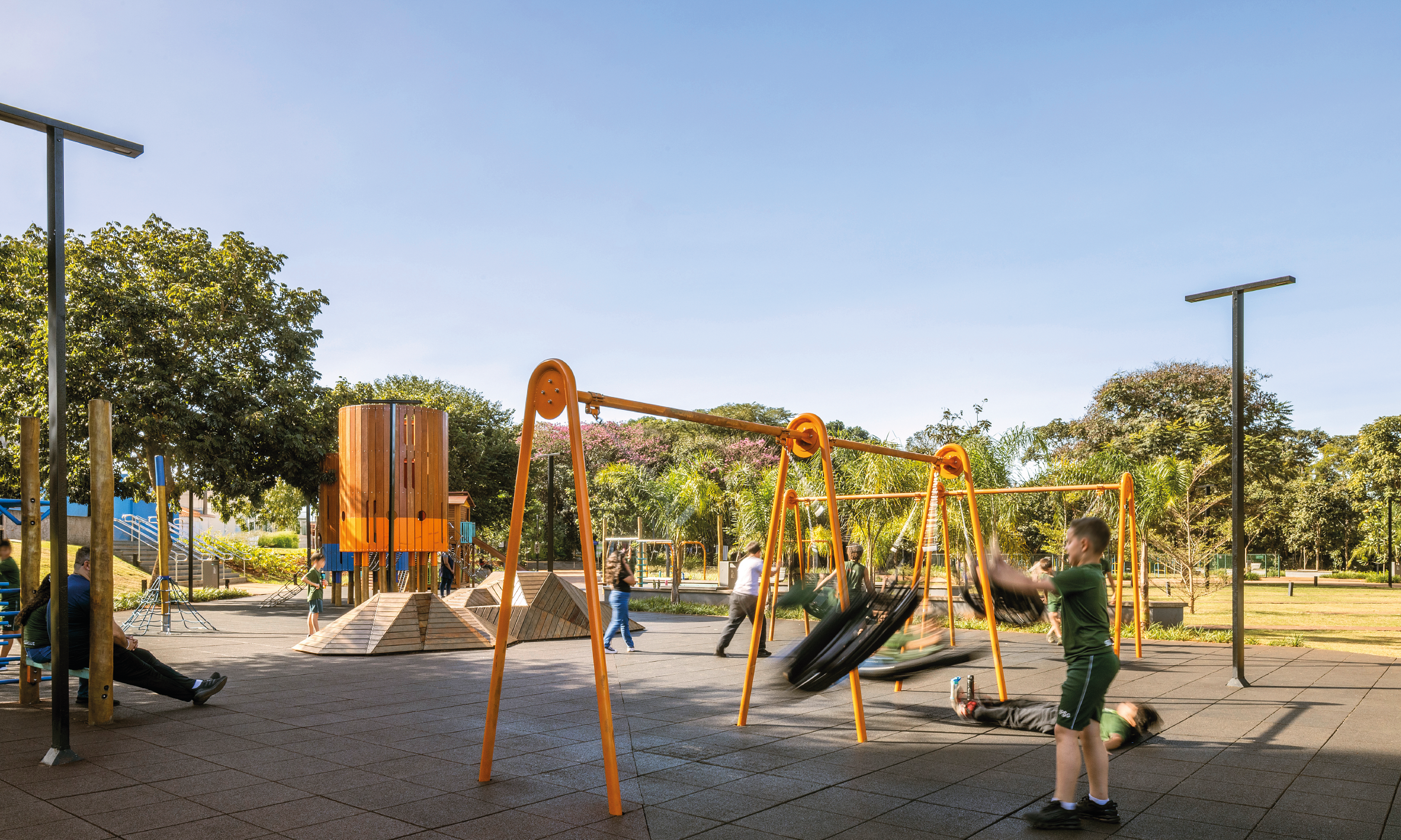
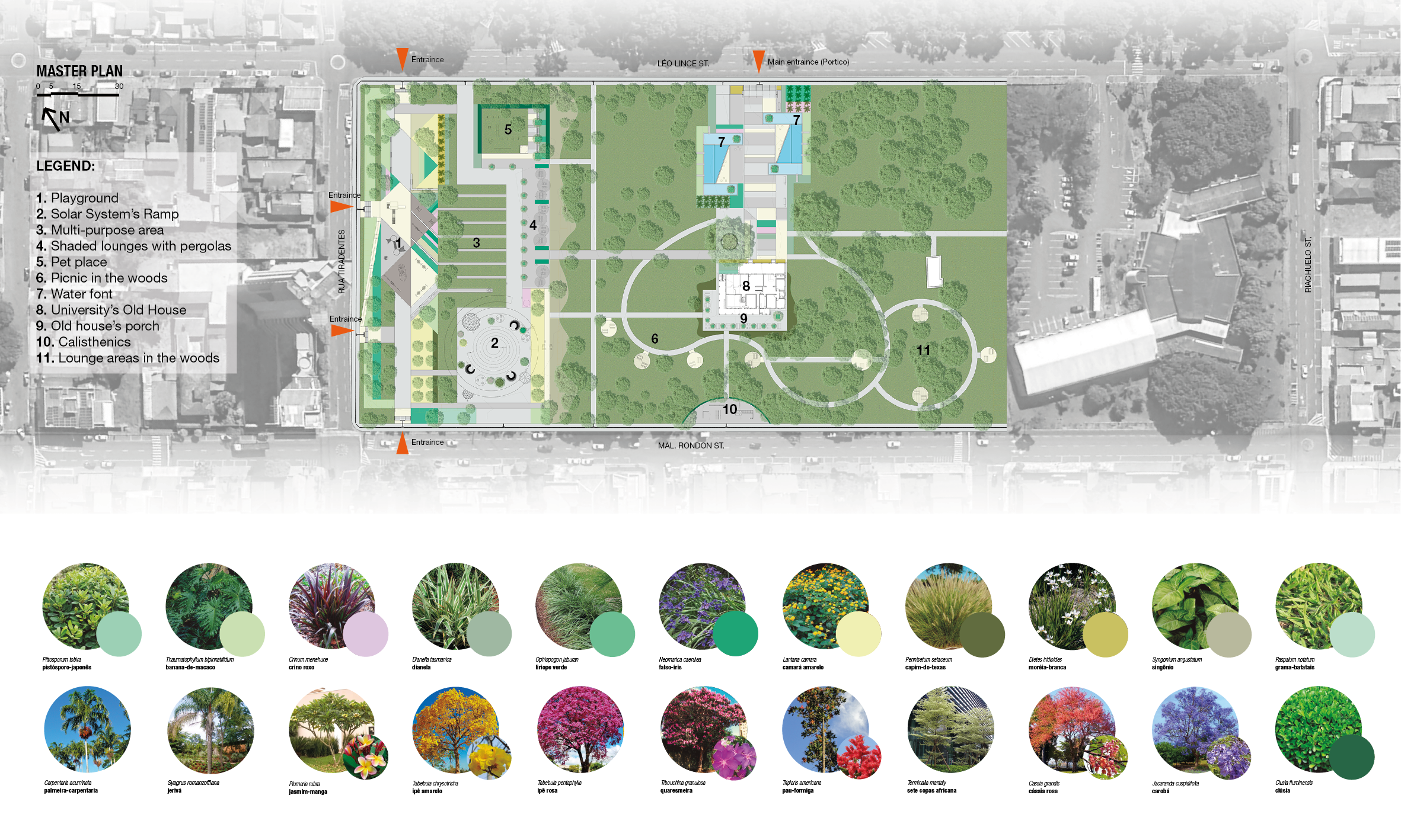
Zoning plan: By respecting all the natural conditions, as well the existing vegetation, the project was divided in two zones, so the visitor could explore the best topography’s potential in each one. The first zone, is the one we call “Solar system”, it sits on the highest and flattest area of the site, and that’s where are the most equipment and recreation areas such as: pet place, playground and shaded places with pergolas. This zone contains vegetation that creates some vertical landmarks in the landscape and provides shades in strategic locations. The lack of dense vegetation contributes to create a visual identity to the plaza, integrating each recreational area and providing more security to the visitors.
The second zone, is the “Old house and the woods”, where we have a former private residence, which is currently an administration spot of the University. This zone is not built yet, and it is part of the second phase of the project. The concept design in this area is to create an identity that values the architecture of the house and also create pathways that connect the woods to the plaza. So, in this case, it was designed a big portico to mark the entrance, and it is aligned to the main façade of the house, and introducing the access to a new pathway, combining nature and built elements, such as the water fonts in each side of this access. The main entrance, leads to the woods’ pathways that circulates between the old trees and creates a few small lounge areas to the visitors along the way.
Our main goal with this project was to create a new landscape that celebrates the old and the new times that will come, through an accessible design, allowing a place in the city to be a place for everyone.