Fish Cylce Wieringermeer
Fish Cycle Wieringermeer
Landscape, art and ecology
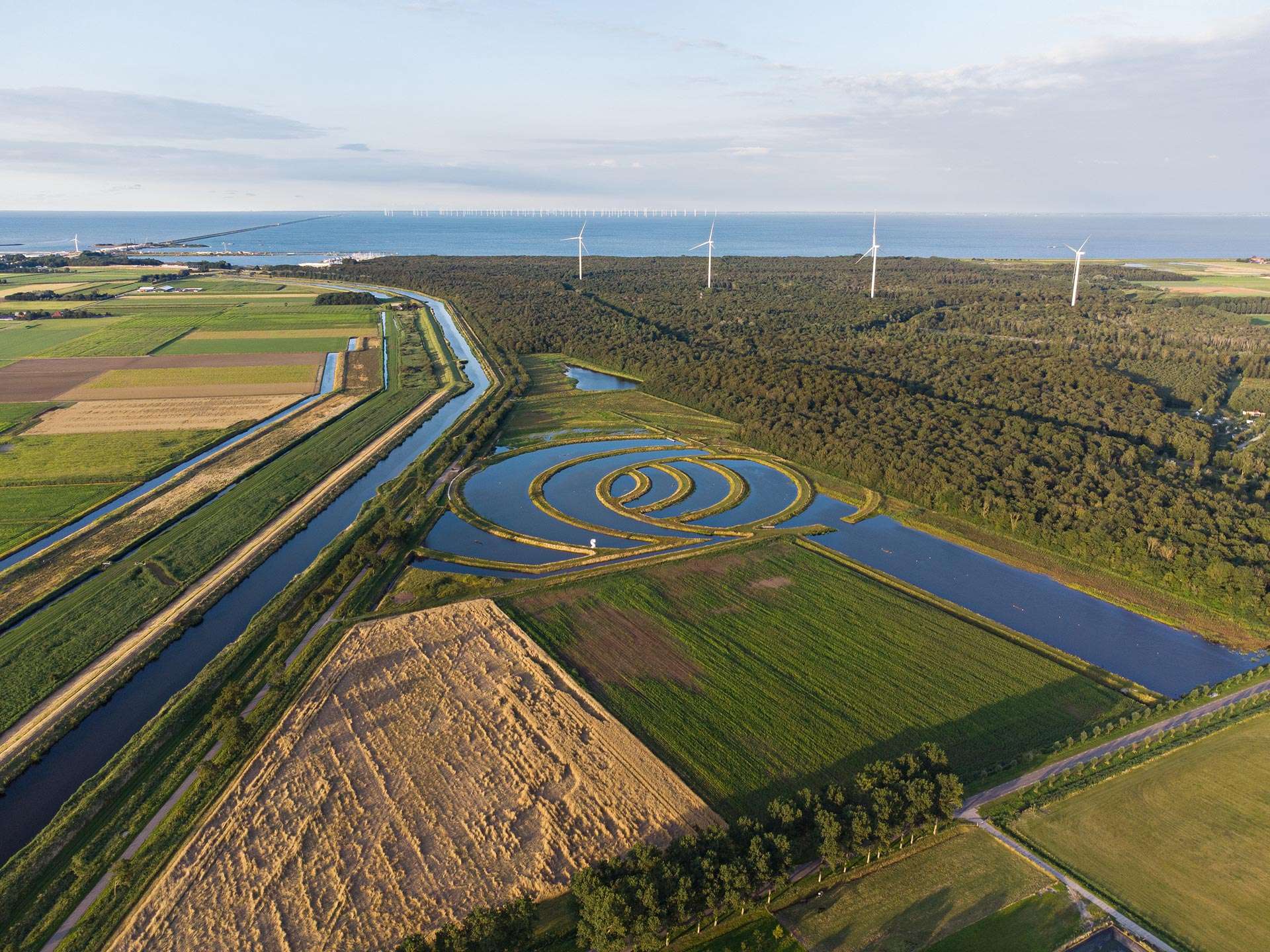
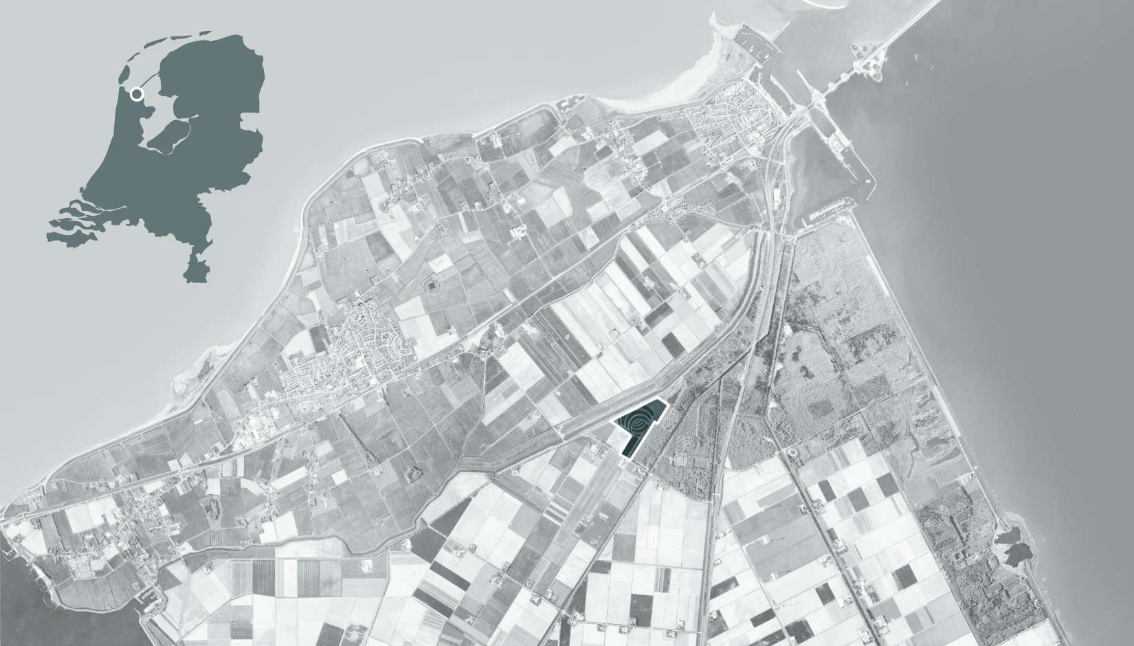
In the agricultural landscape of the Wieringermeer, a nursery habitat for fish has been created. The design was established in close collaboration with an artist and an ecologist. Landscape architecture, art and ecology are fully interwoven in the design. The concept is based on the artistic design of the landscape, while at the same time creating the best foundation for the development of high nature values. The combination of landscape, art and ecology creates a unique habitat for fish and a contemporary ‘landmark’.
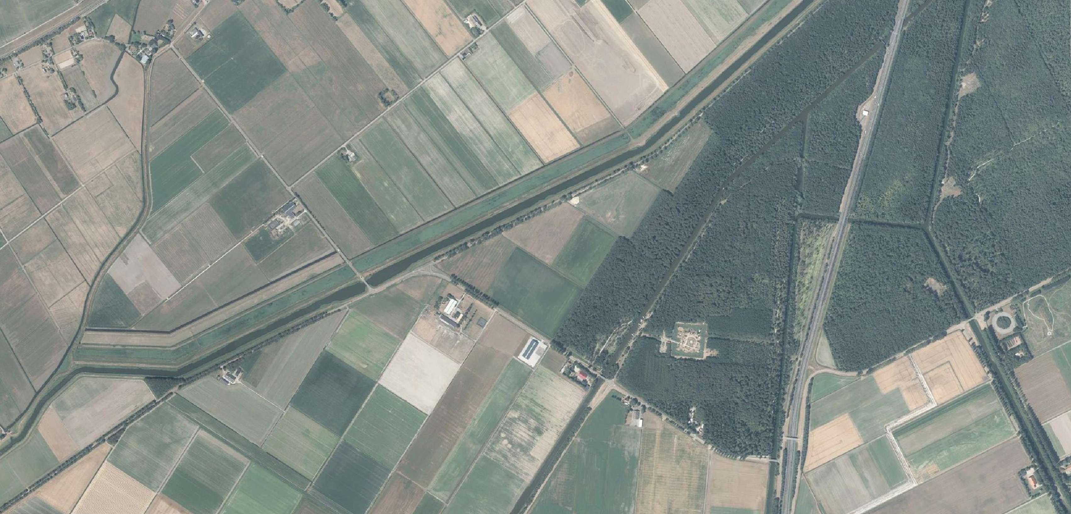
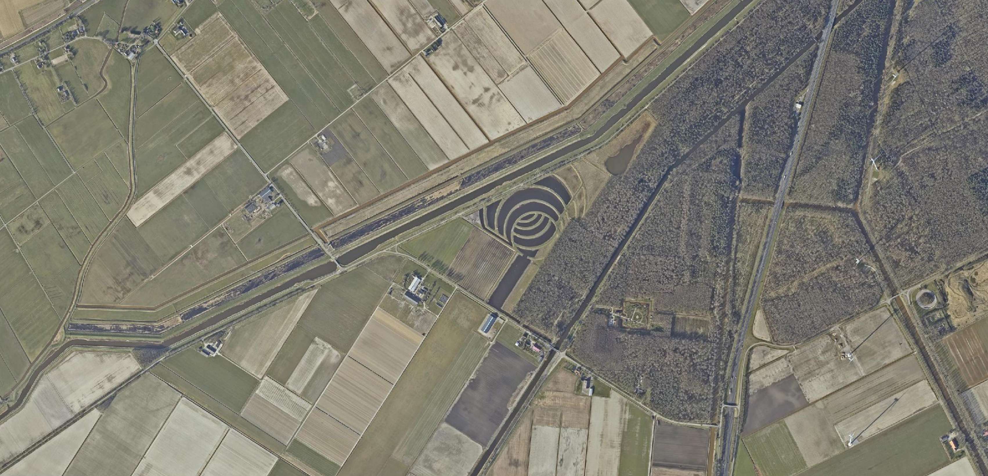
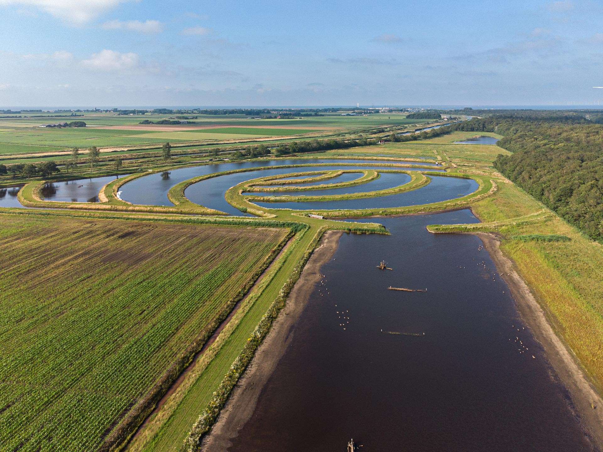
The construction of the Fish Cycle and the fish passages has created an ecological link between the Amstelmeer canal (to the IJsselmeer) and the water system of the polder.
Concept
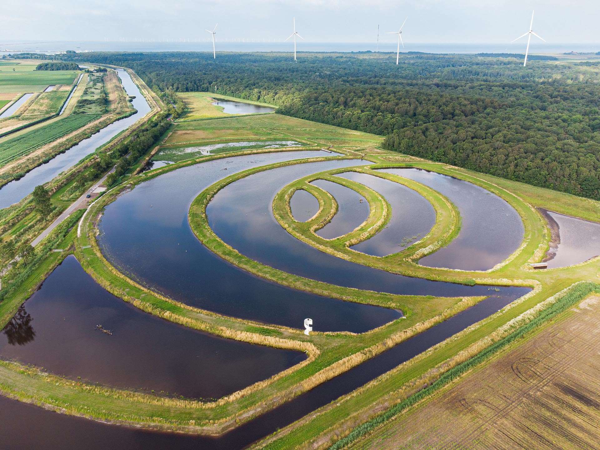
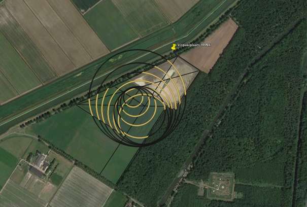
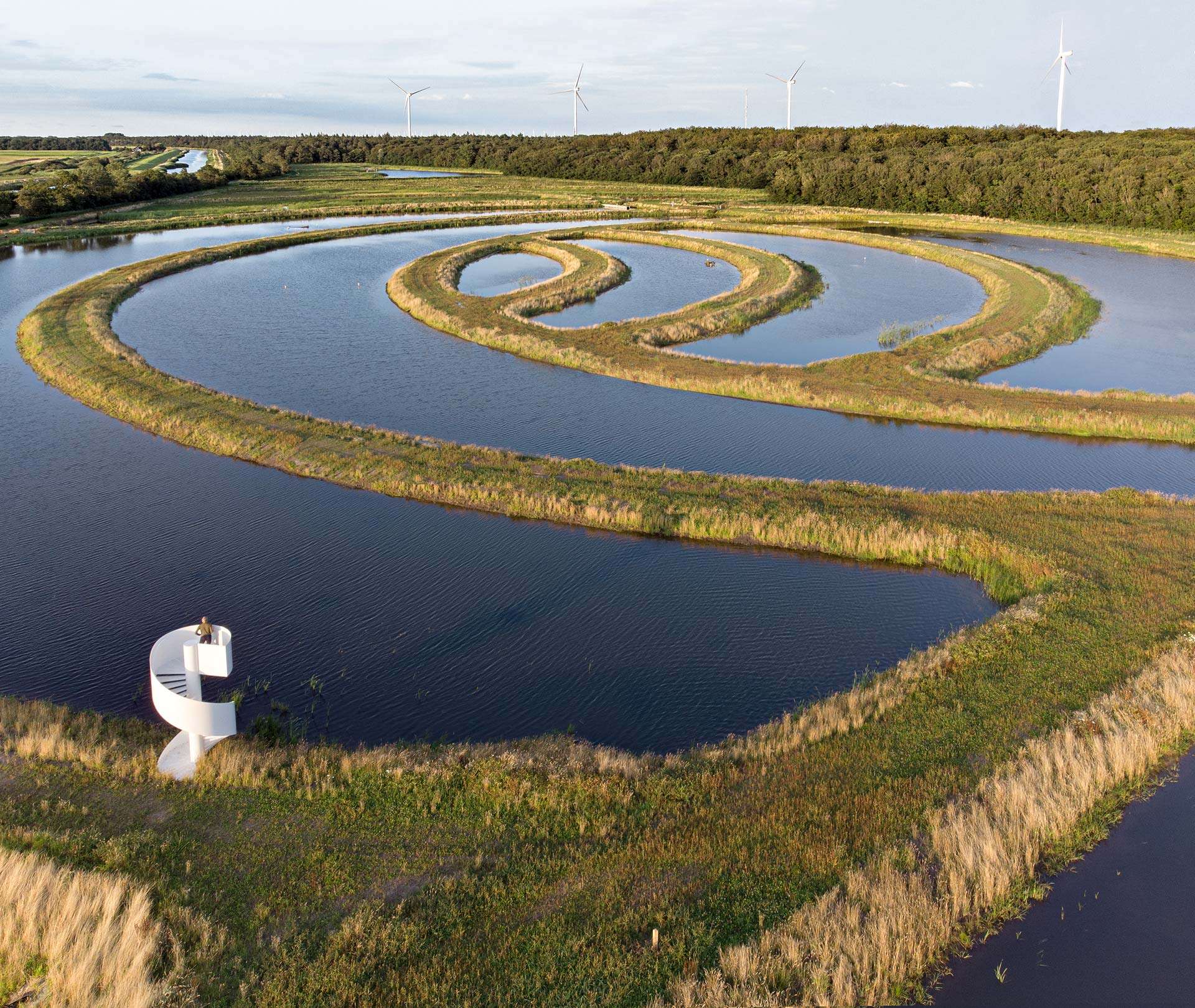
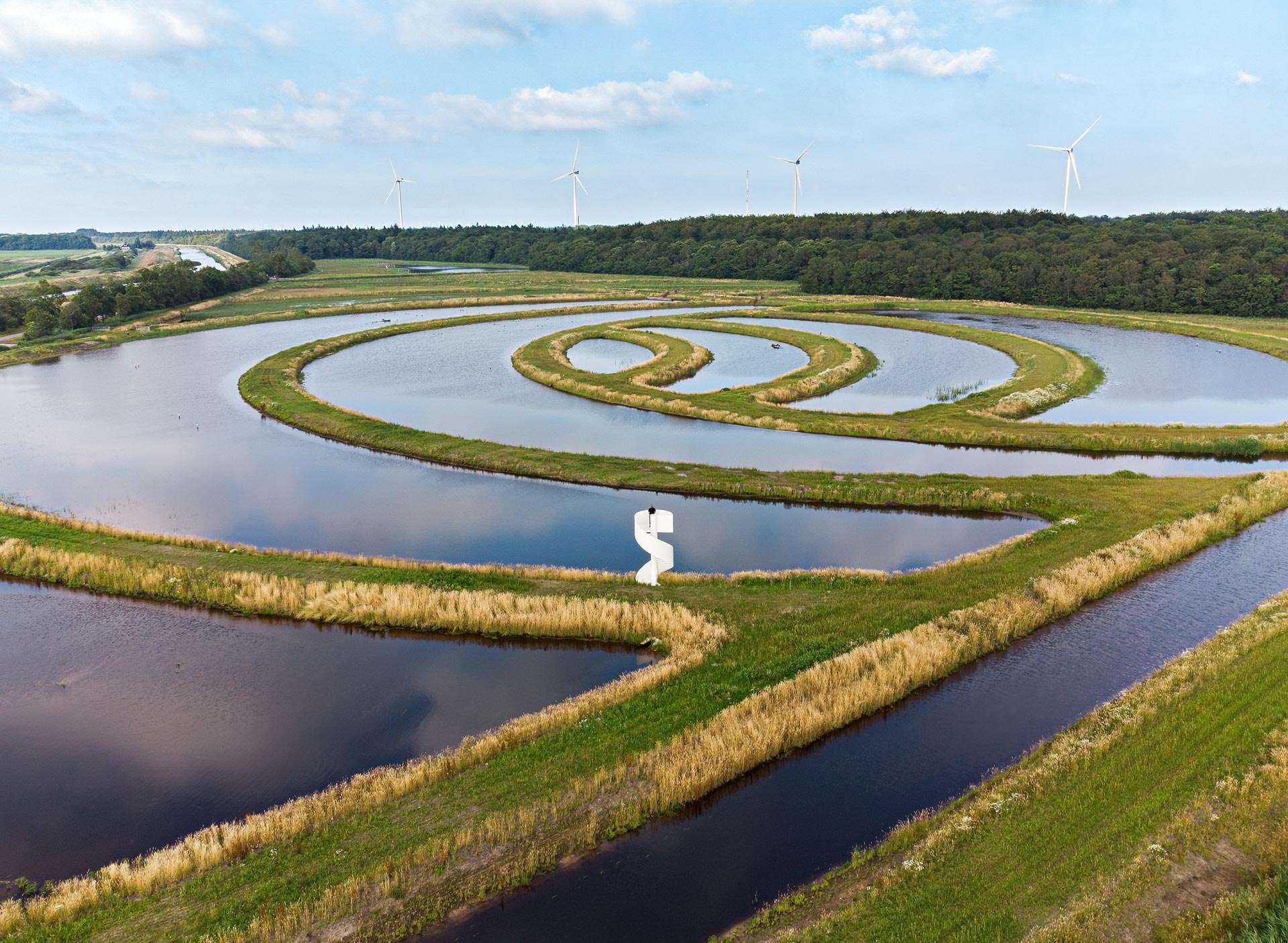
The ‘Fish Cycle’ refers to the cycle of life that the fish will experience in this habitat. It also refers to the ripples created when two stones are thrown into the water. This has resulted in a peculiar visual image of water flowing in circles through the landscape.
Design
The design is spectacular in its simplicity. The clear, large circles create a strong image and are in line with the robust dimensions of the polder.
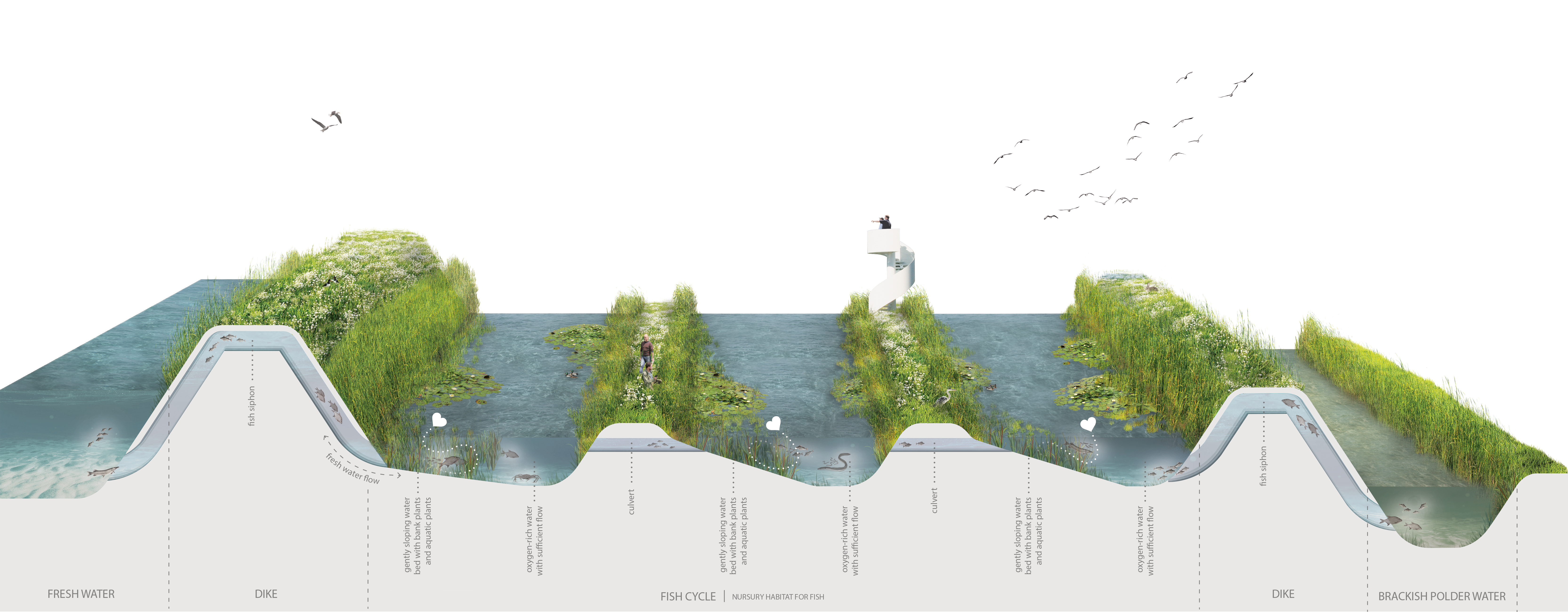
Water, grass dikes, reeds and various (underwater) vegetation are given a clear place in the design. The variation in water depths, directions and orientation to the sun creates a wealth of ecology, colours and structures.
Water and ecology
To create the largest possible useful surface area (longest route), the water twists and turns through the area like a radiator structure. The different parts are interconnected by fish ladders. Innovative fish siphons connect the area to the Amstelmeer canal and the polder water.
There is a wide range of water depths, from wetland at the edge to well over a meter of depth in the center. Underwater structures such as logs and gabions make the area even more attractive as a spawning and hiding area. In addition to fish, the area is also valuable as a breeding and wintering area for reed and water birds. A new forest edge provides an ecological transition to the Robbenoord forest.
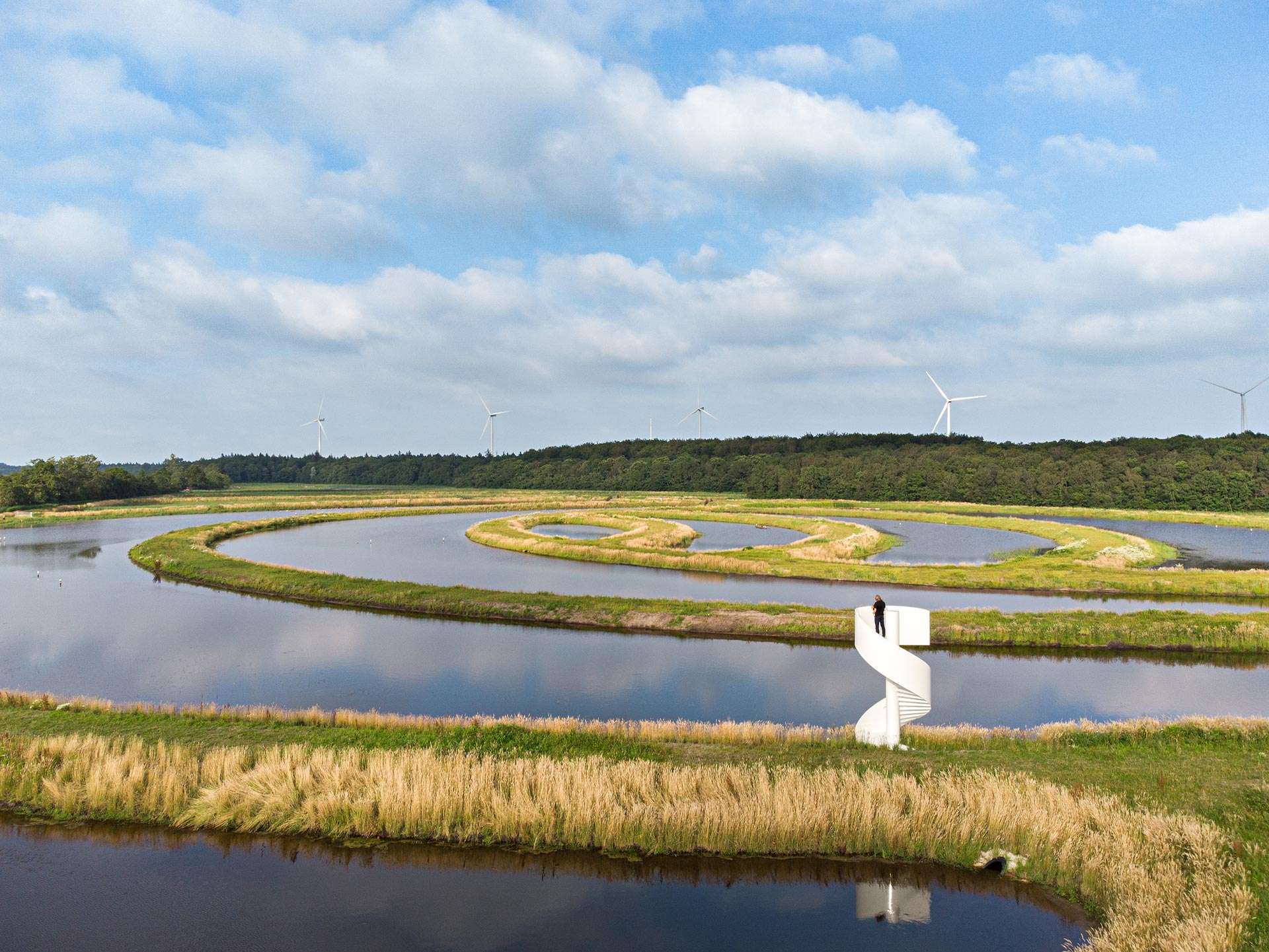
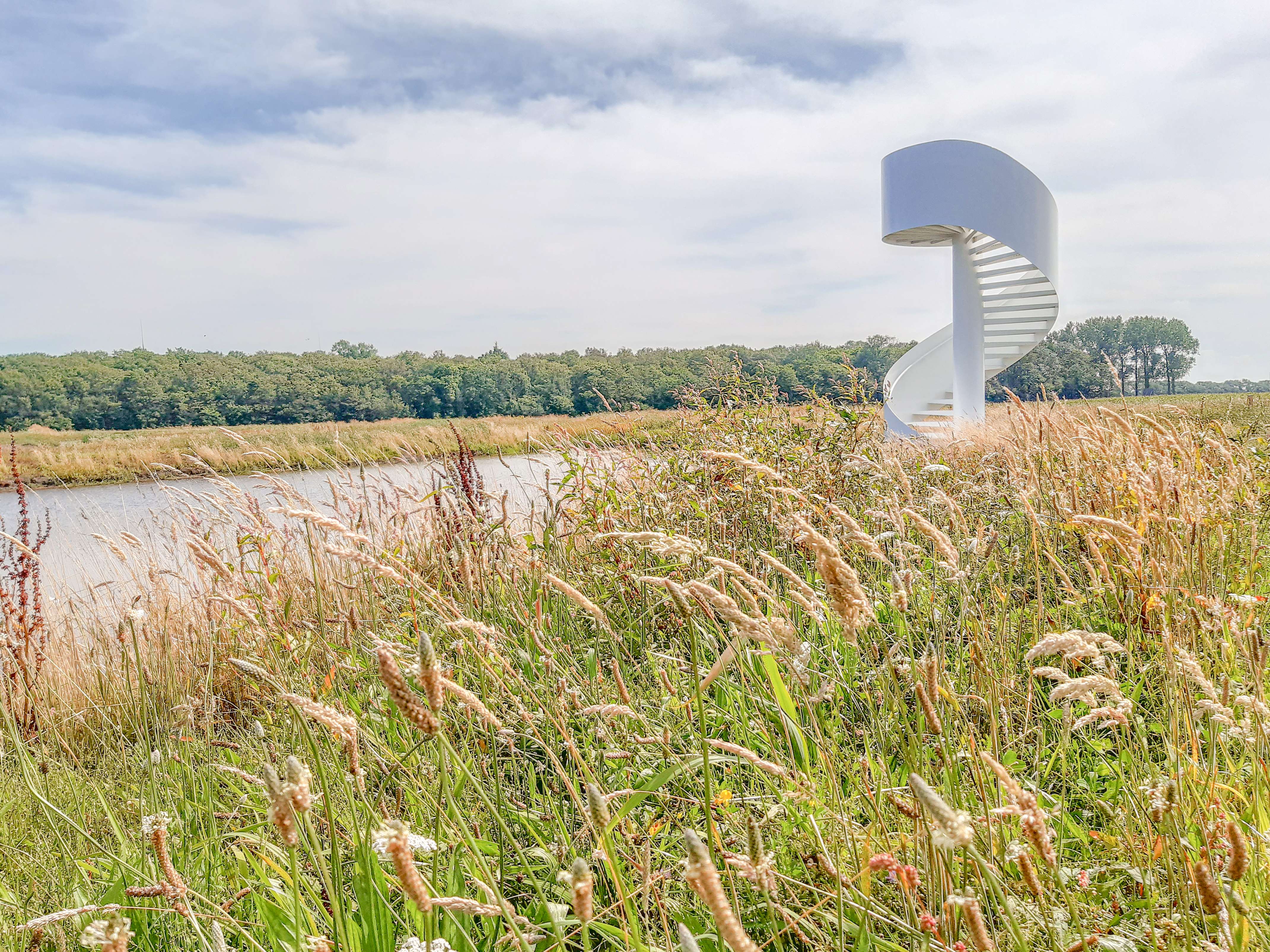
Observation tower
A public grass path placed over the dike connects the Wieringerrandweg with the Robbenoord forest. An observation tower offers visitors a beautiful view of the expressive shapes and the rich ecology of the area, including many species of birds. The shape of the tower is based on the circles of the Fish Cycle. The observation tower is a strong eye-catcher, inviting passers-by from the surrounding roads to enter the area.
Impact
The project proves that ecology can have a clear design, and that land art can have a strong ecological added value.
It ensures maximum functionality (water system, management routes, maximum variation in water depth and sun orientation, ecological links) and has a strong image, without concessions.
The benefits of this project have been made visible to the public through the observation tower, an artistic film of the construction and an underwater camera that shows the researchers and the public which animals enter and leave the area.