Downtown Høje Taastrup
Downtown Høje Taastrup
Downtown Høje Taastrup
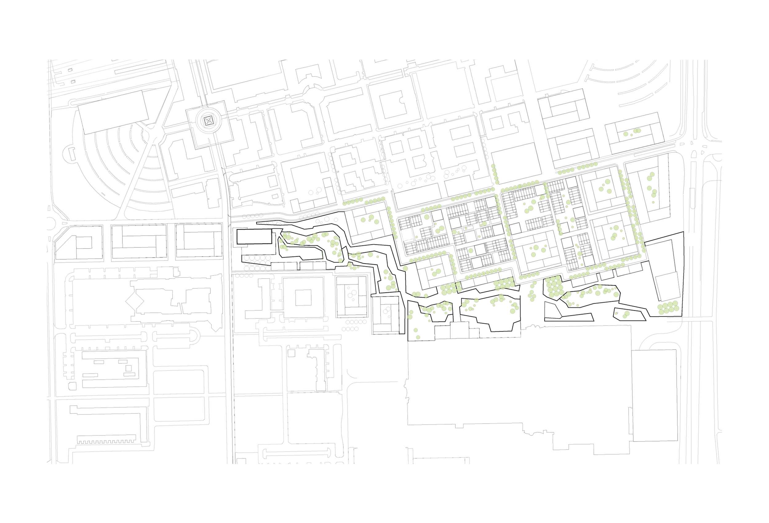
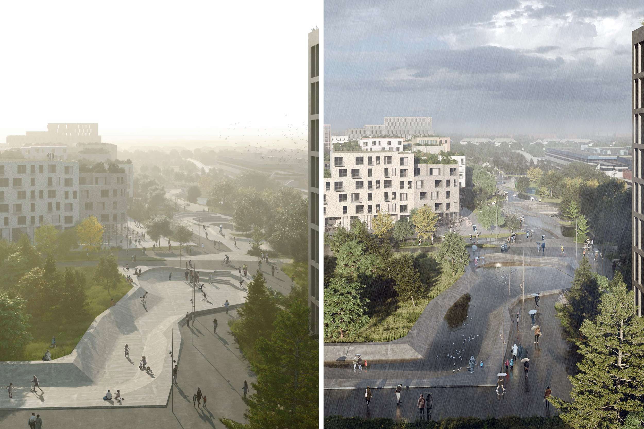
The vision for Downtown Høje Taastrup, a newly developed urban neighbourhood near Copenhagen in Denmark, is a central green core that reactivates the city through activity and urban culture. The project responds to the need for housing while considering aspects of social, economic, and environmental sustainability. The new open space creates spatial structures that are able to cope with heavy rainfalls to be expected in the future due to climate change. A sudden and exceptionally heavy rainfall in 2011 had affected Copenhagen so severely that many urban areas were flooded. Subsequent hydraulic assessments of local conditions showed that protection against extreme weather events was not sufficient to prevent future flooding in parts of the city.
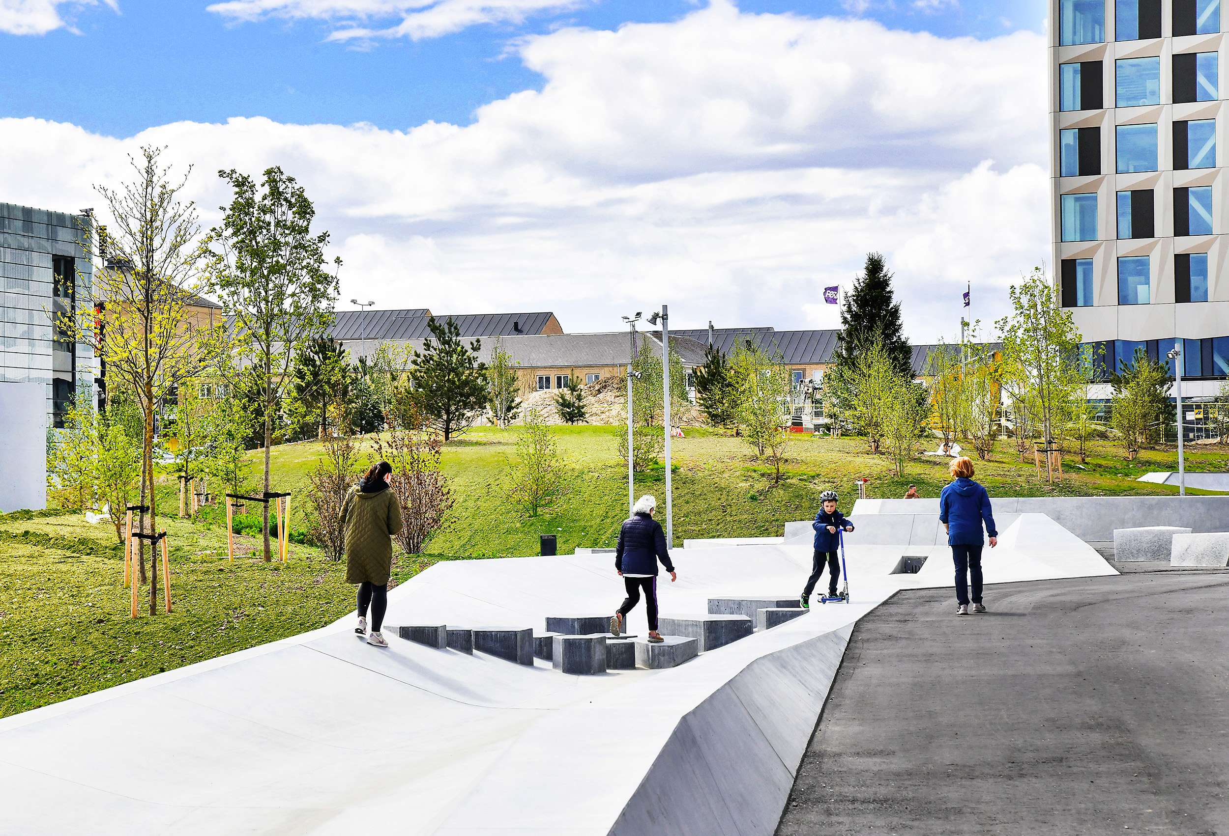
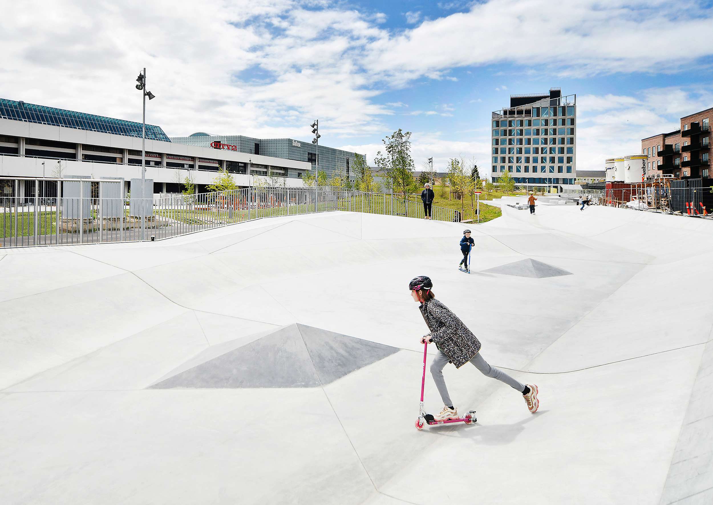
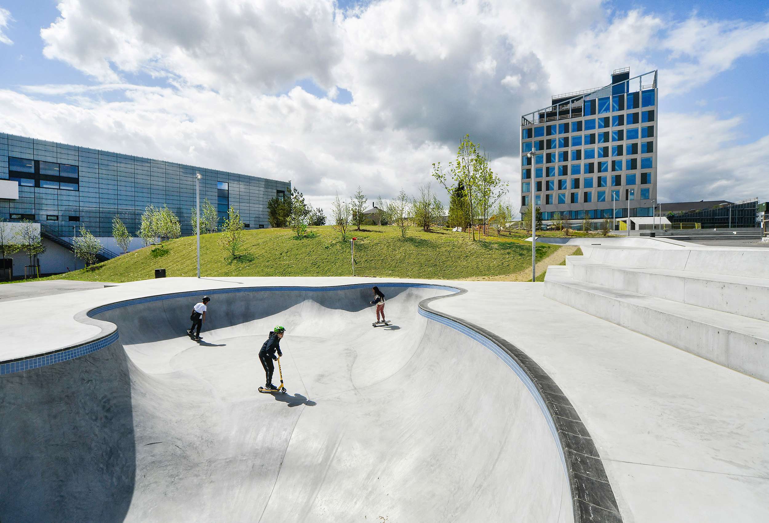
The master plan focuses on a new city park. Containing play areas and sporxts facilities as well as green spaces and path connections, it offers various leisure options for both in- and outdoors. Through the holistic urban design approach of an active and coherent centre – a place of interaction between architecture, landscape, urban space and programme is created.
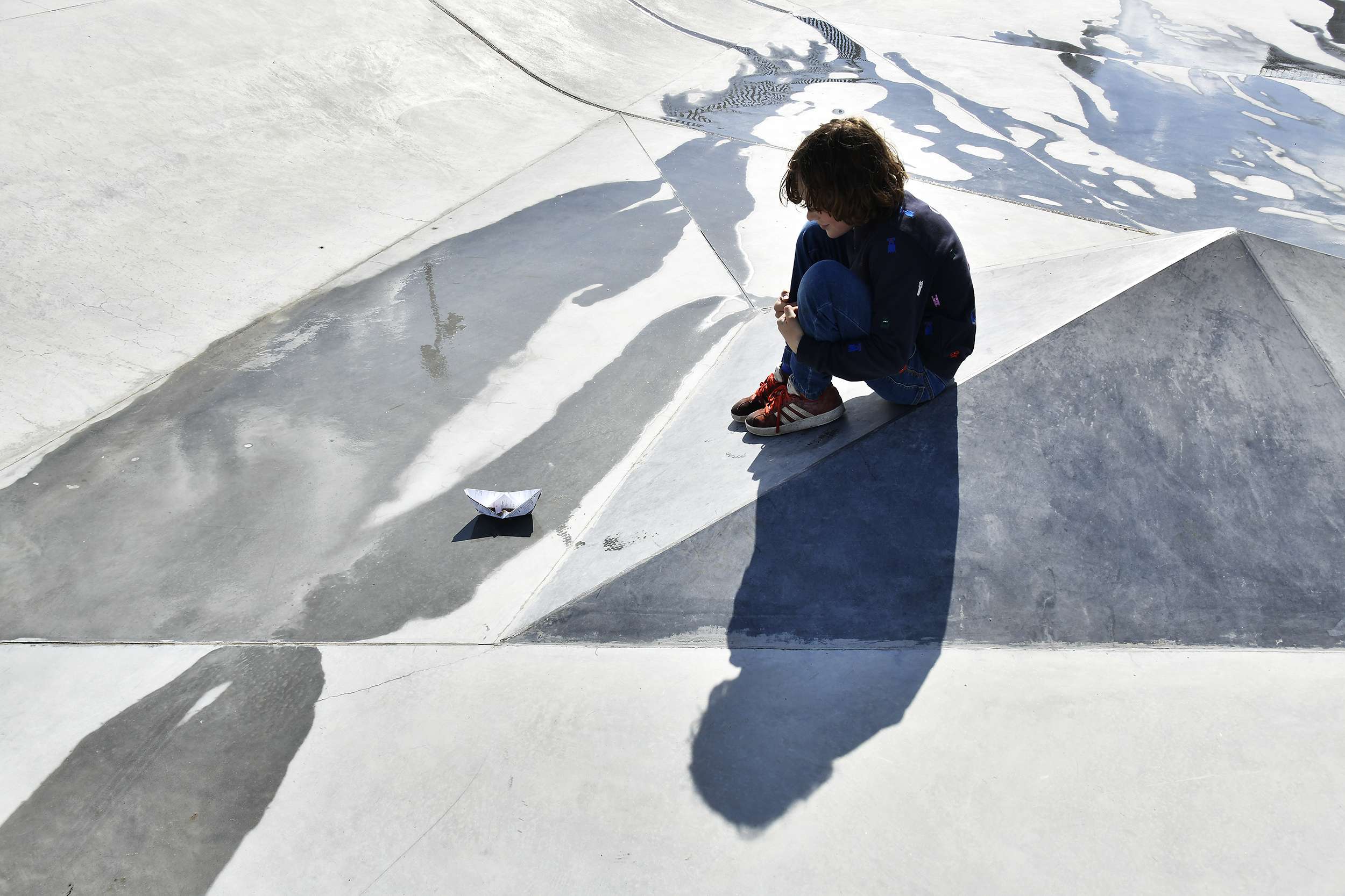
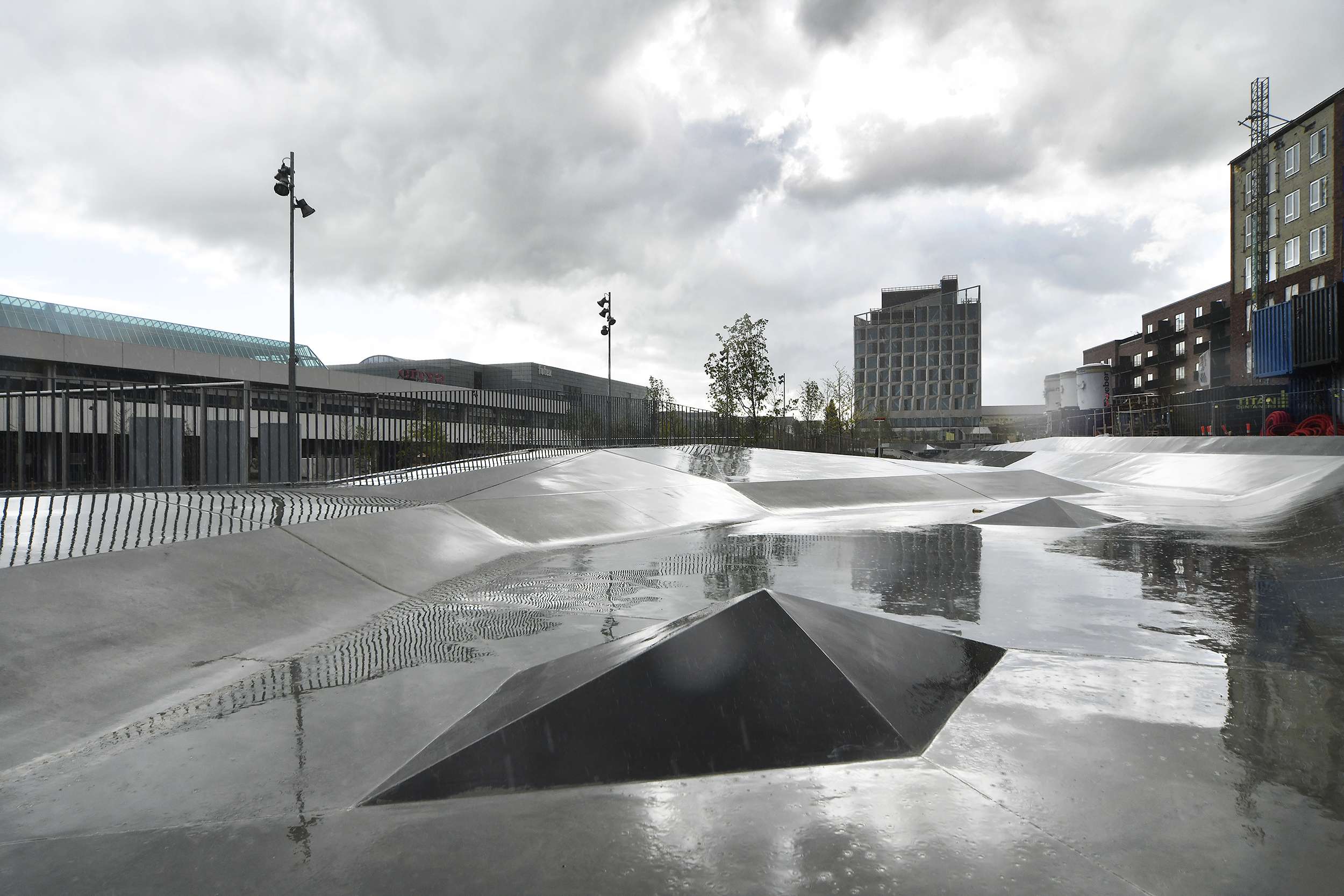
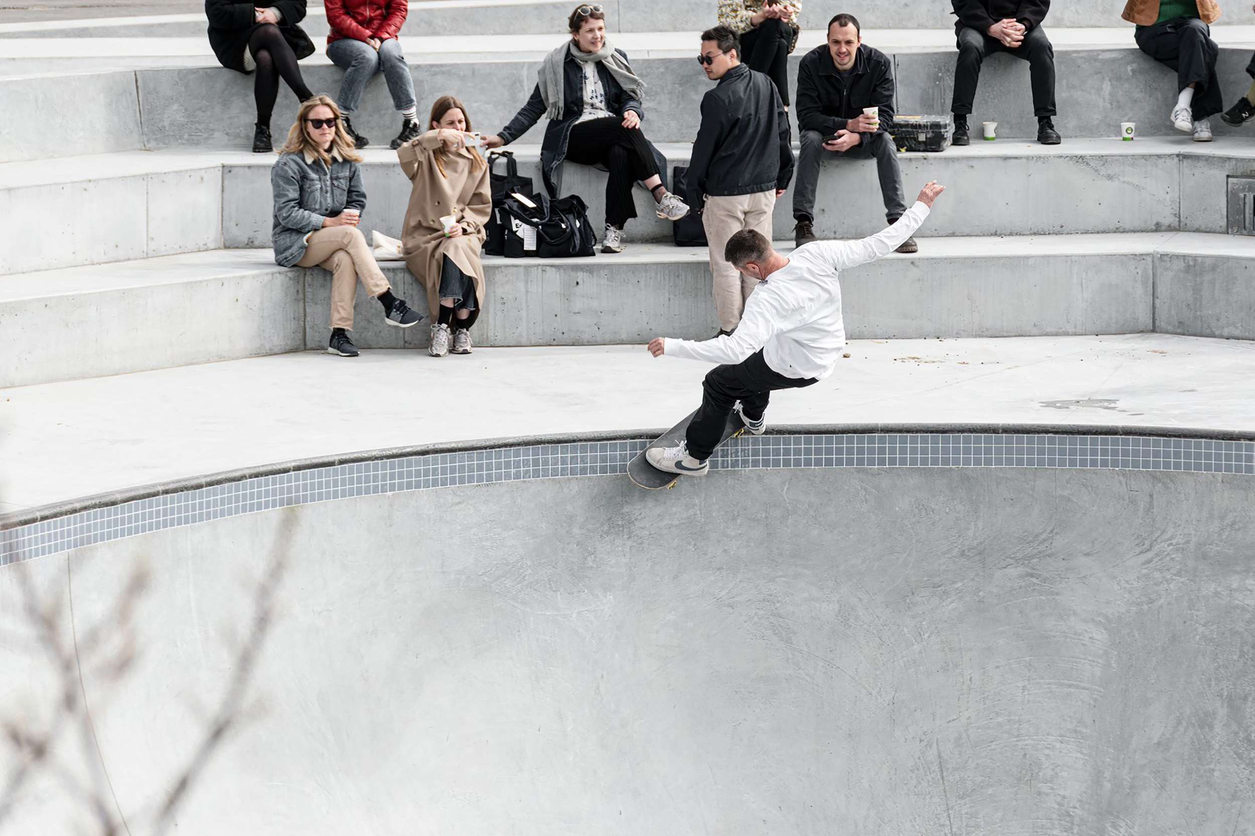
With an exemplary approach to climate resilience, the public space is disguised as the world’s longest skatepark. At the same time, the topography leads and detains rainwater, while serving as a great recreational space for residents and visitors.
The water management is the central feature of the design: hundred metres of ditches, complementary reservoirs, and rain gardens are situated along the site. Rainwater is irrigated to the green areas and further on to an open rainwater pond. Additional rain- and wastewater pipes run below the site. Along its total length, the skatepark stretches up to one kilometre, ensuring the capacity to handle frequent rainstorms up to 6500 m3.
The planning concept implemented in Høje Taastrup finds a contemporary answer to contemporary complex issues and challenges. Against the background of increasing demand and higher requirements for public spaces and the limited availability of land resources in urban centres, it is obvious to think and plan infrastructural space management in an integrative rather than additive way in the future. The example of Høje Taastrup shows that spatial multiple coding and intersection of different programmatic layers works perfectly and can enrich urban open spaces with individual local characteristics. The dynamic, climate- and weather-related change, which makes the parallel uses only temporarily available at a time, teaches the users to live with the climatic conditions and changing weather patterns. Through a holistic understanding of urban planning, a place of interaction between architecture, landscape, urban space and programming has been created in Høje Taastrup, characterised by qualitative specificity and identitary uniqueness.