

LORIENT, Jules Ferry Park and the East Indies mall
A mall, a square and a park connecting the city center to the sea.
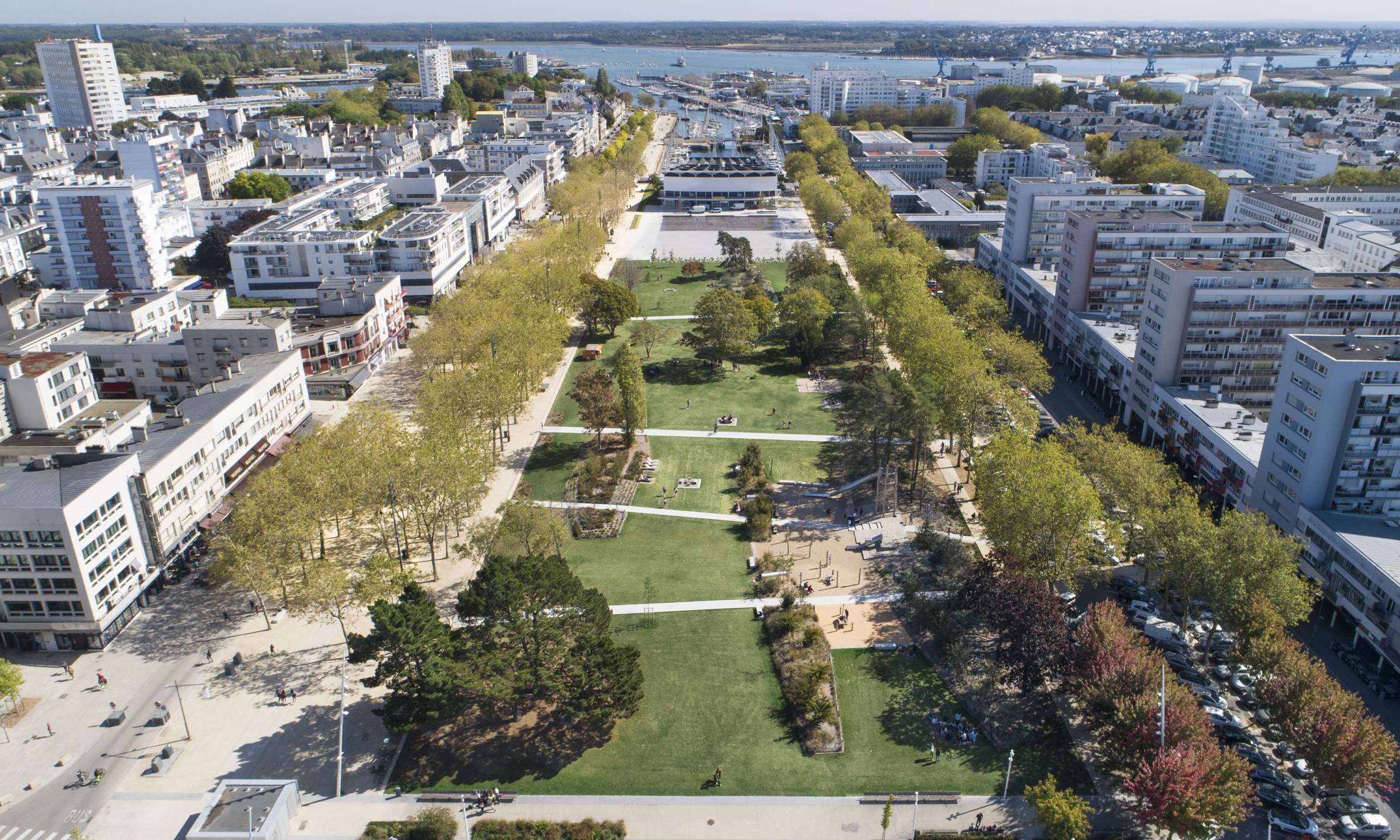
Jules Ferry Park is an exceptional urban piece in terms of its size, availability and location: 4 hectares in the city center of Lorient. This project opens up a former city square, and a unified public space in the extension of the port now clearly states the city’s maritime identity. A true "central park" in the heart of the city, Jules Ferry Park brings back plants and many uses.
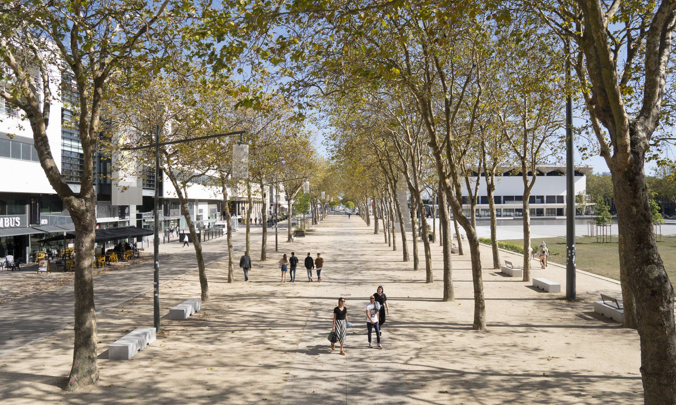
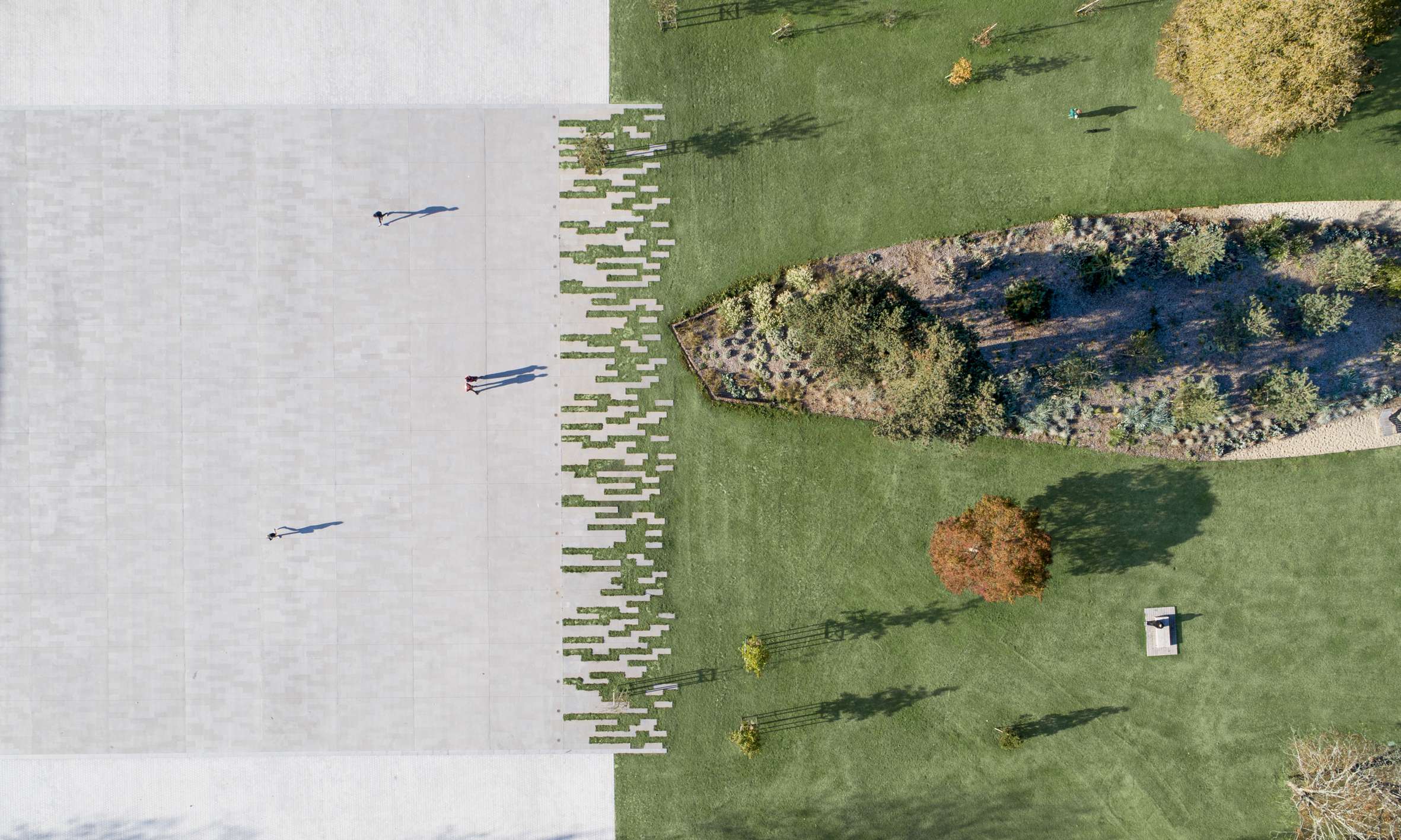
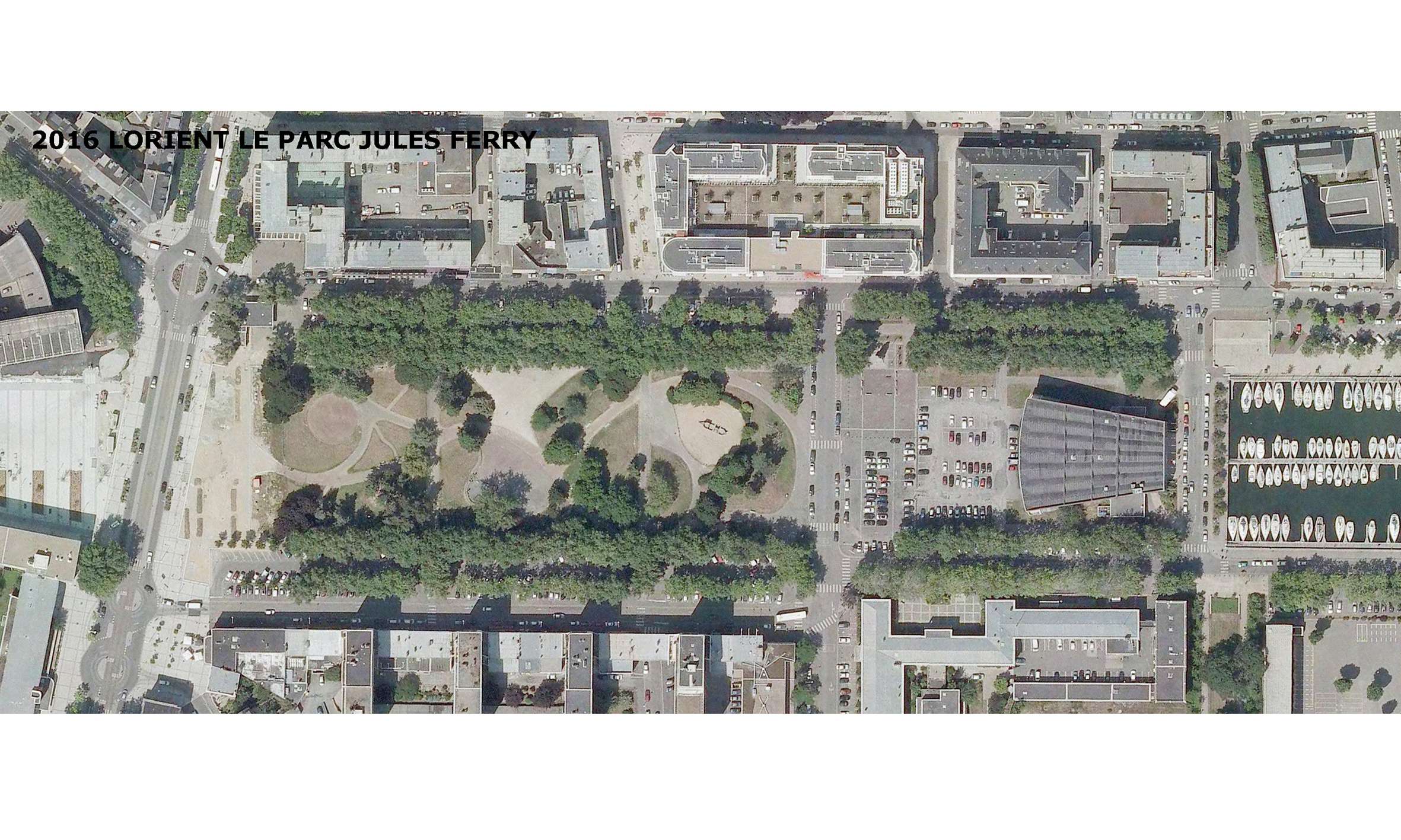
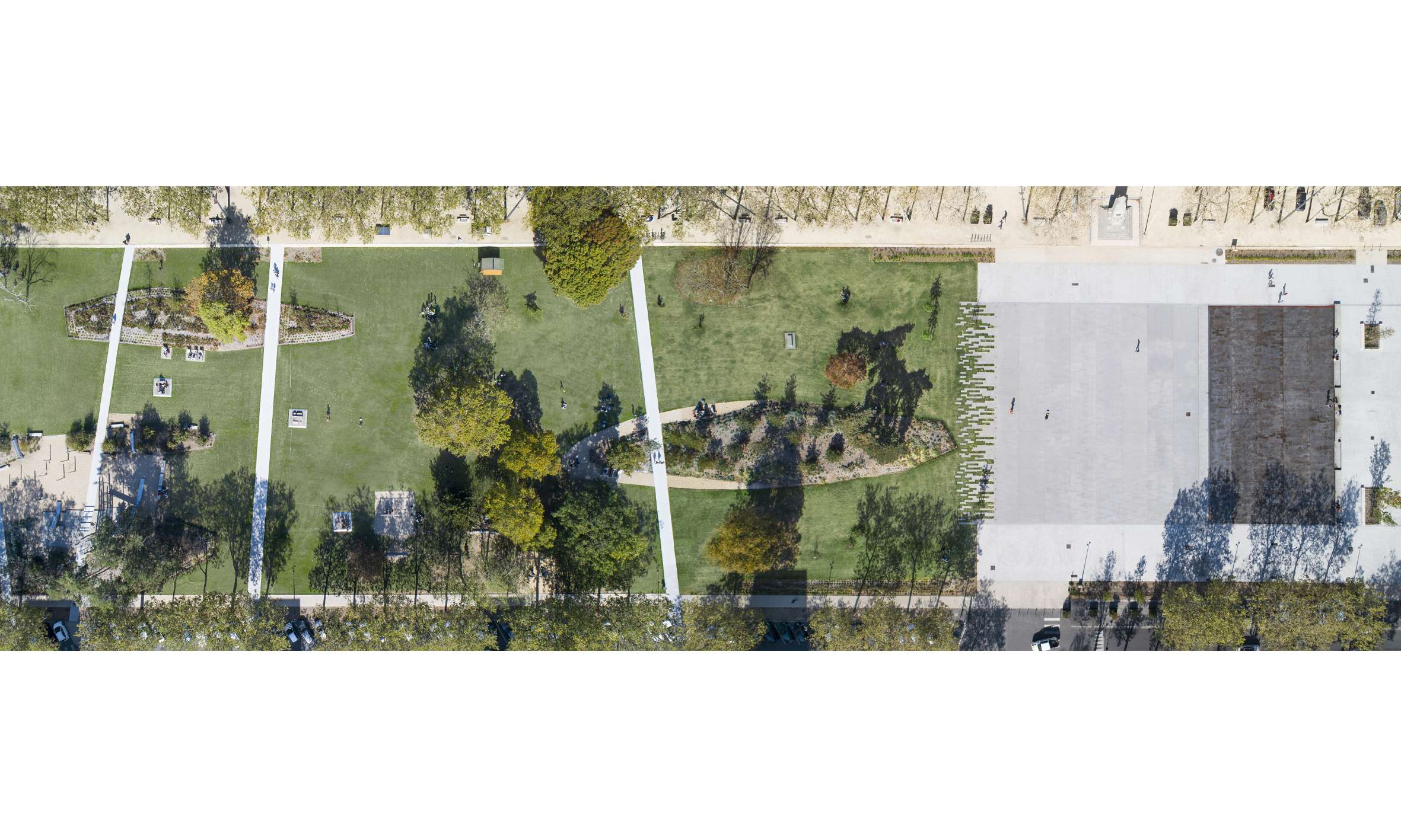
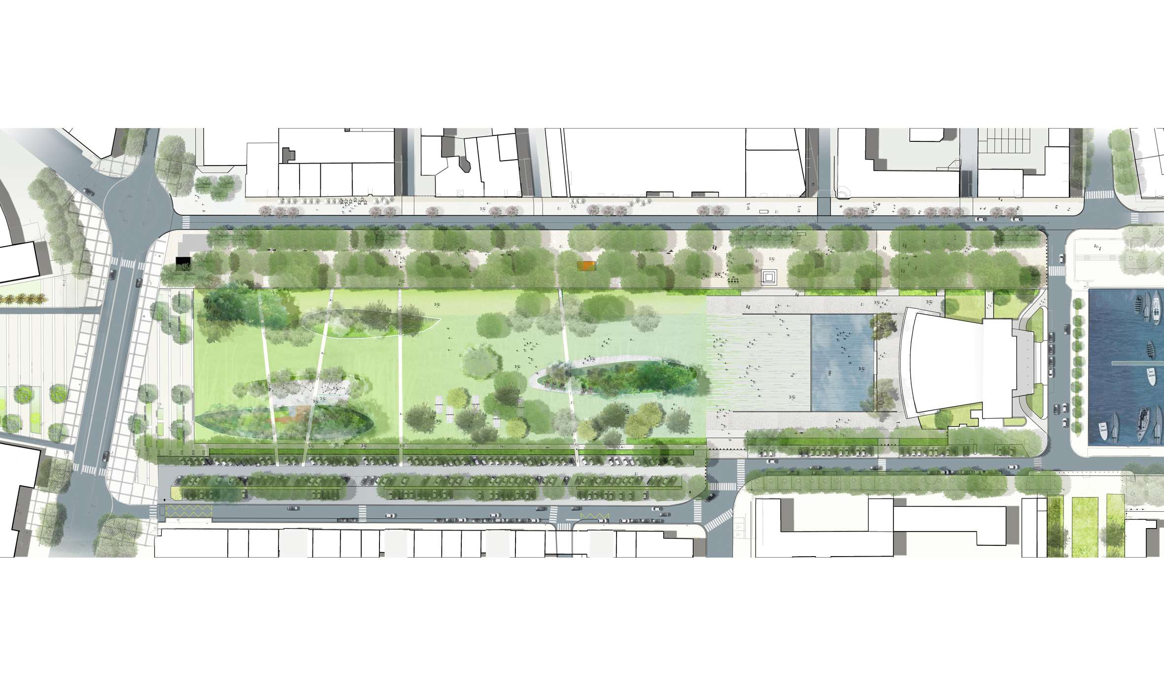
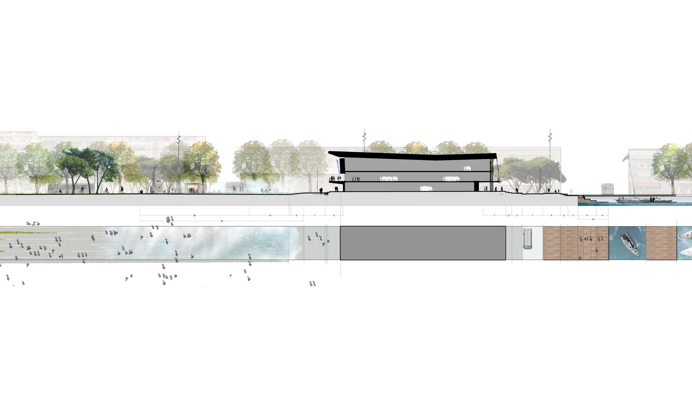
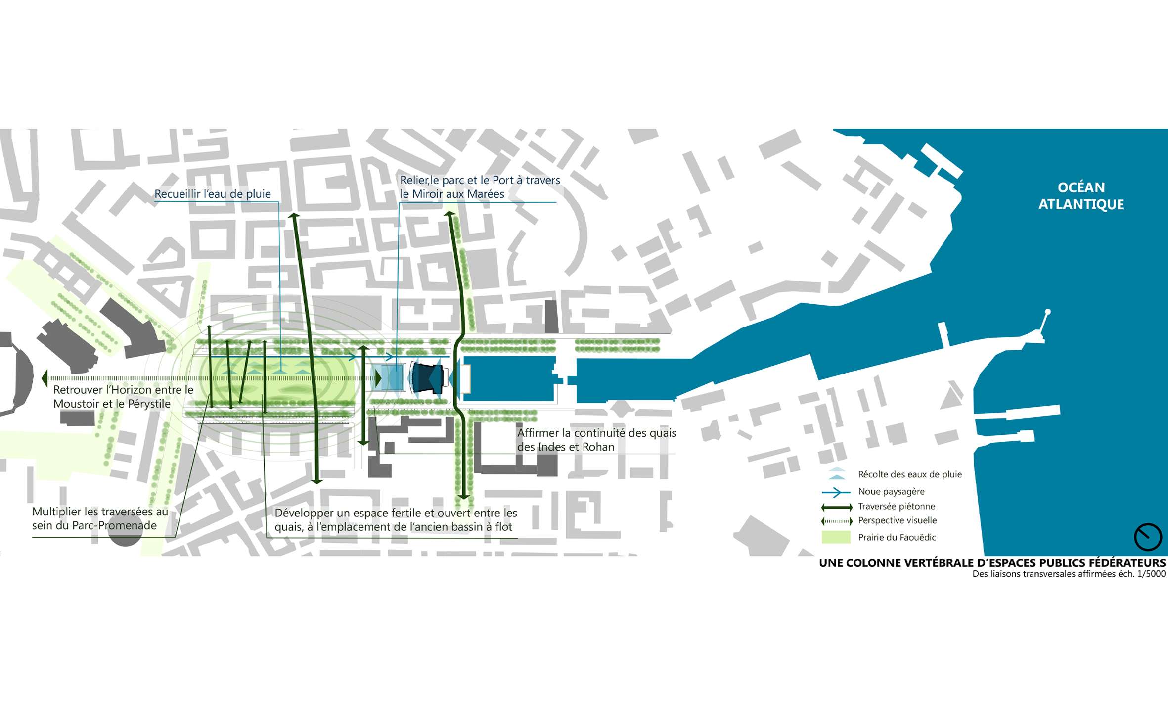
Jules Ferry square, a vast emblematic public space, stretches from west to east, between the town hall and the port. It lies in place of the former wet dock, which was filled in following the 1945 bombings. This formerly ill-used and aging green space used to create a real disconnection in the urban fabric. The square had been downgraded to a parking lot and had lost all attractiveness. Other car parks on the two quays, aging plantations, degraded paths, mineral and impermeable surfaces all constituted obstacles between the two sides of the city. The link with the sea was broken when the Palais des Congrès was built creating an obstacle between public space and the landscape. This hybrid public space now combines various settings: the East Indies quay and the rambla, Glotin square and the water mirror, the great central meadow of Faouëdic and an archipelago of garden islands. The East Indies quay has been transformed into a true rambla, combining a bus lane, pedestrian and cycling paths, kiosks and terraces along the shopping facades.
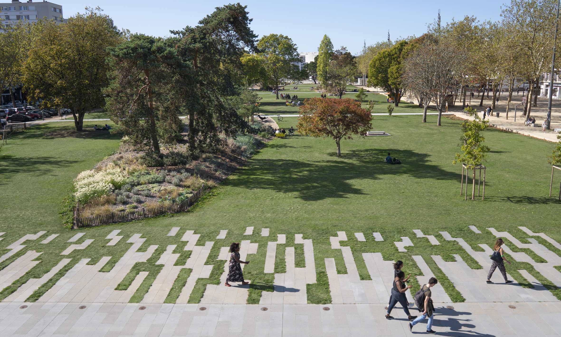
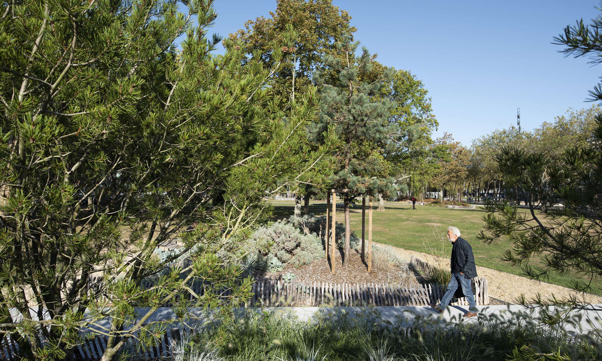
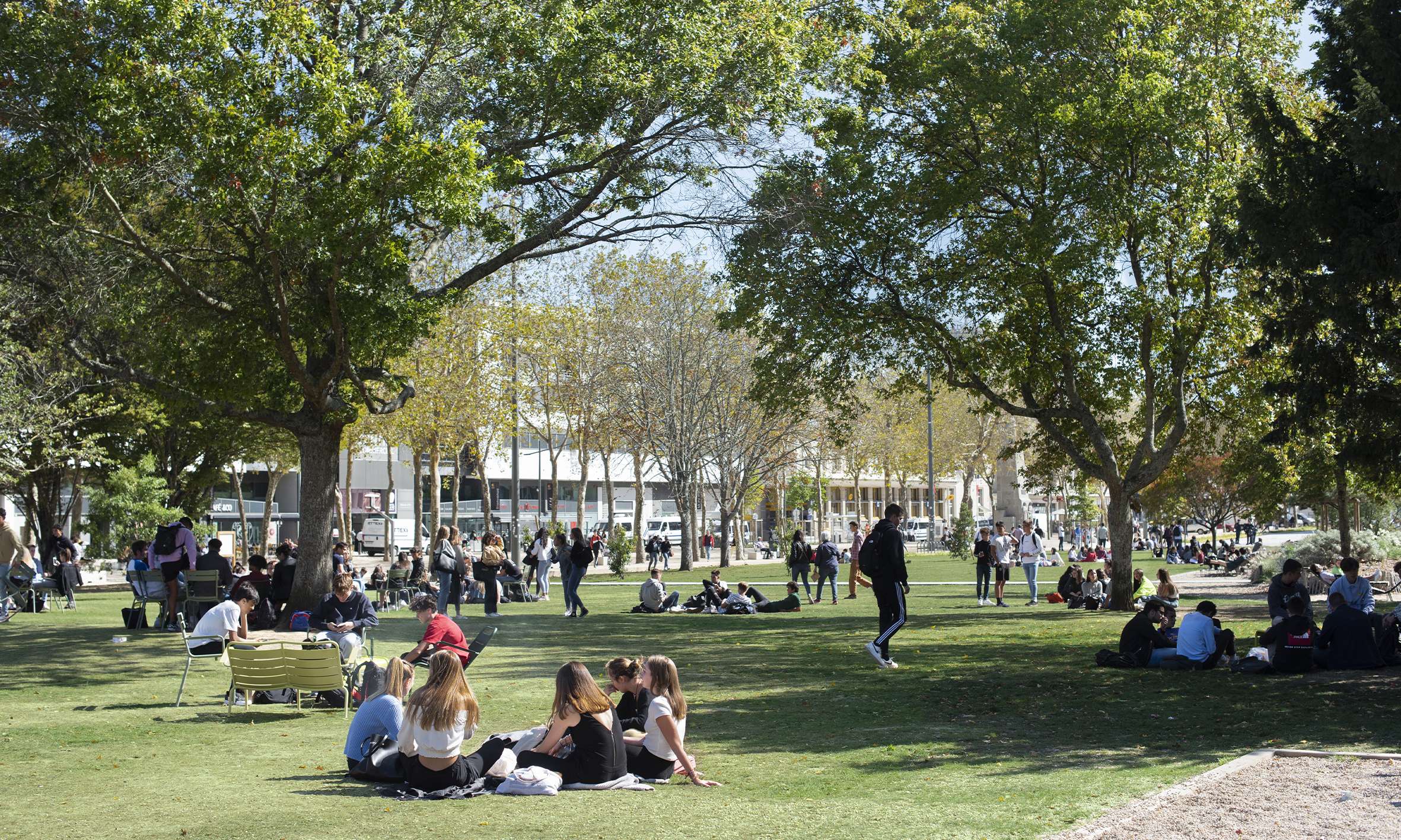
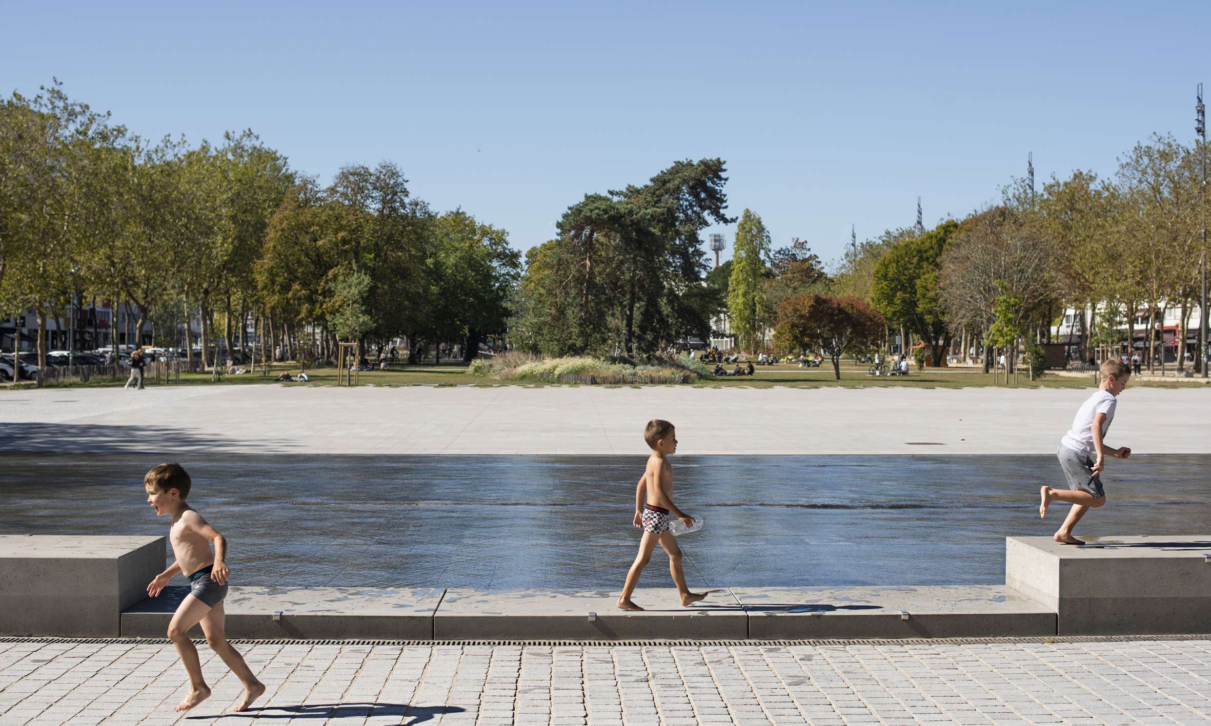
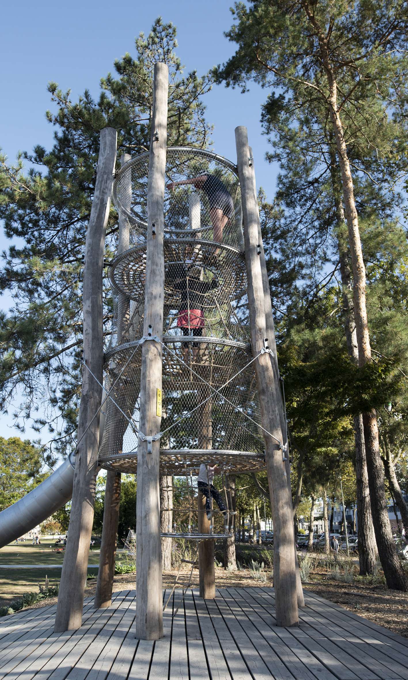
The large Faouëdic meadow (1.6 hectares) is the main space. It is simple and open, and people can easily take ownership of it. "Garden islands" thicken the existing tree patterns with new plantations which renew the tree stratum and the ground cover stratum. These islands host different microcosms, playgrounds, places of rest and contemplation... The Isle of Pines is home to a large custom-made playground designed in consultation with children from Lorient. The 7 meter high tower-slide is a true landmark of the park. A large raft, suspended boats, a climbing course and tube-tunnels offer a wide variety of games. At the foot of the Palais des Congrès, the Glotin car park has been transformed into a large urban square animated by continuous misting and a sheet of water. The slight slope of the square invites you to play with water and sky.
The lively water mirror can be “turned off” to host events and the famous Inter-Celtic Festival. This reorganization allows multiple uses and atmospheres within this downtown park: daily uses for all generations but also festive uses and events on a larger scale specifically with the Inter-Celtic festival. Not only in order to stay within budget but also in a resolutely sober and frugal approach, this project was an opportunity to experiment with various avenues such as the reuse of materials (road edges, granite cobblestones, granite blocks on site) and the use of the site's wood resources (mulch and furniture). The water mirror is made of micro-sanded concrete, the use of large stencils and saw lines have created a qualitative and interesting "paving effect" that animate this necessarily mineral space with regard to its uses. Today Jules Ferry Park has become a place of daily life again. Free and open for the people of Lorient, it is also a welcoming space for many visitors during major events.
---
Partners :
ATELIER CMJN ARCHITECTES
LES ECLAIREURS
ARTELIA VILLE ET TRANSPORT
ATELIER CMJN ARCHITECTES
LES ECLAIREURS
Fountain subcontractor : Infrastructure Conseil Coordination
---
Previous award : Gold for the Victoires du Paysage 2020, France