
Niel Garden_rosa_barba
Le Jardin Niel
Niel Garden
Current situation:
On a slight elevation placed on Garonne's riverside, safe from its floods, the site has been turned into a particular place across the history. Archaeological works carried out on this site, recently discovered an Iron Age graveyard, a second century craftsman area and an early roman era forum.
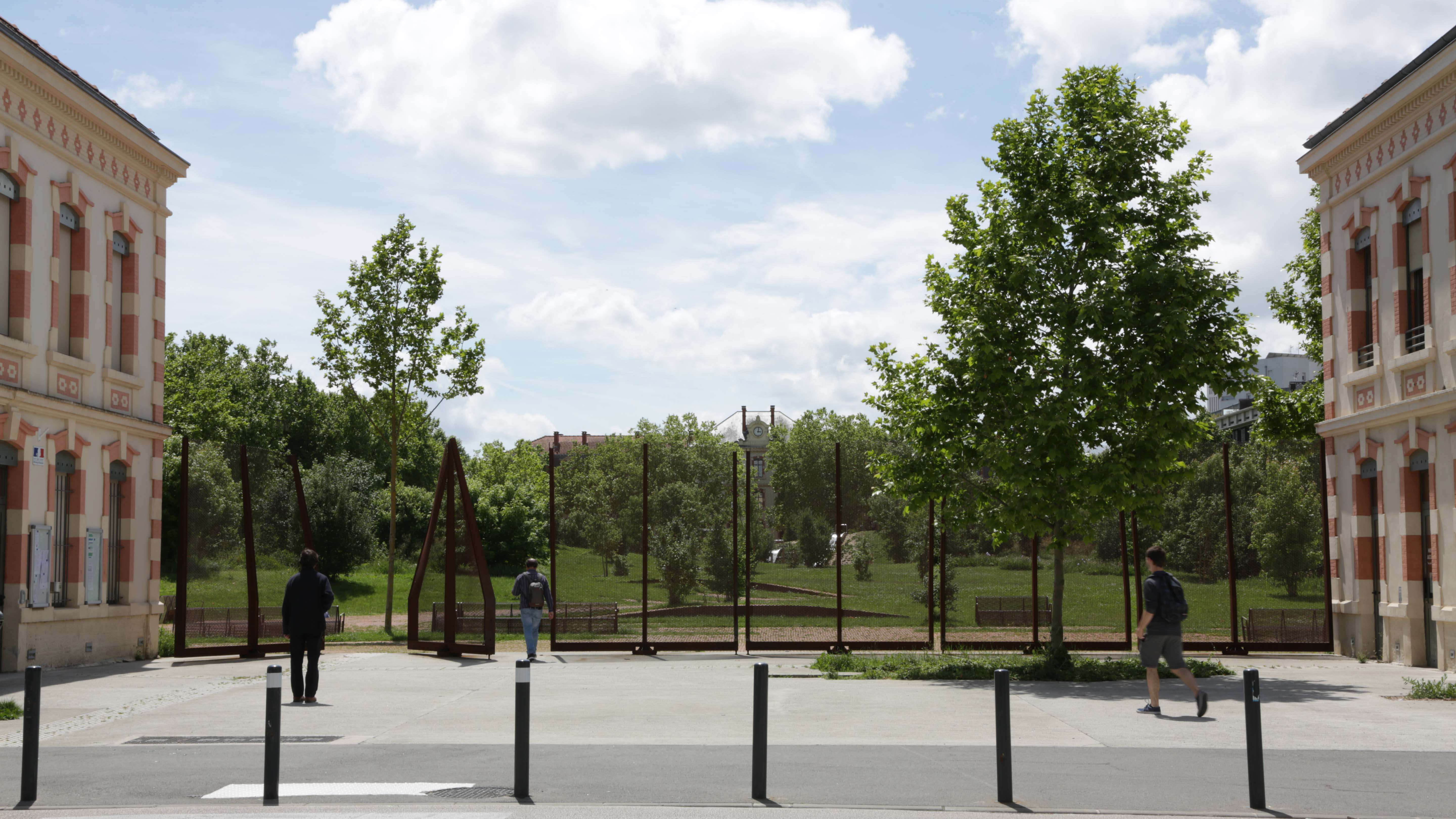
Built in the nineteenth, the Niel barracks is made up of two entrance pavilions and in the opposite side, the building Major State. The linear barracks occupied the north and south lateral sides. In the middle, a large square of arms of 200mx100m.
Surrounded by high insurmountable walls, it constituted a site "out of the city". The place was turned into a breaking point between the districts of Busca and Empalot, and also between Busca district and Garonne River.
Objectives:
- A STRATEGIC SITE WITHIN THE GREEN CONNECTION
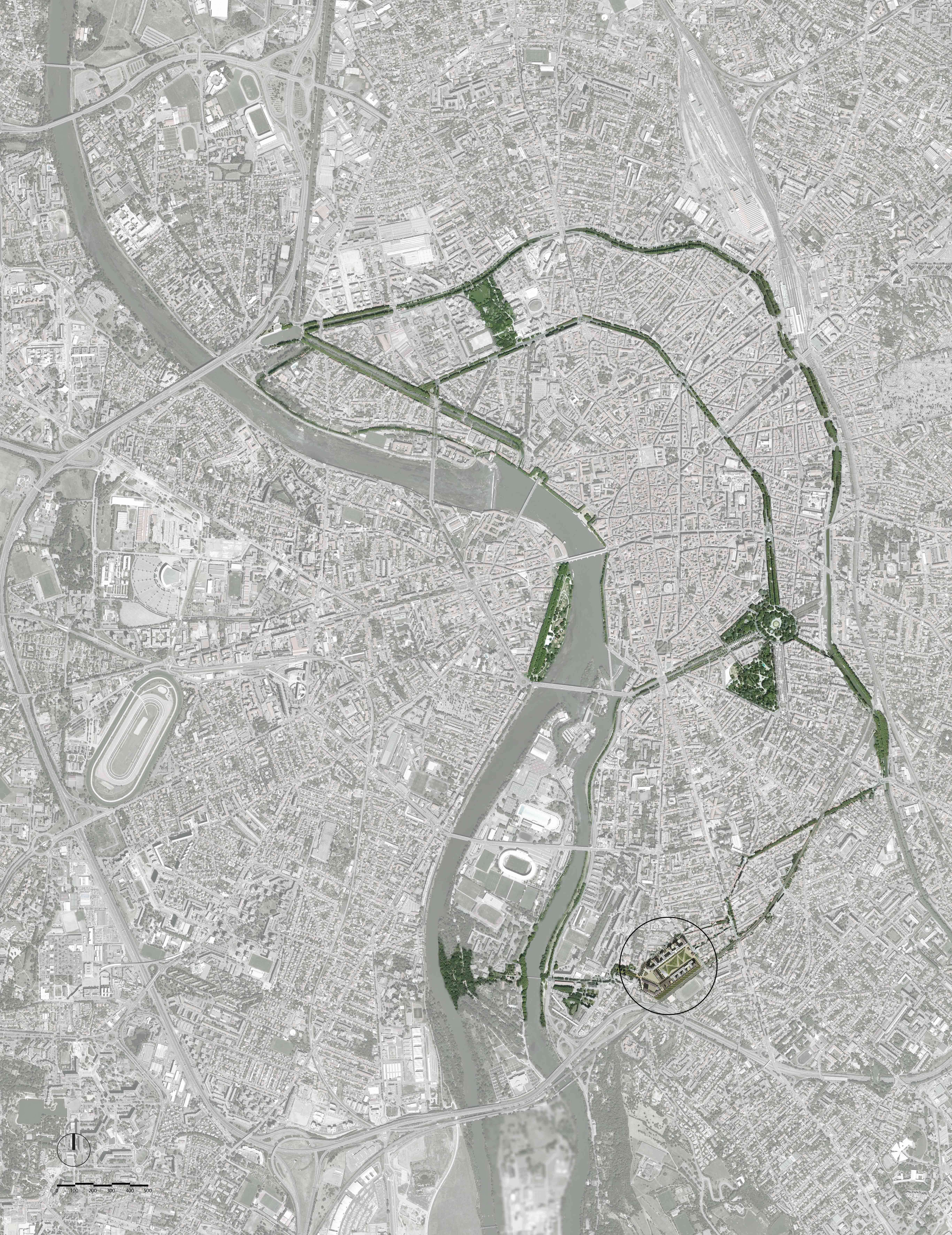
Acquired by the municipality, the site becomes an strategic place to open a connection between neighborhoods. A master piece in the network of the green connections that links the island of Ramier, Garonne riverside and the Canal du Midi.
- A NEW HOUSING DISTRIC SURROUNDING A CITY-SCALE GARDEN
The municipality decided:
. To keep the entrance pavilions and the staff building, facing each other on both sides of the former Place d’Armes.
. To build new housing buildings on the place were the old barracks demolished were.
. To organized public participation meetings and a competition to design the outdoor spaces such as a large public garden at Place d'Armes, a square behind the Major State building, new streets and pedestrian paths.
- A PARTICIPATION PROCESS FOR CREATING A "GREEN OASIS" IN THE CITY
The result of public meetings with the inhabitants was to build a garden, a green oasis in the city: with trees, vegetation, pathways, bike lanes, playgrounds…In other words, a garden for all ages. All of this, on a strictly asphalted platform, a large mineral void.
The inhabitants wanted to appropriate this place which they always knew closed and to change its function and, especially, its character.
- A VERY RESTRICTED SITE
Actually, archaeological excavations could not be realized on Place d’Armes site. For this reason, one of the restrictions was not touch archaeological remains and therefore, was not allowed to excavate more than 60cm. Under this principle, any type of tree planting became in a complicated task.
Description:
- A NEW TOPOGRAPHY
The project proposes:
. To remind the promontory configuration of the site and to evoke Toulouse tipical landscape like Lauragais or Volvestre region.
. To suggest that a precious archaeological site be recovered for future generations.
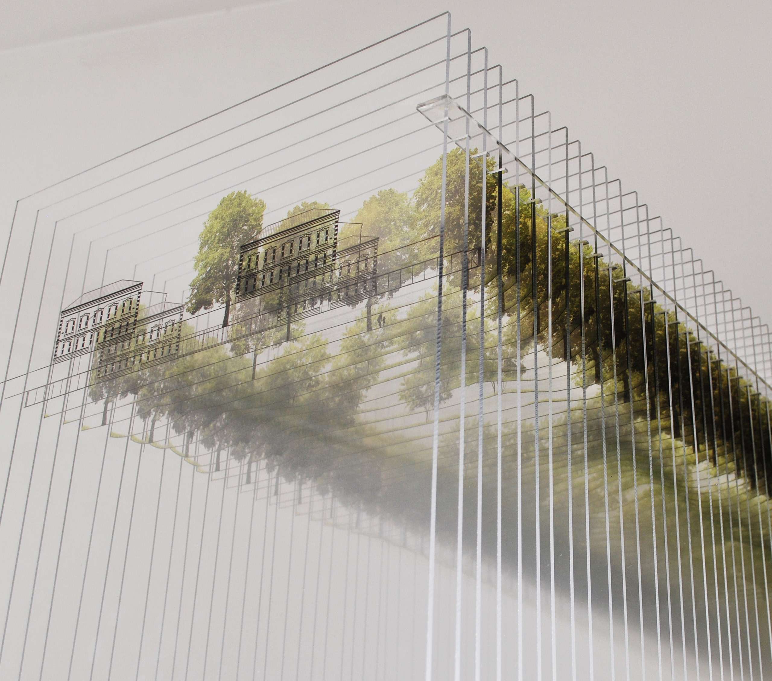
. To increase the central perspective and to reinforce the military barracks configuration emphasizing the high relief configuration, taking the form of an undulating relief like a veil covering the archaeological site and its treasures.
The new topography reinforce the lineal perspective composed by the Pavillons - Etat Major building. In addition, new variable horizons are created throughout the garden.
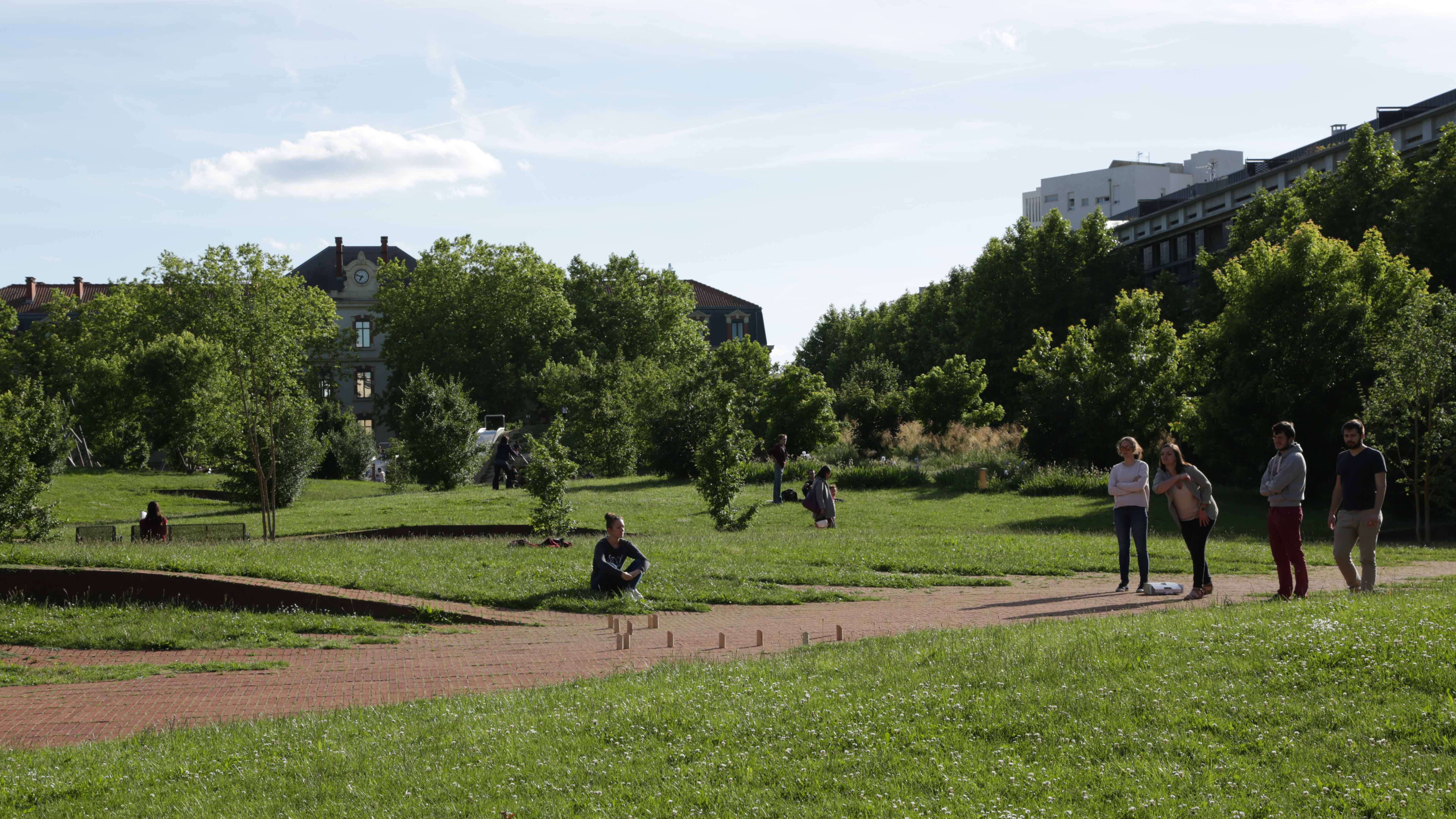
The undulating movement lifts slightly between the pavilions from the entrance to become gradually more strong on the back of the garden. At the bottom of the Etat Major building, the topography rises to 6m high and down gradually to become into an amphitheater dominating by a water mirror that reflects the trees and the facade of the building.
- A WAVING VEIL WITH A CHANGING TEXTURE
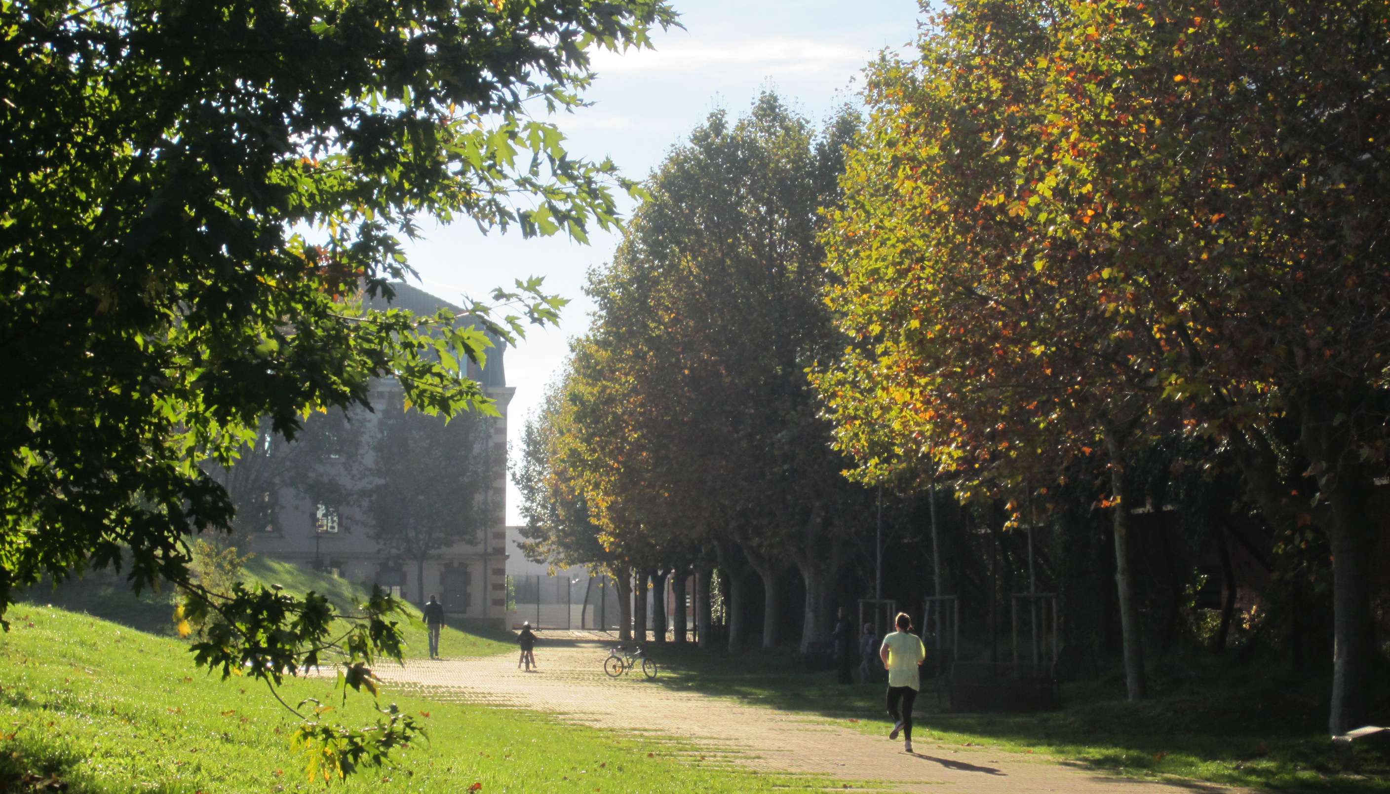
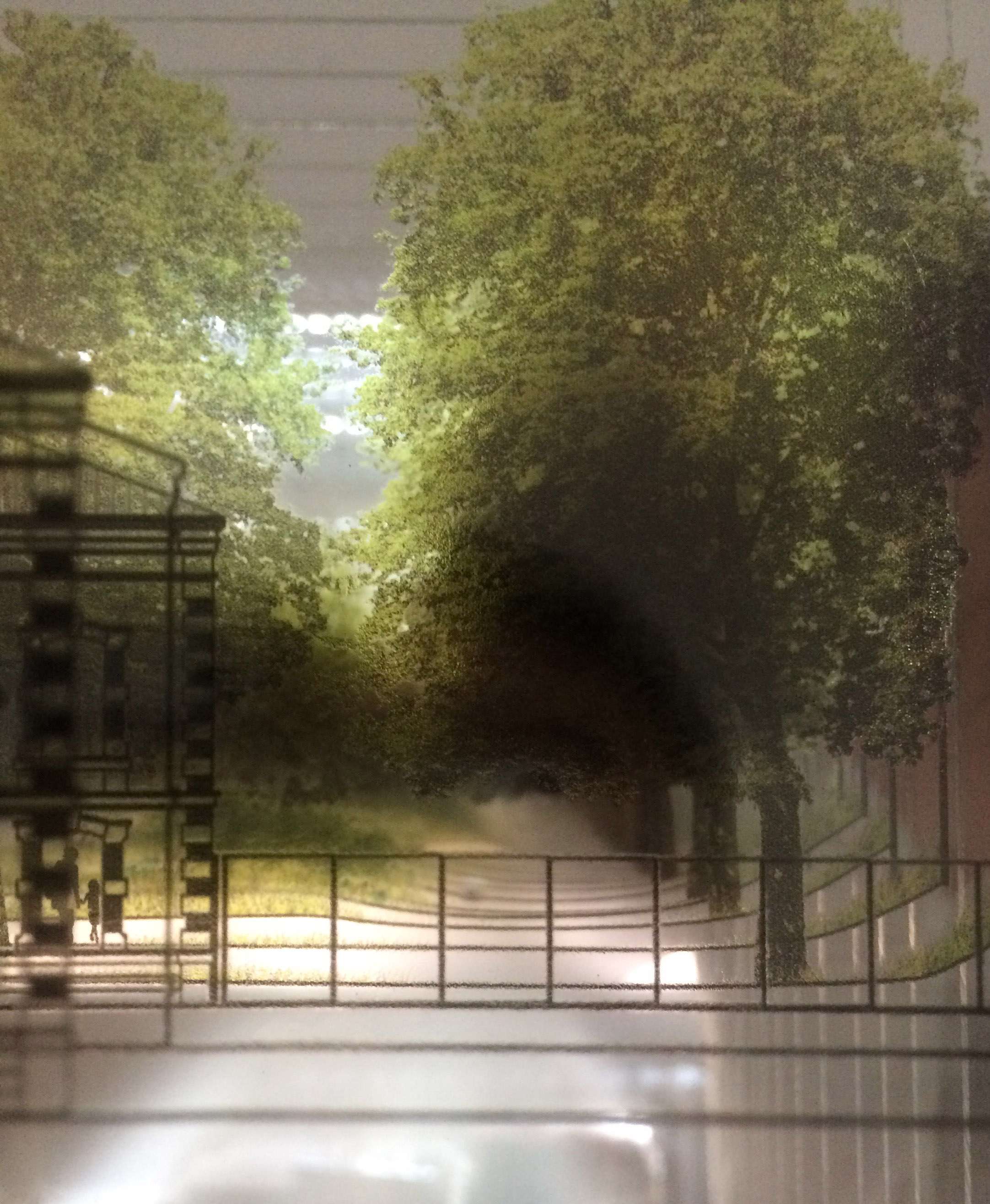
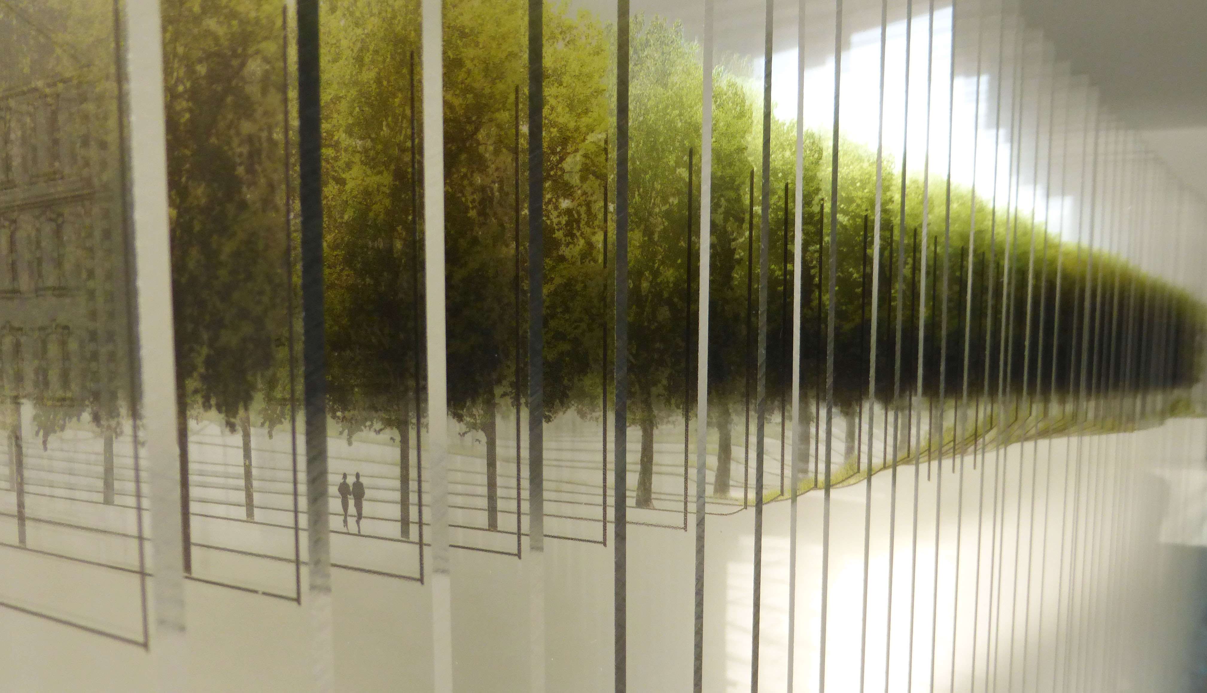
The new topography moves like an undulating and shining veil with a changing texture that ranges from the mineral to vegetal soil: brick on the valleys where pathways are located; meadow on the slopes and trees on the top.
Without limits and borders between materials the brick pathway wanders over the grass. The material of the paths is indeed, the brick, which also covers the facades of the surrounding buildings in the park.
The material is red brick, as the whole Toulouse city, well-known as the “Ville rose”.
- A PROGRESSIVE PLANTATION WITH DIFFERENT AMBIANCES
This topography of small raising hills allows tree plantations and creates an oasis of greenery in the central area of the garden.
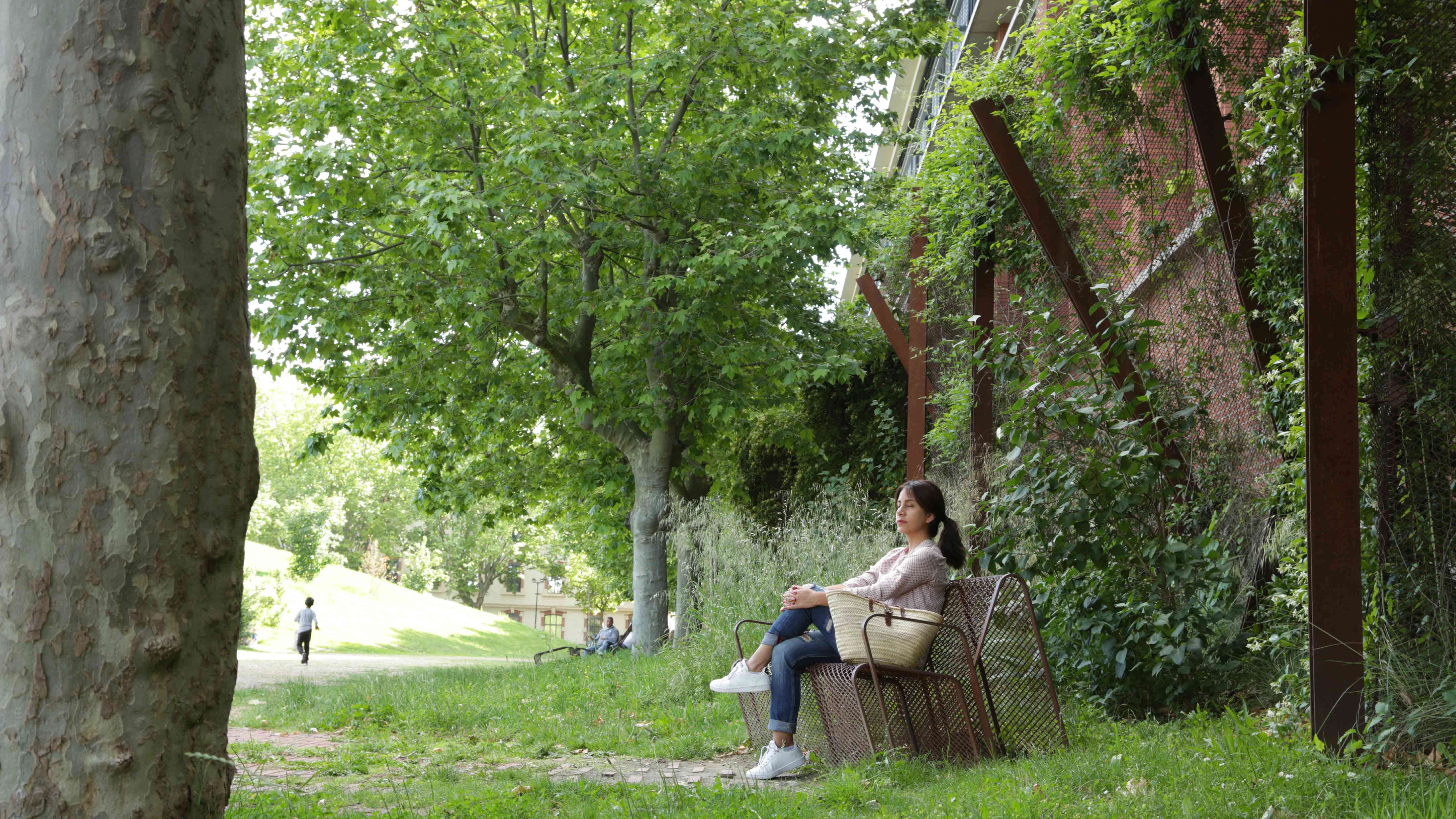
On the perimeter of the garden, the high existing “Platanes” trees alignments are refitted. The facing south side is bordered by a pergola, support of flowering climbing plants, which is a base of green buildings and create shaded areas of rest.
On the central area and on the hills, the different types of vegetation are gradually arranged as the height of the hills increases:
. The meadow starts between the brick paths and climbs the slopes
. The shrubs and grasses take over to turn into undergrowth under groves of trees
. The trees: a random plantation of maple trees, organized into groves, occupy the highest part of the hills, accentuating the topography: acer cappadoccicum, saccharinum and campestris.
- A SEQUENCE OF PLACES WITH DIFFERENT USES AND ATMOSPHERES
Due to this new topography, the garden results in a multiple spaces, small landscapes and complexity ambiences. The hills, groves, lawn, pahtways, viewpoints... are suitable for various activities : children's playgrounds, “pétanque” ball games, children slides on the slopes and resting areas.
. A great esplanade at the bottom of the House of Associations in the former Etat Major building allows meetings and various activities.
. The pergola of climbing plants creates and creates a fresh and shadowed area of resting and contemplation.
. The furniture are light, transparent, in deployed mesh of Corten steel, destined to be invaded by the grass. What could be more enjoyable than re-finding the childish feeling of sitting in the grass?
- A CONSTRUCTION AWARE OF SOCIAL AND ECONOMIC CHALLENGES
. The topography: a recycling of 15000 m3 of excavation land of surrounding buildings real estate operations.
. The base of the paths and the entrance esplanade: recycle asphalt of existing grave of the old military platform is recovered, crushed and put back in place.
. The draining base allows rainwater completely infiltrated on site: no discharge in public networks: serves as retention of rainwater in the event of torrential rains
. The brick, a pavement of paths, an economic and fast installation system
Toulouse materiality is based on red brick, the challenge was to find a quick and economical way of laying.
Large brick strips, 1m wide and 10m long, were manufactured in the factory, transported in rolls and spread on the site by means of a lifting gear. These strips are made of a metallic mesh that weaves the elements of brick. They have the dimension of the traditional brick of Toulouse: 30x5 cm.
Thanks to the flexibility of the mesh and the small dimensions of the pieces of brick, the band can deform and adapt to the undulations of the ground, in all directions. This system allows you to play with the density of bricks. "Voids" arranged in the mesh randomly allow to achieve diffuse limits between brick and grass. We have adapted the "flexbrick" system previously used in facades.
Valoration
When the result seems simple and natural concern behind many difficulties and hard work before the realization: plans, details of the specific elements, pavement, pergola, furniture, water mirror, plantations…etc.
What else can we add if the birds and children have invaded the garden and now move freely?
Collaborators
Estructures - BOMA, SL, MIQUEL ANGEL SALA & ROBERT BRUFAU
Facilities - SATEC - BET Infrastructures, fluides, économie de la construction
Vegetation - TERESA GALI – ARQUITECTURA AGRONOMIA S.L.P.