Parque Brasil
Parc Brasil
Brazil Park
PARQUE BRASIL
Renovation of Parque Brasil, La Granja Municipality, Santiago de Chile
1. Introduction: From Abandonment to Urban Park
In the Latin American urban context, public spaces hold both symbolic and functional weight: they serve as indicators of territorial equity, social cohesion, and quality of life. In vulnerable areas, the absence of parks—or their state of abandonment—deepens exclusion and reinforces dynamics of segregation, insecurity, and environmental degradation. This was the case with Parque Brasil, in the municipality of La Granja, Santiago de Chile.
For years, this land remained in a state of neglect. At the center of the block, an interactive museum for children (MIM) was built, isolated from the rest of the site, altering the topography with a hill that turned its back on a vulnerable neighborhood. The remaining land contained twelve improvised sports fields marked with lime, weakened trees, and a surrounding atmosphere steeped in fear, distrust, and violence. It was a space that contradicted the very idea of a park: a place where the community withdrew, families enclosed themselves, and communal dynamics dissolved into the margins of abandonment.
Faced with this scenario, the project proposed a radical intervention at its core: to bet on children and family life as regenerative forces of the territory. Revitalizing the park meant imagining a new urban ecosystem where play, coexistence, and nature could act as engines of social transformation. From that vision, the renovation of Parque Brasil emerged: a living infrastructure that organizes emptiness, reorders flows, and restores trust in the collective.
2. Diagnosis: The Context and Its Tensions
The design began with a deep analysis of the site. The municipality of La Granja is historically marked by processes of social vulnerability, with high levels of insecurity and limited public investment. The perception of urban space is shaped by mistrust: fences, walls, inward-facing patios, and streets empty for much of the day.
The park is situated within this fabric, at a critical junction between dense residential neighborhoods, with little green space and deteriorated community facilities. Its initial condition, a large vacant lot, concentrated a series of symptoms: informal appropriation, ecological deterioration, lack of lighting, and an eroded social structure.
Given this context, the strategy could not be limited to physical design. The challenge was to reclaim the park not just as green infrastructure, but as a social platform for cohesion, a catalyst for new urban imaginaries.
3. Concept: Zero Gravity
The concept of Zero Gravity arises from a poetic and political image: to dream of a place where bodies, lives, and imaginations can rise, liberated from the conditions that constrain them. In a neighborhood burdened by social tension, the park needed to offer an experience opposite to confinement: spaces where violence has no weight, where time is suspended, and public space regains its meaning as a shared territory.
4. Strategy: Trusting in Families
The central hypothesis of the project was to trust families as active agents of social regeneration. Instead of reinforcing the logic of enclosure as defense, the proposal was to enable a space that invited the community to reclaim it through play, physical activity, contemplation, and social gathering.
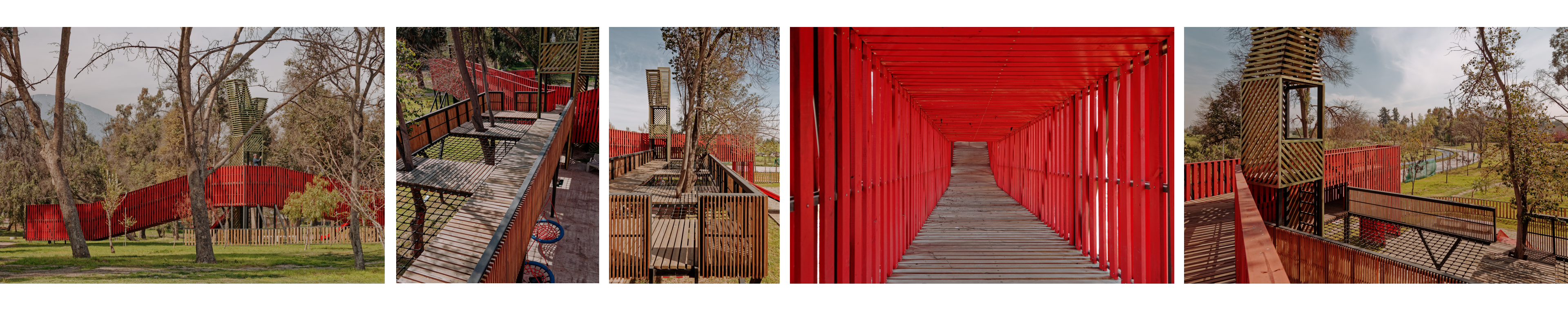
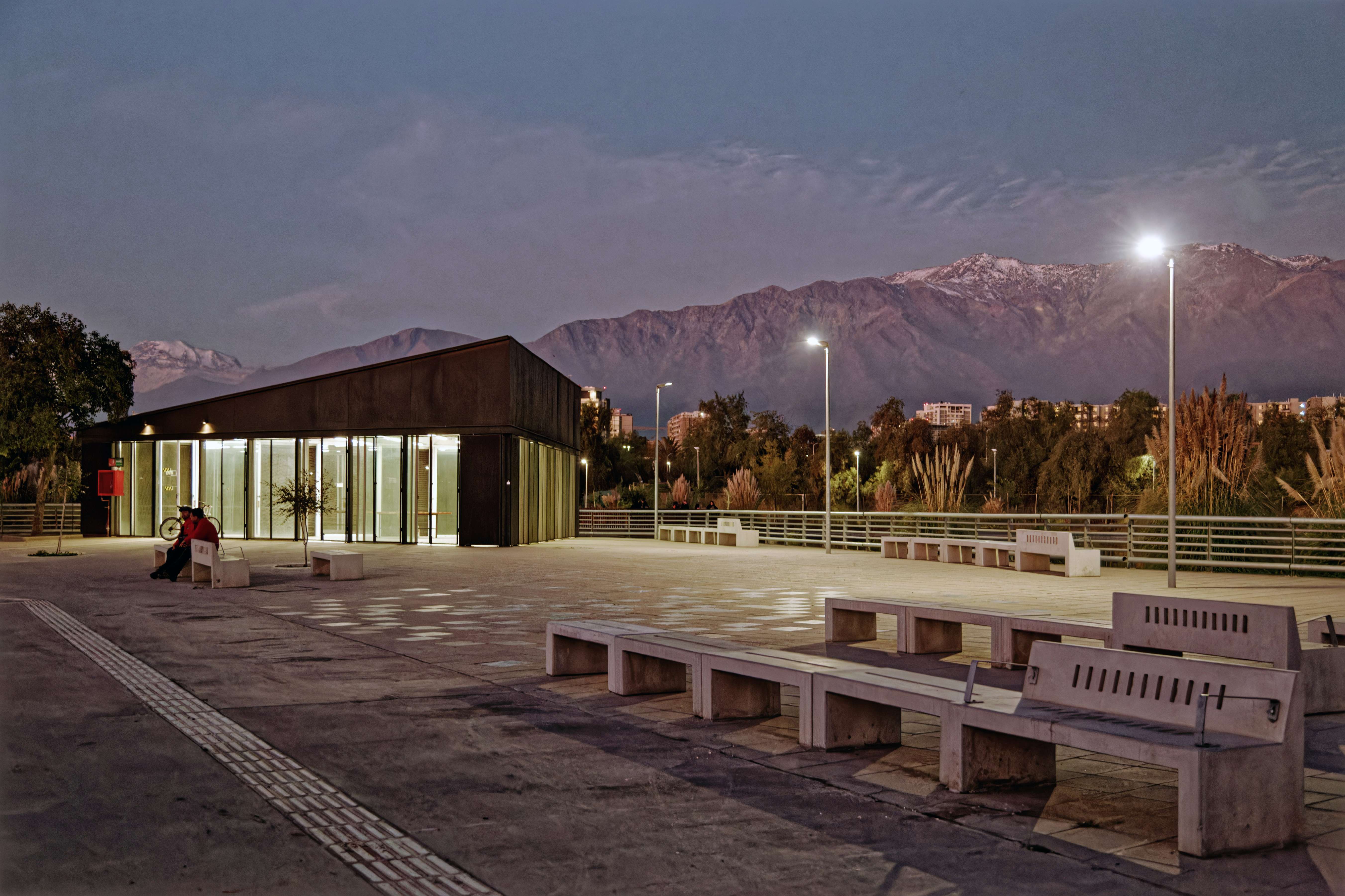
This trust was not only conceptual, but structural: the park was not designed as a closed-off area, isolated from its surroundings. Instead, a thickened edge infrastructure was proposed, functioning as an interface and mediation. This move was crucial: the boundary became a place of life, not exclusion.
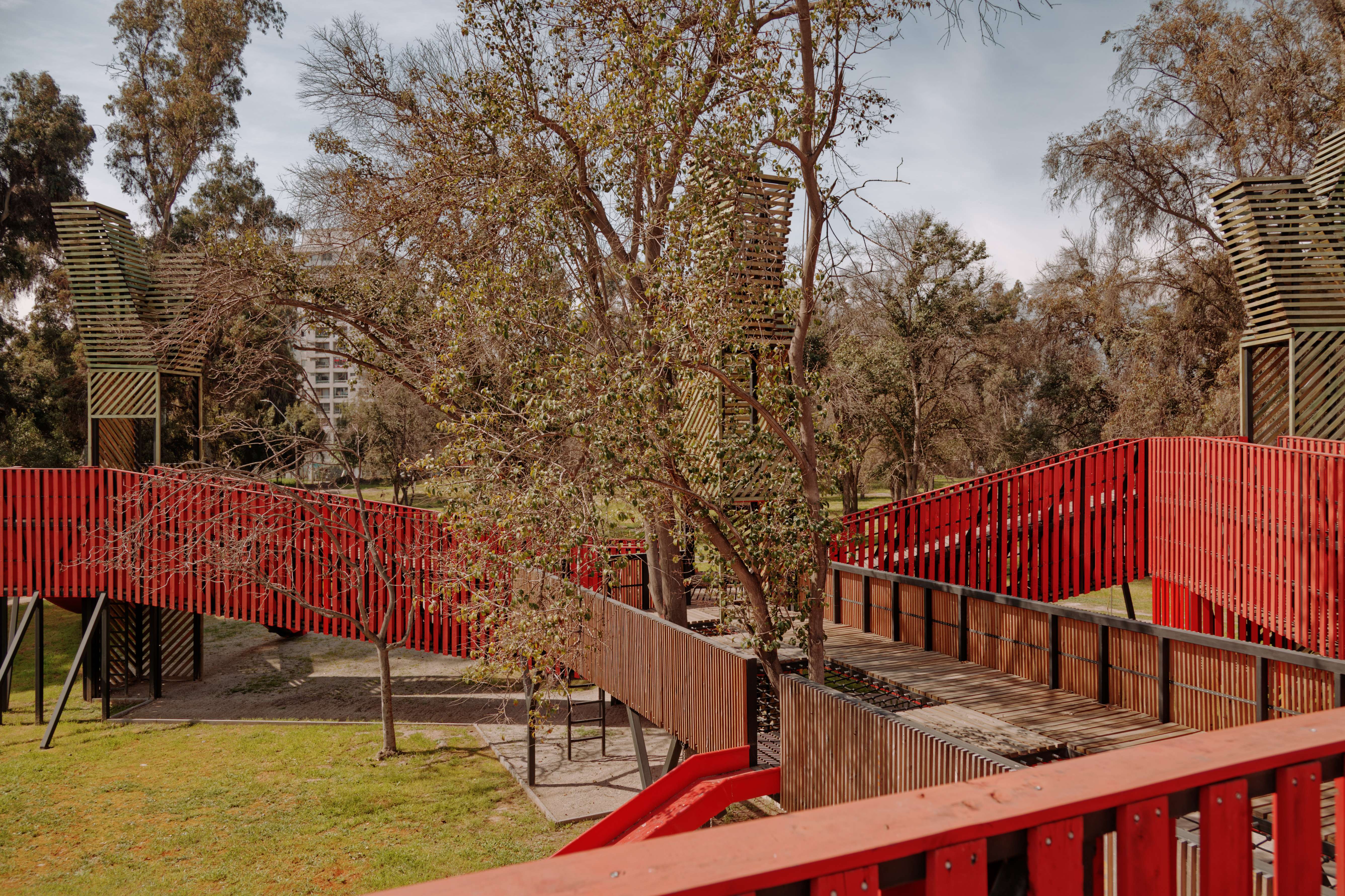
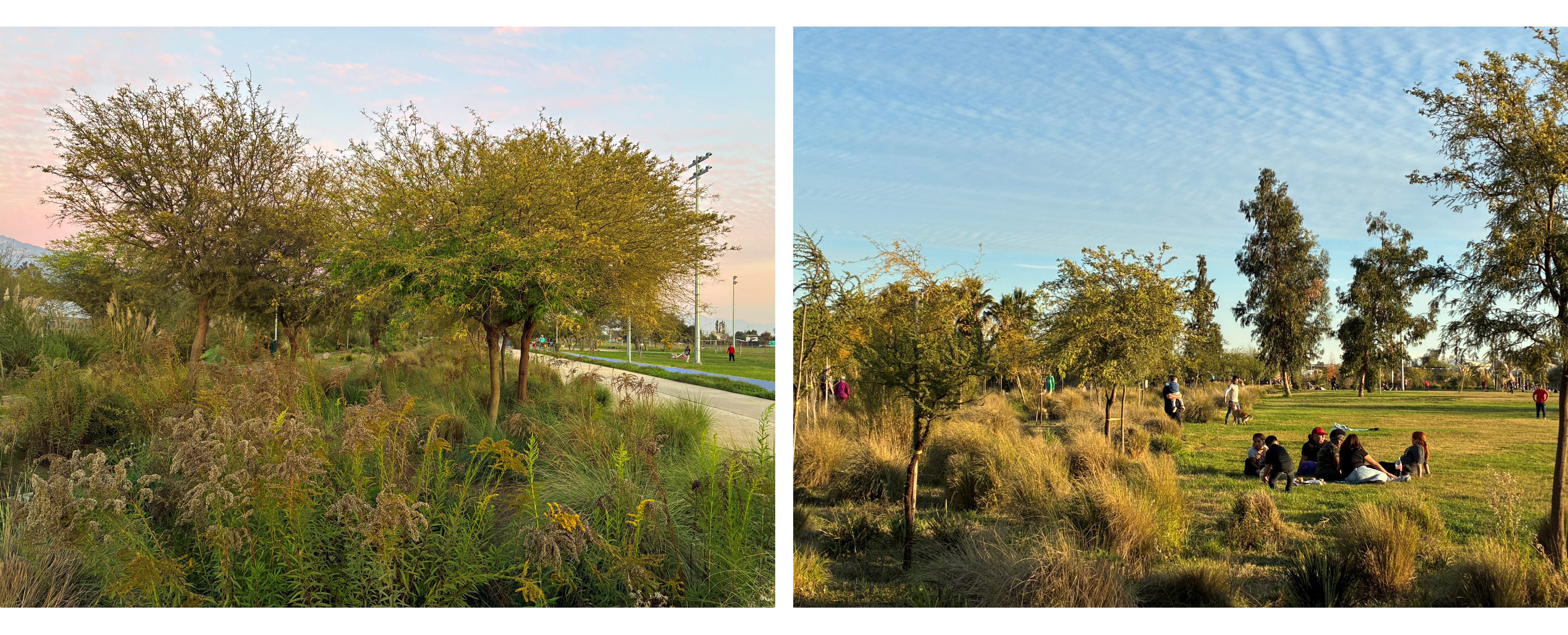
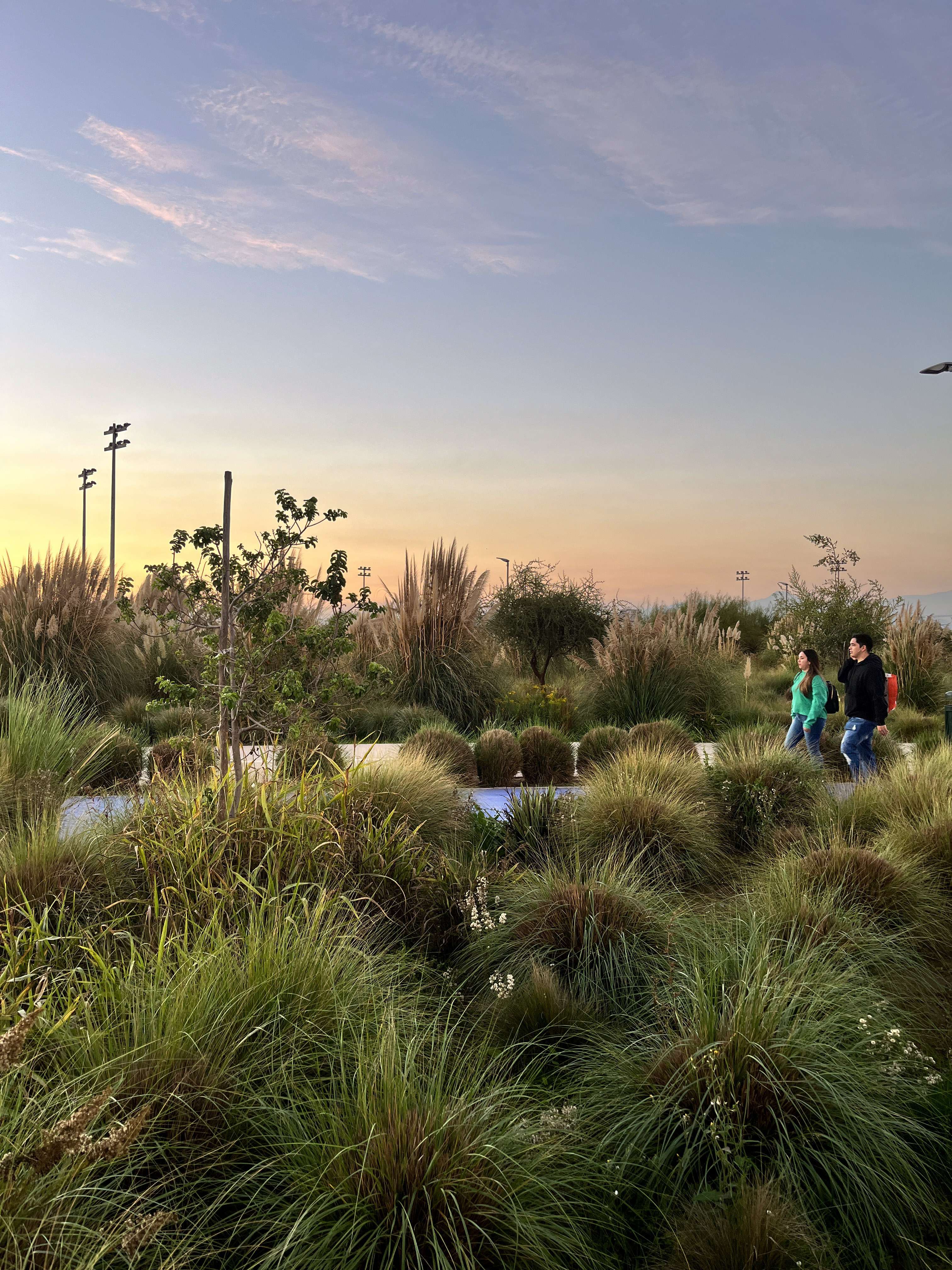
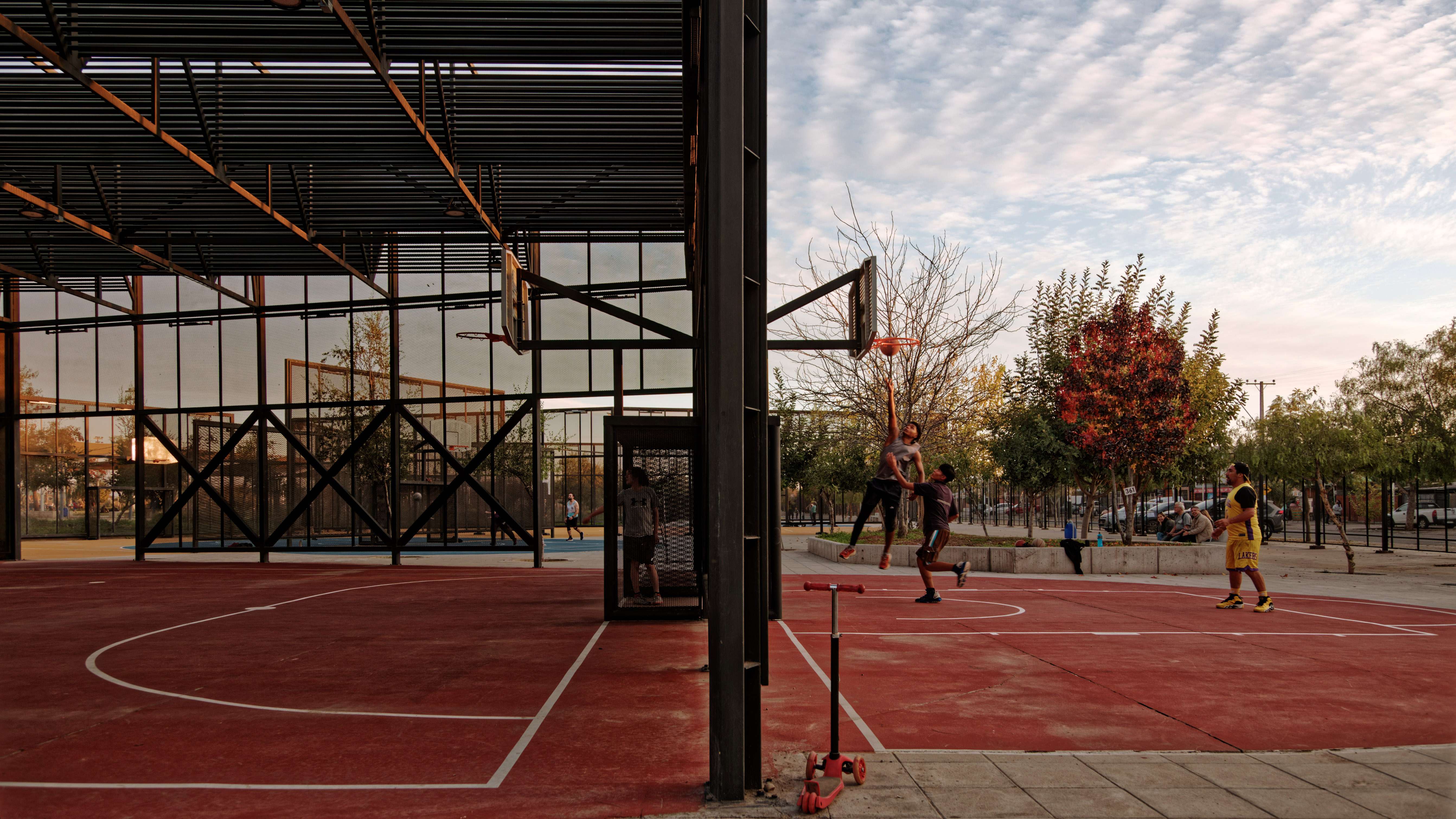
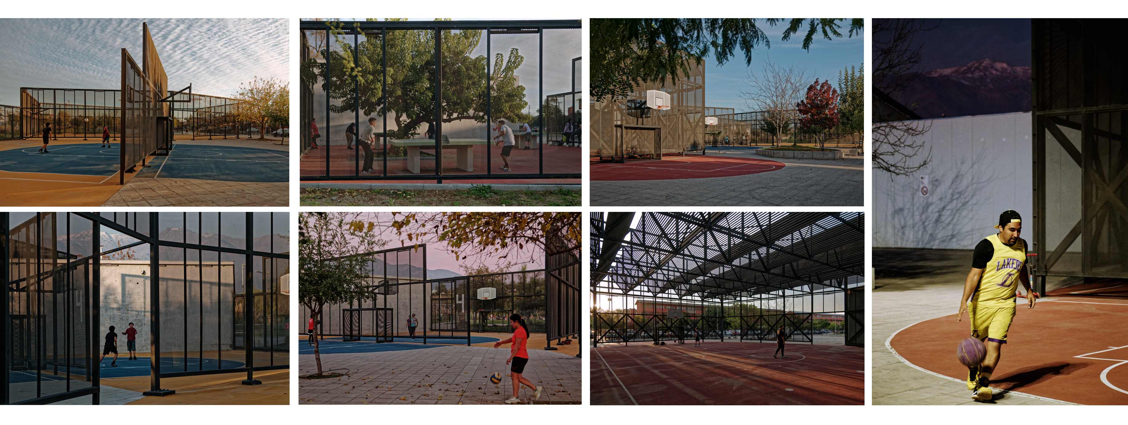
Today, months after its inauguration, families have responded to that trust with active appropriation of space. Children run, play, and skate; teenagers use the sports fields, and the community has begun to see the park not as a threat, but as an opportunity.
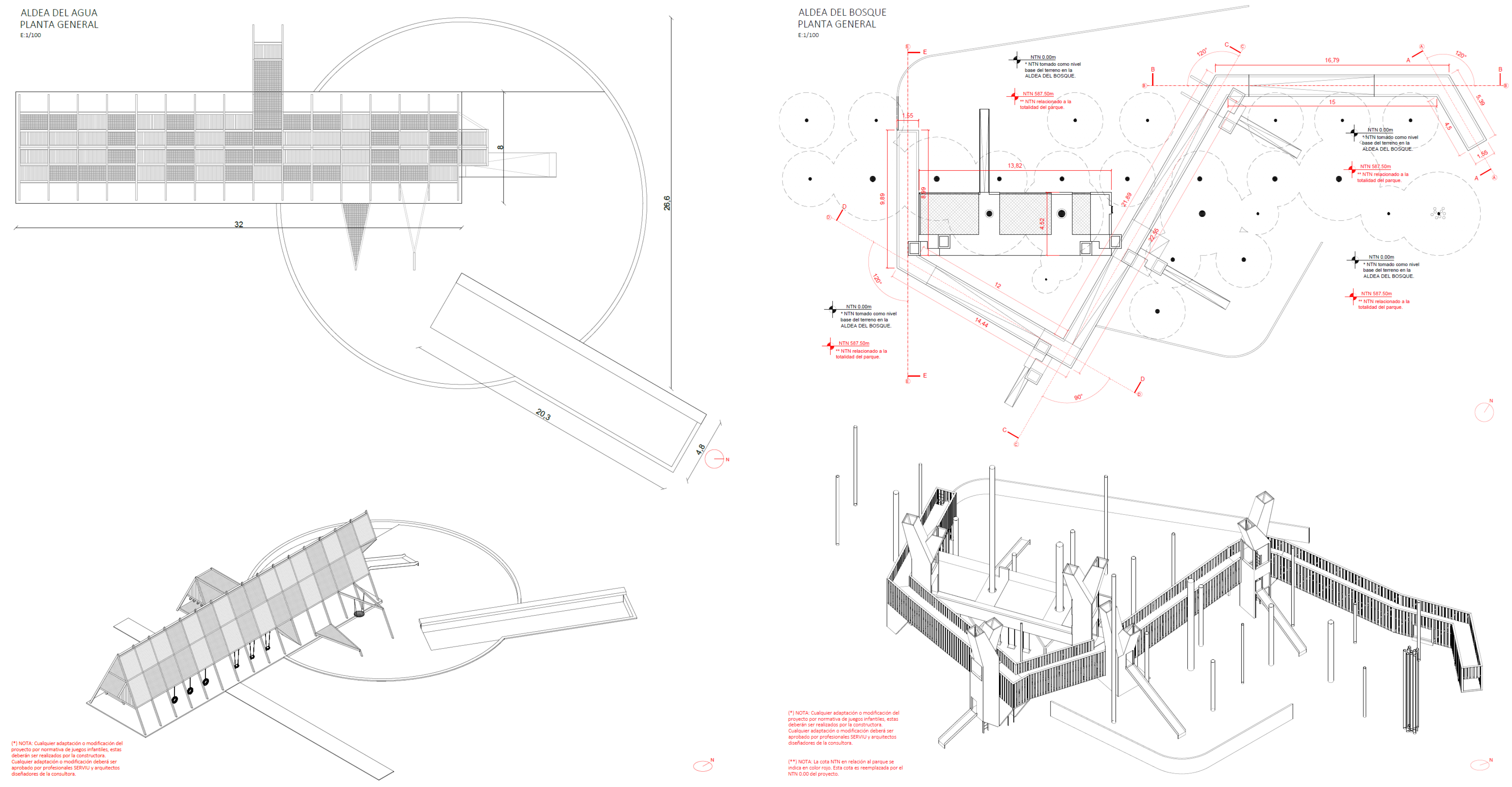
5. Spatial Structure: Two Structural Lines
The design is articulated around two main structural lines that organize both the park’s ecological functions and its social life:
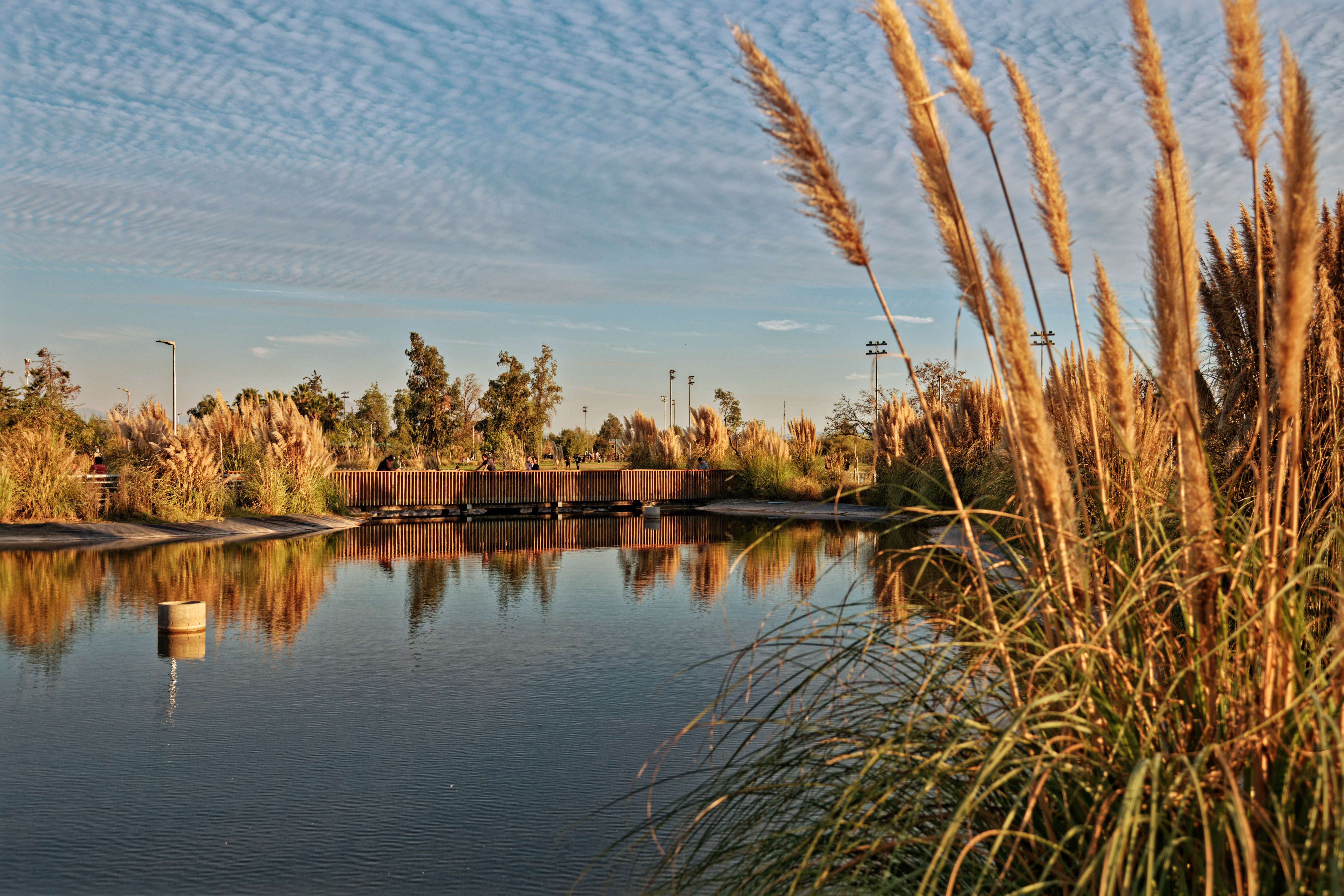
a. Inner Line: The Water Corridor and Children’s Villages
Inside the park, a gentle and sheltered path follows a water system composed of a sequence of retention and infiltration ponds interconnected by a canal. This infrastructure reorganizes slopes, controls runoffs, and creates a biological corridor that promotes local biodiversity.
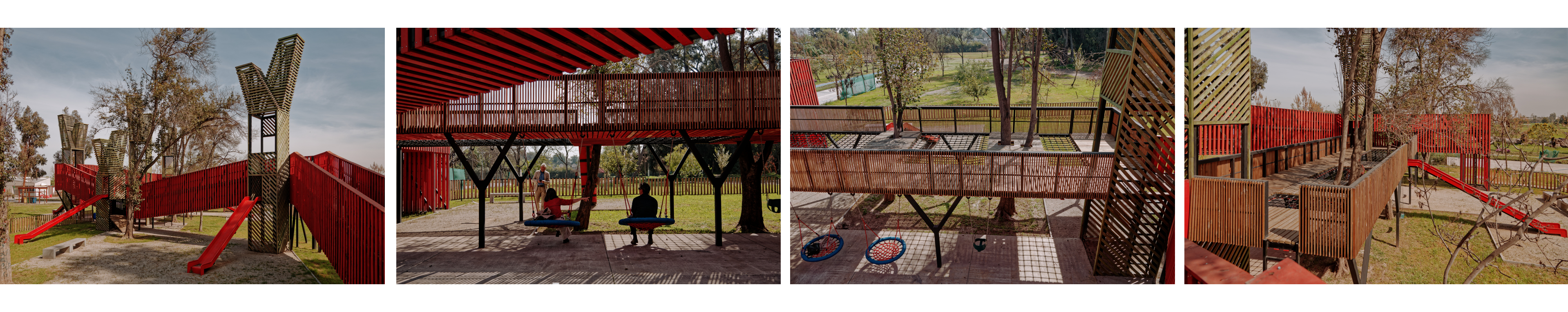
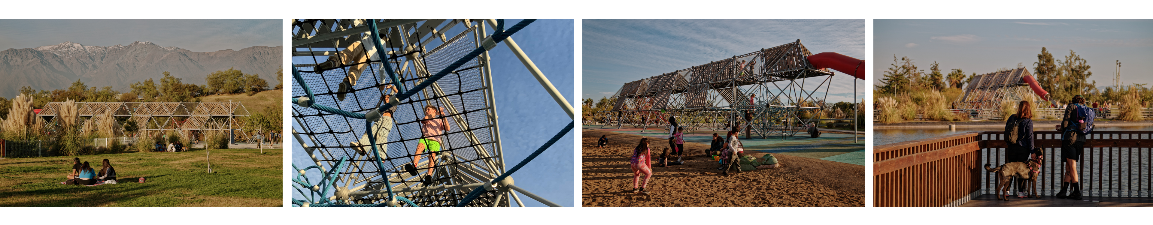
Along this corridor are the so-called children’s villages: play clusters designed at a child’s scale, immersed in vegetation and built with noble materials. These villages are not just play areas, they are small landscapes designed to stimulate curiosity, movement, and imagination. Here, children become protagonists of space, and the park becomes a territory of exploration and learning.
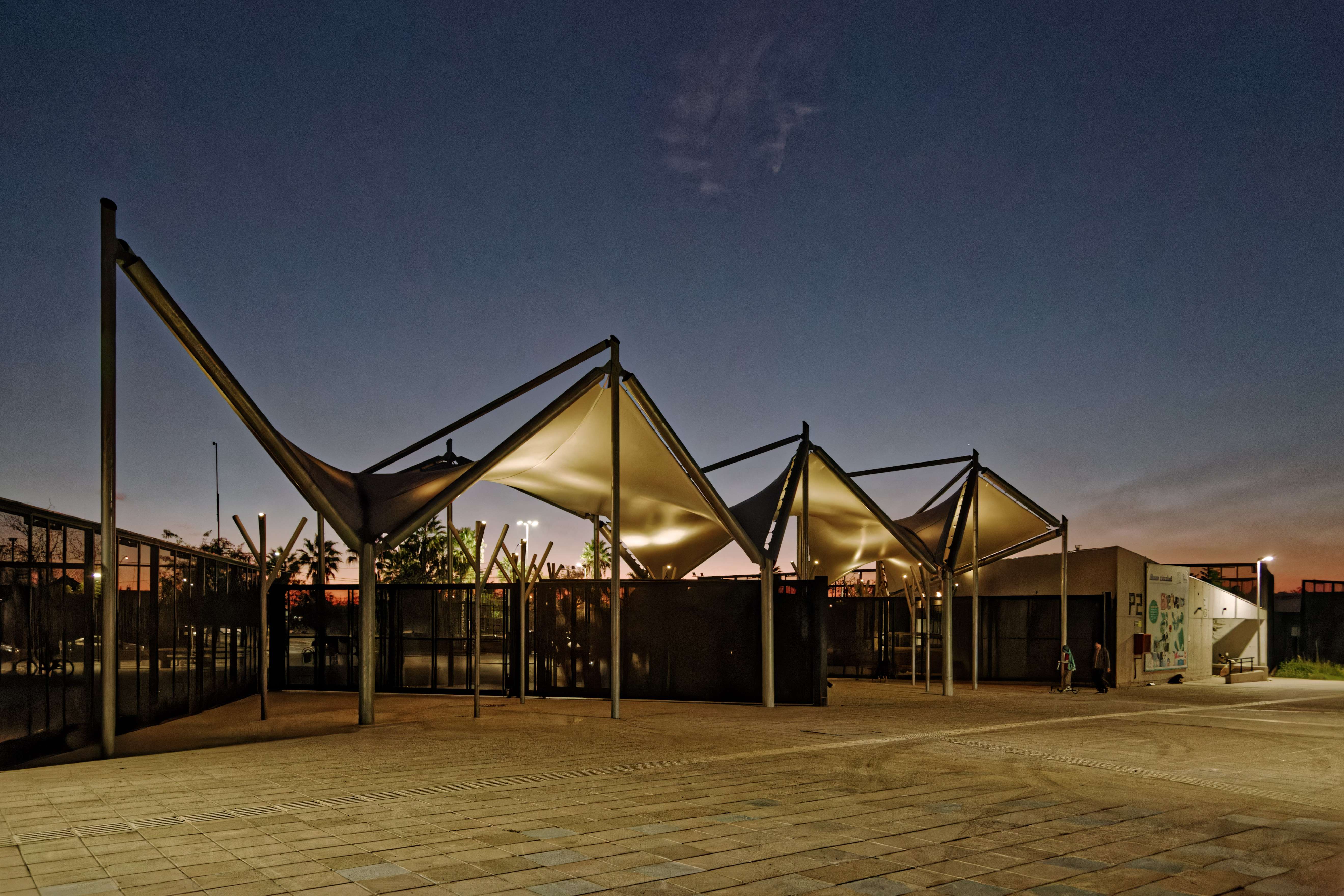
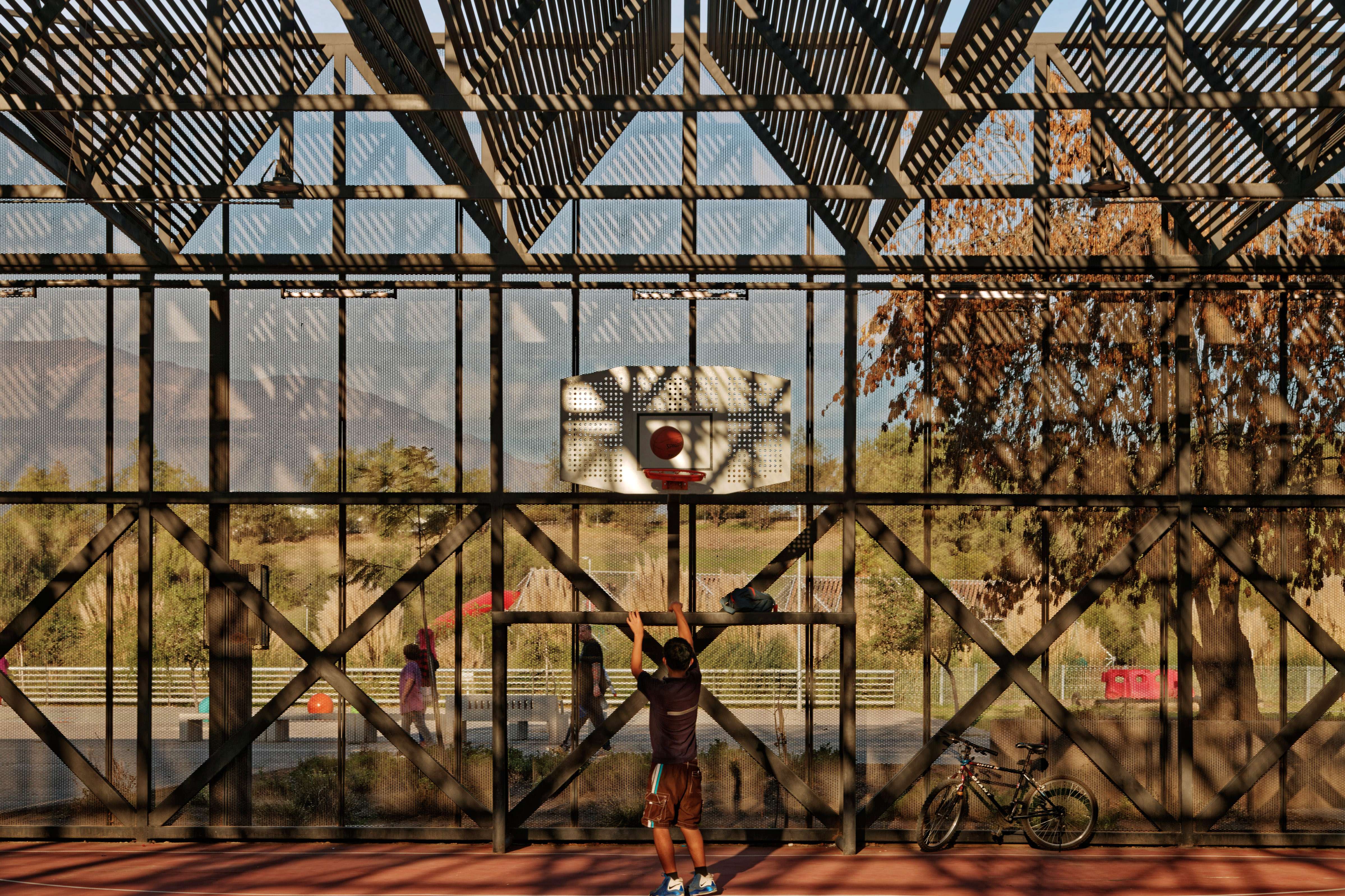
b. Outer Line: The Active Edge
Along the park’s edge, facing the most vulnerable neighborhood and in direct dialogue with the city, a second line unfolds: a system of open fences, metal planes, sports structures, and park services that, rather than enclosing the space, activate it. This edge infrastructure provides a sequence of sports fields open toward the neighborhood and closed toward the park, forming a dynamic strip of youth-oriented use.
This active edge is a band of intensity, where sports, music, and urban movement interact with the natural world inside. Here, public space acts as an interface, it does not impose itself on the context but adapts to it and transforms it through coexistence.
Originally, this area was designed as an open plaza to be used by people during hours when the park is closed.
6. Sustainability and Materials
The design incorporates strategies for ecological and constructive sustainability.
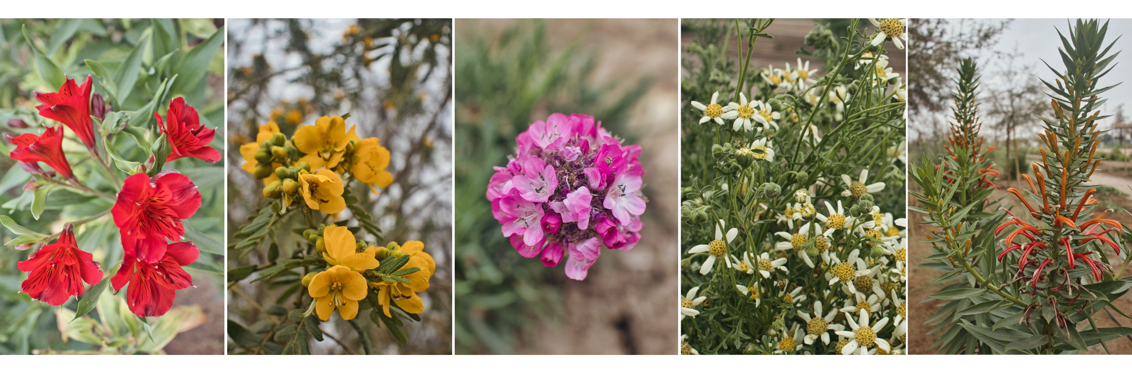
Environmentally, it prioritized rainwater infiltration, runoff management, and reforestation with native and adapted species—making it one of the pioneering parks in the use of native flora. Soil was reused, existing elements were recycled, and durable, low-maintenance materials were selected.
In terms of construction, lightweight metal structures and noble woods were used in the play areas. This choice reflects economic and ecological criteria but also aims to create an austere and honest aesthetic, where materials engage in dialogue with the context rather than imposing it.
7. Impact and Appropriation
Today, Parque Brasil is an active, inhabited, and valued place. It was not designed to be perfect, but to be used, lived in, and transformed. It is a park that engages with its context, responds to its tensions, and places trust in the community as a driver of change.
The most profound transformation has been physical. It has been symbolic and cultural: turning a wasteland into a park has also meant transforming an urban narrative.
Parque Brasil does not merely aim to address a lack of facilities. Its contribution is deeper: it proposes a new way of understanding the landscape in vulnerable territories—not as decoration, but as a tool for transformation.
To invest in children, play, and coexistence is not naïve, is deeply human. It is a vote of confidence in the power of the commons, in the strength of nature and public space as mechanisms of resilience.
This park did not just aim to be safe—it aimed to be necessary, loved, and lived. And today, it is.
-------------------------------------------------------------------------------------------------------------------------
The Parque Brasil Project and its Impact on the United Nations Sustainable Development Goals (SDGs)
Parque Brasil addresses several of the Sustainable Development Goals (SDGs) established by the United Nations. Through integrated planning and a strong commitment to territorial equity, this project seeks to improve the quality of life for local communities while tackling long-term urban and environmental challenges.
SDG 10: Reduced Inequalities
Parque Brasil provides high-quality infrastructure and services in an area historically lacking in public spaces. By facilitating equitable access to sports, recreational, and cultural activities, the project promotes social inclusion and helps level the playing field, bridging gaps in access to opportunities across the city.
SDG 11: Sustainable Cities and Communities
The creation of a large green area with native flora and multifunctional facilities strengthens urban resilience, fosters community interaction, and significantly enhances the built environment. Additionally, the park is envisioned as a cultural and community hub, capable of stimulating urban life and acting as a catalyst for sustainable development in the surrounding area.
SDG 13: Climate Action
Through nature-based solutions, such as riparian gardens and natural drainage systems, the park effectively manages stormwater runoff, reducing climate-related risks. Furthermore, it reuses an abandoned lagoon to restore key ecological functions and bring value to the area’s hydraulic heritage.