
Parque de Recreación Embalse Fisher Hill
Parc de Recreació Reservori Fisher Hill
Fisher Hill Reservoir Park
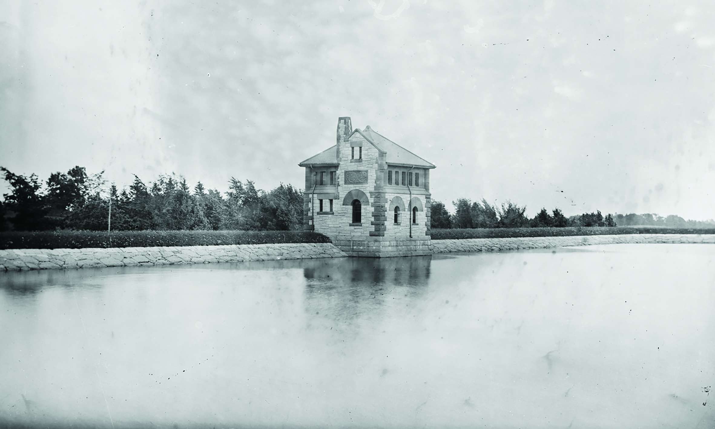
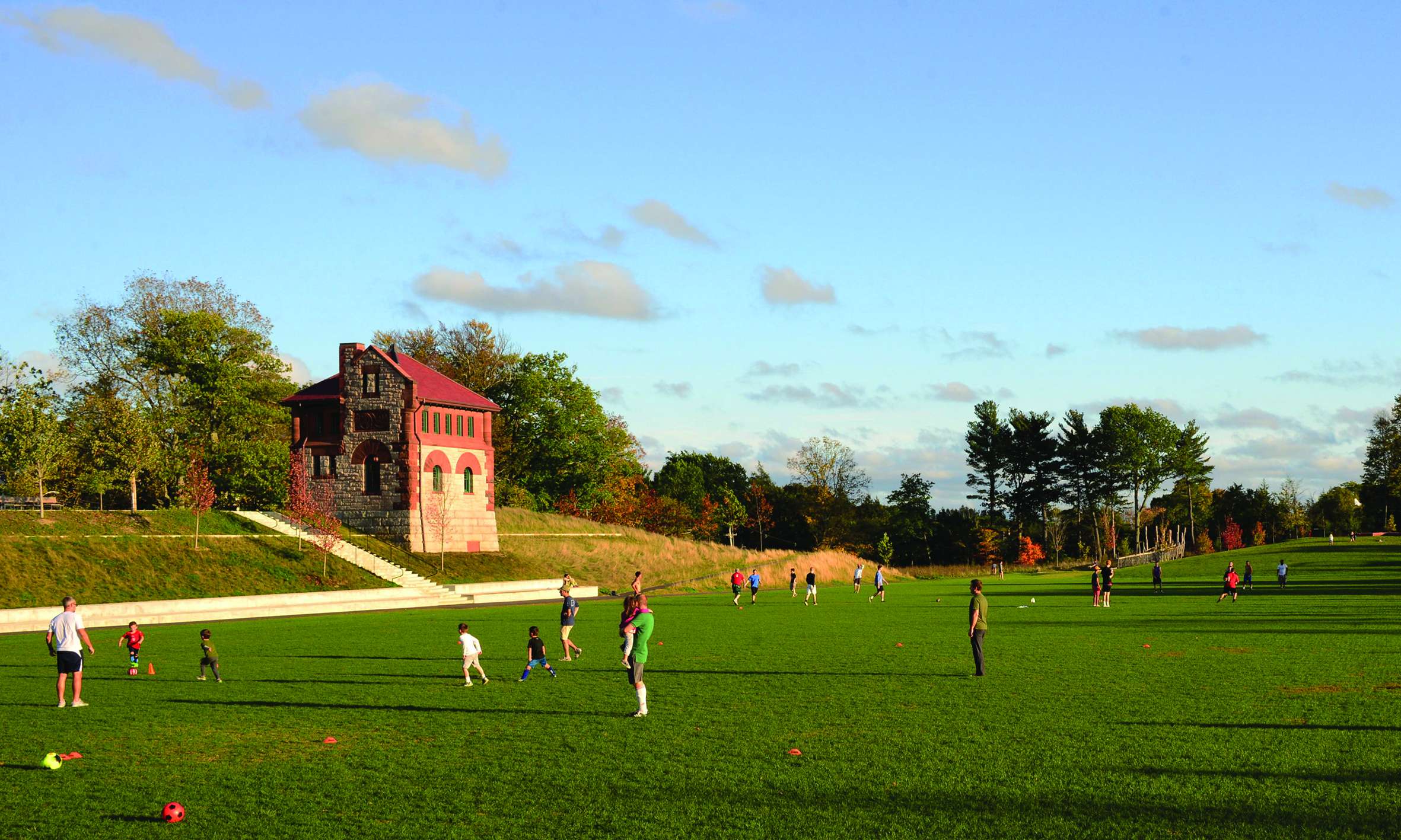
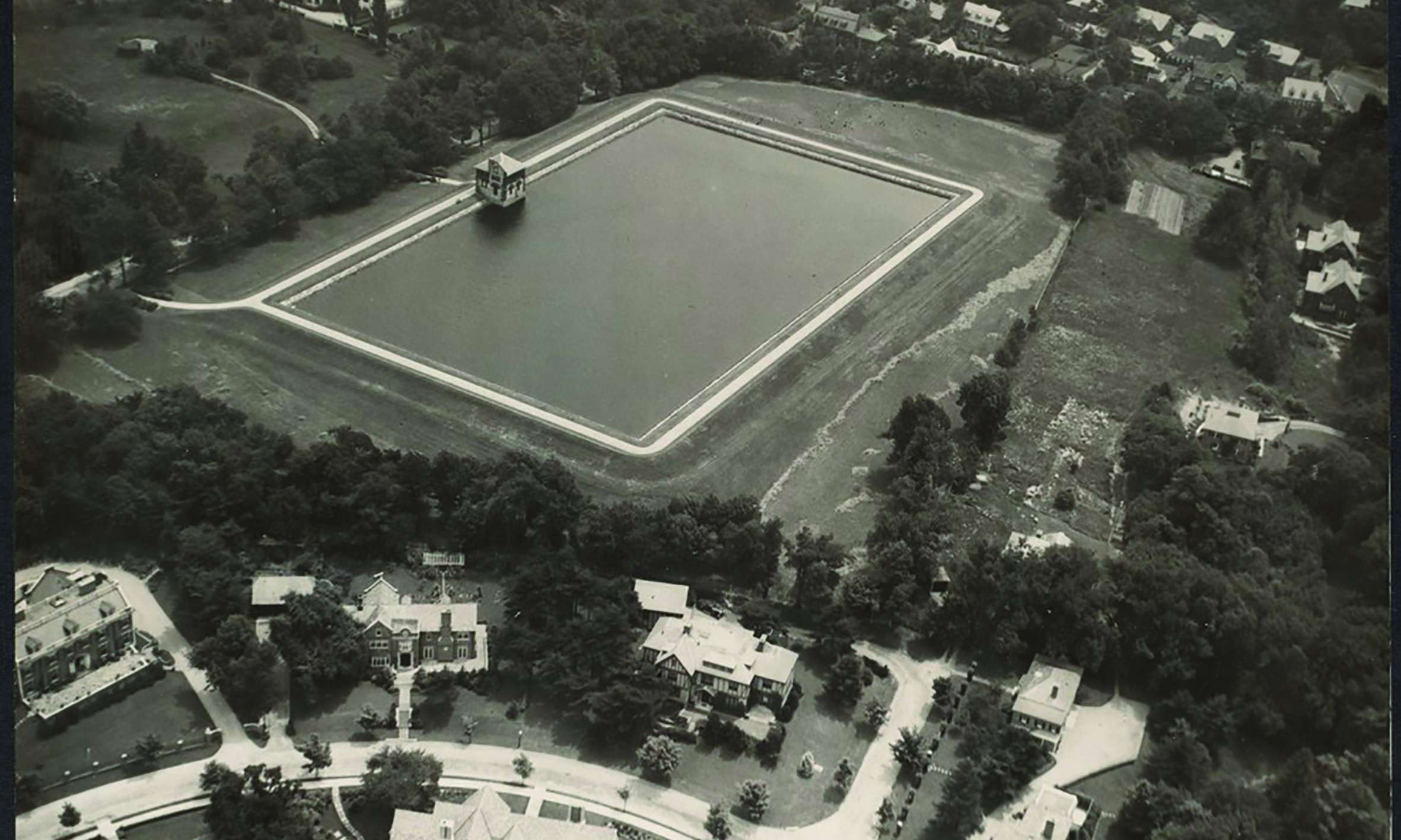
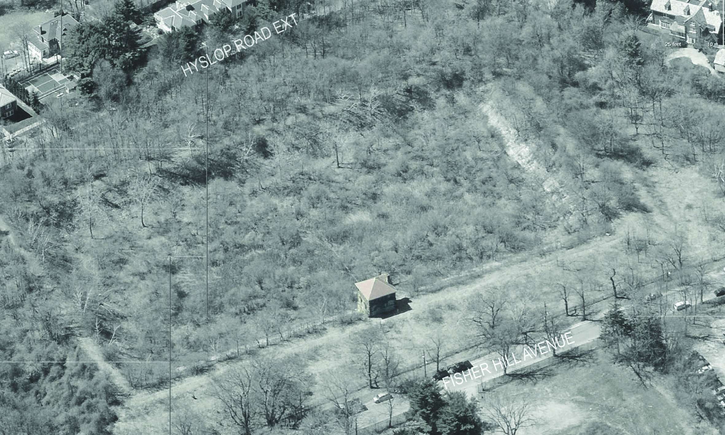
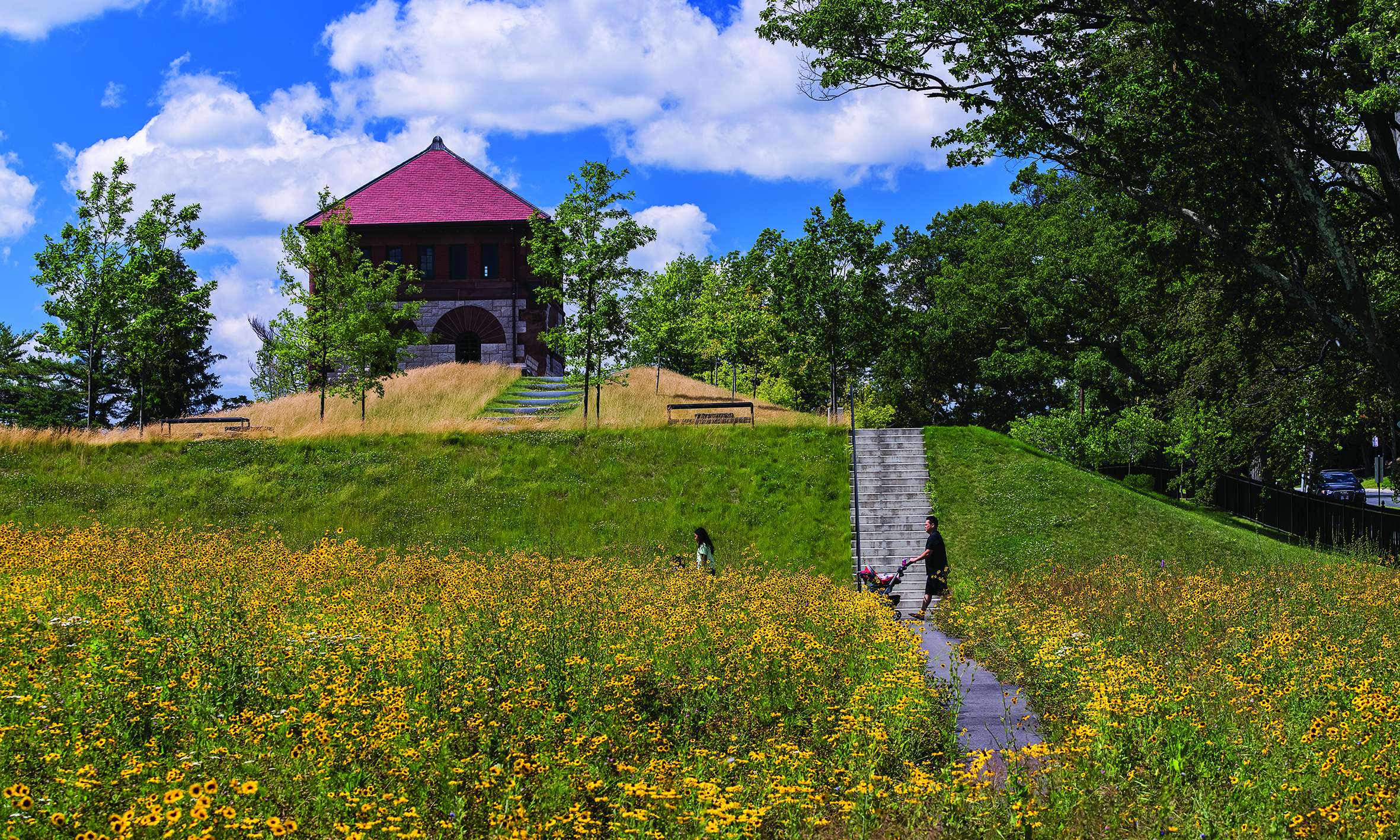
Located within the Olmsted designed Fisher Hill neighborhood, the Fisher Hill Reservoir and gatehouse were completed in 1886. The reservoir distributed water to the area for Boston’s Metropolitan Water District for over 60 years until it was decommissioned, drained and essentially abandoned. Listed with the National Register of Historic Places, the reservoir and its gatehouse were acquired by the Town of Brookline in 2001 with the intent to create a park for passive and active recreation.
Returning to the idea that public infrastructure once played a vital role in recreation around America’s urban centers in the 1800’s, we thought it important to celebrate the reservoir as a cultural artifact. We proposed a substantial departure from the Town’s conceptual master plan, and promoted keeping the earth structure as an historic reference to the site’s context within Brookline and greater Boston. Our approach was to convey the site’s history as a reservoir, using both spatial and interpretive elements, as well as delivering a beautiful and programmatically rich park, worthy of its Olmstedian context.
We led the Town through an extensive process to develop the park design with public input and to allay the concerns of neighbors facing a dramatic shift in the site’s usage. The 15-month process concluded with strong support for the design.
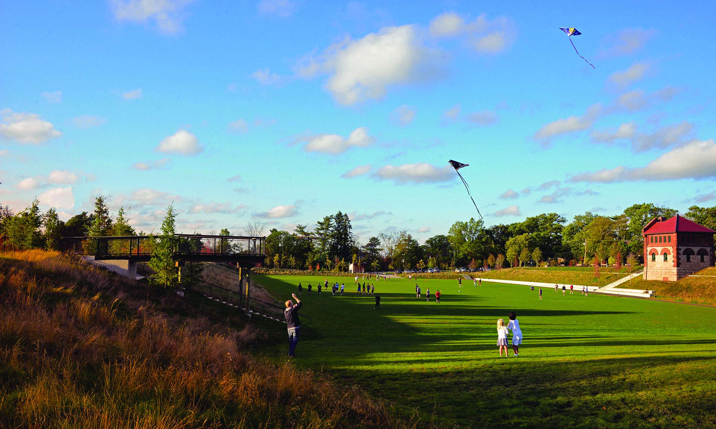
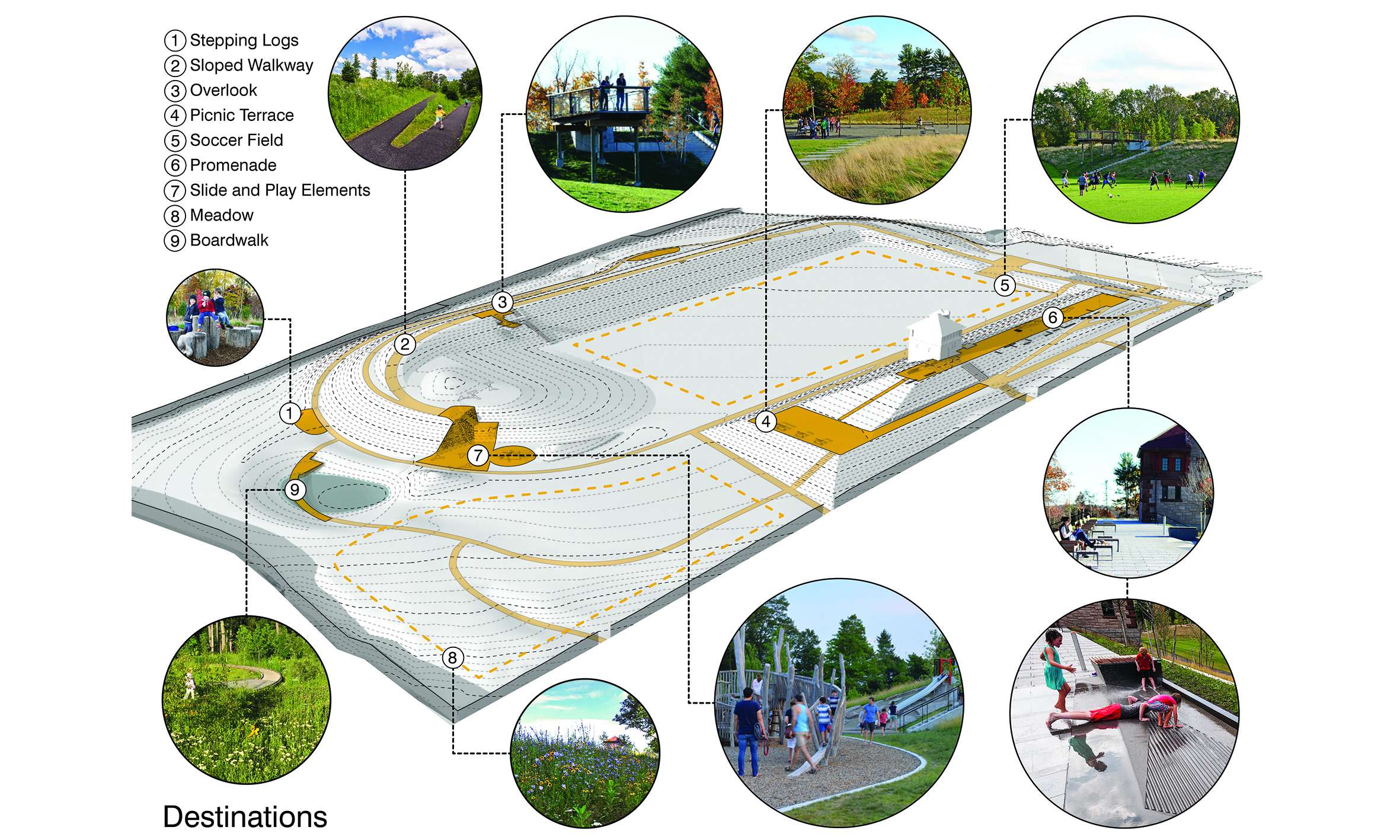
Program requirements included developing opportunities for unique play structures, an athletic field, a new comfort station, restoration of the historic gatehouse, multi-purpose spaces, ensuring public safety within the insular reservoir basin, building a woodland to buffer the park from abutters and providing full accessibility throughout the park.
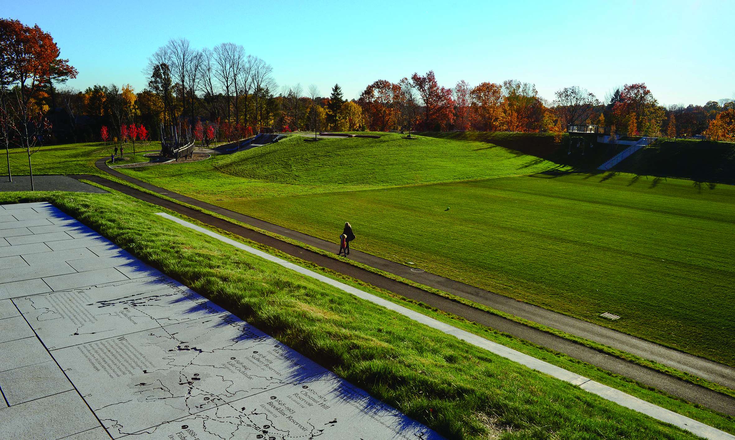
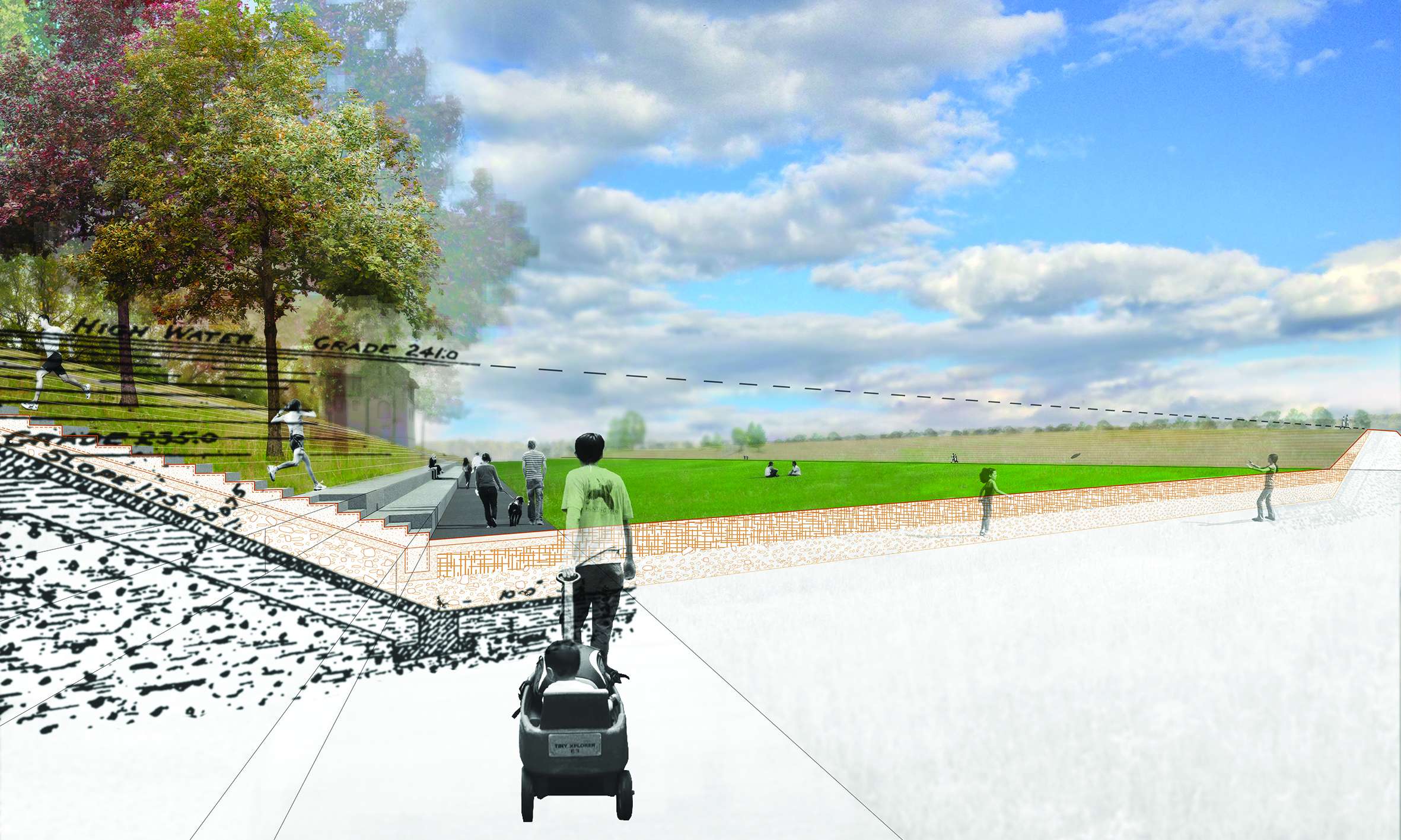
In addition to their historic value, maintaining most of the reservoir’s landform offered the added benefits of creating unique topographic opportunities within the park and avoiding the substantial and unnecessary costs of disposing of the fill material off site. Only the north and southeast portions of the berm were removed to provide sightlines into the reservoir basin and allow multiple entry and exit points of the park. A series of terraces and ramps create access to unique vantage points throughout the park, with places to sit, and changing views for people walking through the park.
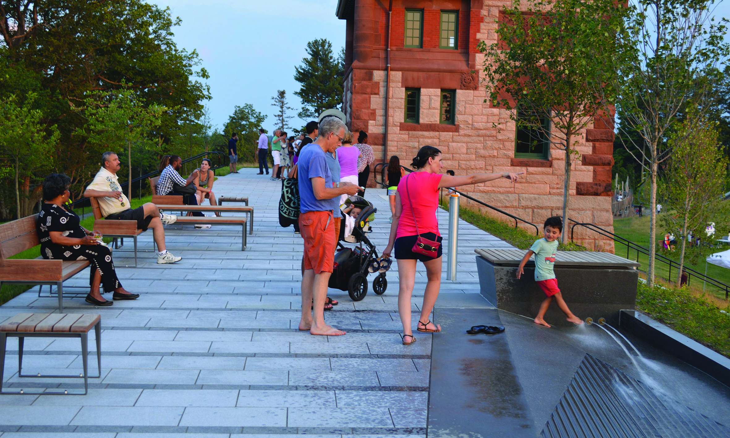
The restored historic gatehouse is grounded by a granite promenade with an interactive playful water feature. Additional destinations throughout the park include an overlook platform, embankment slide, an artist-designed sculptural wooden climber, and a boardwalk through a wet meadow.
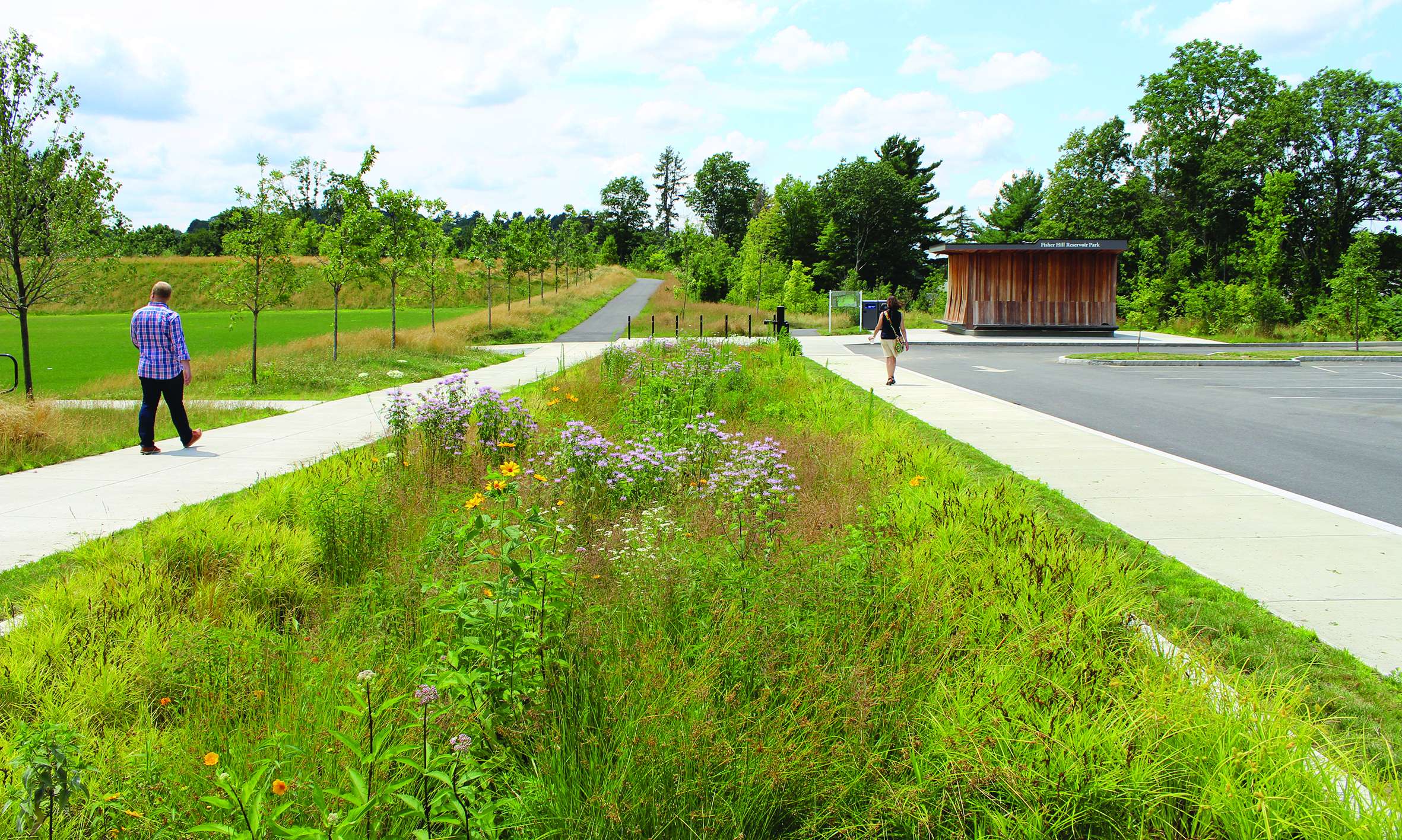
The planting plan for the site is diverse: no-mow grasses cover much of the slopes and help reduce fuel consumption and maintenance costs for the Town; a meadow and wet meadow anchor a portion of the southern part of the park; layered woodlands wrap around the outer edges of the park to provide screening from the adjacent residential neighbors; and the front of the park facing Fisher Avenue is more formal with plantings of maple, oak and black tupelo. A planted swale collects and filters stormwater from the parking area and ultimately drains to the wet meadow. The biodiverse plantings both create wildlife habitat and add seasonal interest for walkers along the network of accessible paths encircling the 10-acre park.
The resulting park balances the modern-day needs of the Town while preserving the cultural importance of the site and connecting it to the historical context of the greater Fisher Hill district.
Fisher Hill Reservoir Park in Brookline, Massachusetts captured an important opportunity to transform an abandoned piece of public infrastructure into a public park for passive and active recreation. The unique landforms and architecture of this former Massachusetts Water Resources Authority (MWRA) facility were retained and integrated into a park serving new functions of spectator seating and shelter. Elements such as a wall and topographic marker indicating the high-water mark, allow visitors to experience ‘plunging’ into the former watersheet of the full reservoir, and granite pavers with a carved map of the state-wide water supply system, of which the reservoir is a part, help contextualize this place in the state and neighborhood, and illustrate how our water resources are still delivered. The fully accessible path network allows universal access to the various artful play elements, prospect points, and diverse, native, woodland and meadow plantings that give the park scale, seasonal interest, and ensure a rich botanical future.