RECUPERACIÓN DE LA ANTIGUA SENDA AL CASTILLO DE MÓRA D’EBRE
RECUPERACIÓ DE L’ANTIGA SENDERA AL CASTELL DE MÓRA D’EBRE
RESTORATION OF THE OLD PATH FOWARDS THE CASTLE IN MÓRA D’EBRE
SENDERA
RECUPERACIÓ DE L’ANTIGA SENDERA AL CASTELL DE MÓRA D’EBRE
Projecte de recuperació d’un antic camí de ferradura que uneix la façana fluvial amb el Castell de Móra d’Ebre.
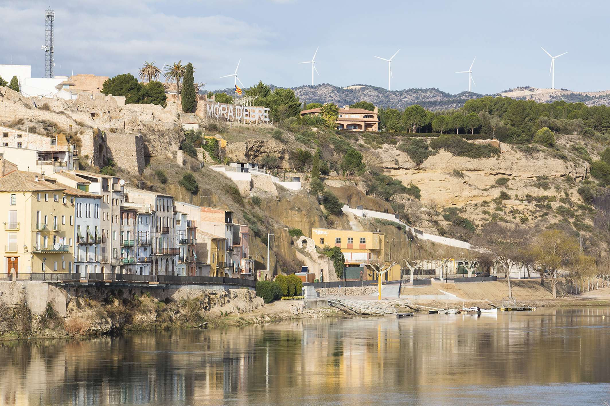
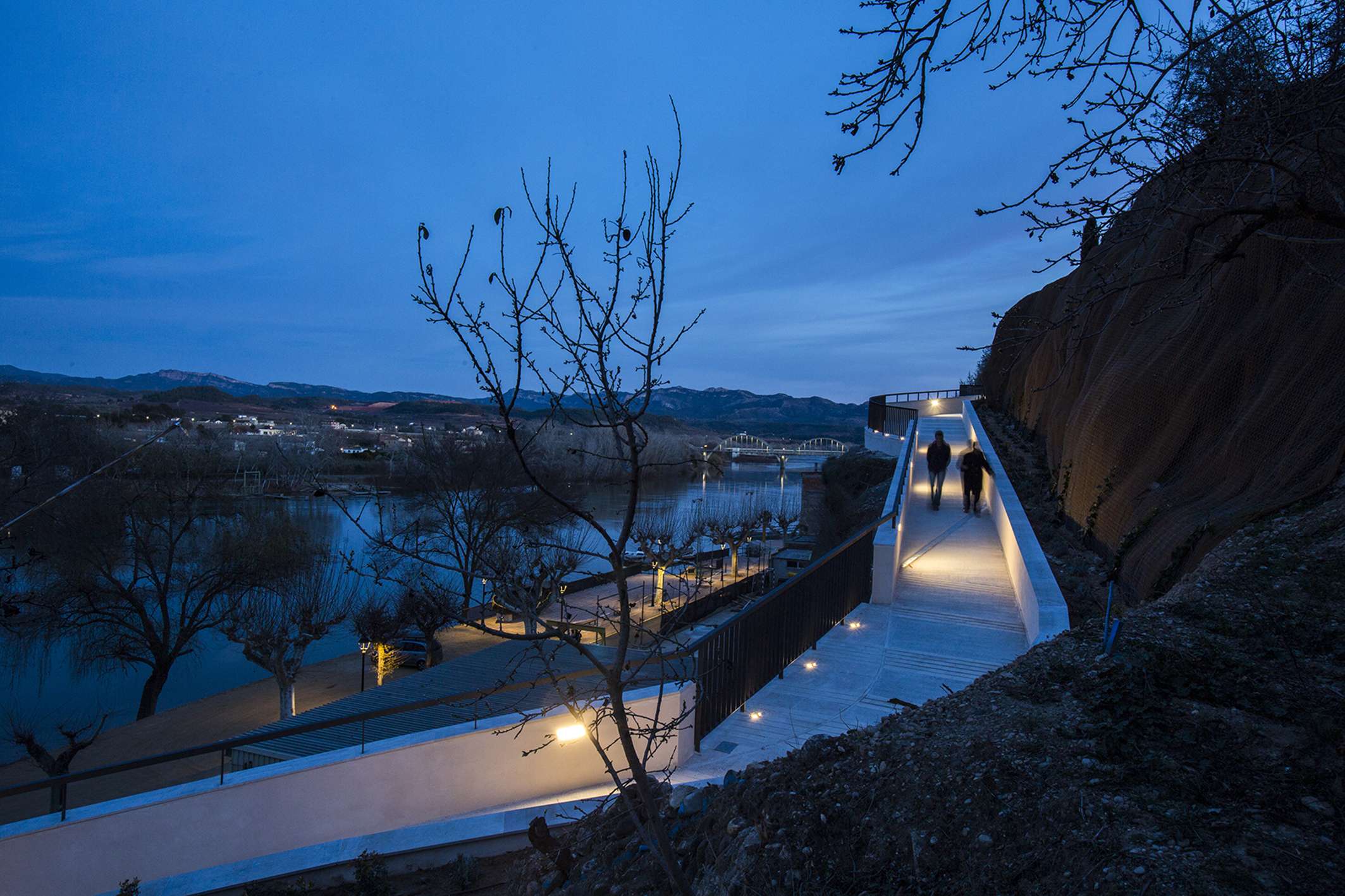
L’antiga sendera pujava al castell des del camí de sirga, aquell que s’utilitzava per arrossegar els llaguts riu amunt. Aquest traçat, perdut entre solcides de marges de pedra seca i talussos esllavissats, relacionava dos punts crucials del municipi: el final del passeig del riu, on actualment hi trobem l’embarcador, el club nàutic, l’antiga plaça de braus (i que té continuïtat fins a Ascó pel GR-99) amb el casc antic del poble, coronat pel castell d’origen islàmic declarat Bè Cultural d’Interés Nacional.
EL PAISATGE COM A PATRIMONI
La recuperació de la sendera com a passeig que connecta el patrimoni natural amb el patrimoni cultural del territori obre noves possibilitats de cara a un potencial turisme fluvial, però sobretot descobreix racons i visuals als veïns de la població. La nova geometria d’aquesta drecera es desenvolupa entre els horts, les oliveres, les atzavares i amb la mirada posada sobre l’aubadera i el paisatge de ribera.
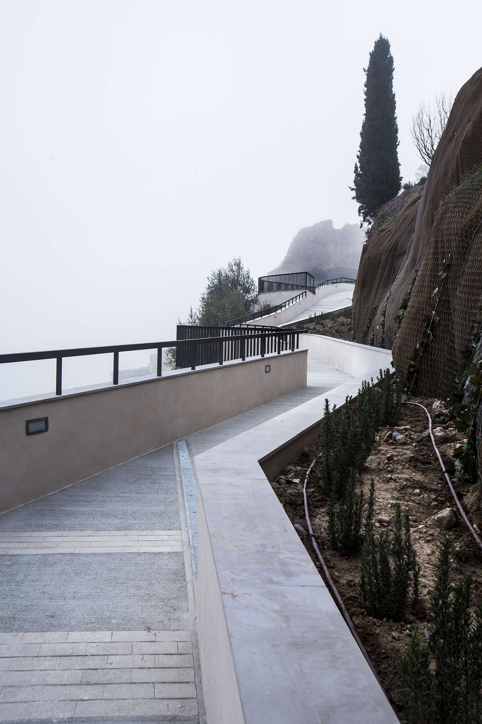
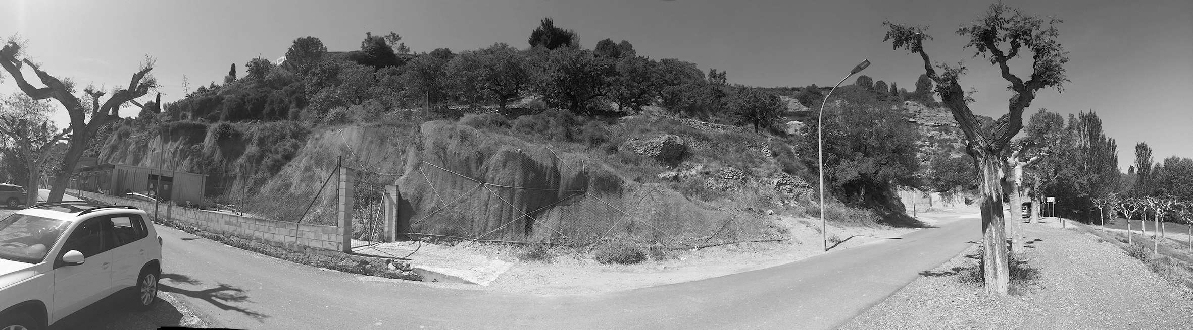
El traçat creua els talussos cercant la plena integració en el paisatge, conscient que tota la Cubeta de Móra hi té els ulls posats.
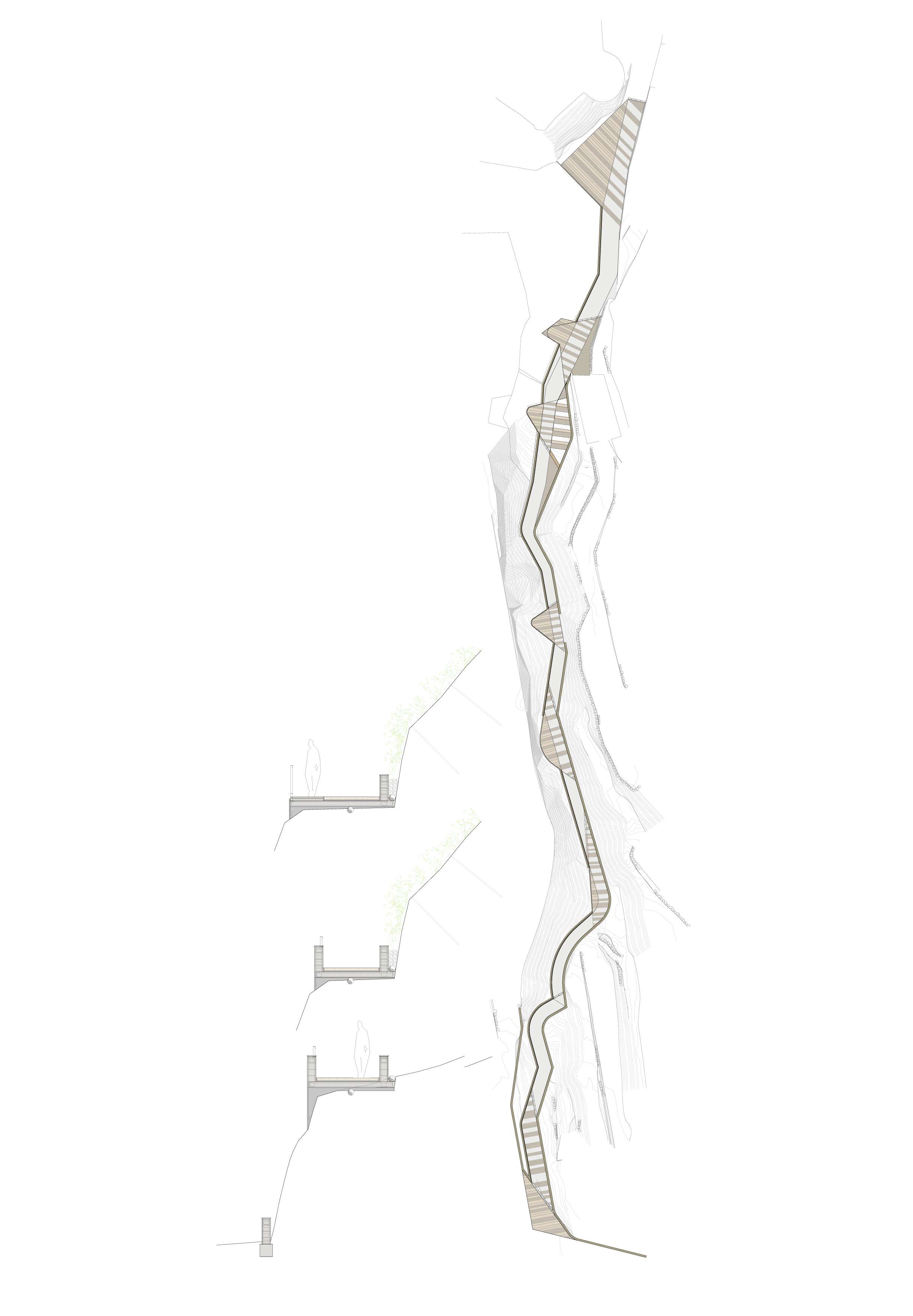
DIBUIXAR LA TOPOGRAFIA
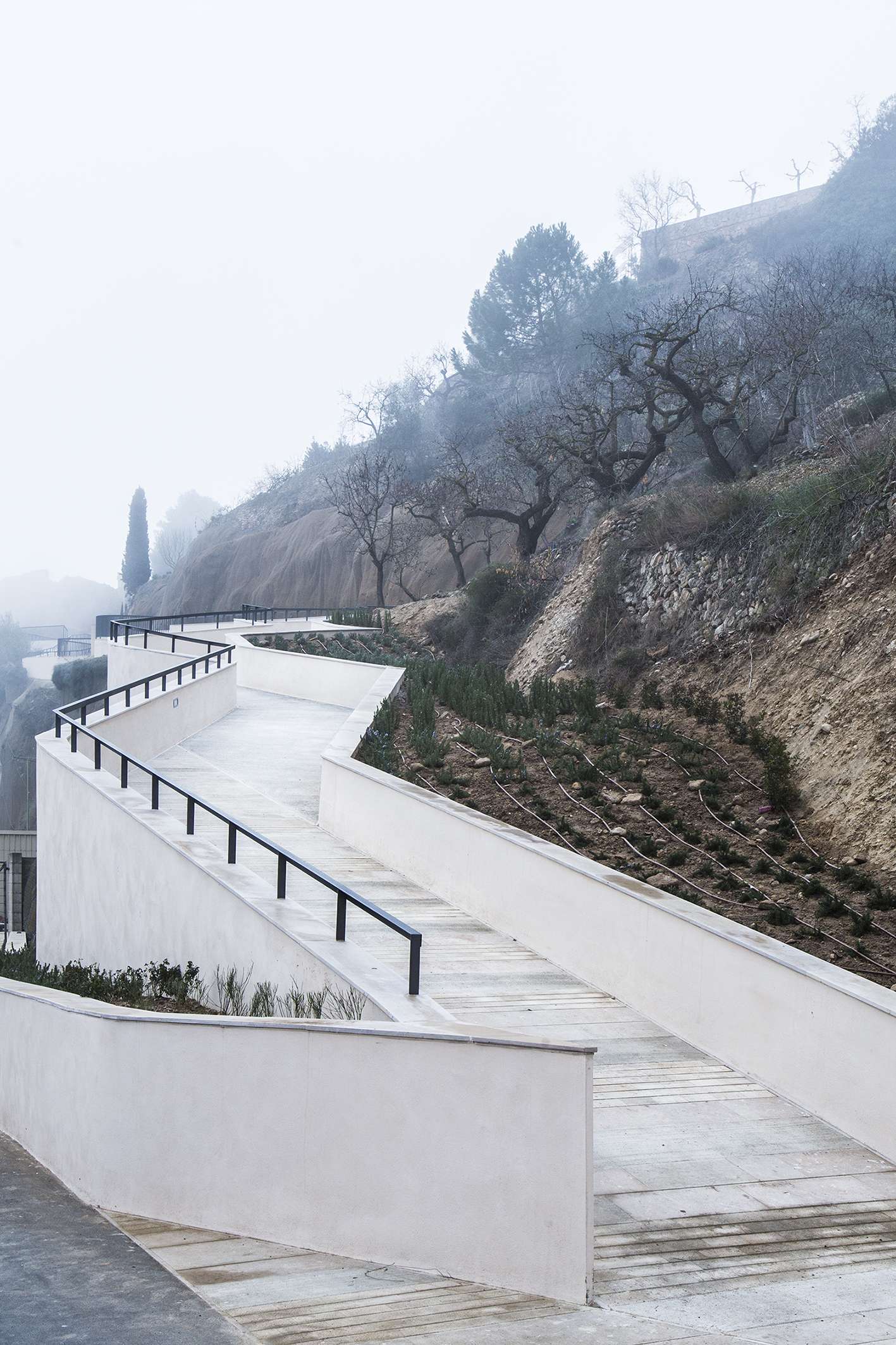
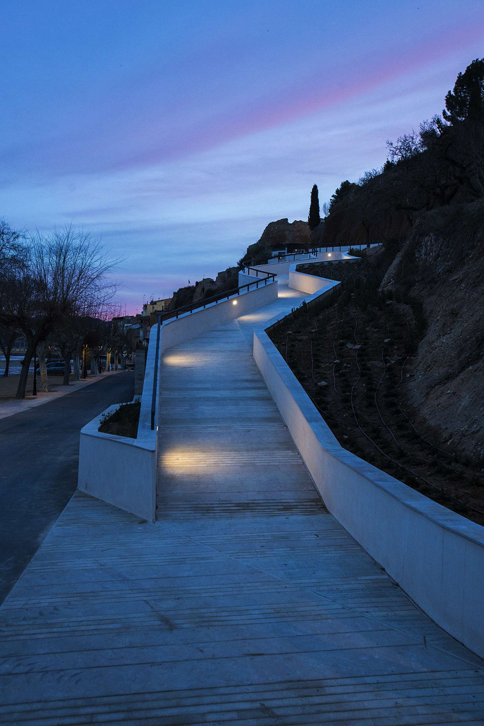
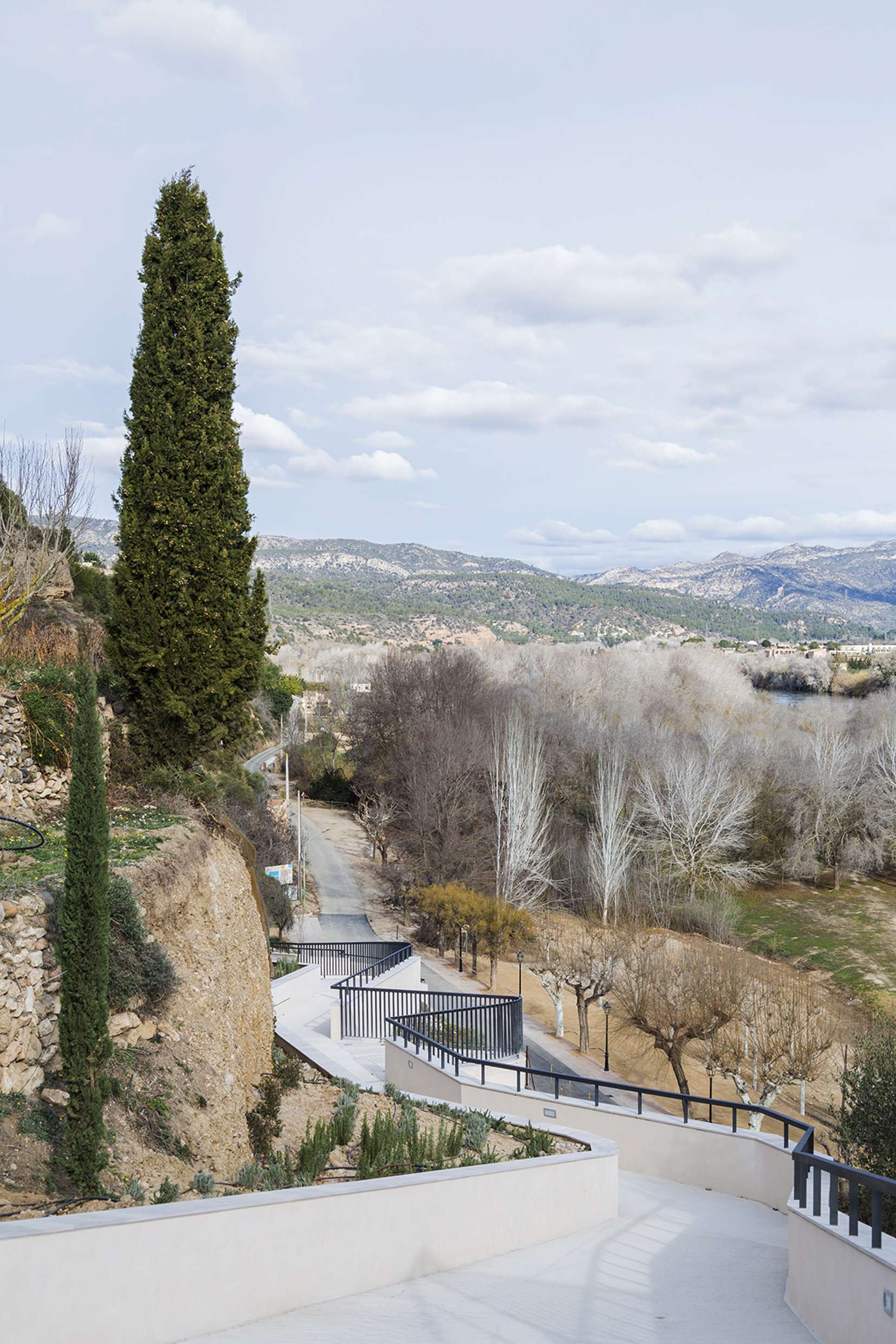
Partint d’una intervenció prèvia que havia consolidat els talussos que delimitaven l’antiga sendera, s’incorpora el límit que defineixen com a element de projecte. Del respecte per aquest gest sinuós de la topografia neix la geometria d’aquesta cinta que s’enfila muntanya amunt.
El formigó, acabat en els murs amb un estuc que busca els cromatismes de la Ribera, i la pedra natural, dialoguen discretament per integrar la intervenció en el territori.
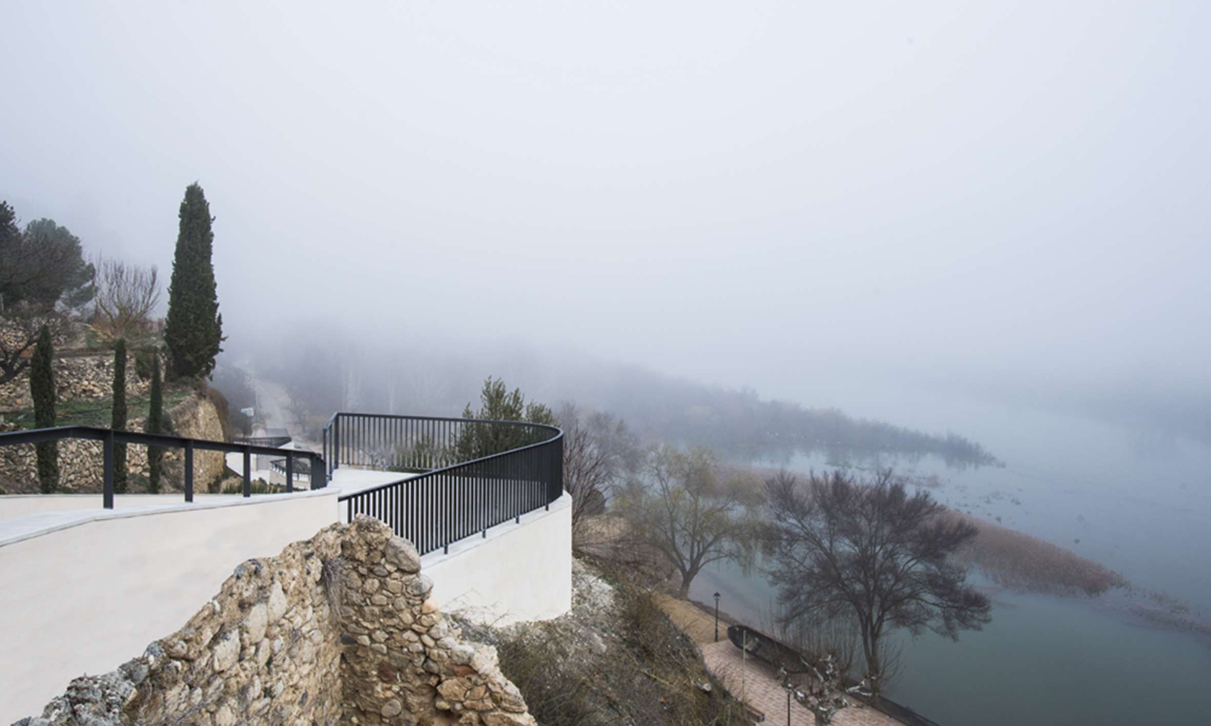
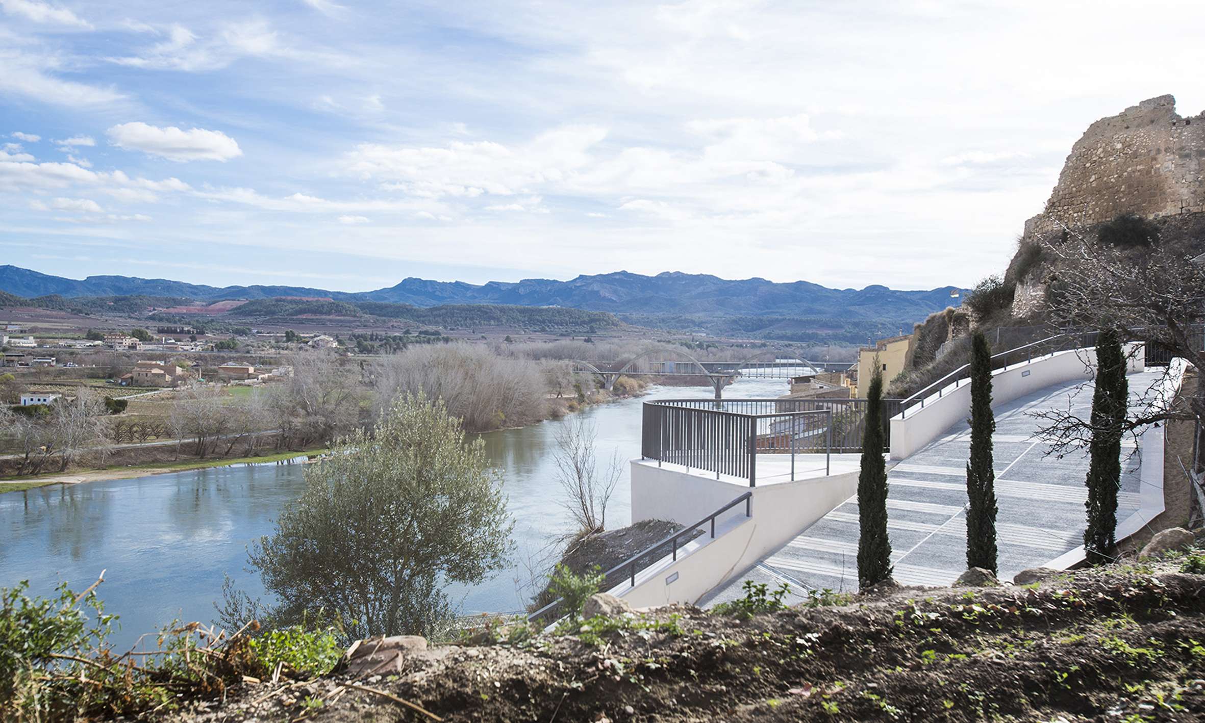
UNA NOVA MIRADA SOBRE L’EBRE
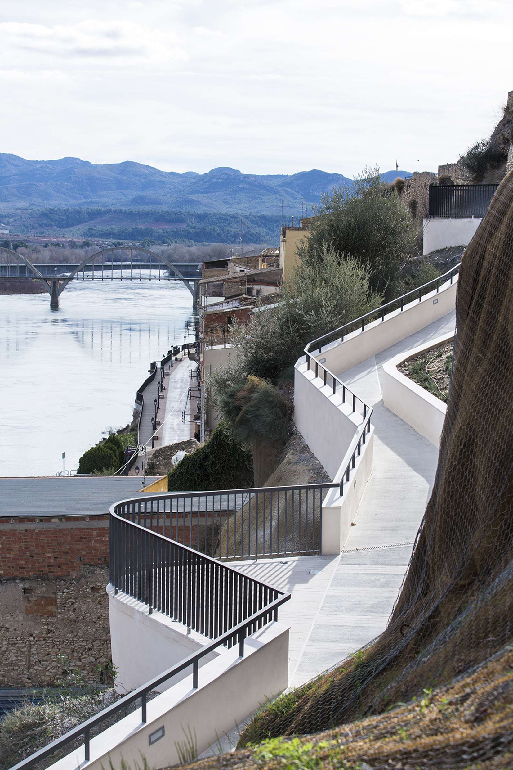
El nou recorregut s’aprofita de cada racó, de cada trencat, per descobrir noves visuals, noves maneres de mirar sobre el riu.
La barana de ferro que perfila la línia que delimita la sendera s’obre en els punts que el camí treu el nas per de descobrir un paisatge fluvial encara desconegut.
PATH
RESTORATION OF THE OLD PATH TOWARDS THE CASTLE IN MÓRA D’EBRE
Project for the restoration of an old horseshoe track that used to connect the riverside with the Castle of Móra d’Ebre.
The old path used to go up to the Castle from the towpath, the one used to carry the sailboats against the stream. This route, lost between collapsed dry stone walls and fallen slopes, used to link two key spots of the municipality: the end of the river promenade -where nowadays we can find the dock, the nautical club and the old bullring (that continues to Ascó through the GR-99)- with the old town, crowned by the Islamic Castle, declared an Asset of National Cultural Interest.
THE LANDSCAPE AS HERITAGE
The restoration of the old path as a promenade, connecting natural heritage with the cultural heritage in the territory, opens up new opportunities for potential river tourism, but especially discovers places and views to the locals. The new shape of this shortcut climbs up between fields, olive trees and agaves and looks at the poplar grove and the river promenade.
The route goes across the slopes, searching for the full integration in the landscape, aware that the whole Mora Basin is looking at it.
DRAWING THE TOPOGRAPHY
Starting from a previous intervention -the consolidation of the slopes that defined the old path-, the proposal embraces the geometry of the slope edges as a project object. The respect for the winding topography determines the final shape of this path climbing up the hill.
Concrete walls, in a stucco finish with a local color palette, and natural stone work together to integrate the intervention in the territory.
A NEW LOOK AT THE RIVER
The new route uses every corner and every turn, to discover a new view and other ways to look at the river.
The iron rail defines the edge of the path, in the viewpoints along the route it opens to offer the still unknown river landscape.