Valls landscape adaptation
final project
Universitat Rovira i Virgili. Escola Tècnica Superior d'Arquitectura de Reus.
The present final degree project is located in Valls. Its main aim is to give a special value
to landscape and heritage through the sportive use of public areas.
Nowadays, in many cities, landscape is becoming meaningless and the actions that have been
defining it are disappearing. In order to solve this, cities have the need to create new and
specific uses. This is a needed discussion for Valls.
Through the overlay of history, heritage, torrents, discontinuities, sports uses, vegetation
and associations, a self-managed network of roads is created. Through systematized and
coherent interventions, they connect the territory and give a new meaning to the landscape,
creating a city with new values: a respectful with heritage, healthy, active, green and self-
sufficient city.
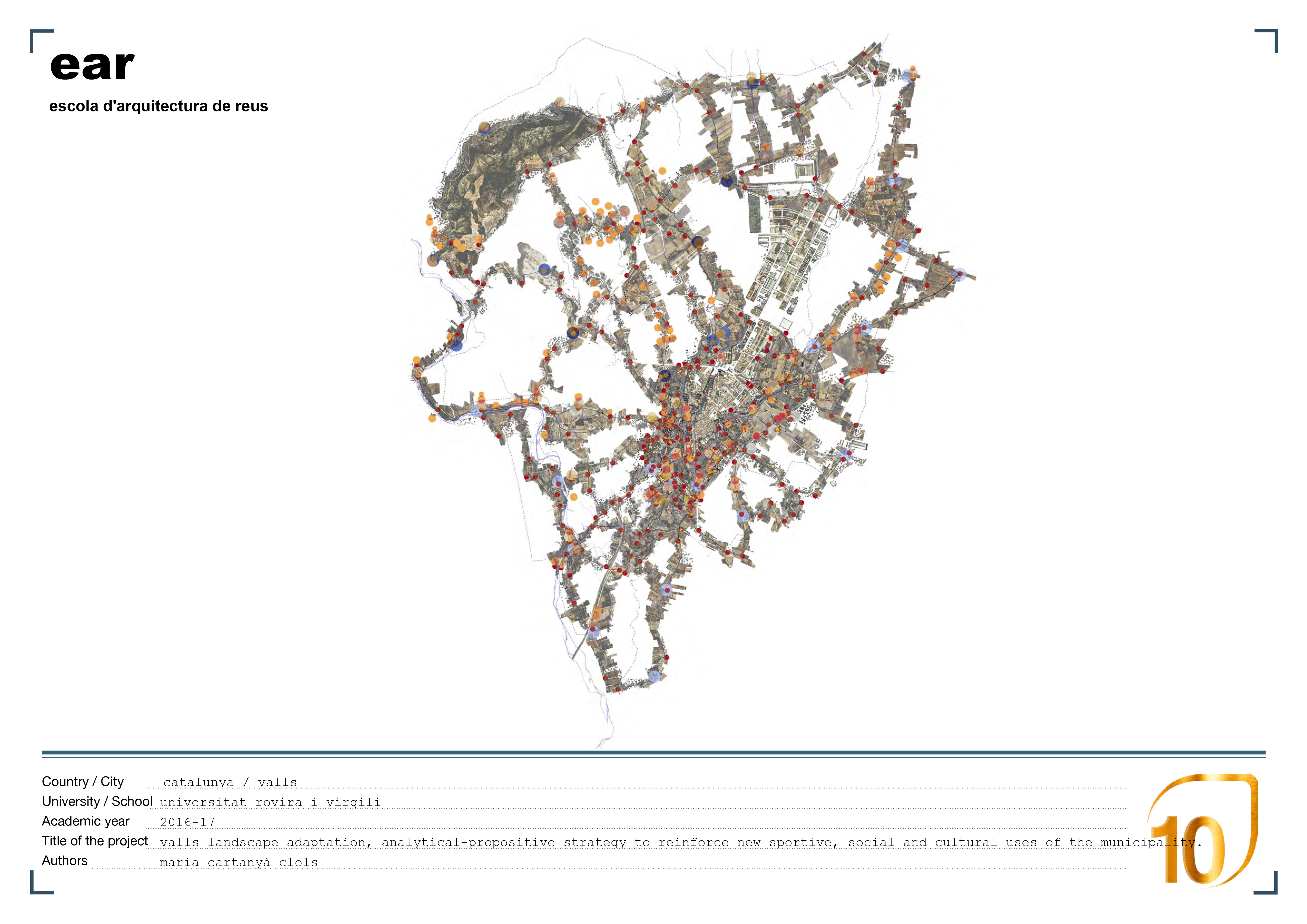
In order to classify the interventions the municipal district has been structured on three
map scales: the municipality scale where the interventions are focused specially on the
creation of large routes (marathon, half marathon, 10 km) and their connections. This
intervention is based on a sportive use and the views of its surroundings. The torrents’
scale where the intervention is focused on the streams and the creation of medium routes
(10,5,2.5km) and their connections. This intervention gives new uses to the existing heritage
and creates a green ring around the city. And finally, the urban scale, where the routes are
circular and they promote a healthy lifestyle (5,2.5,1). At the same time, in this scale we
find the exit points that open gates to other scales.