View of a Land
Planning in historical context studio
Politecnico di Milano, Polo territoriale di Mantova, Master of Science in Architectural design and history
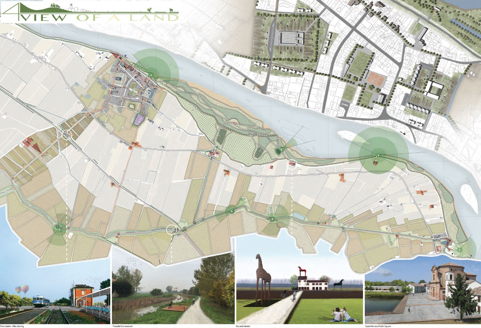
The great protagonist of the territory is water in its various forms and relationships. In the first place, the Po River with its large scale conditions from the beginning the territory needs to be protected and creates a first barrier, the dam. This is a first barrier that divides a large area of natural landscape, with a highly usable area for agricultural purposes, the dike runs the entire route of the Po becoming a first linear system. The sequence of urban centers consolidates the idea of longitudinal organization whit historical and cultural itineraries that constitutes a concrete affirmation of the fundamental values of the society and cultural identity.
The territory is played out by an agricultural use and the urban centers, of small scale, provide services to a population that depends mainly on an economic activity based on the production of the soil. Within the area there are many historic buildings that historically have been related to agricultural use and they have being a fundamental part of the economy of the place. That is why the initial scheme with which the project starts is the understanding of the importance of the river, the generation of a new axis that collects the Fossalta channel and a system of transversal connections that allow to relate these two structuring elements and recover the historic buildings that are inside the agricultural land.