Transitioning. RAMSAY'S MOTIONAL LANDSCAPE
Landscape Architecture Studio Ii
University of Calgary. School of Architecture, Planning and Landscape
Inglewood and Ramsay are the most historic communities in Calgary located in the center of the city across two major rivers of Calgary, Bow River and Elbow River. Inglewood was established in 1875 after Fort Calgary (national historic site of Canada) was built. After the arrival of Canadian Pacific Railway (CPR) in 1883, the city and these communities changed significantly. However, the presence of CPR causes significant fragmentation of green spaces and the separation of Inglewood and Ramsay.
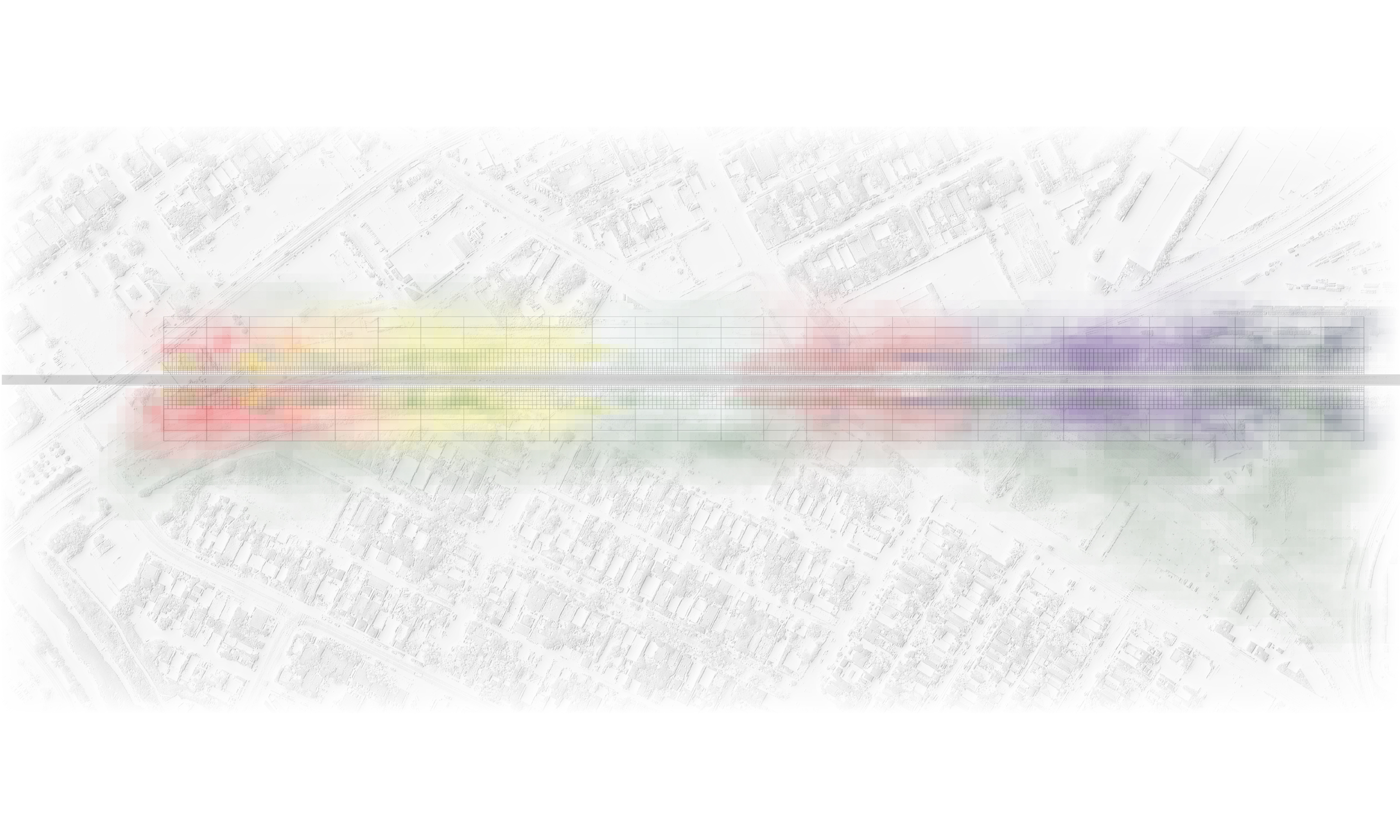
Today, the City of Calgary is implementing a new Light Rail Transit line (LRT), the Green Line, which connects norh central and southeastern Calgary and in the Inglewood/Ramsay section runs next to the historic CPR. The goal of the project is to mitigate the community and landscape fragmentation by proposing a green corridor along the Green Line and create a memorable image for users and travelers. The proposed corridors is approximately 1Km long, and links Fort Calgary to a Green Line station along the historic CPR. The goal is to create a memorable image reminding the travelers on LRT Calgary as a prairie city. The planting strategy is bases on the fact it takes 20-30 seconds for short memory to store an image and Light Rail Transit travels at the average speed of 50km/h. The corridor along the LRT is divided into 6 plant communities with native plants in varieties of colors, textures, and heights. The colours at plants communities' edges blend together and generate a motional landscape in Ramsay.