Main Road and Side Roads. Connections between the founding cities of Sulcis-Iglesiente
Mining Landscapes
University of Cagliari_Faculty of Engineering and Architecture
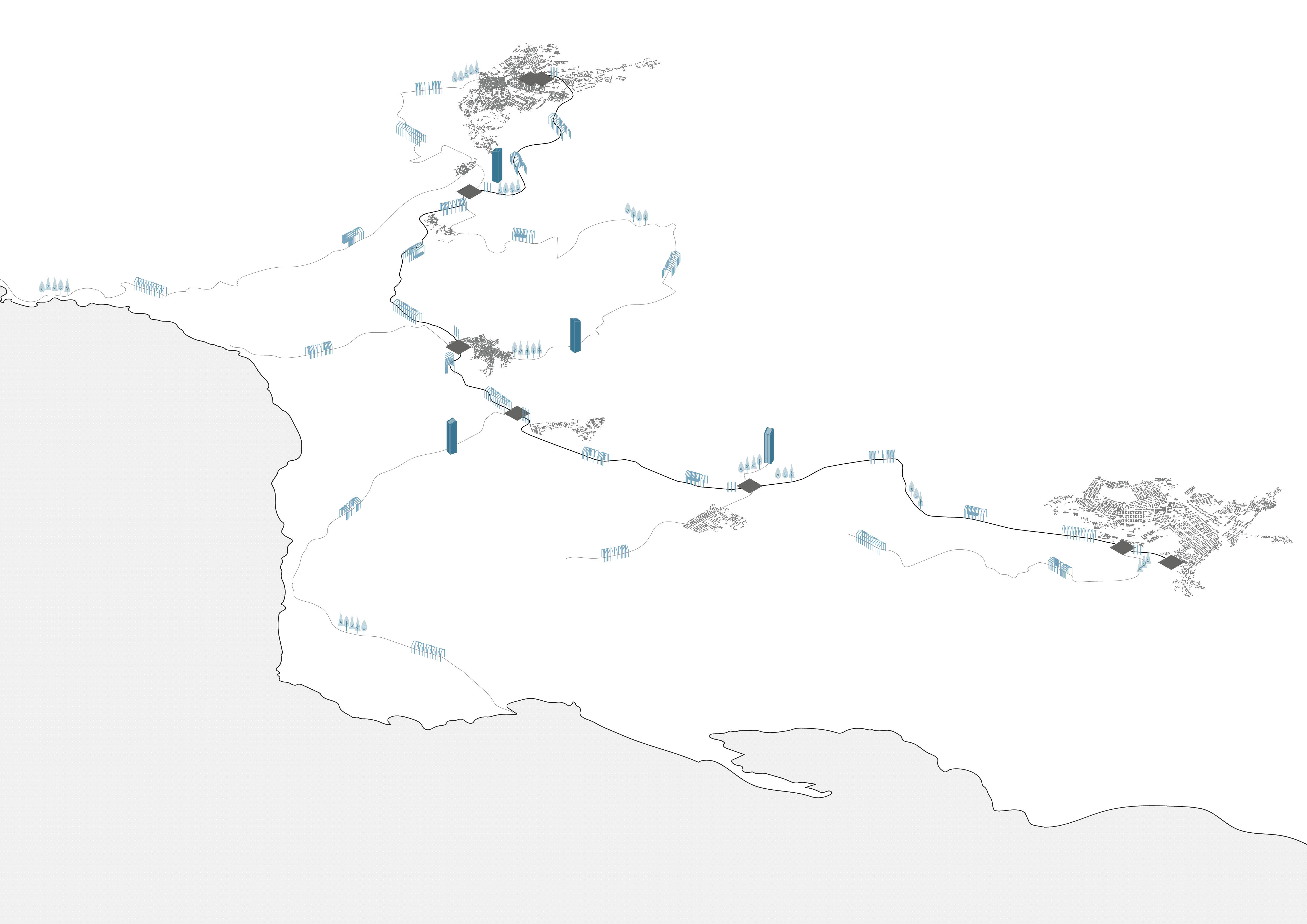
The Sulcis Iglesiente railway network started operating in the 1920s, connecting mining sites, washeries, foundries, ports, cities and villages, and representing the central element of the communications and transport network of the mining production system. This route was abandoned in the mid-70s sanctioning a return to the isolation that had characterized this area in the past. Today the site of the disused railway track presents itself as an important testimony to the identity of the past: mining has irreparably left its traces in the landscape, connoting its identity.The project aims to re-qualify the abandoned railway track in a sustainable way, promoting a new modality of crossing the territory, by the conversion in a cycle-pedestrian path. Along the route, there are service stations and elements that go with the path and lead the eye across the landscape. The slow mobility practices allow a re-appropriation of the cultural and territorial identity. The theme of the itineraries is repeated in a smaller scale in Monteponi, village of miners currently in a state of total abandonment. The path allows the visit of the complex, enhancing the use of the abandoned buildings. The inner circulation branches off from the cycle-pedestrian main path. The route, which connects the main buildings of interest and the open spaces, ends on the large panoramic terrace of red muds, to whom is connected by the restored inclined plane, which hosts a funicular that connects the higher point of the route to the big tower down in the valley.